熊野古道伊勢路~世界遺産 紀伊山地の霊場と参詣道 ~
掲載日:2013.01.04
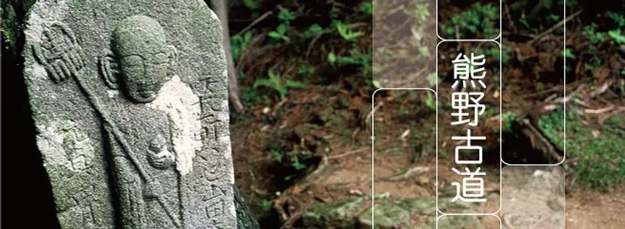
熊野三山、吉野・大峯、高野山の霊場とそこへ至る参詣道は、日本古来の自然に対する信仰と大陸から伝来した仏教が融合して成立し、日本の文化の発展にも大きな影響を与えました。こうした点が高く評価され、2004年、「紀伊山地の霊場と参詣道」として世界遺産に登録されました。
平安時代から知られ、特に江戸時代以降、盛んとなった伊勢から熊野へと向かう熊野古道「伊勢路」は、伊勢参宮を終えた旅人や西国三十三ヵ所めぐりの巡礼たちが辿った、いわば庶民の道。巡礼装束に身を改めた旅人が、いくつも険しい峠を越えて、あこがれの地・熊野を目指した道です。
index


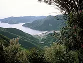


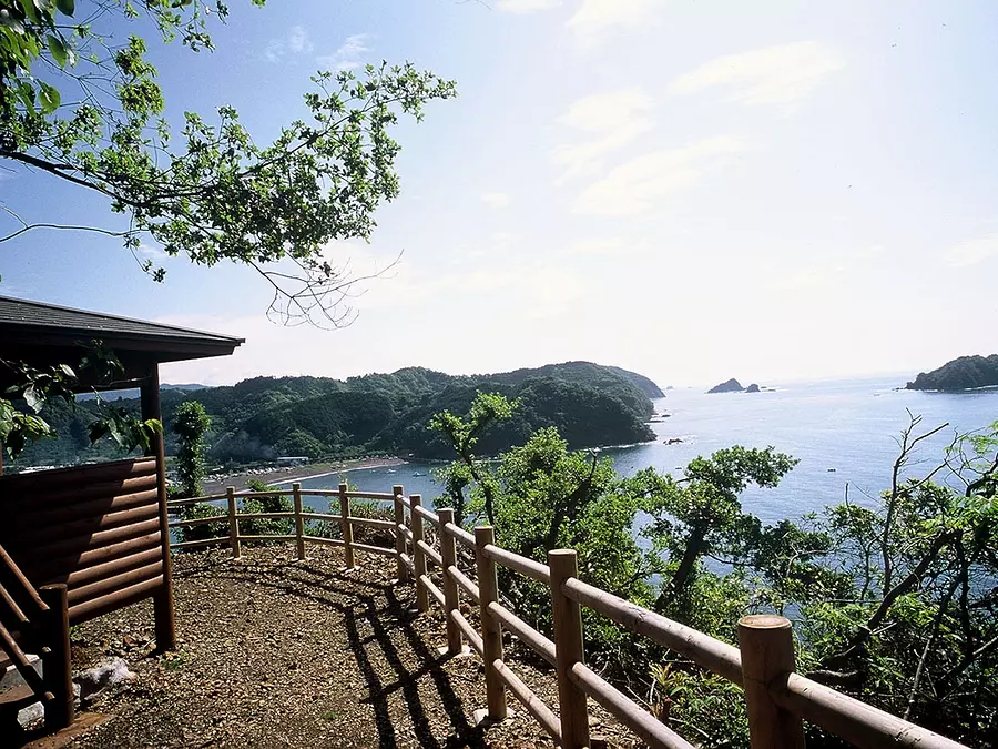
荷坂峠 (度会郡大紀町)
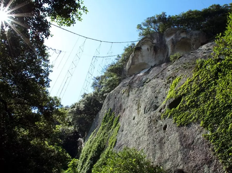
大紀町と北牟婁郡紀北町の間にある峠。江戸時代初期から中期にかけて、徳川頼宣公の入国をきっかけに、ツヅラト峠に代わって紀州への正式な玄関口となりました。現在の国道42号、JR紀勢線も荷坂峠を越えています。
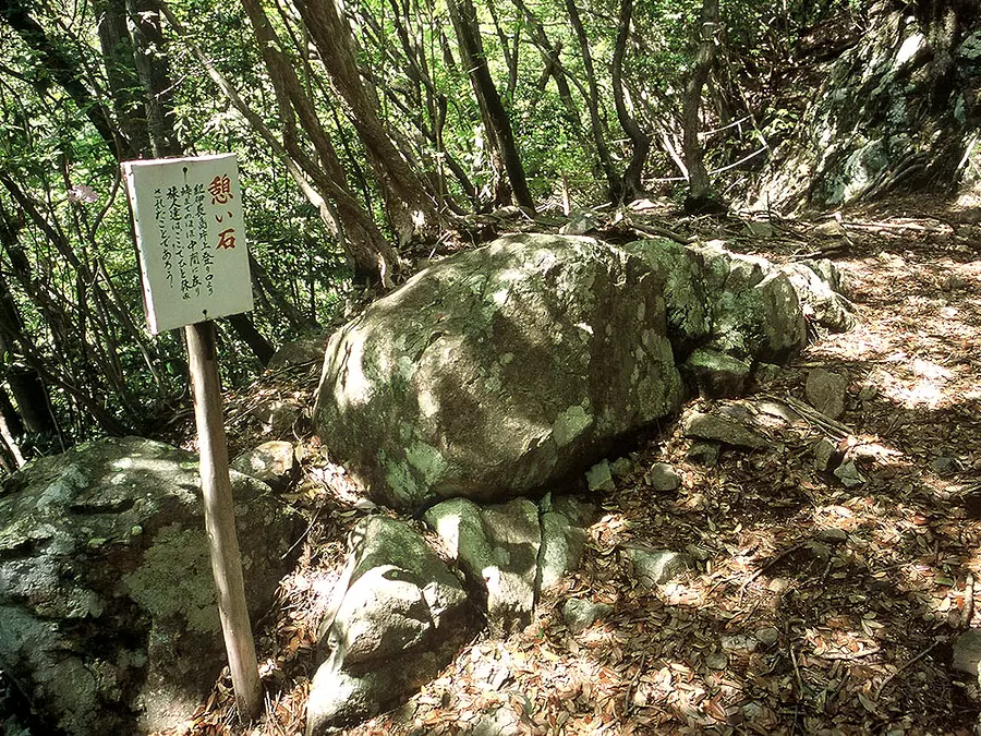
道幅も広く、勾配もゆるいので歩きやすい道です。重い荷物を担いでも越えることができるということで、この名前がついたとも言われています。途中の沖見平は見晴らしのいい休憩所となっており、江戸時代の紀行作家・鈴木牧之が詠んだ二句が書かれた木板が立っています。
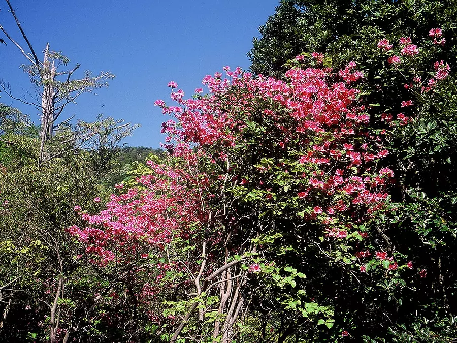
広葉樹が多いコースで、4月頃のツツジをはじめ、季節ごとにいろいろな種類の植物を楽しむことができます。
○コースのポイント:荷坂峠の茶屋跡と石仏~一里塚跡~薬草園跡~片上池 ほか
○歩行時間:約2時間30分
○距離:約8km(JR梅ヶ谷駅~JR紀伊長島駅)
○休憩スポット:道の駅紀伊長島マンボウ、ふれあい広場マンドロ ほか
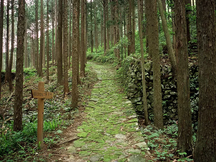
ツヅラト峠 (度会郡大紀町)
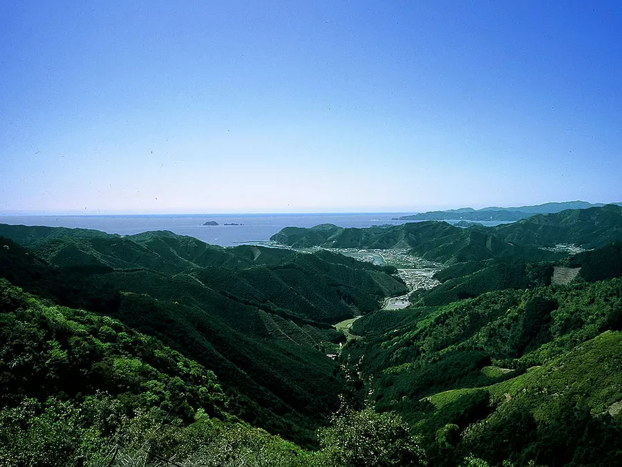
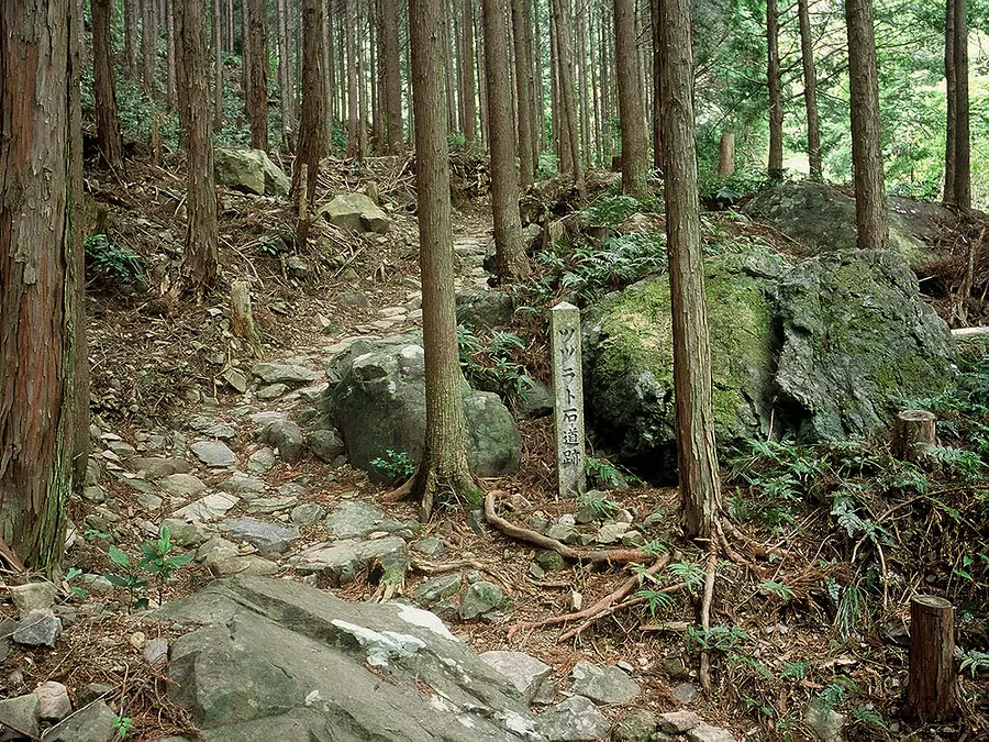
かつて「伊勢国」と「紀伊国」の国境であった峠。紀伊へのルートが荷坂峠に移行した後も、昭和初期まで生活道として使われていた道で、伊勢から熊野へ向かう旅人は、この峠に立ってはじめて熊野の海を目にした「聖地・熊野」への玄関口である。
「ツヅラト」とは「九十九折」のこと。その名の通り、紀伊長島へ下る峠道はカーブが連続しています。現在も道は整備されており、石畳や石垣もよく保存されています。
○コースのポイント:「ツヅラト峠登山口」標柱~「ツヅラト峠頂上」標柱~石でかためた側面(石垣)~石畳道~庚申堂(コウシンドウ)~紀州公句碑~八柱神社 ほか
○歩行時間:約3時間30分
○距離:約9km(JR梅ヶ谷駅~JR紀伊長島駅)
○休憩スポット:道の駅紀伊長島マンボウ、ふれあい広場マンドロ ほか
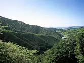
一石峠・平方峠・熊ヶ谷道 (北牟婁郡紀北町)
紀北町紀伊長島区加田から三浦までに、一石峠・平方峠・三浦峠の3つの峠を越えるコースです。どれも小さな峠なので、平坦な道が多くなっています。
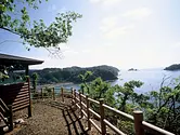
険しい山道の多い熊野古道の中でこの区間は、旅人の心を癒してくれる海沿いの道です。紀伊の松島と呼ばれる島々と、洋々たる熊野灘を望む絶景ポイントを楽しめる、なだらかなコースです。古里、道瀬などの素朴な海辺の町を散策したり、温泉に立ち寄るのもオススメです。
○コースのポイント:一石峠登り口のお地蔵さま~サボ鼻展望台~若宮神社~道瀬海岸 ほか
○歩行時間:約3時間
○距離:約8km(加田教会前バス停~JR三野瀬駅)
○休憩スポット:きいながしま古里温泉 ほか
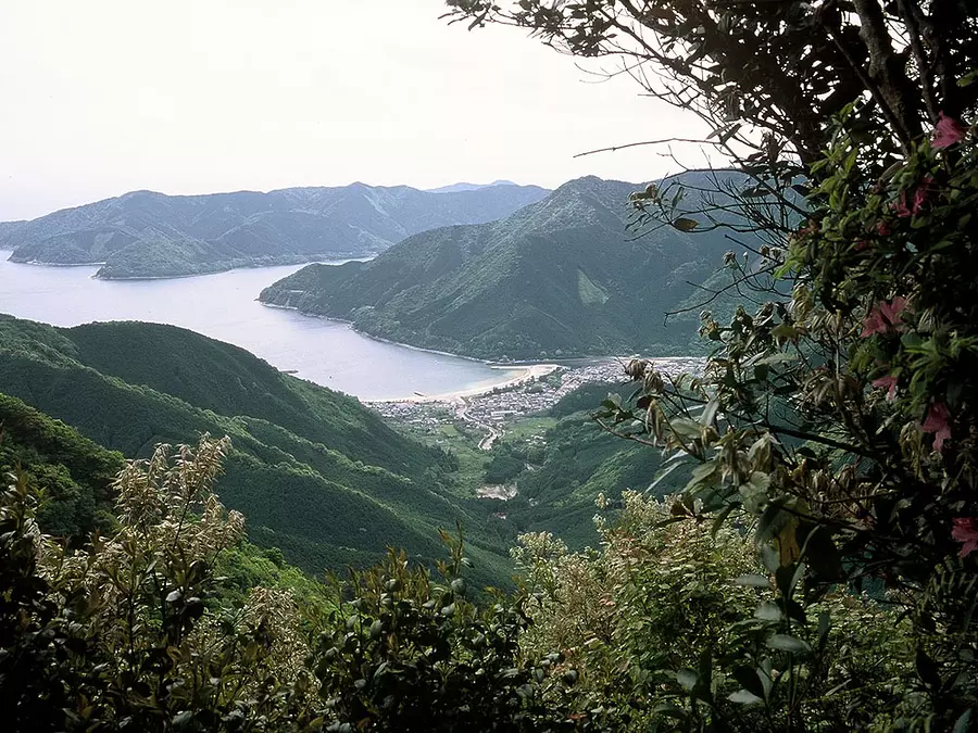
始神峠 (北牟婁郡紀北町)
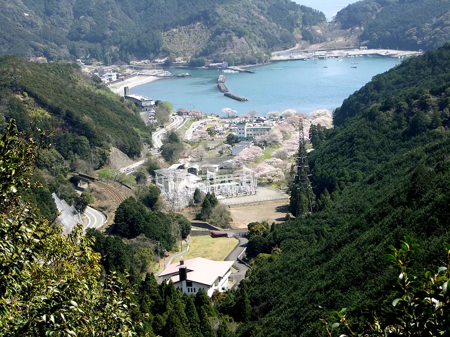
紀伊長島と海山の境に位置する峠。やや急めで、土止めの石畳が歴史を感じさせる「江戸道」、緩やかで雑木林から聞こえてくる小鳥のさえずりが心を癒す「明治道」の2つのコースがあり、始神峠で合流します。往復でコースを変えることや、そのまま船津駅方面に抜ける事もでき、体力によって調整してみてはいかがでしょうか?
峠の展望台からは、紀伊の松島の島々が熊野灘に浮かぶ優美な景色が一望できます。登り口は宮川第二発電所の裏手で、始神さくら広場は桜の名所としても知られており、春には桜並木に彩られます。
○コースのポイント:始神さくら広場~明治道or江戸道~始神峠~宮谷池 ほか
○歩行時間:約2時間
○距離:約3.5km
○休憩スポット:始神さくら広場 ほか
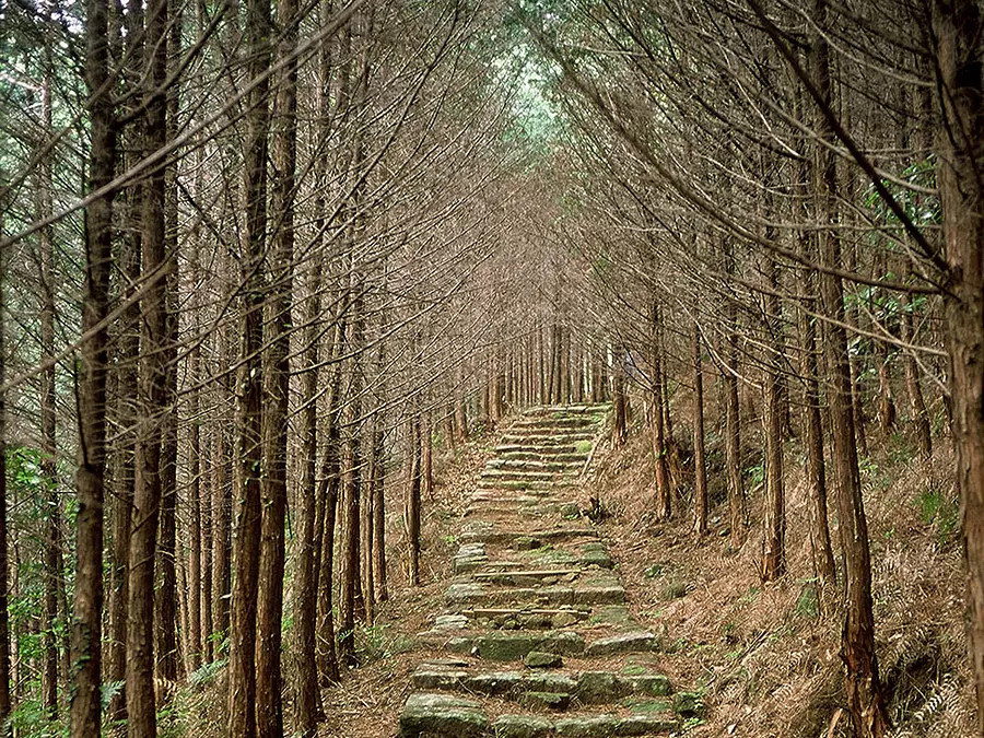
馬越峠 (北牟婁郡紀北町)
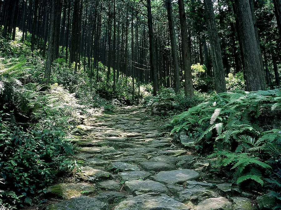
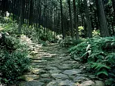
紀北町と尾鷲市の境界にある人気の峠、熊野古道伊勢路の中で随一と言われる石畳が、尾鷲ヒノキの美林の中に続いている。夜泣き地蔵などの史跡も多く残っており、これぞ熊野古道という雰囲気を味わえます。
峠からは、頂上の絶景が素晴らしい天狗倉山や便石山の山頂へ続く登山コースハイキングコースもあり。峠を下った馬越公園は桜の名所にもなっており、春には大勢の人が訪れる人気スポットです。
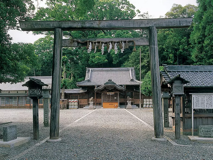
○コースのポイント:道の駅海山~夜泣き地蔵~石橋~馬越一里塚~可涼園桃乙の句碑~桜地蔵~馬越公園~尾鷲神社 ほか
○歩行時間:約2時間30分
○距離:約5km(道の駅海山~JR尾鷲駅)
○休憩スポット:道の駅海山、馬越公園、まちかどホットセンター ほか
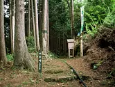
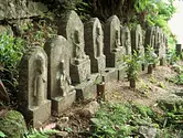
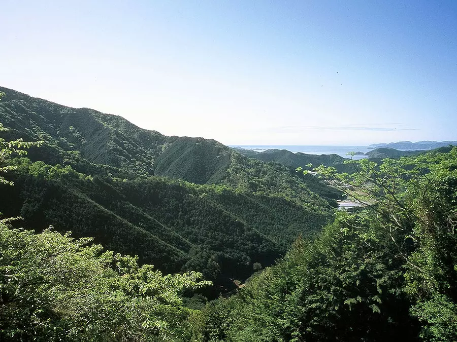
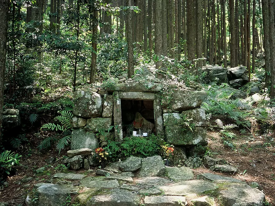
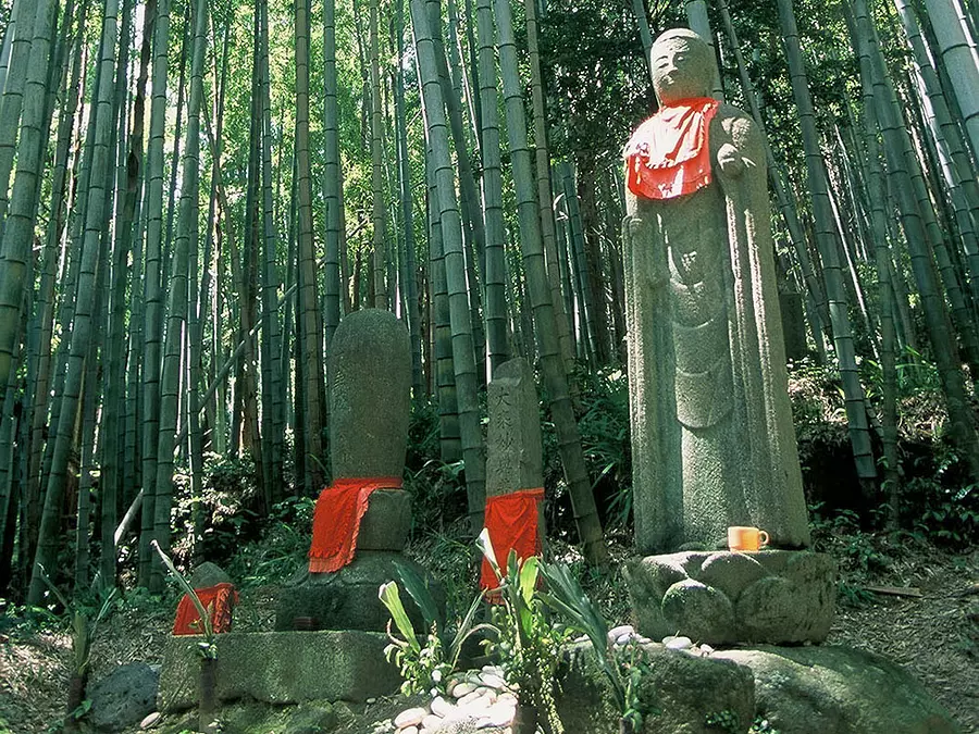
八鬼山越え (尾鷲市)
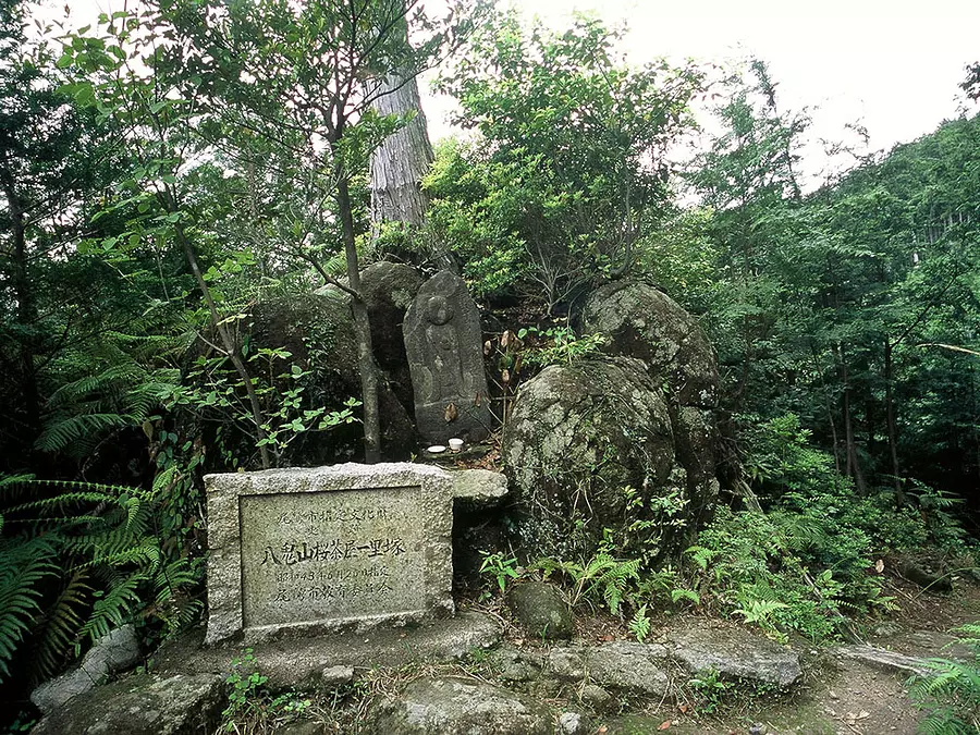
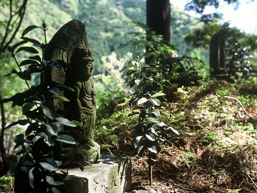
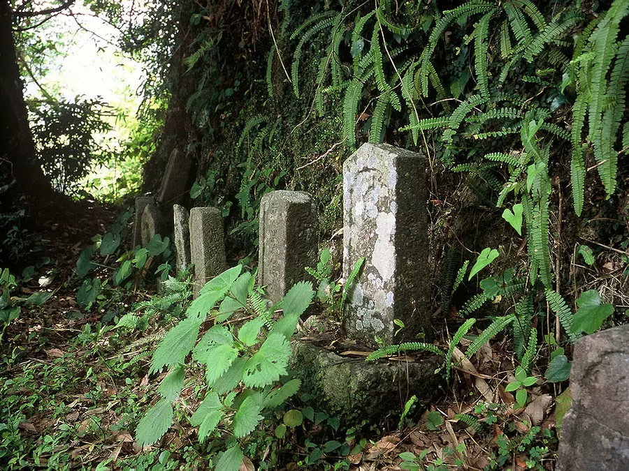
巡礼者たちに「西国第一の難所」といわれ、かつては山賊や狼が出没した道。八鬼山越えでは石畳道の傍らに町石をかねた地蔵や石仏、巡礼墓碑が数多く見られます。
三木里への下りは「江戸道」と「明治道」に分かれており、三木峠の先にある「さくらの森」からは熊野灘が一望でき、芝生の広場となっているのでランチ休憩にはオススメの場所です。
登り、下り共に険しい道ですが体力に自信のある方は、昔の巡礼者の気分を味わいながらトライしてみてはいかがでしょうか?
○コースのポイント:尾鷲節歌碑~駕籠立場~十五町石~巡礼碑~桜茶屋一里塚~蓮華石~三宝荒神堂(日輪寺)~名柄一里塚 ほか
○歩行時間:約5時間
○距離:約10km(三重県立熊野古道センター~JR三木里駅)
○休憩スポット:三重県立熊野古道センター、さくらの森広場 ほか
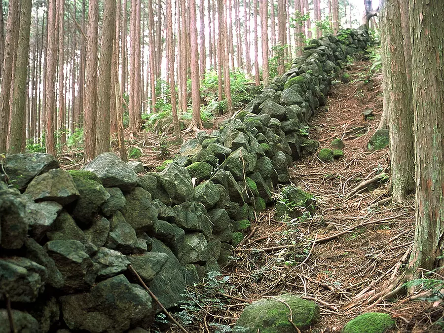
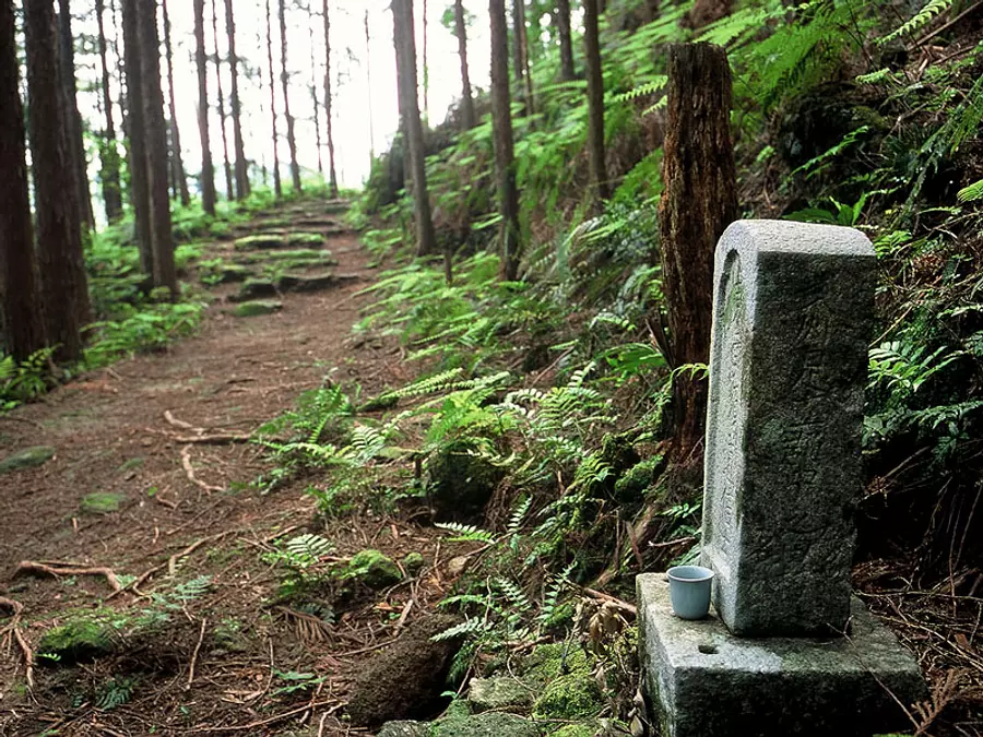
三木峠・羽後峠 (尾鷲市)
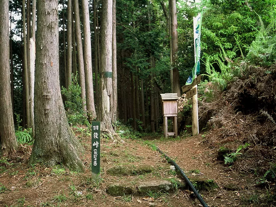
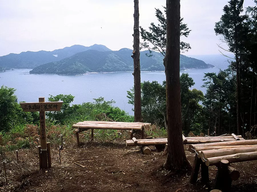
入り江の集落である三木里町と賀田町・曽根町を結ぶルートで、海岸線を行く国道311号を見下ろしながら2つの小さな峠を越えます。近年、地元の方々によって発掘された道で、自然道は数か所で寸断されており、その間は舗装路で繋がっています。
峠から延々と続く猪垣は、当地方では最長と言われており、そこに暮らした人々の存在を物語っています。峠には随所に苔むした石畳などが見られ、熊野古道の雰囲気を満喫できるハイキングコースとして親しまれています。
○コースのポイント:三木峠~羽後峠の道標~秋葉山~賀田~五輪塔 ほか
○歩行時間:約3時間
○距離:約6km(JR三木里駅~JR賀田駅)
○休憩スポット:三木峠の展望台 ほか
曽根次郎坂・太郎坂 (尾鷲市)

尾鷲市賀田から熊野市二木島へ抜ける甫母峠を越えるコースです。「次郎・太郎」の名前の由来は、かつて「志摩の国」と「紀伊の国」の国境であったため、「自領・他領」がなまったものを言います。
また、峠越えから楯ヶ崎まで足をのばすのもオススメで、美しい石畳や猪垣などのある、静かなハイキングを楽しめます。
○コースのポイント:飛鳥神社~南と北の関所跡~甫母峠~楯ヶ崎~猪垣~神武東征 ほか
○歩行時間:約2時間30分
○距離:約5km(JR賀田駅~JR二木島駅)
○休憩スポット:甫母峠 ほか
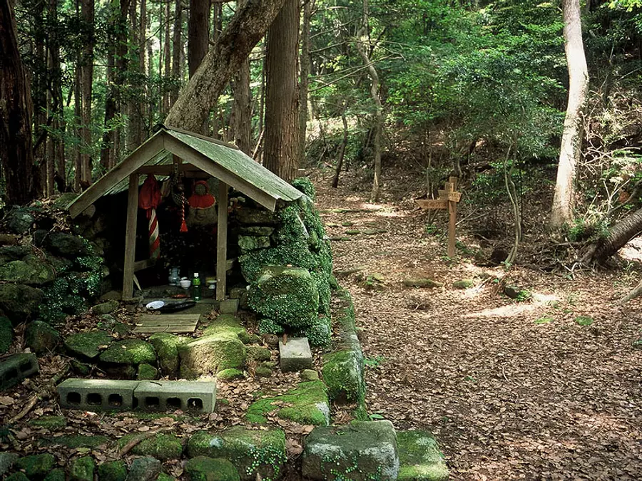
二木島峠・逢神坂峠 (熊野市)
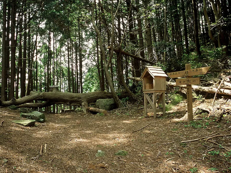
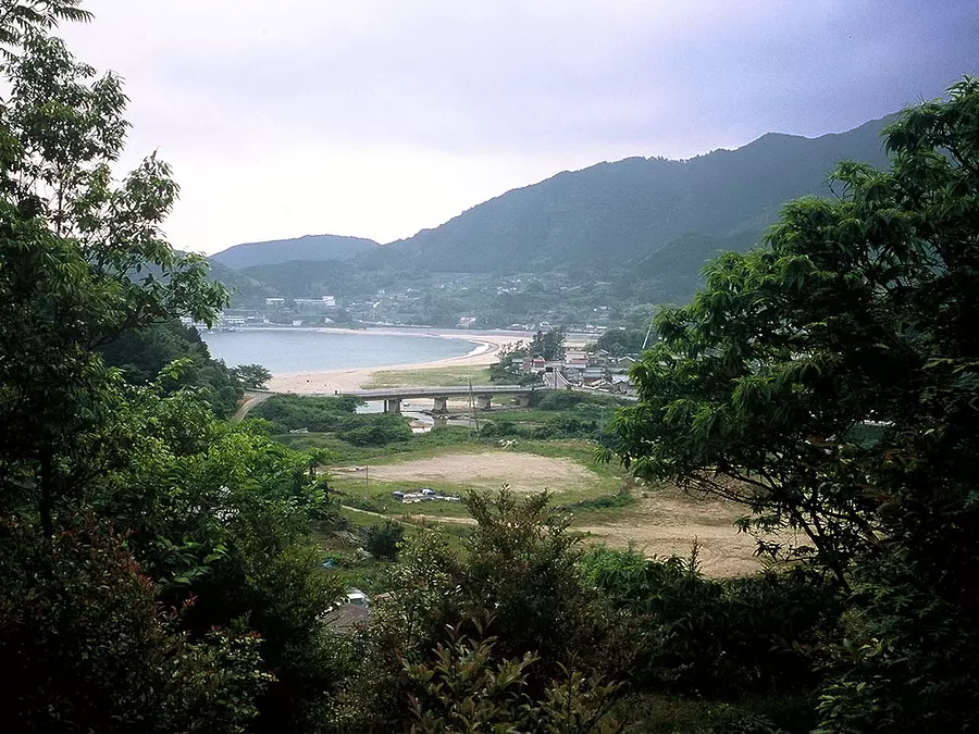
熊野市の二木島と新鹿を結ぶルートで、ほぼ直下をJR逢神坂トンネルが貫いています。古くから捕鯨の里として知られる二木島から古道にはいると、杉と桧による山林でほぼ全区間に端正な石畳道が通じており、適度なアップダウンが楽しめハイカー達に人気のコースです。
またコースは苔むした石畳や石垣が続くルートで美しい山道が続いています。「逢神」とは、伊勢と熊野の神が出会う場所という意味や、かつて狼が出没したためという説もあります。
○コースのポイント:神武東征~キリシタン灯ろう~猪垣~三浦樗良の句碑~里川の道しるべ ほか
○歩行時間:約2時間30分
○距離:約4.5km(JR二木島駅~JR新鹿駅)
○休憩スポット:---
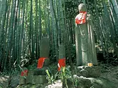
波田須の道・大吹峠 (県外)
(波田須の道)
新鹿町から波田須・大泊を経て熊野市街を通り花の窟神社へ抜けるコース。 波田須は、二千年以上の昔に不老不死の仙薬を求めて中国からやってきた徐福が上陸した里と伝わる里。
距離は長くないが鎌倉期のものと思われる巨石の石畳が残っています。海と山の間に棚田や民家が点在する、伝説と神話の里で数々の史跡が、三重県指定の「母と子の自然と歴史の散歩道」に指定されています。
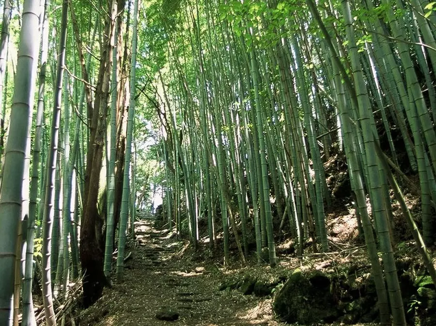
(大吹峠)
熊野古道には珍しい竹林が広がる古道です。距離は短いですが比較的緩やかな道が続き、情緒ある景観の中、古道歩きを楽しむことができます。
峠付近の猪垣は、猪の進入を防ぐため江戸時代に約10kmにわたって築かれた物が現在でもその形を残しています。
○コースのポイント:新鹿海水浴場~徐福の宮~弘法御足跡水~大吹峠口(東屋)~大吹峠~大泊海水浴場
○歩行時間:約5時間30分
○距離:約8.5km(JR新鹿駅~JR大泊駅)
○休憩スポット:新鹿海水浴場、徐福の宮 大吹峠口 ほか
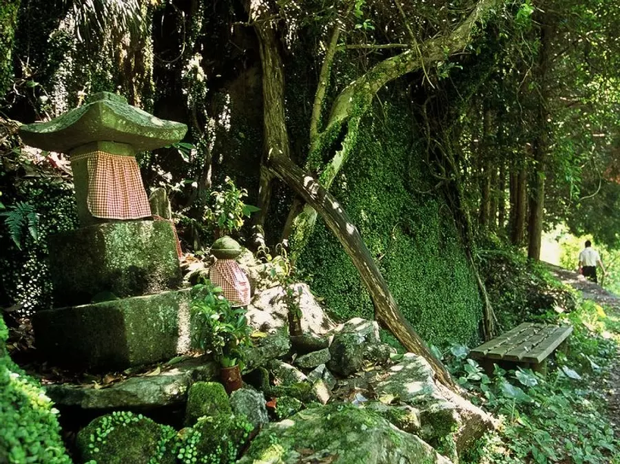
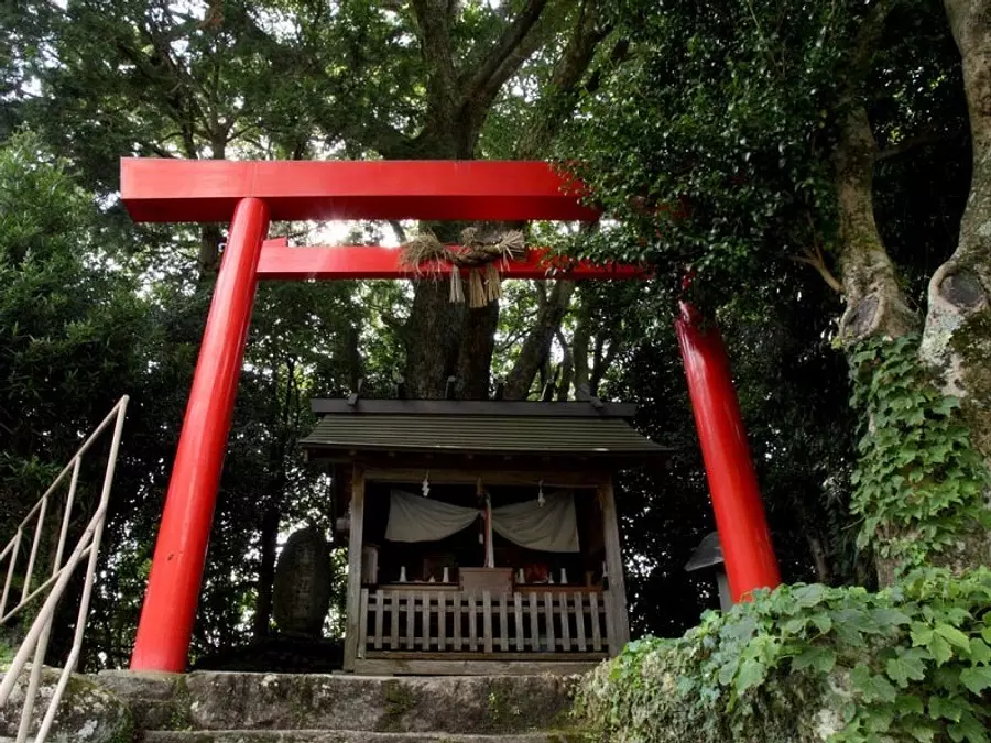
観音道 (熊野市)
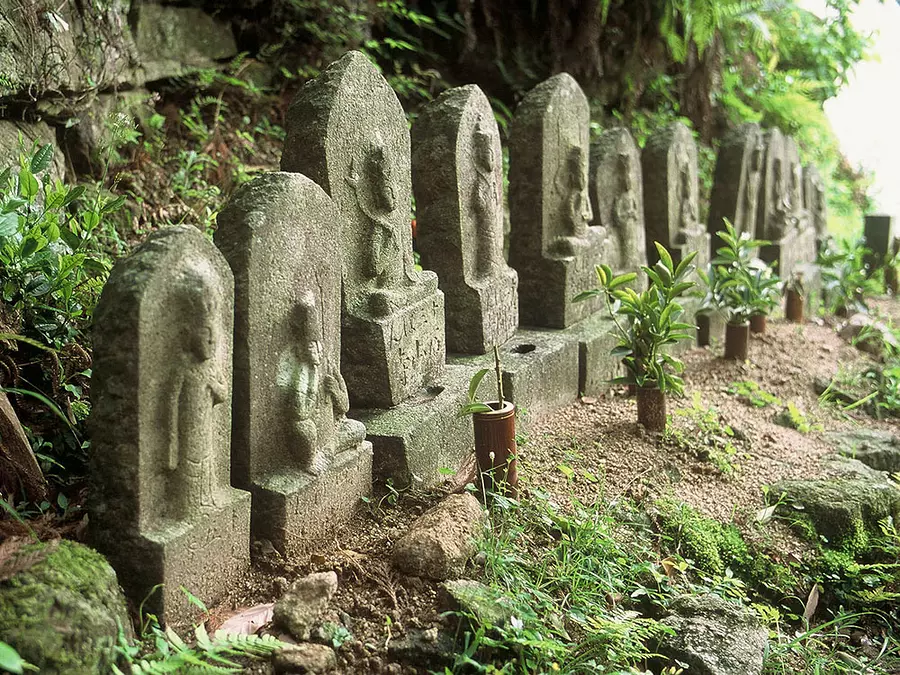
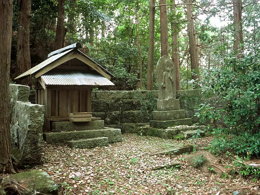
大泊から波田須への信仰の道。観音信仰が盛んな時代は大吹峠道ではなく、西国三十三所の観音石像が立ち並ぶ観音道がよく使われました。
頂上にある観音堂には当時の石仏など時代を感じさせる物が現在も残っており、この道の歴史を感じさせます。
この観音堂は大同4年(809)に坂上田村麻呂により建立され、鬼退治の伝説が残っています。急な登りもなく古道の中でも比較的楽に歩けるコースです。
○コースのポイント:清泰寺~観音堂登り口~馬頭観音~観音堂 ほか
○歩行時間:約2時間30分
○距離:約3.8km(JR大泊駅発着)
○休憩スポット:---
松本峠・花の窟 (熊野市)
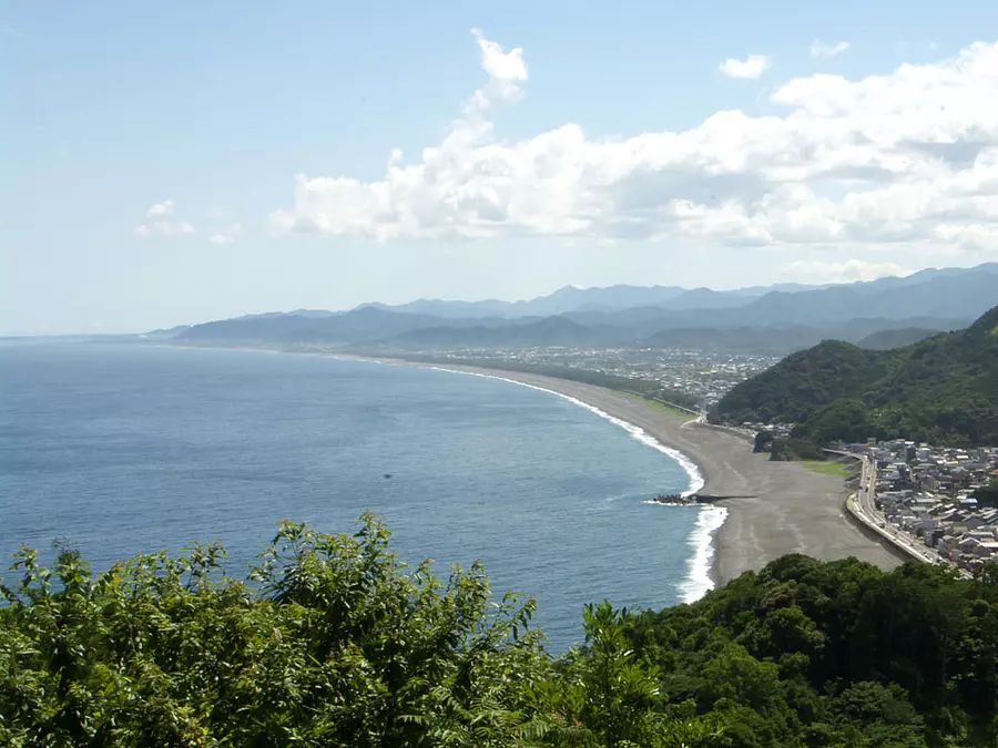
熊野市の大泊と木本を結ぶ峠。その道のほとんどに石畳が残っており、名勝・鬼ヶ城の山手に位置しています。竹林に囲まれた峠には、鉄砲で撃たれたと伝わる地蔵が立っており、途中の梅林からは七里御浜が一望できます。
また松本峠から鬼ケ城展望台を往復するコースを含んでいますので、体力に自信のある方は経由してみてはいかがでしょうか?松本峠を越えれば新宮まで峠越えはなく、かつての巡礼者が、七里御浜の向こうの新宮に鎮座する熊野速玉大社に思いを馳せたであろう場所です。
○コースのポイント:江戸の石畳~松本峠と地蔵~峠道の梅林とあずま屋からの眺望 ほか
○歩行時間:約3時間
○距離:約5km(JR大泊駅~JR熊野市駅)
○休憩スポット:紀南ツアーデザインセンター ほか
関連情報
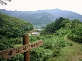
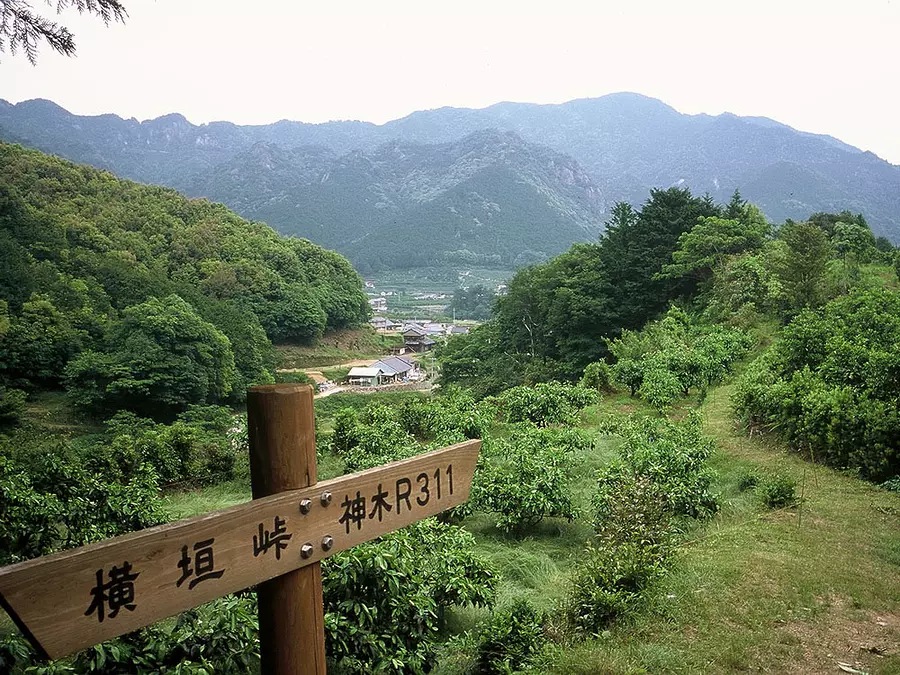
横垣峠 (南牟婁郡御浜町)
※2013年10月現在、水壷地蔵前~東屋休憩所間が 【通行止め】 となっております。
熊野古道伊勢路は、海岸沿いに新宮を目指して南下する浜街道と、本宮を目指す本宮道に分かれています。横垣峠道の本宮道の一部は、特有の神木流紋岩が敷き詰められた石畳が続きます。
町の民話として伝わる水壺地蔵を過ぎると、峠には東屋が整備されており休憩スポットとなっています。みかん畑などを通る人気のコースです。
○コースのポイント:水壺地蔵~石畳道~折山神社~亀島の石灯籠 ほか
○歩行時間:約2時間
○距離:約5.4km(横垣峠登り口バス停~高千良バス停)
○休憩スポット:横垣峠登り口、熊野古道地域センターさぎりの里、東屋 ほか
※おでかけ前に各問い合わせ先にご確認ください。
風伝峠 (南牟婁郡御浜町)
御浜町と紀和町の町境にある峠。この峠は熊野の海辺と山村を結ぶ要路でした。苔むした石畳が続くこの道は、巡礼者だけでなく海の幸を山里に、山の幸を海沿いの里に届ける人々が行交った道です。
風伝とは、風のよく通る峠を意味し、秋から春にかけて朝晩の気温の寒暖が激しい時に「風伝おろし」と呼ばれる峠から麓へ吹き下ろす風が霧を巻き込んで起こる巨大な朝霧が発生します。古道は旧国道に寸断されつつ峠へ至り、熊野市紀和町へ抜けていきます。
○コースのポイント:尾呂志城跡~石畳道~風伝峠と法界塔 ほか
○歩行時間:約1時間30分
○距離:約3.5km(高千良バス停~後地バス停)
○休憩スポット:熊野古道地域センターさぎりの里 ほか
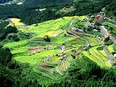
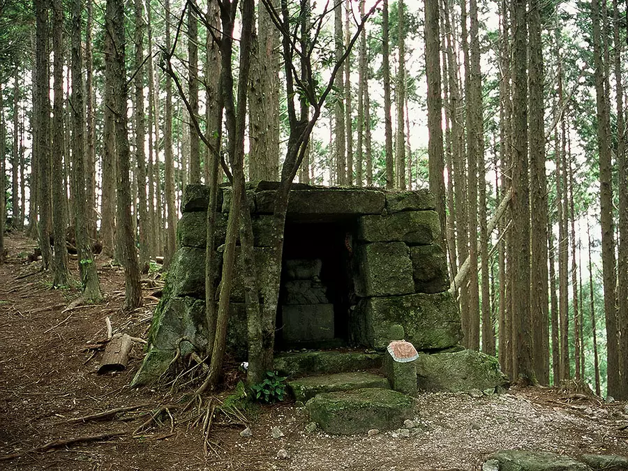
通り峠と丸山千枚田 (熊野市)
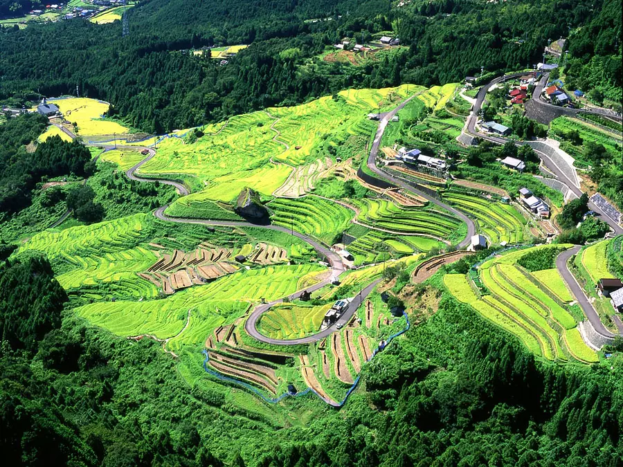
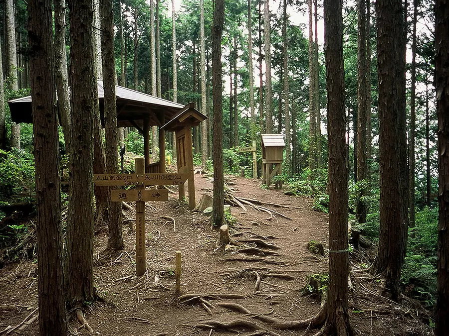
風伝峠を下りたのち、本宮へ向かう本宮道と分かれ、吉野方面へ向かう北山道です。世界遺産の対象ではありませんが、古くから地元の人たちに生活道として使われていました。
丸山千枚田は現在でも米作りが行われ、今なお時間帯や四季を通じて様々な表情を見せる美しい景観が保存されています。その千枚田を見下ろす展望台や、田圃道に突如現れる大岩など見どころも多く人気のコースとなっています。近くにはキャンプ場もありシーズンには多くの人で賑わいます。
○コースのポイント:展望台~丸山千枚田~通り峠~子安地蔵 ほか
○歩行時間:約2時間30分
○距離:約4.8km(千枚田・通り峠入り口バス停発着)
○休憩スポット:千枚田付近に点在、東屋 ほか
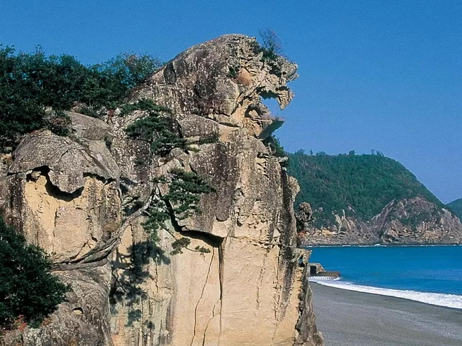
浜街道 (熊野市)
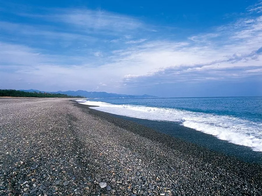
熊野市街から七里御浜に沿って、熊野三山のひとつ熊野速玉大社が鎮座する新宮を目指すコース。
(浜街道北)
峠越えが続く伊勢路の中にあって唯一、海岸沿いを行く比較的平坦なコースですが、かつては巡礼者が志原川や市木川の河口を渡る際に、波にさらわれ命を落とすことも少なくなかったといいます。
距離が長いですが、花の窟や獅子岩など東紀州特有の大自然スポットを見る事ができ、道の駅などもある通りなので立ち寄り場所も多数あります。
(浜街道南)
七里御浜の海岸沿いから、見晴らしのいい高台を抜けて耳切り坂を下がると世界遺産にも登録されている熊野川に出ます。
熊野川の向こうは熊野の聖地。熊野速玉大社への参拝を終えた巡礼者は、熊野那智大社や熊野本宮大社を目指してさらに旅を続けました。
○コースのポイント:獅子岩~花の窟~立石の道標~市木の一里塚~六部の墓~井田観音~紀宝町ウミガメ公園~梶鼻王子跡(梶鼻の大岩) ほか
○歩行時間:浜街道(北)約4時間、浜街道(南)約5時間
○距離:浜街道(北)約12.2km、浜街道(南)約14.4km
○休憩スポット:道の駅パーク七里御浜 道の駅紀宝町ウミガメ公園 ほか
熊野川 (南牟婁郡紀宝町)
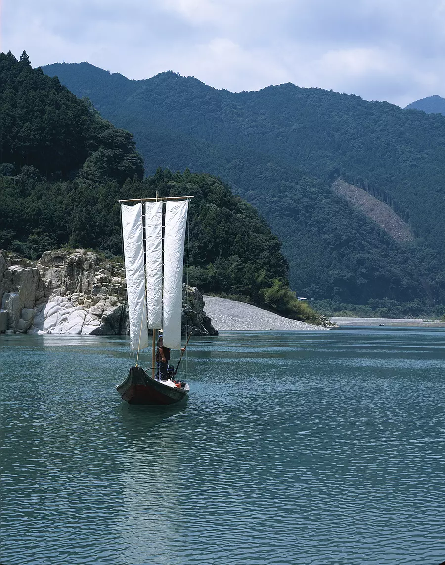
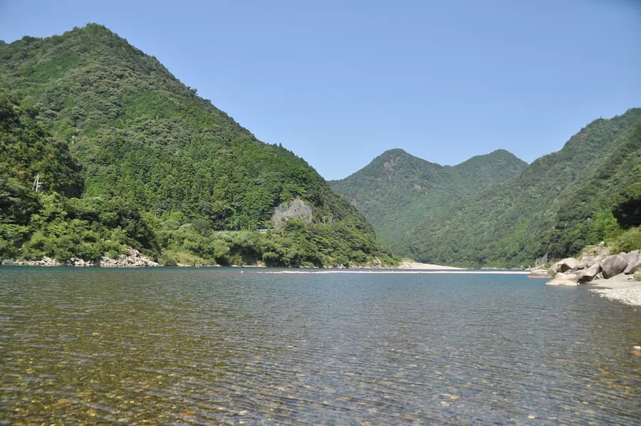
三反帆で熊野川を体験し、比丘尼転びや釣鐘石など、奇怪な自然の造形物を眺めながら熊野川を実感できる。熊野川沿いに、川端(川丈)街道(※平成25年12月現在、通行不可)がある。

.png)