東紀州の名山「便石山」&「天狗倉山」大人気の映えスポット「象の背」までの道のりをご紹介!
紀北町にそびえ立つ「便石山」と「天狗倉山」。便石山の山頂付近にある「象の背」はまるで象の背中に乗っているような写真が撮れる大人気の映えスポットです。この記事では、「便石山」と「天狗倉山」の見どころや、アクセス・駐車場などについて解説します!
- 【登山するにあたって注意しておきたいこと】
- 登山は自然を相手にするので、不確定な要素、予期せぬ事態が起こる可能性が十分あります。準備をしっかりと、余裕を持った計画をして楽しみましょう。
① 登山をする際は時間に余裕をもって行動し、自分の経験や体力に見合った山を選んで出かけましょう。
② 事前に登山計画を立て、当日までに最寄りの警察署か登山ポストに登山届を出しましょう。当日は地図やコンパスなども忘れずに。
③ 熊やスズメバチなど、危険な野生動物と遭遇する可能性があります。クマ鈴など対処できる装備を持参しましょう。
④ 事前に気象情報を確認した上で行動しましょう。山は気候の変化が激しいです。雨具をはじめ、急な気温の変化にも対応できる服装を用意しましょう。
⑤ 水分や携帯食を持参し、熱中症対策と適度な休憩を心がけましょう。
⑥ 冬場に登頂する際はアイゼンなどの雪山の登山道具を必ず持参しましょう。麓に雪が無くても山頂付近に雪や氷が残っている可能性があります。
▼ 目次
便石山&天狗倉山とは?
・登山レベル:★★★☆☆
・標高:便石山(611m)、天狗倉山(522m)
・登山時間:約6時間(馬越峠から)
今回は紀北町にそびえ立つ便石山(びんしやま)と天狗倉山(てんぐらやま)について紹介します。東紀州で人気の山です。中でも便石山の山頂付近にある「象の背」はまるで象の背中に乗っているような写真が撮れる大人気の映えスポットです。
記事を参考にみなさんも是非、大自然の映えスポットへ!
アクセス・駐車場・トイレについて
・馬越峠の登山口前に5台程度の駐車スペース有り。
・「道の駅 海山」に20台程度の駐車スペース有り。登山口まで徒歩10分程度です。
※長期休みなど繁忙期における長時間の駐車は銚子川河川敷の駐車場をご利用ください。
便石山、天狗倉山には売店や自動販売機はありませんので、登山開始前に道中のスーパーやコンビニなどで飲み物や食べ物をを調達しておきましょう(もちろんゴミは各自で持ち帰りましょうね)。
トイレもありませんので、登山スタート前に済ませておきましょう。「道の駅 海山」では軽食の販売、トイレもありますので是非、ご活用ください。
映えスポット①便石山の「象の背」へ
■登山口 8:00
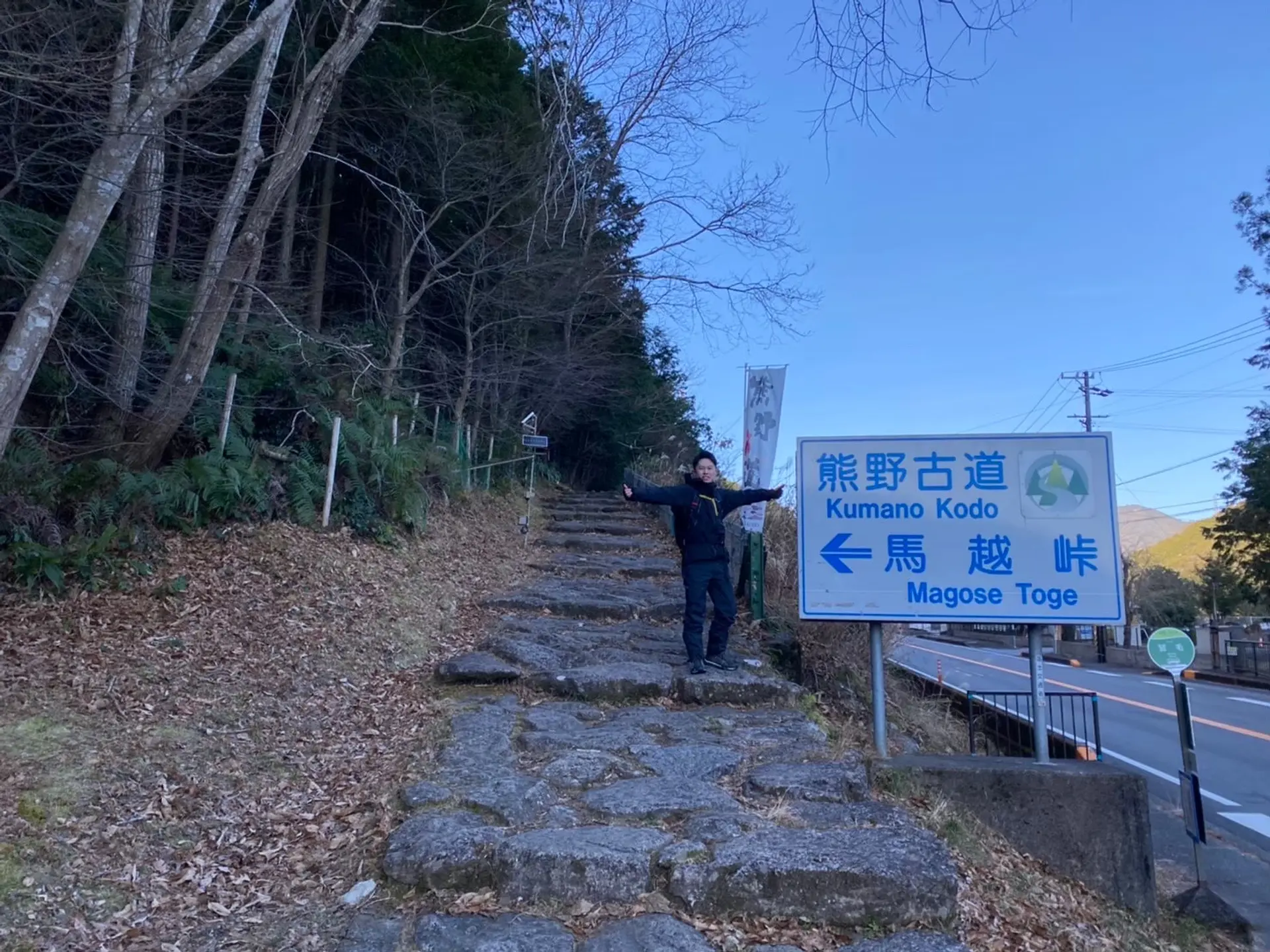
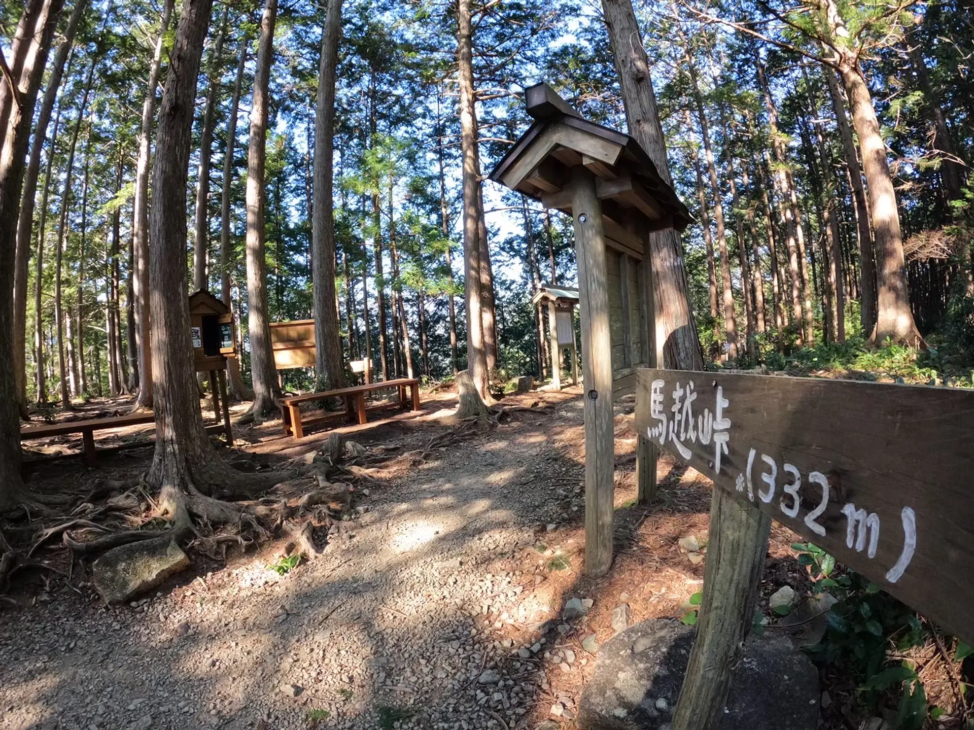
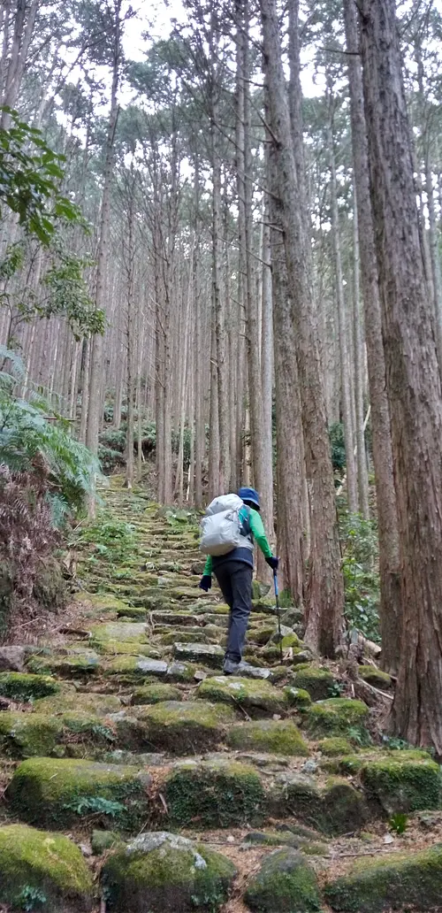
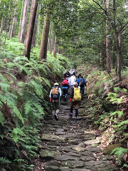
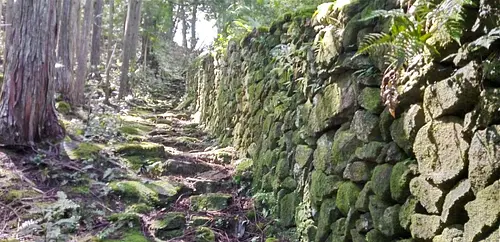
今回は馬越峠(まごせとうげ)から便石山→象の背→天狗倉山の順に登山を楽しみます。世界遺産「熊野古道」の四峠の中で最も北に位置するのが馬越峠です。山頂までの道のりで世界遺産を満喫出来るのも便石山、天狗倉山のオススメポイントです!
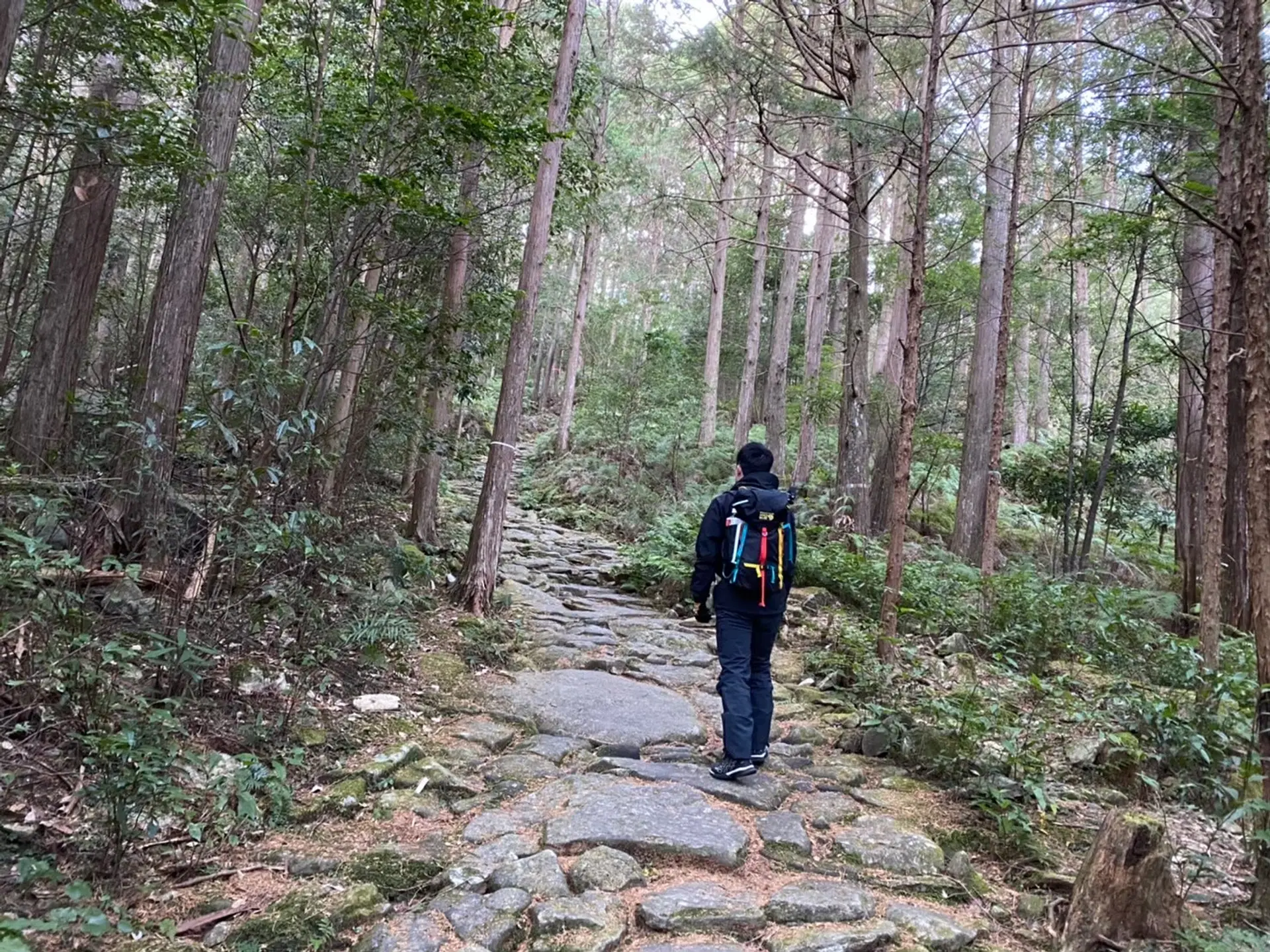
■古の旅人が歩いた石畳 8:15
熊野古道と言えば、この石畳です。熊野古道の中でも馬越峠の石畳の量は随一と言われています。東紀州は大変、雨の多い地域です。道が雨に流されるのを避けるために石畳が利用されています。雨の日の翌日は石畳が滑りやすくなっているので注意しましょう。
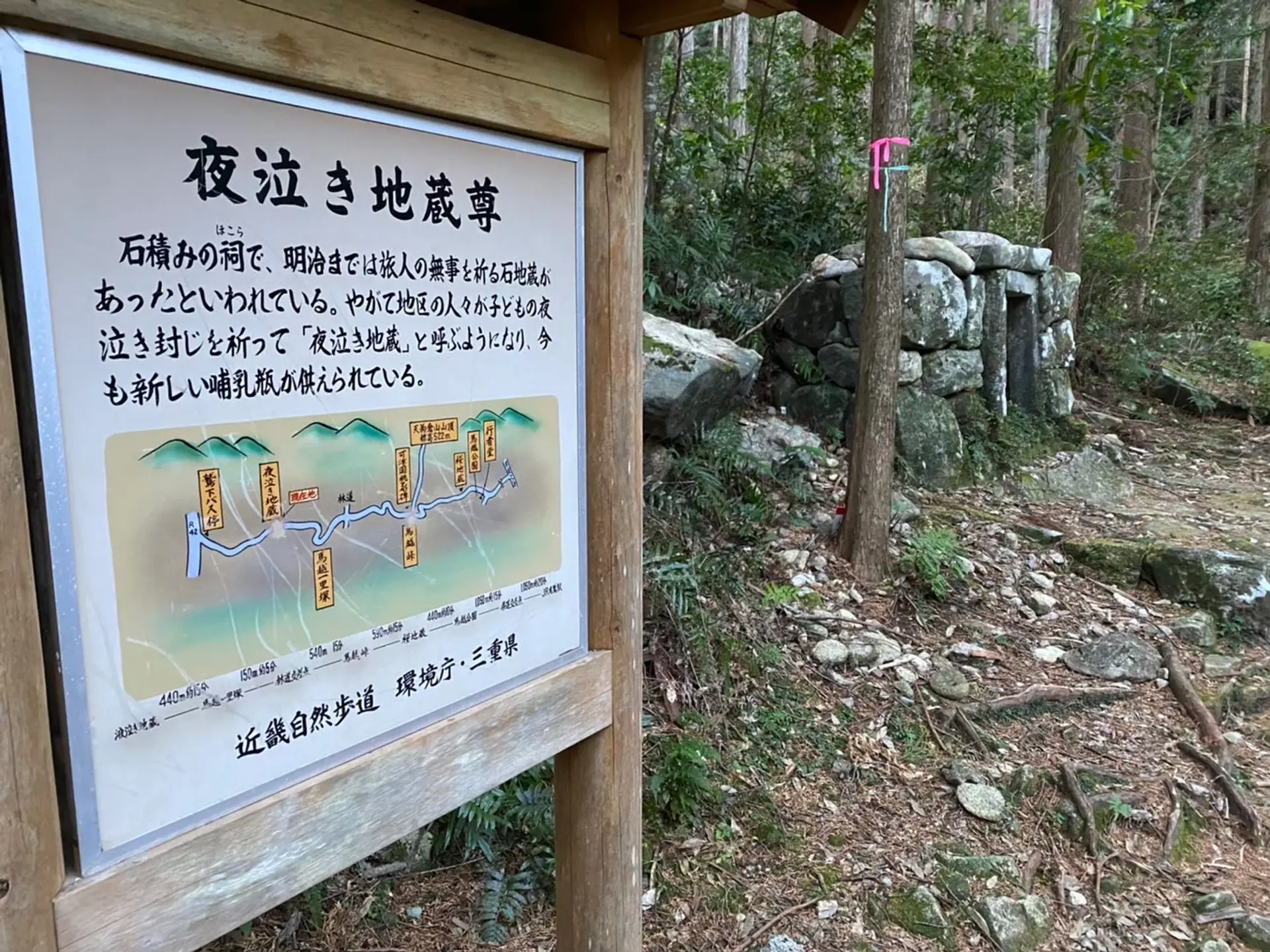
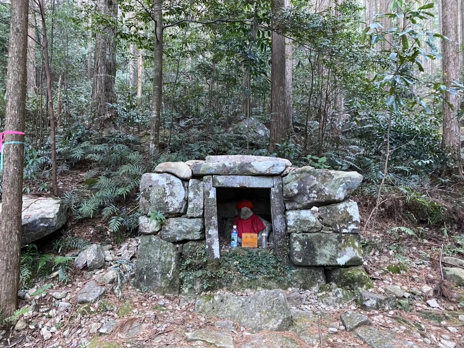
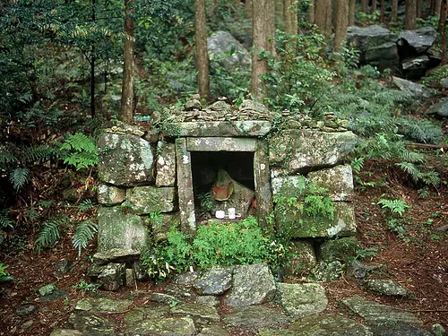
■夜泣き地蔵 8:25
夜泣き地蔵です。子ども達の夜泣き封じを願って「夜泣き地蔵」と呼ばれているそうです。
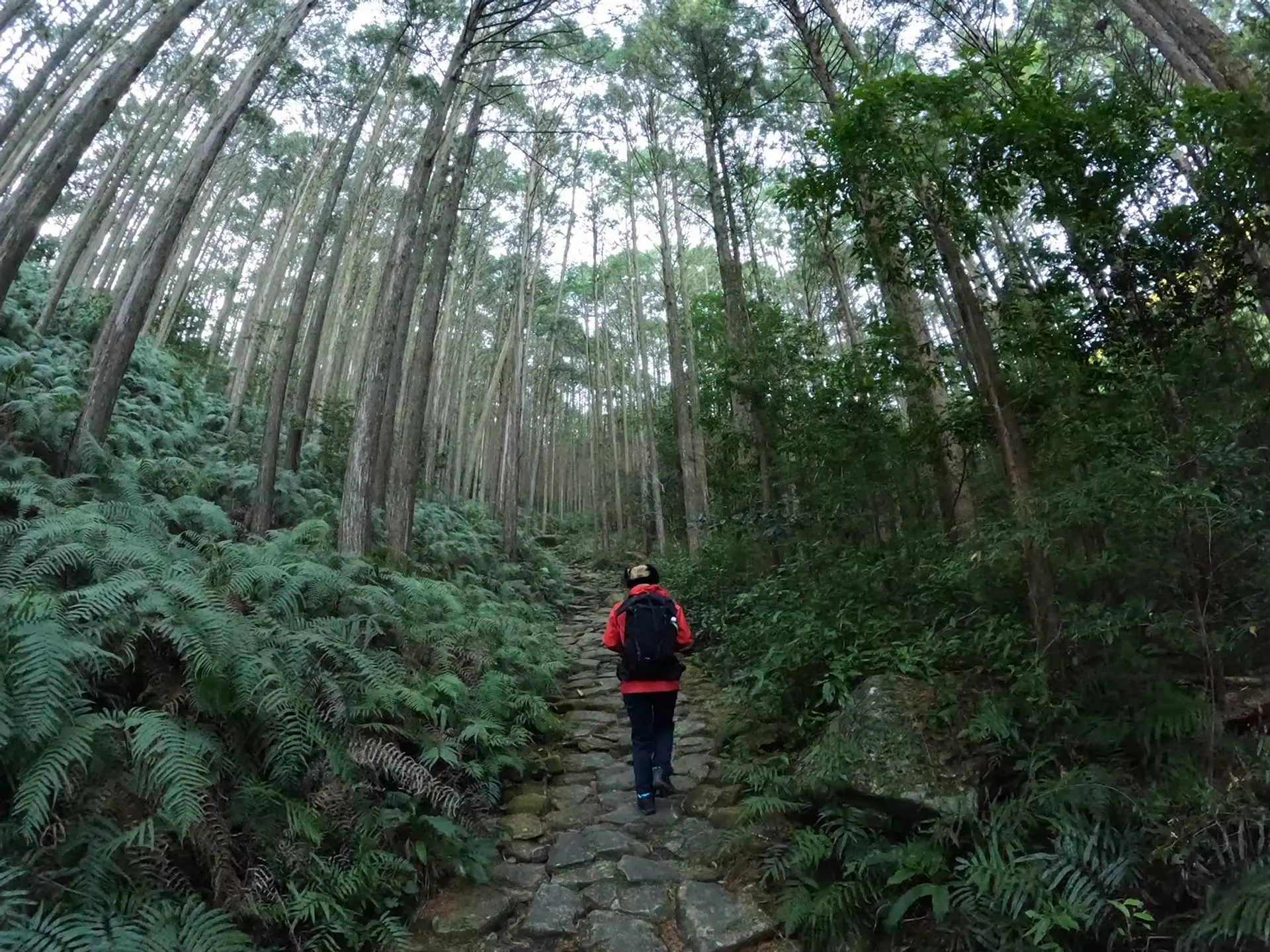
■8:40
石畳をどんどん進んでいきます。
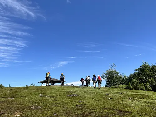
■休憩スポット 9:00
大きく開けた場所に到着しました。便石山の山頂までの丁度、中間辺りの地点にあります。ベンチが多数設置されていますので、ここで一休憩しましょう。
ここが便石山と天狗倉山の分岐点にもなっています。他にも尾鷲湾を眺めながら休憩できるスポットもありますので、お気に入りの休憩スポットを見つけましょう!
■9:15
便石山の山頂付近が見えます。
■9:30
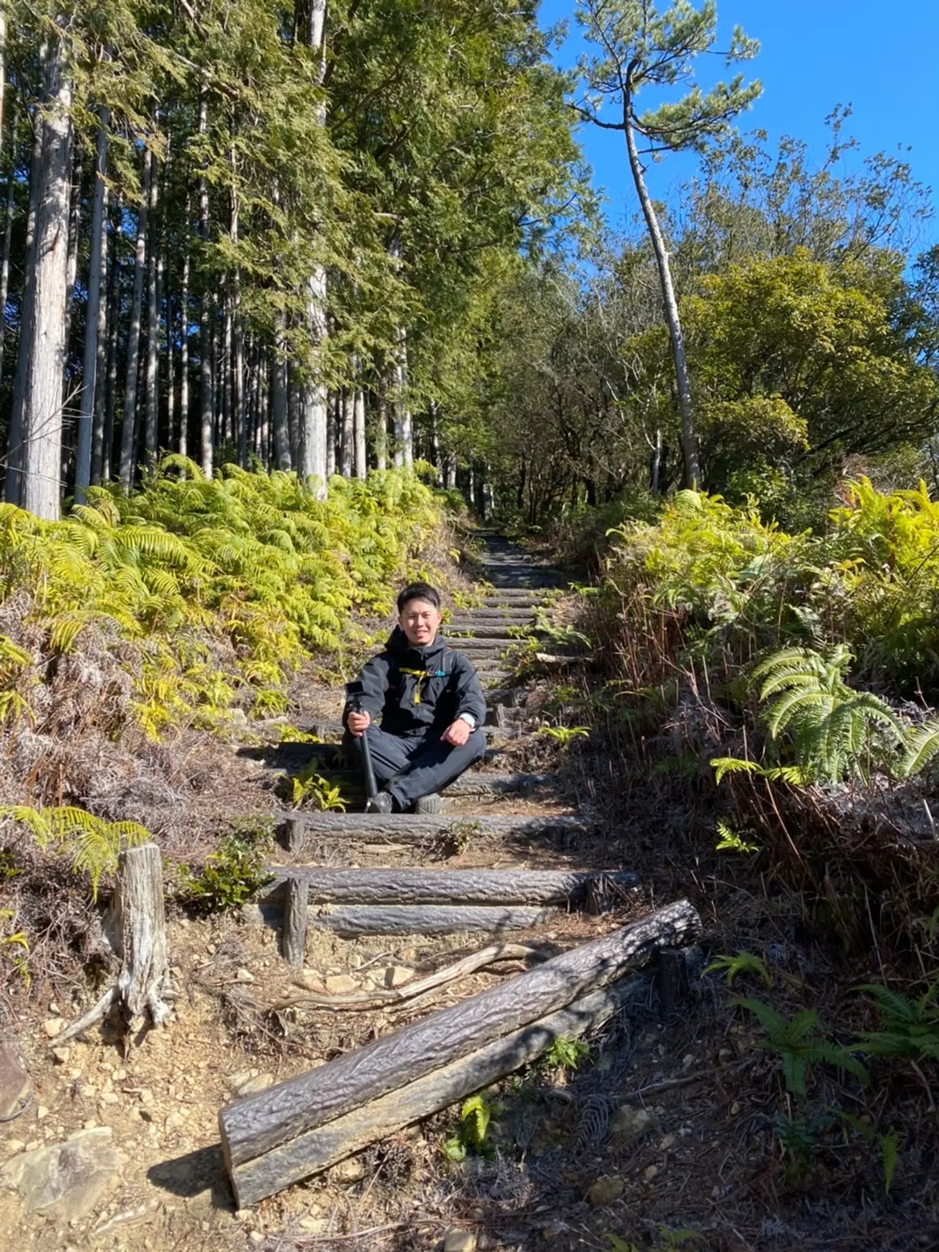
道中、このような階段を登り降りする箇所があります。歩きやすいように整備されていてありがたいですね。
■山頂まであと少し! 9:45
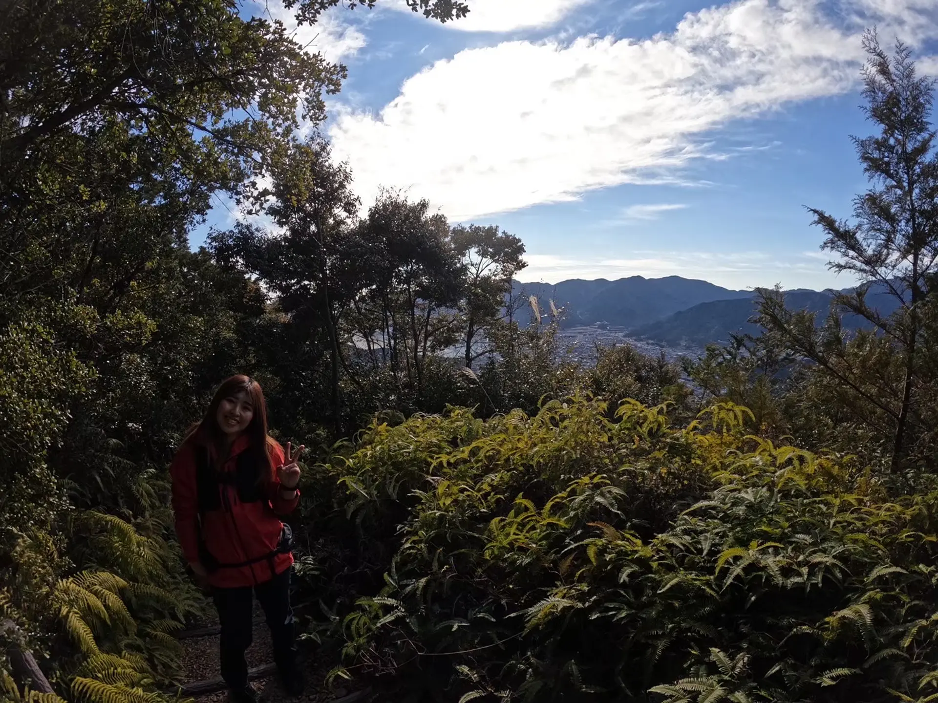
チラッと尾鷲市街が見えました。山頂まであと少しです。
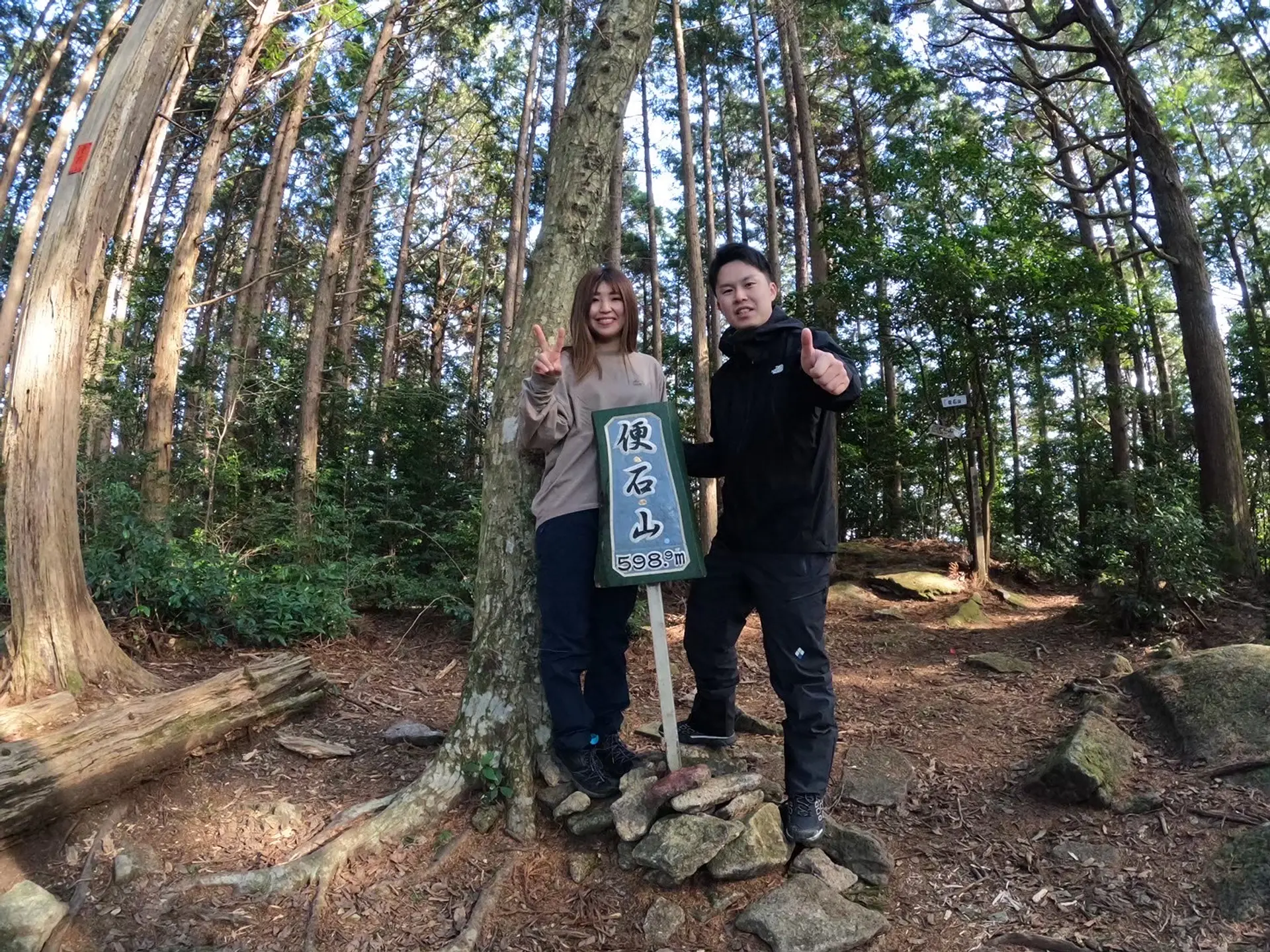
■便石山山頂 10:15
便石山の山頂に到着!山頂には便石山と書かれた看板があります。残念ながら周りは木々で囲われており、尾鷲市街の景色を眺めることはできません。
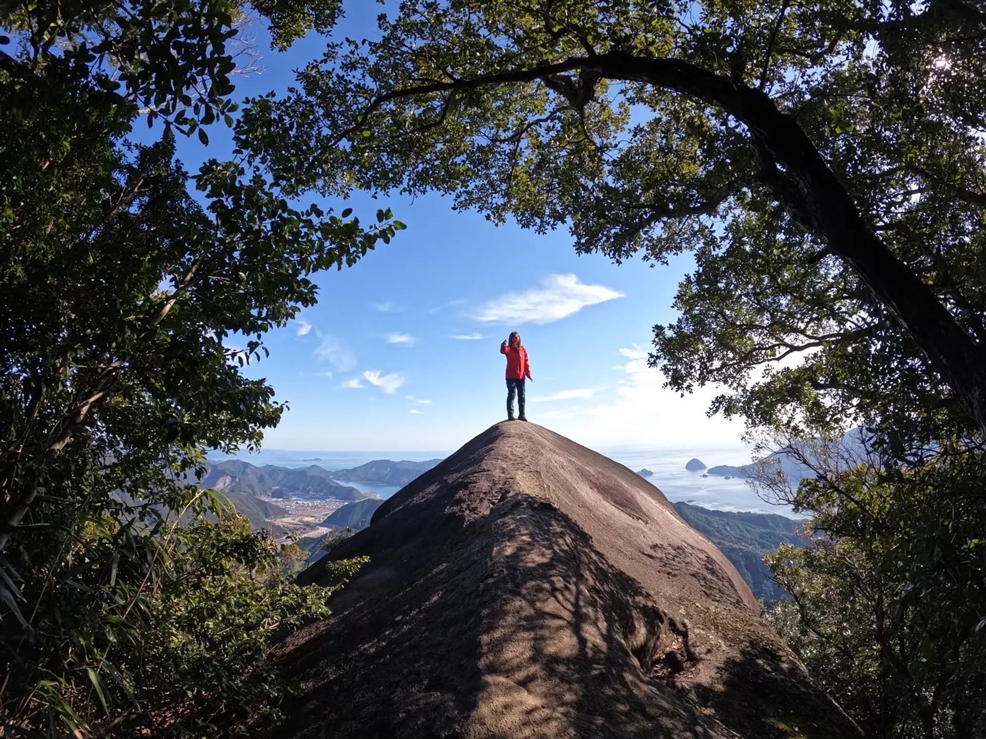
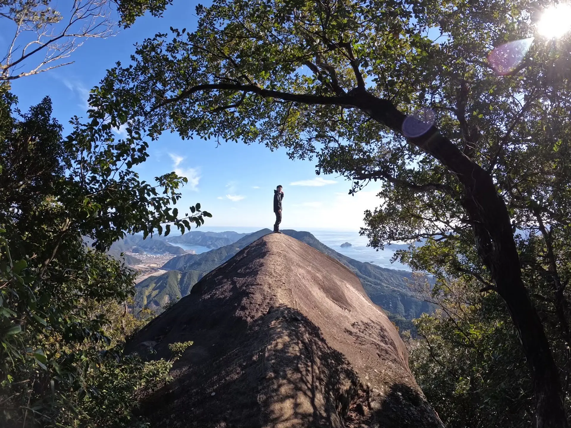
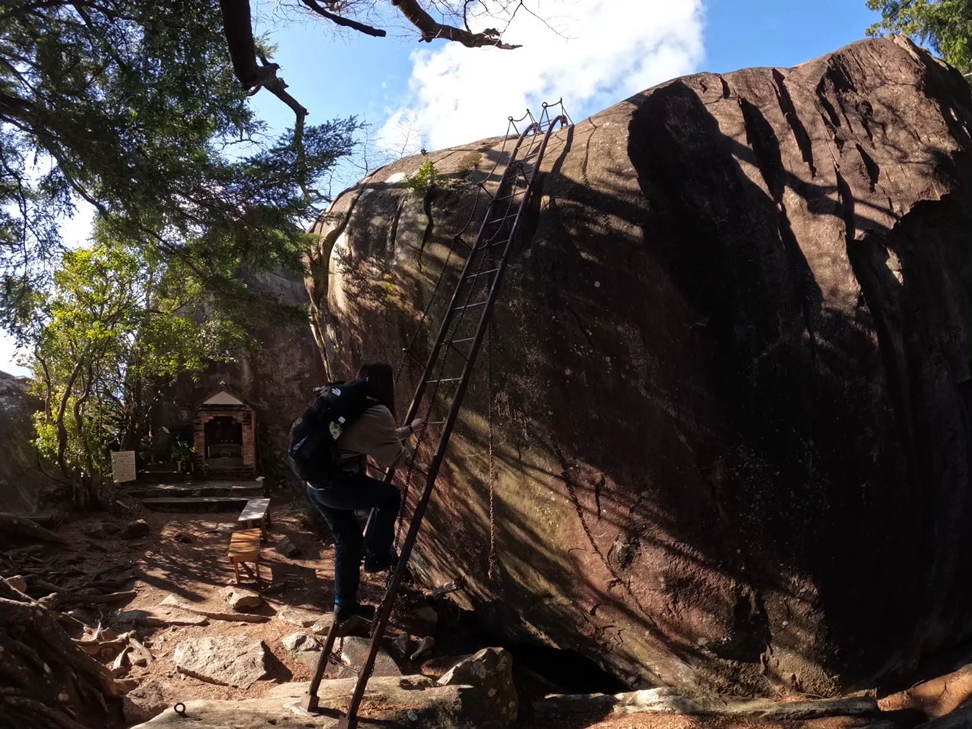
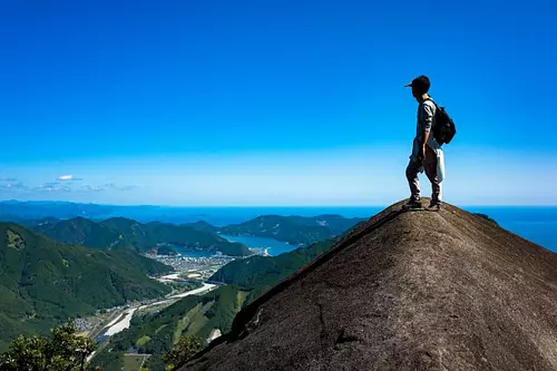
■象の背 10:25
便石山から10分程度歩くと大きな岩が現れます。これが「象の背」です。名前の通り、大きな象の背中のような景観をしています。勇気を出して象の背中に登って記念撮影をしましょう!(くれぐれもジャンプなど危険な行為はお控えくださいね…!)
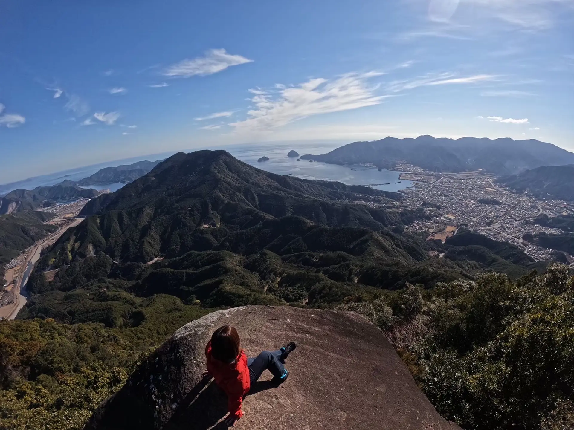
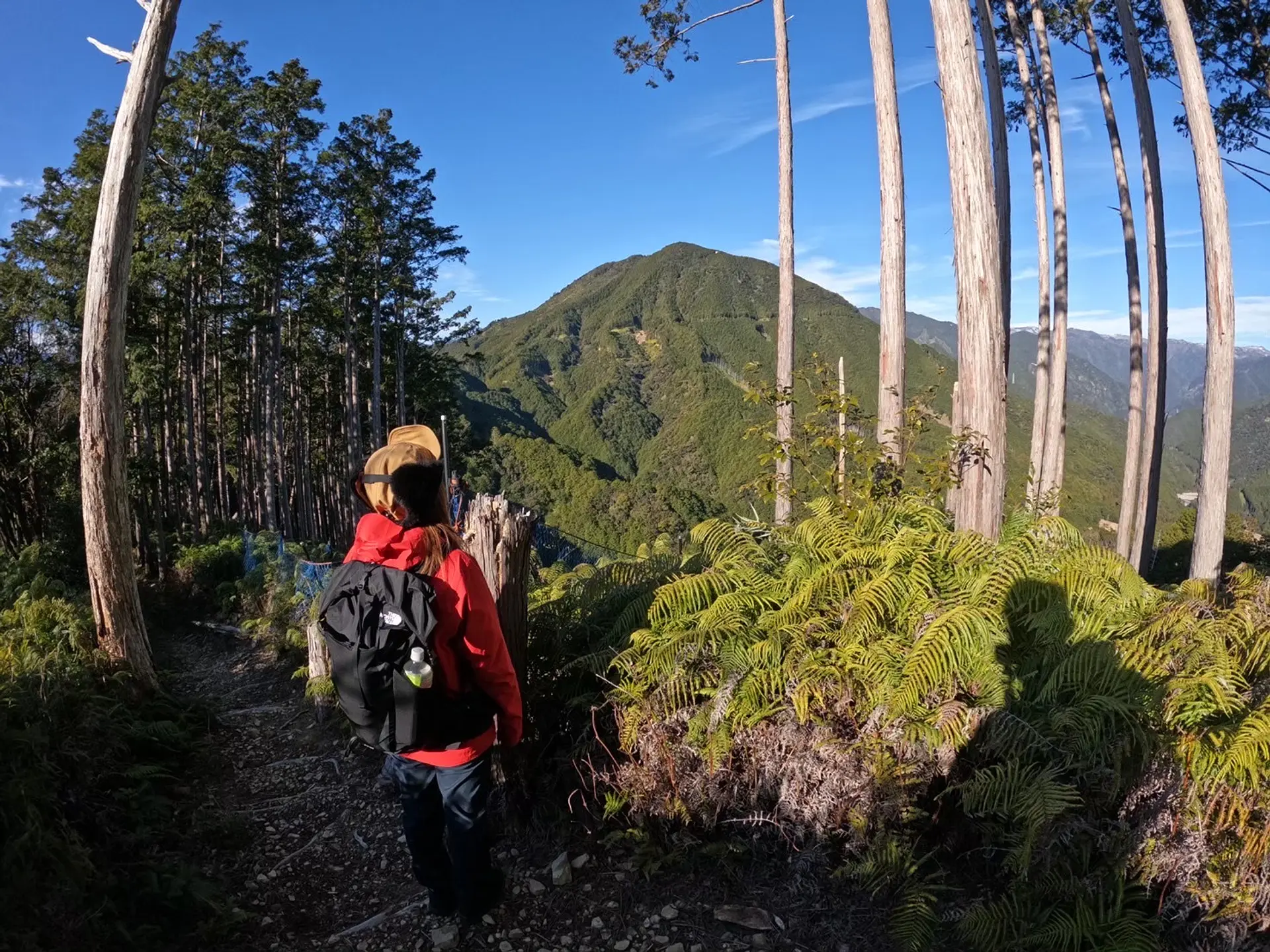
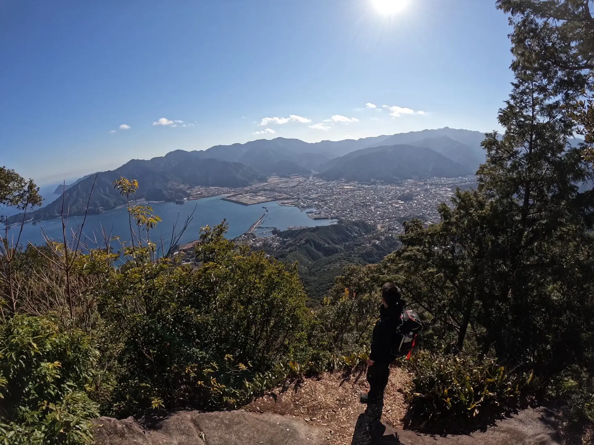
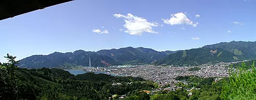
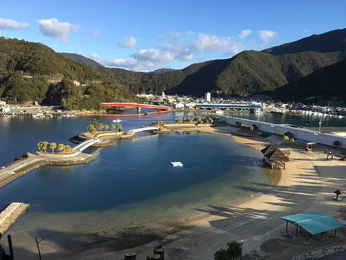
象の背からの眺めです。象の背からは隣の天狗倉山、尾鷲市街、尾鷲湾を眺めることができます。最高の景色です!この景色を見る為に県外からも沢山の登山客が訪れています。
映えスポット②天狗倉山を目指す
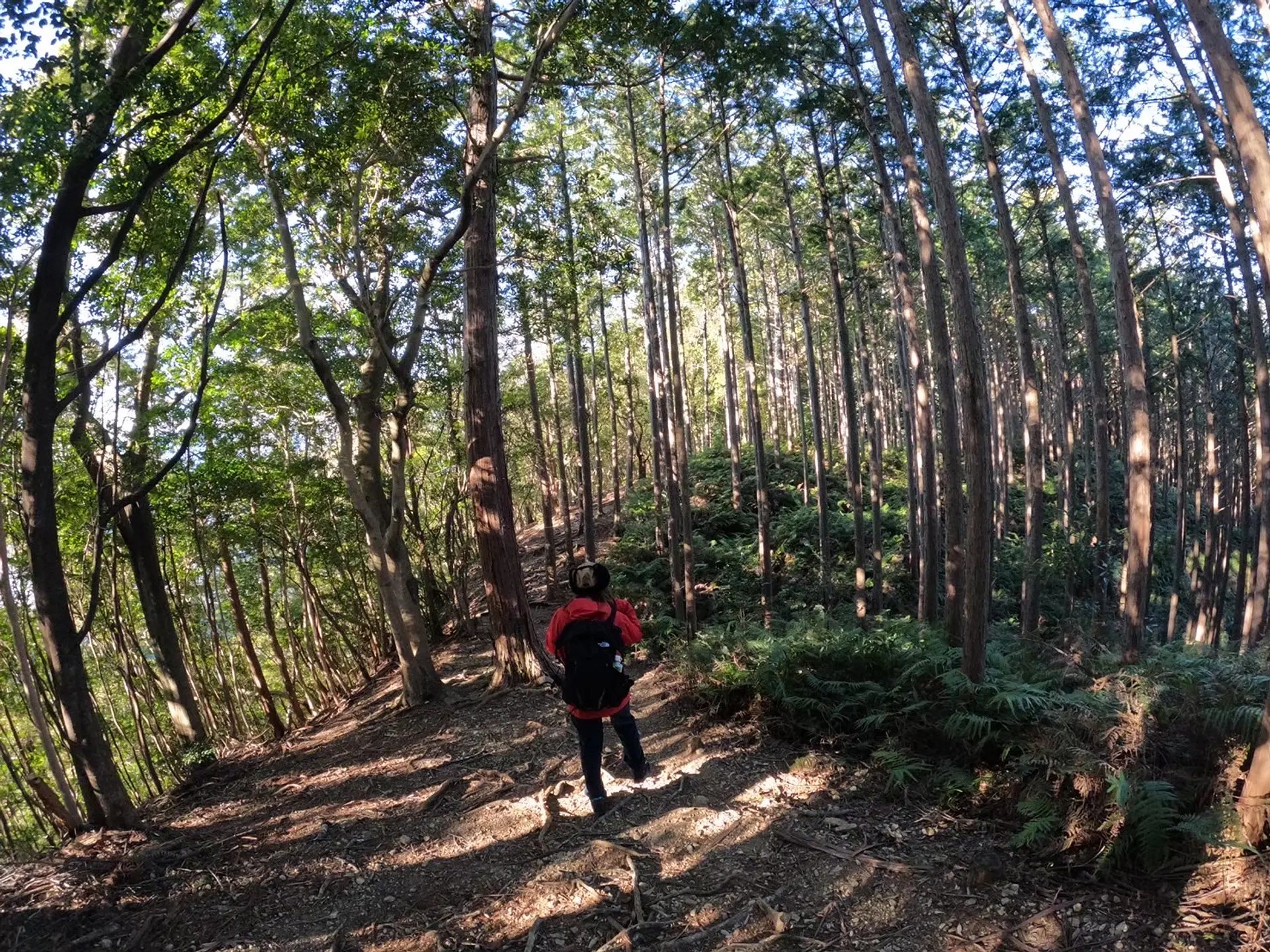
■象の背を出発 10:45
一つ目の映えスポット「象の背」を後にして次なる映えスポット「天狗倉山」に向かいます。
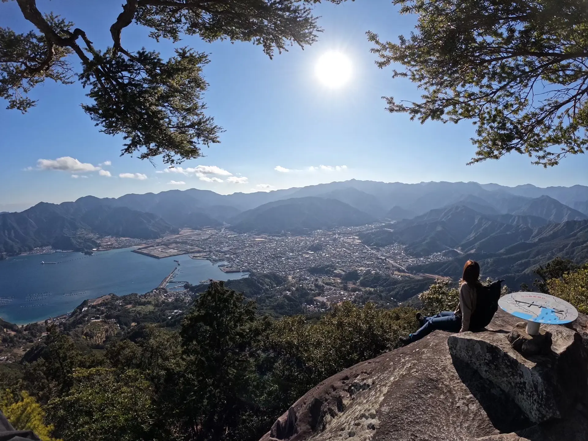
■尾鷲湾を望む 11:15
天狗倉山への道中は尾鷲湾を眺められるスポットが沢山あります。
■そびえたつ巨岩 11:45
天狗倉山の山頂付近にはこの大きな岩があり、上に登ることができます。
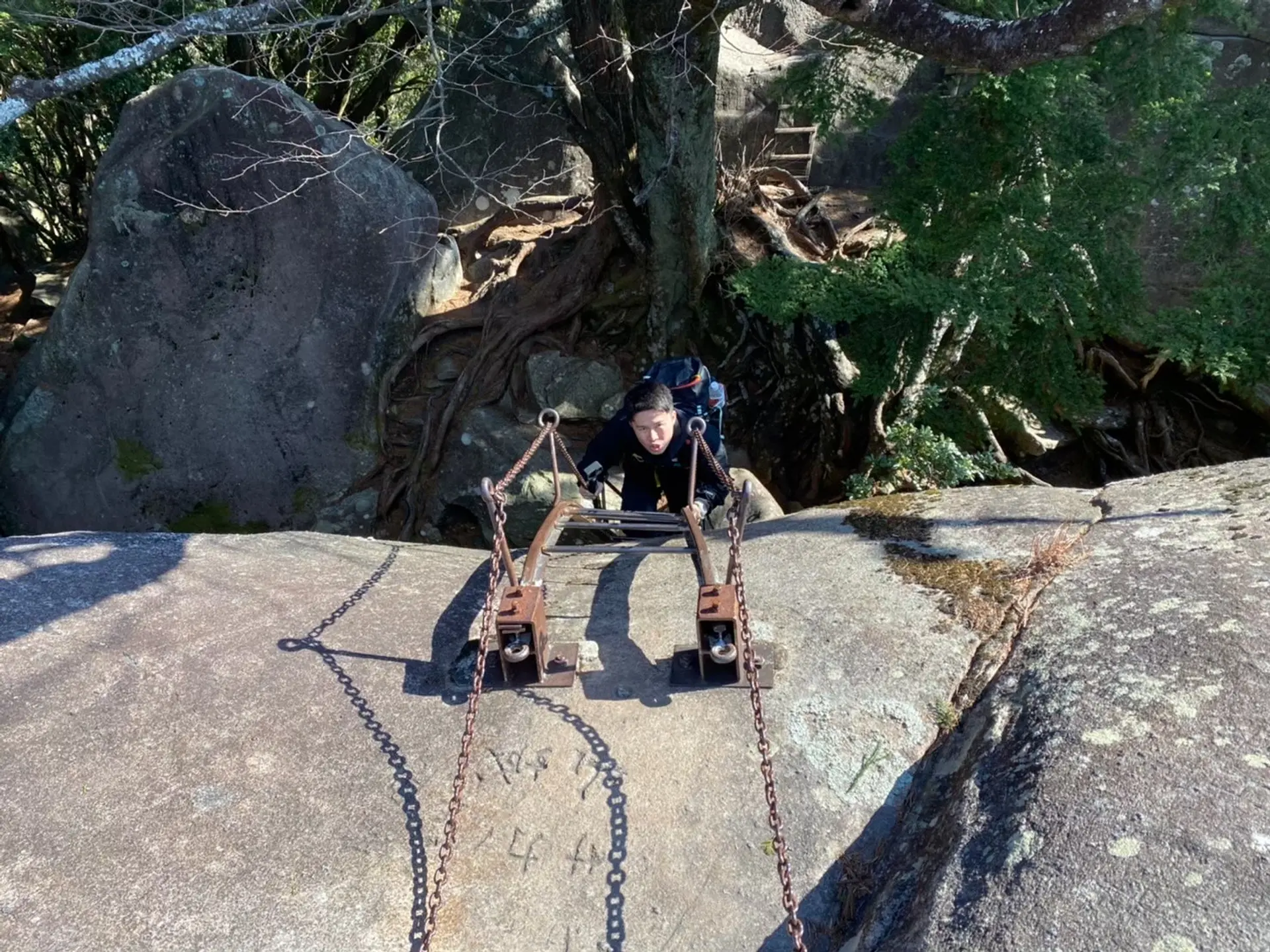
急なはしごを登るので気をつけてください。
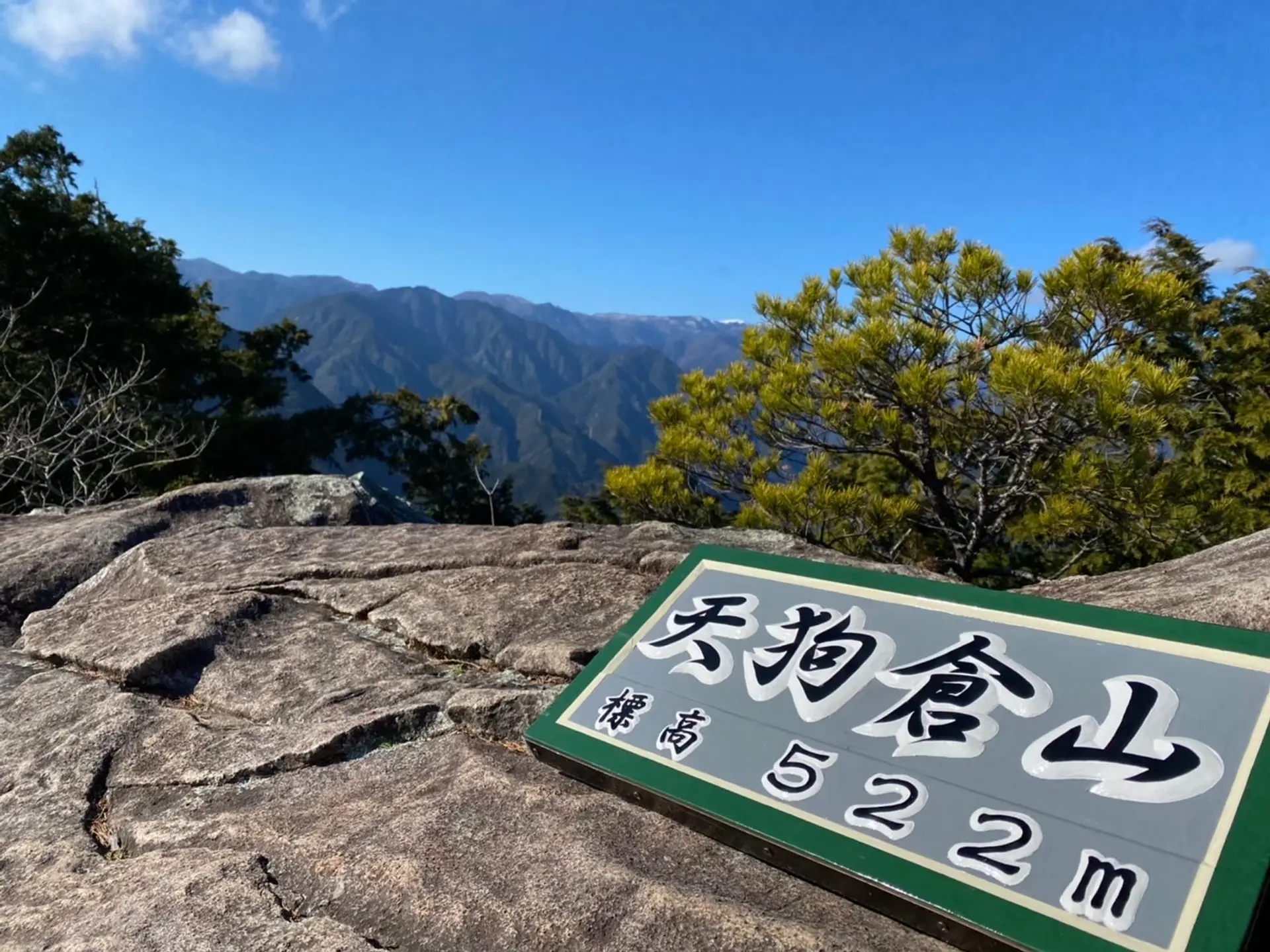
大きな岩の上には天狗倉山と書かれた看板が置かれています。
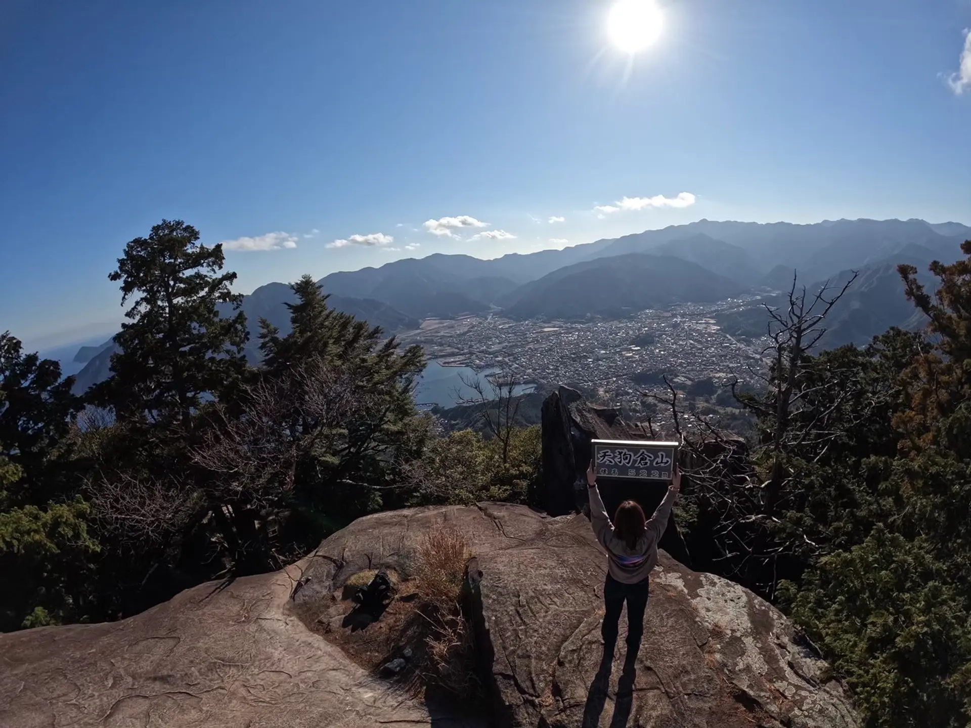
岩の上からの眺めです。看板を持って記念撮影をしましょう。
■天狗倉山山頂 11:55
大きな岩の近くに天狗倉山の山頂があります。ここから尾鷲市街、尾鷲湾を一望することができます。手前の大きな木を入れて撮影すると映えた写真が撮れますよ。
天狗倉山山頂から駐車場まで下山するのには約2時間かかりました。下山時もしっかり踏みしめて、無理せず自分のペースで進みましょう♪
いかがでしたか
いかがでしたか?二つの映えスポット「便石山(象の背)」と「天狗倉山」は初心者の方でも楽しめる山です。体力に自信が無い方はどちらか片方の山だけでもチャレンジしてみて下さい!
紀北町に関する記事を掲載しています。是非、参考にしていただき、登山前後に立ち寄ってみて下さい。
https://www.kankomie.or.jp/report/899
僕たちのInstagramのフォローもお願いします!
https://www.instagram.com/takuma___0117/
https://www.instagram.com/uma.sensei.to2/
https://www.instagram.com/asobisia/
この投稿をInstagramで見る
近くのスポット
近くのイベント
開催日:2026年02月01日(日)〜2026年02月05日(木)
直線距離:2.2km
尾鷲ヤーヤ祭り
開催日:2025年12月31日(水)〜2026年01月03日(土)
直線距離:2.2km
尾鷲神社で初詣
開催日:毎月18日
直線距離:2.3km
毎月開催:「岩屋堂ゆるまいり」ツアー
開催日:2025年1月7日~
直線距離:2.5km
旅びと食堂「ぷらっつナカセン」 ワンディシェフランチ 始めます
開催日:2025年10月から毎月開催
直線距離:2.5km
尾鷲よいとこ見つけ旅2025 トレッキングツアー 10月から毎月開催!
開催日:毎月第1土曜日、12月のみ第3土曜も開催。※ただし1月...
直線距離:2.7km
尾鷲イタダキ市
開催日:2025年12月01日(月)〜2026年02月28日(土)
直線距離:2.9km
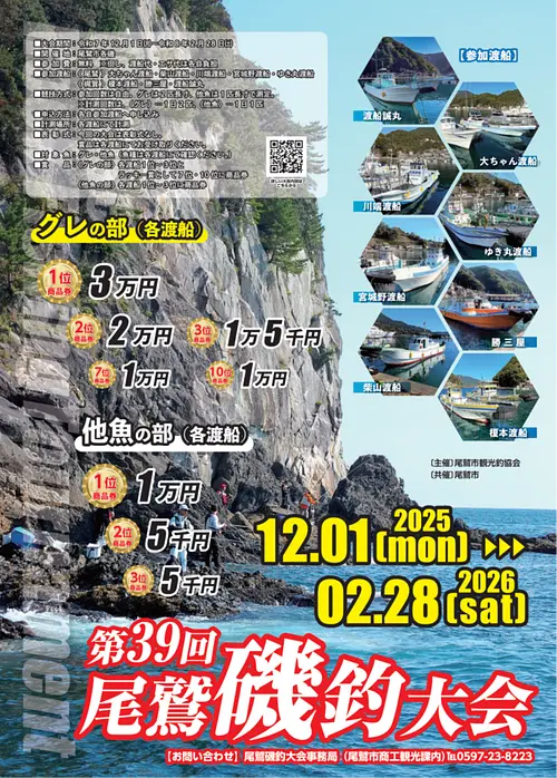
第39回尾鷲磯釣大会
開催日:2025年12月31(水)~2026年1月3日((土)
直線距離:13.2km
ギッチョホイ
開催日:2026年01月12日(月)〜2026年01月12日(...
直線距離:14.8km
ハラソ祭り
開催日:2025年12月02日(火)〜2025年12月30日(火)
直線距離:18.2km
年末・きいながしま港市
開催日:2026年2月14日(土)
直線距離:23.6km
大紀町シーサイドトレイル
開催日:2026年1月11日(日)
直線距離:24.0km
八幡祭
近くでできる遊び・体験
直線距離:2.5km
尾鷲セラピストと歩く熊野古道・八鬼山越え
直線距離:2.5km
「大地のパワーみなぎるowase岩ヨガ体験」(尾鷲プライベート岩ヨガ体験)
直線距離:2.5km
尾鷲セラピストと歩く熊野古道・曽根次郎坂太郎坂
直線距離:2.5km
尾鷲セラピストと歩く熊野古道・馬越峠
直線距離:2.5km
尾鷲セラピストと歩く熊野古道・三木峠・羽後峠
直線距離:2.5km
尾鷲セラピストと歩く大配 オハイブルー探訪

直線距離:4.2km
黒の浜で潮干狩り!
直線距離:10.8km
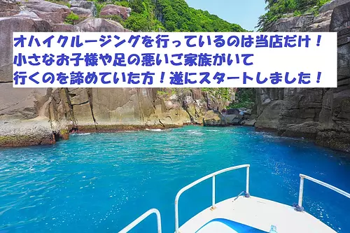
オハイクルージング
直線距離:18.9km
【冬のアクティビティ】男女で入れるサウナ!貸切テントサウナが2500円!全国トップクラスの水質の赤羽川が水風呂に!
直線距離:18.9km
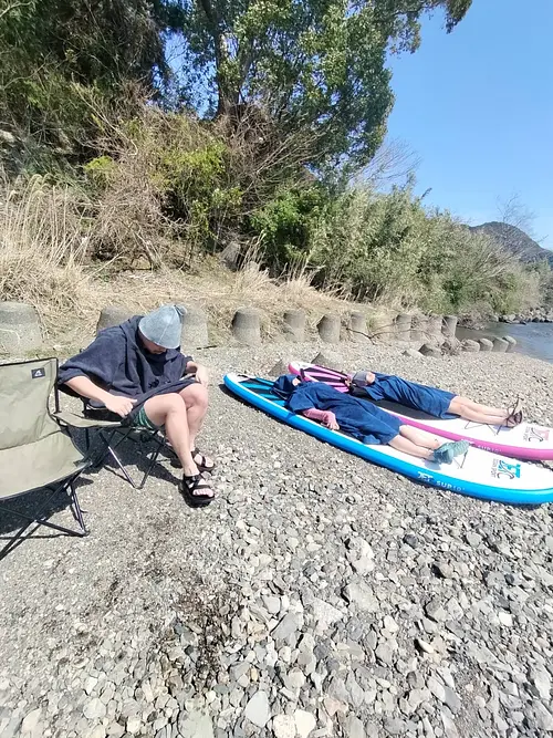
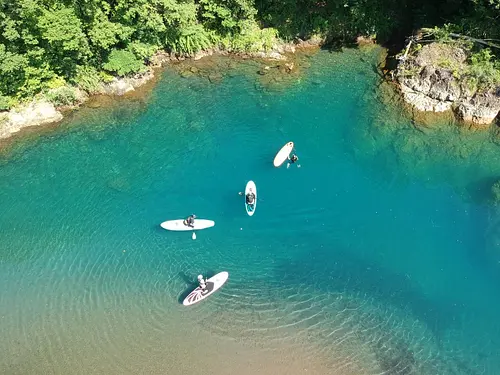
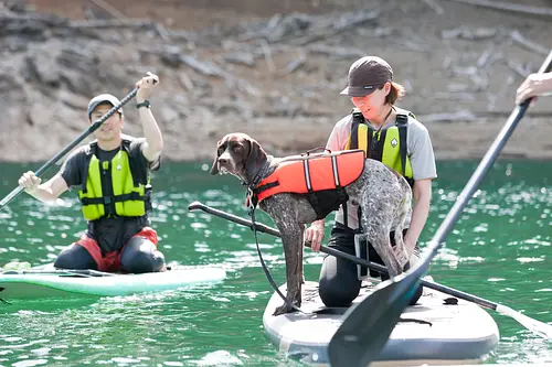
三重県で人気のアクティビティ【紀北町】全国ここだけ!?川から海まで流れるSUP体験!初心者でも安心のガイド付きSUPツアー!
直線距離:20.5km
RocaRocaアクティビティ
直線距離:24.1km
熊野市絶景めぐり
関連スポット
種まき権兵衛の里
東紀州
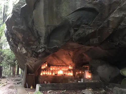
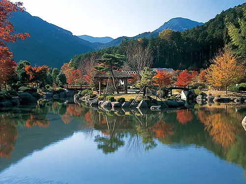
北牟婁郡紀北町「権兵衛が種まきゃ、カラスがほぜくる・・・」の俗謡で有名な権兵衛さんにちなんで作られた施設。 園内には、ゆっくり散歩が楽しめる築山林泉回遊式のみごとな日本庭園や、権兵衛さんのゆかりの品々や紀北町海山地区の民俗資料を展示した「権兵衛屋敷」があります。館内の展示室、茶室は文化的研修の場としても利用できます。 春には河津桜やソメイヨシノ、秋には美しい紅葉が楽しめるスポットです。 また、銚子川、魚飛渓の駐車場としてもご利用いただけます。 【関連取材レポートはこちら】 👉絶景!抜群の透明度を誇る「銚子川」に行ってみた!周辺の観光スポットもご紹介! 👉GENERATIONS小森隼さんが便石山 「象の背」の絶景や、尾鷲の新鮮&絶品海鮮グルメを堪能! 2025年の桜の開花状況はこちら 三重の花カレンダー 三重県の他の桜の名所はこちら 三重県の桜の名所特集2025年版
キャンプinn海山
東紀州
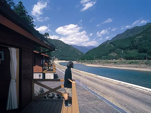
北牟婁郡紀北町海・山・川3拍子揃ったキャンプ場です。おススメは、驚くほど水が澄んでいる銚子川での川遊び。カヌーに挑戦したり、水中メガネを持ってきて天然の水族館をのぞいてみたり。 また、ウッディークラフト教室やストーンクラフト教室など各種イベントも盛りだくさん。森林浴を楽しんだり、一日中遊び、ゆったりできます。 紀北町の海の幸をふんだんに使った海鮮・焼肉バーベキュー。家族で,グループで、海辺や川遊び、熊野古道ハイキングを楽しんだ後は、大自然の恵みをお腹いっぱいバーベキューで味わおう。屋根付きのため、雨でも大丈夫です。
道の駅「海山」
東紀州
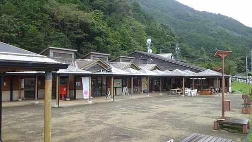
北牟婁郡紀北町東紀州の観光スポット、海・山・川での自然体験の情報提供や、海の幸・山の幸など、地域の特産品の紹介や販売をいたしております。特に世界遺産熊野古道「馬越峠」や清流銚子川流域のホットな情報をお届けしております。 特産品:海山ブッセ、さんまたつた丼、ひもの定食、まぐろ丼、オリジナルミニドッグ、トマト
便石山
東紀州
北牟婁郡紀北町世界遺産「熊野古道伊勢路」の馬越峠(まごせとうげ)から、便石山(びんしやま)に向かう道を進んだところに、「象の背」と呼ばれる絶景ポイントがあります。 天気の良い日には、素晴らしい眺めを楽しめる、フォトジェニックなスポットです。 頂上まで3時間程度かかるので、十分な備えをしたうえで登りましょう。 ・2枚目の写真は、観光三重 第58回フォトコンテスト グランプリ作品「象の背からの朝日」