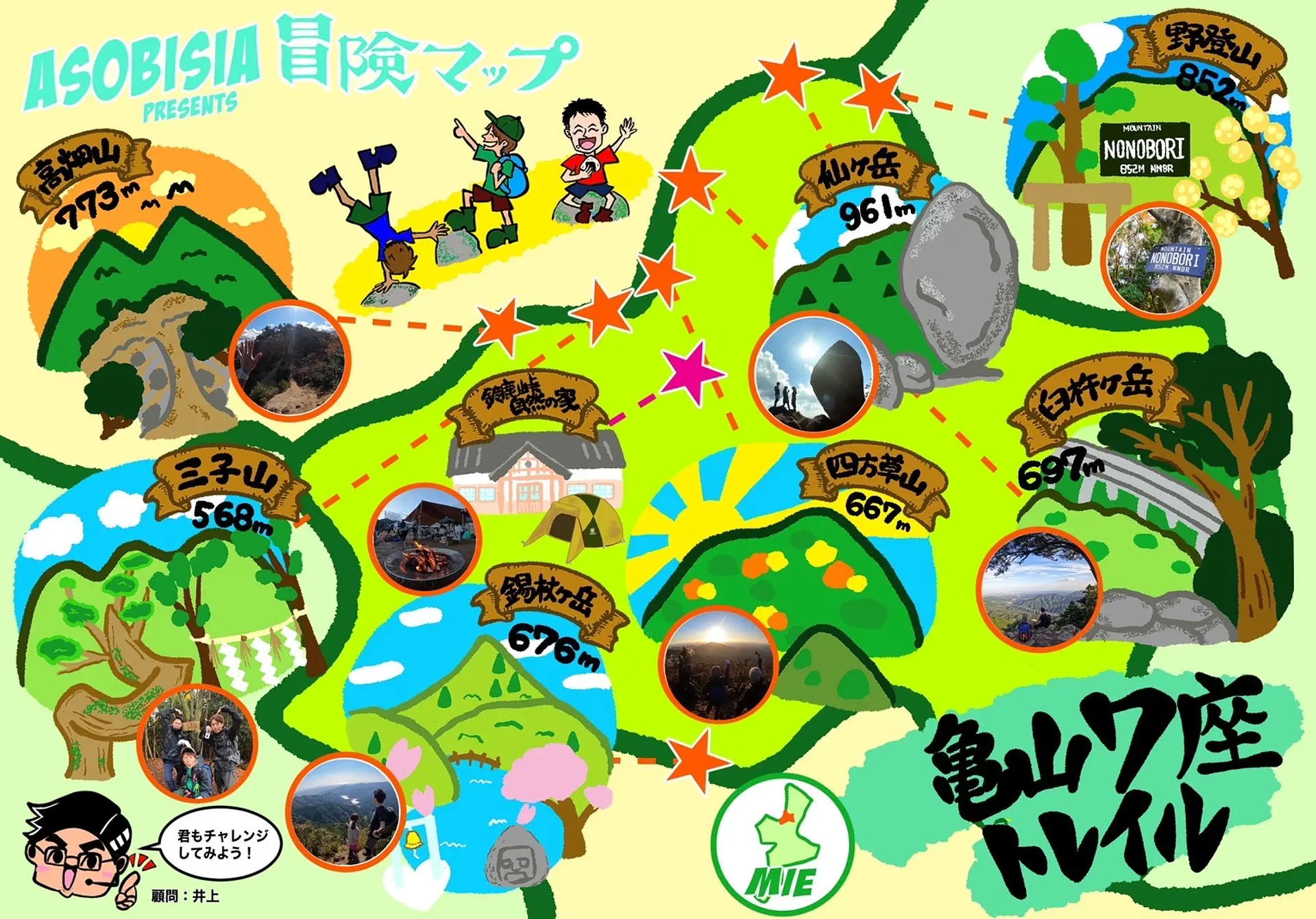
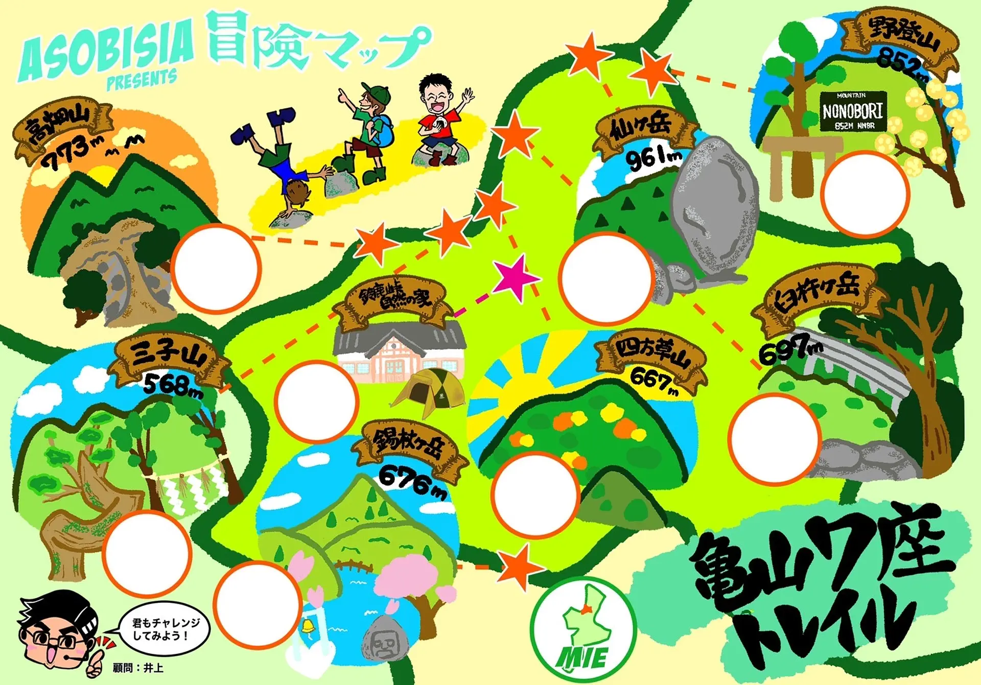
三重の山がもっと好きになる!「亀山7座トレイル」!!
掲載日:2022.01.16
今回はASOBISIAが「亀山7座」を制覇してきましたので紹介します!「亀山7座」とは鈴鹿山脈で石水渓付近の700メートル前後の山を7座として選定したものです。「亀山7座」には「鈴鹿セブンマウンテン」の山々とはまた違った魅力の山が揃っています。さあ、この記事を読んで亀山の山に出かけましょう!!!
◆記事作成:ASOBISIA(アソビシア)#みえ旅カメラ部
アウトドアが大好きな、同僚の仲良しトリオ。普段は日本のサラリーマンとして奮闘し社会の荒波に立ち向かう。2020年10月、とある日の登山をきっかけにASOBISIAを結成し、InstagramとYouTubeを開設する。Instagramでは、宮川でのSUPの写真で、観光三重2020年「いいね」ランキング1位を獲得。駆け出しのアクティブなグループである。
亀山7座を120%満喫する、ASOBISIA流の楽しみ方をご提案☆ 冒険マップを使って登頂の証を残していこう!
日付を入れるのもよし、写真をコラージュするのもよし!一緒に達成感を味わおう!
■登山の注意点
・登山をする際は時間に余裕を持ち、自分の体力に見合った山を選んで出かけましょう。
・ASOBISIA目線で、山の難易度を星5つで表現しています。亀山7座の中で比較した時の難易度です。参考にしてくださいね。
・事前に登山ルート、天気予報(山の気温等)をチェックしましょう。
・動きやすく、急な気温の変化にも対応出来る服装を用意しましょう。
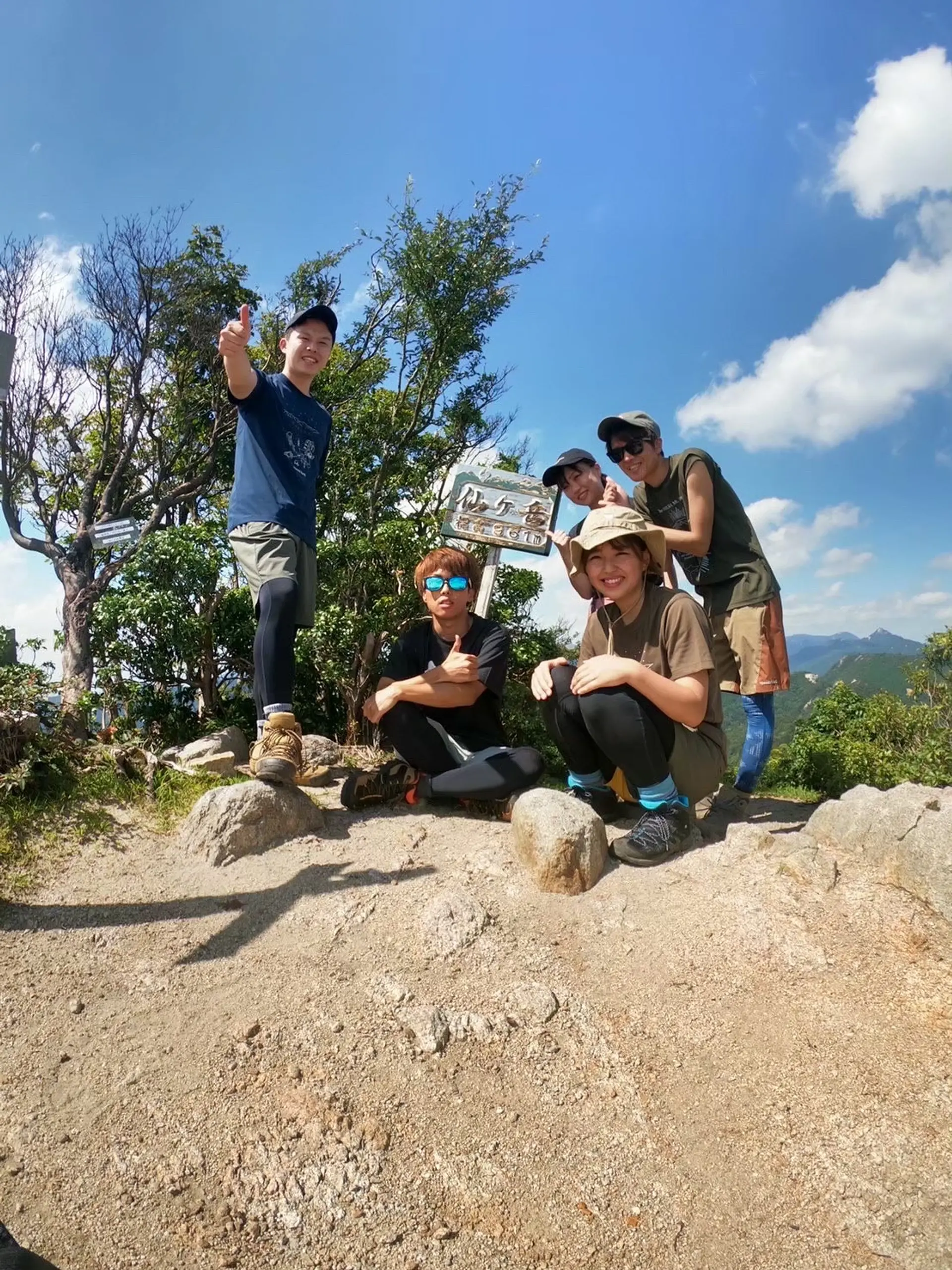
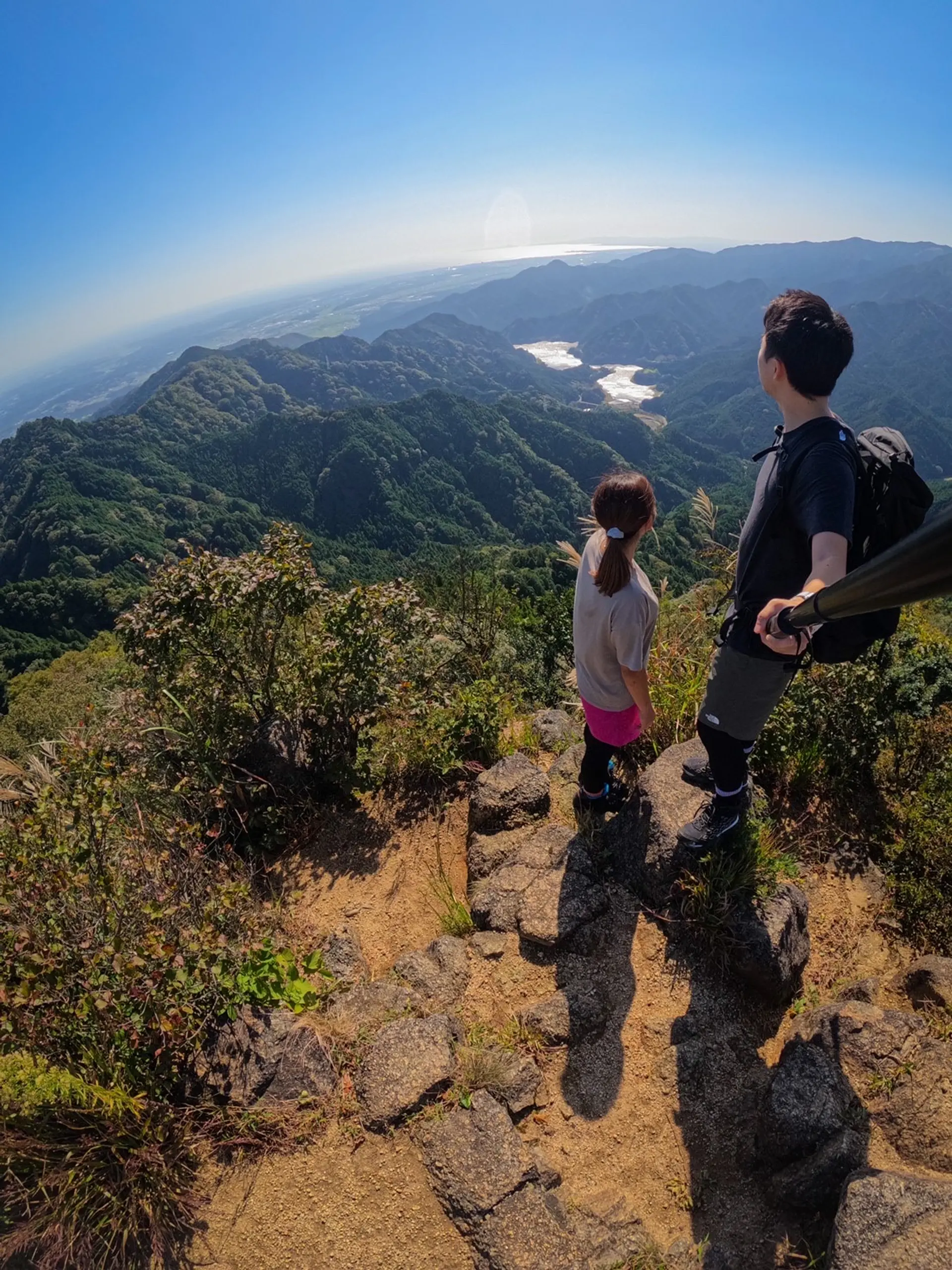
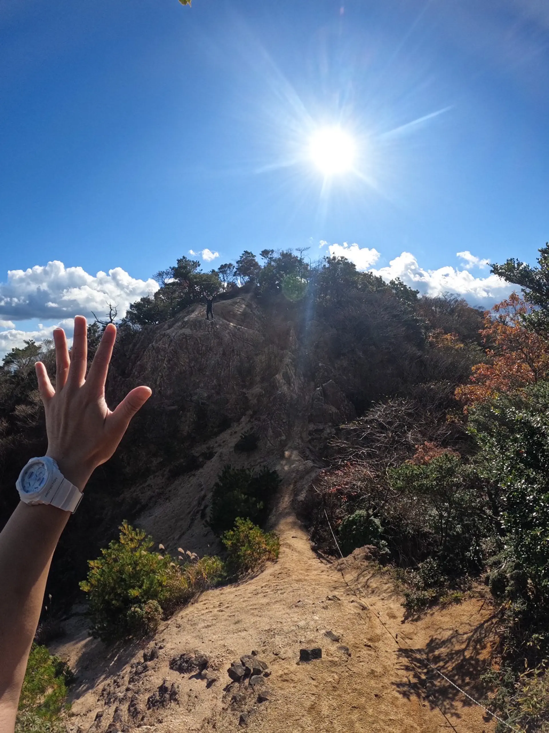
仙ヶ岳(せんがたけ)
■登山レベル:★★★☆☆
■標高:961m
■ASOBISIAチョイスの登山コース
小社峠~山頂(西峰)→仙の石(東峰)~仙鶏尾根
■アクセス
ナビは「小岐須渓谷(おぎすけいこく)キャンプ場」にセット。ナビの目的地からもう少し先まで10分程進むと駐車できるスペースがあります(約7〜8台)。
■山の特徴
林道、渓谷、岩場、尾根といった多彩な道を踏みしめられ、山歩きのステップアップにちょうど良い山なのではないでしょうか♪
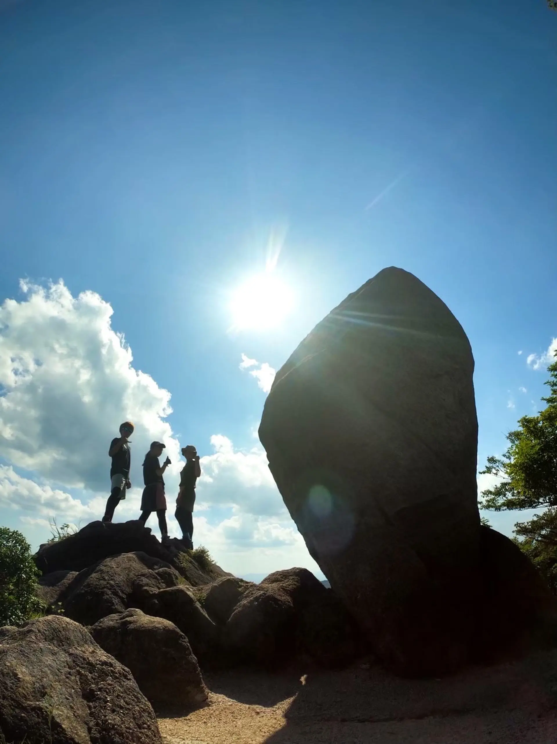
ビュースポットもたくさんあり、山頂(西峰)からは鎌ヶ岳のカッコイイ姿が良く見えます。シンボルである「仙の石」の圧倒的存在感にも酔いしれることでしょう!
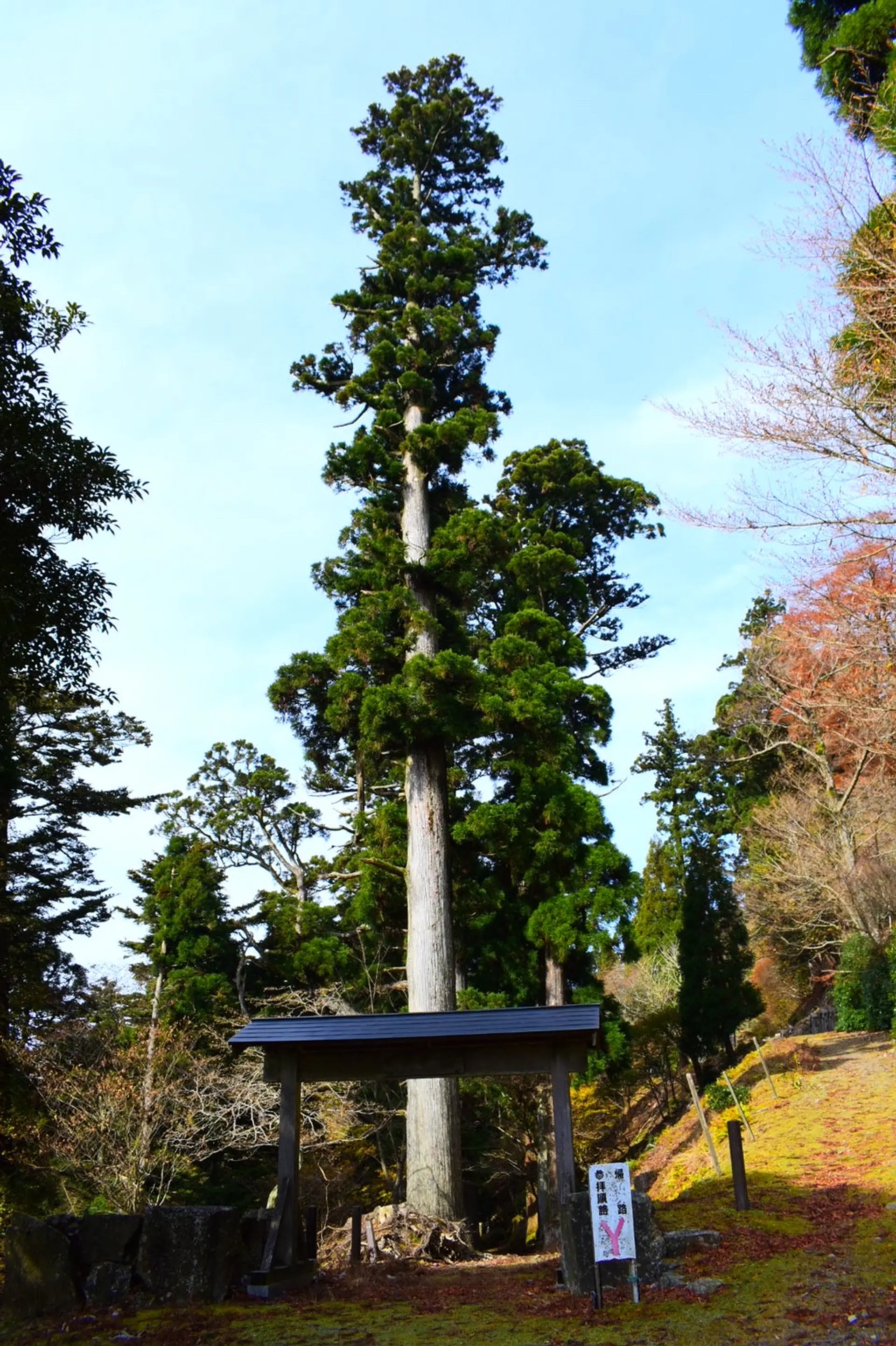
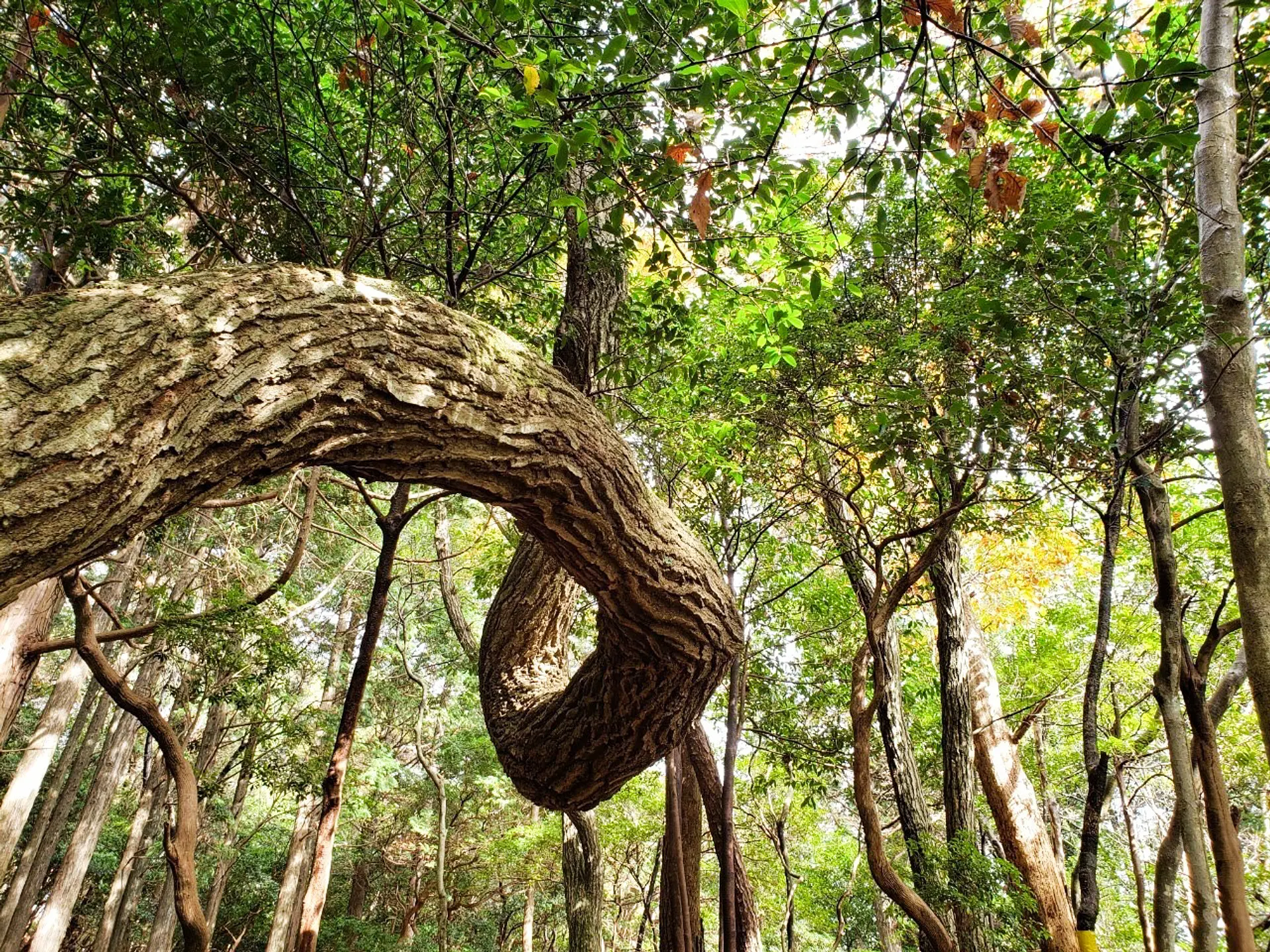
#7座のシンボル
亀山市のイメージキャラクター、カメのぶんちゃんもびっくり仰天!横に並ぶとその大きさに圧倒されます!なぜ?!どうやって?この場にそびえ立ったのか・・・その答えは亀山の文化がたくさん詰まっているぶんちゃんの甲羅の中にも無さそうです(笑)
自然の歴史は面白い!
YouTubeに動画も投稿しているのでぜひチェックしてみて下さい⬇︎
https://youtu.be/GPaU9FBuYIk
仙ヶ岳
無料
平田町駅(近鉄鈴鹿線)からC-BUS(鈴鹿市西部地域コミュニティバス)椿・平田線で約60分
小岐須渓谷口下車,山頂まで徒歩約210分
東名阪自動車道・鈴鹿ICから約15分,小岐須渓谷山の家駐車場(無料)に駐車し,山頂まで徒歩約180分
※お車でお越しの際は,鈴鹿市小岐須町1028番地の遍照寺(へんしょうじ)を目標に(カーナビに設定)し,遍照寺から西へ約1500m進むと小岐須渓谷山の家駐車場がある。
※小岐須渓谷山の家駐車場までは林道を含む。
#ナイスな頂上
今回はASOBISIAとASOBISIAファミリー略して「ASOFAM」の女性2人を合わせた、計5人のパーティで挑戦しました!山頂(西峰)は見晴らしが良く、今回登頂時には鈴鹿セブンマウンテンの鎌ヶ岳と御在所岳も鮮明に見ることができました!※写真右端
また、頂上にはスペースがあるので、みんなでご飯を食べたり、少しお昼寝をすることができます。天気が味方してくれたこともあり、とてもゆっくりすることができました♪
#この足で掴んだ絶景
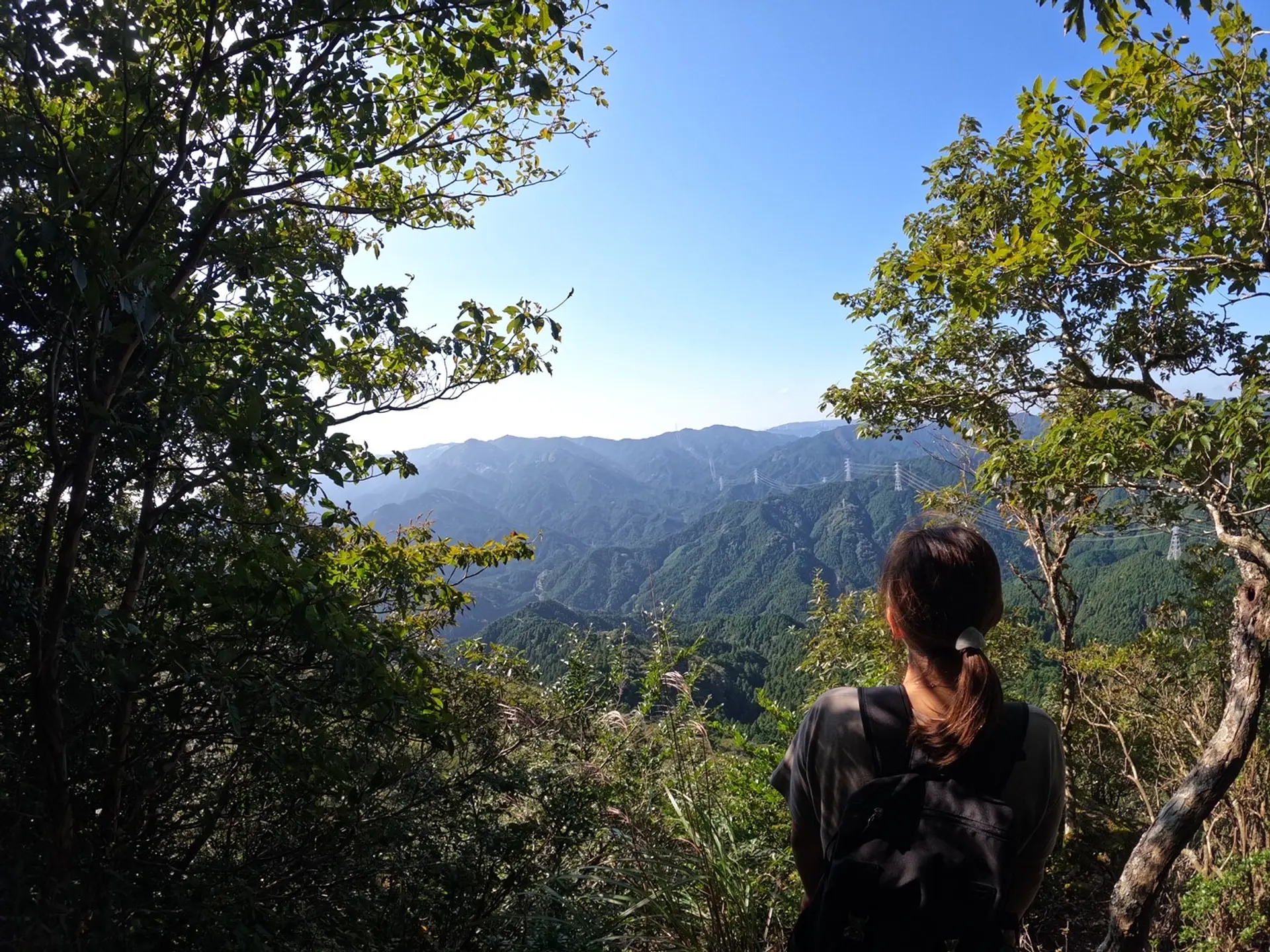
仙の石に寄った後は、仙鶏尾根(せんけいおね)方面へ。下り始めにこの絶景が現れます!亀山市街を一望できて、下り始めるのが少し惜しい・・・もっと眺めていたい、と思える景色でした!
#まだまだ続くよ亀山7座
冒頭にも少し書きましたが、ビュースポットがたくさんあって周りの山々を見渡すことができます!海のように果てしなく広がっている山々に向かって、いざ出航だ!
ここで一句、
山ガール 登りたくなる 山がある
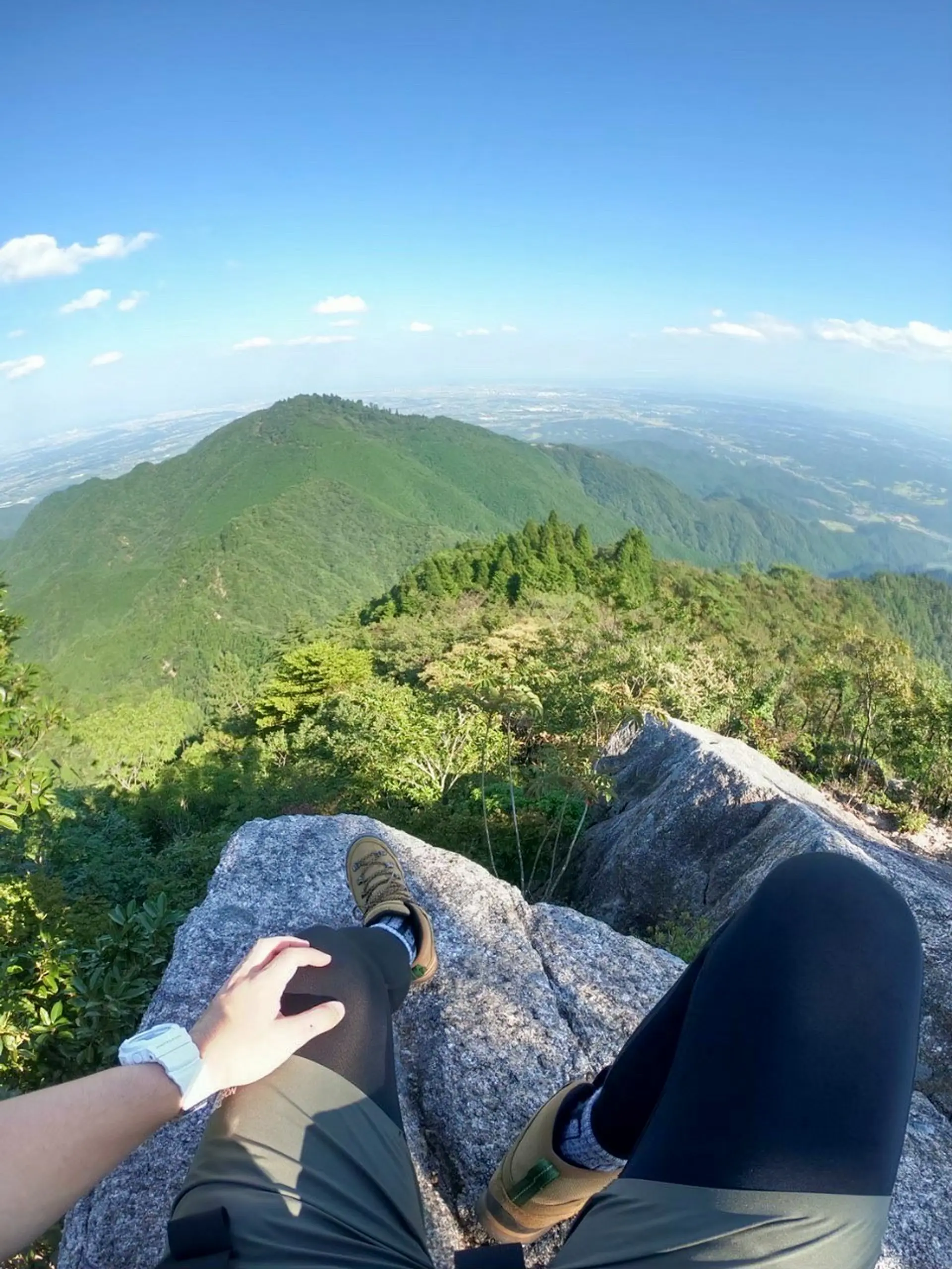
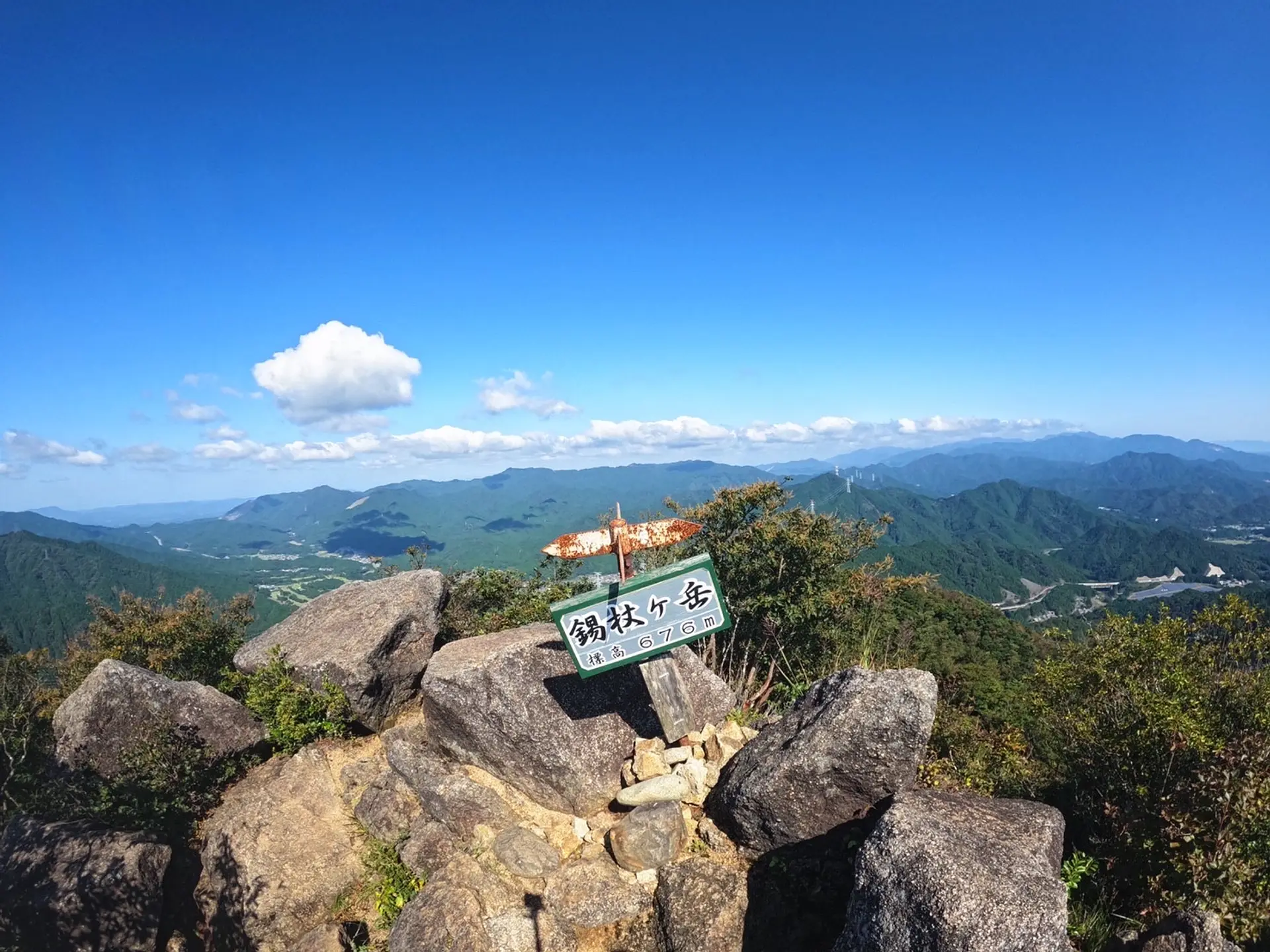
錫杖ヶ岳(しゃくじょうがたけ)
■登山レベル:★★☆☆☆
■標高:676m
■ASOBISIAチョイスの登山コース
加太(かぶと)登山口
■アクセス
加太登山口とGoogle Mapで検索をかけるとヒットします。約10台程の駐車が可能な広場に到着します。錫杖ヶ岳にはトイレがありませんので事前に済ませてから加太登山口に向かいましょう。
■山の特徴
錫杖ヶ岳は亀山市加太向井と津市芸濃町との境にそびえ立っています。頂上からの景色がとにかく美しい山です。約1時間半で登頂出来ますし、道も綺麗に整備されている為、女性や登山初心者の方など体力に少し自信がない方にもオススメの山です!また、一部、鎖を使って登る箇所もあり、アスレチック性も備えた山になっています。YouTubeに動画も投稿しているのでチェックしてみて下さい⬇︎
#錫杖湖
錫杖ヶ岳の山頂からの景色です。見えている水場は「錫杖湖」と言う湖です。この湖が映えポイントですね!(笑) 山頂から湖が見える山といえば三重県では錫杖ヶ岳ではないでしょうか?
錫杖ヶ岳
20台
JR加太駅から登山口まで徒歩30分
名阪国道向井ICから車で10分
#錫杖ヶ岳山頂からの景色
山頂は360度のパノラマになっています。亀山市の工場地帯や街並み、津市、伊賀市の青山高原の風車まで眺める事が出来ます。ASOBISIA的に亀山7座で一番、山頂からの景色が素晴らしい山です!
山頂は約10人程は滞在出来るスペースがあります。山頂から少し下りた所にベンチもあるので山頂がいっぱいの時は少し下りてから休憩しても良いですね!
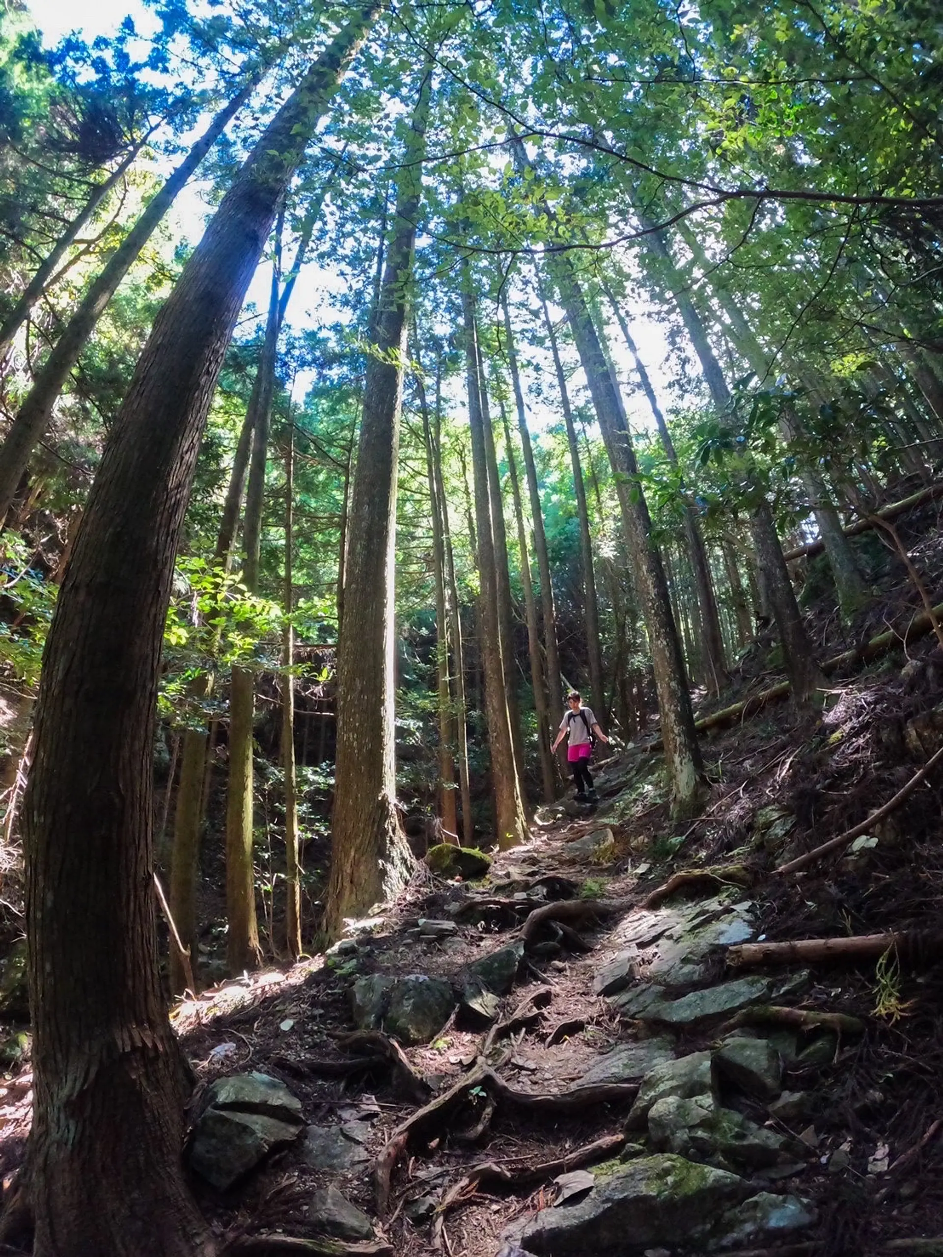
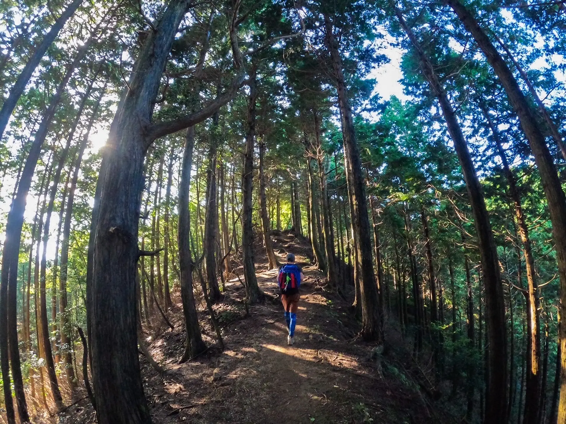
#今日の気分は森林浴
加太登山口からのルートの前半は美しい森の中を進んでいきます。途中、川や橋も有り、歩いていて飽きる事がないです。森の中を歩きますが道が綺麗に整備されているので迷う事はないです!整備していただいている方に感謝しかありません。
YOYO!なんて美しい森 苦しい時 みんなこの山に来い!
#駆け出しのラッパーたくじろう
#中腹からの眺め
前半は森の中を歩きますが、途中から近隣の山を眺められるスポットが何箇所か登場します!津市の人気の山、「経ヶ峰(きょうがみね)」も綺麗に拝む事ができました!
ここで一句、
迷ったら 7座のスタート 錫杖で
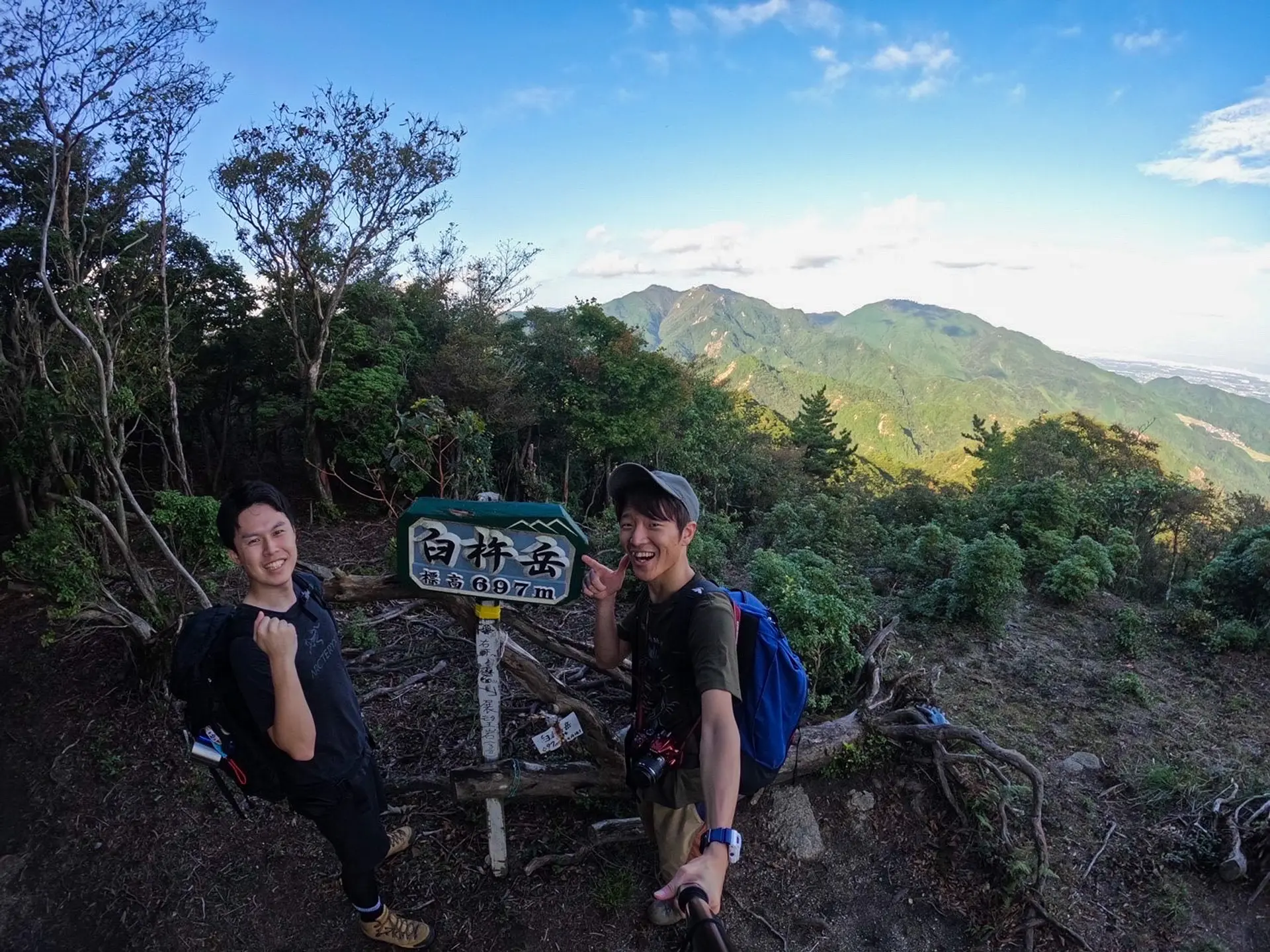
臼杵ヶ岳(うすきねがたけ)
■登山レベル:★☆☆☆☆
■標高:697m
■ASOBISIAチョイスの登山コース
安楽峠〜かもしか高原〜臼杵ヶ岳(山頂まで約1時間半)
安楽峠〜かもしか高原〜臼杵ヶ岳(山頂まで約1時間半)
■アクセス
「安楽峠」とGoogle Mapで検索。安楽峠までの道のりはかなり狭く、運転には十分気をつけてください。駐車スペースは2〜3台と少ないです。
■山の特徴
比較的短時間で山頂まで辿りつくことができ、山道はとても歩きやすいので気軽に登山を楽しむことができる山です。
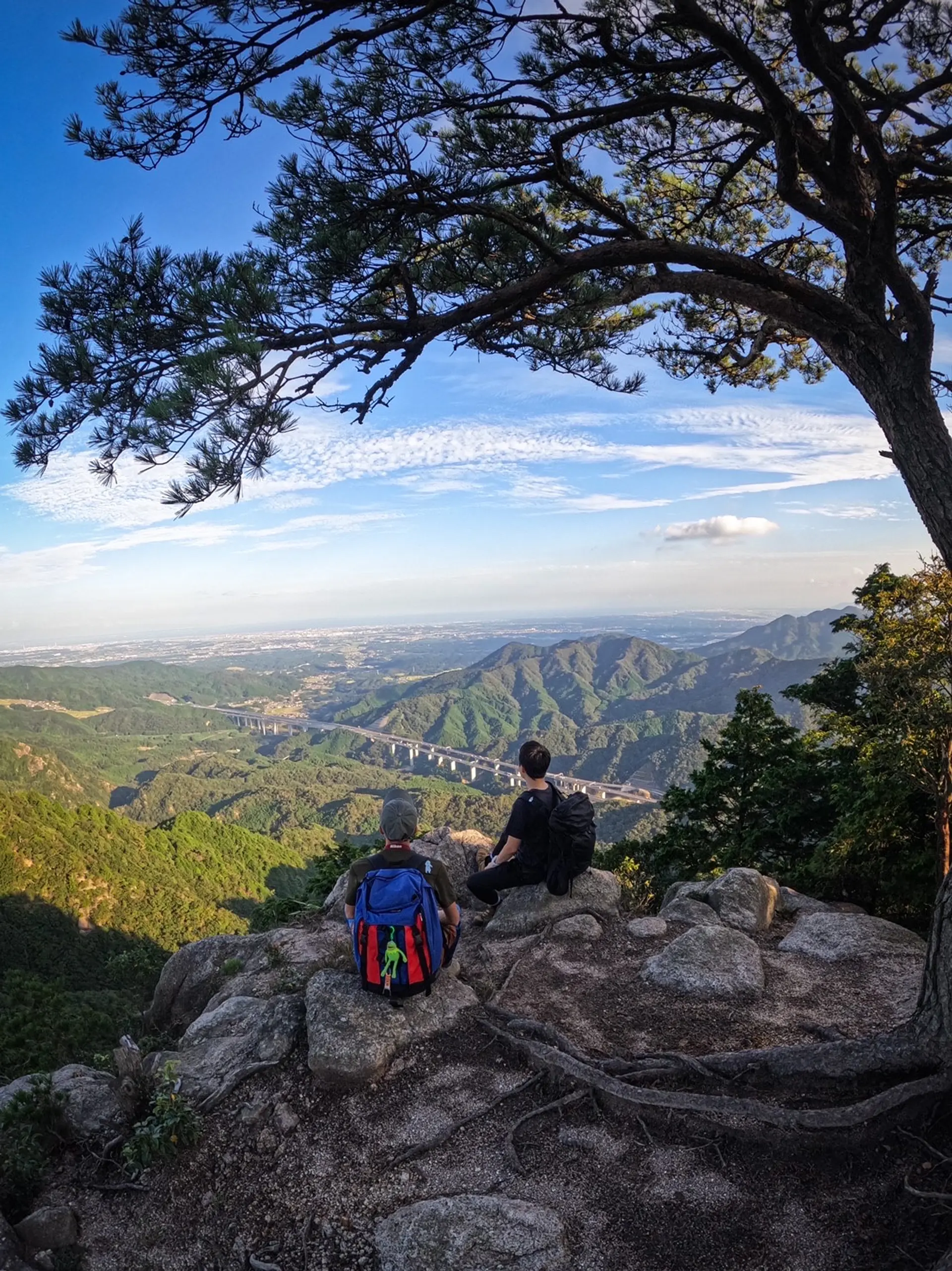
#展望岩から亀山の町を見下ろして。
臼杵ヶ岳山頂の看板から数十m下ると、こちらの展望岩へ辿り着きます。ここが臼杵ヶ岳の絶景ポイントです!!新名神高速道路と亀山の町を一望することができ、とても綺麗だったのでASOBISIAお気に入りのスポットになりました^^
#仙ヶ岳と野登山をバックに
この日は午後から登山を開始しました!お昼ご飯を食べてから登ったので体が重かったのを覚えています(笑)
登山口からおよそ1時間半程度で頂上にあるこの看板までたどり着きました。サクッと登ることができるので登山初心者の方や、軽く体を動かしたい方にはおすすめの低山です^^とは言っても、”登山”ということは忘れずにしっかり準備をして行きましょう!
頂上からは、臼杵ヶ岳と同じ亀山7座に選ばれている仙ヶ岳や野登山を眺めることができますよ!
#木漏れ日の林道をゆく
登山道はこのような林道が続きます。森の妖精さんたちが戯れていそうな木漏れ日が綺麗な林道で、心地がいいです。”この道をゆけ”と森の妖精に案内されているように道がわかりやすくなっているので、ほとんど迷うことはないと思います。
登山道が画角のセンターラインに来るように写すと、このように真っ直ぐな一本道を堂々と歩く感じの写真を撮ることができるので、ぜひ登山仲間のかっこいいところを納めてあげてください^^
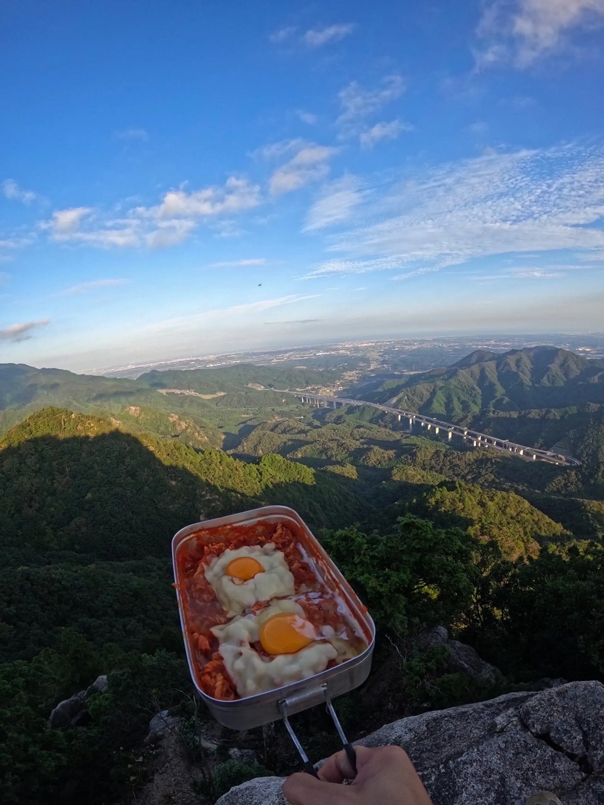
#メスティンでマカロニパスタに挑戦!
展望岩で軽食を作り食べました。今回は、メスティンを使いトマトソースのマカロニパスタを作ってみました!チーズは上手にとろけましたが、卵はもうちょっと固まって欲しかったなぁ•••(゚∀゚;)山でのご飯、とても美味しくいただきました!
この時、ASOBISIA初のインスタライブをして、リスナーさんとコメントで会話しながら調理したりこの景色を共有したりしたのが思い出です!
ここで一句、
臼杵の 見晴らし台で クッキング〜
高畑山(たかはたやま)
■登山レベル:★★☆☆☆
■標高:773m
■ASOBISIAチョイスの登山コース
鈴鹿峠~(山頂までの道のり約1時間半)
鈴鹿峠~(山頂までの道のり約1時間半)
■アクセス
万人講常夜燈(まんにんこうじょうやとう)と言う、高さ5.5mの巨大な灯籠が目印です。Google Mapで検索をかけるとヒットします。約10台程の駐車が可能です。綺麗なトイレも設置されています。
■山の特徴
高畑山は三重県亀山市と滋賀県甲賀市の境にそびえ立っています。「鏡岩」や「ナイフエッジ」等の見所がたくさんある山です。山頂は360度のパノラマになっており、素晴らしい景色を拝む事ができます。
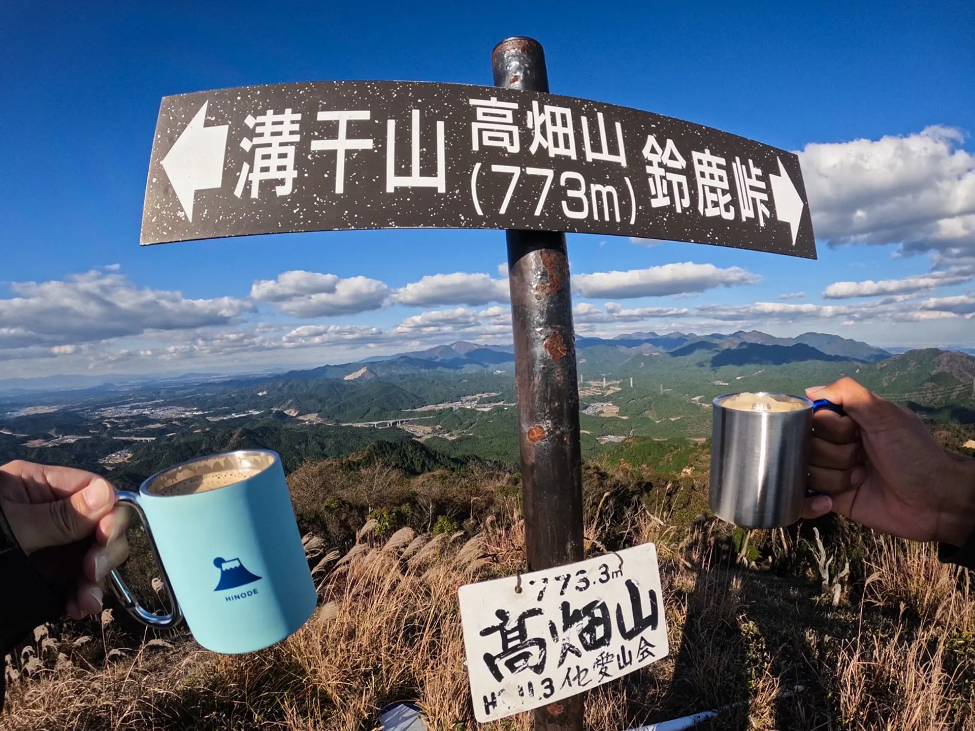
#頂上で乾杯
頂上に到達した自分へのご褒美にコーヒーを飲みました!山で飲むコーヒーは家やカフェで飲むより美味しく感じます。しかも普通のピースよりもコーヒーを持って撮る写真の方が映えますね!(笑)
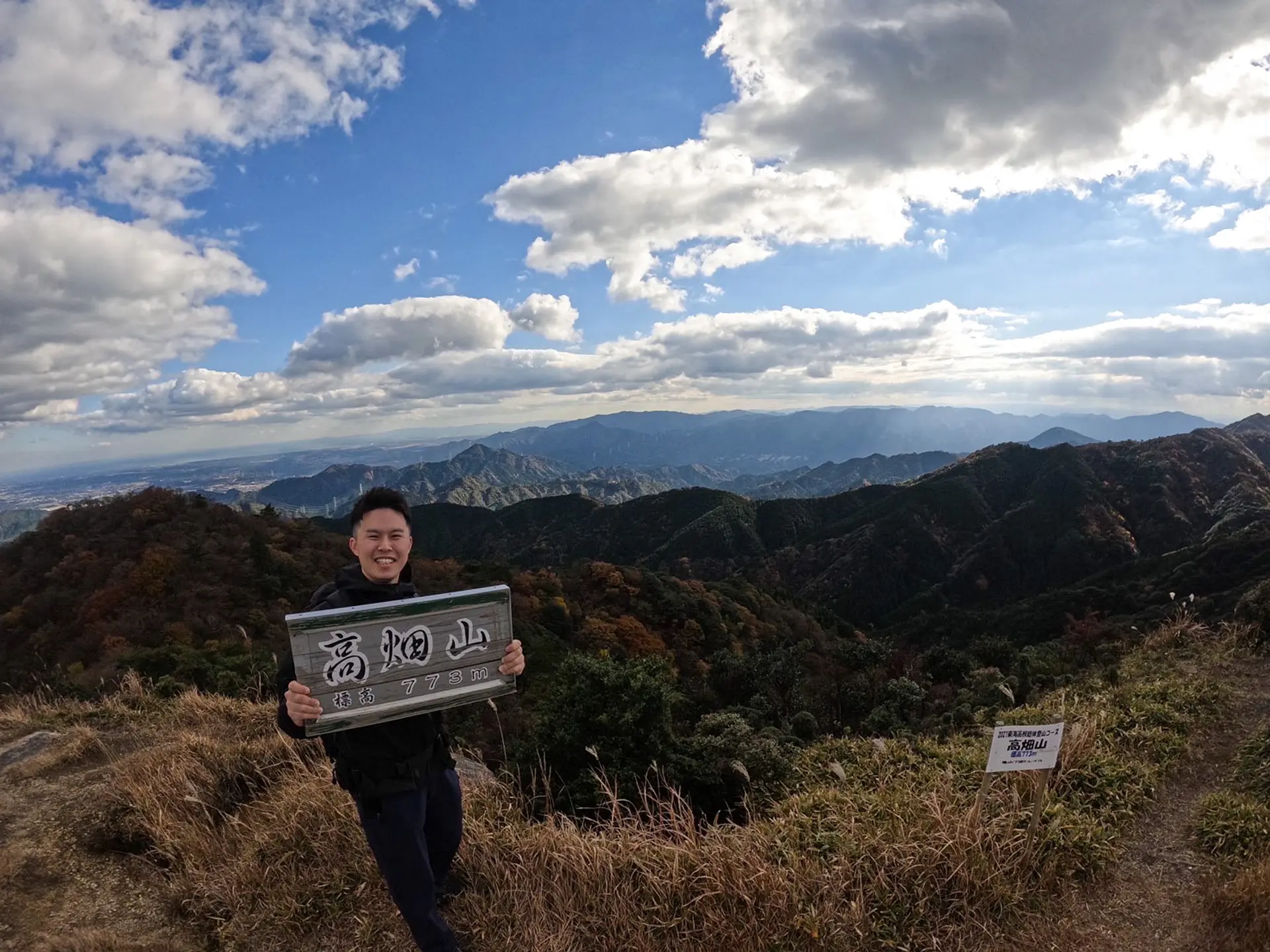
#高畑山の山頂からの景色
山頂で「高畑山」と書かれた看板を持ってパシャり!!!
山頂は360度のパノラマになっており、景色がとても美しいです!天気が良いと琵琶湖や伊勢湾も拝む事ができますよ!山頂は10~20人は休憩できる広さになっています。登山口から山頂までで大きく開けた空間があまりなかったので、お昼ご飯は山頂で景色を眺めながら食べるのをオススメします!
#ナイフエッジ
ナイフエッジとはナイフの刃の様にとがった尾根の事を言います。周囲の山々ではあまり見られない見応えのあるポイントです!良い写真が撮れる映えポイントである事と同時に一歩間違えば滑落の可能性もある危険ポイントでもあります。滑らない様に落ち着いてゆっくり渡りましょう。
#鏡岩
鏡岩は高畑山の山頂に向かう際に経由する「鈴鹿峠」の頂上にある巨大な岩です。意外にも登山口から徒歩5分程で到着します(笑) 山賊がこの岩を磨き、そこに映った旅人を襲ったと言う伝説から「鬼の姿見」とも言われているそうです。鏡の様な輝きは失われていますが、鏡岩からの景色は美しいのでオススメのスポットです!
YOYO! 来たぜ鏡岩 思ったより儚いな でもこの景色は宝になる
#駆け出しのラッパーたくじろう
更にここで一句、
山頂で 振る舞うコーヒー 反響だ
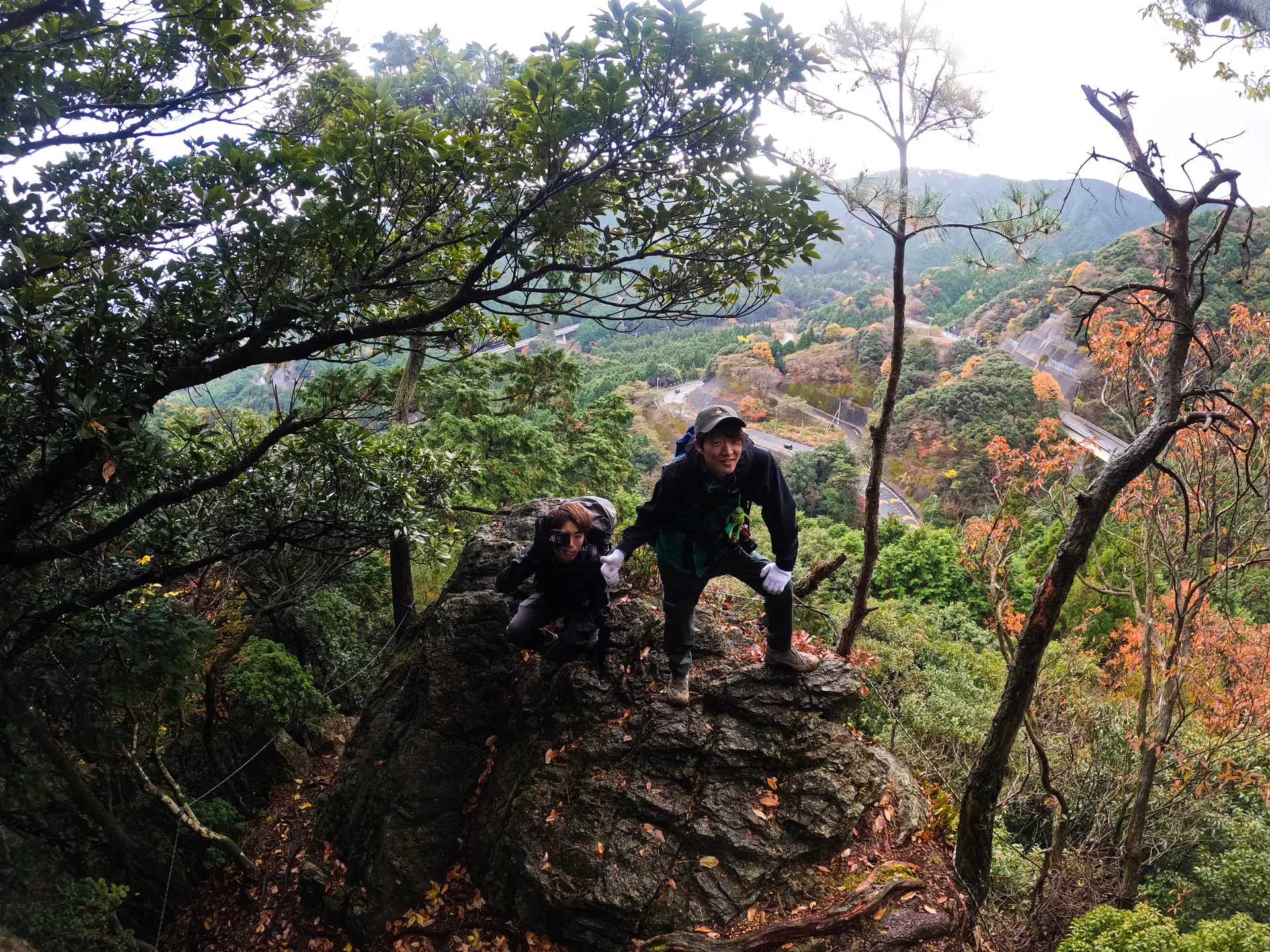
野登山(ののぼりやま)
■登山レベル:★★★☆☆
■標高:852m
■ASOBISIAチョイスの登山コース小岐須渓谷(おぎすけいこく)キャンプ場から始まる、一の谷コース(登山口から山頂までの道のり約2時間半)
■アクセス
「小岐須渓谷キャンプ場」とGoogle Mapで検索。キャンプ場までの道中は非常に狭い道が続きます。運転には十分ご注意ください。
■山の特徴
ミツマタの群生地や野登寺(やとうじ)があり、季節や歴史を感じられる山です。山頂は木々に囲まれていて展望は望めませんが、山頂付近に”国見広場”という芝生が広がる広場があり、鎌ヶ岳や御在所岳を望むことができます。
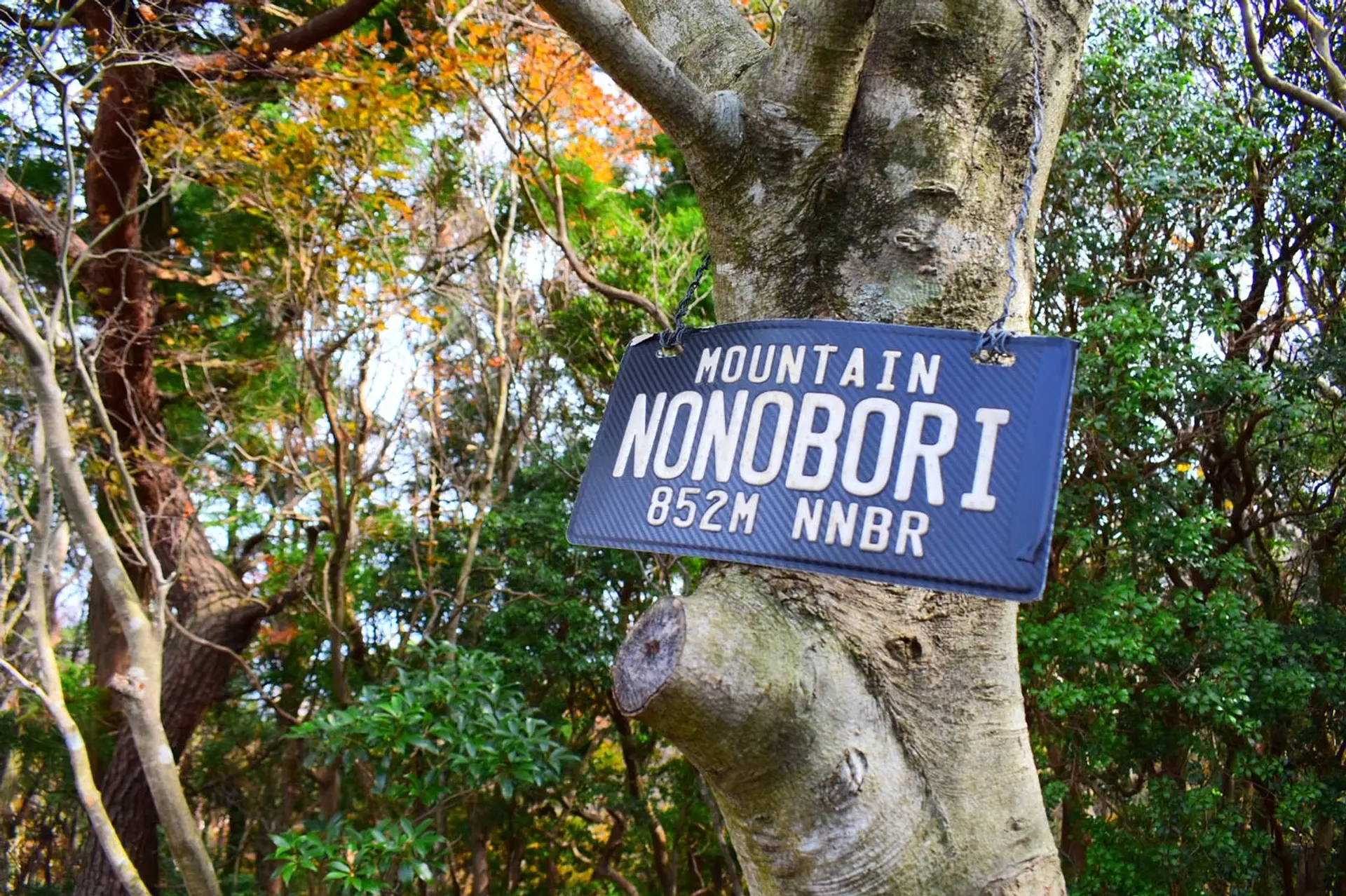
#MOUNTAIN NONOBORI 852M NNBR
野登山山頂の三角点にある看板です!亀山7座の中で、こんなにお洒落な看板が設置されているのは、この山だけです!(笑)三角点は木々に囲まれているので展望は望めませんが、この看板のおかげで達成感を味わうことができました(笑)この看板を設置した方はとてもセンスがありますね^^インスタグラムでもたくさんの方がこの看板をUPしています。登頂の記念に撮ってみてくださいね!
野登山
近鉄平田町駅からC-BUS(鈴鹿市西部地域コミュニティバス)椿・平田線 小岐須渓谷口下車
東名阪道鈴鹿IC下車
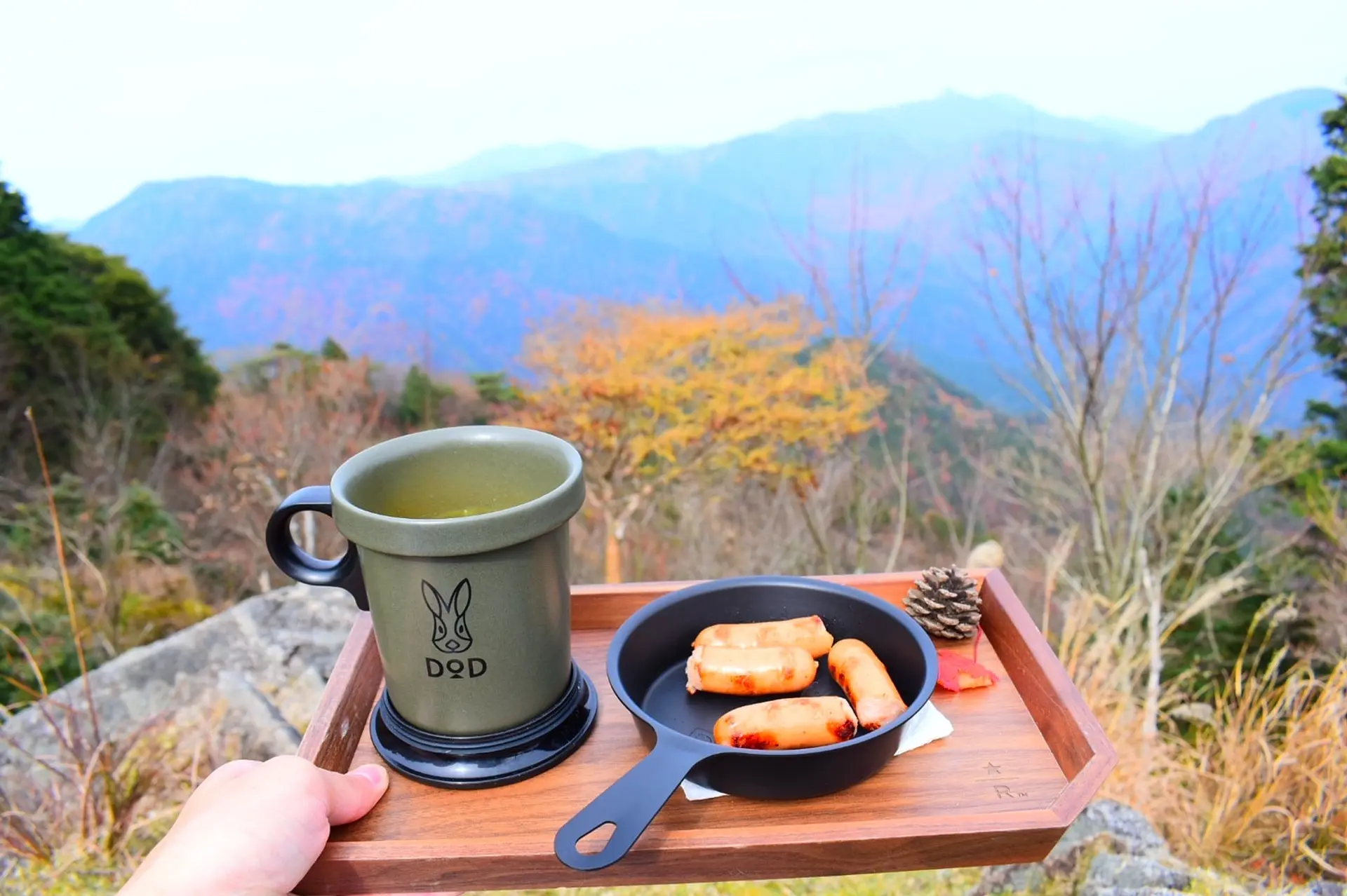
#色づく鈴鹿山脈を見ながら秋を楽しむ
野登山の山頂付近にある国見広場の一角に、鈴鹿セブンマウンテンの”鎌ヶ岳”や”御在所岳”を望むことができる特等席がありました!紅葉の時期に行ったので、ススキや色づいた木々がとても綺麗で、お昼ご飯を食べるにはピッタリのスポットです!
ウィンナーを焼き、インスタントのカボチャスープを作ってホッと一息。道中に落ちていたモミジの葉やマツボックリを添えてさらに秋を感じながら、ご飯を嗜むことができました!ちょっと小物を添えるだけで季節感も出て一気に映えた写真になるので、是非やってみてください^^
#立派な杉。すごすぎ。
野登山には"野登寺"(やとうじ)”という真言宗御室派の仏教寺院があります。本堂、庫裡(くり)、鐘楼は亀山市の指定文化財で、野登山を訪れた際にはぜひ立ち寄っていただきたいスポットです!
寺の入り口にある鳥居付近には立派な杉の木が数本生えていて、これはまさにパワースポットだと思います!!たくさんパワーを感じてきました。杉の木が大きすぎて全体を画角に収めるのが難しかったです(笑)
#石橋地蔵(子宝地蔵尊)
鳥居をくぐり野登寺まで向かう道脇に写真のような祠が並んでいて、この祠1つに1体ずつお地蔵さまがいらっしゃいます。とても神聖な雰囲気が漂っていました!野登寺境内には清泉があり自然石4枚の石橋がかかっていて、それぞれにお地蔵さまが掘られています。幼くして亡くなった子どもたちが次の世代には元気な子どもで生まれ変われますようにと、悲願が込められたお地蔵さまだそうです。
登山だけではなく、お寺も参ることができる野登山は、亀山7座の自慢ですね^^
ここで一句、
山登り 子宝祈願 野登で
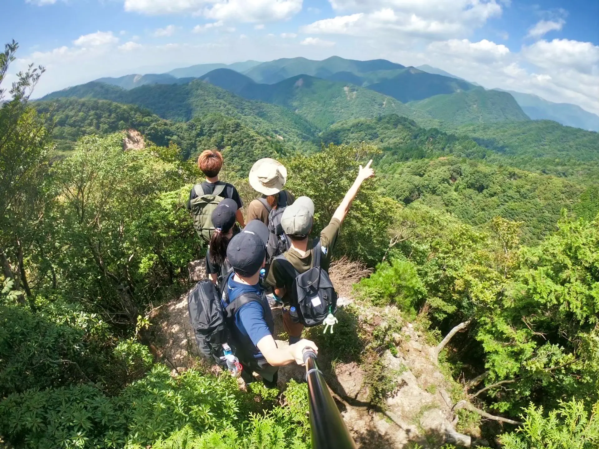
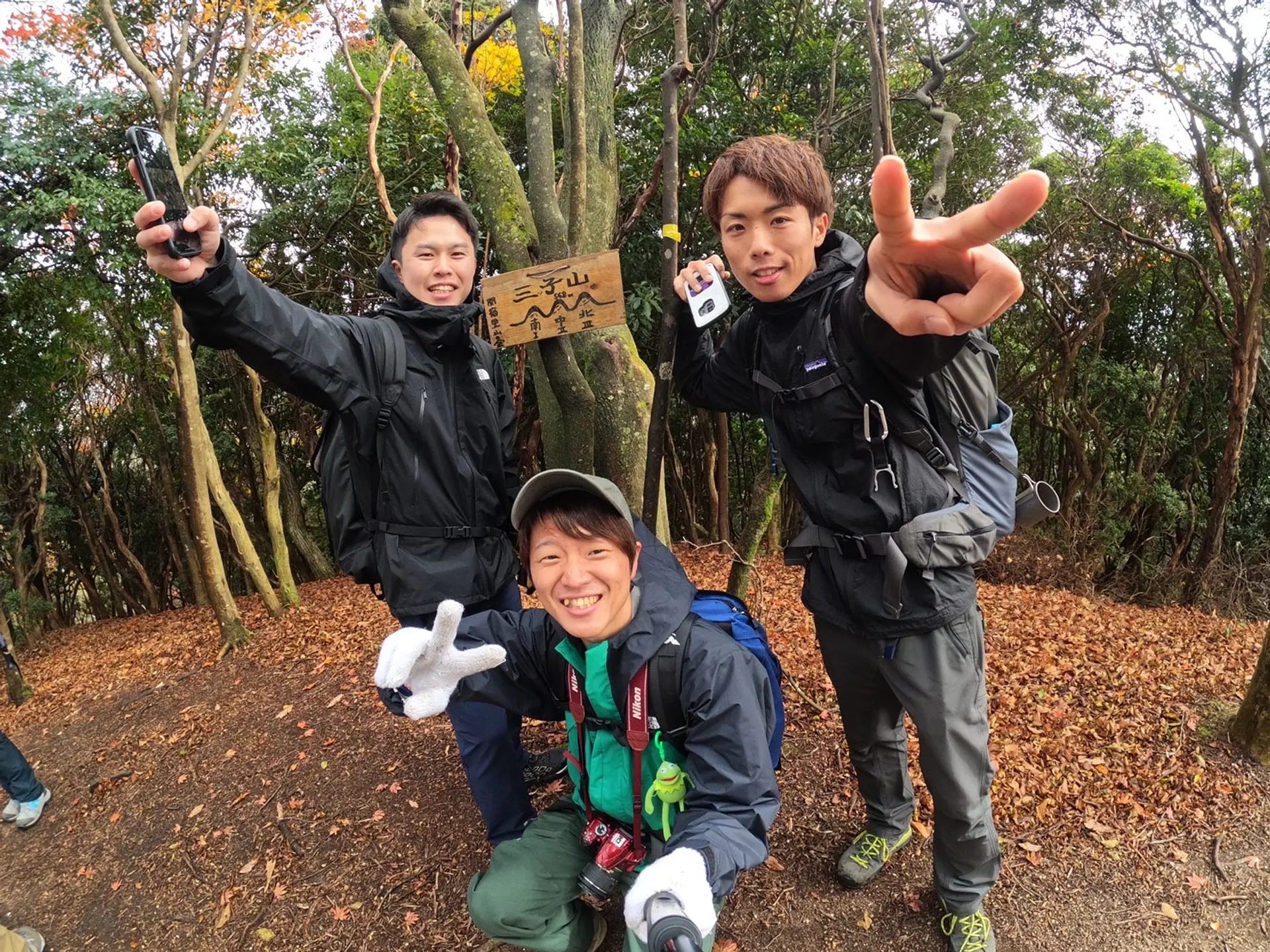
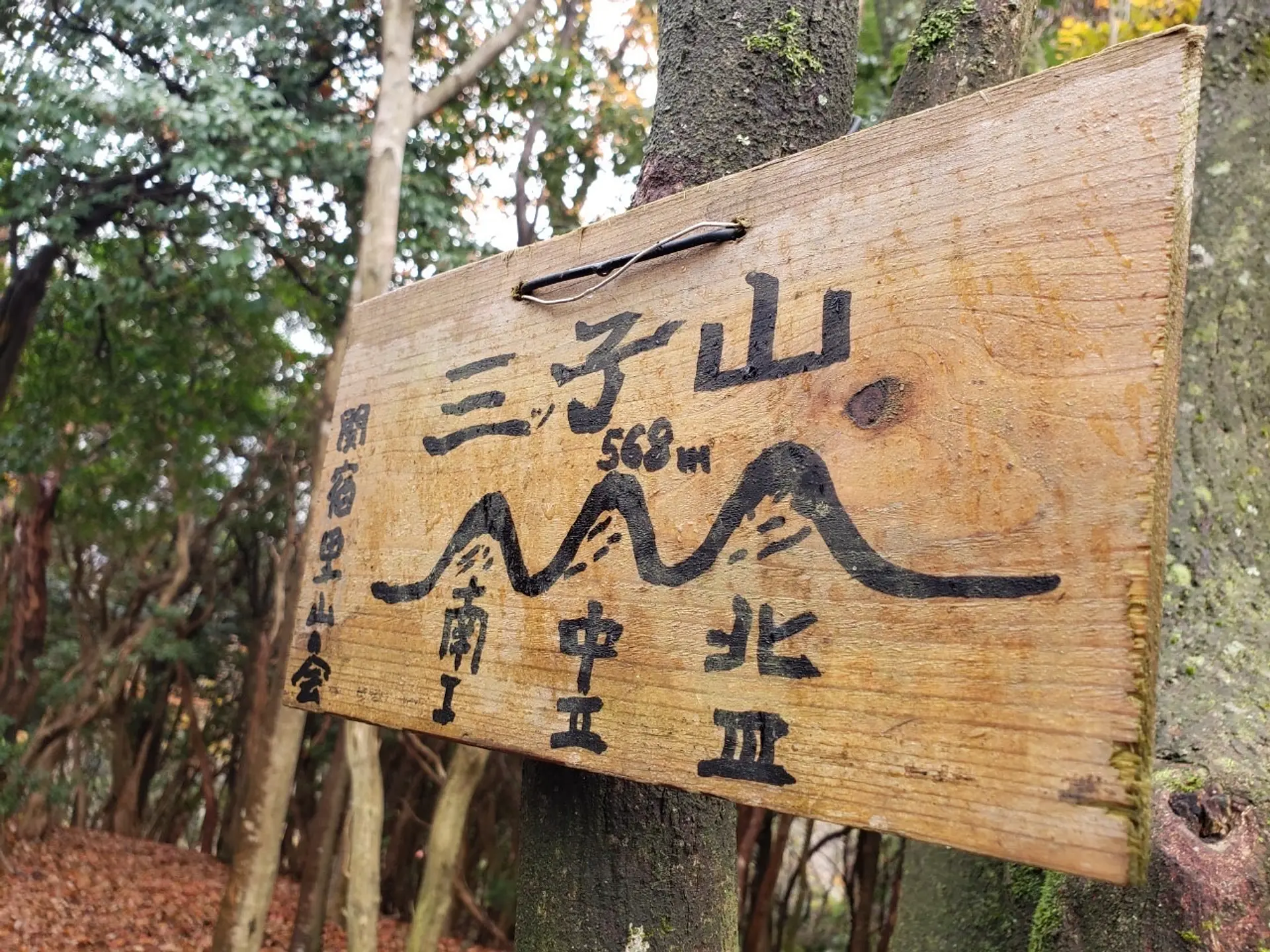
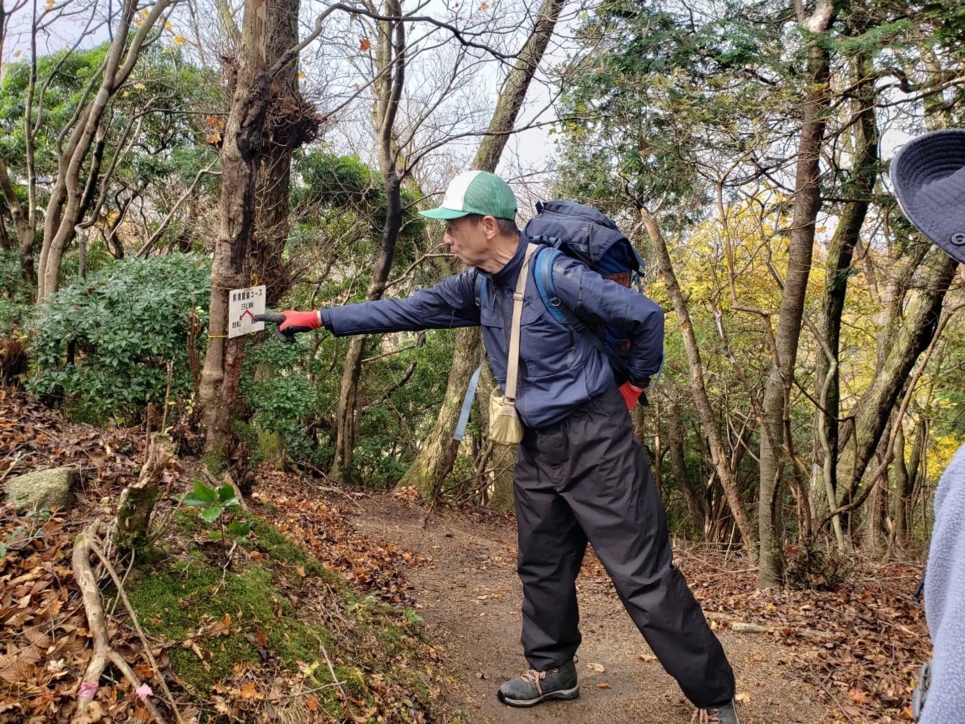
三子山(みつごやま)
■登山レベル︰★☆☆☆☆
■標高︰568m
■ASOBISIAチョイスの登山コース
国道一号線沿い、岩屋十一面観世音菩薩付近の登山口~南峰→中峰→北峰
■アクセス
国道一号鈴鹿トンネル入り口付近(滋賀県側)の万人講常夜燈(まんにんこうじょうやとう)に小さな駐車場有り ※ASOBISIA登山時はイベント参加にて「鈴鹿峠自然の家」の駐車場を利用
■山の特徴
名前の通り、”山”という漢字のモデルのように、北峰(1峰),中峰(2峰),南峰(3峰)と並ぶ三つの山からなっています!
南峰<中峰<北峰の順に標高が高く、いちばん高い北峰が568mとなります。峰から峰への移動は登った分だけ一度下るのでかなりのアップダウンにはなります。しかーし!低山とは言え一日に三つも山を登ったことは自分への自信に繋がりますし、周りに自慢できる体験になるのではないでしょうか!
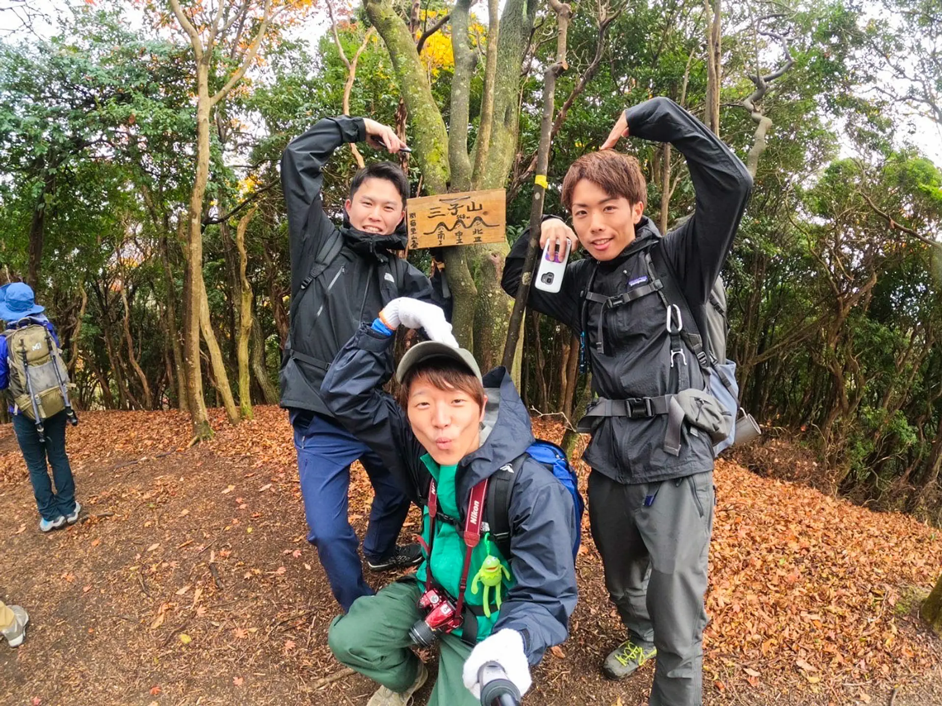
#三人仲良くウッキッキー
奇遇なことにASOBISIAも三人組!勝手ながら親近感も湧き、三人で三子山ポーズしてきました♪
(お猿じゃないよ、お山だよ!笑)
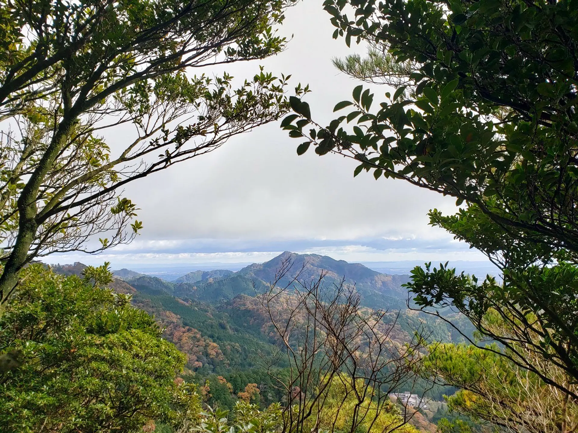
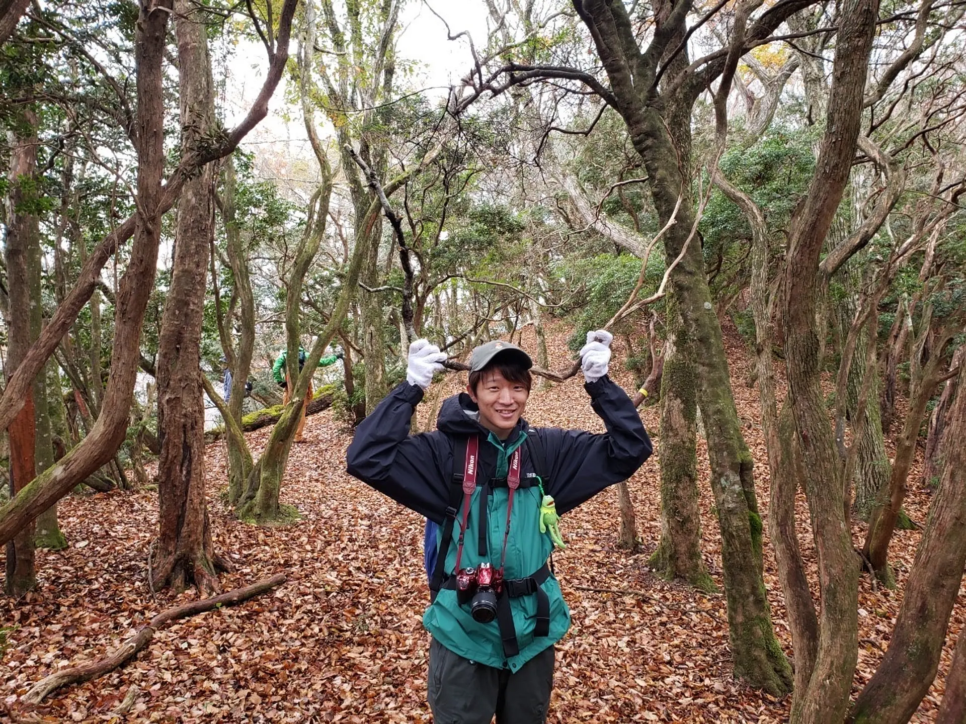
#ふとしたところで
山からの景色は、北峰の頂上まではあまり開けておらず、黙々と木々が生い茂る登山道を進んでいきます。ビュースポットが全く無いわけではありません!生い茂る木々を額縁にしてみたりと、撮り方次第で絶景写真が撮れるようなスポットもいくつかありました!(もちろん生目で見ても絶景でした♪)これぞASOBISIA流の撮影テクニックです!
足元には十分注意しながら、是非色々なところに視線を送りながら登山してみてください♪
#渦巻木
今回ASOBISIAは亀山市さん主催のイベントに参加させて頂き、ガイドさんと他の参加者さん達と一緒に、南峰→中峰→北峰の順に登りました。
そこで不思議な形をした木を発見!!渦巻木(勝手に命名(笑))は登り始めから最初の南峰頂上までの間にありました!一度ひねくれた時期もあったみたいですが、しっかり持ち直して立派に立っていました!反抗木だったんですね〜(笑)
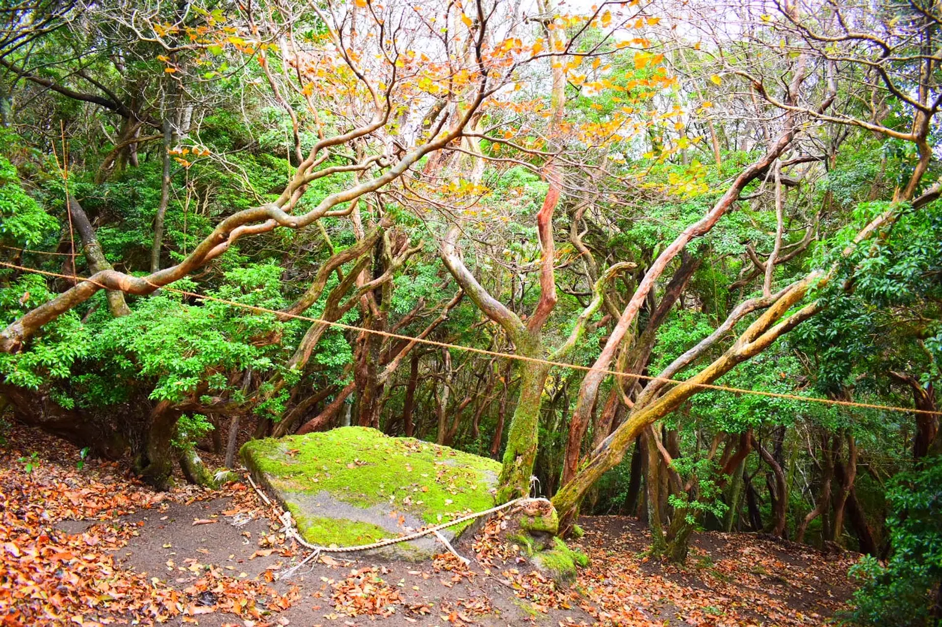
#神様が眠る山
どんな神様かは不明ですが、三子山には神様がいるであろう神聖な場所がありました。
(南峰頂上付近)
どんな言い伝えや物語あるのか考えてみるのも、三子山登山の楽しみ方の一つかもしれませんね♪
ここで一句、
ASOBISIA 3人揃って 三子山
四方草山(しおそやま)
■登山レベル︰★★★★☆
■標高︰667.4m
■ASOBISIAチョイスの登山コース
特別養護老人ホーム華旺寿(かおす)のすぐ側にある登山口~四方草山山頂→三子山(北峰→中峰→南峰)を経由して下山。
■アクセス
国道一号鈴鹿トンネル入り口付近(滋賀県側)の万人講常夜燈(まんにんこうじょうやとう)に小さな駐車場有り ※ASOBISIA登山時はイベント参加にて鈴鹿峠自然の家の駐車場を使用
■山の特徴
大きな特徴がある山ではありませんが、写真のように大きく景色が開けているポイントもあって登りごたえは十分にある山でした!
登山道が少し分かりづらい箇所や、小キレットがあったりしたので登山レベルは亀山7座で一番高い★4つにしました。コースをしっかり下調べして楽しく登山に挑んでくださいね!
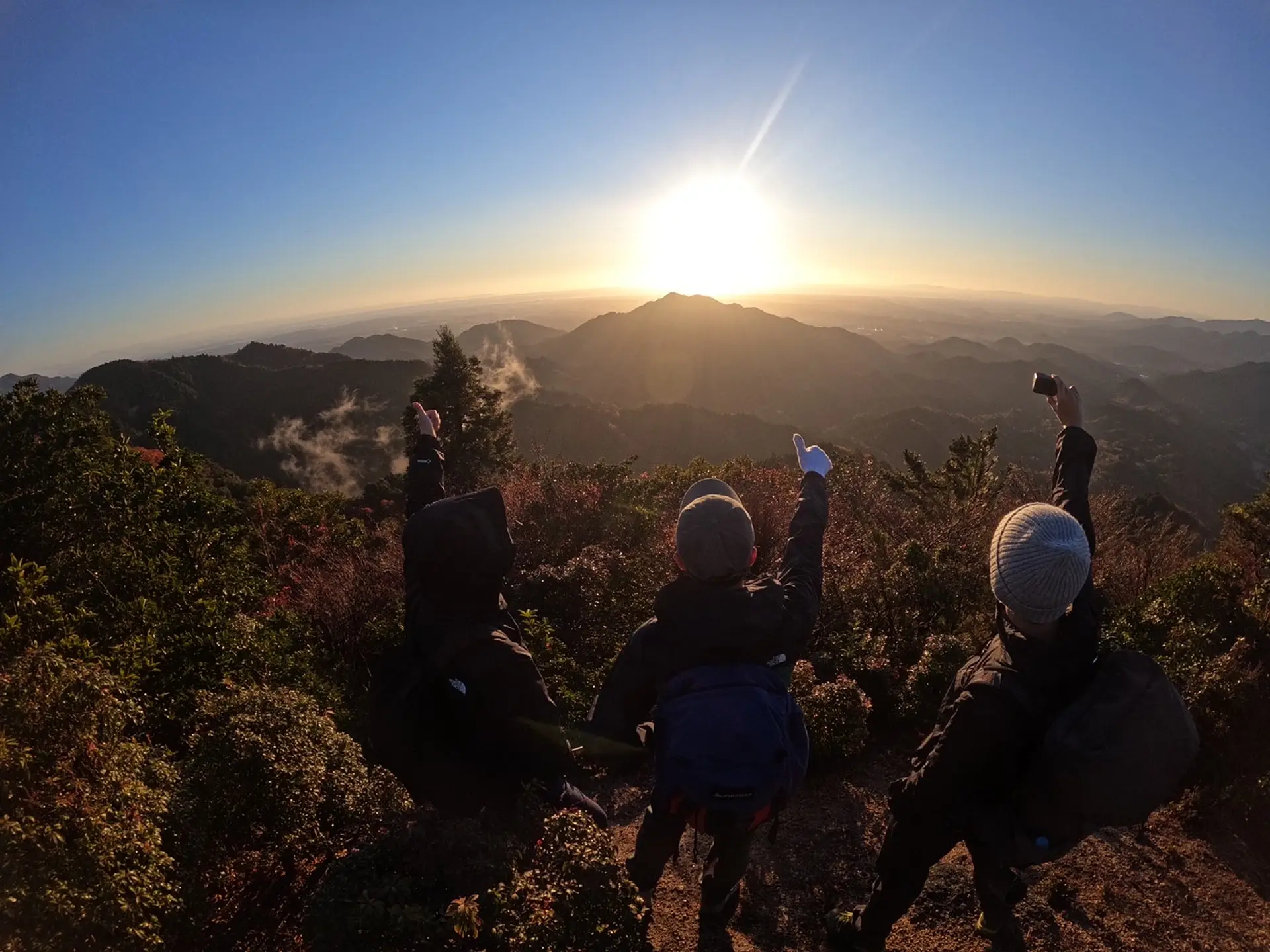
#光り輝く亀山
日の出の時間に合わせて登り始めたASOBISIAは、天気にも恵まれ最高の景色を目に焼き付けることができました!正面に見える明星ヶ岳(みょうじょうがたけ)がとても綺麗で視線が固まってしまっていました(笑)。
いい一日の始まりを告げてくれているような、それと同時に亀山7座制覇の祝福をしてくれているような暖かい朝日に心奪われていました。
まさしく早起きは三文以上の徳!笑
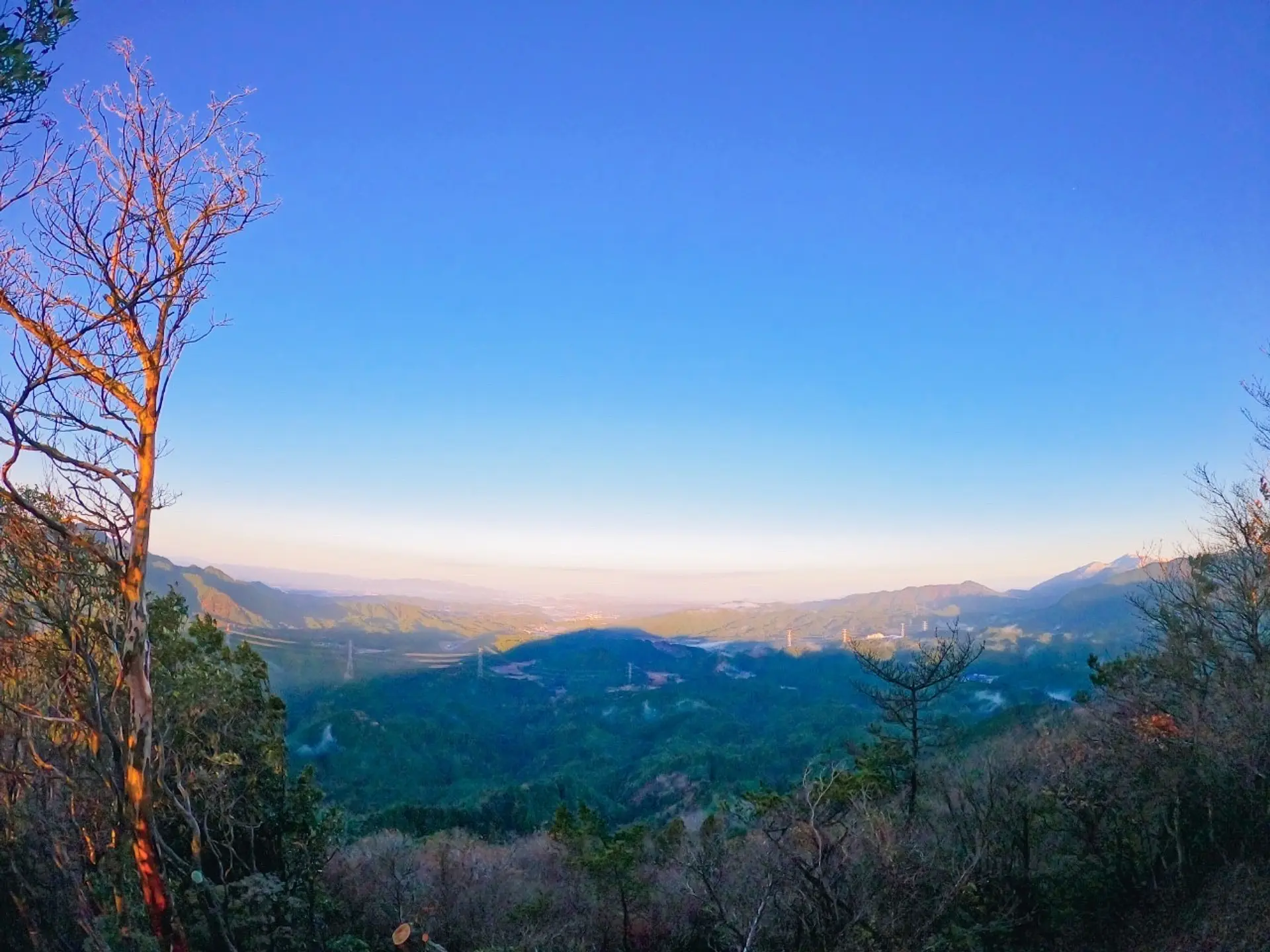
#太陽待ちの山達
朝日を浴びていたASOBISIAの背中側の景色です。こちら側の展望も素晴らしく、周りの山より少し高めなので遠くまで見渡すことができ、すごい高い山に登っている感覚になっちゃいました(笑)
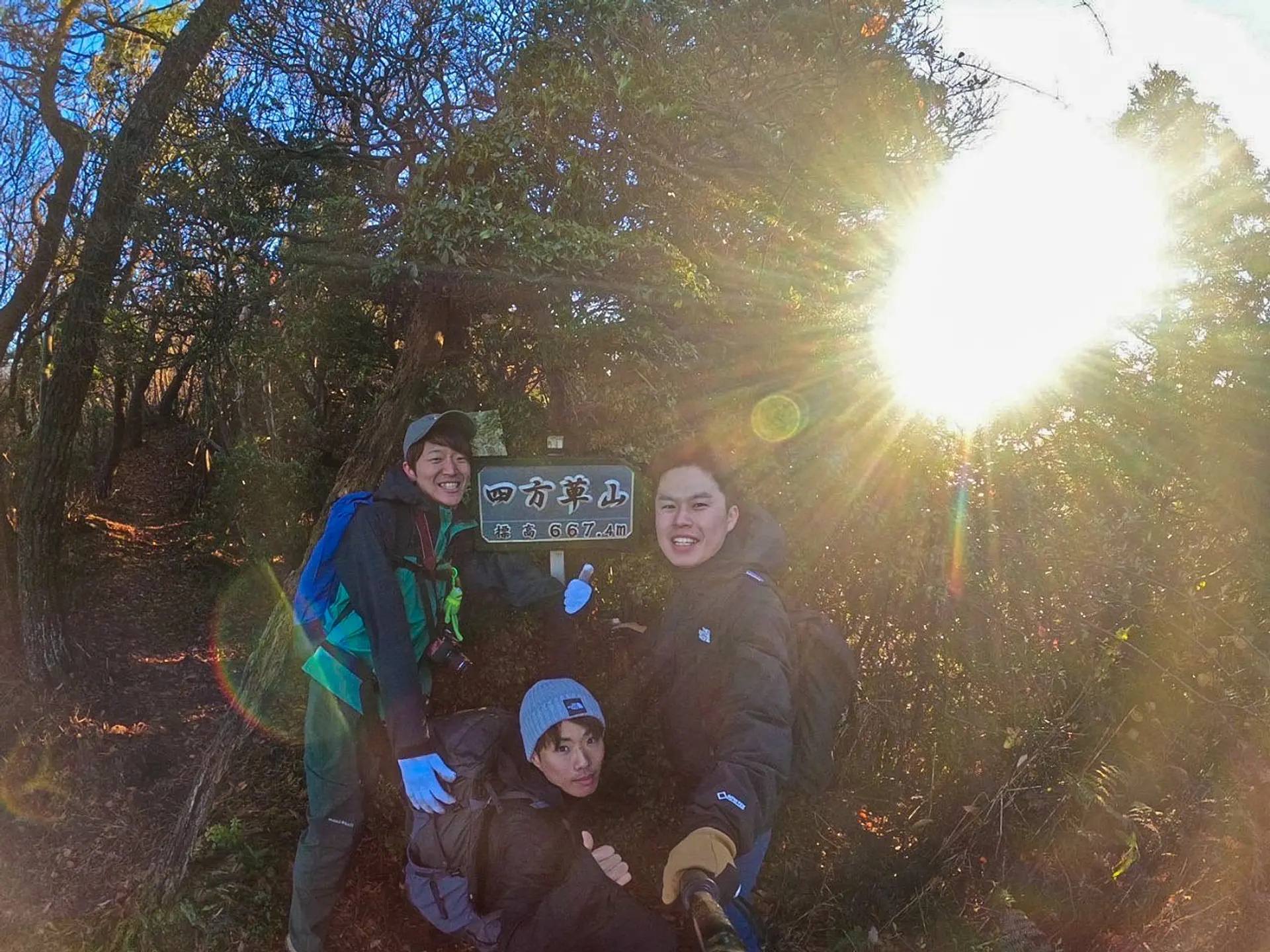
#祝!7座制覇!
ASOBISIAの亀山7座トレイル挑戦は四方草山が終点となりました!
以前記事にした鈴鹿セブンマウンテンよりは、いずれの山も低山ではありますが、見所は負けず劣らずたくさんあって登山していてとても楽しい山ばかりでした!
少し注意が必要な道も多いですが、認知度が上がって足を運ぶ人が増えたら、より登山道も分かりやすいものになって亀山7座の魅力に触れる人が増えていくと思うので、全力でこの”亀山7座”を応援していきたいと思います!
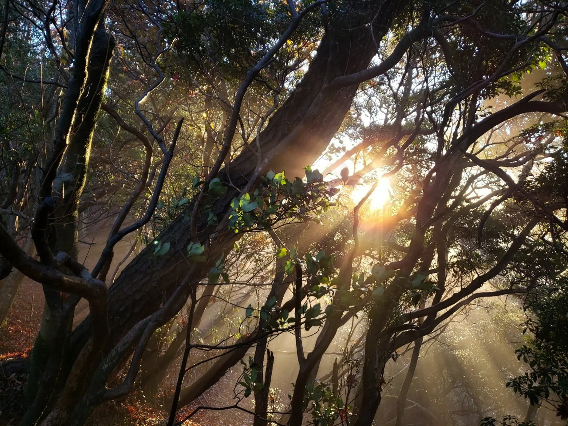
#朝日のカーテン(おまけ)
うっすらとした朝靄の中、木々の間から差し込む朝日の赤い光がなんとも神々しく、心も体も軽くしてくれるような景色にも出会え、大満足でした♪
ここで一句、
亀山市 四方草の南で モーニング~
#早速、MAPをダウンロード!!
保存方法:画像長押し→画像保存
この冒険MAPを手に入れたあなたは、もう立派な冒険者!!あなたにしか体験できない素敵な物語が待っているはず。。。!ぼくら3人と一緒に、この三重で、亀山7座トレイルで登山してみませんか^^!?あなたの一歩を応援します!
「観光三重」内に亀山7座トレイル特設サイトが立ち上げられました。
https://www.kankomie.or.jp/special/kameyama_7mts/
亀山市の公式ホームページには、亀山7座のページがあります。(以下のリンクから入れます)
・亀山7座トレイル(Kameyama 7Mts. trail)の取組について
https://www.city.kameyama.mie.jp/docs/2019012100040/
・亀山7座トレイル(Kameyama 7Mts. trail)の最新情報
https://www.city.kameyama.mie.jp/docs/2020051900010/
登山前に必要な情報を確認し、安全な登山を心掛けましょう!
登山好きな方は「鈴鹿セブンマウンテン」の記事もチェックしてみて下さい!
https://www.kankomie.or.jp/report/786.html
◆◆◆◆◆◆◆◆◆◆◆◆◆◆◆
↓Follow Us! チャンネル登録よろしくね☆
■Instagram:@ASOBISIA
リンク⇒https://instagram.com/asobisia?r=nametag
■YouTube:ASOBISIA Channel
リンク⇒www.youtube.com/channel/UCKrgfv5STSHezyOWmVwiUOQ
■TikTok:@asobisia
リンク⇒https://www.tiktok.com/@asobisia
今回、亀山市さんが主催する「亀山7座トレイル」&「キャンプ」のイベントに参加してきました!亀山市さんは定期的に色々なイベントを開催されています!詳しくは下記のホームページをご覧下さい!
まずは「亀山7座トレイル」の様子からご覧下さい。
今回のイベントでは「三子山」へ行ってきました!
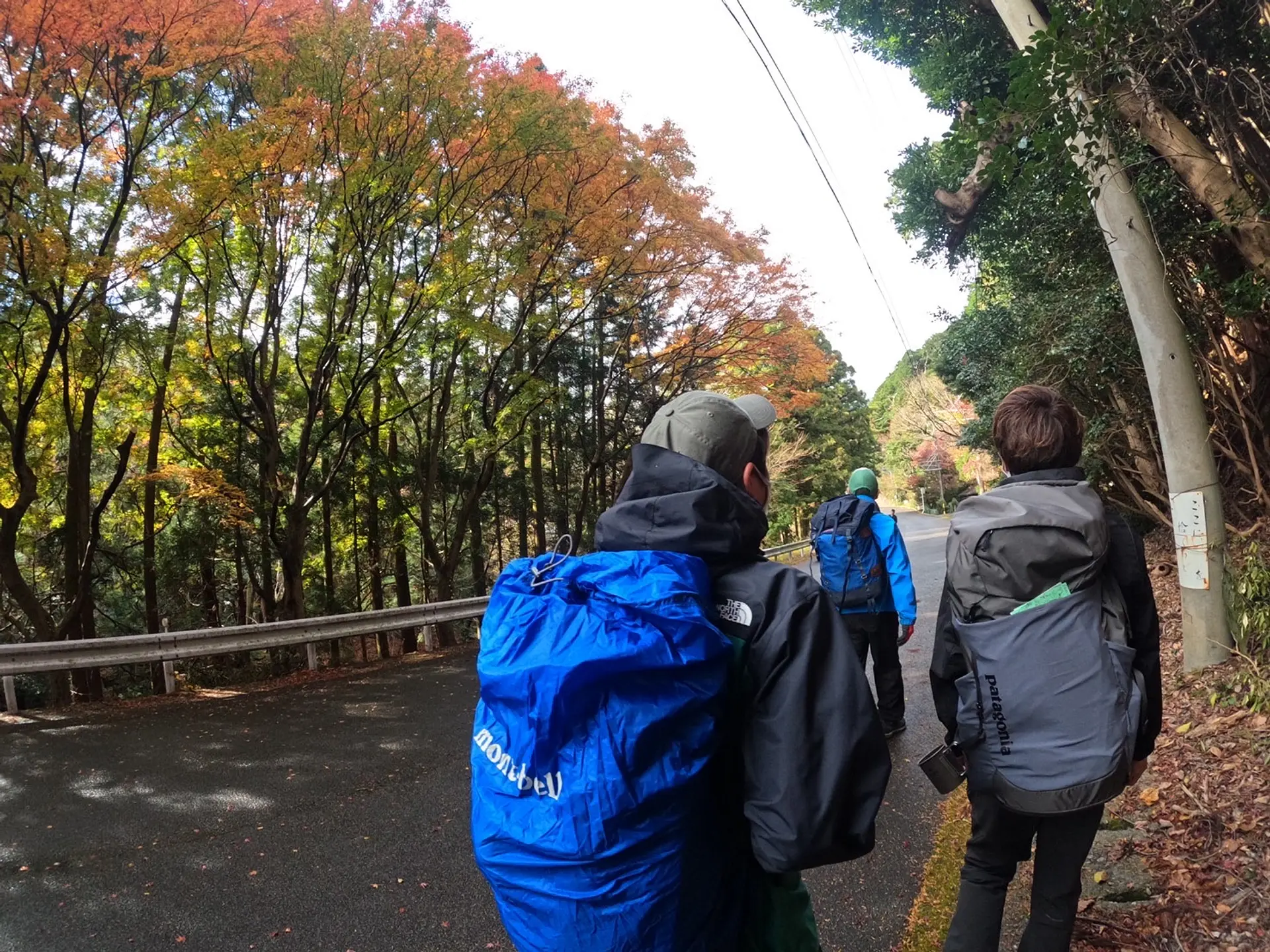
指定の時間に集合してからみんなで登山開始します!
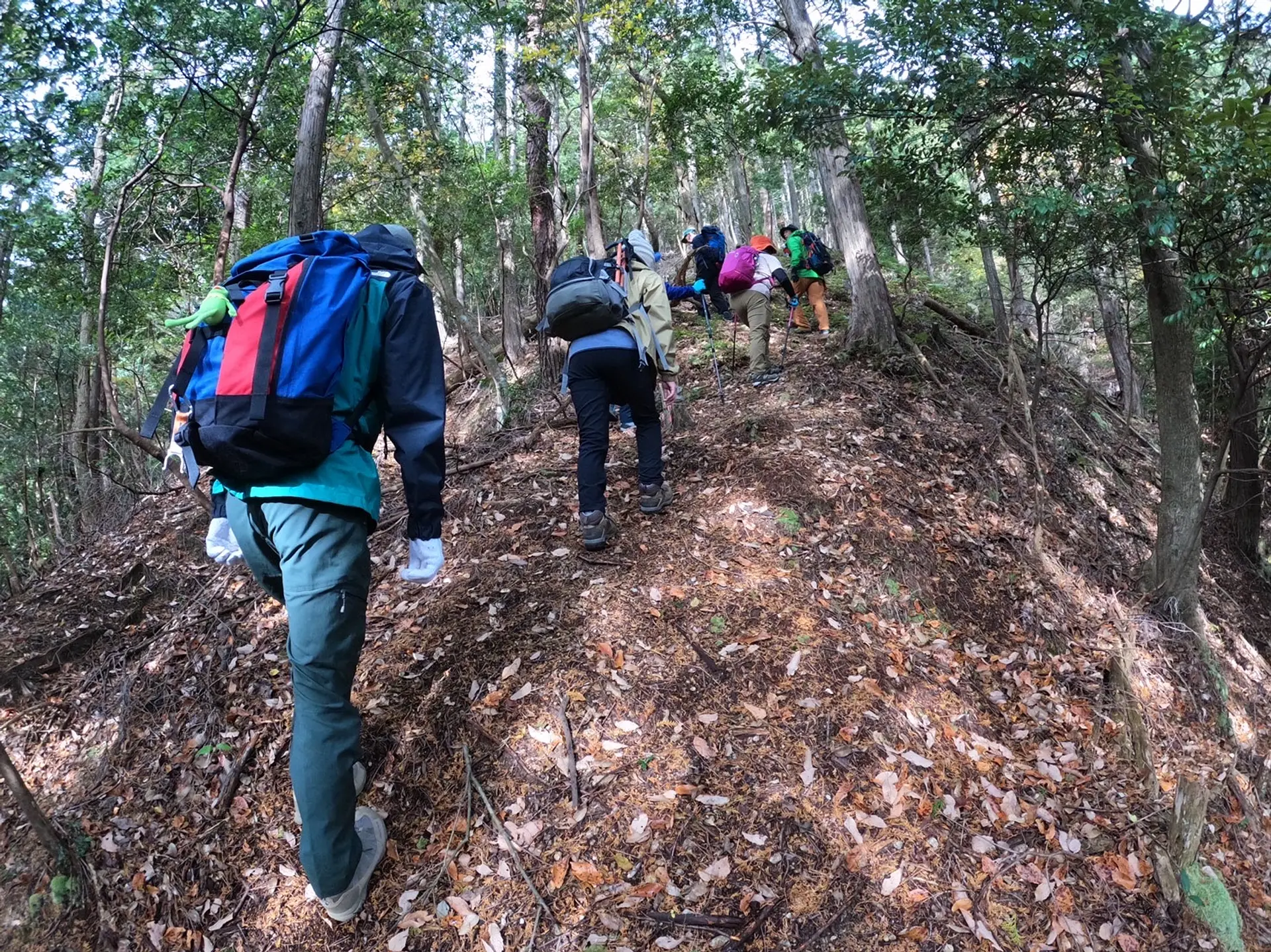
大勢で登るのは楽しいですね!
三子山の南峰に到着!
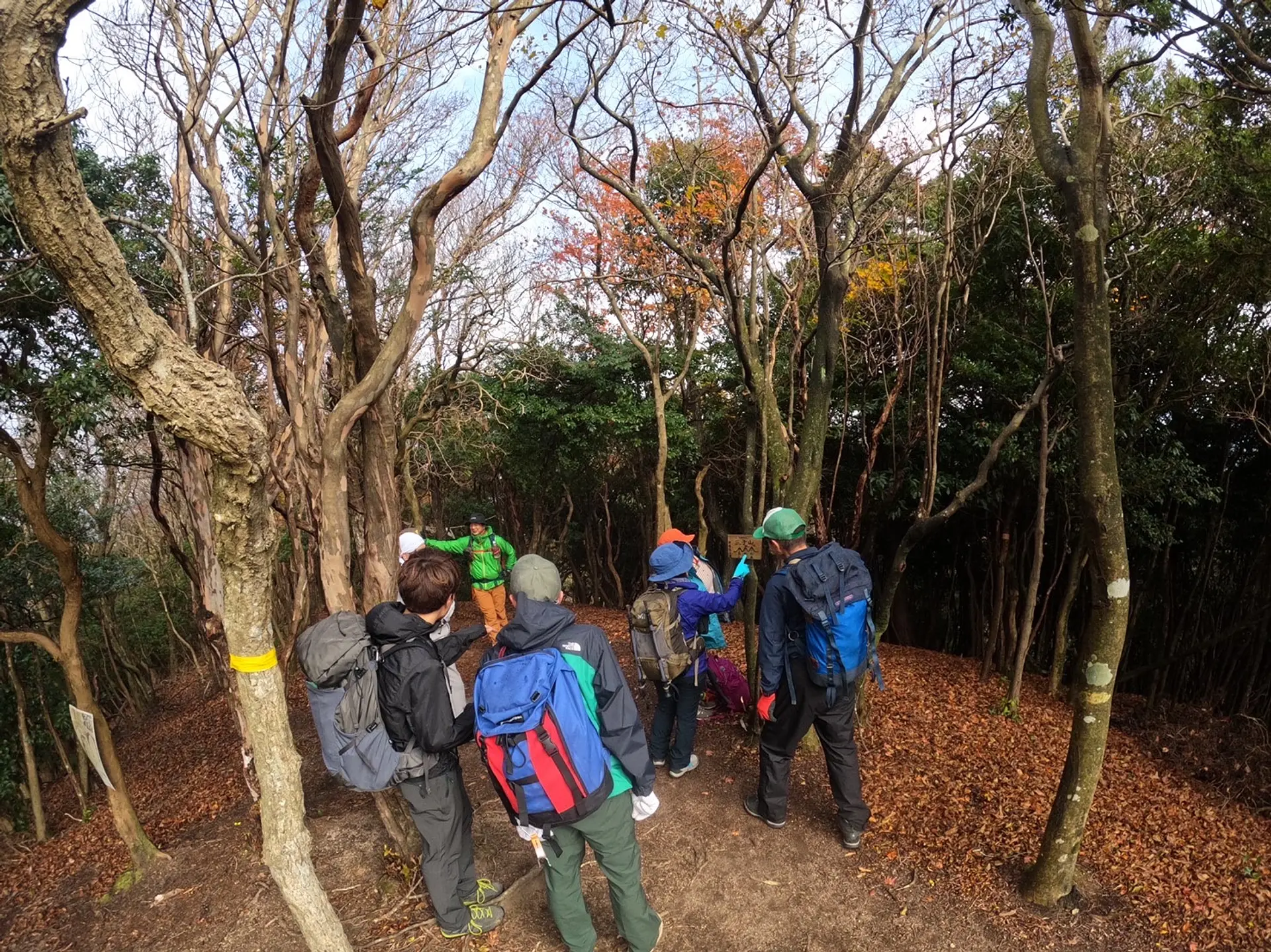
定期的に休憩もとってもらえます!
登山には山の知識が豊富な山岳協会の方が同行してくれるので自分達だけで登山に行くより安心感がありますよね。登山経験が少ない方は亀山7座トレイルのイベントで登山慣れするのも良いかもしれません!
トニートニー・ユーマ
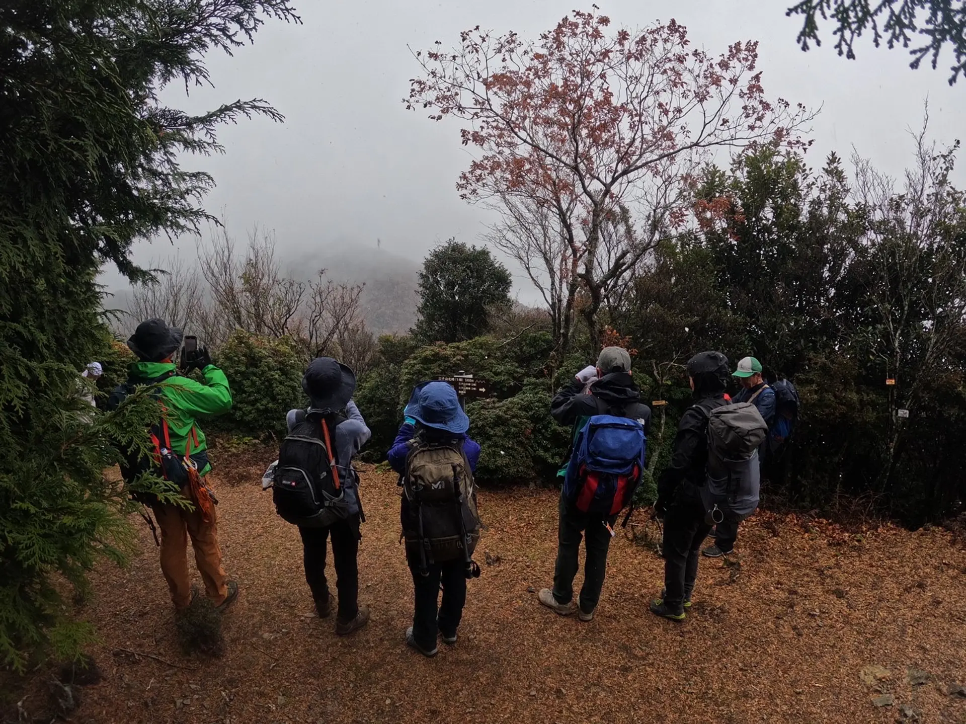
三子山の北峰に到着と同時に雪が降ってきました!(笑)
山は天気が変わりやすいのでレインコートはリュックに常備しておいた方が良いです。
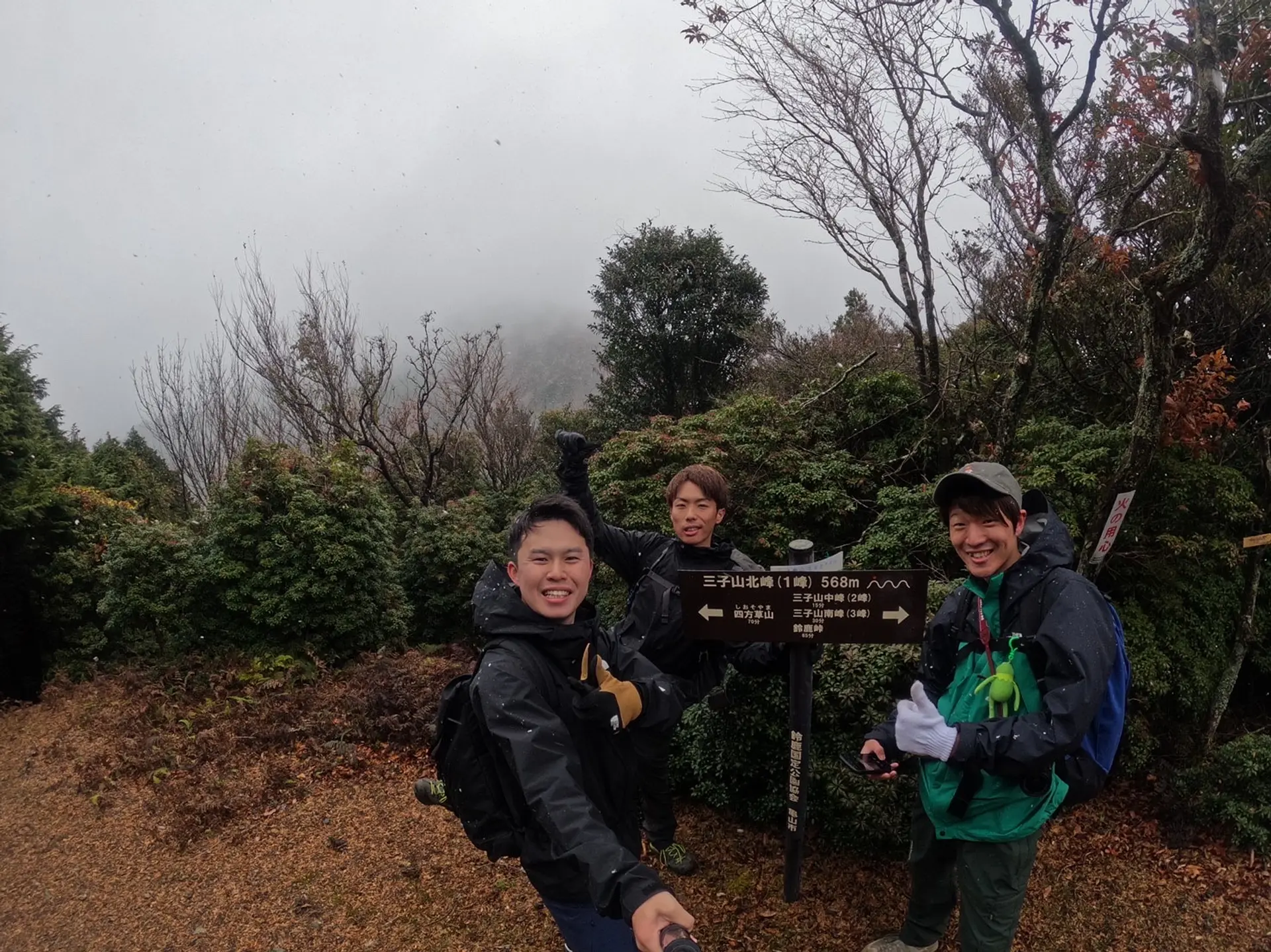
三子山の北峰で記念撮影!
天気が良ければバックに「四方草山」も見えました。。。
残念!!!
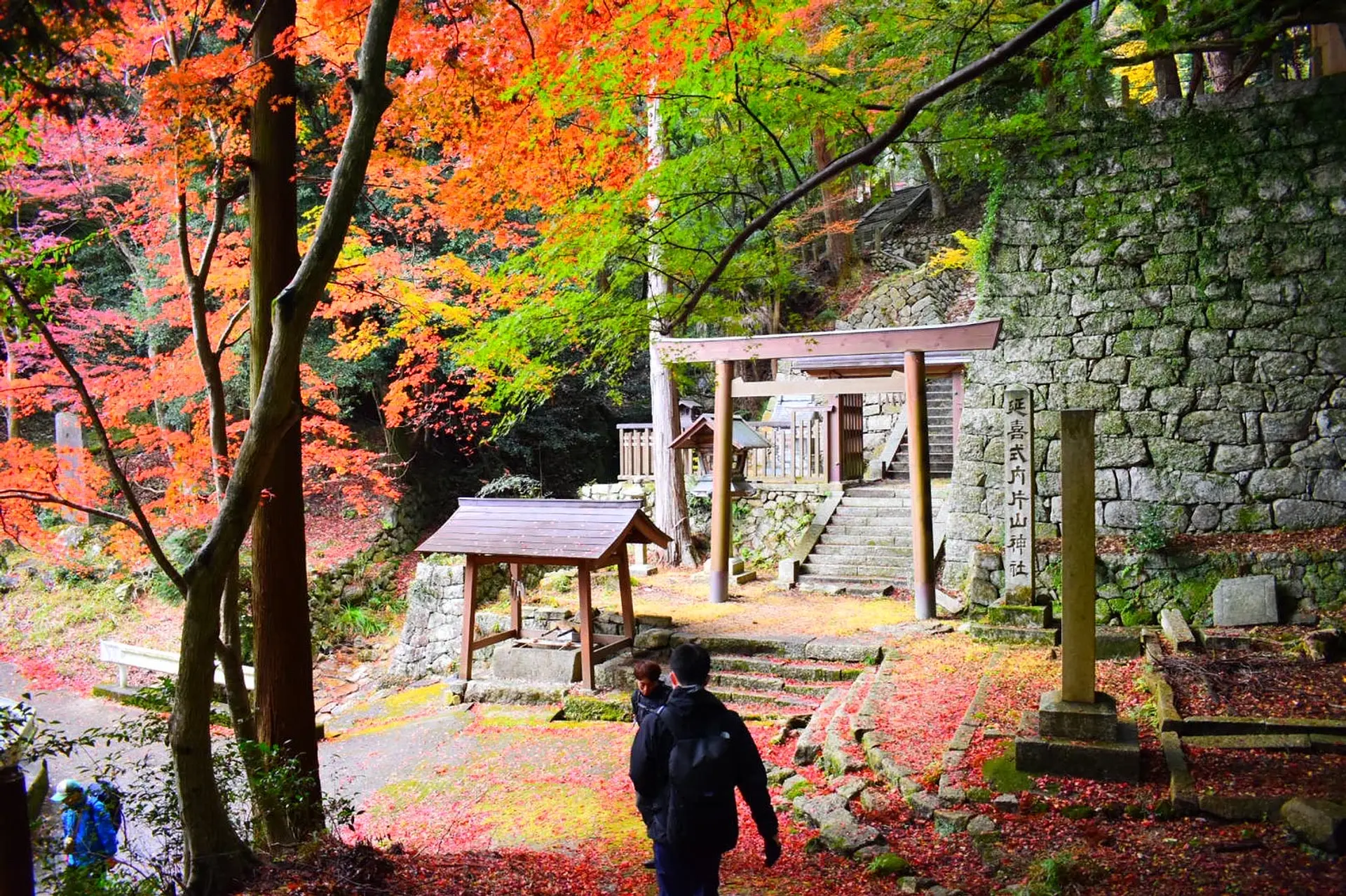
鈴鹿峠から下山中に「片山神社」に立ち寄りました。紅葉がとても綺麗でした!登山途中に参拝出来るのも良いですね。
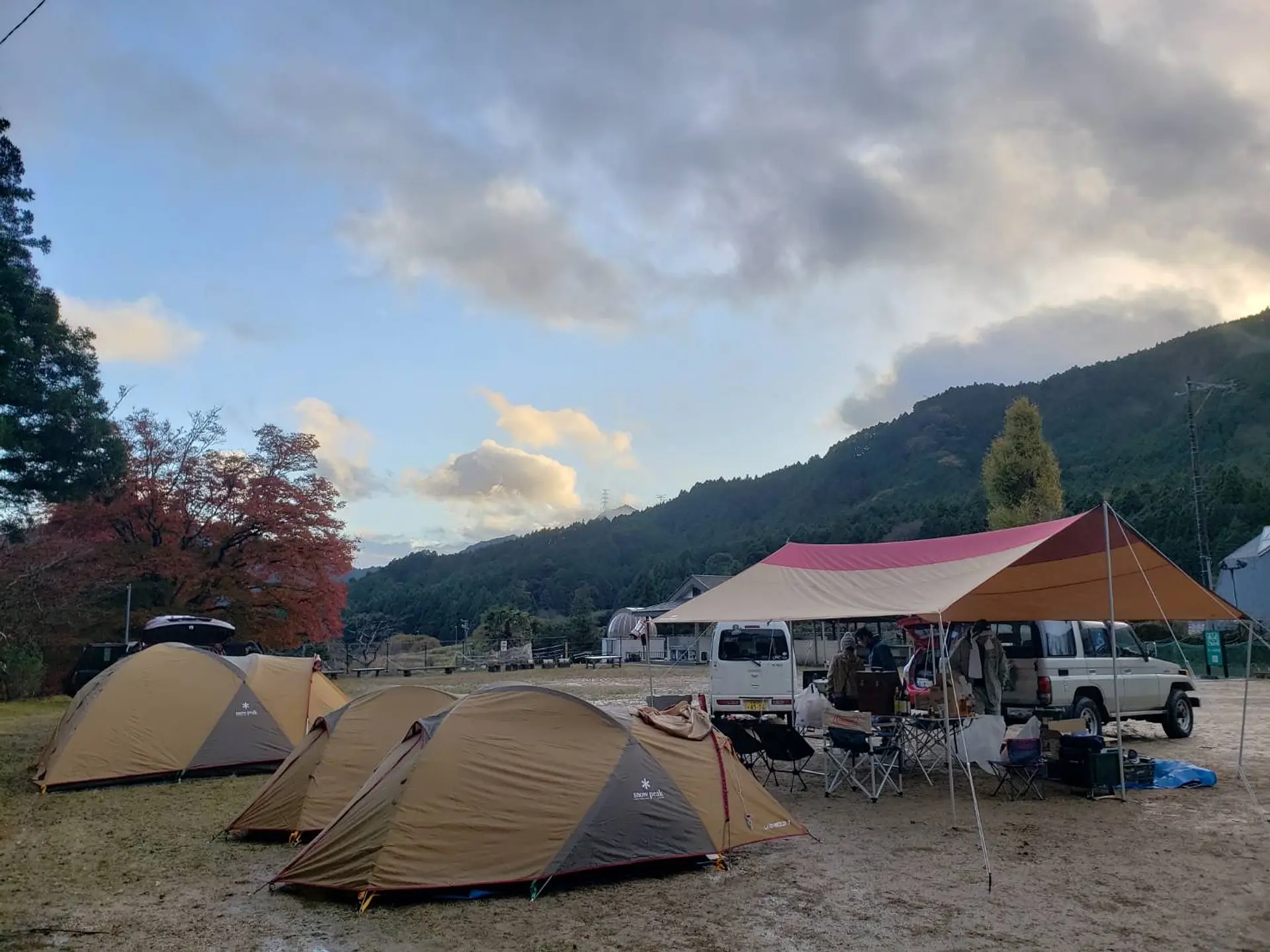
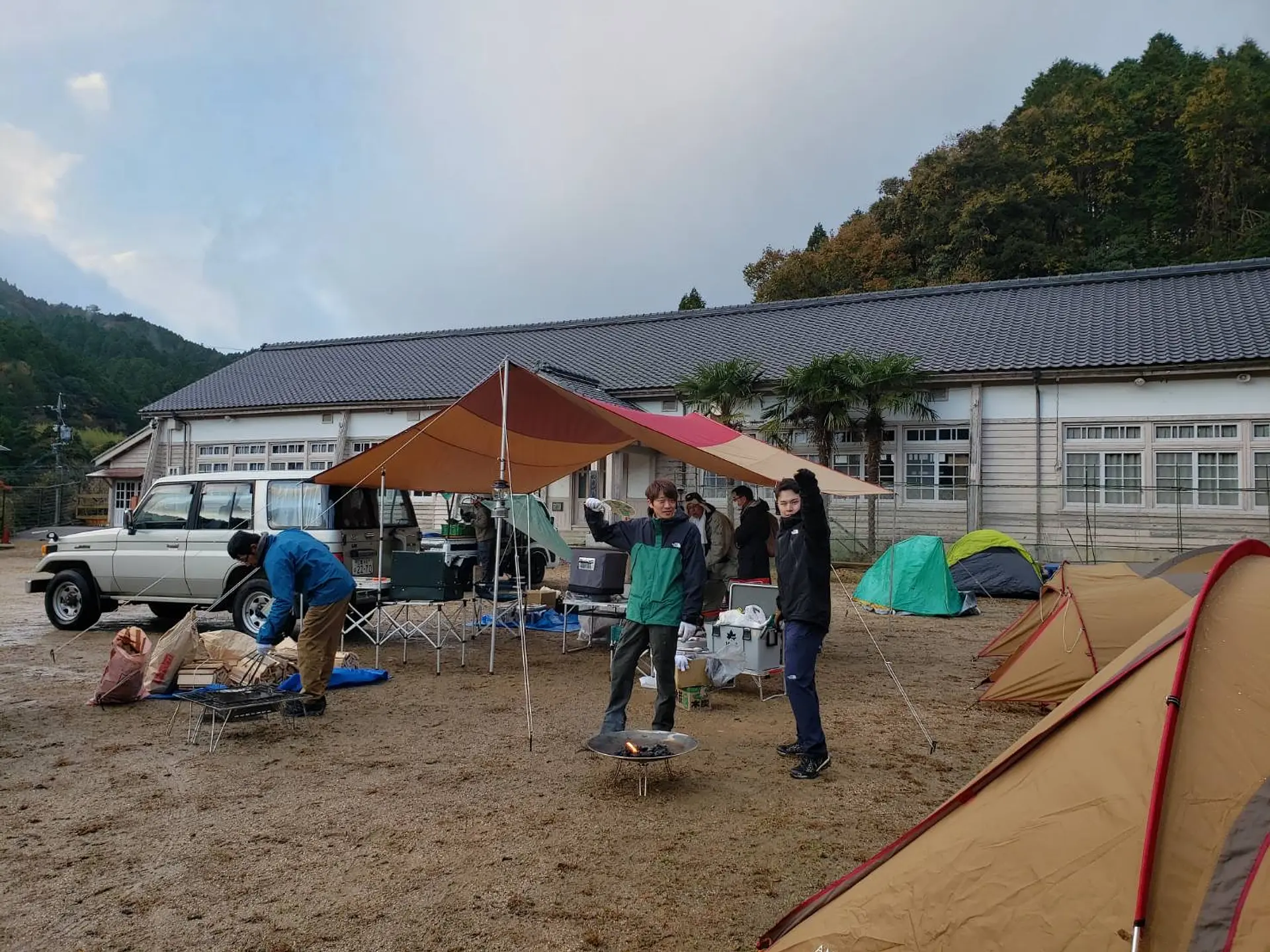
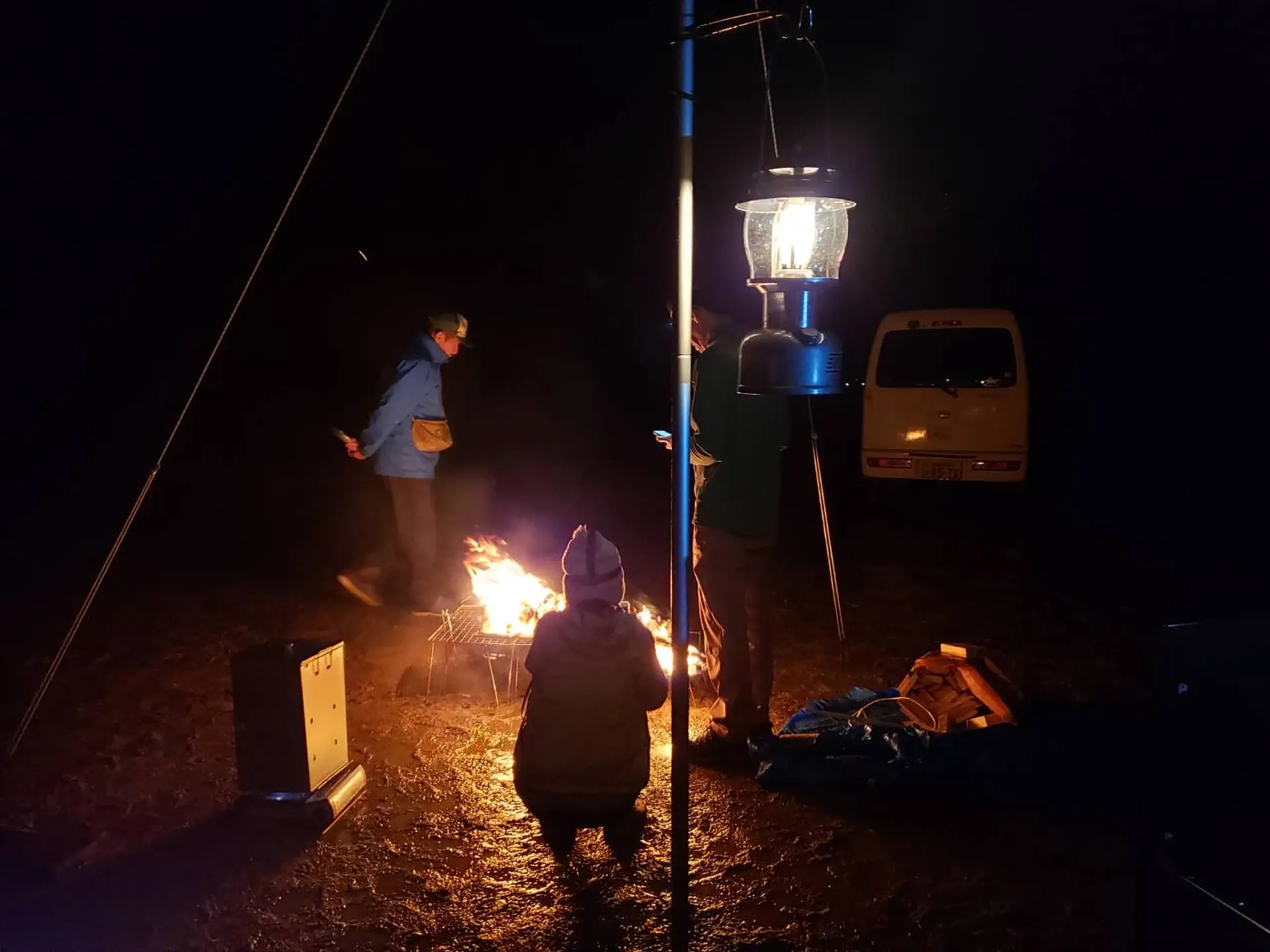
登山の後は「鈴鹿峠自然の家」でキャンプです!
キャンプのイベントは今回が初だそうです!!!
グラウンドにみんなでテントを張ります。
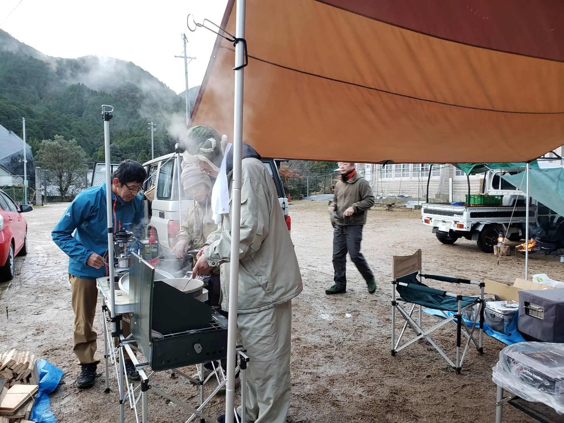
グツグツ、カレーを煮込んでいます。
キャンプと言えばカレーですよね!秋、冬のキャンプにはピッタリです!
カレーを食べて冷えた体も温まりました!
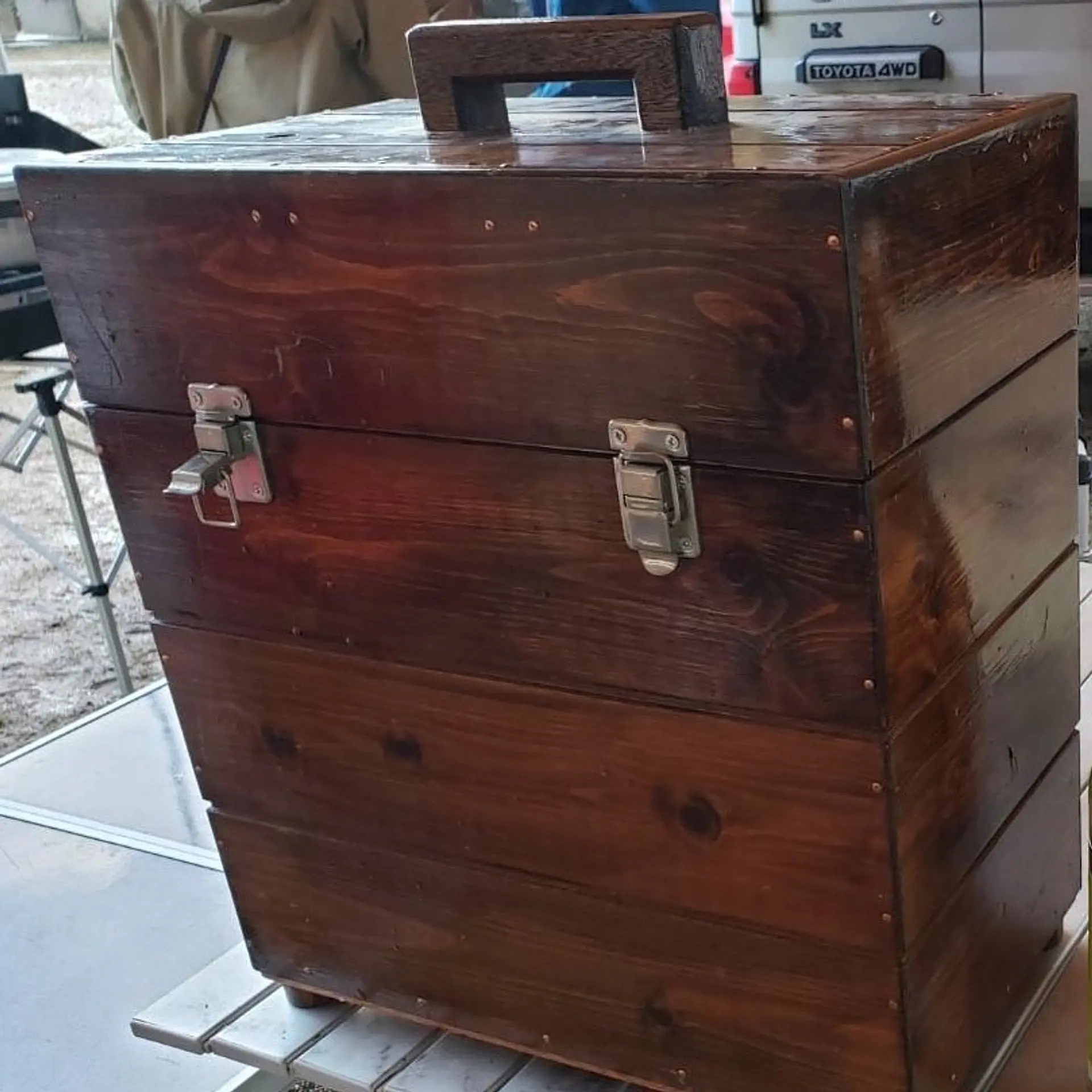
イベント主催者さん、手作りのランタン入れです。センスと技術が半端ないです!(笑)
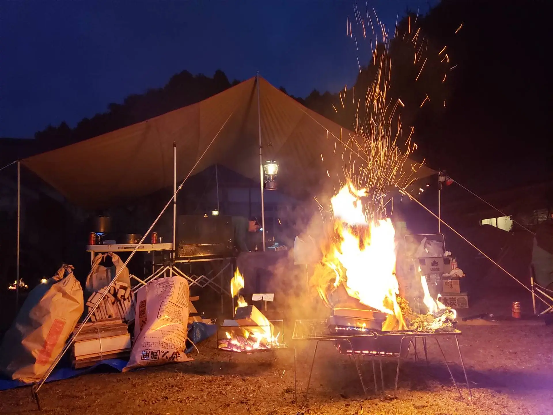
秋、冬のキャンプは焚き火が必須ですね。身も心も温まります。
いかがでしたでしょうか?気になった方は是非、亀山市のホームページからイベントに参加してしみて下さい!
https://www.city.kameyama.mie.jp/docs/2020051900010/
関連スポット
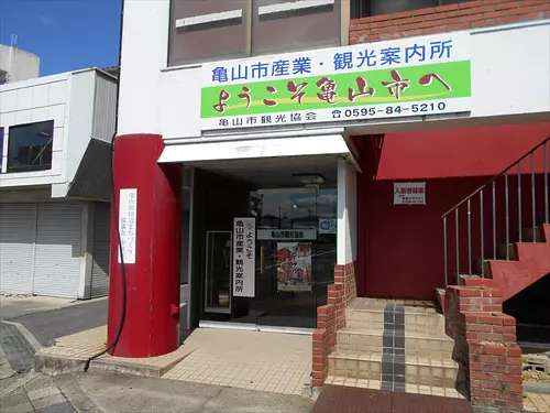
亀山市産業・観光案内所
北勢
亀山市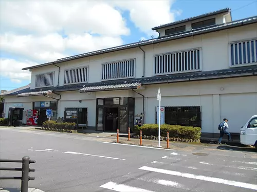
亀山市観光協会
北勢
亀山市JR関駅構内にある「亀山市観光協会」でこのまちの情報を手に入れよう! 改札を出たらすぐのところにあります。
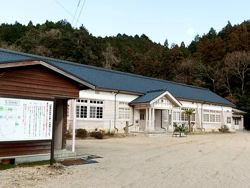
鈴鹿峠自然の家
北勢
亀山市廃校になった坂下小学校校舎を野外活動施設として改築、豊かな自然の中で、宿泊しながら研修することができます。 プール、グラウンド、炊事棟、研修室、歴史民族資料館などもあり、キャンプ、合宿などにも利用できます。
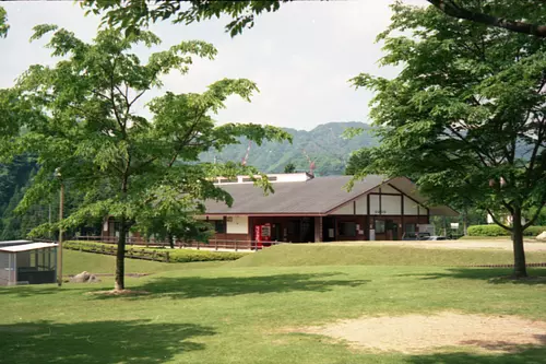
亀山市石水渓キャンプ場
北勢
亀山市鈴鹿国定公園内に位置する美しい渓谷「石水渓」は、毎年4月には恒例の山開きが行なわれ、グループや家族連れキャンパーたちでにぎわいます。 研修施設は団体用宿泊施設、バンガローはグループ・家族連れ用宿泊施設として、ハイキングやキャンプの拠点として最適です。
.png)