初心者からベテランまで楽しめる山遊び「鈴鹿セブンマウンテン」
掲載日:2025.07.02
三重県の北勢地区にそびえる地元のシンボル「鈴鹿セブンマウンテン」!初心者でも気軽に挑戦出来る山から、ベテランこそやみつきになるリピーターが絶えない登山スポットです!春は花、夏は新緑、秋は紅葉、冬は樹氷、四季折々の表情豊かなマウンテン!ぼくらの心はSo、満点♪
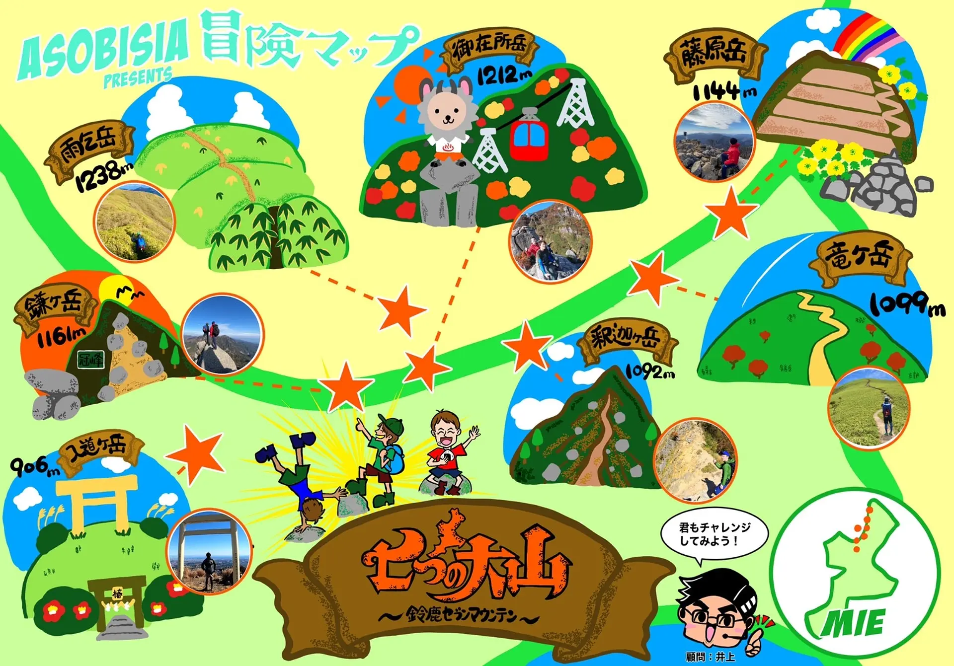
ASOBISIA presents 冒険MAP!
◆記事作成:ASOBISIA(アソビシア)#みえ旅カメラ部
アウトドアが大好きな、同僚の仲良しトリオ。普段は日本のサラリーマンとして奮闘し社会の荒波に立ち向かう。2020年10月、とある日の登山をきっかけにASOBISIAを結成し、InstagramとYouTubeを開設する。
Instagramでは、宮川でのSUPの写真で、観光三重2020年「いいね」ランキング1位を獲得。駆け出しのアクティブなグループである。
三重の山といえば、鈴鹿山脈に連なる"鈴鹿セブンマウンテン"!そんな鈴鹿セブンマウンテンを120%満喫する、ASOBISIA流の楽しみ方をご提案☆
冒険マップを使って登頂の証を残していこう!
日付を入れるのもよし、写真をコラージュするのもよし!一緒に達成感を味わおう!!
Instagramでハッシュタグ、#七つの大山、#ASOBISIA冒険MAP を付けて自分の冒険をみんなにシェアしよう!
冒険マップのダウンロードは最後のページから!!(画像を長押し→画像保存)
さぁ心の準備はできましたか?
七つの大山、鈴鹿セブンマウンテンへ!冒険のはじまりだ!
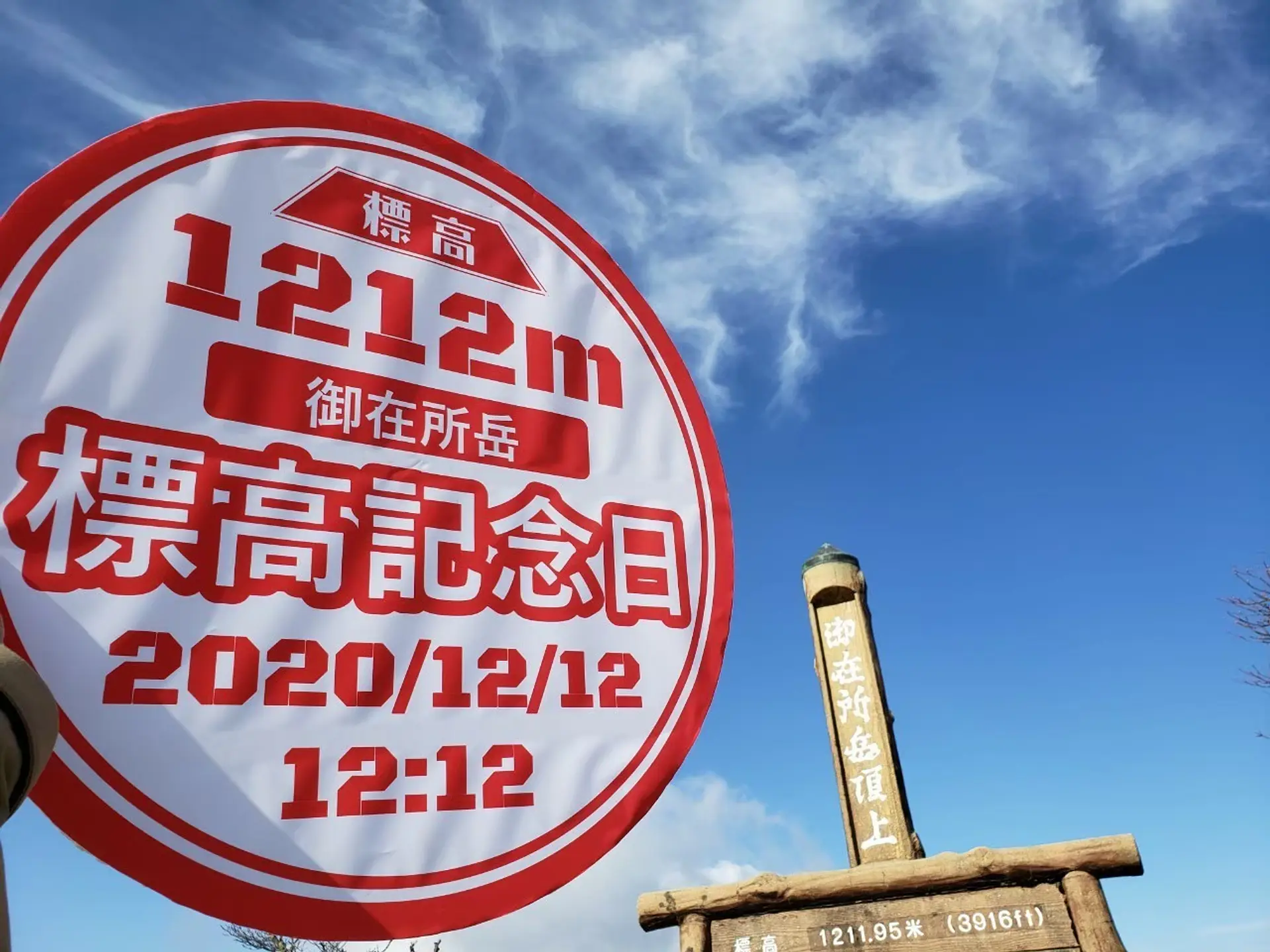
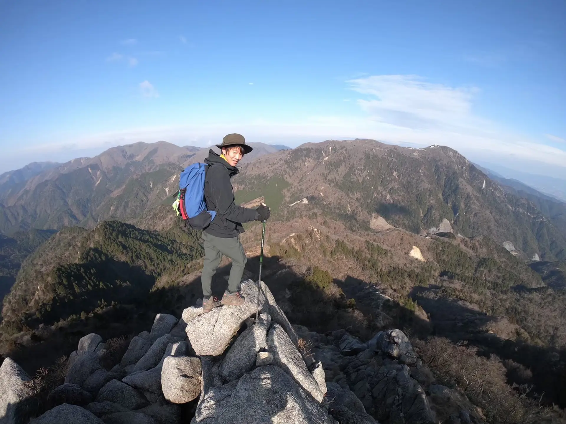
御在所岳 (標高1212m)
登山レベル★★☆☆☆
三重県三重郡菰野町と滋賀県東近江市の境にそびえ立っています。登山に訪れる山ボーイ、山ガールが年中後を絶たない鈴鹿セブンマウンテンの中で最も人気のある山です!アスレチック性が高く、インスタ映えスポットも多く存在している事が人気の理由の一つになっています。登山ルートがはっきりしていて、迷う事も少ない為、初登山にはもってこいの山です!ASOBISIAのメンバーも初登山は御在所岳でした!
■ASOBISIAチョイスの登山コース
中登山口~(山頂までの道のり約3時間)
▶御在所岳「中登山道」おばれ石崩落注意について(2025年7月2日現在)
御在所岳の中登山道、おばれ石付近にて崩落の危険があります。他の登山道のご利用をお願いいたします。御在所岳の登山ルートは、うら登山道、おもて登山道、とうげ登山道、一の谷新道をご利用ください。
◆アクセス
名神高速菰野ICで下車し、国道577号線を約30分道なりに行くと左手に駐車場にが見えてきます。
約70台駐車可能 ※紅葉シーズンは8時には満車になっています。
御在所岳
詳細はこちらから(御在所ロープウエイHP)
https://www.gozaisho.co.jp/access/
近鉄湯の山温泉駅から三交バスで終点三交湯の山温泉下車。後、山上までロープウエイ12分
東名阪道自動車道・四日市IC下車湯の山温泉方面車20分
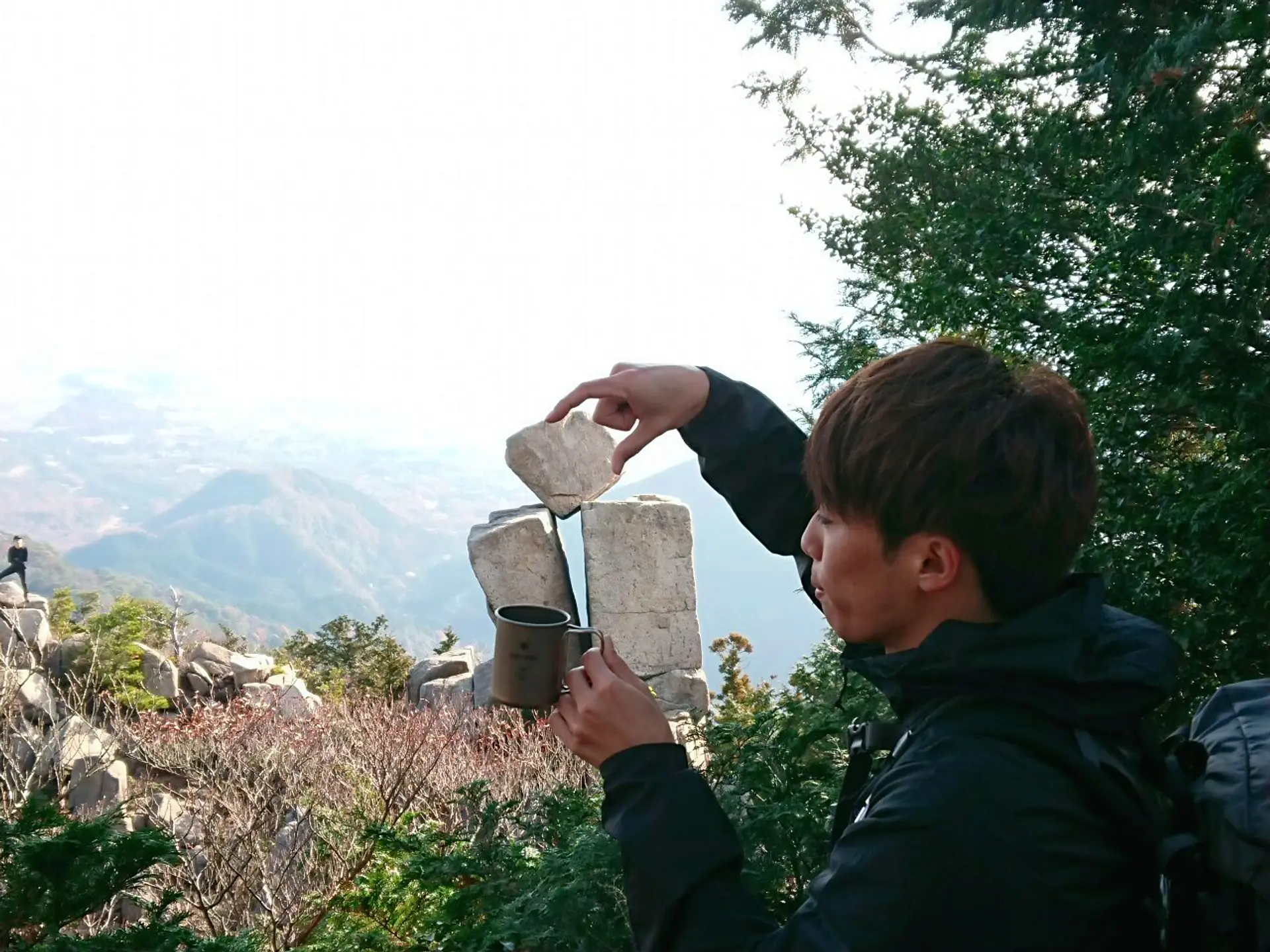
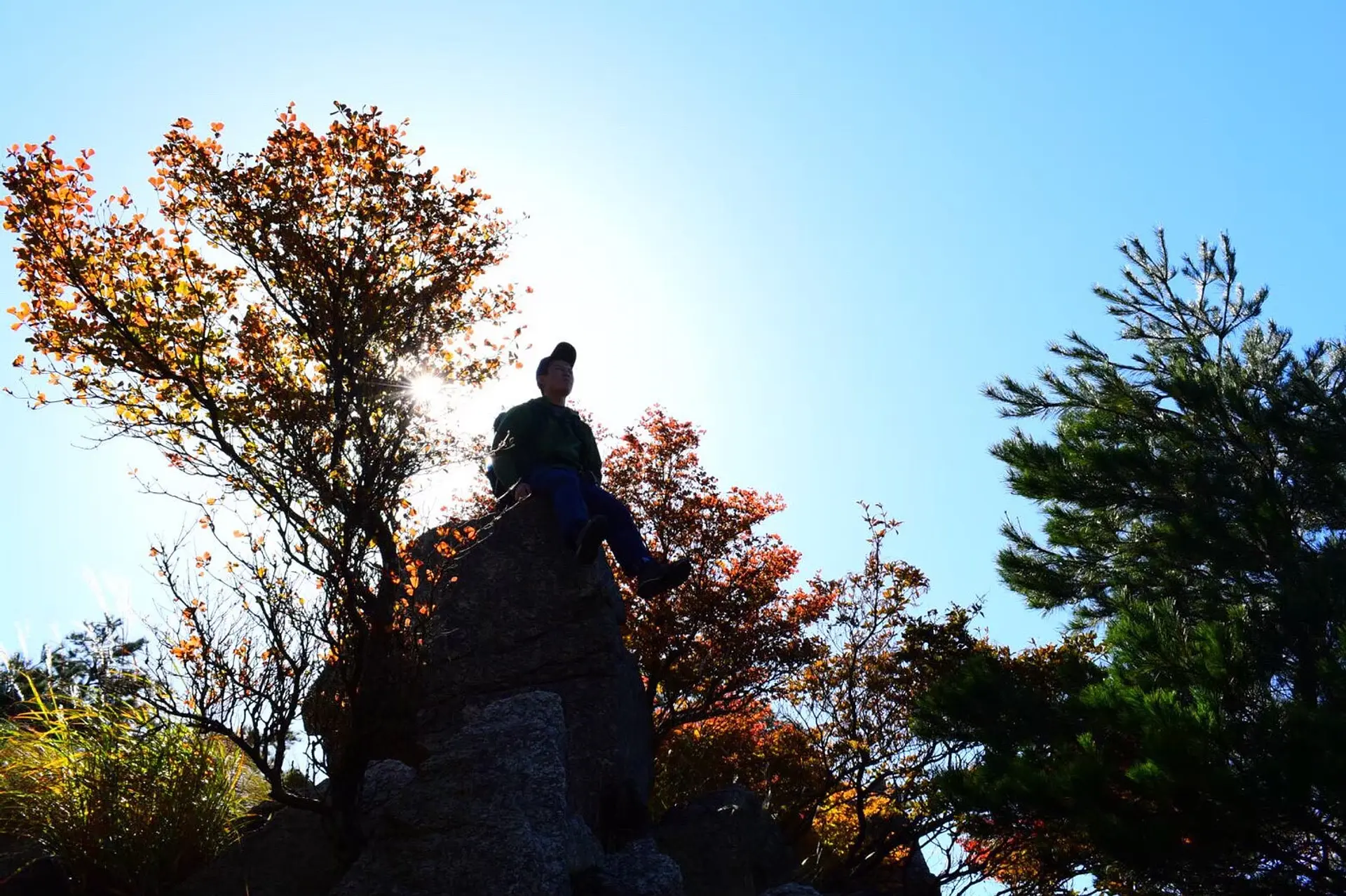
#地蔵岩(じぞういわ)
地蔵岩は中登山道を登り、5合目と6合目の間にあるスポットです!バランス感!マジ神!!!何故この様な場所に岩が乗っているのか、こもしかくんでも知りません。。。地蔵岩はロープウェイから見る事が出来ません。登山者だけの特権なのです。
角砂糖を入れて、ここでひと息(超甘党なのかな?笑)。どう遊ぶかはアナタ次第です♪
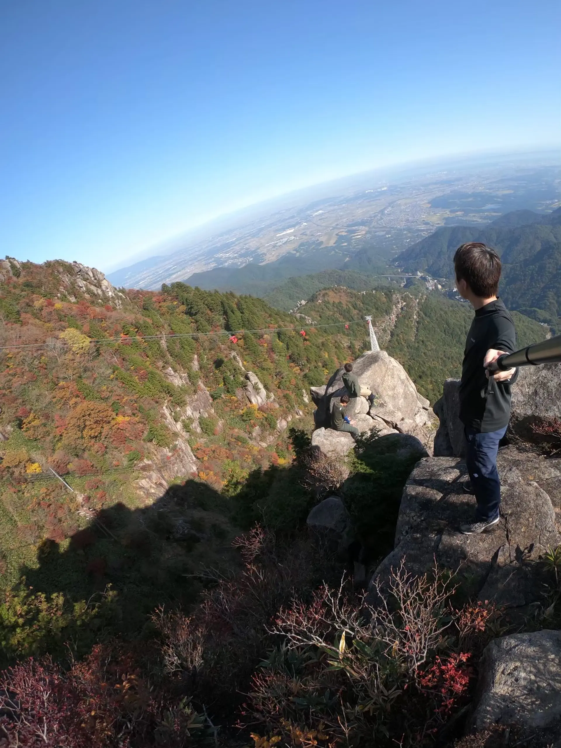
#アソビ岩(自称)
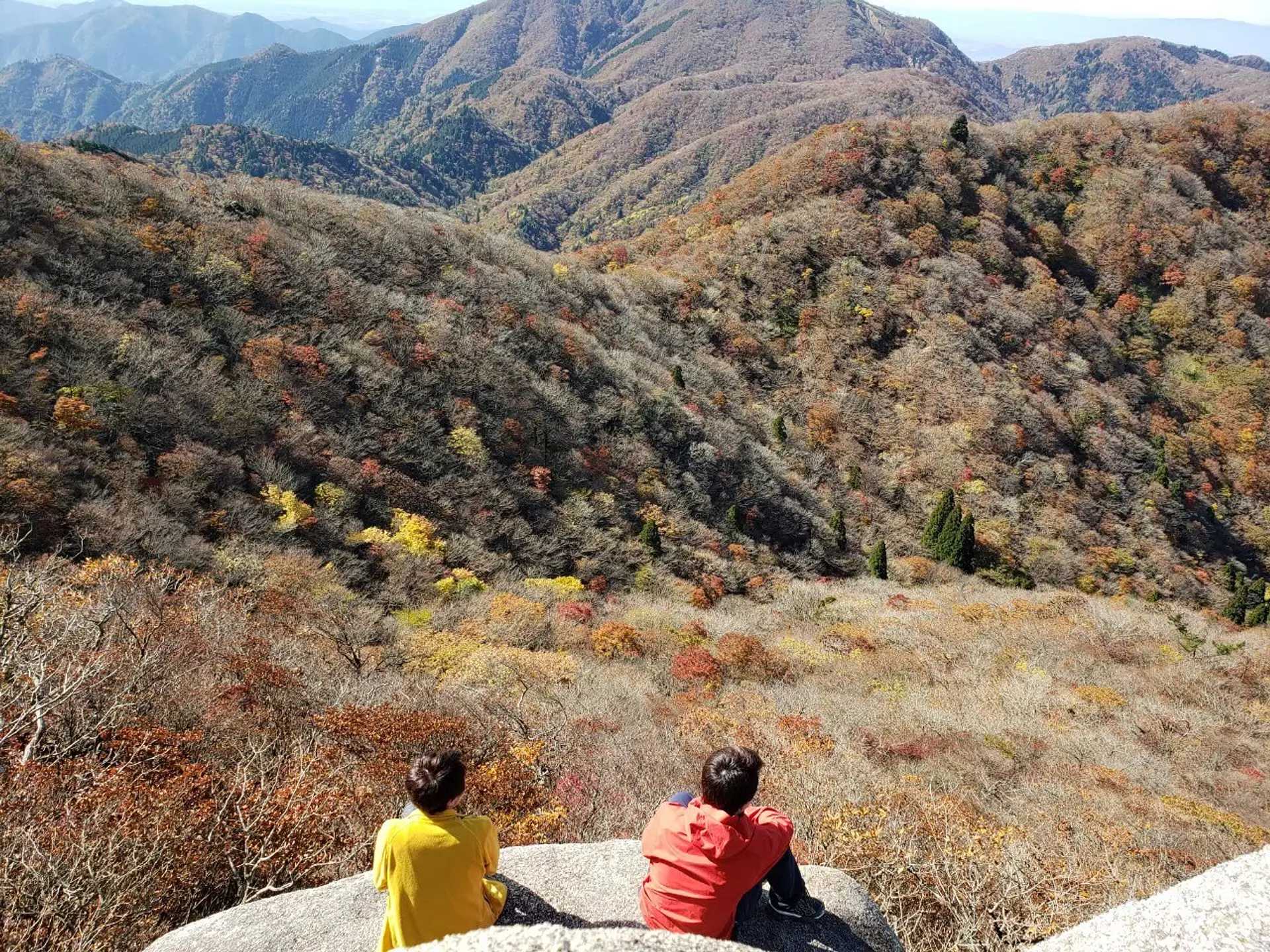
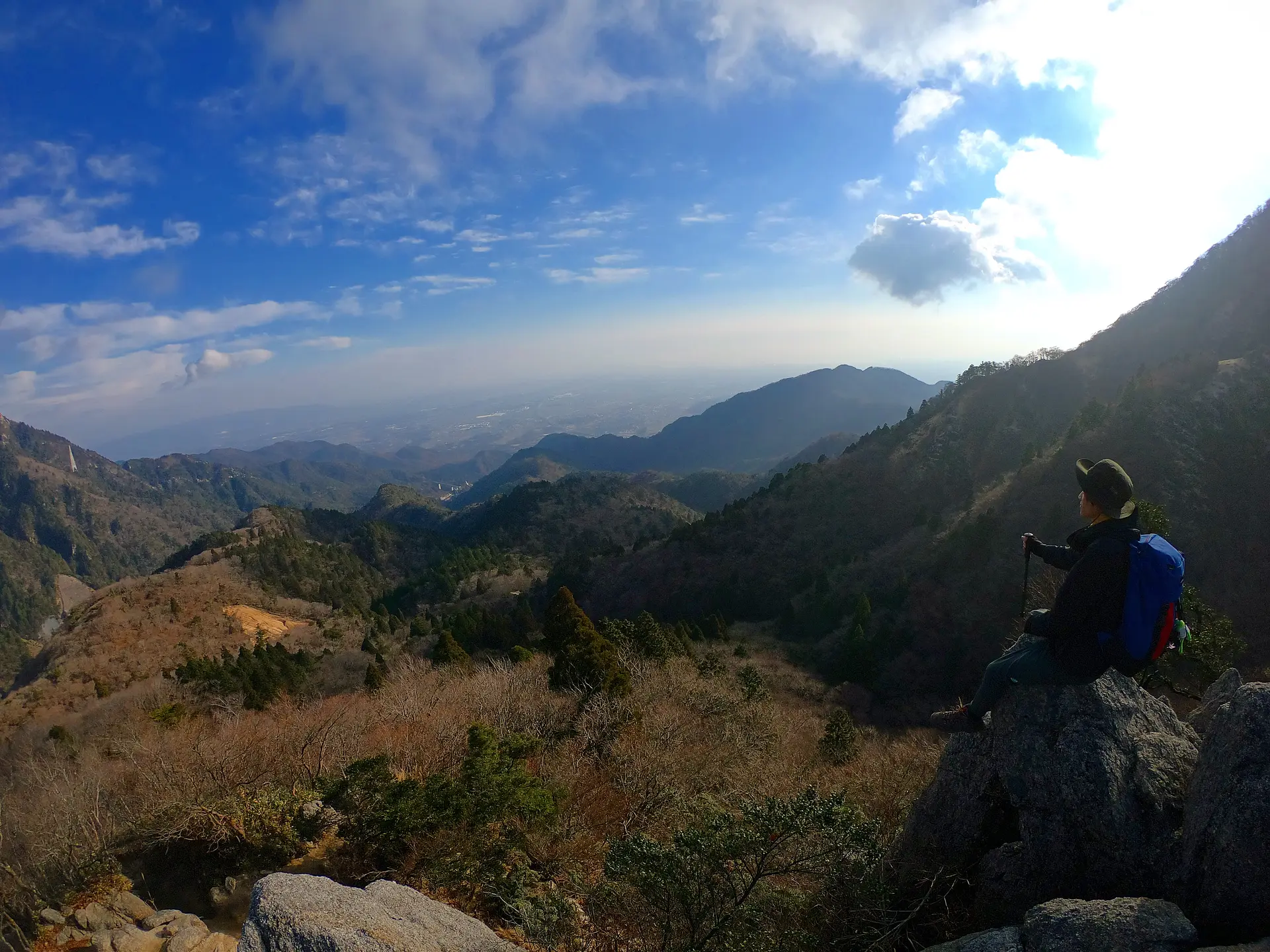
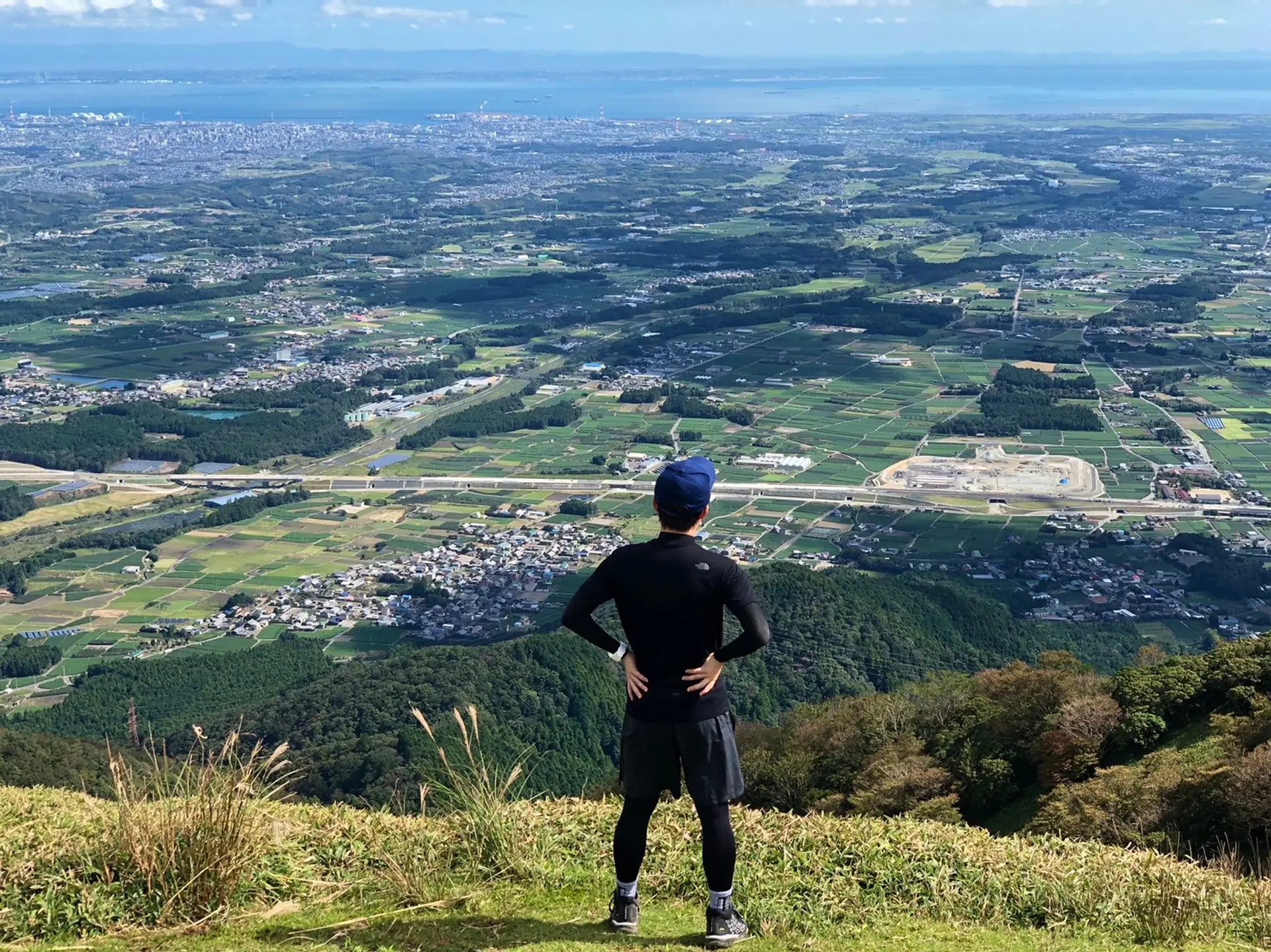
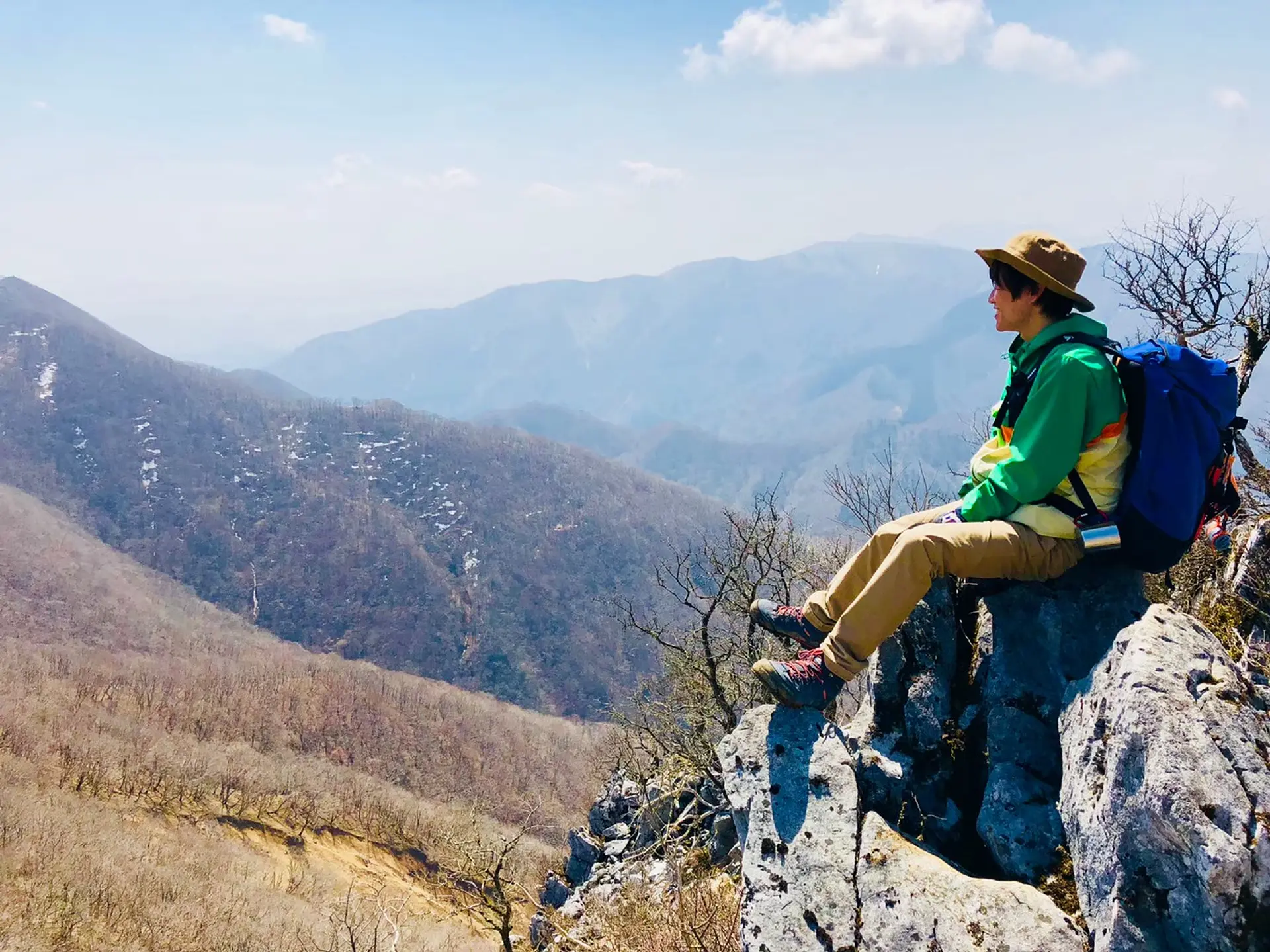
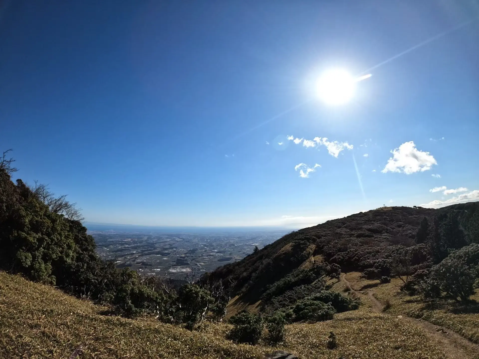
山頂付近にある、滋賀の山々を一望出来るビュースポット(望湖台)。意外と知られていないのか、壮大な景色を一人占め出来るASOBISIA一押しのスポットです!その壮大な景色でメンタルリセット!!!
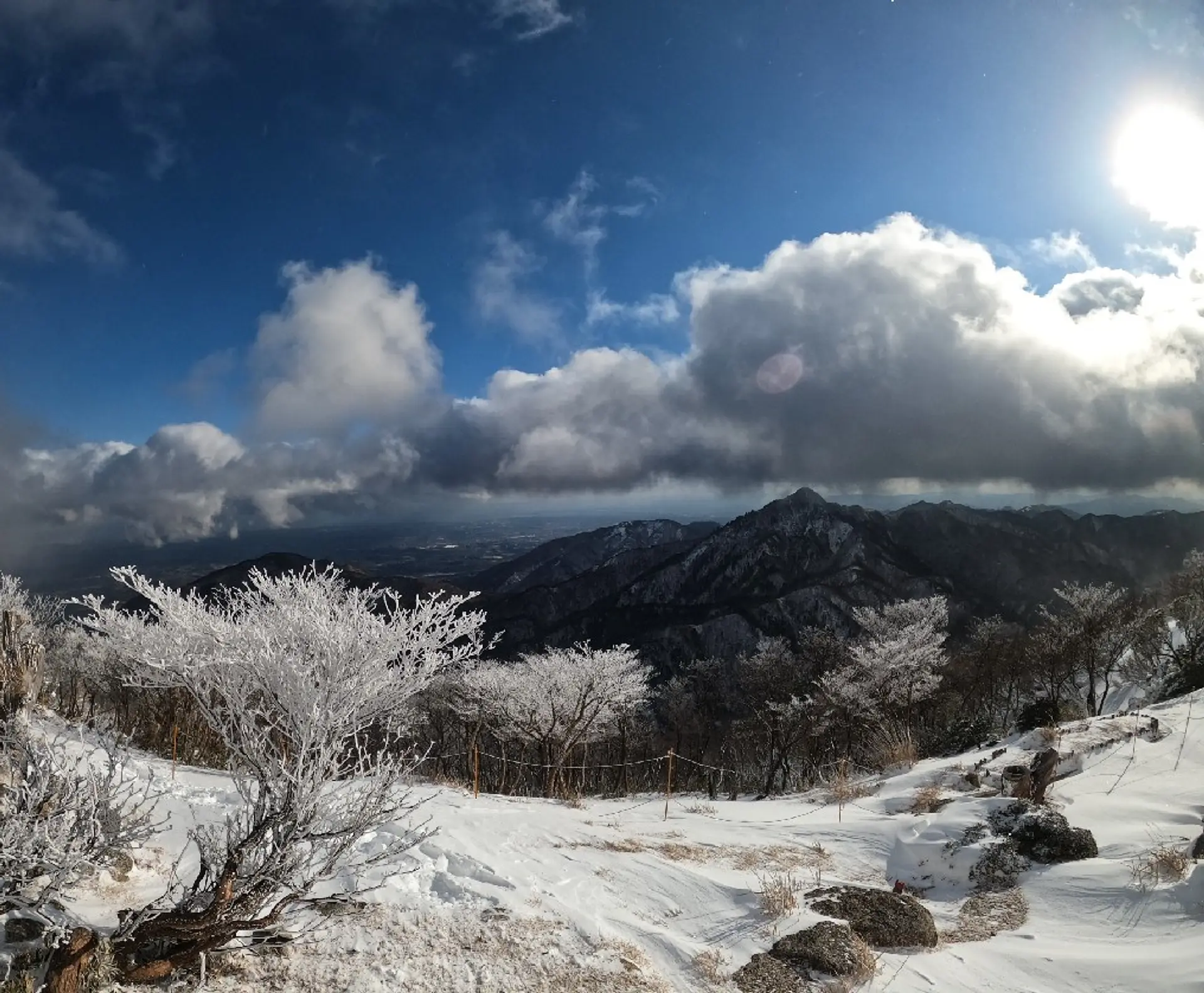
#御在所からの冬景色
頂上目前のスキーハウス前にある、カモシカ広場からお隣の鎌ヶ岳を撮影した写真です!冬の御在所岳では樹氷や氷瀑も見る事が出来ます!すぐそばにはソリ専用無料ゲレンデも有るので、冬の御在所岳に挑戦する際はソリを持参して、子供に混じって楽しむのがASOBISIA流です。
ここで一句、
美(うま)し国 御在所岳と ASOBISIA
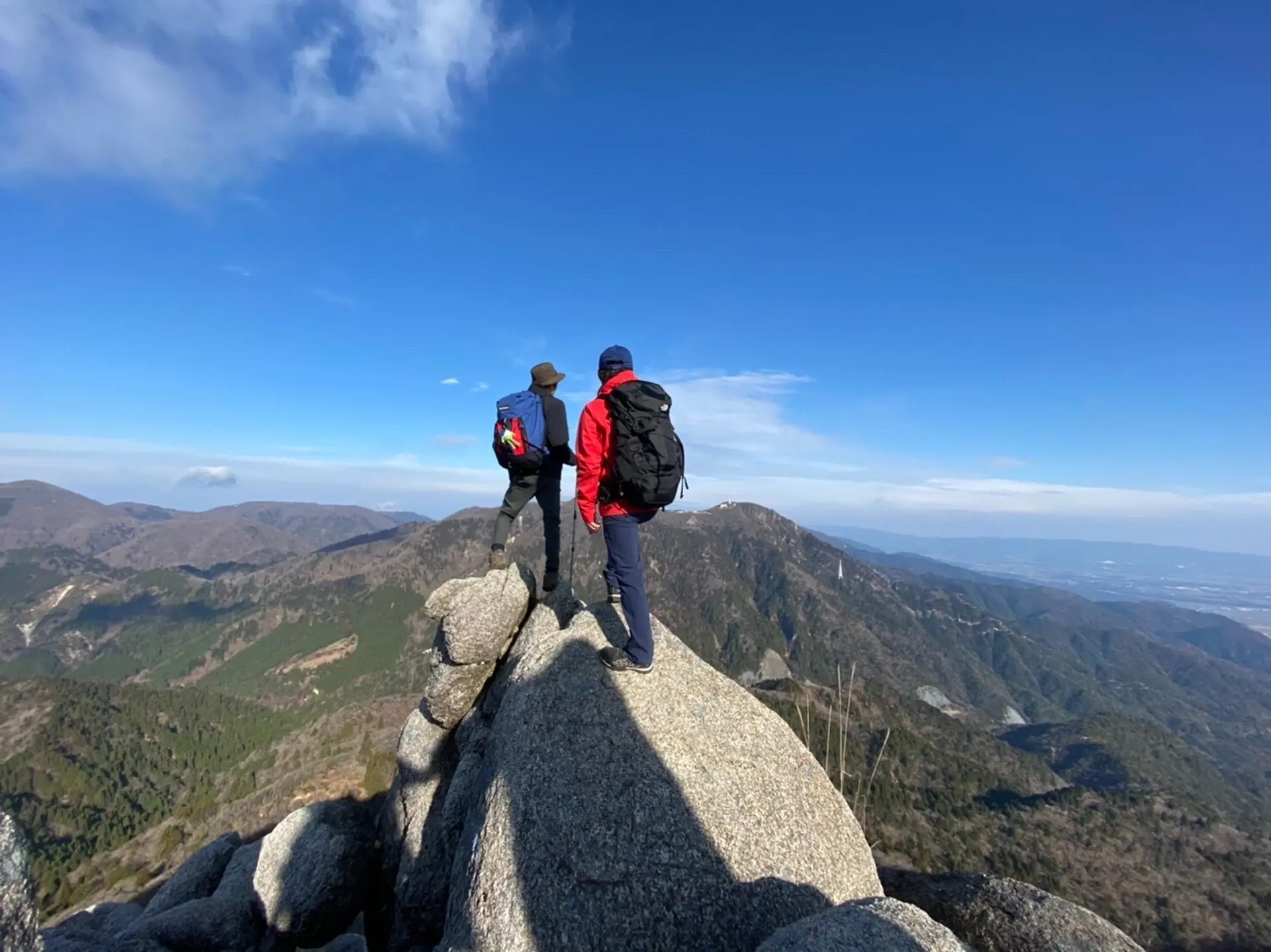
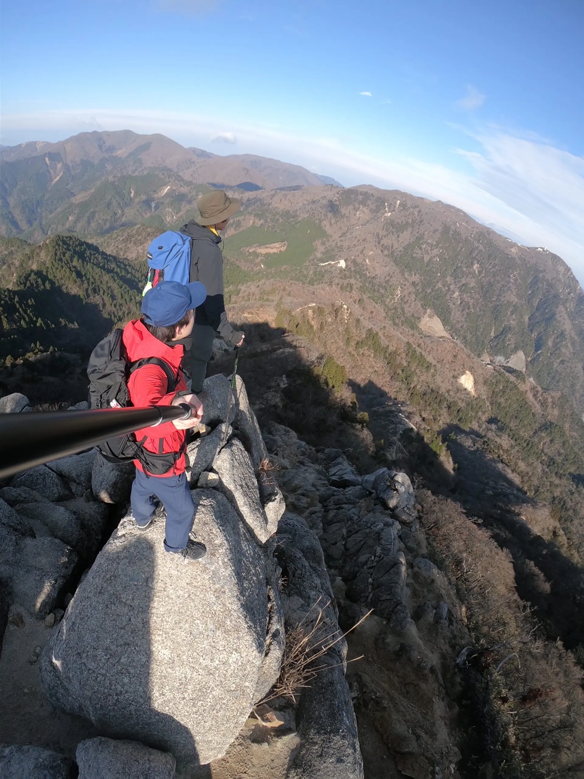
鎌ヶ岳(標高1161m)
登山レベル★☆☆☆☆
三重県と滋賀県の境にそびえ立っており、鈴鹿山脈の南部に位置しています。御在所岳のお隣さんです!御在所岳〜鎌ヶ岳の縦走をする方も多く見られます。鋭く尖った姿が特徴的で「鎌」という名前が良く似合います。名前付けた人、センスありますね〜。
この写真は鎌ヶ岳の山頂から御在所方面へ少し降りた場所で撮影しました!御在所岳を一望出来るスポットになっています。
YOYO!御在所岳を一望、登るのマジでキツそう、でもおれは何度でも登山に行くぞう♪
#駆け出しラッパーたくじろう
■ASOBISIAチョイスの登山コース
武平峠~(山頂までの道のり約2時間)
◆アクセス
名神高速菰野で下車し、国道577号線を約40分道なりに行くと武平峠トンネルの手前、左手に駐車場が見えてきます。御在所岳の中登山口から鈴鹿スカイラインを少し上がった所です。
鎌ケ岳
#富士山が見られるスポット
鎌ヶ岳、後半にある場所から撮影した写真です!武平峠からの登山ルートから少し外れた場所にあるプチ隠れスポットです!晴れた日には富士山が見える事もあるそうです!
#スリルある映えスポット
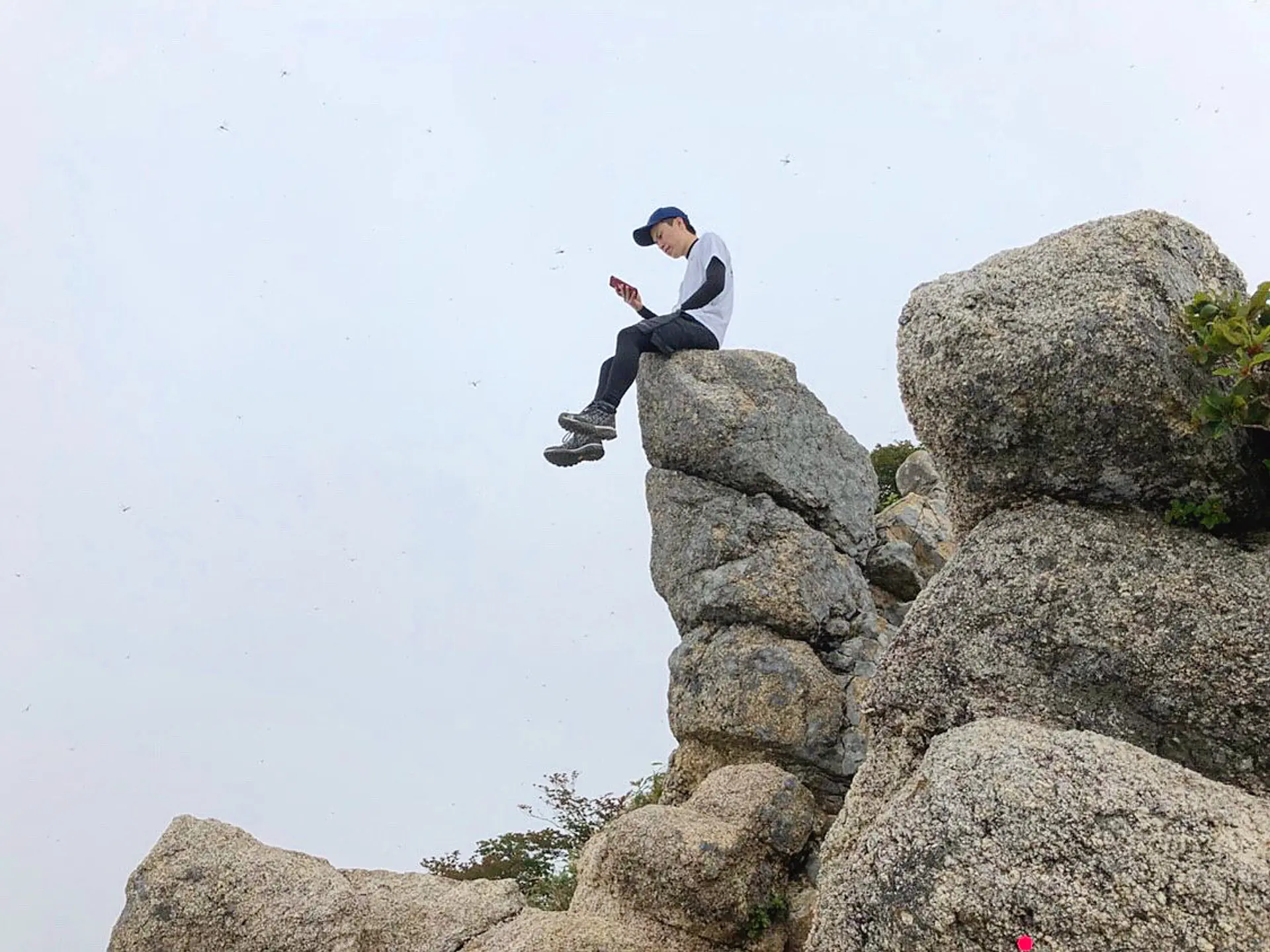
鎌ヶ岳の山頂付近にあるスポットです!初夏に鎌ヶ岳を登った時の写真です。よく見ると周りに沢山のトンボが飛んでいます。落ちないように気をつけて、映え写真を撮りましょう!
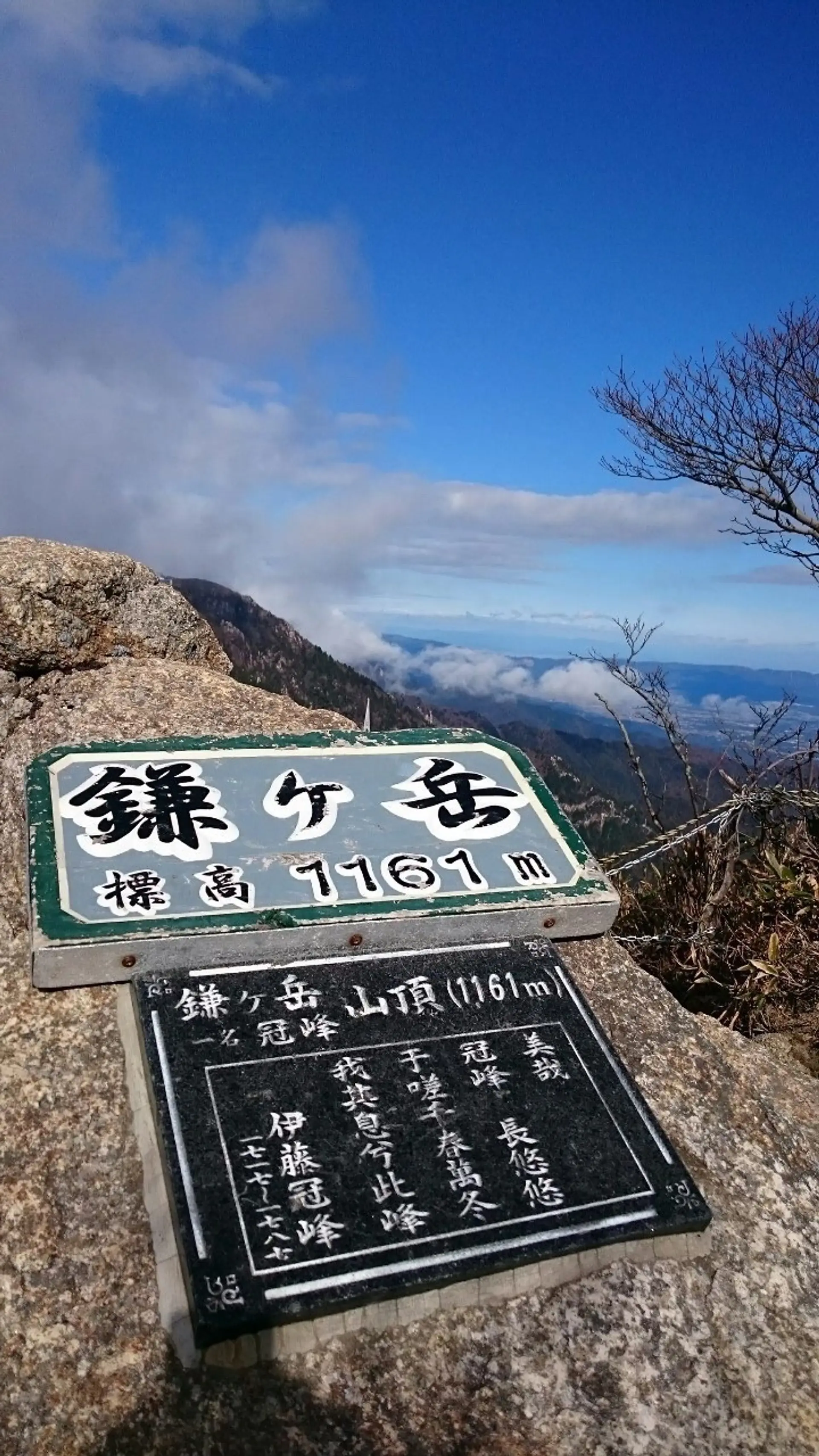
#鎌ヶ岳山頂にあるボード
鎌ヶ岳の山頂には「鎌ヶ岳」と書かれたボードが有ります!ボードが置かれている岩には伊藤冠峰さんが鎌ヶ岳について書かれた詩の一部が刻まれています!手に取って記念撮影をしましょう!
ここで一句、
聳え立つ 冠峰惚れた 鎌ヶ岳
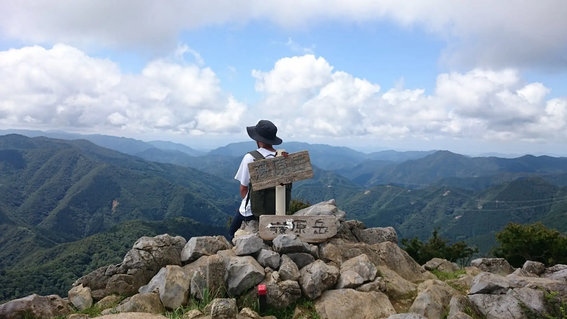
藤原岳(標高1144m)
登山レベル★★☆☆☆
藤原岳は三重県と滋賀県の境にそびえ立っており、鈴鹿山脈の北部に位置しています!藤原岳はフクジュソウやセツブンソウなど、様々な花が咲く山で「花の百名山」にも選定されており、特に春先が登山ボーイ、登山ガールで賑わっています!
■ASOBISIAチョイスの登山コース
大貝戸登山口~(山頂までの道のり約2時間半)
◆アクセス
東海環状自動車道 東員ICを下車してから約20分程の藤原岳登山口駐車場に駐車する事が出来ます。Gogle Mapでも出て来ます!無料で約20台駐車する事が出来、トイレもあります!
藤原岳
【大貝戸登山口駐車場】
駐車可能台数:約40台 駐車料金:無料
※大型車は駐車不可
【藤原岳観光駐車場】
駐車可能台数:約30台
駐車料金:普通車 300円 マイクロバス 1,000円
※大型車も駐車可能ですが、予約することをおすすめします。
予約する場合は、いなべ市商工観光課までご連絡ください。
三岐鉄道三岐線「西藤原駅」から登山口まで550m(徒歩約5分)
【登山口へのアクセス】
東海環状自動車道「大安IC」から11.1km(約20分)
東名阪自動車道「桑名IC」から21.4km(約40分)
名神高速道路「関ヶ原IC」から24.3km(約35分)
#藤原岳山頂からの景色
藤原岳の山頂で撮影した写真です。藤原竜也さんもビックリな絶景!この日の山頂はキンキンに冷えてやがりましたが、寒さも忘れる様な素晴らしい景色を拝むことが出来ました!
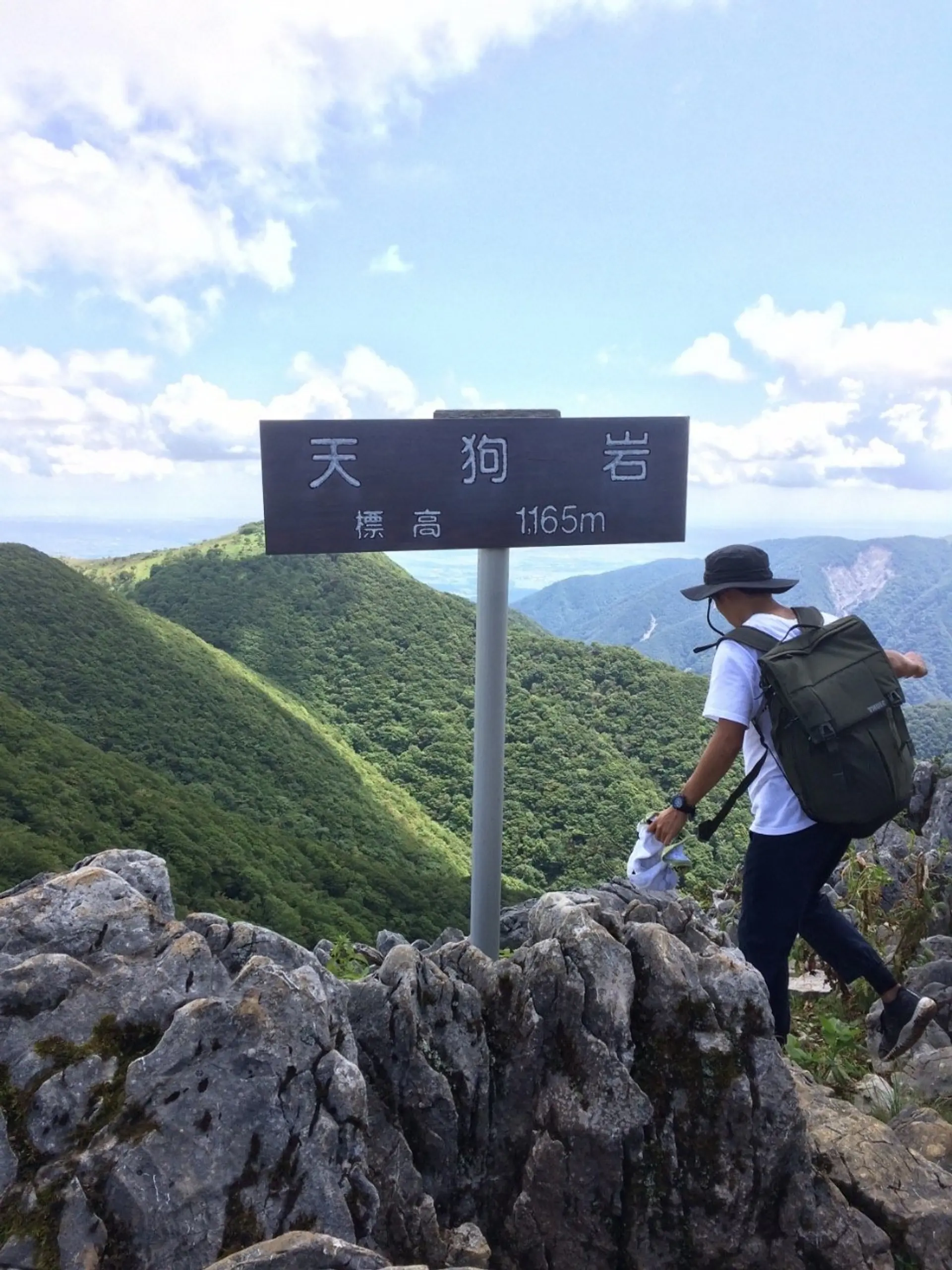
#天狗岩
藤原山荘から藤原岳山頂と逆方面に約45分、歩いた位置にあります!藤原岳の最高点で標高1165mもあります!竜ヶ岳などの山々も眺めることが出来るビュースポットです!
YOYO!俺は登り詰めたぜ天狗岩、見えるぜ竜ヶ岳の全体が、そこでカップ麺食いな!
#駆け出しラッパーたくじろう
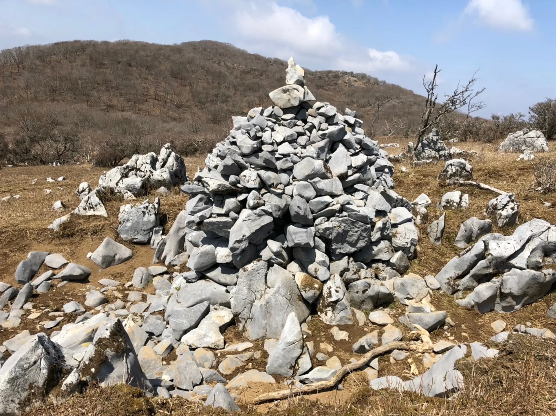
#ビッグケルン
藤原岳には巨大なケルンがあります!この石の数だけ登山者が訪れた証ですね!とても人気な山である事が分かります!こんなにデカければ道に迷う事もありませんね!
ケルンとは:山頂や登山道の道標となるように石をピラミッド上に積み上げた物の事を言います!
ここで一句、
藤原の 看板娘 フクジュソウ
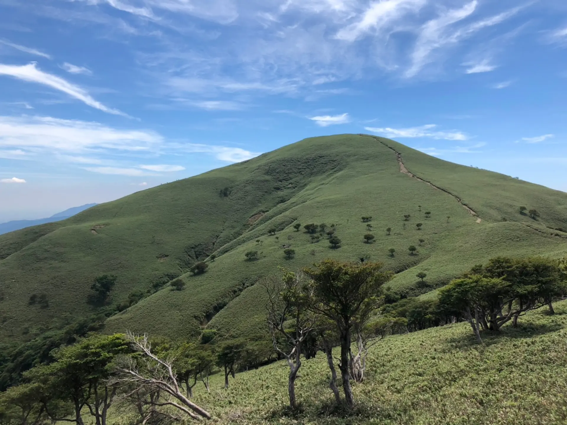
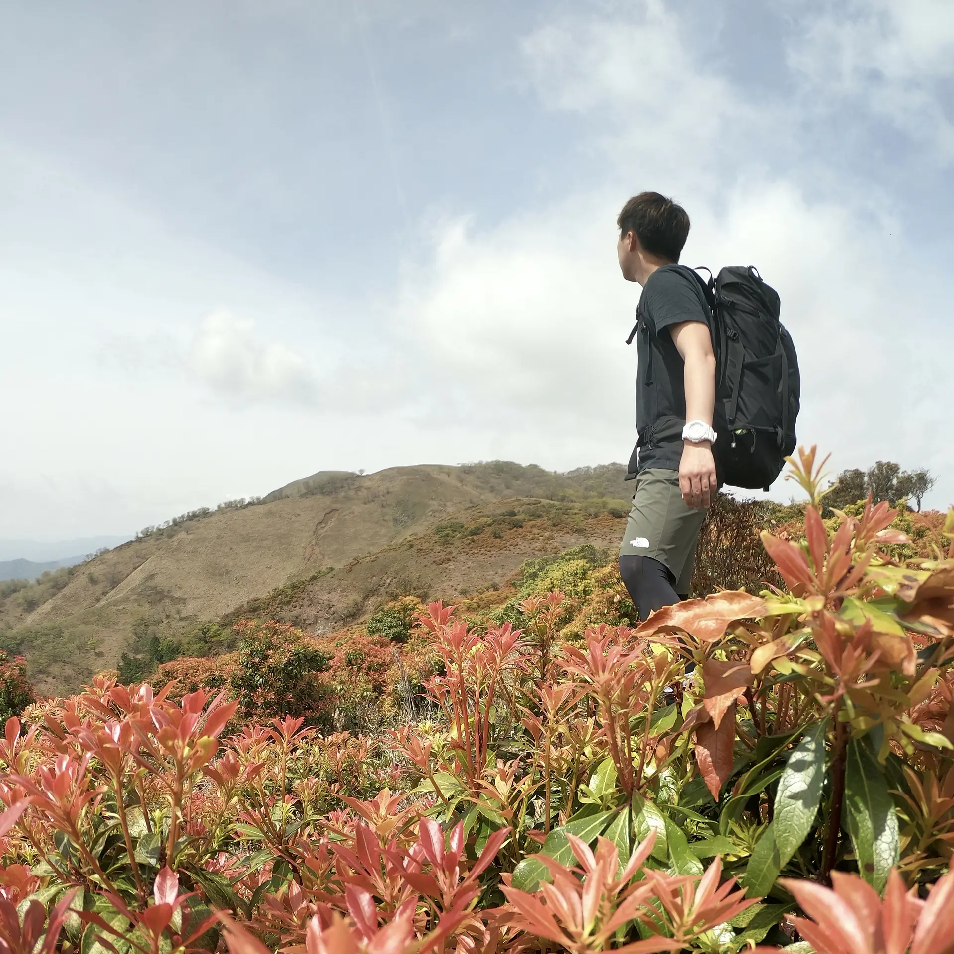
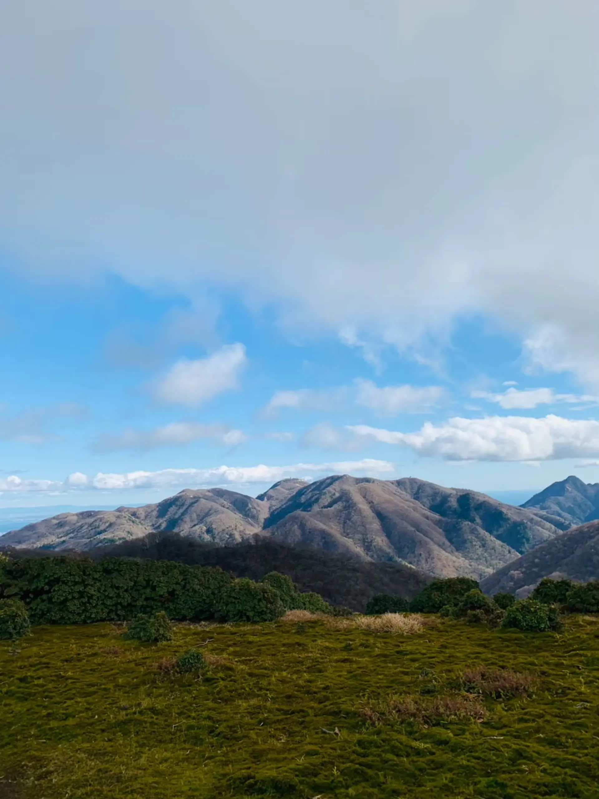
竜ヶ岳 (標高1099m)
登山レベル★★☆☆☆
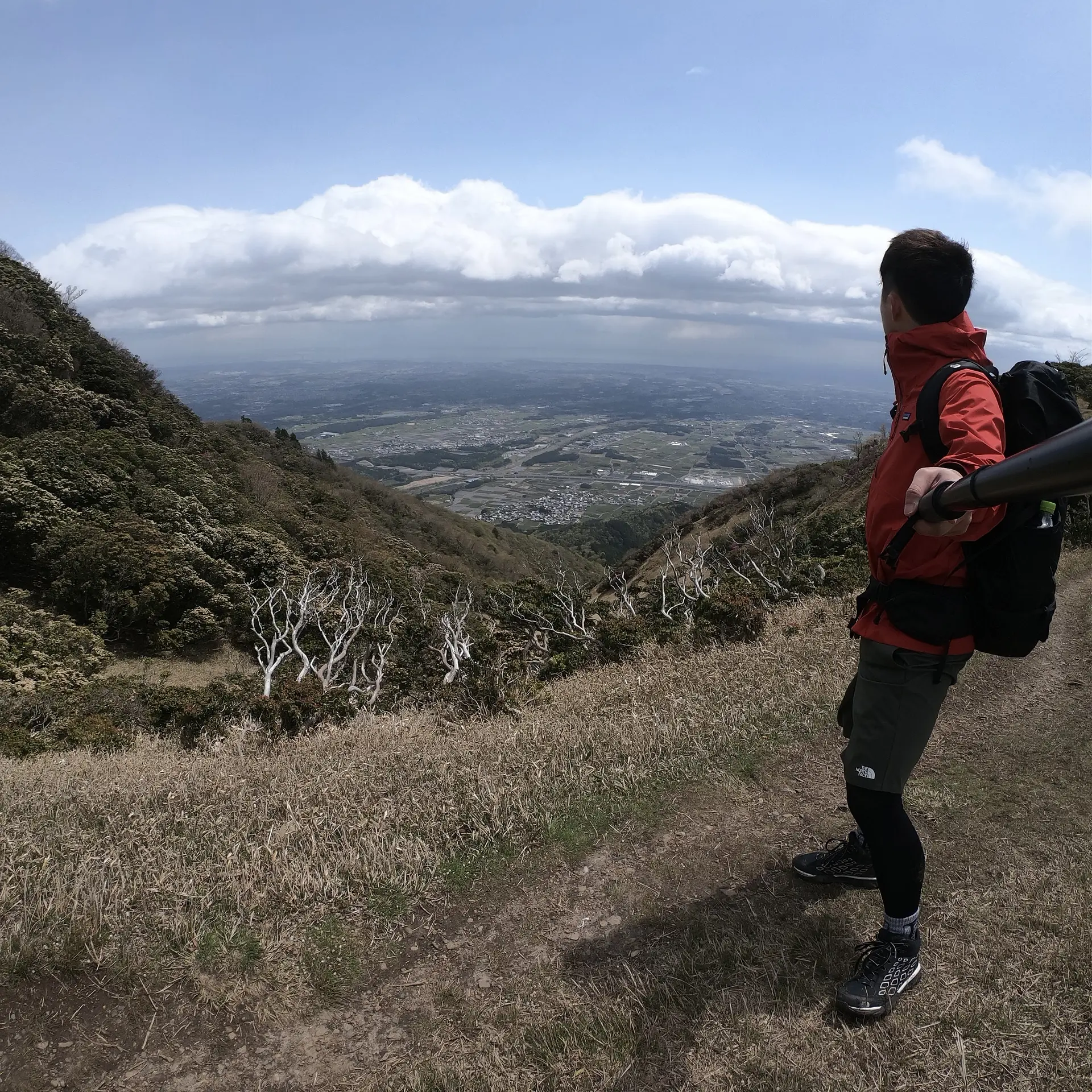
三重県いなべ市と滋賀県東近江市の境にたたずんでいて、釈迦ヶ岳と藤原岳の間に位置しています。他の大山に負けない四季折々の表情を持っていて、春夏は空と緑と先まで続く小道のコントラストが素晴らしく、秋には赤い羊さん(シロヤシオという木の紅葉)に会いにくる人も多いです!冬は白い羊さんになるとかならないとか・・・?イケメンなのは名前だけではない、そんな山なのです。
■ASOBISIAチョイスの登山コース
遠足尾根登山口~(山頂までの道のり約2時間半)
◆アクセス
宇賀渓キャンプ場の駐車場から徒歩15分弱のところ右手側に小さな看板があります。
竜ヶ岳
入山料200円(駐車場利用者は不要)
160台
<駐車料金(1日あたり)>
大型バス(要予約):4,000円
小型バス:2,000円
普通車:500円
二輪車:200円
東海環状自動車道「大安IC」から8.3km(約15分)
東名阪自動車道「桑名IC」から20.2km(約35分)
名神高速道路「八日市IC」から29.2km(約40分)
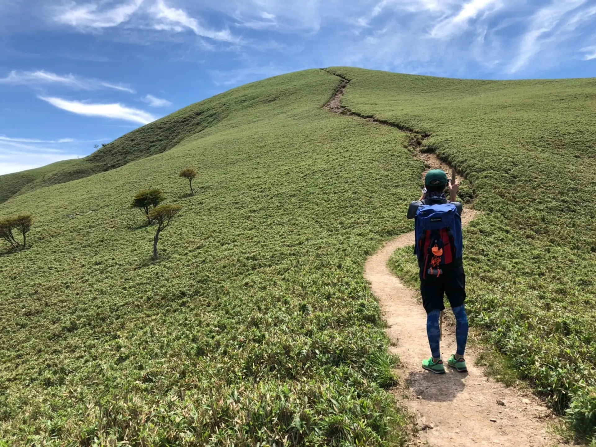
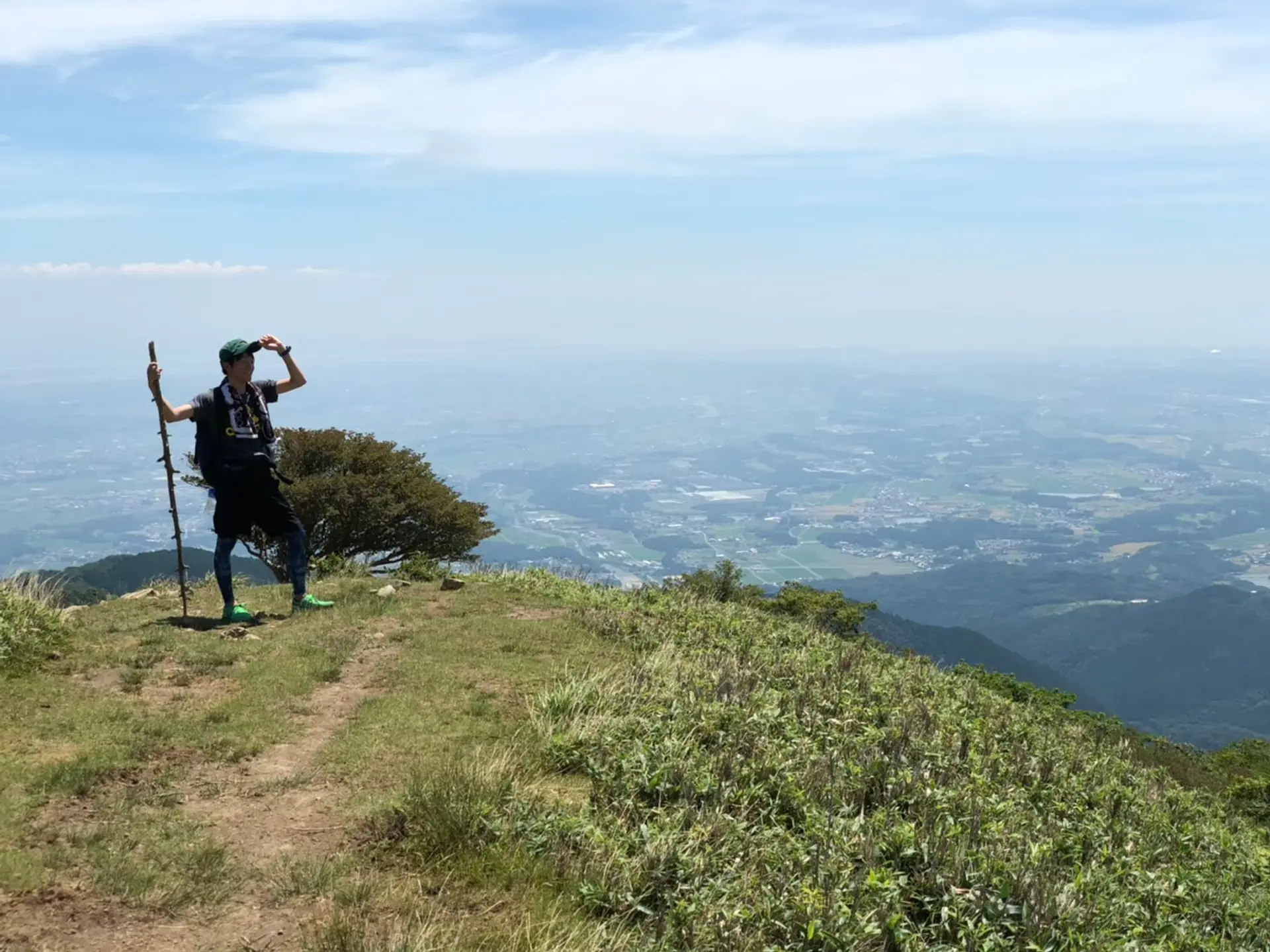
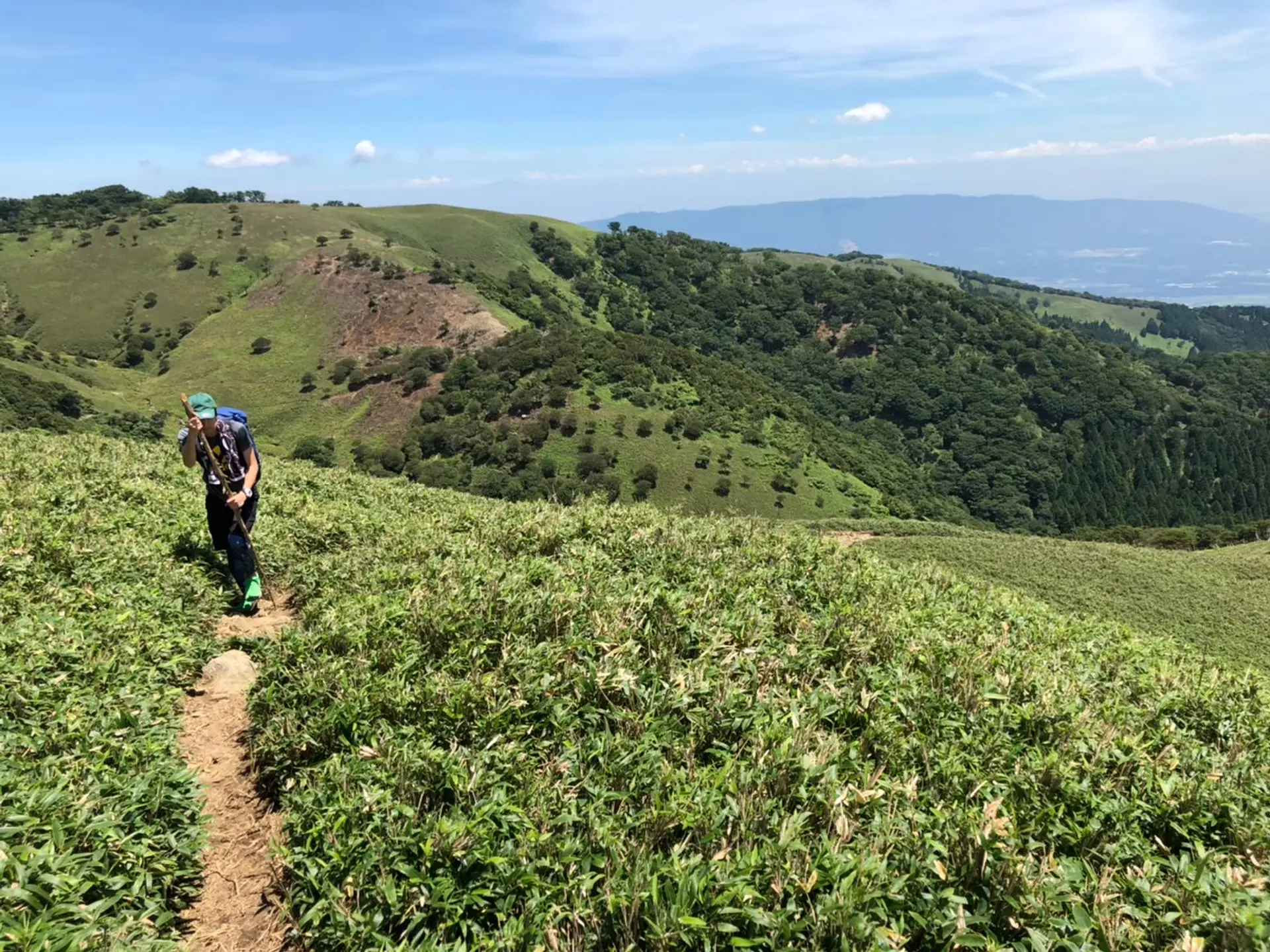
#竜の尾根
頂上が近づいてくると、冒頭で記載した青と緑と茶のコントラストが際立つ景色が現れます。どんな立ち方をしても必然的に映えてしまう絶景です!SNSのトプ画選びに悩んでいるそこのあなた、新しいトプ画撮影は是非竜ヶ岳へ!!笑
#三重がまる見え!
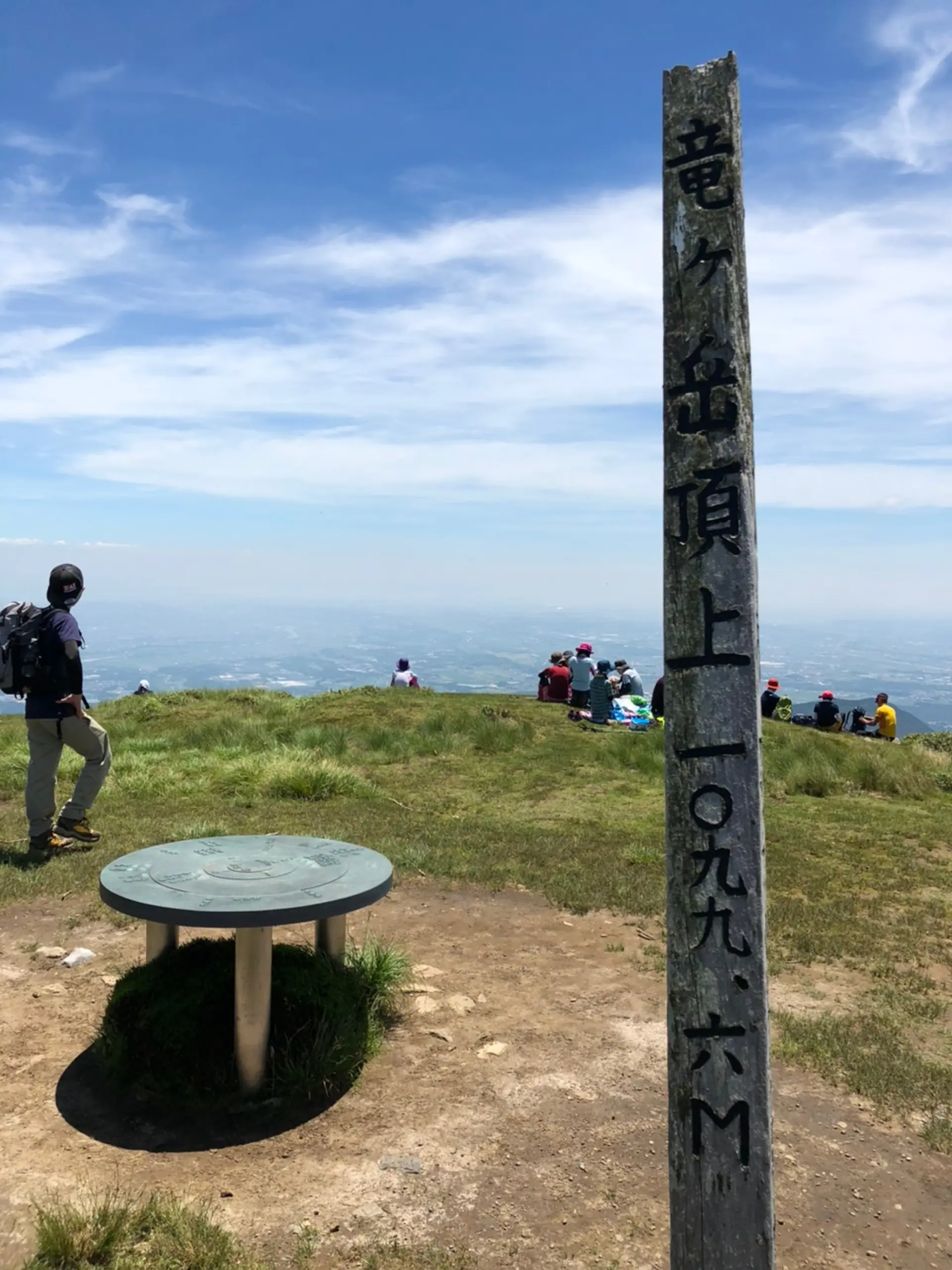
頂上からの眺望頂上は360℃のパノラマビューとなっていて、天気がいいと琵琶湖や辺りの山々、三重の町が一望出来ます!ミエがまるミエ!なーんつって☆
運が良ければ富士山も??三重から富士山見えるって素敵やん↑
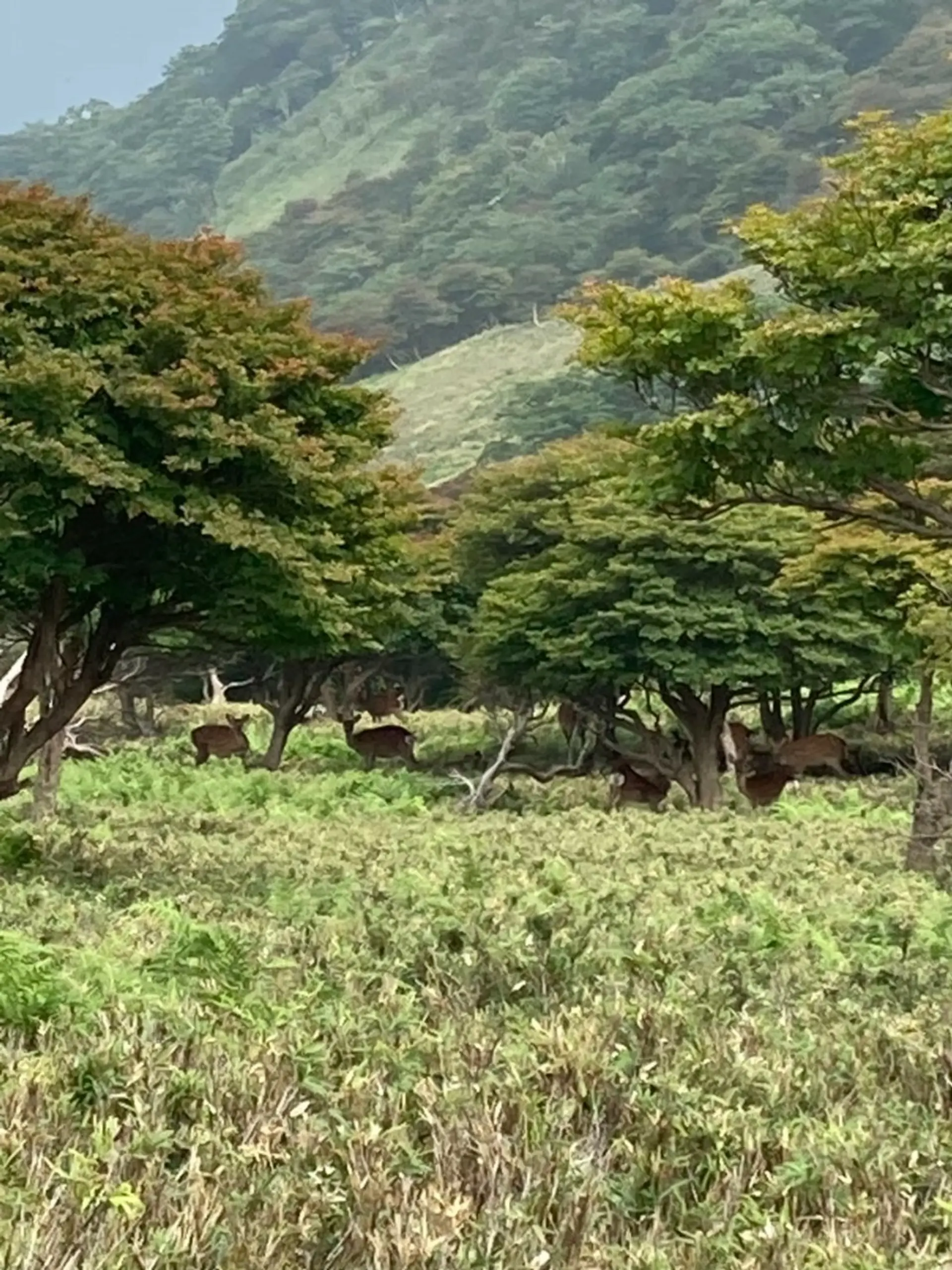
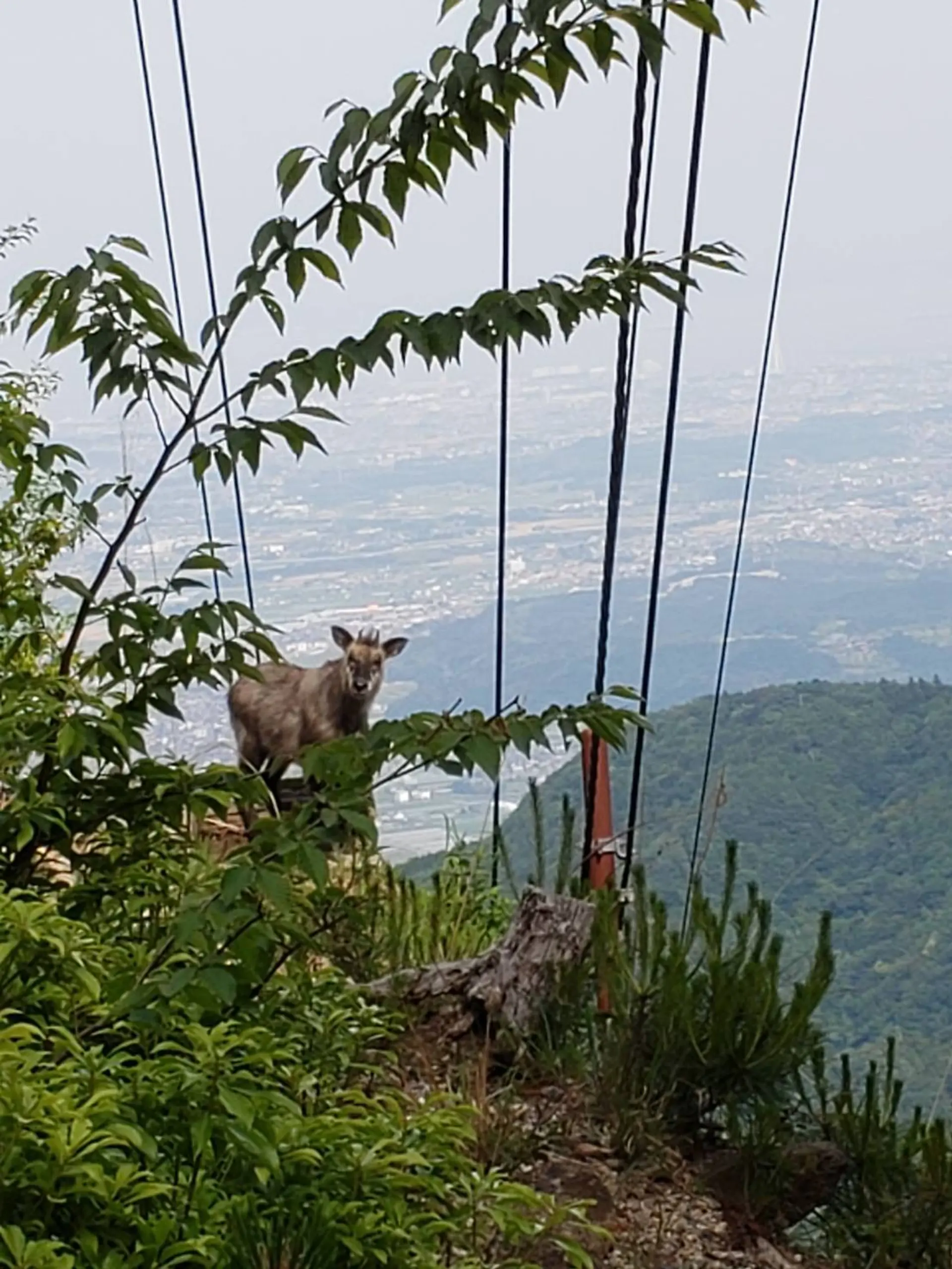
#こもしかくんのライバル
御在所岳がカモシカなら、竜ヶ岳はニホンジカです。運が良ければこもしかくんをもしのぐキューティーアニマルが総出で歓迎してくれます!こもしかくんピンチ!笑笑
ここで一句、
長い丘 赤い羊と 緑の竜
釈迦ヶ岳(標高1092m)
登山レベル★★☆☆☆
三重県菰野町と滋賀県東近江市の境に堂々と君臨しております!お釈迦様が寝ている姿に似ていることから、釈迦ヶ岳と名付けられたそうです。パノラマ縦走も出来ちゃう指折りの山でもあるんです。途中の瓦礫(ガレ)が見所でスリル満点ですが、はしゃぎすぎて滑落しないように、そしてお釈迦様の睡眠をさまたげないようにそろりそろりと進んでくださいね!
■ASOBISIAチョイスの登山コース
朝明公園登山口~(頂上までの道のり約2時間半)
◆アクセス
朝明駐車場(朝明ヒュッテ)。約70台駐車場可能でトイレもありです!登山口は駐車場すぐ側です。
釈迦ケ岳
近鉄菰野駅から朝明ヒュッテ行きバス(季節運行)26分終点下車徒歩180分
#ガレの上のCrazy
釈迦ヶ岳の魅力はなんと言っても雄大でスリル満点な展望スポットが数多く存在しているところです。Myスポットを見つけて、壮大なパノラマの一部となってみませんか?みなさんのCrazyな一面を最大限に引き出してくれるアソビ場になっていると思います!新しい自分に会いに行こう!
Crazy Crazy Crazy スリルモンスター♪
緑の山からやってきた♪
Crazy Crazy Crazy 喜んだ♪
ガレの上の男の子♪
自分の実力に見合った登山をしましょう。
#釈迦の瓦礫
釈迦ヶ岳の瓦礫で撮影した写真です!スリル満点!この瓦礫を目当てに釈迦ヶ岳に訪れる方も多いと思います!落ちないように気をつけて渡りましょう!
YOYO!沢山流した汗、たどり着いた釈迦のガレ、危ない渡り方は辞めぇ( ̄^ ̄)!!!
#駆け出しラッパーたくじろう
ここで一句、
釈迦の瓦礫(ガレ) みんなで渡れば こわくない
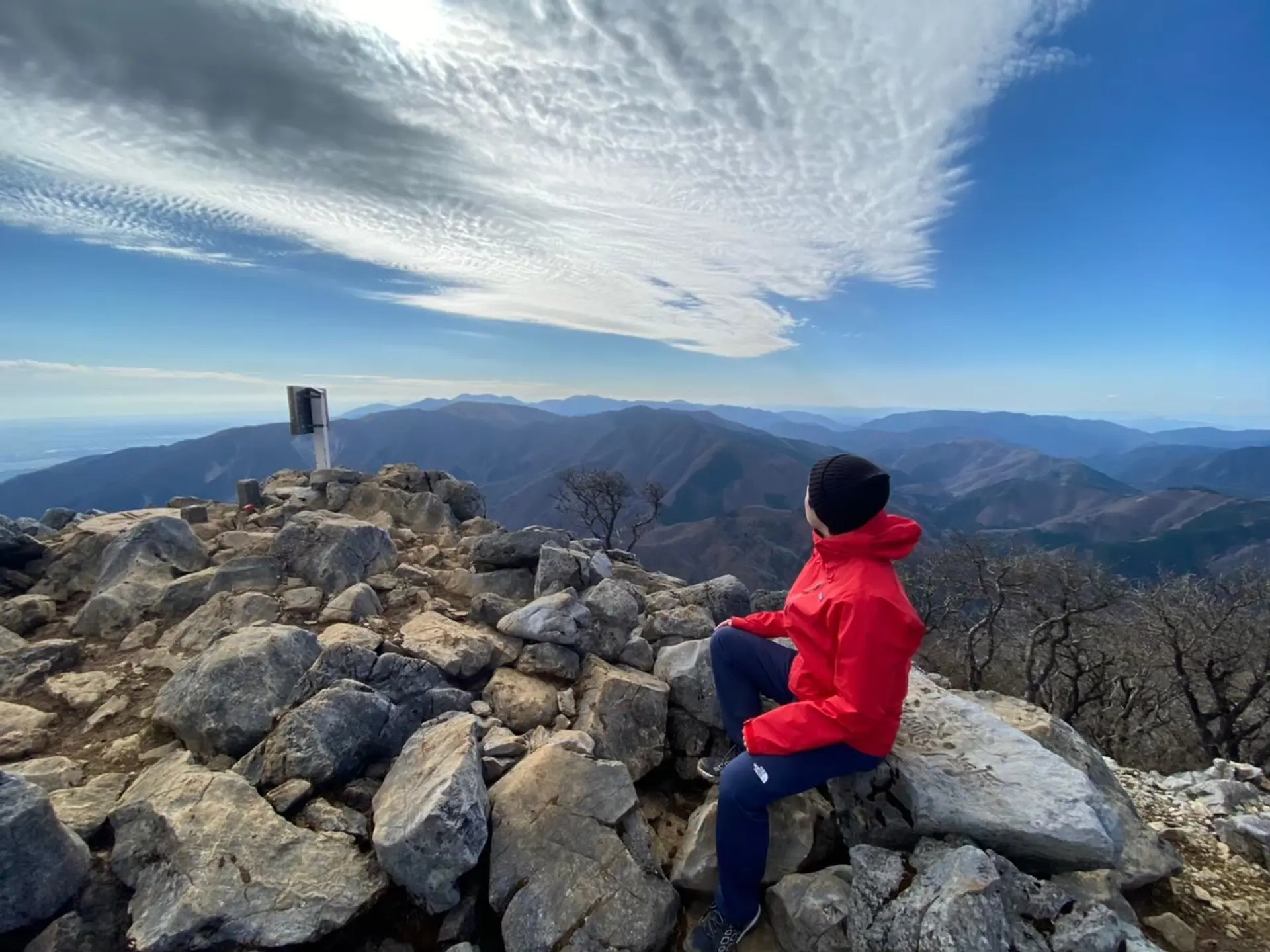
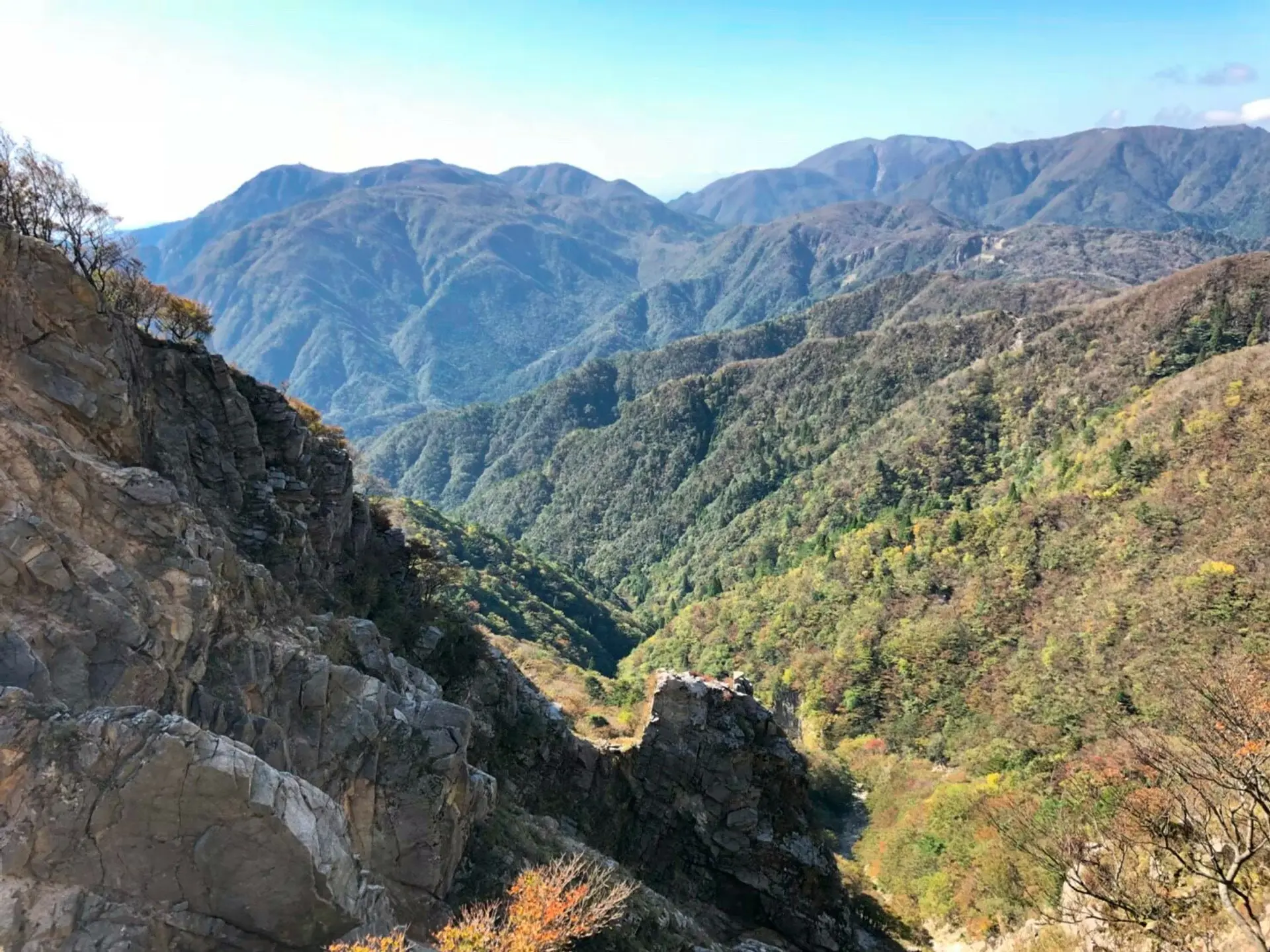
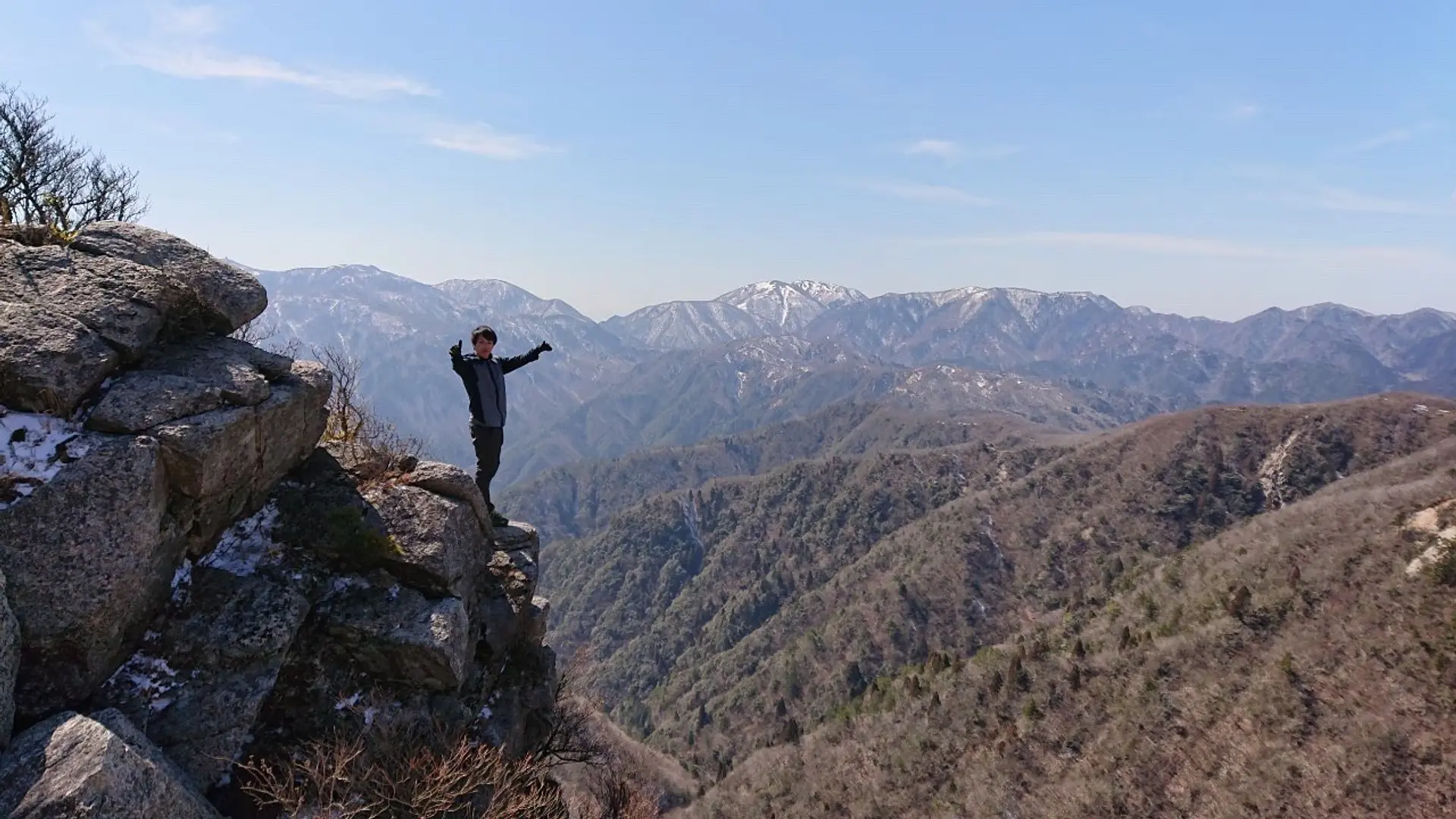
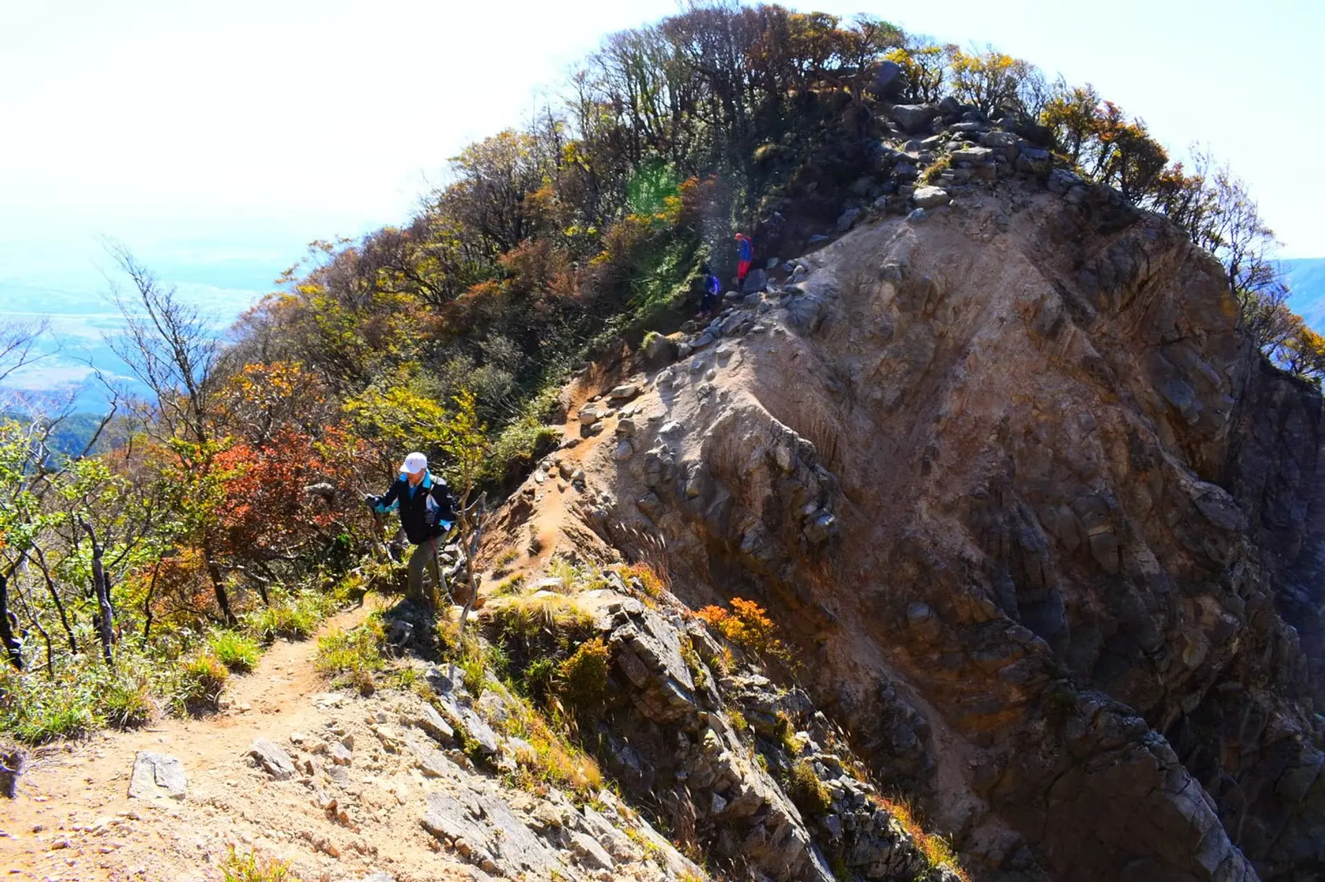
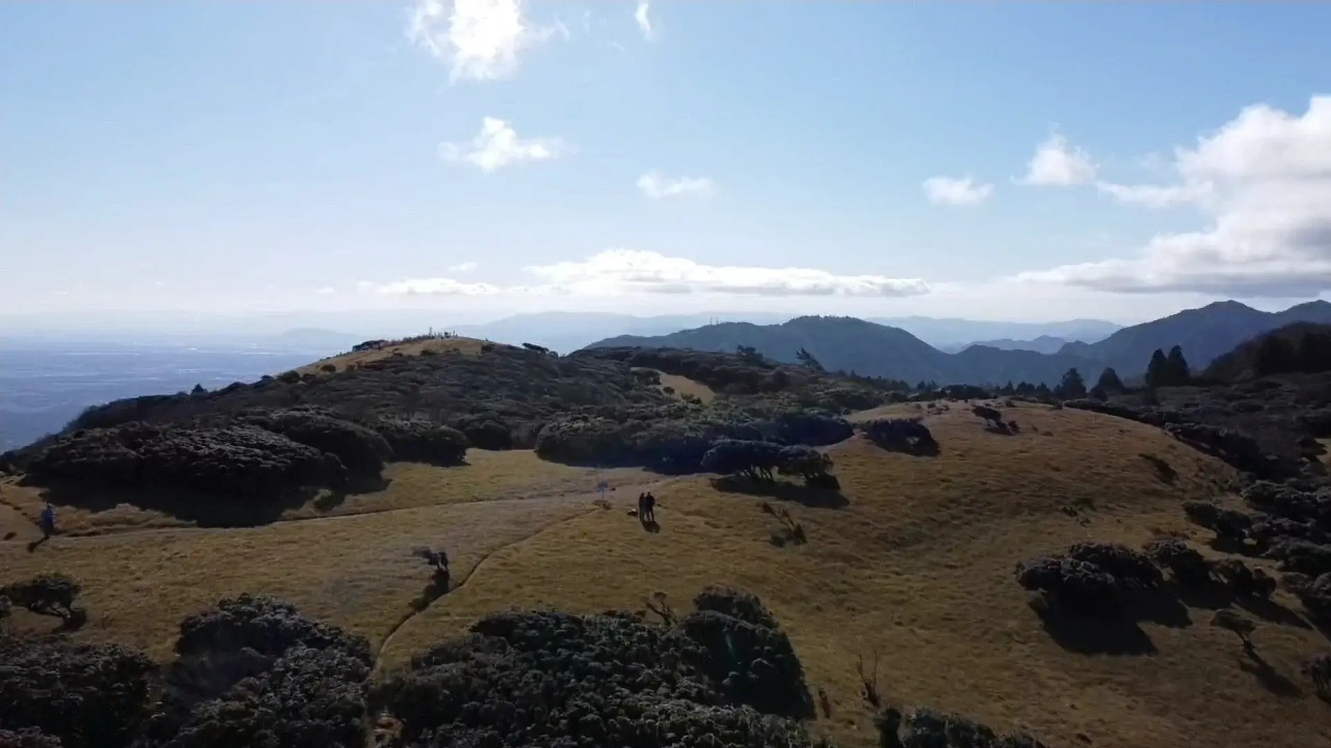
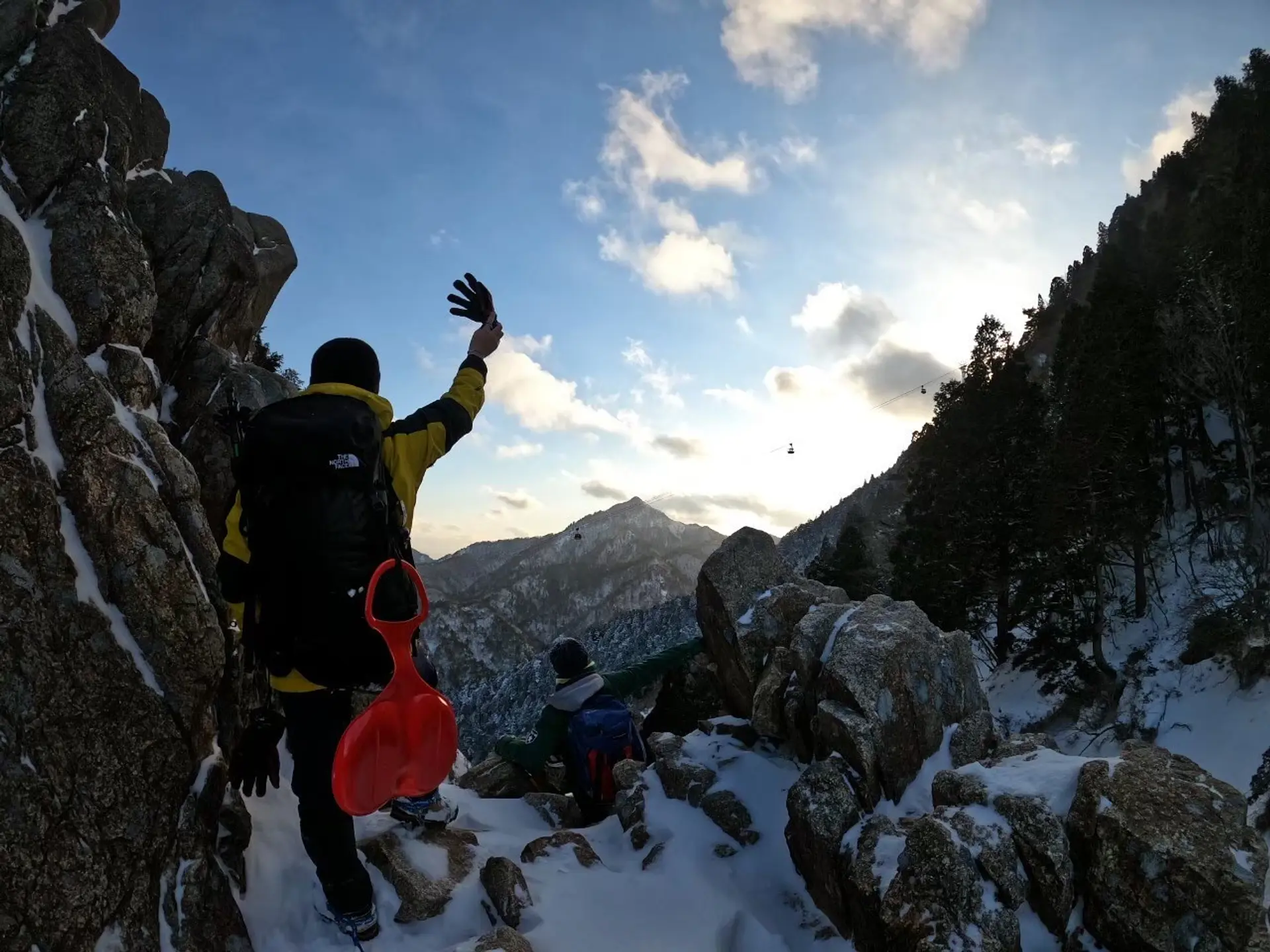
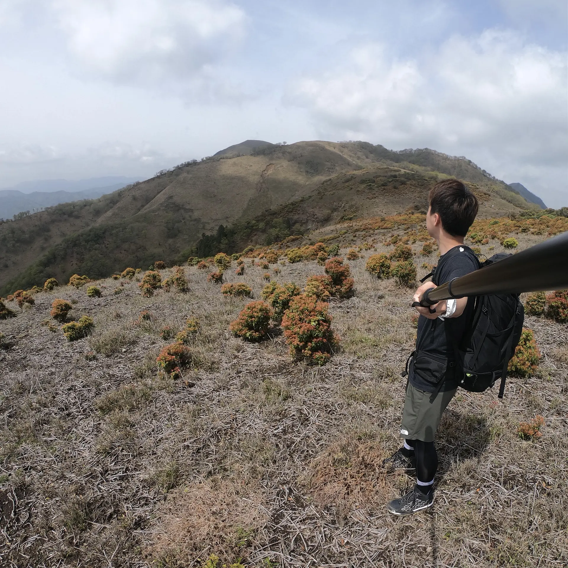
雨乞岳(標高1238m)
登山レベル★★★☆☆
三重県のお隣さん、滋賀県に君臨する雨乞岳は、鈴鹿セブンマウンテンの中では最高峰の山です。整備された道が少なく自然に造りだされた登山道が推し★です!登山道は「え!?ここはジブリの世界!?」と錯覚するほど美しく、癒し空間を感じながら登山することができます。
この写真は雨乞岳山頂付近の尾根から御在所岳・鎌ヶ岳を写した1枚。
山頂には、涸れることのない池”大峠ノ沢(おおとうげのさわ)”があり、雨乞い信仰が行われていたことが名前の由来だそうです。
雨よ降れ降れもっと降れ♪だけども登山中は、やめてくれ~~~
■ASOBISIAチョイスの登山コース
武平峠~(山頂までの道のり約3時間)
◆アクセス
名神高速 菰野ICで下車し、国道577号線を約40分道なりに行くと武平峠トンネルの手前、左手に駐車場が見えてきます。御在所岳の中登山口から鈴鹿スカイラインを少し上がった所です。ここから雨乞岳・鎌ヶ岳・御在所岳へアタックすることができます。
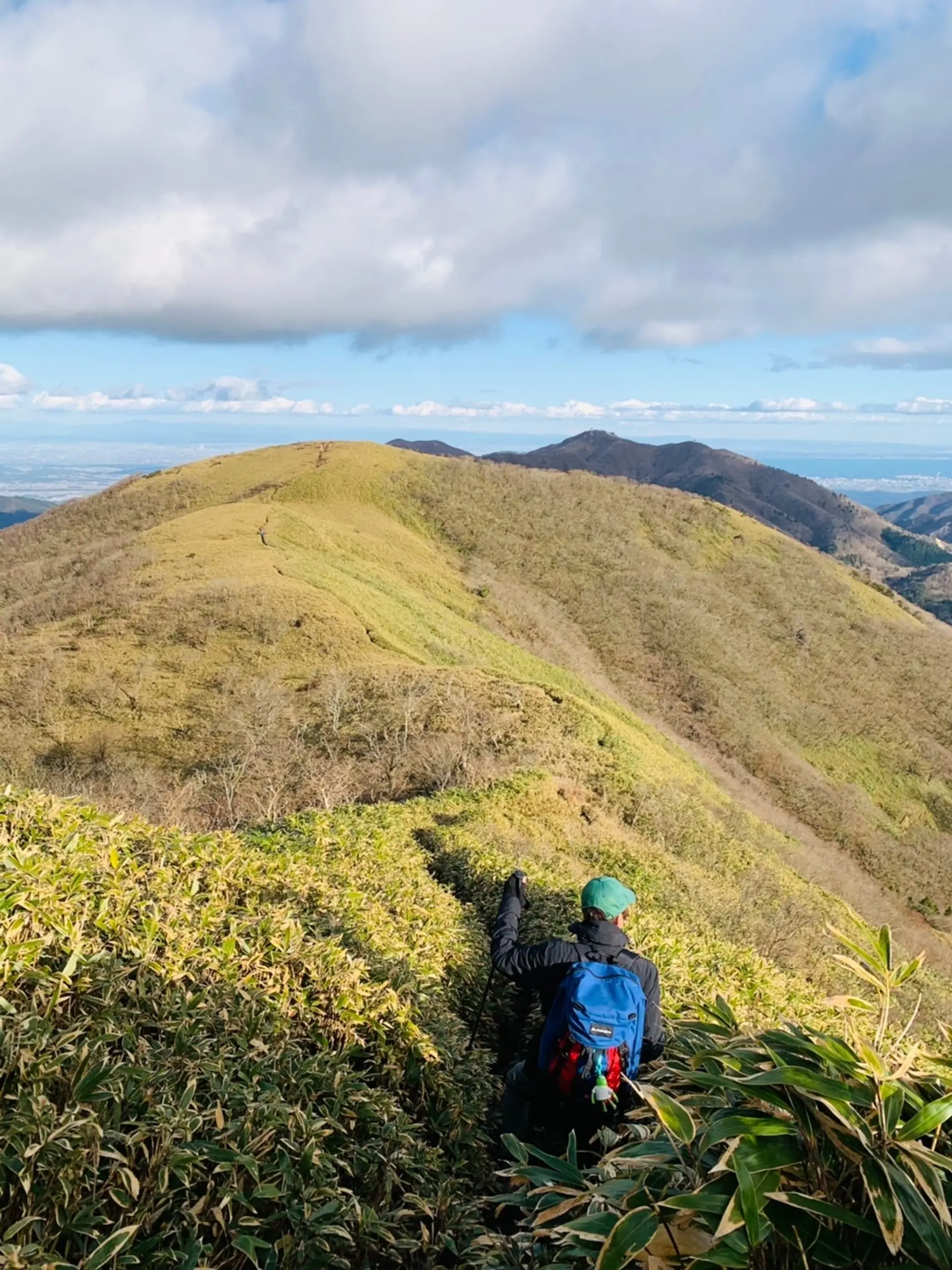
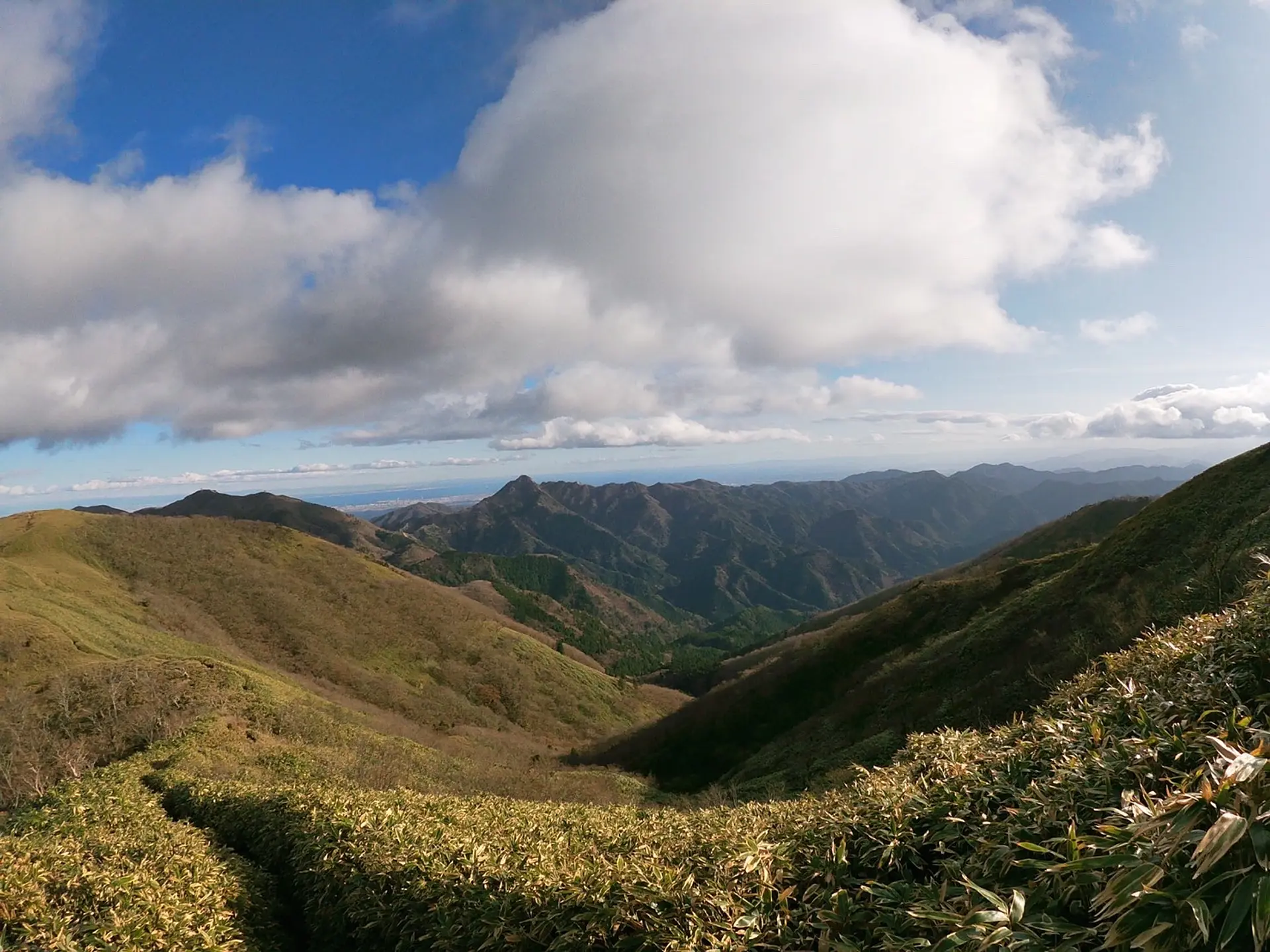
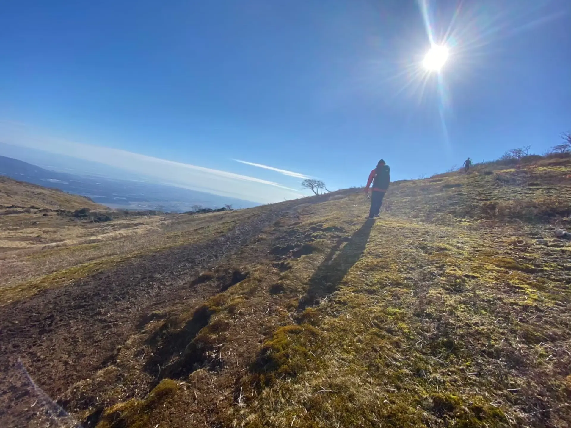
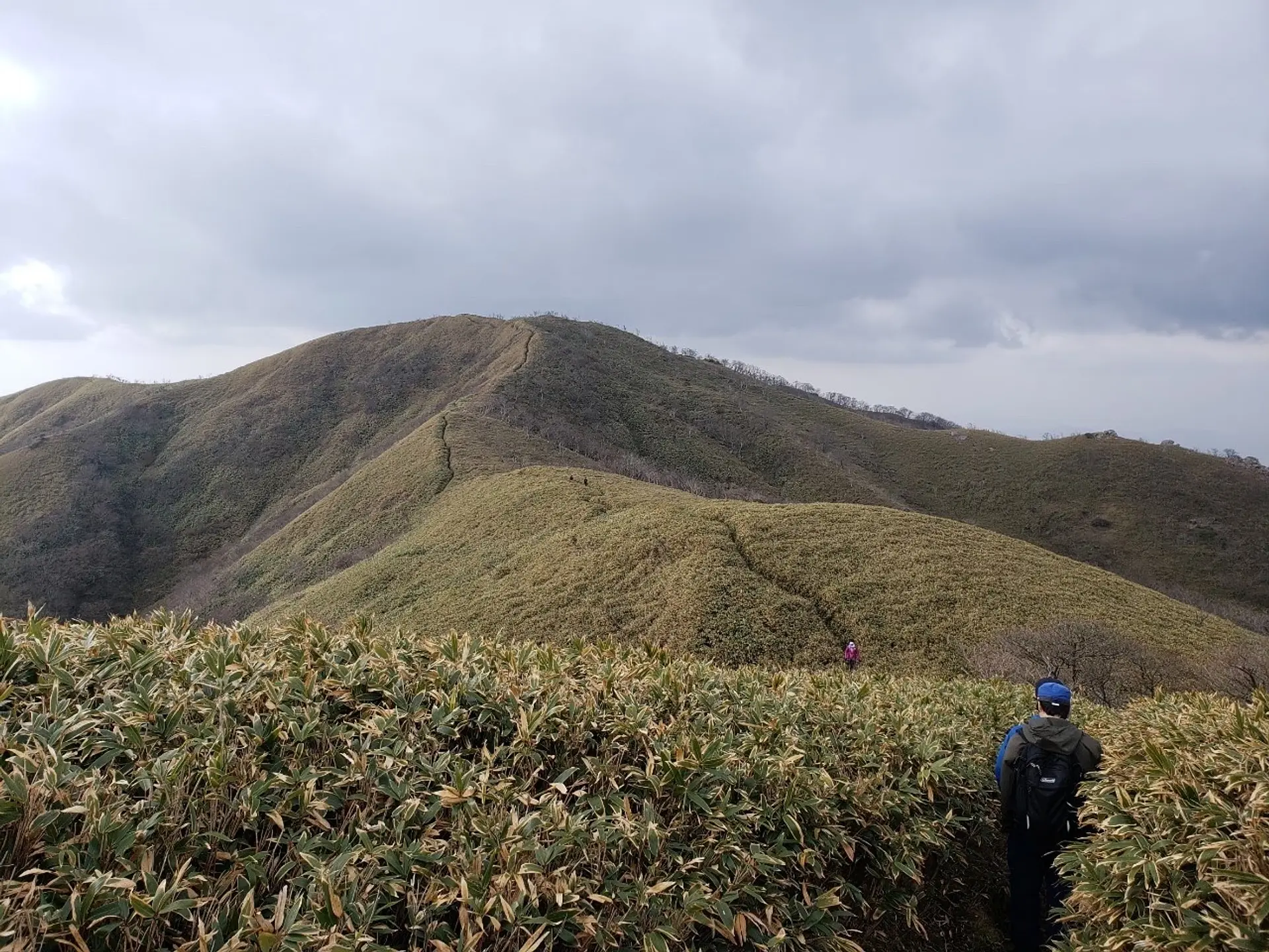
#クマザサの試練
太陽の恵みを受け、山頂付近にもっさりと生い茂るクマザサ。背丈ほど伸びていて、クマザサに埋もれかぎ分けて進む道は冒険感たっぷりです!自然を直に!肌で感じることができるでしょう!こんな体験ができるのは、鈴鹿セブンマウンテンの中でここだけです!
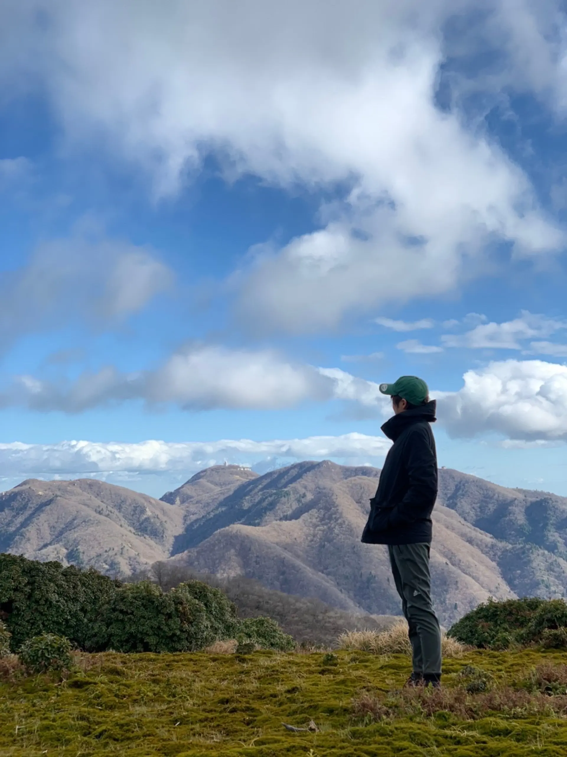
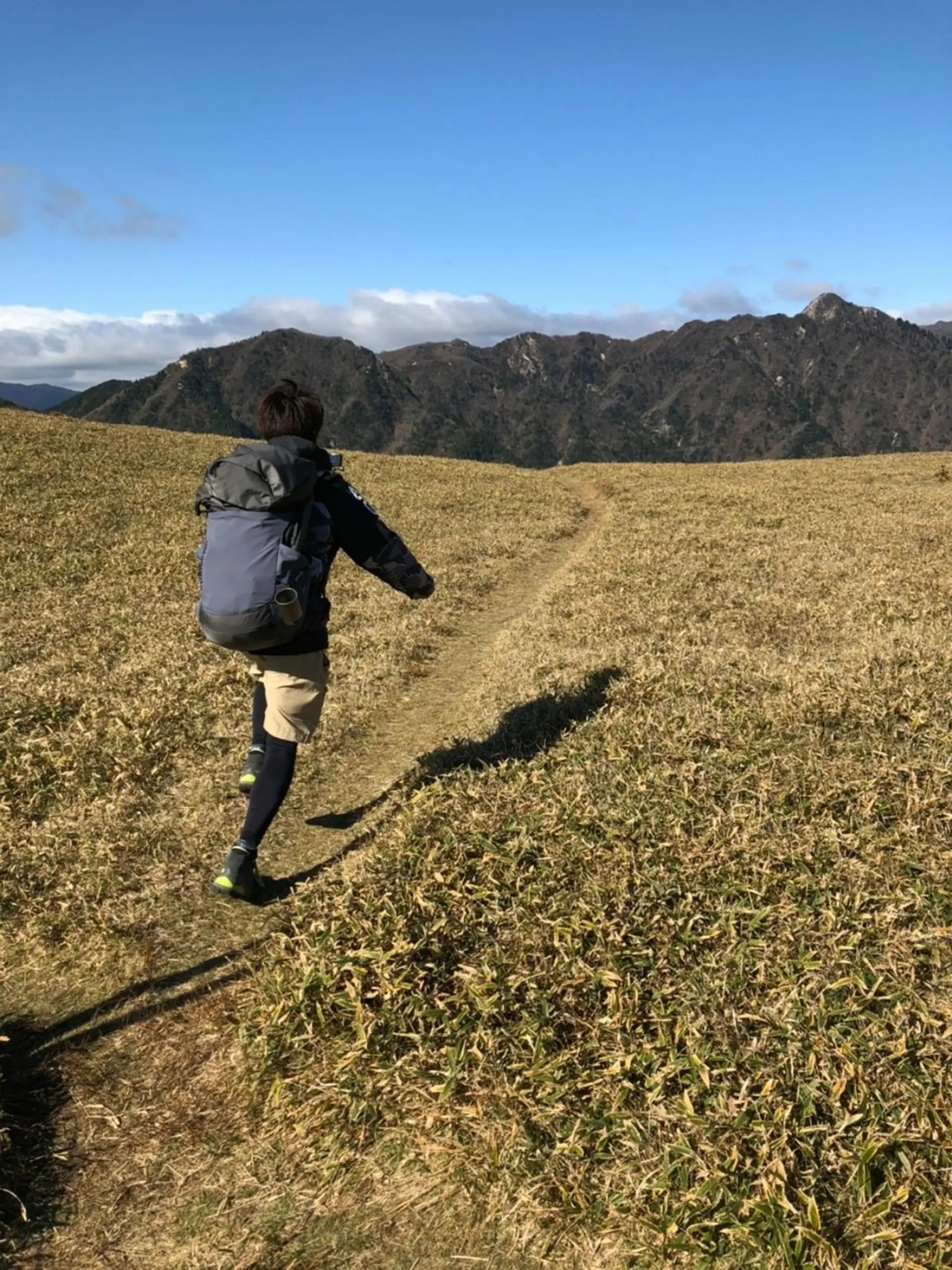
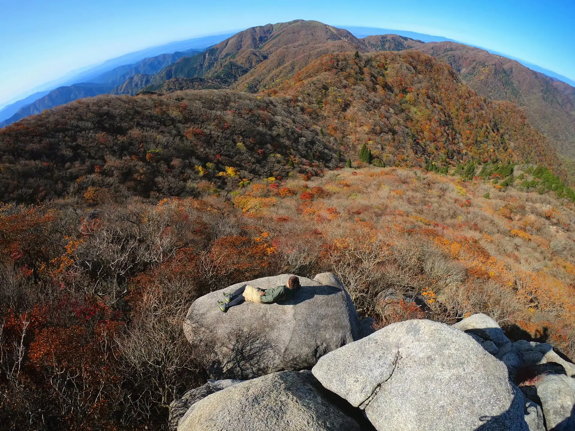
#イブネからドヤっ
雨乞岳山頂から北方へ伸びる尾根を進むと、”イブネ”という山があります!道中には杉峠や佐目峠などがあり、歩きゴタエある登山道です!御在所岳や鎌ヶ岳も拝むことができ、「あっちの山にも登ったんだな~!すごいな自分、やるじゃん自分☆」と達成感を味わえます!登山っていいなと思える瞬間です!また登りたい欲がマシマシになること間違いなし!!そんなことを感じながらドヤっている一枚です。
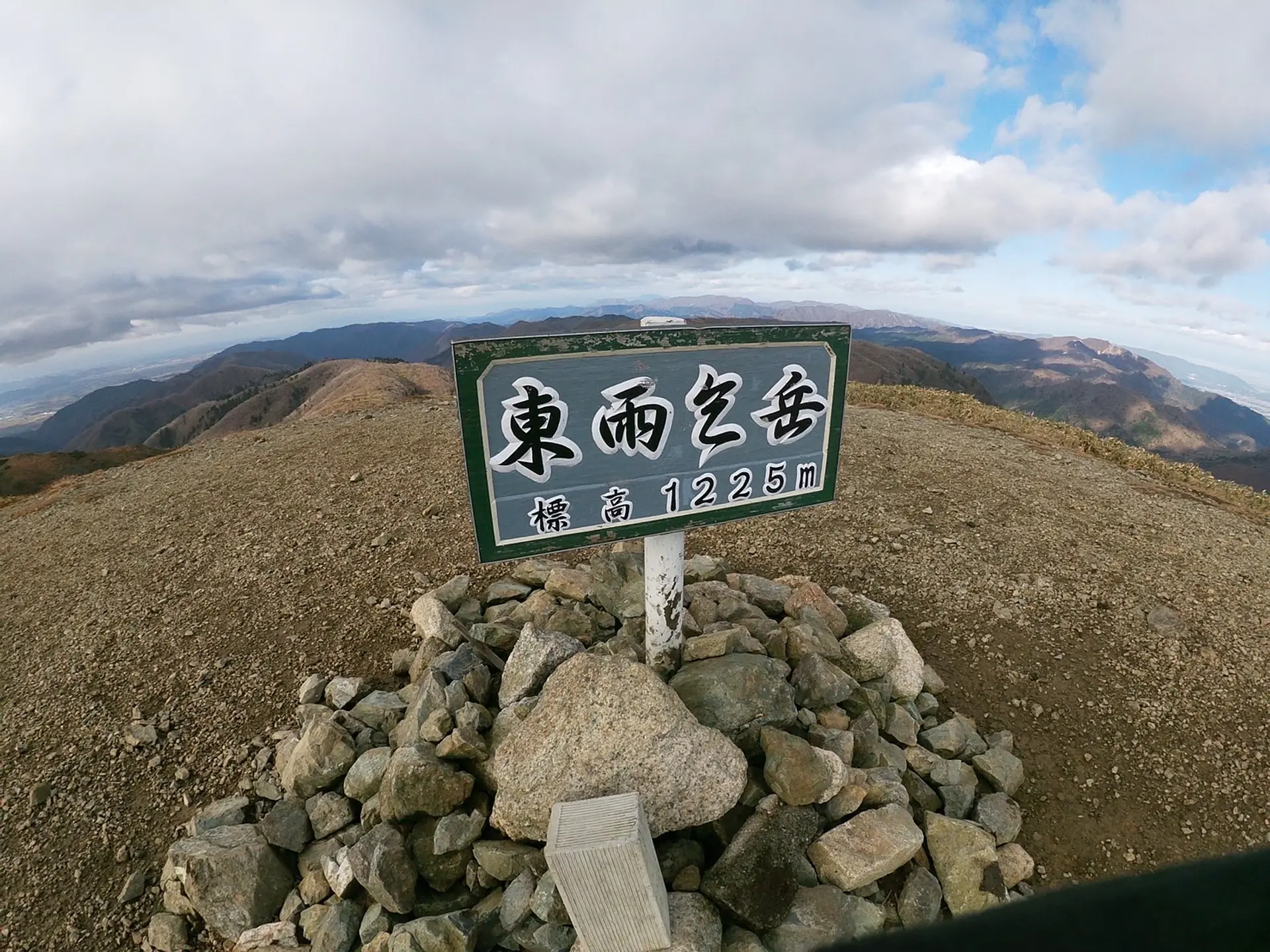
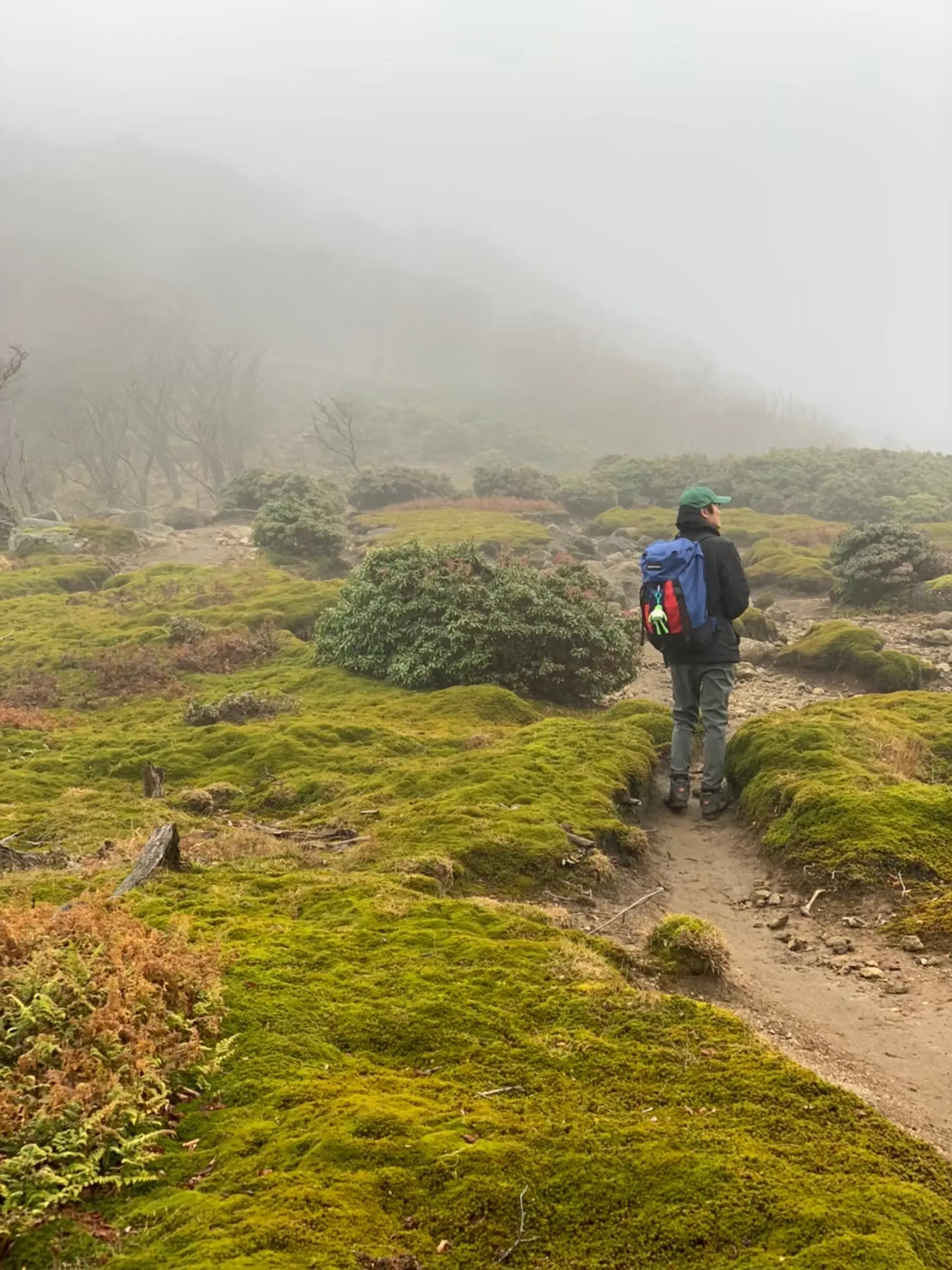
#一旦休憩、東雨乞岳(標高1225m)
武平峠コースから登ると最初にたどり着くピークが東雨乞岳。
あれ?ここ頂上?と思ってしまう方もいると思いますが、雨乞岳山頂まではもうひと踏ん張り!
この立札以外は、360℃、平地!HEY!CHEEEESE!視界が悪いときは来た道がわからなくなるのでしっかり確認しましょう!SO SHIMA SHOW!!
ここで一句、
山頂で ただ幸せの 雨を乞う
入道ヶ岳(標高906m)
登山レベル★★☆☆☆
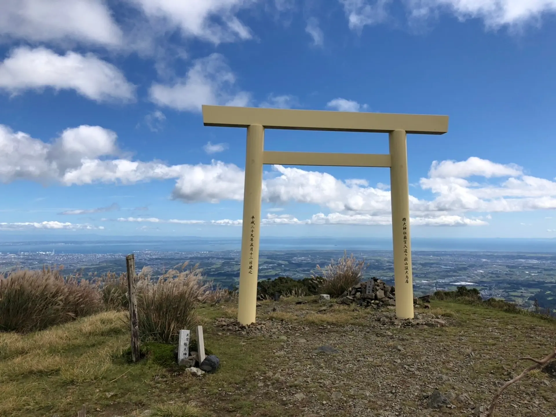
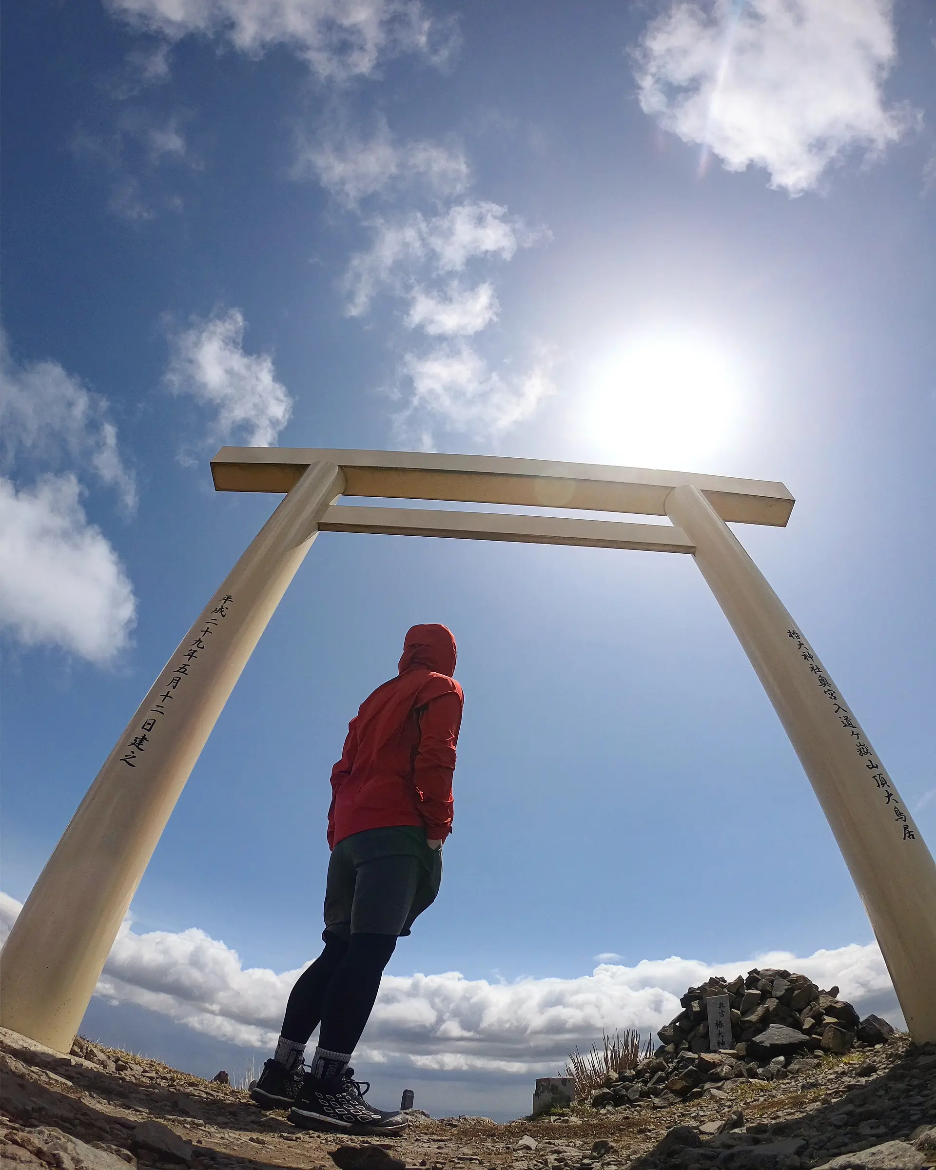
鈴鹿市にある鈴鹿セブンマウンテンの中で最も南に位置し、標高が一番低く比較的登りやすい山です。麓には椿大神社もあり、各地から年中多くの人が訪れます!椿大神社の御神体でもあり、ゴッドマウンテンと呼んだり呼ばなかったり・・・。登れることに感謝ですね!入道ヶ岳といえばこの鳥居!!(#天空の鳥居)山頂に鳥居があるって神秘的で幻想的でなんだか冒険心をくすぐられますよね♪
非現実的な景色を是非目の当たりにしてみてください!
■ASOBISIAチョイスの登山コース
北尾根登山口~(頂上までの道のみ約2時間)
◆アクセス
椿大神社の第3駐車場が登山客用の駐車場となっています。椿大神社側の奥に進むと愛宕社(あぬごしゃ)と書かれた石で出来た鳥居があり、そこから登り始めます。
入道ヶ岳
#俺の景色
鳥居のすぐ側、頂上からの景色です。鳥居周辺は高い木がなく視界が開けていて、鈴鹿の町だけではなく遠くのあんな所やこんな所まで一望出来ます。景色の満足度、保証致しますm(_ _)m
#鳥の目から見た景色
頂上付近になると木が減り視界が開けて来ます。傾斜がほとんど無い緩やかな道になり、ピクニックスポットが沢山あります。ワンちゃんと一緒に駆け回るのにもうってつけかもしれませんね!(笑)
鈴鹿セブンマウンテン全てに言えますが、登り始め~頂上まで同じ山でも景色の変化が多く、最初から最後まで本当にワクワクさせてくれます!
#山は僕らのパワースポット(笹の草原Ver.)
入道ヶ岳の山頂付近からは鎌ヶ岳,御在所岳をはじめとした他の鈴鹿セブンマウンテンも眺めることが出来ます。思わず走り出したくなっちゃう景色ってありますよね!
ここで一句、
”登りきる” 椿の花に 思い込め
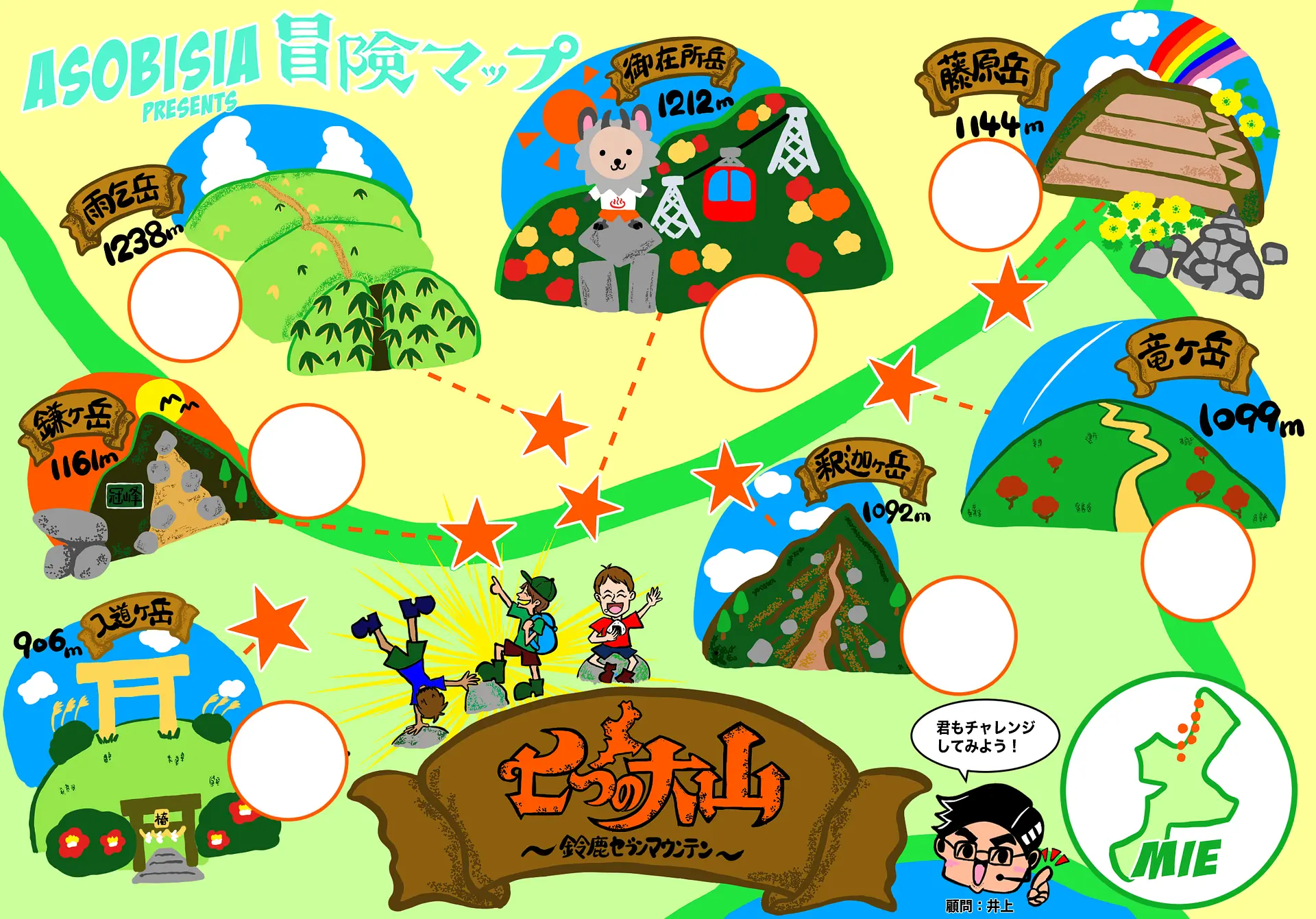
#早速、MAPをダウンロード!!
>>保存方法:画像長押し→画像保存
この冒険MAPを手に入れたあなたは、もう立派な冒険者!!あなたにしか体験できない素敵な物語が待っているはず。。。!ぼくら3人と一緒に、この三重で、鈴鹿セブンマウンテンで、登山してみませんか^^!?あなたの一歩を応援します!
Instagramでハッシュタグ、#七つの大山、#ASOBISIA冒険MAP を付けて自分の冒険をみんなにシェアしよう!
Let's GO!!!
記事としては載せる事が出来なかったASOBISIAオススメの鈴鹿セブンマウンテンの映え写真を2ページ目に載せています!是非、チェックしてみて下さい!
◆◆◆
鈴鹿セブンマウンテンは今回チョイスさせて頂いた登山口の他にも数多くの登山口,登山道があり、本っ当に奥が深く、冒険の終わりはありません!
山についても写真についても語彙力についてもまだまだ駆け出しのASOBISIAですが、皆さんと一緒に冒険してどんどん成長していきたいと思います!!
アウトドアを中心に活動し、魅力溢れる三重の大自然をぼくら流に紹介していきます!!色んな三重の表情を紹介し、行きたくてうずうずするような記事をお届けします!!
全力でアソビ尽くすぞーー!!おぉー!!!
◆◆◆
↓コチラの記事も見てね☆
三重の山がもっと好きになる!「亀山7座トレイル」!!
リンク⇒https://www.kankomie.or.jp/report/1012.html
↓ Follow Us!チャンネル登録よろしくね☆
■Instagram:@ASOBISIA
リンク⇒https://instagram.com/asobisia?r=nametag
■YouTube:ASOBISIA Channel
リンク⇒www.youtube.com/channel/UCKrgfv5STSHezyOWmVwiUOQ
■TikTok:@asobisia
リンク⇒https://www.tiktok.com/@asobisia
御在所岳
鎌ヶ岳
藤原岳
竜ヶ岳
釈迦ヶ岳
雨乞岳
入道ヶ岳
関連スポット
フォレストアドベンチャー・湯の山
北勢
三重郡菰野町三重県初のフォレストアドベンチャー!自然の立木の地上から2~15mの位置に設置された足場から、樹間に空中散歩♪ スリルのある高さ約10mから飛び降りる”ターザンスイング”42種類のアクティビティを楽しめる【アドベンチャーコース】 身長110㎝のちいさい子から挑戦できるので高さが苦手っ・・・でも挑戦してみたいというお客様にもオススメの【ジップトリップコース】 と2種類のコースがあり、どちらも長さ100mを超える”ジップスライド”に、フォレストアドベンチャーではココだけ!2人同時に手をつないでゴールできる"ダブルジップスライド"を体験できるので満足すること間違いなし!! 子供は大人へと一歩近づき、大人は童心に帰れる、お互いに普段見れない一面が見れるかも♪ ぜひ挑戦をお待ちしております!!
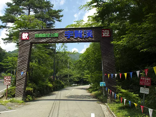
宇賀渓キャンプ場
北勢
いなべ市キャンプ場は現在、再整備中ですので、一時的にご利用制限をすることがあります。 ご不明な点、ご利用に際しては、宇賀渓観光案内所にお尋ねください。 鈴鹿国定公園内の竜ヶ岳の登山口にある、宇賀川の清流と豊かな森林に囲まれた自然溢れるキャンプ場です。透明な水のせせらぎが美しい川原にあります。滝めぐりや砂山登山などのハイキング、川遊びやバーベキューが楽しめます。 都会の喧騒を離れて、是非宇賀渓キャンプ場へ。「宇賀渓に来て好かった」「また来たいな」と思って頂けるキャンプ場造りを目指しています。
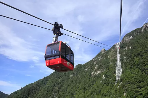
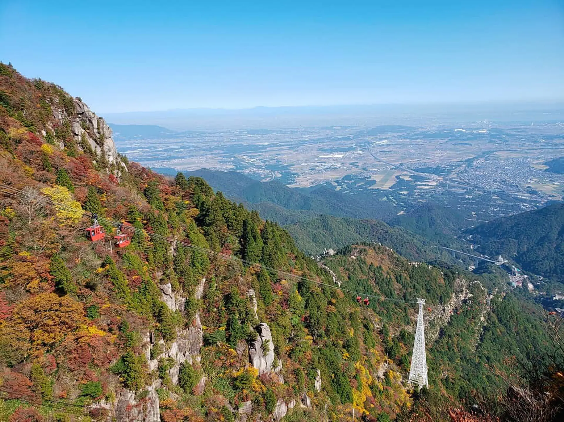
御在所ロープウエイ
北勢
三重郡菰野町全長2161m、高低差780m、所要時間(片道)約15分、世界有数の規模を誇るロープウェイ。春はツツジの花々が山を彩り、夏はアカトンボも避暑にやってきます。秋の紅葉は10月中旬に山上公園から始まり、11月下旬にかけて徐々に麓に降りてきます。冬は美しい自然の芸術「樹氷」に感動!県内唯一のスキー場があり、一年中お楽しみいただけます。 https://twitter.com/GozaishoRopeway?ref_src=twsrc%5Etfw%7Ctwcamp%5Eembeddedtimeline%7Ctwterm%5Escreen-name%3AGozaishoRopeway%7Ctwcon%5Es2 2024年の紅葉の状況はこちら三重の紅葉カレンダー 三重県の紅葉おすすめの名所・穴場特集はこちら 三重県の紅葉特集2024
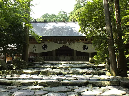
椿大神社
北勢
鈴鹿市開運みちびきの神様として知られる猿田彦大神を祀り、全国から参拝者が訪れます。木々に囲まれた厳かな境内には松下電器の創業者・松下幸之助翁寄進の茶室「鈴松庵」があり、流派を問わず広く一般にも開放しています。