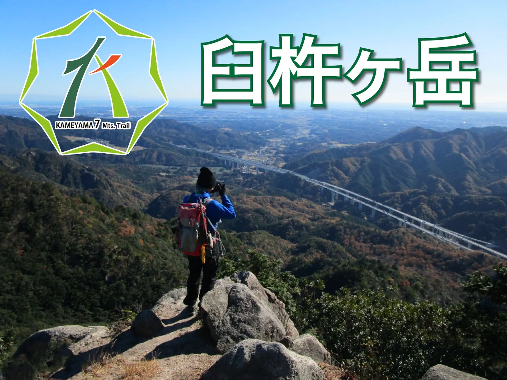
亀山7座「臼杵ヶ岳とは?」見所や駐車場、登山コースを紹介します
掲載日:2022.02.25
臼杵ヶ岳は標高697mの山で、頂上付近の展望岩は伊勢湾を一望できる絶景ポイント!登山道には見晴らしのいい尾根道が多く、山名の由来になった花崗岩があるなど、見所満載です。この記事では臼杵ヶ岳の駐車場や登山コースを紹介します。
みえ旅カメラ部のふがまるちゃんが三重をもっと好きになる情報をお届け!今回は亀山7座の1つ「臼杵ヶ岳」をテーマにした内容です。
目次
臼杵ヶ岳とは?
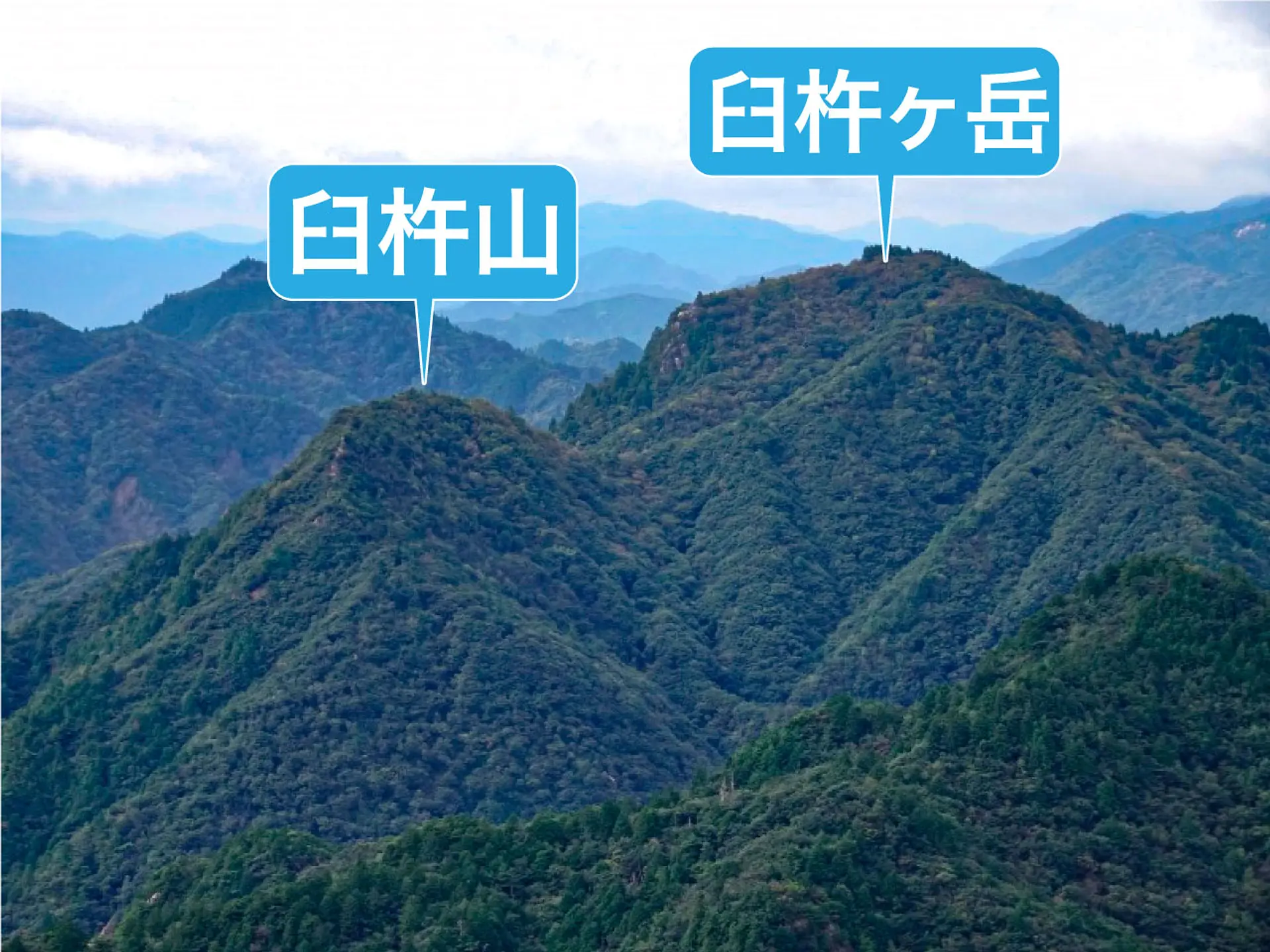
臼杵ヶ岳(うすきねがたけ)は標高697mの山で、無数の露岩や岩峰が点在する花崗岩の岩尾根が特徴的です。
標高630mの臼杵山(うすきねやま)と隣り合う位置関係にあり、この記事で紹介する登山コースでは臼杵ヶ岳と臼杵山の両方を登頂するルートになります。
臼杵ヶ岳の見所・魅力
この記事で紹介する登山コースの見所や魅力を詳しく紹介します。※臼杵山登山口からスタートする登山コースになります。

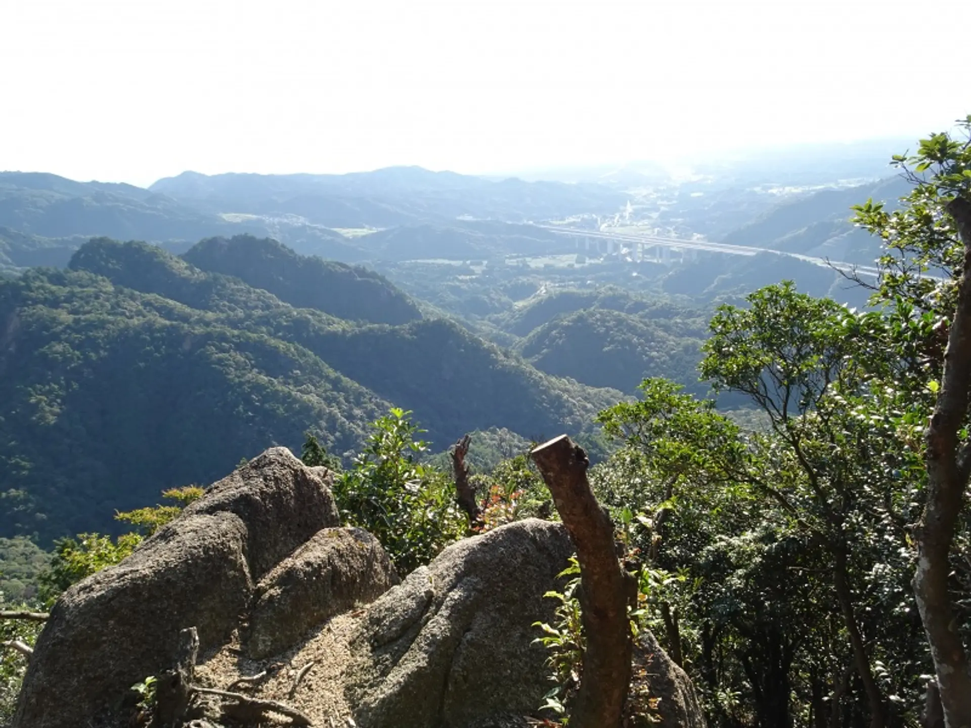
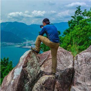
展望岩からの絶景
臼杵ヶ岳の山頂付近にある展望岩は亀山7座の中でも屈指の絶景ポイント!三重県亀山市〜津市の町並みと伊勢湾を一望でき、山を横断するように通る新名神高速道路も眼下に見えます。
山頂からの見晴らしも良いのですが、周辺は木々に囲まれているので絶景をより間近に感じたい方は展望岩がオススメ!山頂から展望岩までは徒歩3分ほどの距離です。

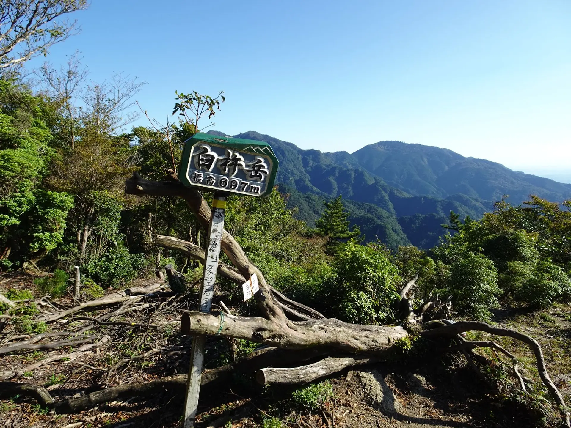
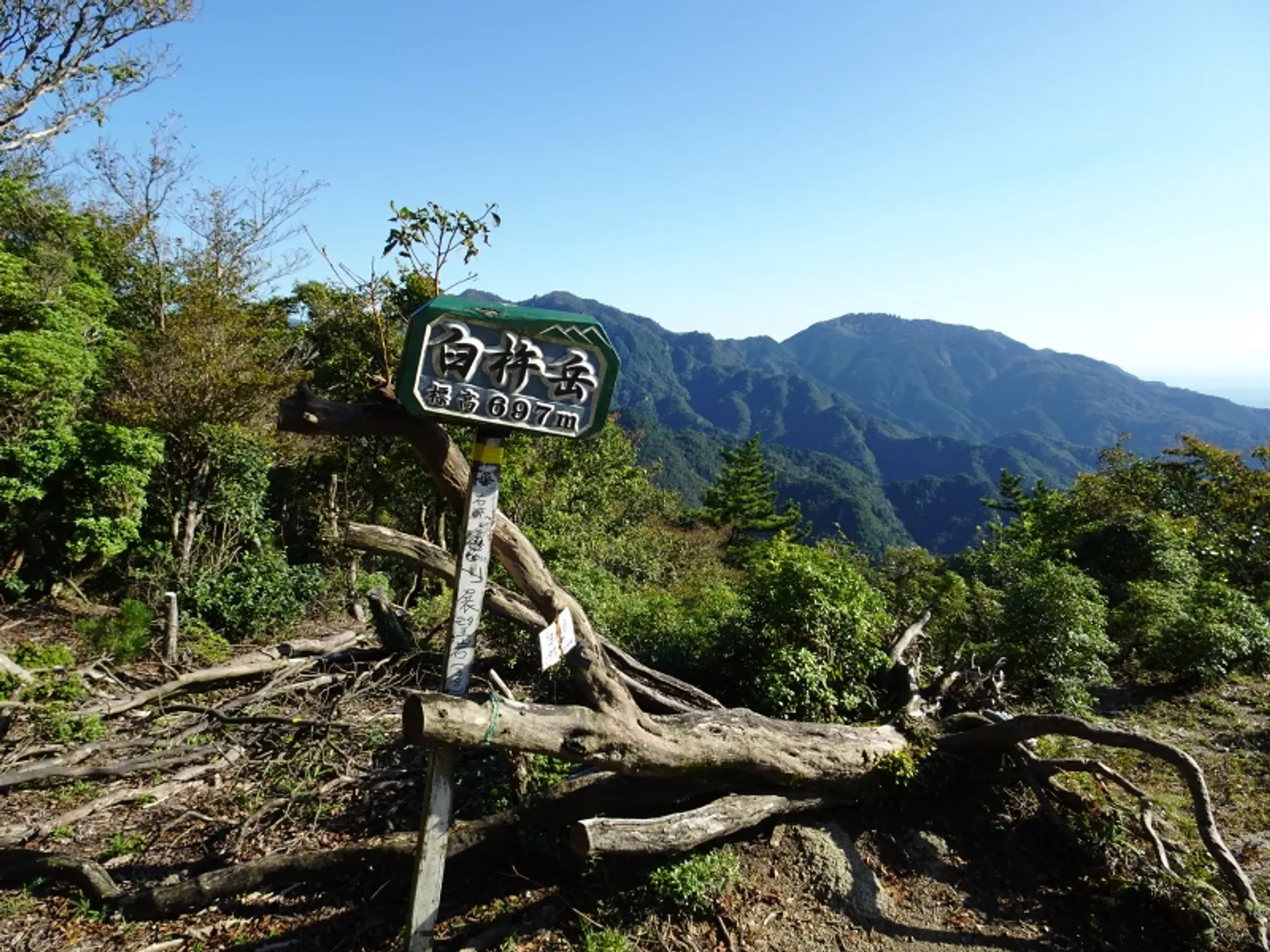
山名の由来になった花崗岩
登山道には山名の由来になっている「うす岩」と「きね岩」があり、巨大な花崗岩がそびえ立つ姿は圧巻!ここからの見晴らしも良好ですよ。
見晴らしのいい尾根道
臼杵山登山口から約30分歩くと見晴らしのいい尾根道が続き、展望ポイントが何箇所もあります。新名神高速道路や亀山市の町並みを望めるのは山頂だけでなく、尾根道からも望めますよ♫
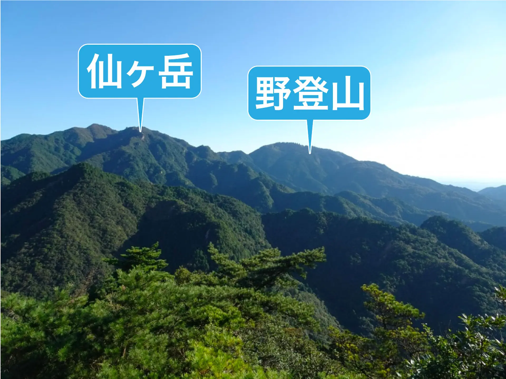
さらに、亀山七座の野登山や仙ヶ岳を眺めることもできます。
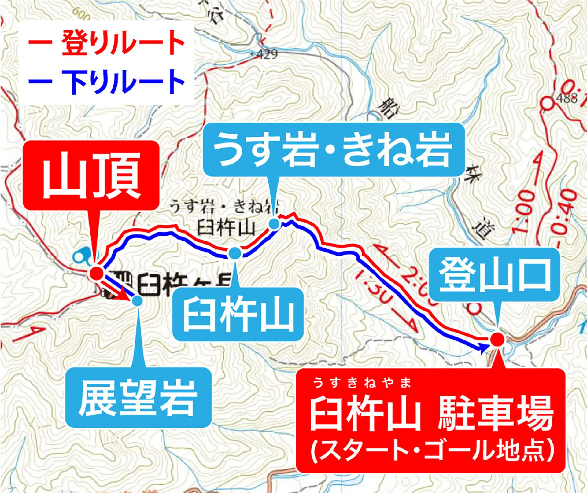
登山コースの概要
この記事では亀山7座トレイルマップのルートに沿った登山コースをご紹介!コースタイムは約3時間、休憩時間は1時間20分、合計で約4時間20分の登山コースになります。
登りのコースプラン
臼杵山 駐車場からスタートし、臼杵山登山口に入って臼杵ヶ岳の山頂を目指します。道中は山名の由来になった「うす岩」「きね岩」の観賞も楽しみ、臼杵山も登頂するルートになります。
臼杵ヶ岳に登頂後、すぐ近くの展望岩で絶景を満喫しながら昼食休憩を取ります。
【登りのルート】臼杵山 駐車場(8:40)➞ 臼杵山 登山口(8:41)➞ きね岩・うす岩(9:50)➞ 臼杵山 山頂(10:05)➞ 臼杵ヶ岳 山頂(10:37)➞ 展望岩(10:40)
下りのコースプラン
展望岩で昼食休憩を取ったあとは来た道を下山して、駐車場に戻ってゴールです。
【下りのルート】臼杵ヶ岳 山頂(11:40)➞ 臼杵山 駐車場(13:10)
コース難易度:中級〜上級クラス
登山口から約30分歩くと急登の尾根道が続き、足場の不安定な岩場もあるため難易度は中級〜上級クラスだと思います。
とくに、岩場の下山は危険を伴うため、岩場での下山経験がない方は臼杵ヶ岳山頂からかもしか高原を経由し、安楽峠へ下山して、東海自然歩道を通って臼杵山 駐車場へ戻る下山ルートが安心です。
尾根道は風通しの良い箇所が多いため、強風の際は滑落しないように注意して進みましょう。
- 登山の注意点・心得
- ① 登山をする際は時間に余裕をもって行動し、自分の経験や体力に見合った山を選んで出かけましょう。
- ② 事前に登山計画を立て、当日までに最寄りの警察署か登山ポストに登山届を出しましょう。
- ③ 事前に気象情報をしっかり確認した上で行動しましょう。
- ④ 雨具をはじめ、急な気温の変化にも対応できる服装を用意しましょう。
- ⑤ 水分や携帯食を持参し、熱中症対策と適度な休憩を心がけましょう。
- ⑥ 冬場に登頂する際はアイゼンなどの雪山の登山道具を必ず持参しましょう。麓に雪が無くても山頂付近に雪や氷が残っている可能性があります。
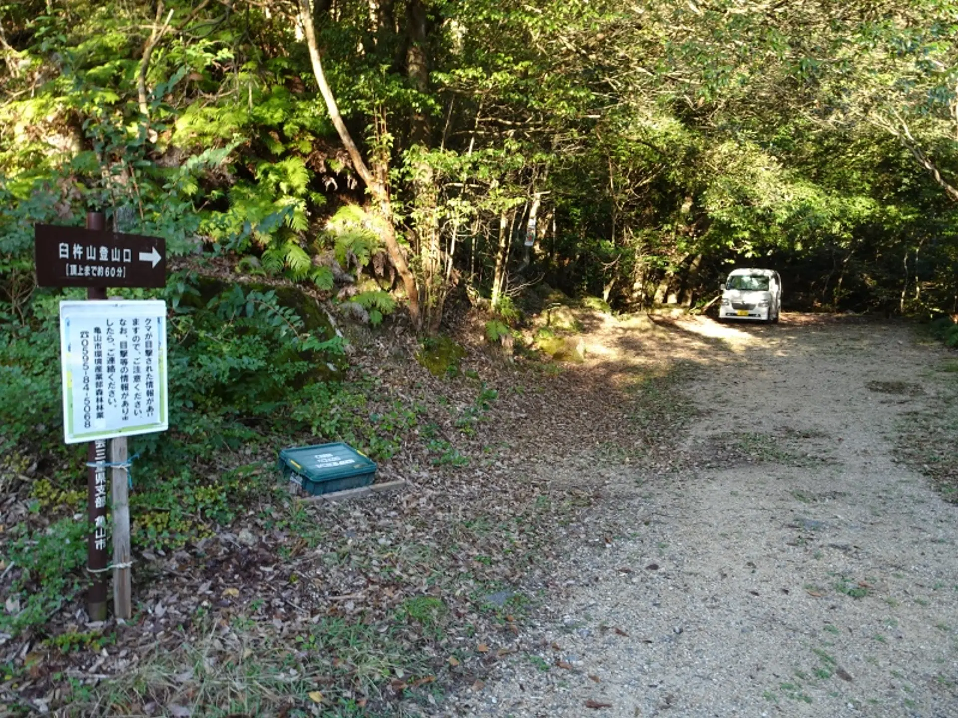
駐車場の場所
今回の登山コースでは臼杵山登山口にある「臼杵山 駐車場」を利用します。登山口のすぐ近くに駐車できるスペースがあり、4台ほど駐車可能です。
上記地図の赤いピンの場所が臼杵山 駐車場になり、石水渓キャンプ場から車で5分の距離です。
Google Mapsや車のナビに登録されていない箇所ですので、上記地図の赤いピンを参考にしていただくか、亀山7座トレイルマップの地図が参考になると思います。
駐車場にトイレはありませんので、事前に済ませておくと安心です。
最寄りのトイレは登山口から車で約3分の距離にある石水渓キャンプ場のバンガローサイトにあるトイレです。このトイレは登山者でも利用可能ですよ。※バンガローサイトのトイレの場所はこちら
登山コースの解説
ここから紹介する写真は2022年10月15日と2022年11月28日に撮影した写真を組み合わせて解説しております。コースタイムはあくまでも目安としてご覧ください。

臼杵山 駐車場(8:40)
臼杵山 駐車場に車を止めて登山スタート!登山口にある駐車場なので、すぐに登山道へ入れますよ。
徒歩:約1分
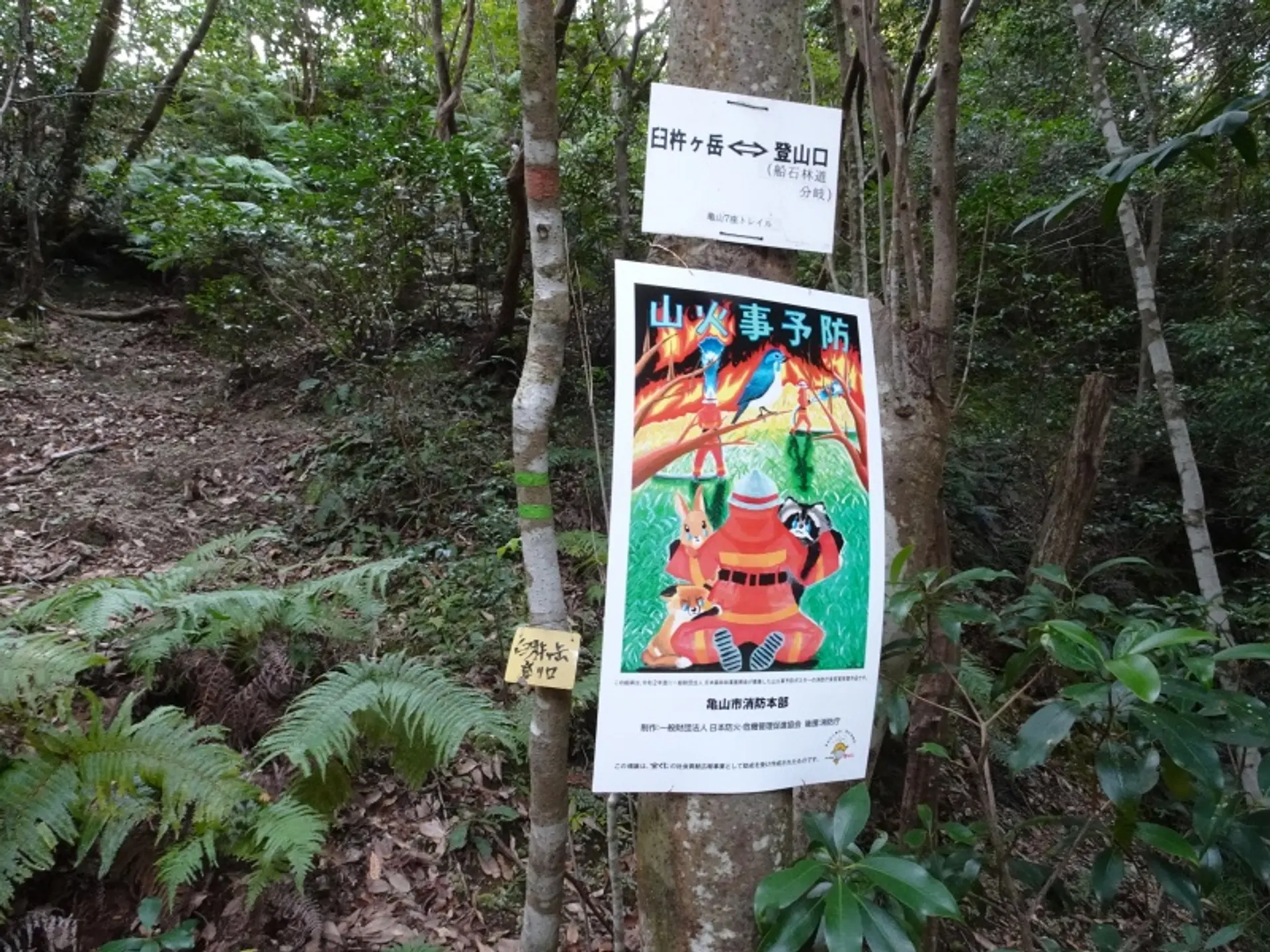
臼杵山 登山口(8:41)
登山口には「臼杵ヶ岳 ←→ 登山口」という標識がありますので、これを目印に登山道へ入りましょう
徒歩:約20分
急登(9:01)
登山口から20分ほど歩くと急登が始まります。※急登・・・急な坂が続く登山道のこと
徒歩:約5分
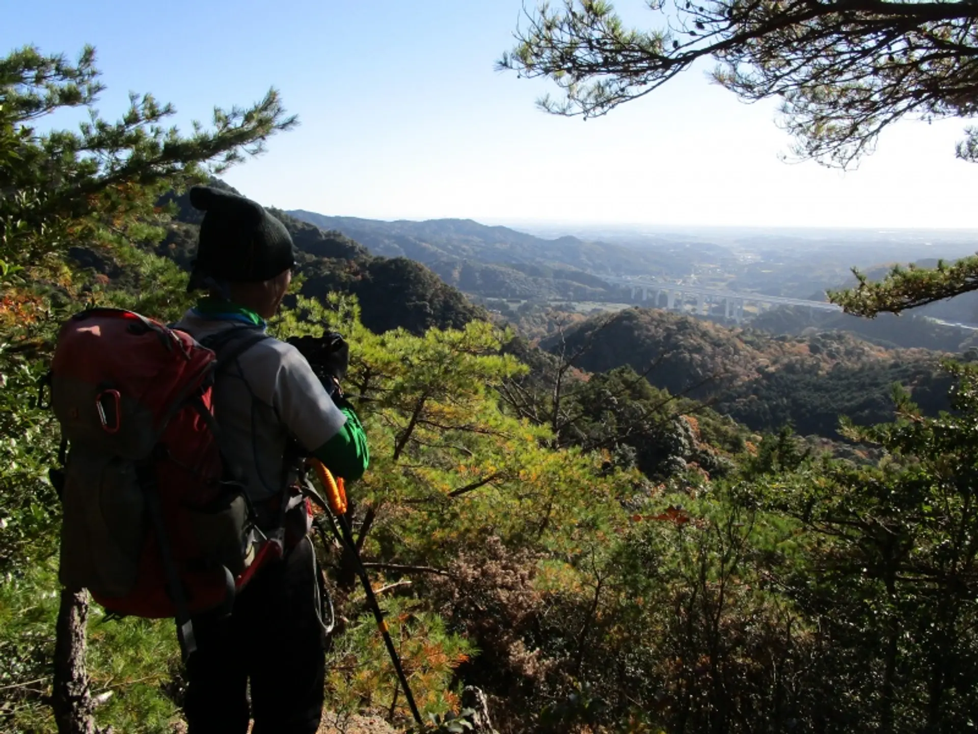
展望ポイント(9:06)
亀山市の町並みと新名神高速道路を見渡せる展望ポイントに到着しました。登山口から25分ほど歩いただけで、このような景色を眺められますよ。
徒歩:約10分
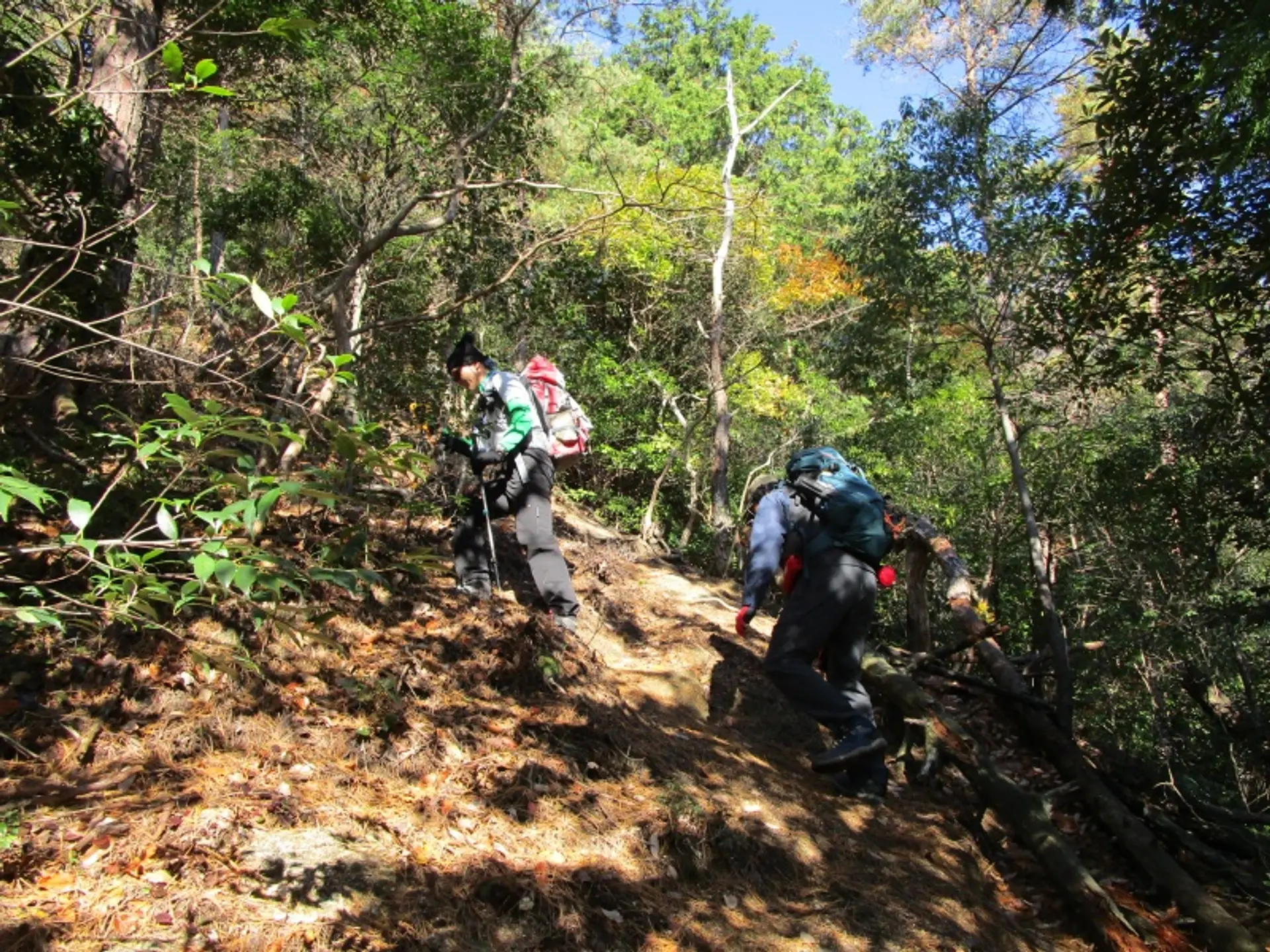
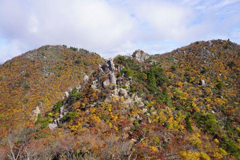
急登の尾根道(9:16)
岩場や崖のある尾根道が暫く続きます。足場の細い箇所もあるので注意して進みましょう。
徒歩:約30分
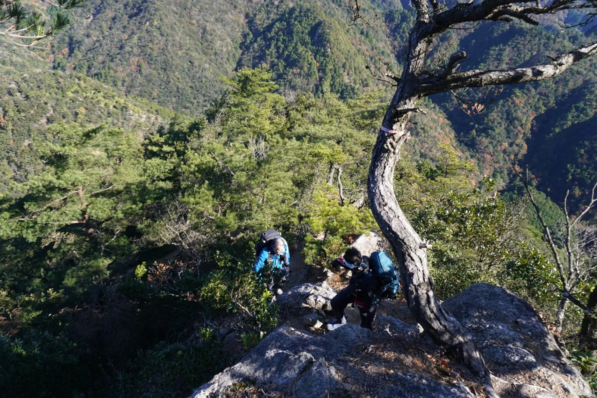
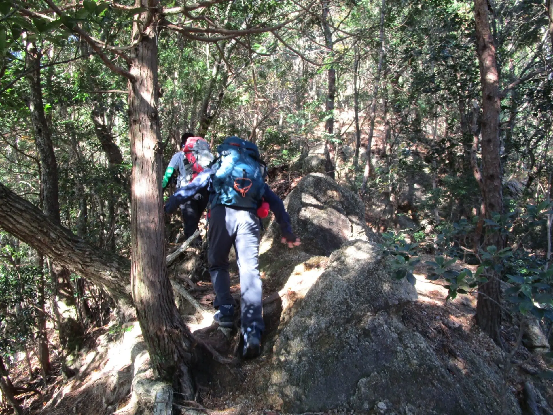
岩尾根(9:46)
登山口から約1時間歩くと見晴らしの良い岩尾根に出ます。ここから崖のような岩場が続きますので、注意して進みましょう。風通しが良い場所なので強風時はとくに注意です。岩尾根は登りよりも下りのほうが難しい箇所になります。
徒歩:約4分
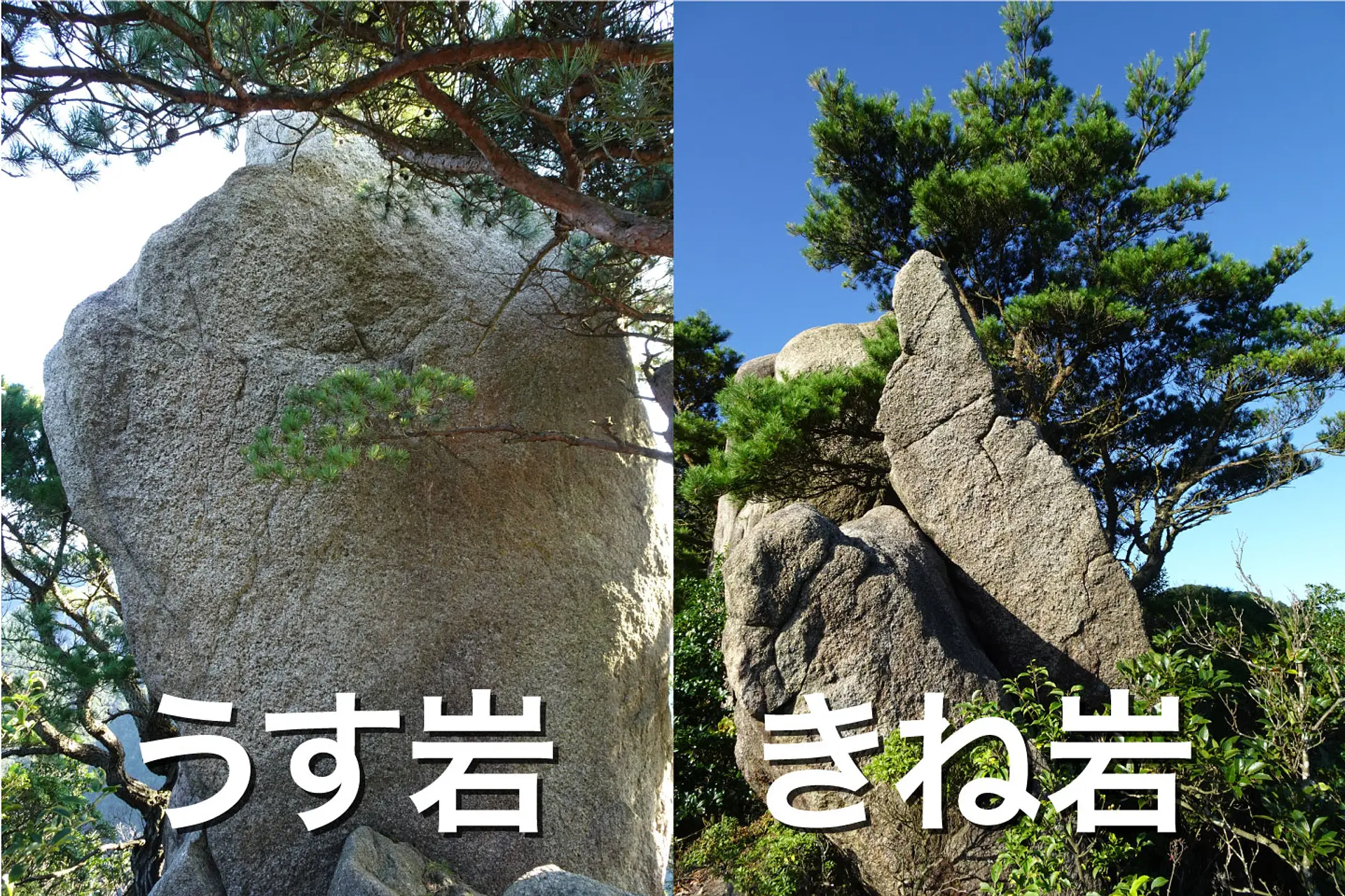
きね岩・うす岩(9:50)※10分の小休止
山名の由来になった花崗岩が2つ並ぶ箇所です。急登な尾根道と岩尾根が続いたのでここで10分ほど休憩します。
徒歩:約5分
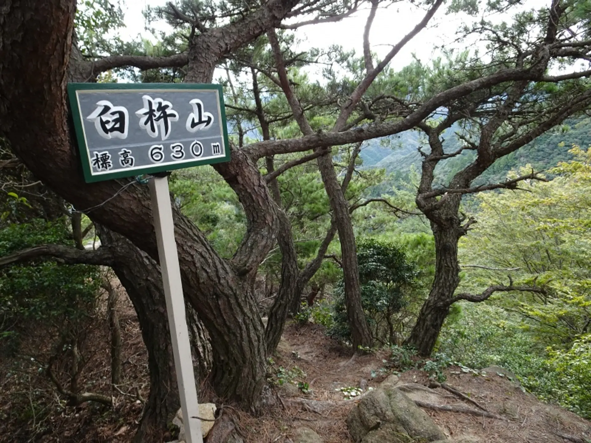
臼杵山の山頂(10:05)
登山口から約1時間20分で臼杵山の山頂に到着。すぐ近くに展望ポイントがあるので移動します。
徒歩:約2分
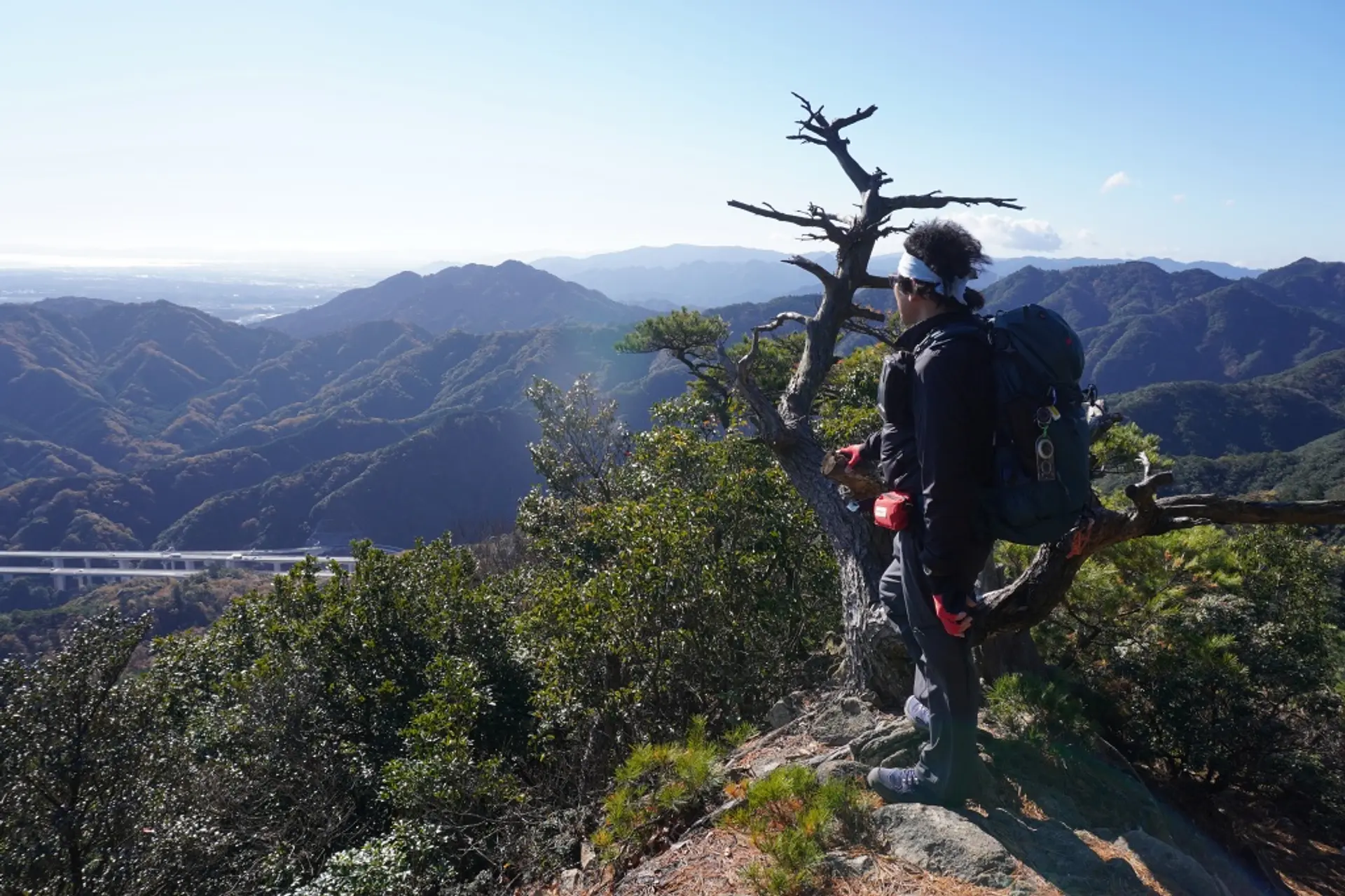
臼杵山の展望ポイント(10:07)
臼杵山の山頂近くには岩場に木が生えた箇所があり、ここからの見晴らしが好展望です。
約10分の小休止
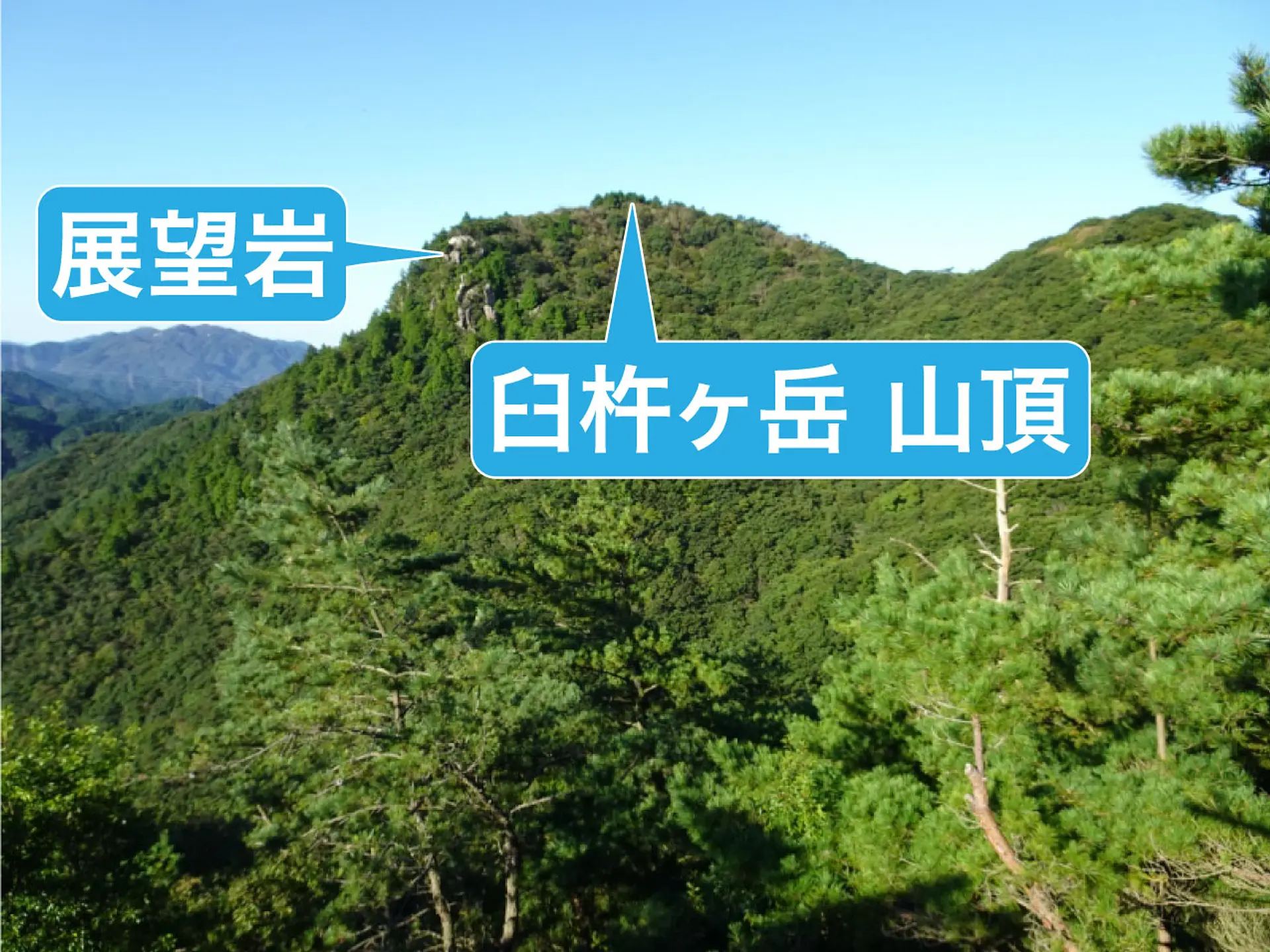
臼杵ヶ岳を眺める(10:17)
先ほどの展望ポイントから臼杵ヶ岳の山頂を眺めることができます。山頂の先にある岩峰が展望岩で、そこで食事休憩を取ります。
徒歩:約20分
臼杵ヶ岳 山頂(10:37)
登山口からあわせて1時間40分ほど歩いて臼杵ヶ岳の山頂に到着。足場が広く、見晴らしも良いので食事休憩に最適な場所です。今回はこの先にある展望岩で食事休憩を取ります。
徒歩:約3分
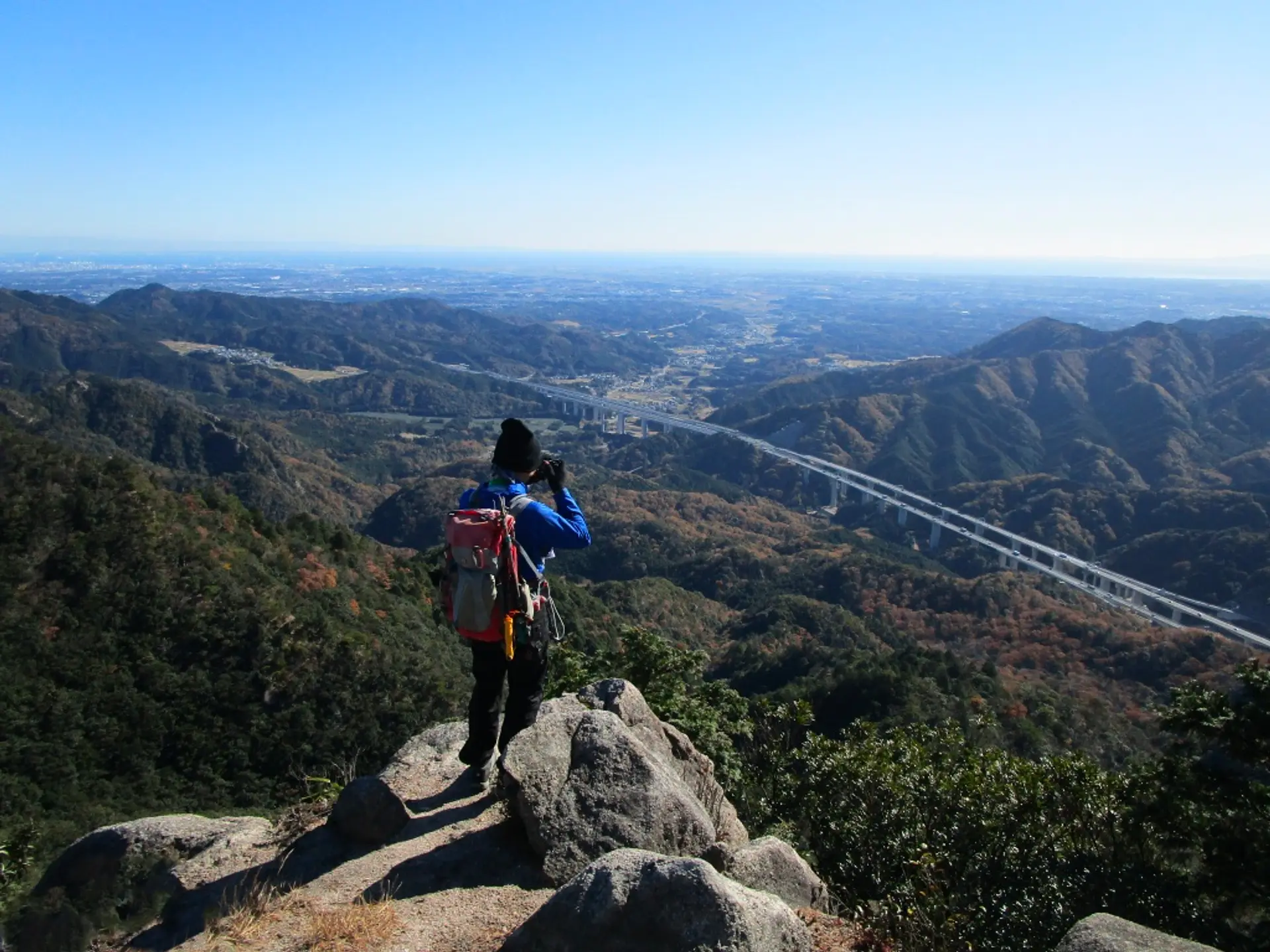
展望岩(10:40)※1時間の食事休憩
臼杵ヶ岳の絶景ポイントである展望岩に到着。3〜4人ほど休憩できるスペースがあるので、ここで景色を楽しみながら食事休憩を取ります。食後は来た道を戻って下山します。
徒歩:約1時間半で駐車場着
いかがでしたでしょうか
臼杵ヶ岳の魅力を登山コースの紹介と共にお届けしました。
急登の尾根道や岩尾根、2つの山を登頂できるなど、バリエーションに富んだ登山を楽しめるのが臼杵ヶ岳の魅力です。
登山中級者の方はステップアップできる山だと思いますので、ぜひチャレンジしてみてくださいね。
亀山7座トレイルを楽しもう
観光三重では亀山7座トレイルの特設サイトを公開しております。亀山7座の魅力や各山の登山コースを紹介しております。
また、みえ旅カメラ部のASOBISIAさんが亀山7座トレイルの魅力を記事で発信しております。各山の魅力が1ページで全て分かりますので合わせてご覧ください。
亀山7座トレイルの最新情報
亀山市の公式ホームページでは、亀山7座トレイルへの取り組みやイベントなどの最新情報を発信されています。
登山届のダウンロードや登山届の提出先が明記されていますので、亀山7座へ行かれる方は目を通しましょう。亀山7座トレイルマップのダウンロードも出来ますよ。
記事の製作者について
ふがまるちゃん(記事制作)
観光三重のみえ旅カメラ部に所属し、三重を撮る写真家としてTwitter・instagramを中心に活動中。三重の風景を無料配布する三重フォトギャラリーと三重の旬な情報を発信する三重のええとこ巡りを運営。
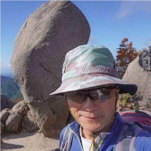
kazenami(写真撮影)
ふがまるちゃんの父親。三重県内のあらゆる山を登頂し、トレッキングだけでなくロッククライミングやアイスクライミング、シャワークライミングもこなす山男。これまでの山行記録をヤマレコで公開中。