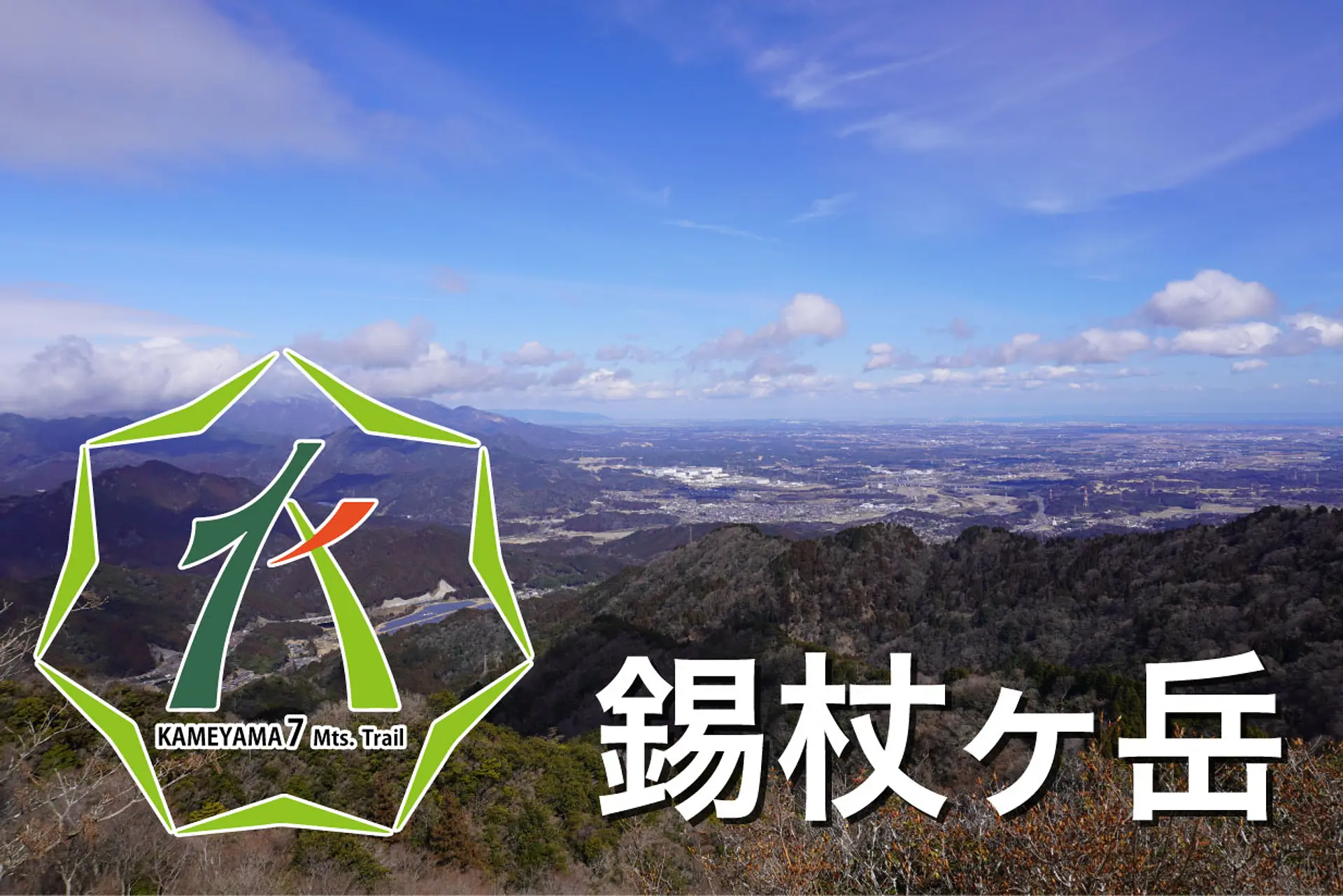
亀山7座「錫杖ヶ岳とは?」駐車場や登山コースを紹介します
掲載日:2022.02.23
錫杖ヶ岳は亀山市加太向井と津市芸濃町との境界にある山で、山頂は360度パノラマビューの好展望です。加太登山口からの登山道はとても整備されており、登山初心者でも登りやすい山です。この記事では錫杖ヶ岳の駐車場や登山コースを紹介します。
みえ旅カメラ部のふがまるちゃんが三重をもっと好きになる情報をお届け!今回は亀山7座の1つ「錫杖ヶ岳」をテーマにした内容です。
目次
錫杖ヶ岳とは
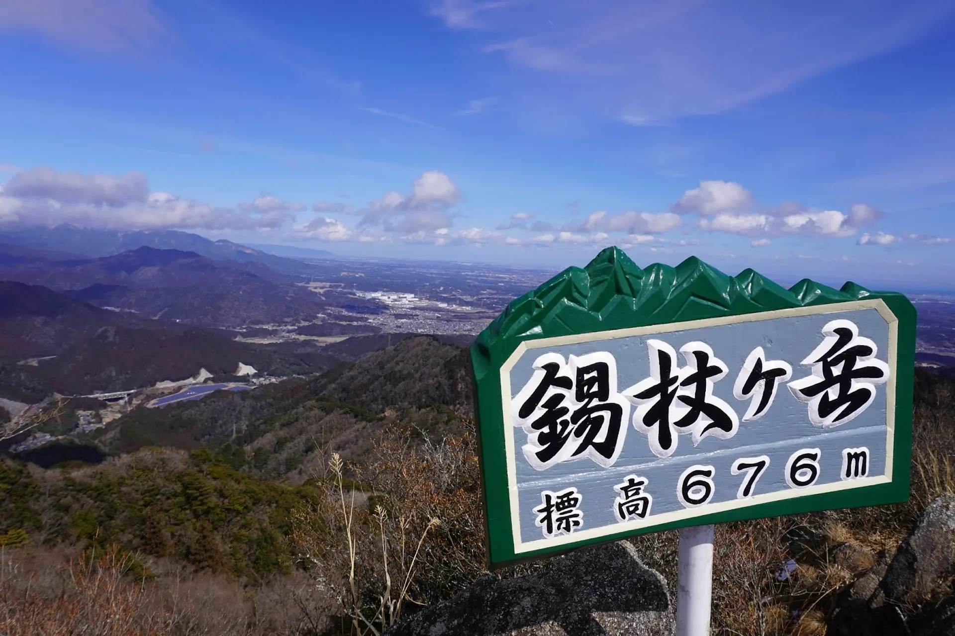
錫杖ヶ岳(しゃくじょうがたけ)は標高676mの山で、亀山市加太向井(かぶとむかい)と津市芸濃町との境界にある山です。山頂は尖った岩峰になっており、昔は雀頭山(じゃくとうさん)と呼ばれていました。古くは雨乞いの霊山として信仰を集めた歴史もあります。
錫杖ヶ岳の見所・特徴
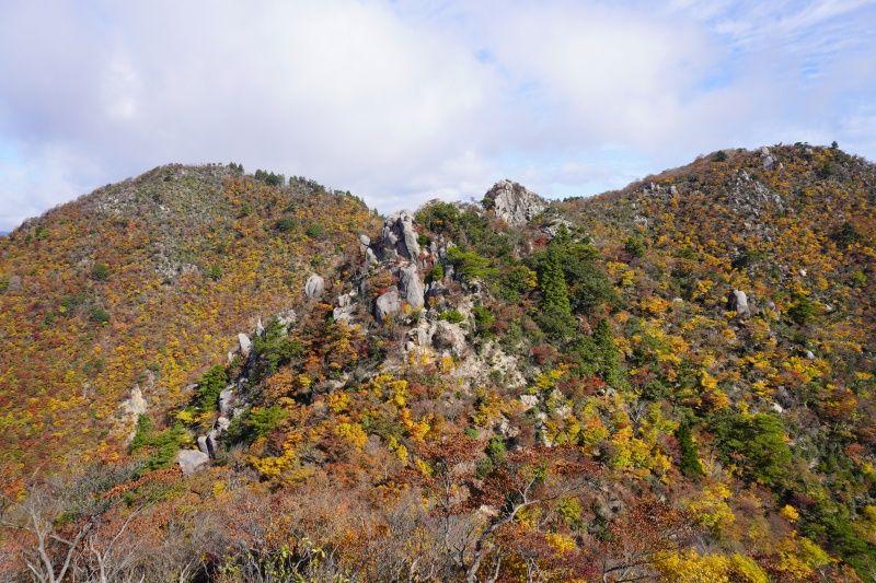
山頂からの360度パノラマビュー
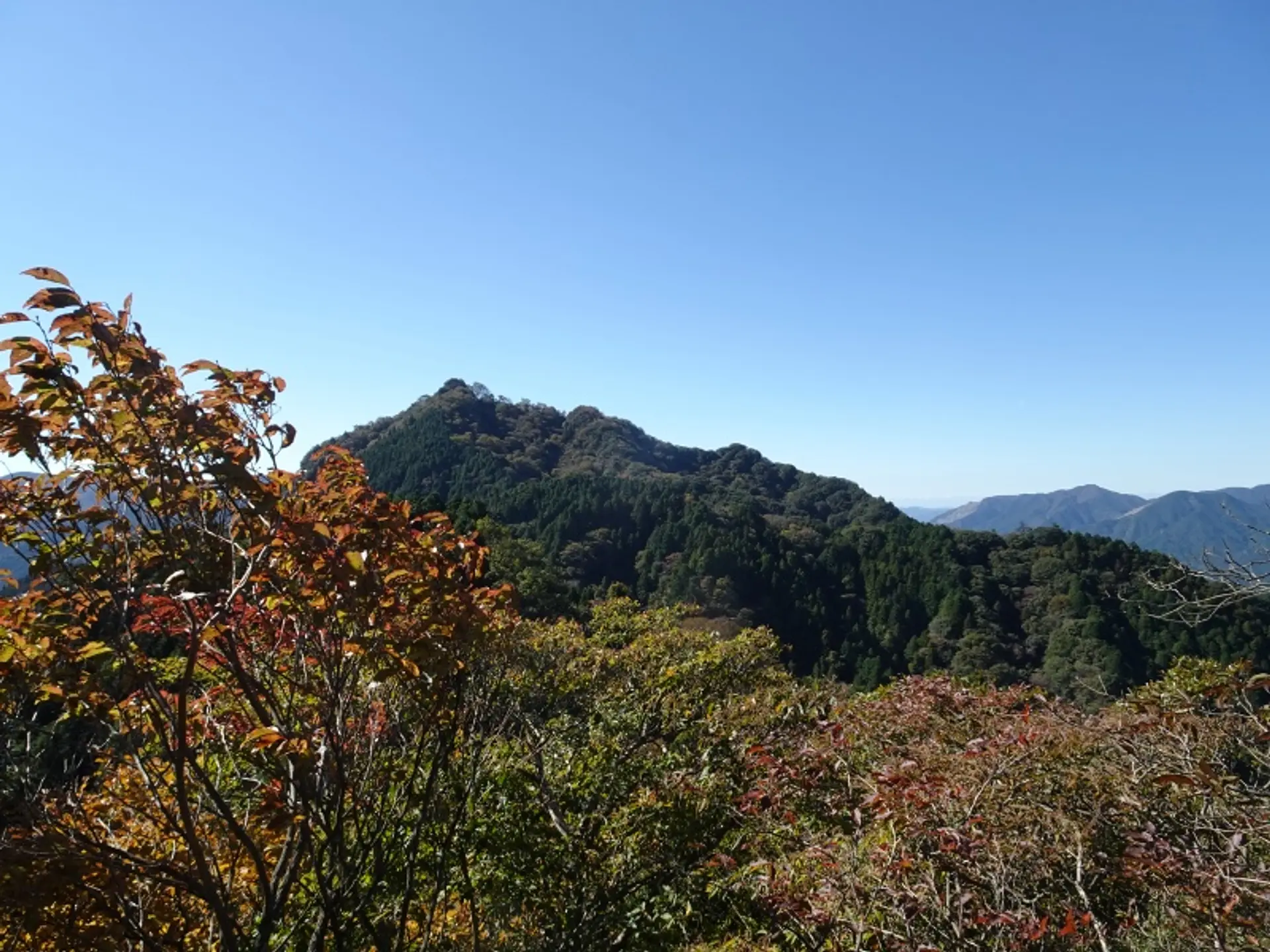
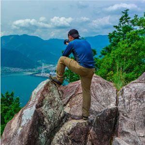
錫杖ヶ岳の山頂は360度パノラマビューとなっており、津市〜亀山市の町並みと伊勢湾を一望できます。
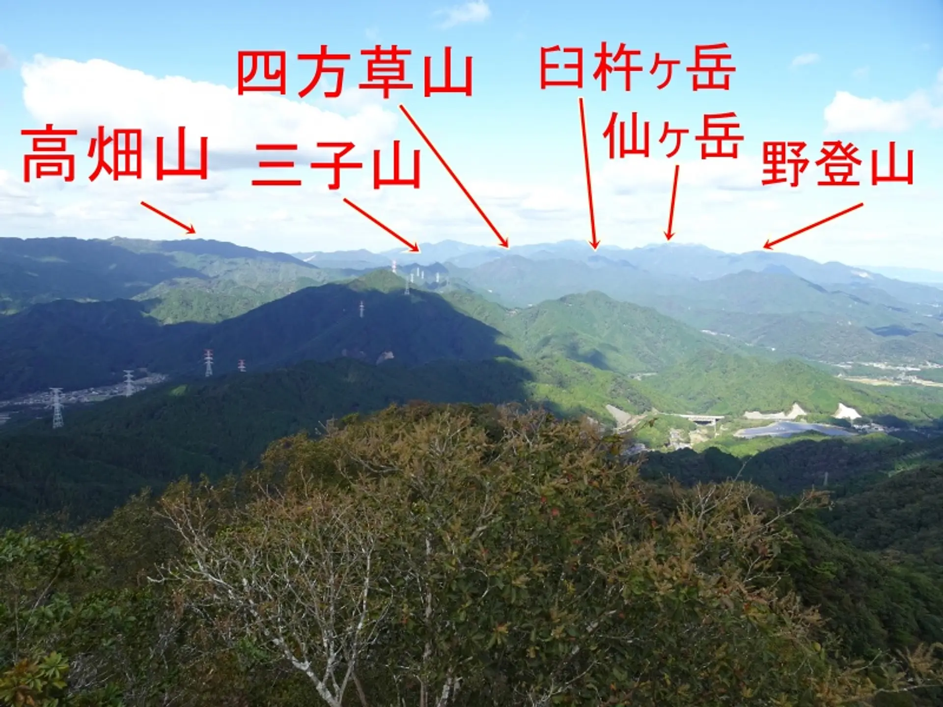
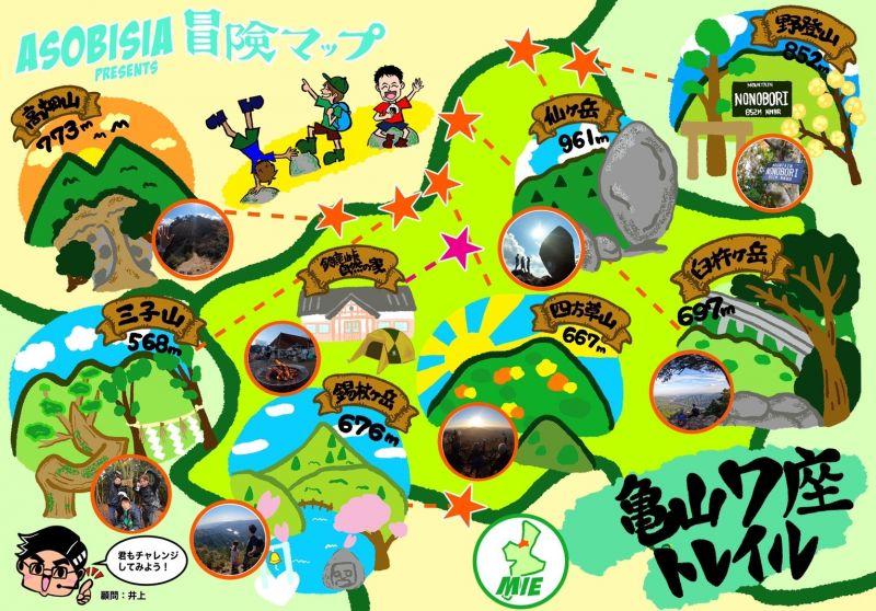
さらに、亀山7座の山々を一望することもでき、高畑山・三子山・四方草山・臼杵ヶ岳・仙ヶ岳・野登山が並ぶ光景は圧巻!ちなみに錫杖ヶ岳は亀山7座の中で5番目に高い山です。
※亀山7座とは、亀山市域にある700m前後の山を認定したものです。
※山の読み方・・・高畑山:たかはたやま、三子山:みつごやま、四方草山:しおそやま、臼杵ヶ岳:うすきねがたけ、仙ヶ岳:せんがたけ、野登山:ののぼりやま
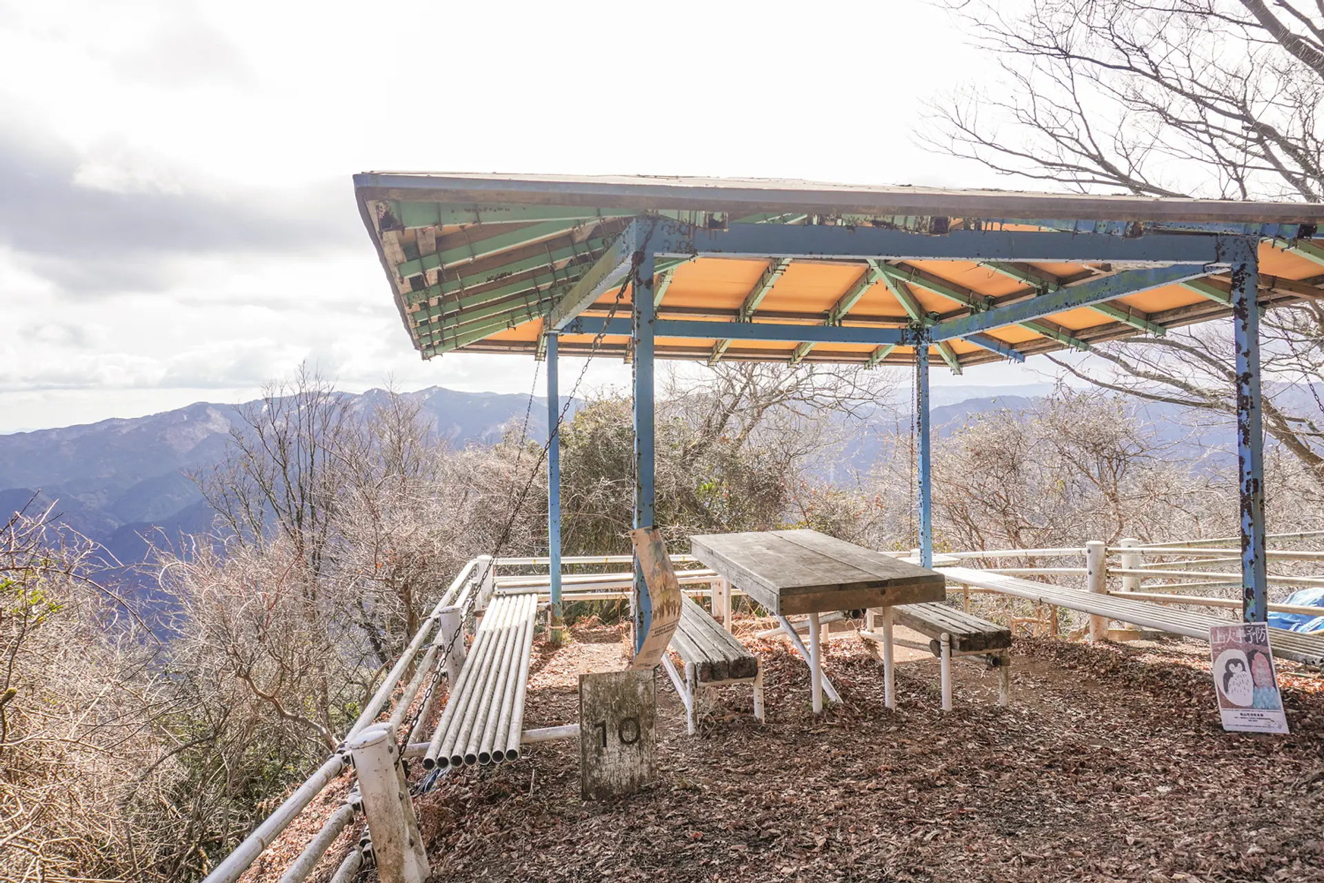
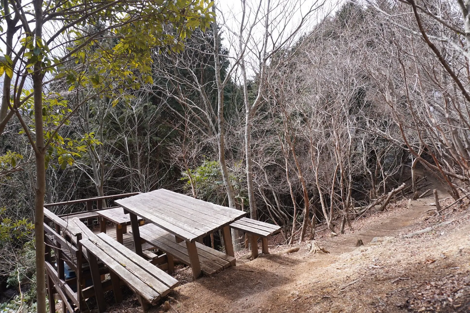
山頂付近にはテーブルとベンチを備えた東屋があり、休憩に最適な場所です。ここからの見晴らしも良いので、景色を眺めながらの休憩や食事を楽しめますよ。
整備された登山道
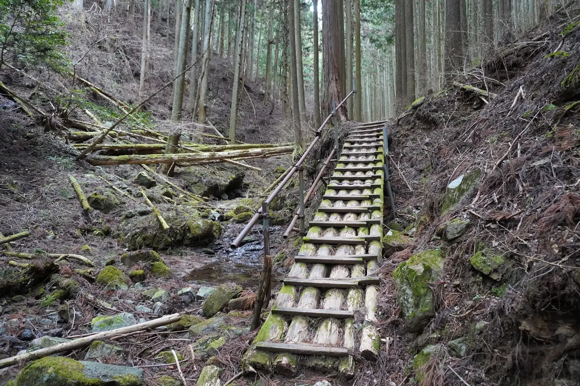
加太(かぶと)登山口からのルートは整備された道が多く、崩落地には橋がかけられているので歩きやすい登山道なのが特徴です。
道中にはベンチやテーブルを備えた箇所が複数あるので、小休止しやすいのも嬉しいポイント!
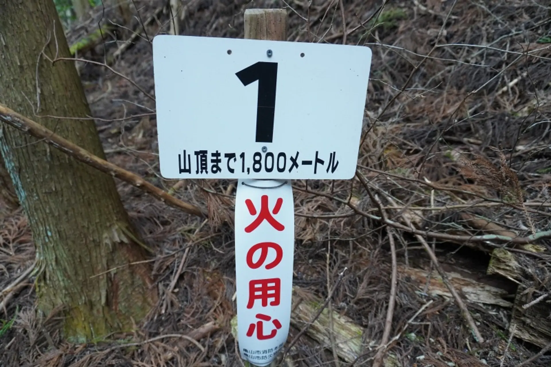
さらに、番号が振られた標識が200m間隔で立っており、山頂まであと何メートルかが分かるようになっています。こういった標識があると休憩するタイミングをつかめたり、ペース配分の管理がしやすいので便利です♫
このように、錫杖ヶ岳は亀山7座の中でも登山道の整備が進んでいる山なので、登山初級者でもチャレンジしやすいと思います。
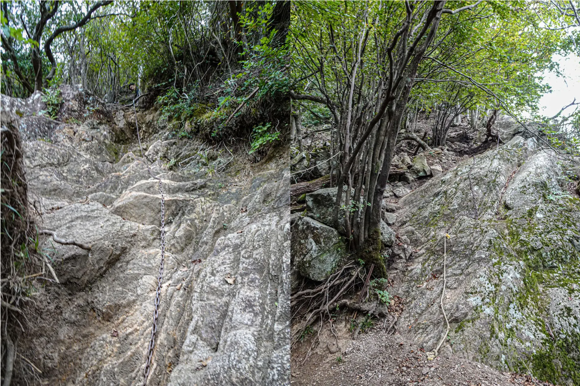
山頂直下の鎖場
山頂直下には鎖を伝って岩場を登る鎖場があり、ロッククライミングのような登山も楽しめます。
足をかけられる場所が多い岩場なのと、登り用と下り用の鎖が用意されているので、鎖場が初めての方でもチャレンジしやすい環境になっています。
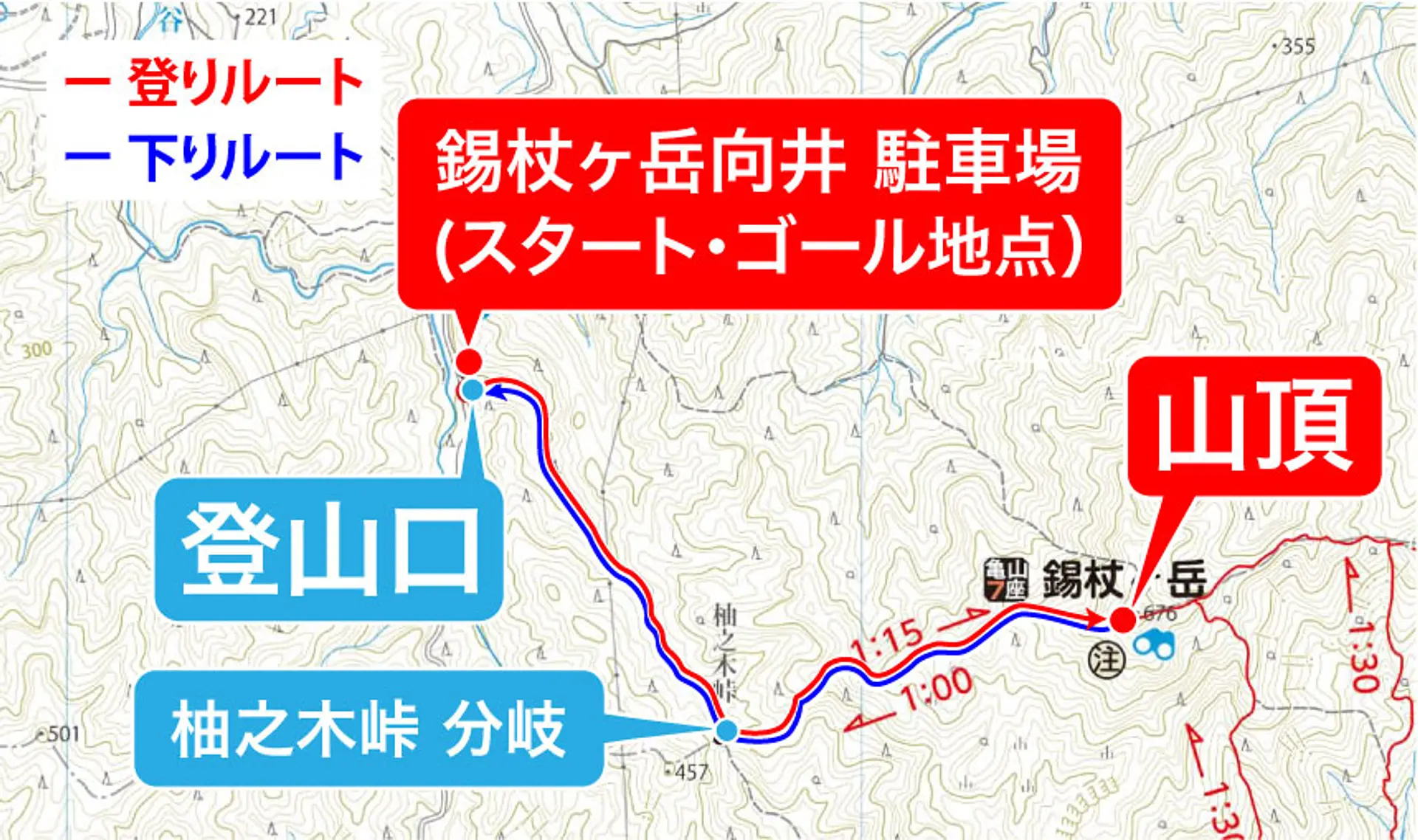
登山コースの概要
この記事では亀山7座トレイルマップのルートに沿った登山コースをご紹介!コースタイムは約2時間半、休憩時間は1時間、合計で約3時間半の登山コースになります。
登りのコースプラン
錫杖ヶ岳向井駐車場からスタートし、柚之木峠(ゆのきとうげ)の分岐点を経由して山頂を目指します。登頂後は山頂付近の東屋へ移動し、そこで昼食休憩を取ります。
【登りのルート】 錫杖ヶ岳向井駐車場(9:00) ➞ 登山口(9:02) ➞ 柚之木峠(9:29) ➞ 錫杖ヶ岳 山頂(10:23)→ 東屋(10:38)
下りのコースプラン
東屋で昼食休憩を取ったあとは来た道を下山して、駐車場へ戻ります。
【下りのルート】東屋(11:38)➞ 錫杖ヶ岳向井 駐車場(12:38)
コース難易度:初級クラス
整備された登山道が多く、片道1時間半ほどで登頂できるのでコース難易度は初級クラスです。
山頂直下にある鎖場は比較的登りやすい岩場なので、鎖場が未経験の方は錫杖ヶ岳で初チャレンジしてみましょう。
- 登山の注意点・心得
- ① 登山をする際は時間に余裕をもって行動し、自分の経験や体力に見合った山を選んで出かけましょう。
- ② 事前に登山計画を立て、当日までに最寄りの警察署か登山ポストに登山届を出しましょう。
- ③ 事前に気象情報をしっかり確認した上で行動しましょう。
- ④ 雨具をはじめ、急な気温の変化にも対応できる服装を用意しましょう。
- ⑤ 水分や携帯食を持参し、熱中症対策と適度な休憩を心がけましょう。
- ⑥ 冬場に登頂する際はアイゼンなどの雪山の登山道具を必ず持参しましょう。麓に雪が無くても山頂付近に雪や氷が残っている可能性があります。
駐車場の場所
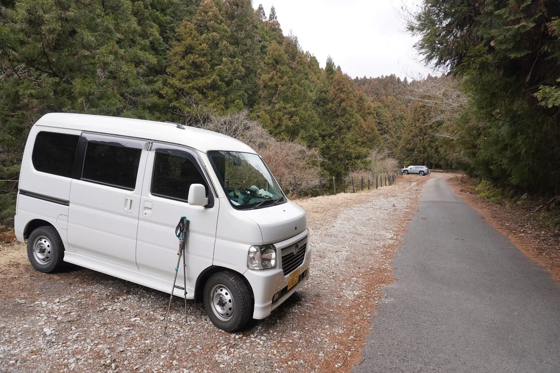
今回の登山コースで利用する駐車場は登山口の近くにある錫杖ヶ岳向井駐車場で、20台ほど駐車できるスペースがあります。
Google Mapsでは「錫杖ヶ岳 駐車場」という名称で登録されており、名阪国道の向井ICから車で約6分とアクセスしやすい立地です。
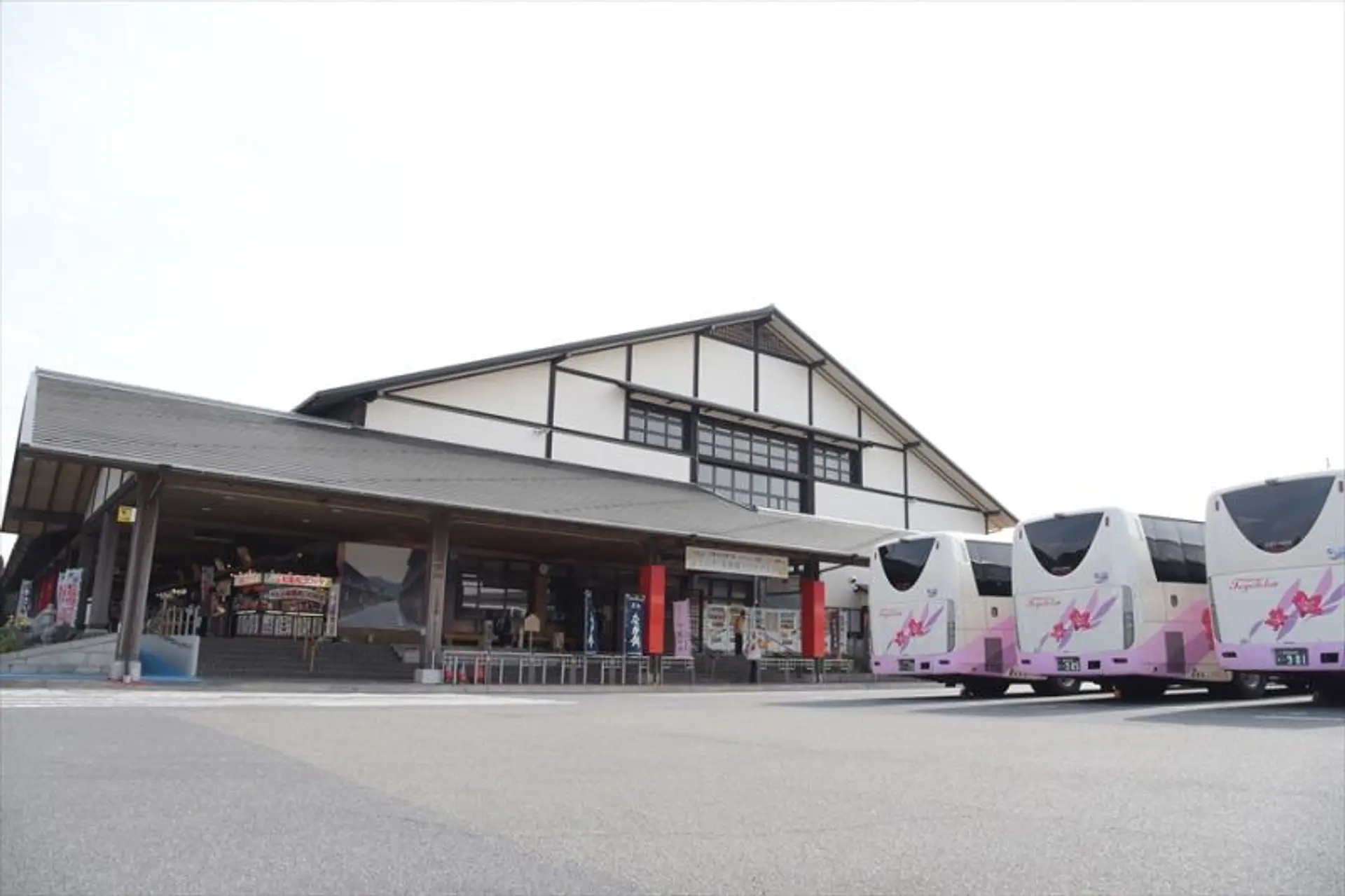
駐車場と登山道にはトイレがないので最寄りの名阪関ドライブインでトイレを済ませておくと安心です。ここには朝8時半から営業する売店があり、飲み物やお弁当などが販売されていますよ。
駐車場から名阪関ドライブインまでは車で約12分の距離です。
※名阪関ドライブインの営業時間は時期によって通常と異なる場合がありますので、詳しくは公式サイトをご覧ください。
登山コースの解説
ここから紹介する写真は2022年2月18日に撮影した写真を使用して解説しております。コースタイムはあくまでも目安としてご覧ください。

錫杖ヶ岳向井駐車場(9:00)
登山口の近くにある駐車場に車を停めて登山スタート!行き道に名阪関ドライブインに立ち寄ってトイレと携帯食の調達を済ませました。
徒歩:約1分
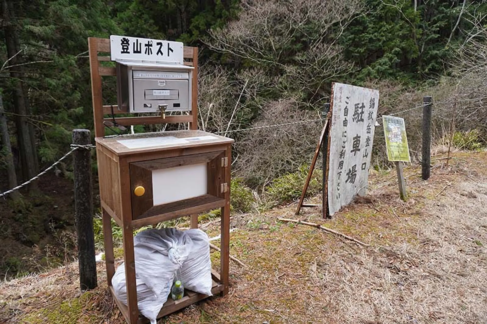
登山ポスト(9:01)
登山口の近くには登山ポストがあります。ここで登山届を提出してから登山道へ入りましょう。
徒歩:約1分
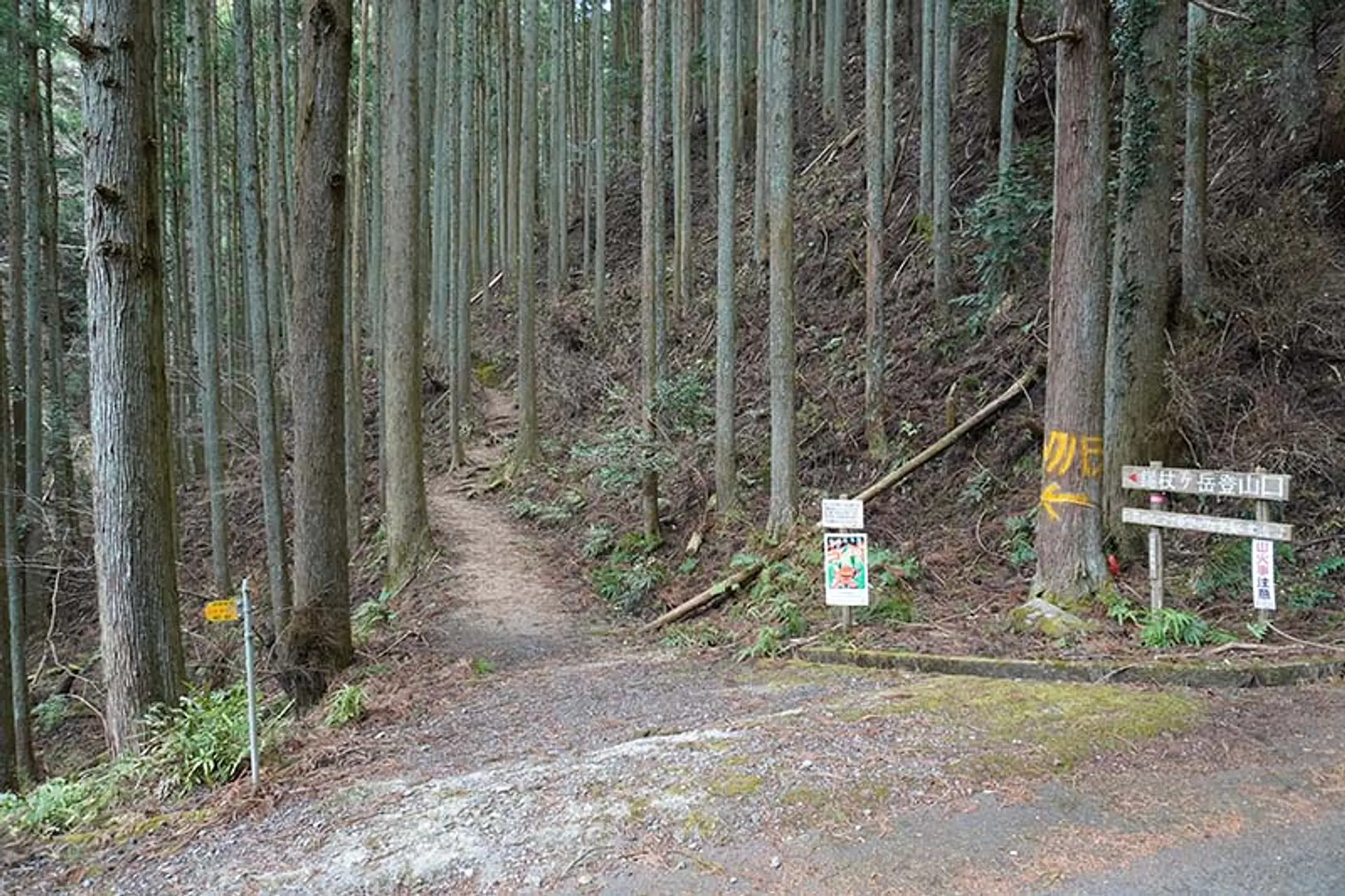
登山口(9:02)
駐車場から道なりに進むと左手側に登山口が見えてきます。「錫杖ヶ岳 登山口」と書かれた看板を目印にするといいでしょう。
徒歩:約2分
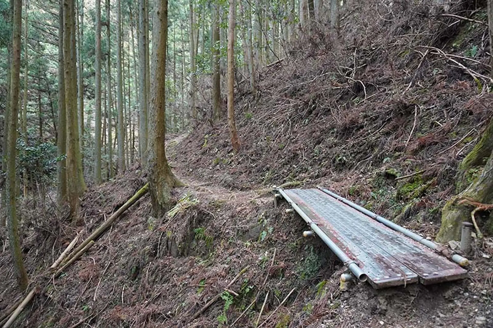
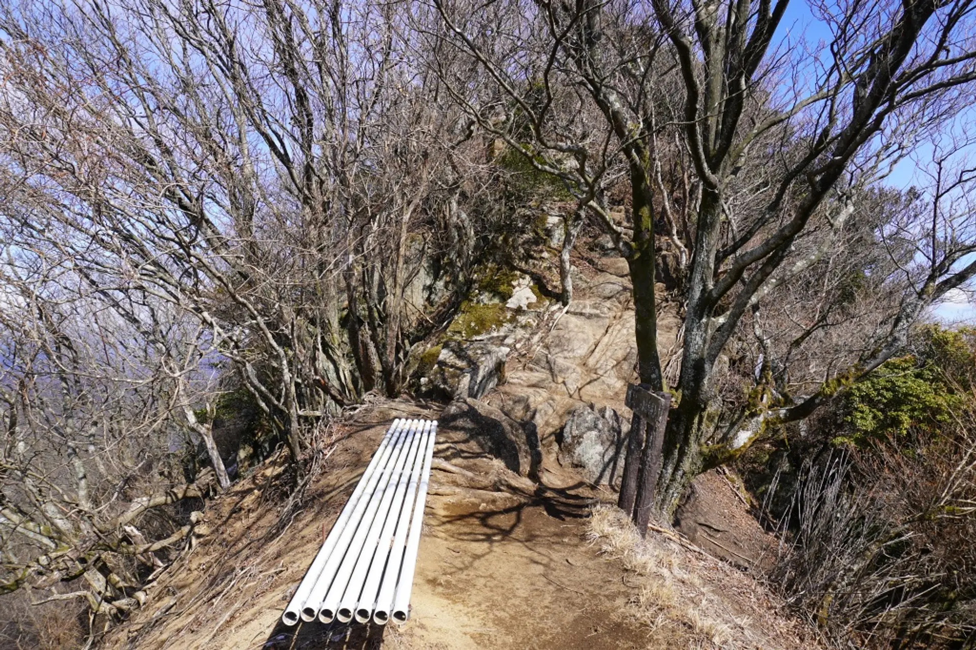
整備された登山道(9:04)
登山道が崩橋した箇所には橋が整備されているので歩きやすい道になっています。
徒歩:約5分

1の標識(9:09)
登山口から山頂まで約2000mあり、道中には約200m間隔で1〜9の標識が立っています。1の標識には「山頂まで1800メートル」と書かれています。
徒歩:約20分
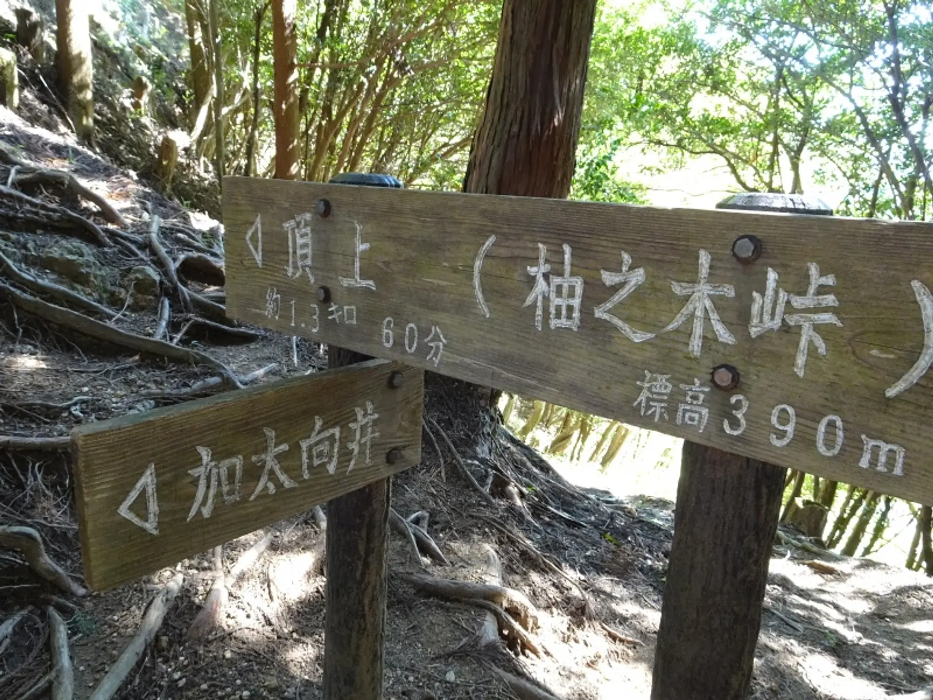
柚之木峠 分岐点(9:29)※5分小休止
加太向井(亀山市)・北畠・河内(津市)・頂上(柚之木峠)の分岐点に到着しました。頂上方面へと進みますが、近くにベンチがあるので5分ほど小休止します。
徒歩:約1分
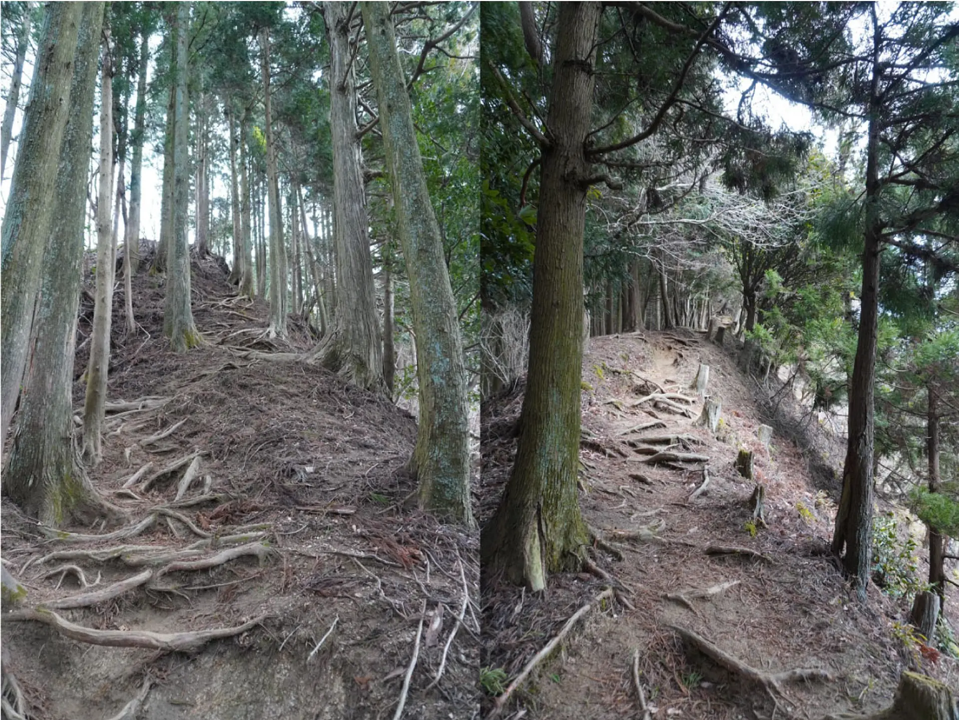
尾根道(9:35)
先ほどの分岐点から頂上方面へ進むと、尾根道を歩くルートになります。
徒歩:約25分
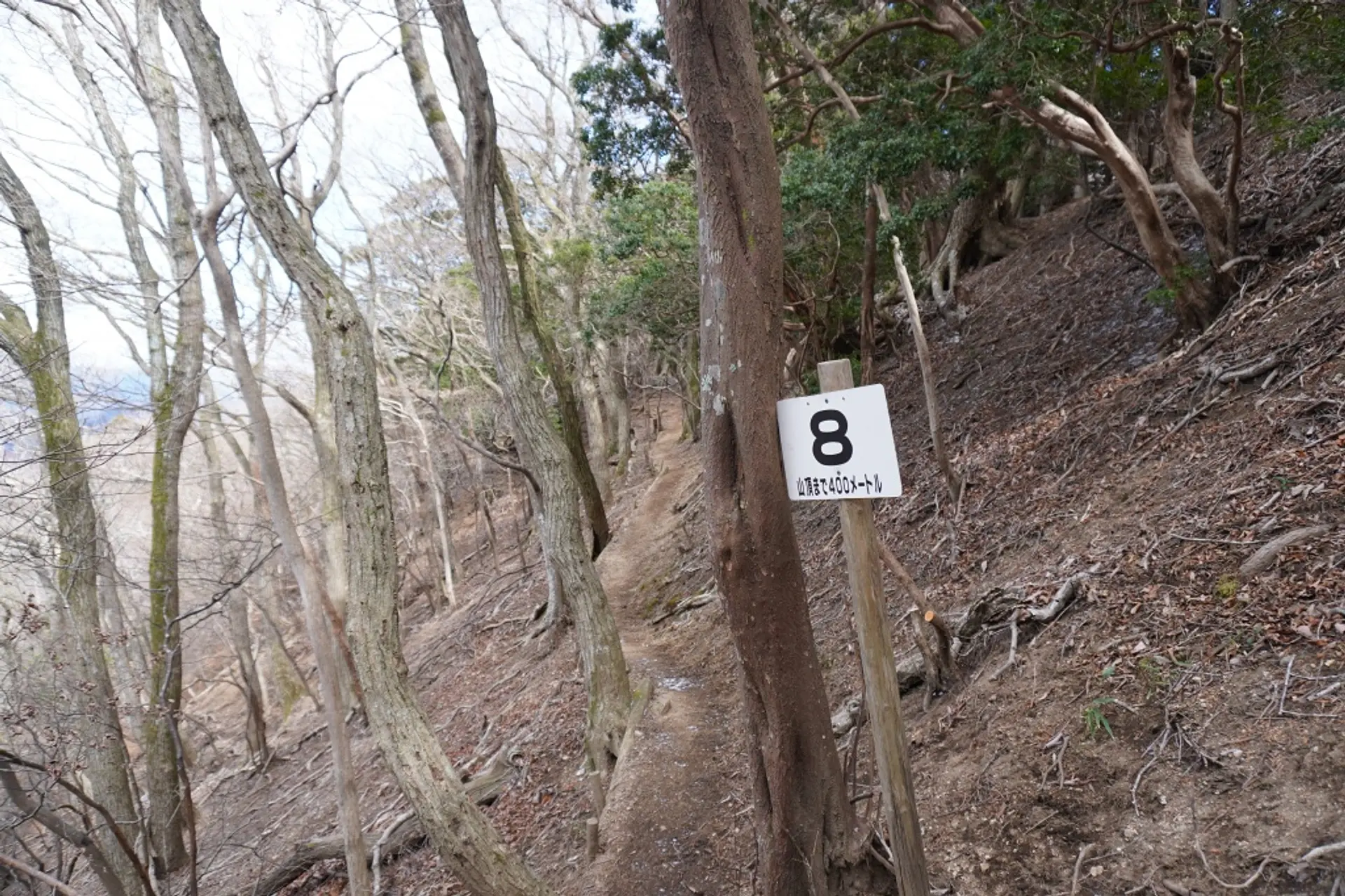
標識8の地点(10:00)
駐車場から約1時間歩くと標識8の地点に到着します。山頂まであと400mなのでもう一息です!ここから道幅が狭くなる箇所がありますので注意して進みましょう。
徒歩:約16分

鎖場(10:16)
錫杖ヶ岳の名物でもある鎖場に到着。三点支持を確保して慎重に登りましょう。※三点支持・・・手足の四股のうち三股で体を支えること。岩登りの基本姿勢です。
徒歩:約5分
山頂直下のベンチ(10:21)
山頂まであと少しのところにベンチがあります。直進すると山頂方面、右側が東屋の方面になるので、登頂後はここへ戻ってきます。
徒歩:約2分
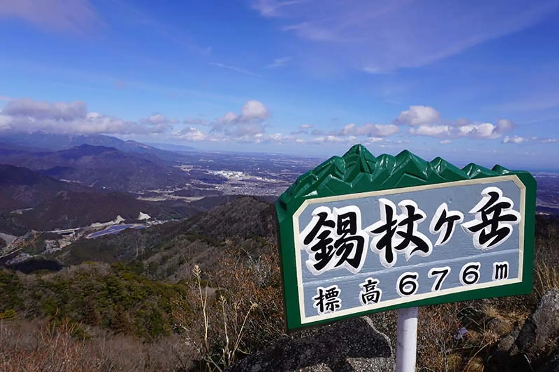
山頂(10:23)※10分小休止
登山口から約1時間20分歩いて山頂に到着!360度の絶景パノラマビューに感動します。眼下には安濃川の水源である錫杖湖も見えるなど、山頂からは様々な景色を観賞できますよ。
徒歩:約5分

東屋(10:38)※1時間の食事休憩
山頂は足場があまり広くないので東屋へ移動して食事休憩を取ります。ここからの見晴らしも良好ですよ♫ 食後は来た道を戻って下山します。
徒歩:約1時間で駐車場着
いかがでしたでしょうか
錫杖ヶ岳の魅力を登山コースの紹介と共にお届けしました。
整備された登山道なのでとても歩きやすく、山頂からの素晴らしい見晴らしが錫杖ヶ岳の魅力です。
登山初級者の方にもピッタリな山ですので、ぜひ挑戦してみてくださいね。
亀山7座トレイルを楽しもう
観光三重では、亀山7座の魅力や各山の登山コースを紹介する亀山7座トレイルの特設サイトを公開しております。
また、みえ旅カメラ部のASOBISIAさんが亀山7座トレイルの魅力を記事で発信しております。各山の魅力が1ページで全て分かりますので合わせてご覧ください。
亀山7座トレイルの最新情報
亀山市の公式ホームページでは、亀山7座トレイルへの取り組みやイベントなどの最新情報を発信されています。
登山届のダウンロードや登山届の提出先が明記されていますので、亀山7座へ行かれる方は目を通しましょう。亀山7座トレイルマップのダウンロードも出来ますよ。
記事の製作者について
ふがまるちゃん(記事制作)
観光三重のみえ旅カメラ部に所属し、三重を撮る写真家としてTwitter・instagramを中心に活動中。三重の風景を無料配布する三重フォトギャラリーと三重の旬な情報を発信する三重のええとこ巡りを運営。
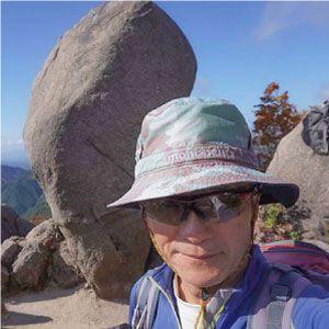
kazenami(写真撮影)
ふがまるちゃんの父親。三重県内のあらゆる山を登頂し、トレッキングだけでなくロッククライミングやアイスクライミング、シャワークライミングもこなす山男。これまでの山行記録をヤマレコで公開中。