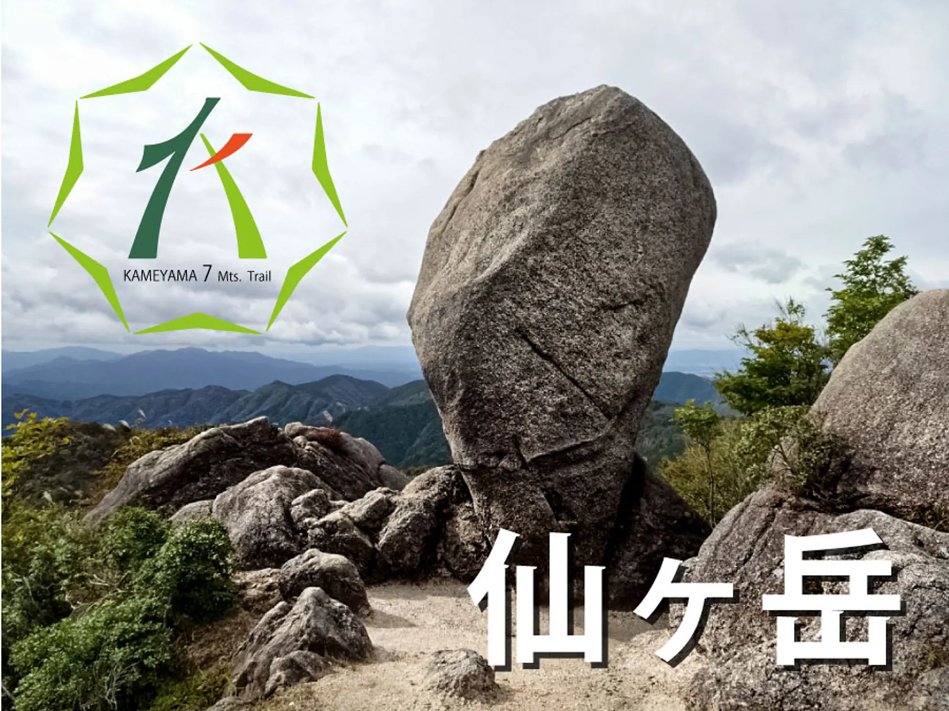
亀山7座「仙ヶ岳」とは?見所や駐車場、登山コースを紹介します
掲載日:2022.02.08
仙ヶ岳は東峰と西峰の2峰からなり、素晴らしい眺望と変化の富んだ登山道が特徴の山です。駐車場の場所や仙ヶ岳の登山コース、見所の数々をご紹介!
仙ヶ岳とは
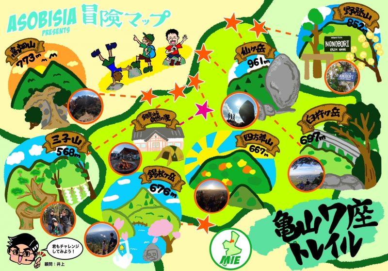
仙ヶ岳(せんがたけ)は東西の2つの峰からなる山で、三重県の亀山市と鈴鹿市、滋賀県甲賀市をまたがる鈴鹿山脈南部の山です。西峰の標高は961mあり、亀山7座の中では最も高い山になります。
※亀山7座とは、亀山市域にある700m前後の山を亀山7座として認定したものです。
仙ヶ岳の見所・魅力
多彩な眺望を楽しめる
仙ヶ岳の登山道には様々なビュースポットがあり、三重県北勢エリアの山々をあらゆる角度で見渡せます。
仙ヶ岳の看板が立つ山頂(西峰)からは亀山7座の高畑山(たかはたやま)や三子山(みつごやま)、四方草山(しおそやま)、臼杵ヶ岳(うすきねだけ)を見渡すことができ、さらには鈴鹿セブンマウンテンの雨乞岳(あまごいだけ)や御在所岳、鎌ヶ岳も見渡せる絶景ポイントです。
南尾根コースからは三重県北勢エリア〜中勢エリアと伊勢湾を一望できる箇所があり、山を横断するように通る新名神高速道路も眼下に見えます。
変化に富んだ登山道と四季の美しさ
岩場や尾根、渓谷、林道など、変化に富んだ登山道が特徴で、登山で想定される様々なバリエーションを一度に体感することができます。
道中は四季折々の景観が広がり、4〜6月にはアカヤシオやシロヤシオなどの花が咲き、秋は山全体が秋色に染まります。
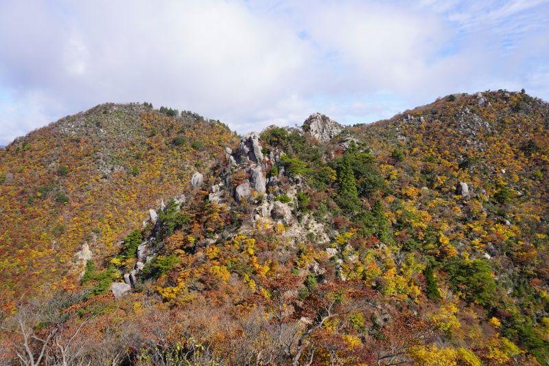
奇岩の数々
東峰付近には奇岩がゴロゴロと続く箇所があり、中でも獅子岩と呼ばれる岩峰は見応えバツグンです。
獅子岩を越えた先には仙ヶ岳のシンボルと言われている「仙の石」があり、縦長の大きい石がポツンとそびえ立つ光景に圧倒されます。
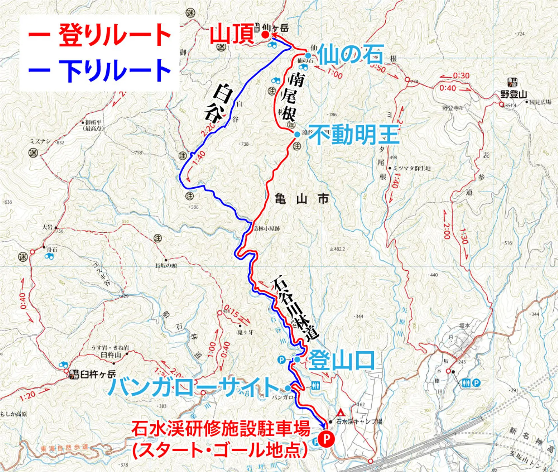
登山コースの概要
この記事では亀山7座トレイルマップの登山コースに基づいた「南尾根ー白谷コース」をご紹介!
コースタイムは約5時間、休憩は約1時間、合計で約6時間の登山になります。
登りのコースプラン
石水渓研修施設駐車場からスタートし、バンガローサイト近くの林道を通って登山口へ到着。そこから石谷川林道を経由して南尾根コースを進み、不動明王コルから尾根伝いに歩いて「仙の石」と西峰の山頂を目指します。
【登りルート】駐車場(7:00)→ 南尾根(7:56)→ 仙の石(09:58)→ 西峰の山頂(10:22)
下りのコースプラン
西峰の山頂で昼食休憩を取ったあとは白谷コースを通って下山し、石水渓研修施設駐車場に戻ってゴールです。
【下りルート】西峰の山頂(11:22) → 白谷コース(11:32〜)→ 駐車場(13:30)
コース難易度:超上級
南尾根・白谷コースは変化に富んだ登山道と素晴らしい眺望の数々を楽しめるのですが、足場の悪い場所や崩壊地を歩いたり、岩場を登る箇所があるため、登山上級者向けのコースとなります。1人で行動するのではなく、登山に慣れた方と行動しましょう。
- 登山の注意点・心得
- ① 登山をする際は時間に余裕をもって行動し、自分の経験や体力に見合った山を選んで出かけましょう。
- ② 事前に登山計画を立て、当日までに最寄りの警察署か登山ポストに登山届を出しましょう。
- ③ この登山コースでは川沿いを通る箇所があるため、大雨のあとは増水で通れない可能性があります。事前に気象情報をしっかり確認しましょう。
- ④ 雨具をはじめ、急な気温の変化にも対応できる服装を用意しましょう。
- ⑤ 水分や携帯食を持参し、熱中症対策と適度な休憩を心がけましょう。
- ⑥ 冬場に登頂する際はアイゼンなどの雪山の登山道具を必ず持参しましょう。麓に雪が無くても山頂付近に雪や氷が残っている可能性があります。
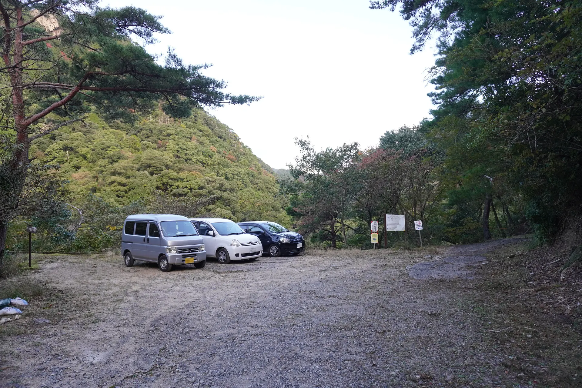
駐車場の場所
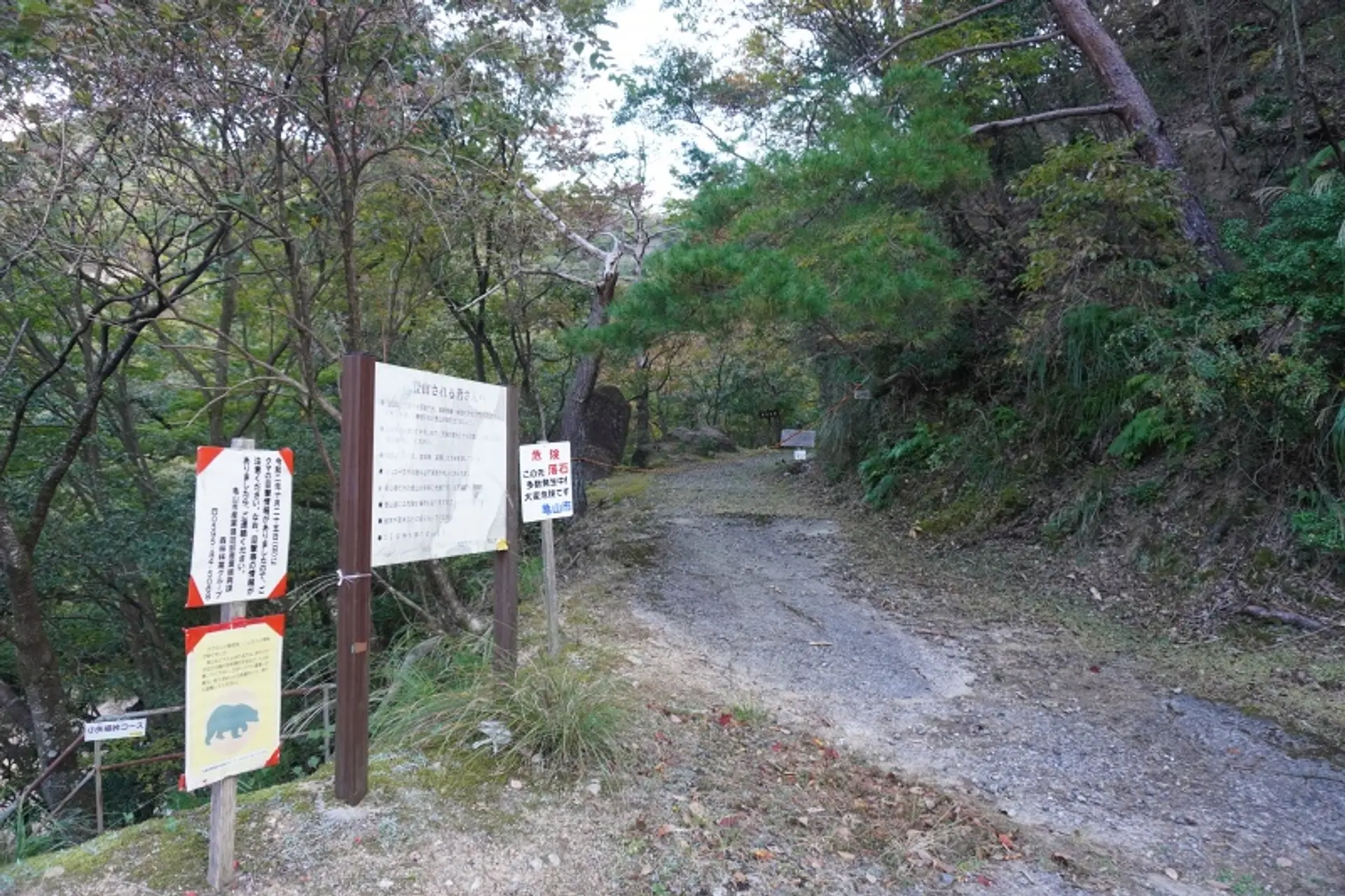
今回の登山コースに最適な駐車場は石水渓研修施設駐車場と砂防ダムの上にある登山口の駐車場です。※画像は登山口の駐車場
登山口の駐車場は停められる台数が約5台と少なく、車のナビでは認識されないような林道を経由して行くので、駐車台数の多い石水渓研修施設駐車場がオススメです。
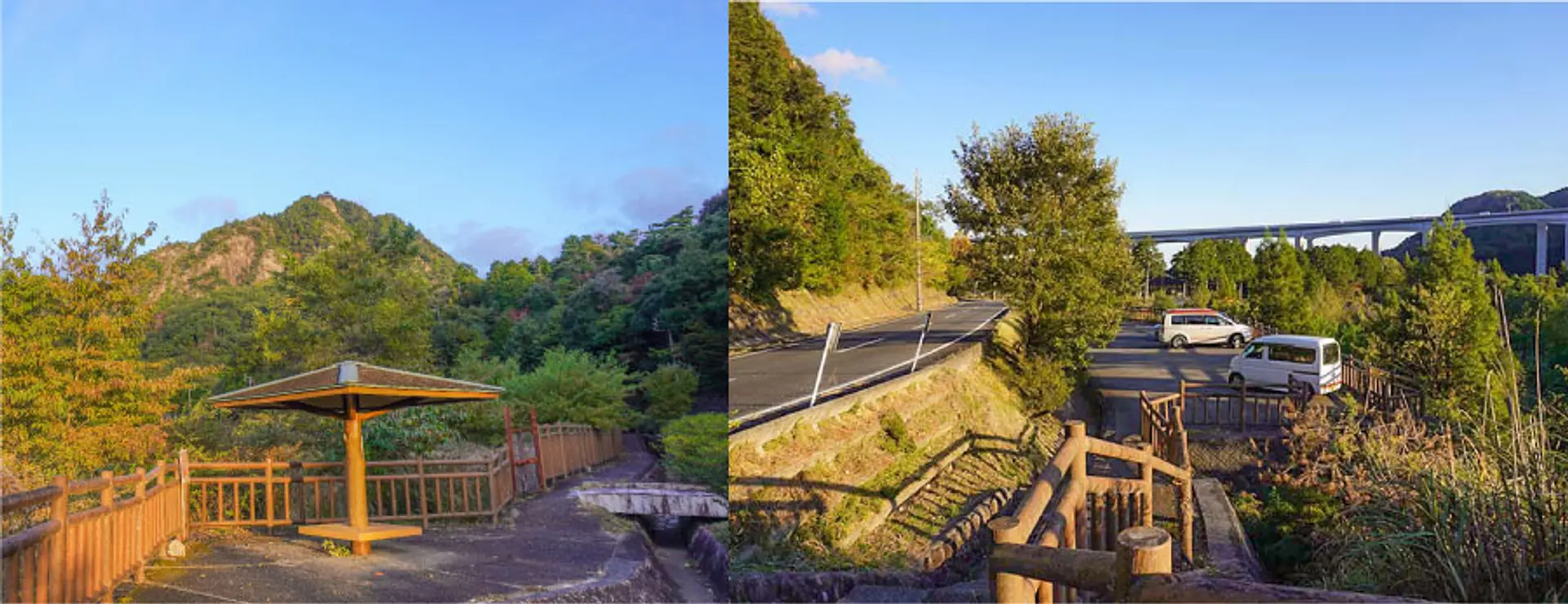
もし、石水渓研修施設駐車場が混雑する場合はすぐ近くの道沿いに5台ほど停められる駐車スペースがあります。上記画像がその駐車スペースで、併設されている東屋が目印です。
この記事で紹介する登山コースは石水渓研修施設駐車場からスタートするルートになります
※石水渓研修施設駐車場は石水渓キャンプ場が管理する駐車場になります。キャンプ場の利用者が多いシーズンは、登山口の駐車場か東屋が目印の駐車スペースを利用しましょう。
登山コースの解説
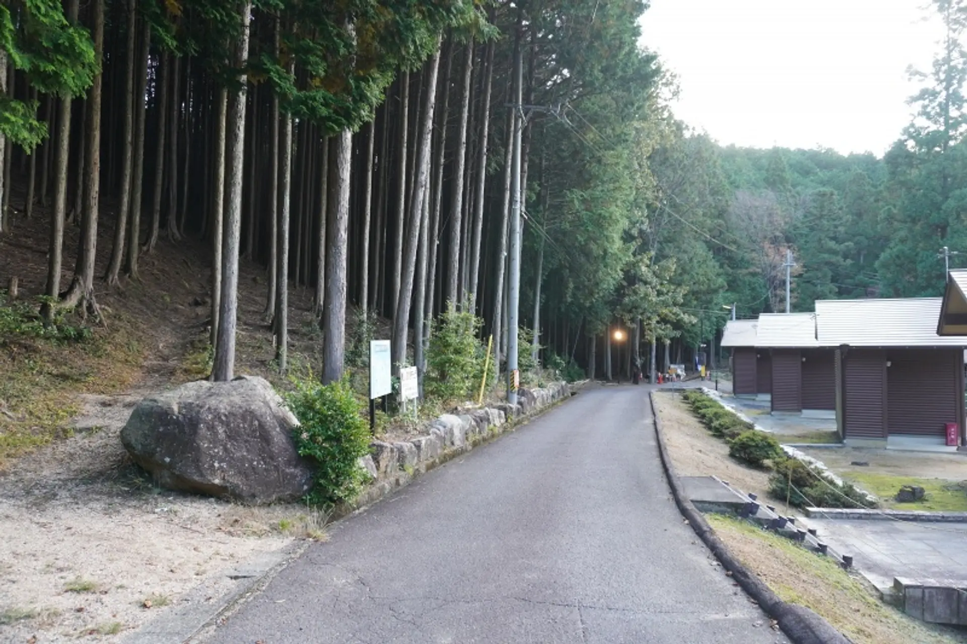
バンガローサイト(07:09)
石水渓キャンプ場のバンガローサイトの向かいにある林道が登山口へ繋がるルートです。林道の入口には石水渓ガイドマップの看板があるので、それを目印にするといいでしょう。付近にトイレもありますよ。
徒歩:約4分
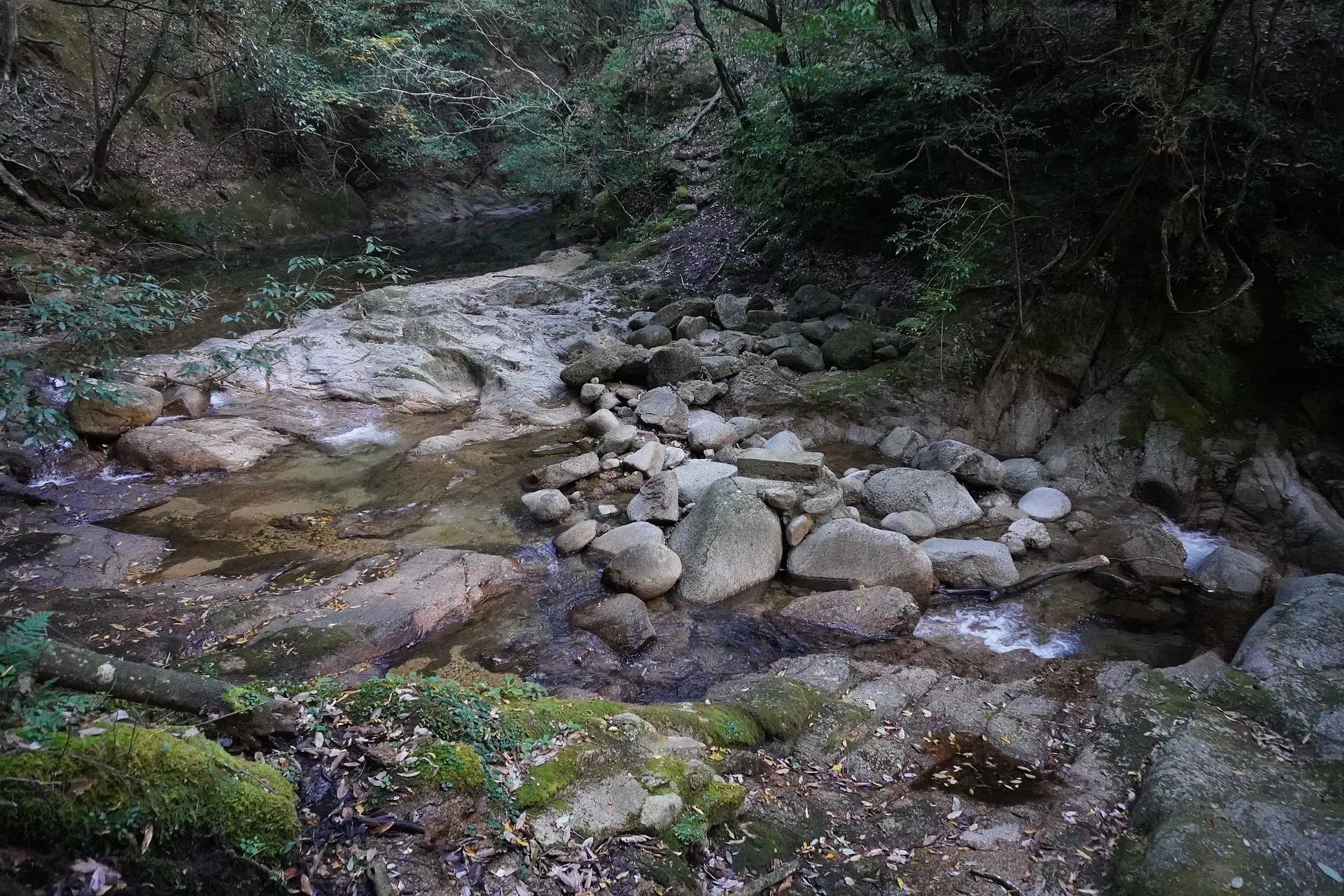
石谷川林道(07:13)
林道の先には石谷川があり、河原の石の上を歩くようにして渡ります。すると、「三ツ渕」と「白糸の滝」の分岐が見えてきますので、三ツ渕へ進むと登山口に到着します。
徒歩:約5分
登山口(07:18)
登山口に到着しました。登山に関する案内看板が立っており、その先に続く林道が登山道です。道中には落石や崩落個所があるので、注意して行動しましょう。
徒歩:約38分
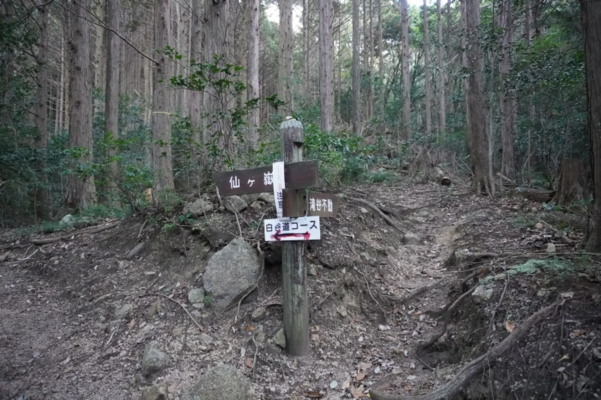
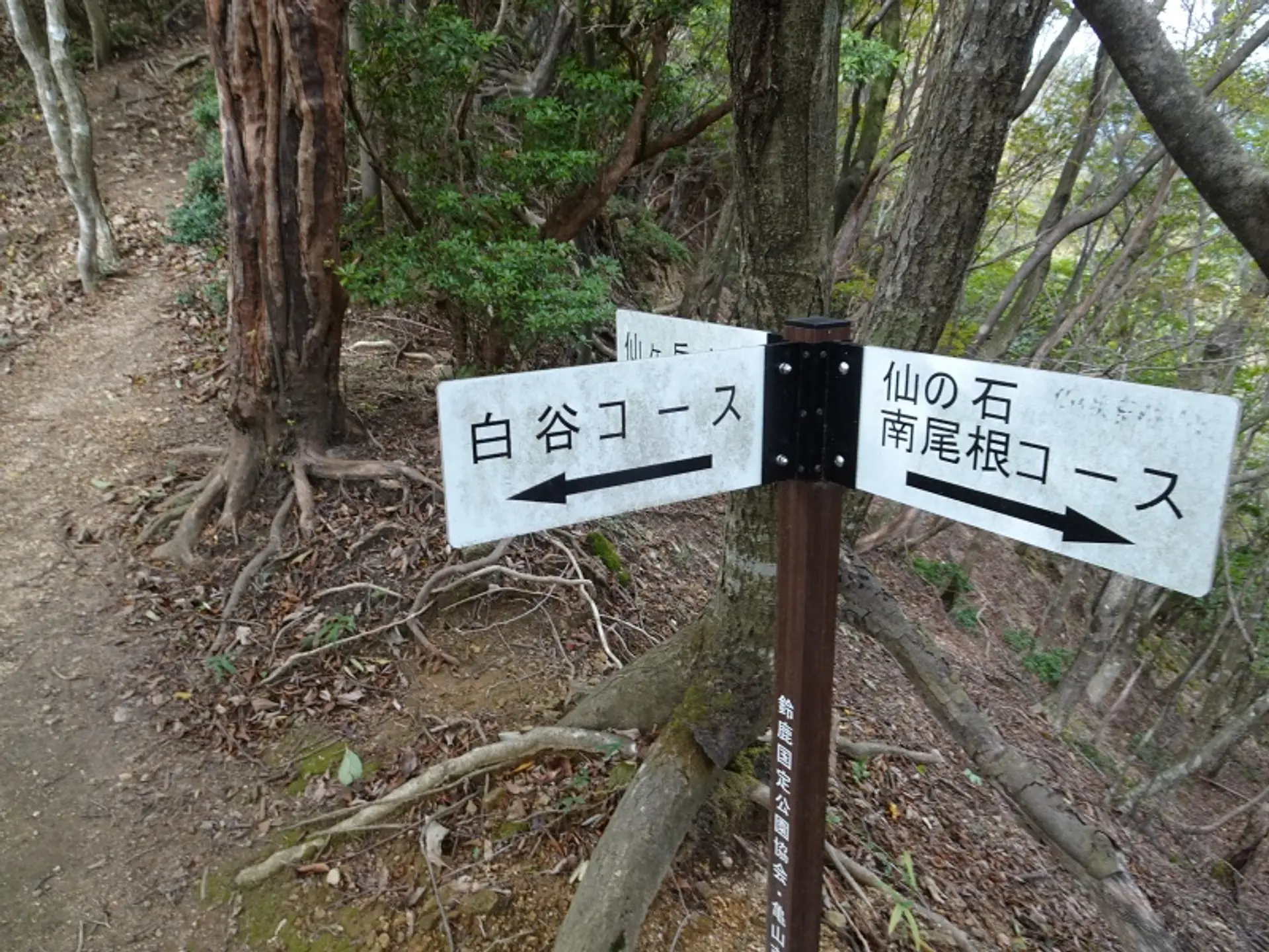
南尾根コース・白谷コース分岐(07:56)
南尾根コース・白谷コースの分岐点に到着しました。今回、上りは南尾根コースになるので、ここを右折します。帰りは西峰の山頂から白谷コースを下って、ここへ戻ってきます。
徒歩:約2分
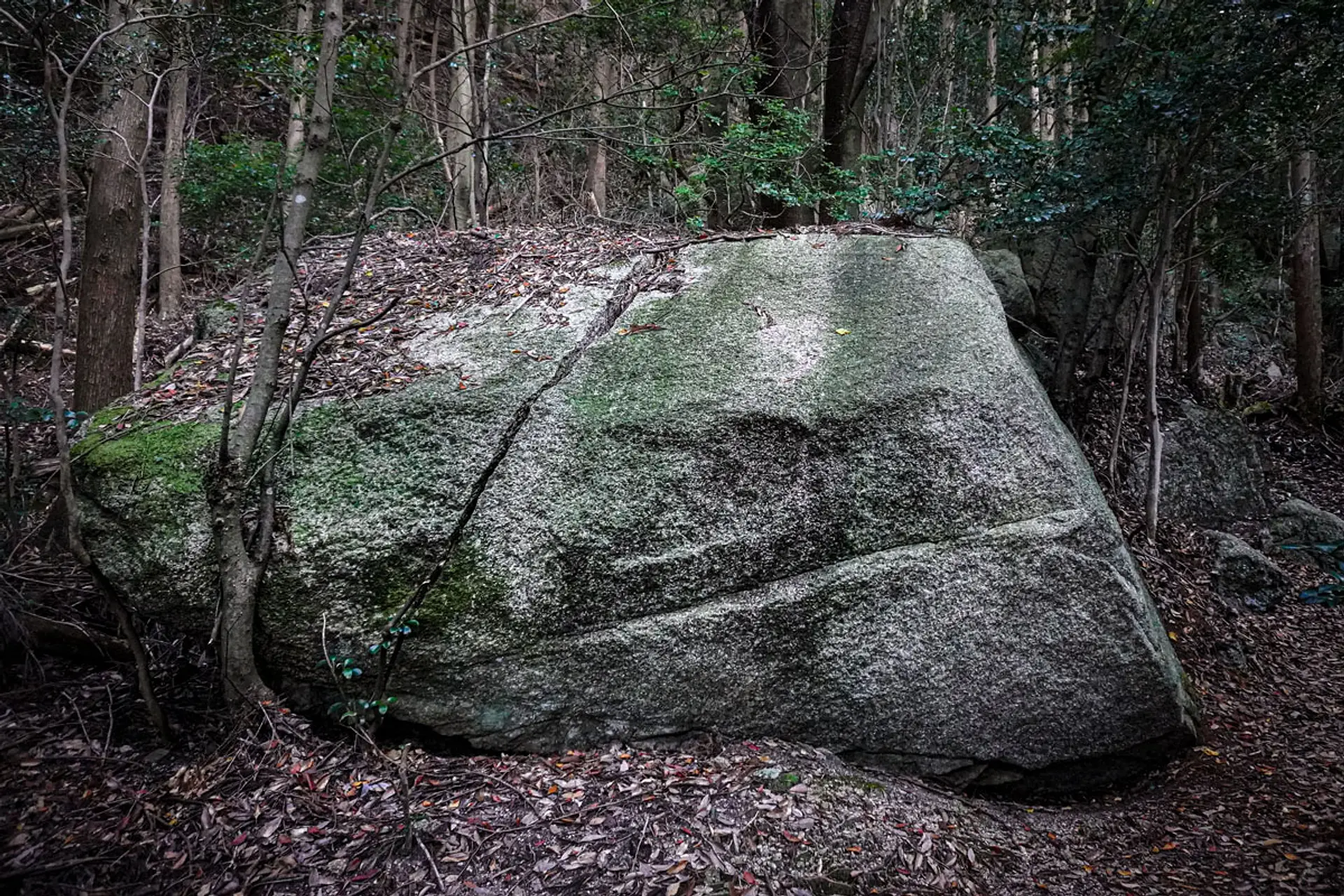
炭治郎が斬ったかもしれない大岩(07:58)
分岐点を越えた先には真っ二つに割れた大岩が鎮座します。私はこの岩を「炭治郎が斬ったかもしれない大岩」と勝手に命名しています(笑)。炭治郎とは今流行の「鬼滅の刃」に登場する主人公なのですが、劇中で似たような大岩が登場しました。今後、この場所が珍名所として話題を集めるかもしれません。
徒歩:約15分
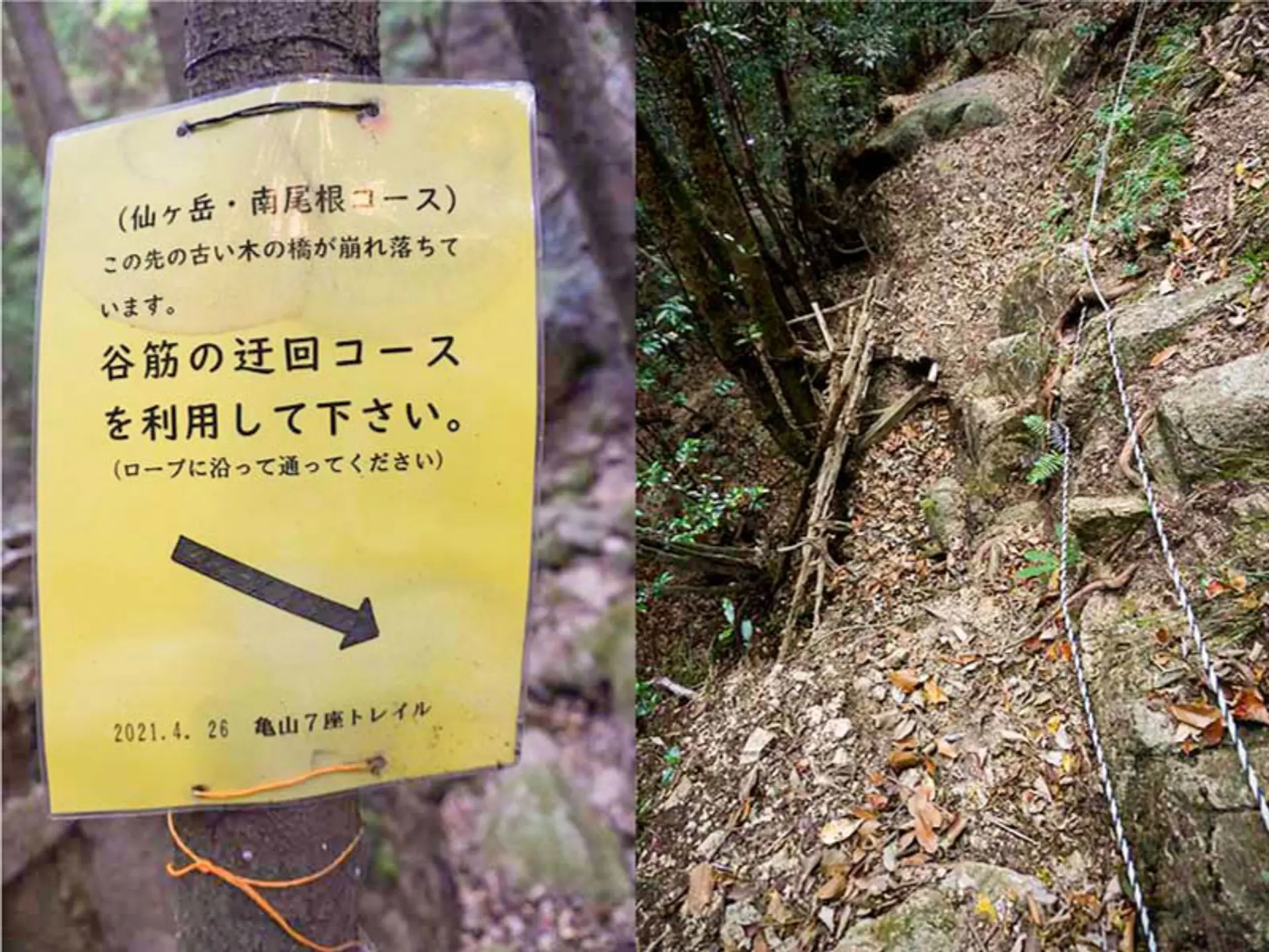
谷筋の巡回コース(08:13)
以前まであった木の橋が崩壊した箇所があり、谷筋の巡回コースを経由して先に進みます。谷筋に設置されたロープに沿って、進みましょう。
徒歩:約8分
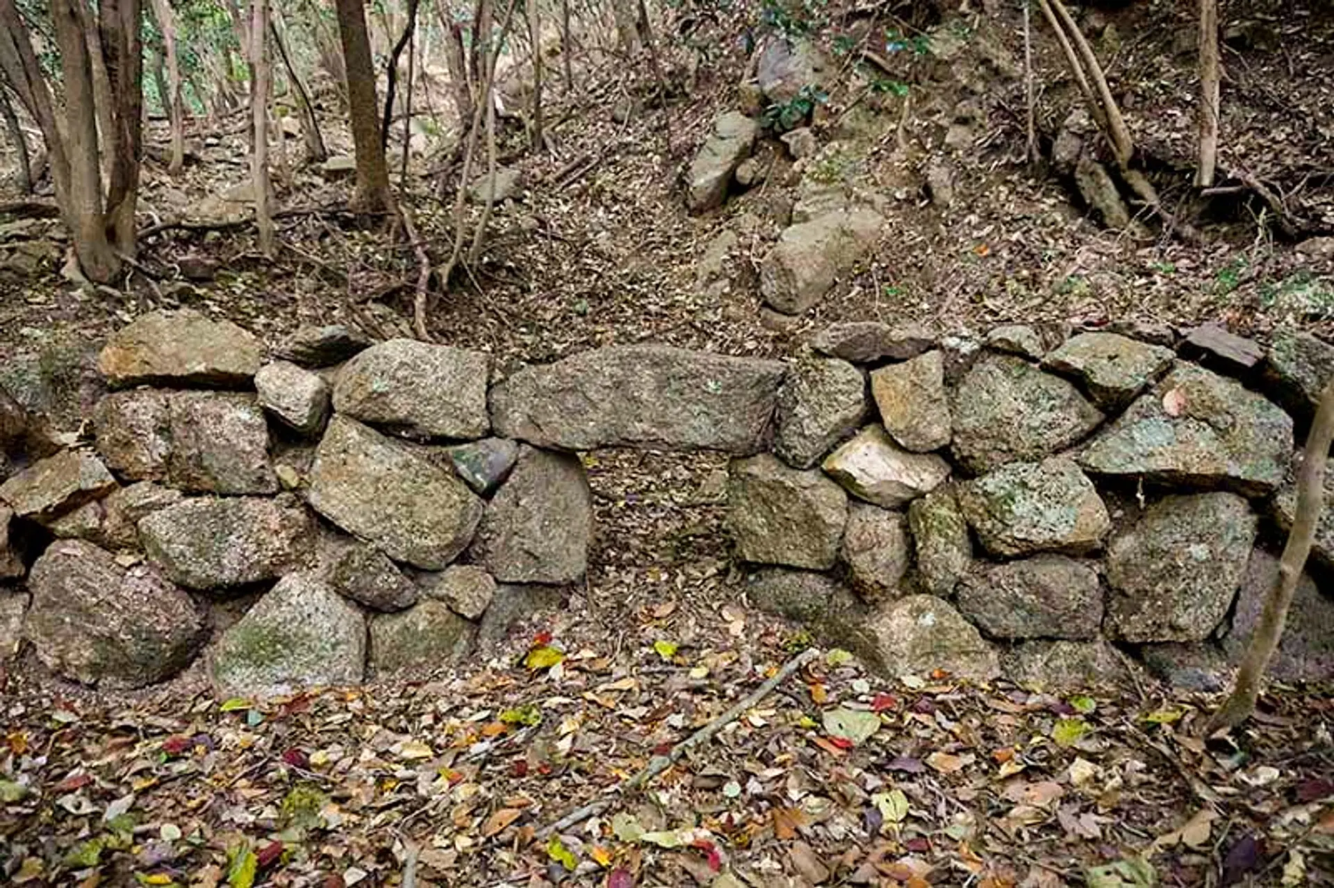
炭焼き窯跡(08:21)
焚口の石もしっかり残った炭焼き窯跡です。炭が生活に欠かせなかった時代、ここで炭を作り生活の糧にしていたと思われます。ちなみに、炭治郎は炭焼きの仕事をしていたのと、「鬼ヶ牙」という山が付近にあるので、亀山市には鬼滅の刃を想像させるような要素があります。
徒歩:約11分
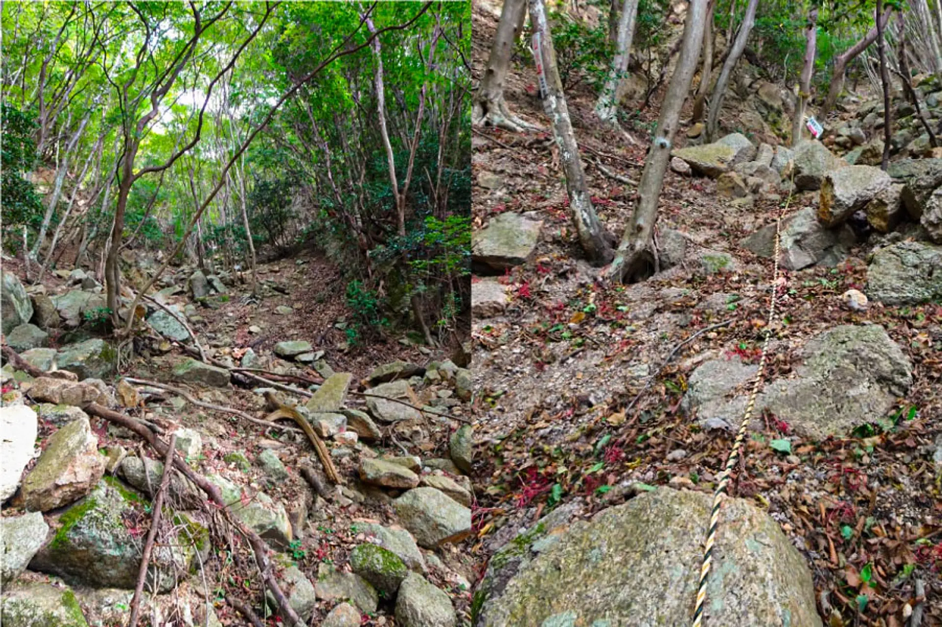
イタハシ谷(08:32)
南尾根の合流地点まで谷道を登っていきます。急斜面が続く箇所にはトラロープがあるので、これを有効活用しながら足元に注意して進みましょう。
徒歩:約16分

南尾根の合流地点(08:48)
ここから山頂方面へと進むのですが、時間に余裕のある方は不動明王像へ立ち寄ってみましょう。山頂方面は岩場を登る箇所があるので、三点支持を確保し、安定した岩や太い木の根をホールドしながら登りましょう。備え付けのトラロープはあくまでも補助的な役割ですので頼りすぎないように。
徒歩:約21分
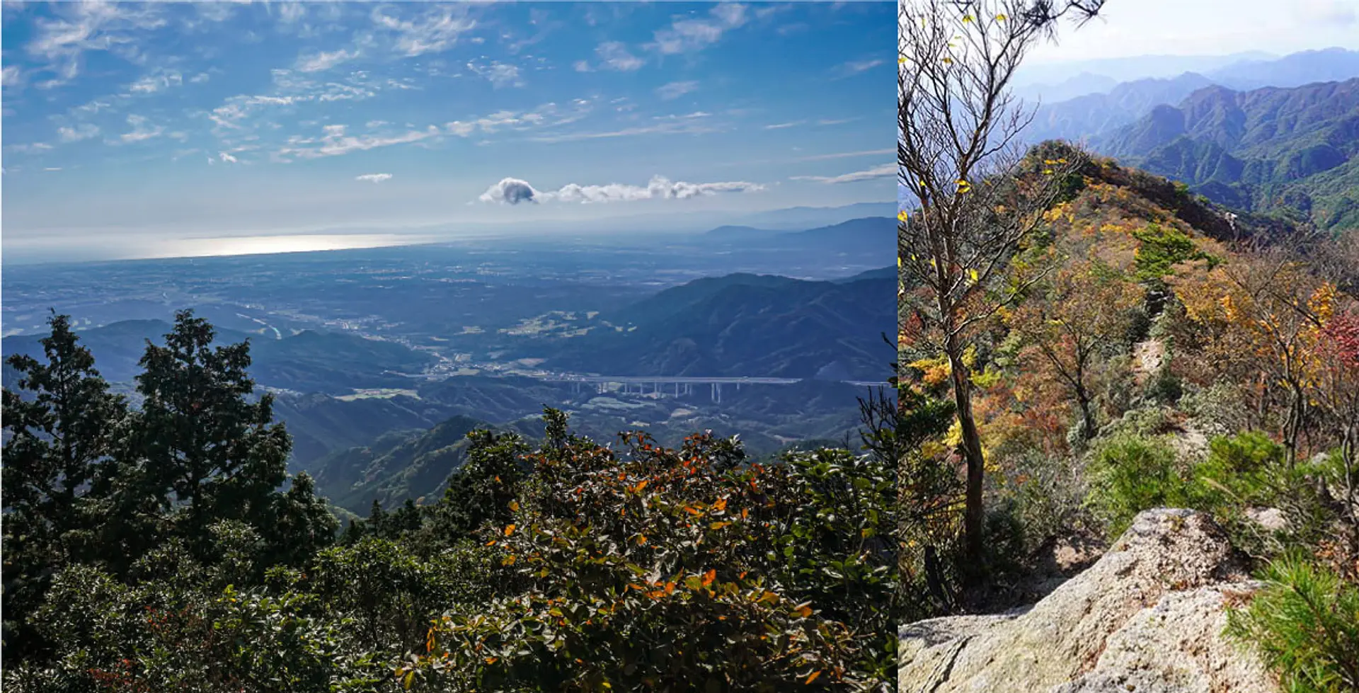
南尾根からの眺め(09:09)
岩場を登りると、伊勢湾を一望できる尾根道に入ります。ここから山頂まで素晴らしい眺望が続く絶景ルートです♫
徒歩:約23分
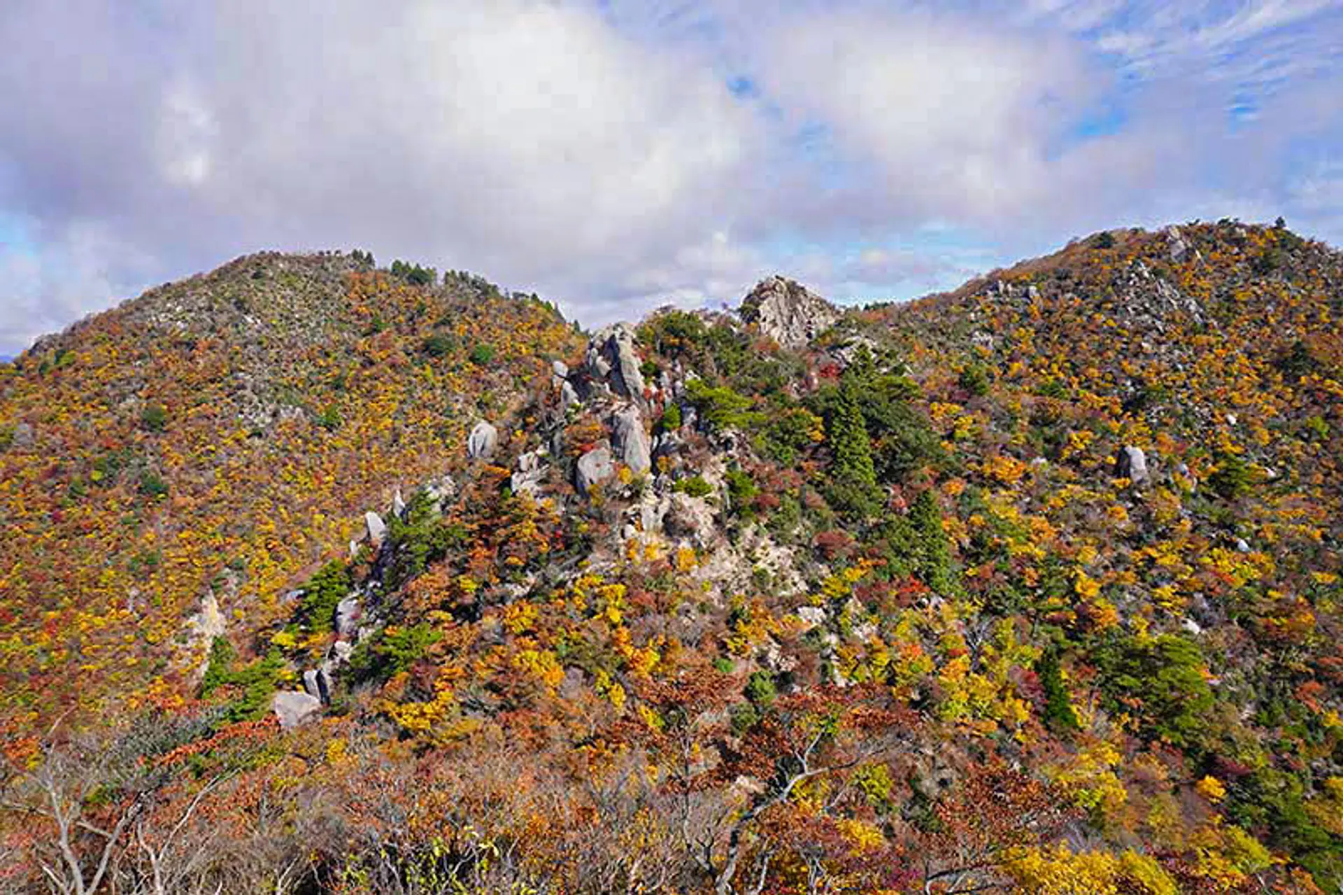
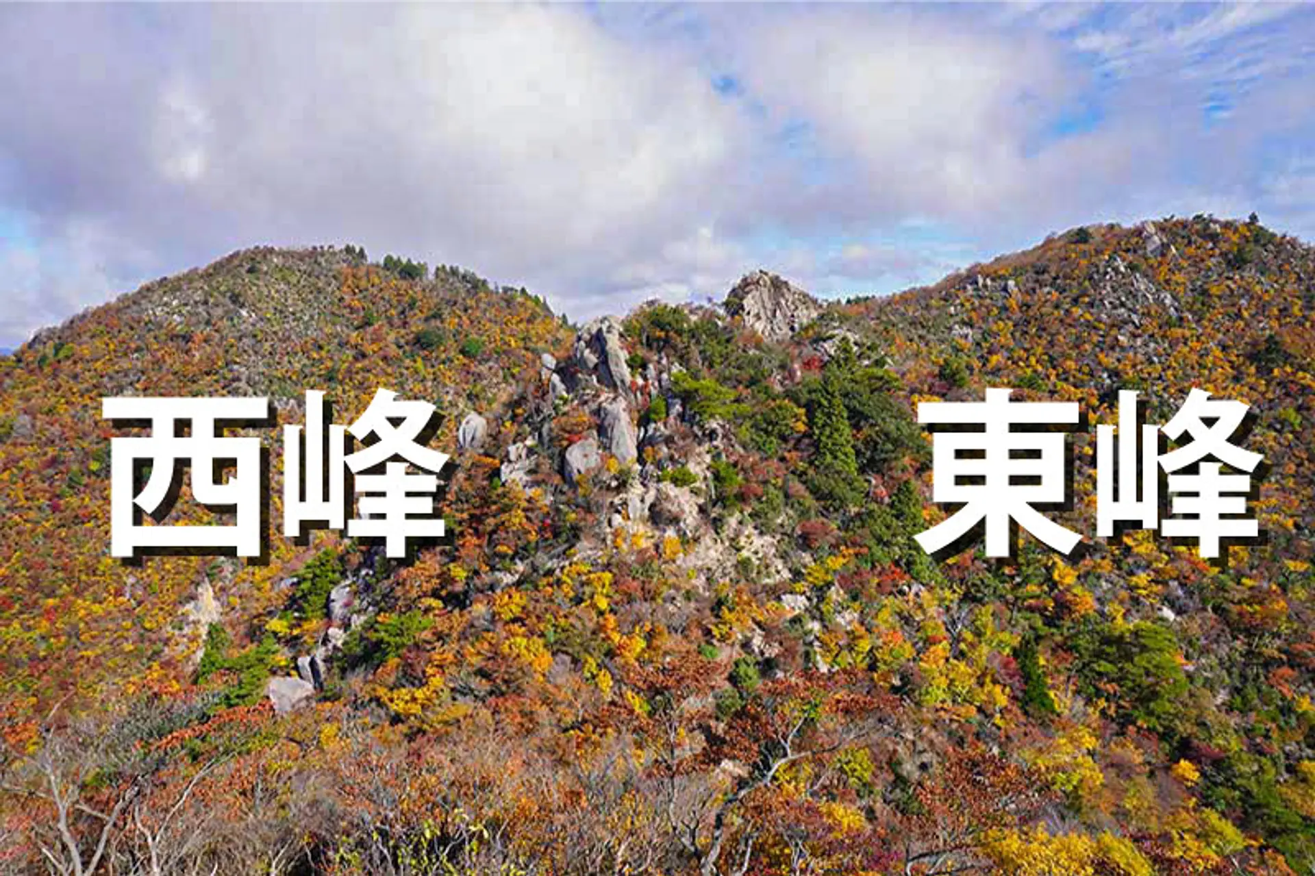
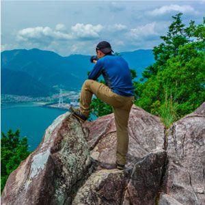
仙ヶ岳の山頂を見渡す(09:32)
尾根道を歩き続けると、仙ヶ岳の山頂がだんだんと近づいてきます。上記写真の左側が西峰、右側が東峰です。真ん中の岩肌は獅子岩と呼ばれる岩峰です。
徒歩:約18分
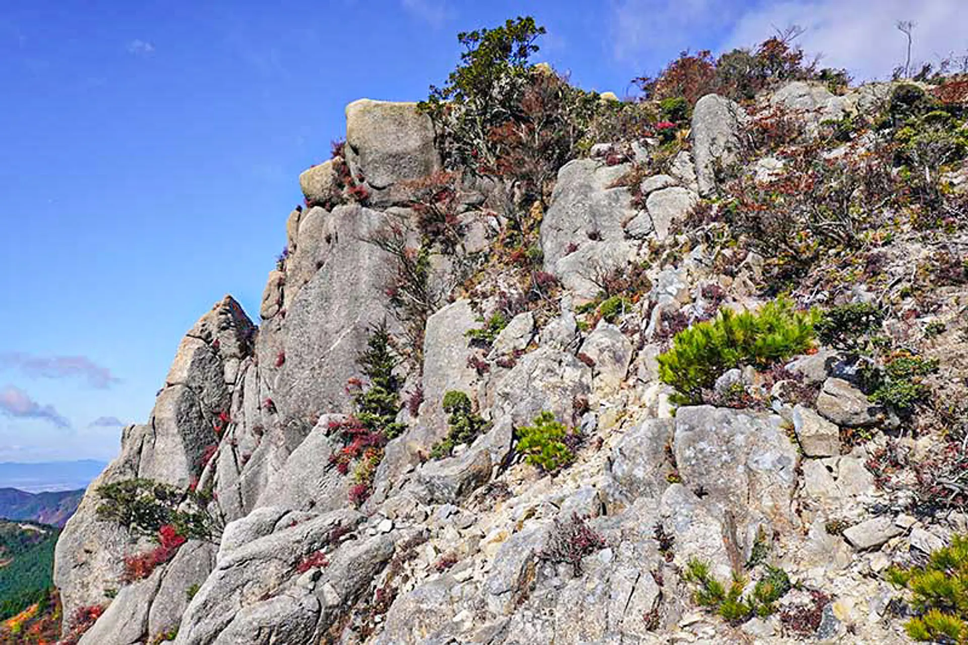
獅子岩(09:50)
獅子岩の近くまで来ました。巨大な岩がゴロゴロと山の上にある不思議な光景です。獅子岩からの眺望も大変素晴らしいので、小休止して絶景を堪能するのもオススメ。獅子岩の真横を通り過ぎた先に仙の石があります。
徒歩:約8分
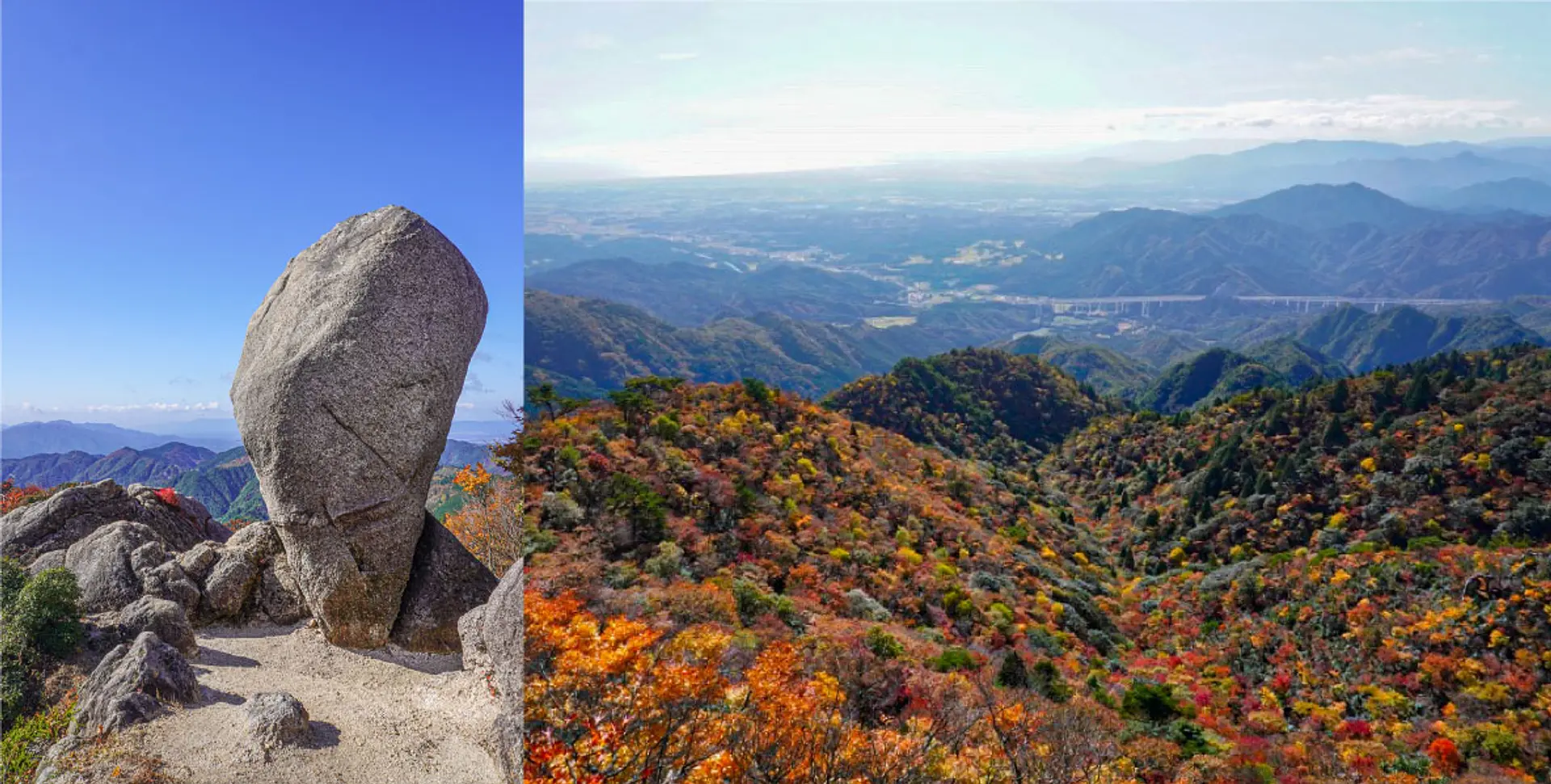
仙の石(09:58)※10分ほど小休止
登山口から2時半ほど歩いて仙の石に到着!縦長の大岩がポツンと立つ光景に圧倒されます。ここからは絶景のパノラマビューを堪能でき、秋は山の斜面が真っ赤に染まる風景を見られます。
徒歩:約1分
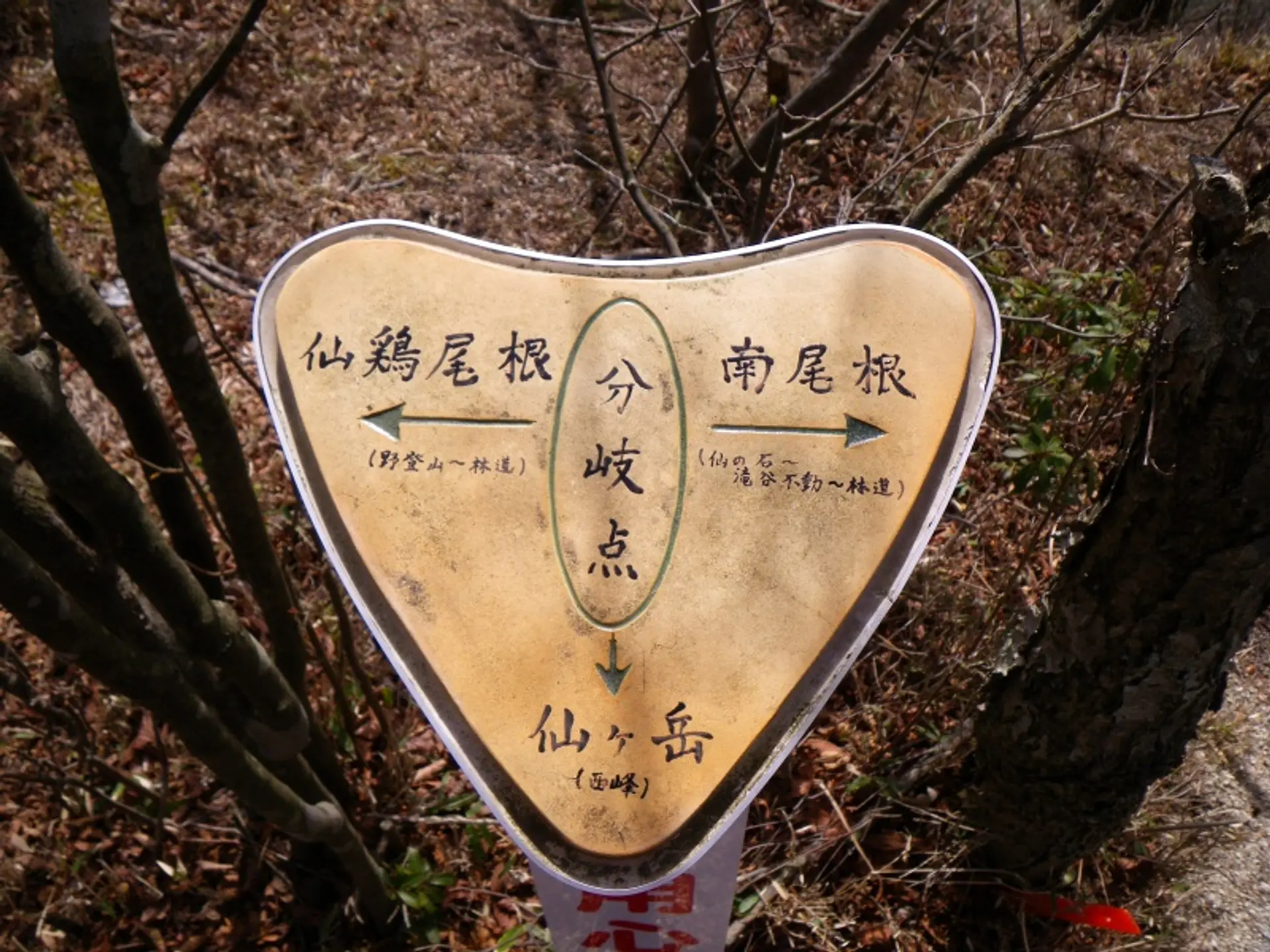
仙鶏尾根・南尾根・西峰の分岐(10:10)
仙の石のすぐ近くに分岐点があり、次は「仙ヶ岳(西峰)」方面へ向かいます。「南尾根」はこれまで通ってきた道、「仙鶏尾根(せんけいおね)」は亀山7座の野登山(ののぼりやま)へ続くルートです。
徒歩:約3分
白谷コースの分岐点(10:13)
西峰までの道中に白谷コースの分岐点があります。西峰へ行ったあとはこの分岐点に戻り、白谷コースを経由して下山します。
徒歩:約9分
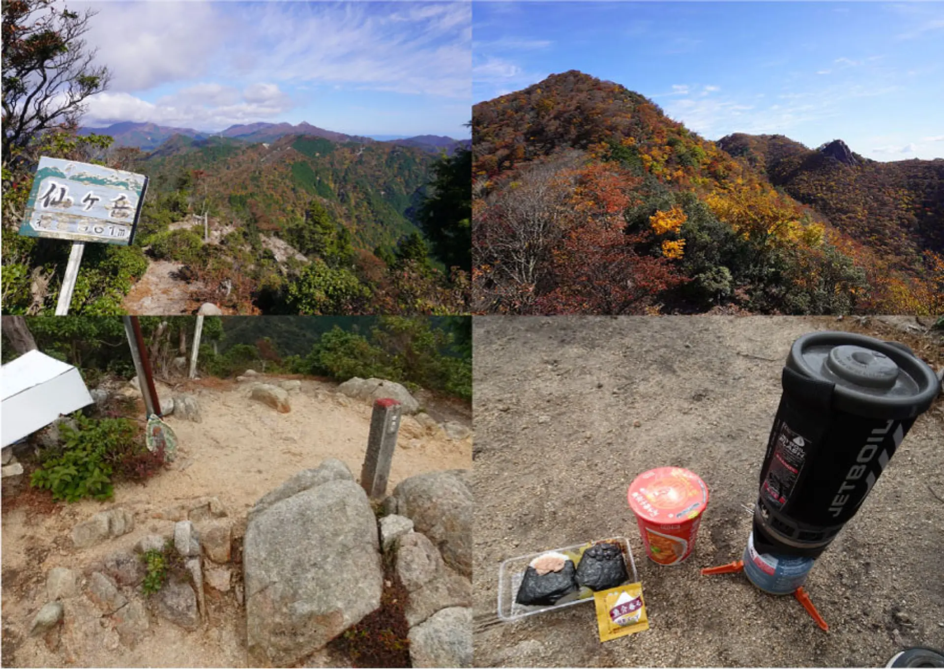
西峰の山頂(10:22)※1時間ほど休憩
最終目的地に到着!標高961mと表記された看板が立っており、ここからの眺望が抜群!鈴鹿セブンマウンテンや亀山7座の山々を見渡せますよ。足場が広いので昼食休憩をここで取りました♫ 絶景を満喫しながら体力回復をしたところで、白谷コースの分岐点へ戻ります。
徒歩:約7分
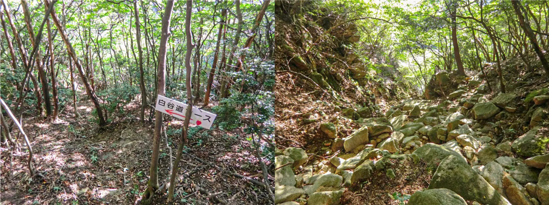
白谷コース(11:32)
白谷コースを経由して下山します。道中は急な谷筋の続く箇所や足元に浮石がゴロゴロと広がる沢道があるので、ストックで体を支えるなどして注意しながら下山しましょう。
徒歩:約30分
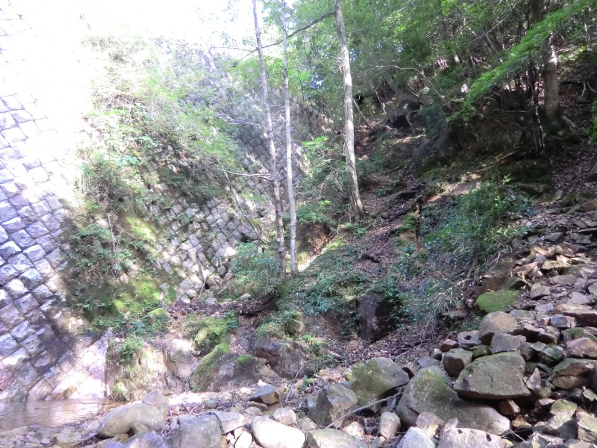
砂防ダム(12:02)
下り続きだった谷筋が終わり、ここから砂防ダムの脇道を進みます。登山道が崩壊した個所があるため、慎重な足運びを意識して進みましょう。
徒歩:約20分
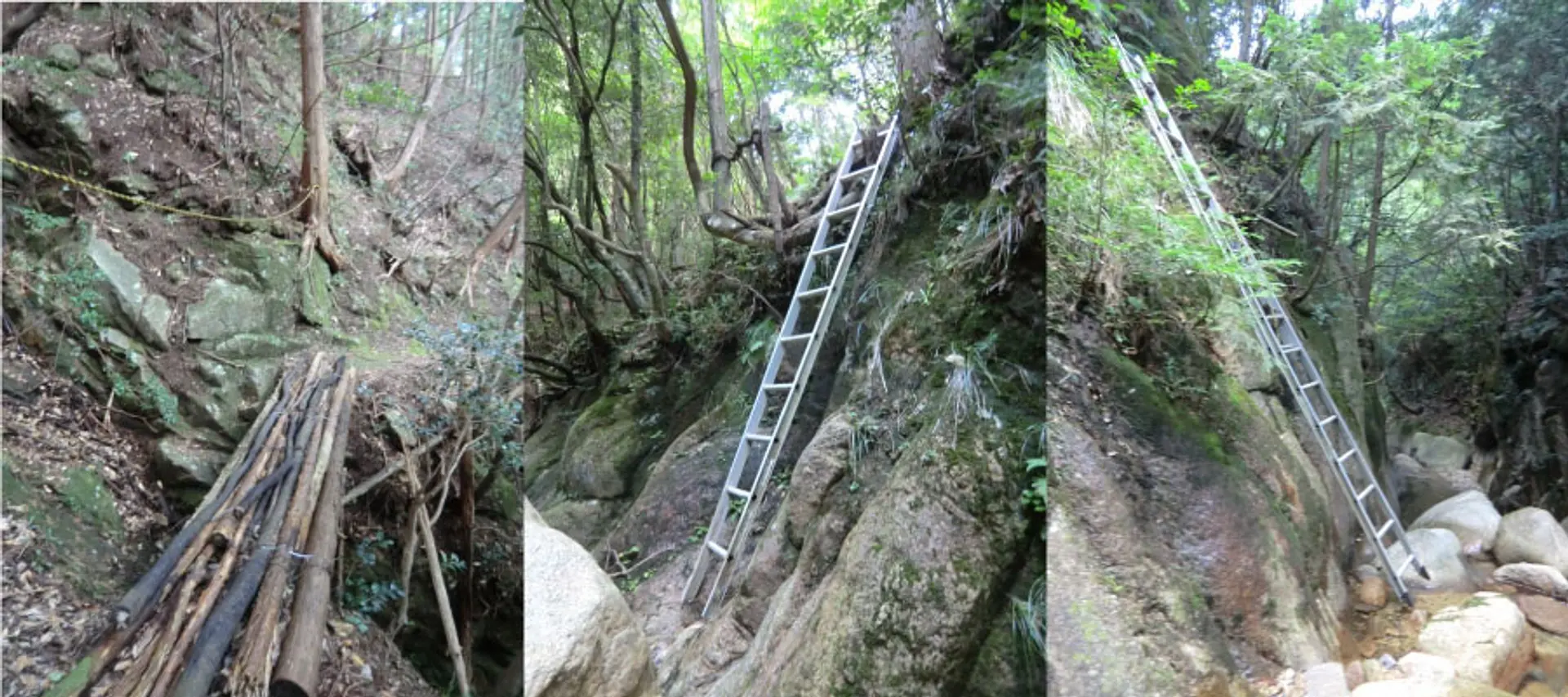
木の橋・ハシゴで山抜け(12:22)
スリル満点の木の橋が3箇所あり、谷をハシゴで降りてハシゴで登る山抜けの箇所があるので注意して進みましょう。※山抜け:登山道が大雨で流され崩壊し迂回ルートとして谷をハシゴで経由する
約25分
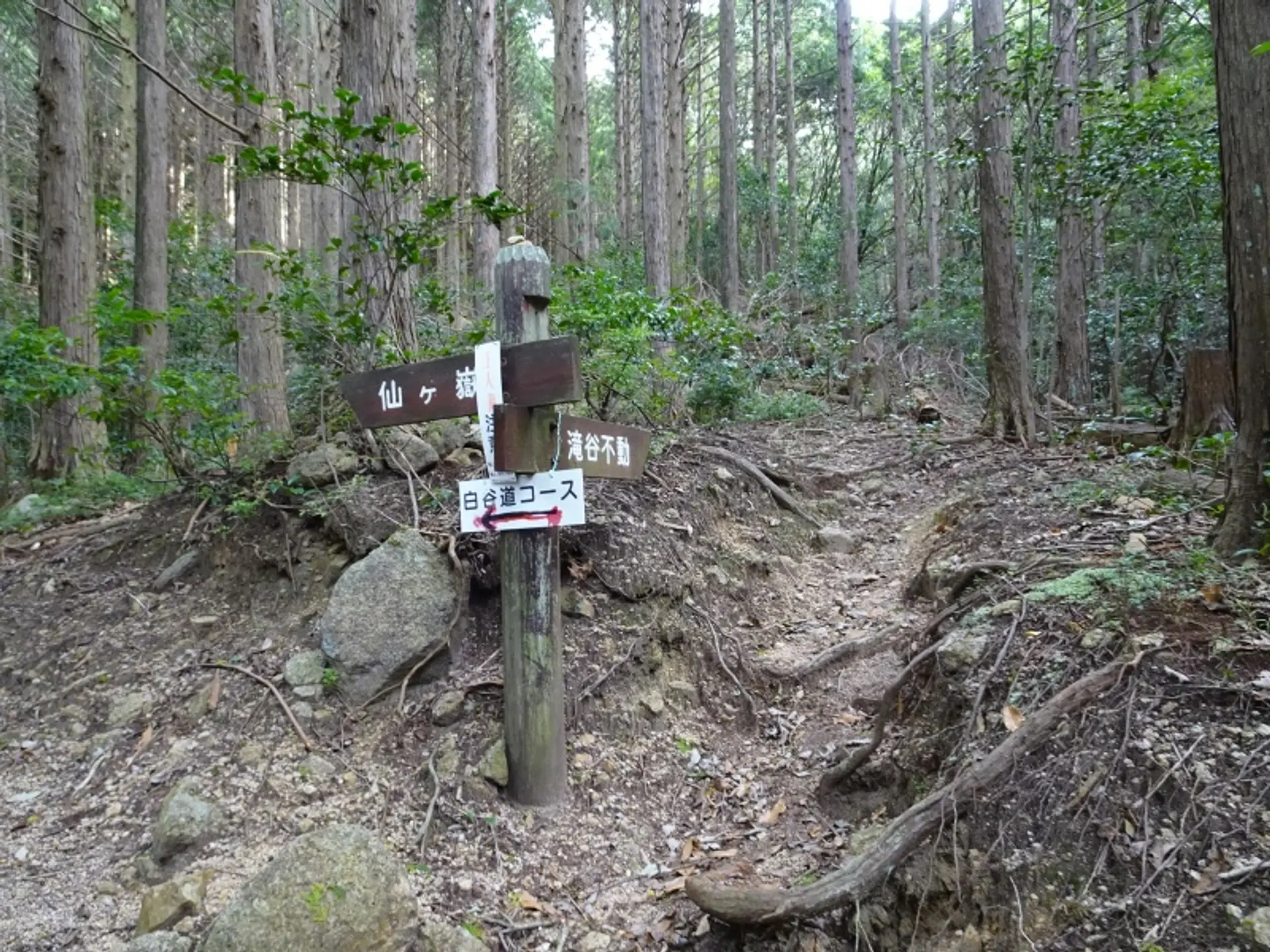
南尾根コース・白谷コース分岐点(12:47)
最初の分岐点へ戻ってきました。登りと下りで違うルートを辿れるのが南尾根〜白谷コースの魅力です。石谷川林道を通って、駐車場へ戻り、帰路へと着きましょう。
徒歩:約40分で駐車場着
いかがでしたでしょうか
仙ヶ岳の魅力を登山コースの紹介と共にたっぷりお届けしました!仙ヶ岳は亀山7座の中でも抜群の眺望と変化に富んだ登山道を楽しめるので、様々なバリエーションを楽しみたい方にピッタリです。
往復5〜6時間以上の登山コースになるので、ご遠方の方は石水渓キャンプ場への宿泊がオススメです。バンガローの料金やキャンプ場の利用料金は石水渓キャンプ場の公式サイトをご覧ください。
亀山7座トレイルを楽しもう
観光三重では、亀山7座の魅力や各山の登山コースを紹介する亀山7座トレイルの特設サイトを公開しております。亀山7座の魅力や各山の登山コースを紹介しております。
また、みえ旅カメラ部のASOBISIAさんが亀山7座トレイルの魅力を記事で発信しております。各山の魅力が1ページで全て分かりますので合わせてご覧ください。
亀山7座トレイルの最新情報
亀山市の公式ホームページでは、亀山7座トレイルへの取り組みやイベントなどの最新情報を発信されています。
登山届けのダウンロードや登山届けの提出先が明記されていますので、亀山7座へ行かれる方は目を通しましょう。亀山7座トレイルマップのダウンロードも出来ますよ。
記事の製作者について
ふがまるちゃん(記事制作)
観光三重のみえ旅カメラ部に所属し、三重を撮る写真家としてTwitter・instagramを中心に活動中。三重の風景を無料配布する三重フォトギャラリーと三重の旬な情報を発信する三重のええとこ巡りを運営。
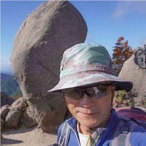
kazenami(写真撮影)
ふがまるちゃんの父親。三重県内のあらゆる山を登頂し、トレッキングだけでなくロッククライミングやアイスクライミング、シャワークライミングもこなす山男。これまでの山行記録をヤマレコで公開中。