Explanation of Mt. Shishigatake with a good view! We also introduce forest walking courses that the whole family can enjoy♪
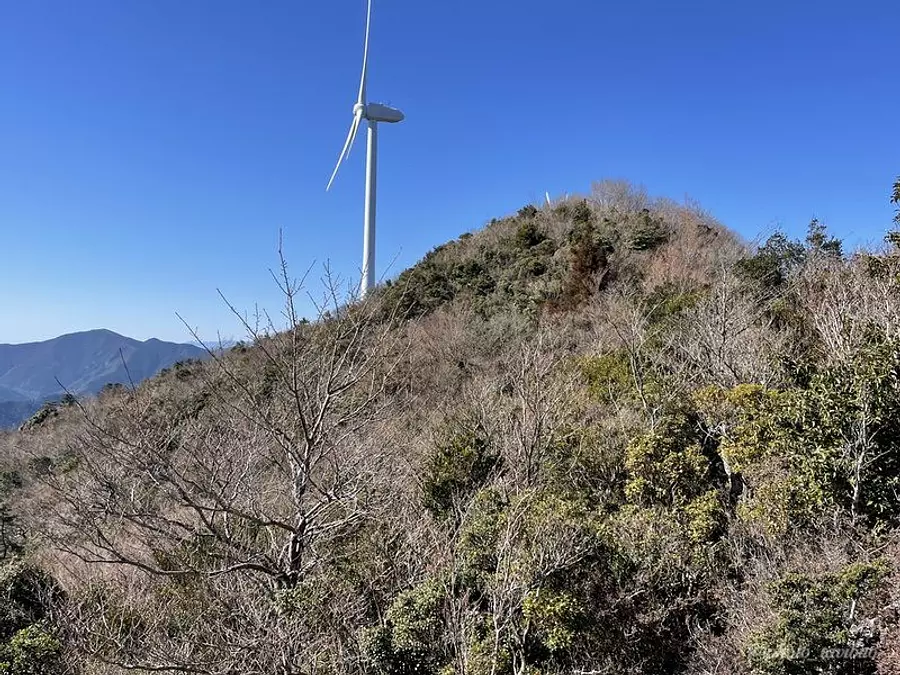
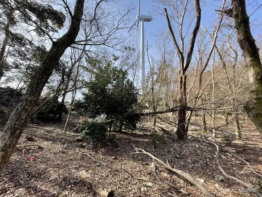
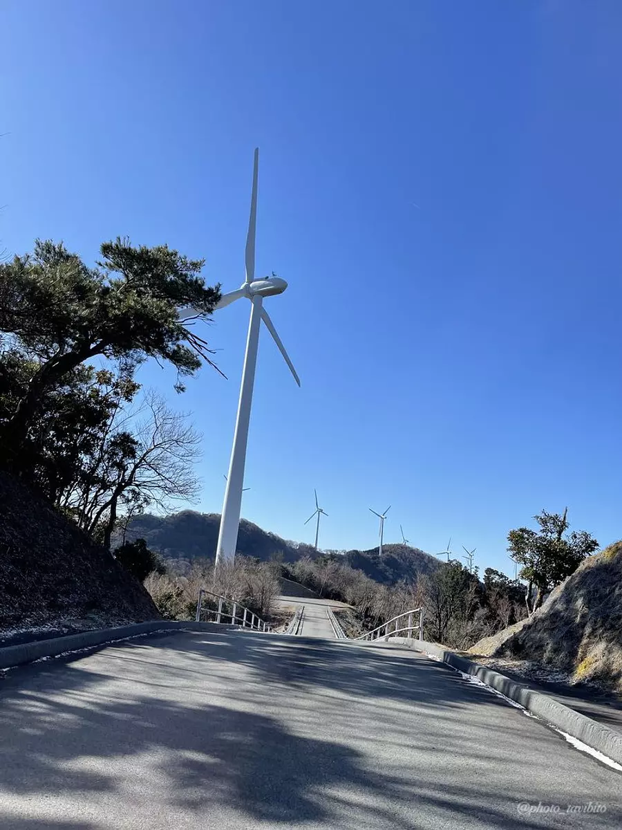
Shishigatake is a mountain located deep in the mountains of Watarai-cho, Mie WataraiTown, with an attractive view, and is a mountain that even beginners can climb and enjoy. Walking along the mountain while admiring the large windmills that can be seen on the way up the mountain is a fun experience that cannot be experienced on ordinary mountains.We will introduce the route of Mt. Shishigatake and recommended spots in the surrounding area.
Article production / Mie Travel Climbing Club TAKA
- [Things to keep in mind when climbing]
- Climbing involves dealing with nature, so there is a good chance that uncertainties and unexpected situations will occur. Be prepared, plan well, and have fun.
~table of contents~
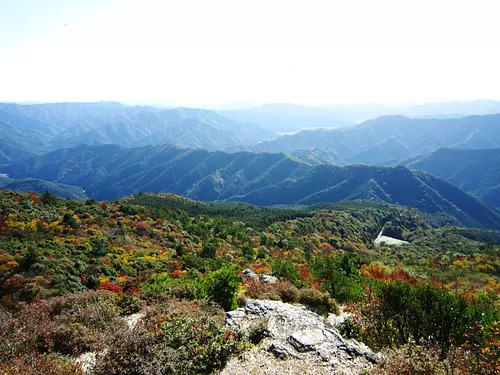
What kind of mountain is Shishigatake?
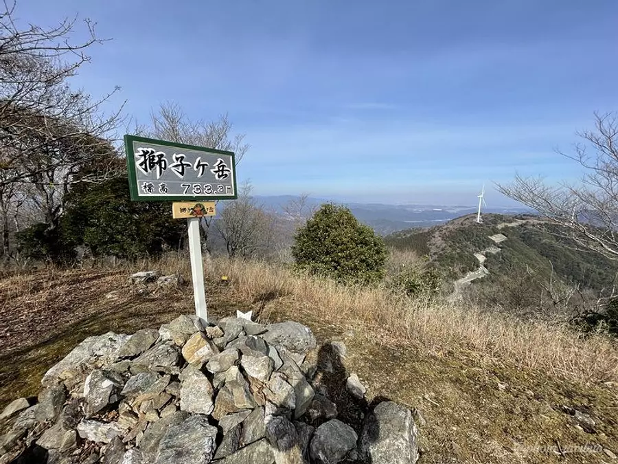
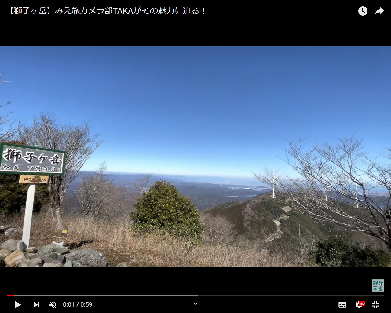
The altitude of Mt. Shishigatake is 733m.
If you only ask about the altitude, some people may think, ``I wonder if I can climb it...'', but the altitude of the parking lot where the trailhead is located is about 530m, and there is only about 200m left to climb, so it's not that difficult. I think so ^ ^
Thanks to the warm climate in the southern part of Mie Prefecture, we recommend this mountain as one that is relatively easy to climb even in winter when the northern part is covered in snow.
- As a point of caution
- The parking lot is located at a high altitude, so please be careful of frozen roads.
Also, one of the charms of Mt. Shishigatake is its ``good view.''
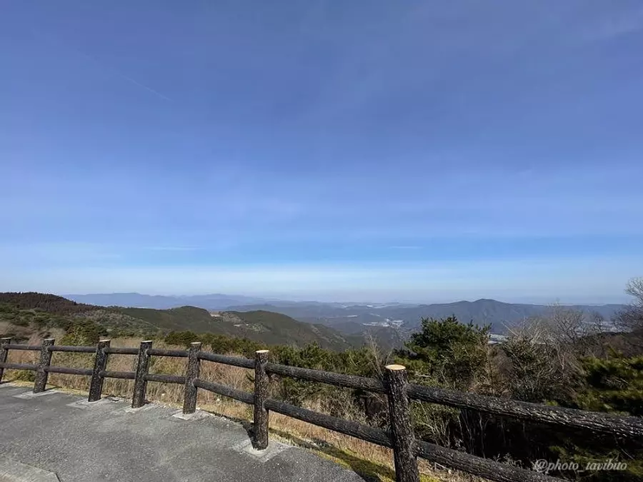
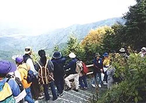
Not only is the view from the top great, but you can also enjoy the view from the parking lot!
You can see the Pacific Ocean and the mountains of Mie Prefecture from the mountain trail, so you can have fun while climbing ^ ^
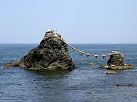
Shishigatake, the origin of its mountain name
Mt. Shishigatake has a really cool mountain name!
Regarding this mountain name, there is a description like this on WataraiTown website.
``The rocky part at the top of the mountain looks like the tip of a boar's nose and is called ``Shishigahana,'' hence the name of the mountain.''
It seems like the ``shishi'' of the boar has become ``shishi''.
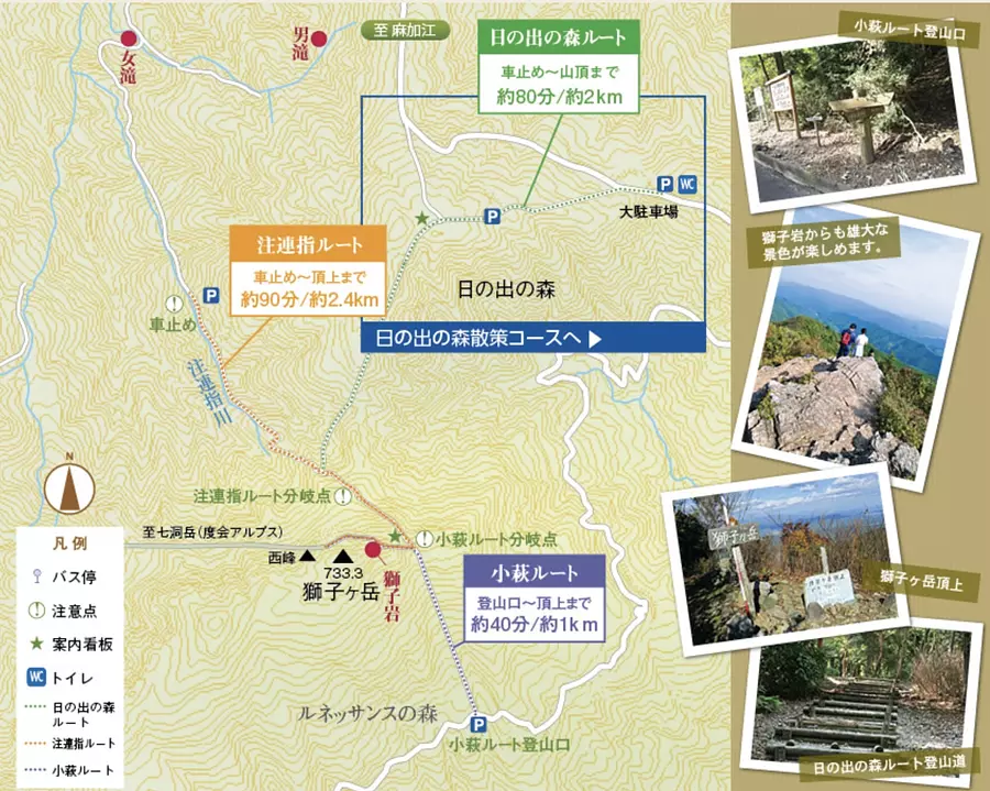
About the climbing route of Mt. Shishigatake
*The route map was taken from WataraiTown Tourist Information website.
There are three main climbing routes to Mt. Shishigatake.
①Kohagi Route
②Hinode no Mori route
③ shimesasu route
It will be.
This time, we will explain the ``Hinode no Mori Route'', which takes about 2 km/80 minutes to reach the summit and is suitable for beginners, along with photos.
Access to the trailhead and parking
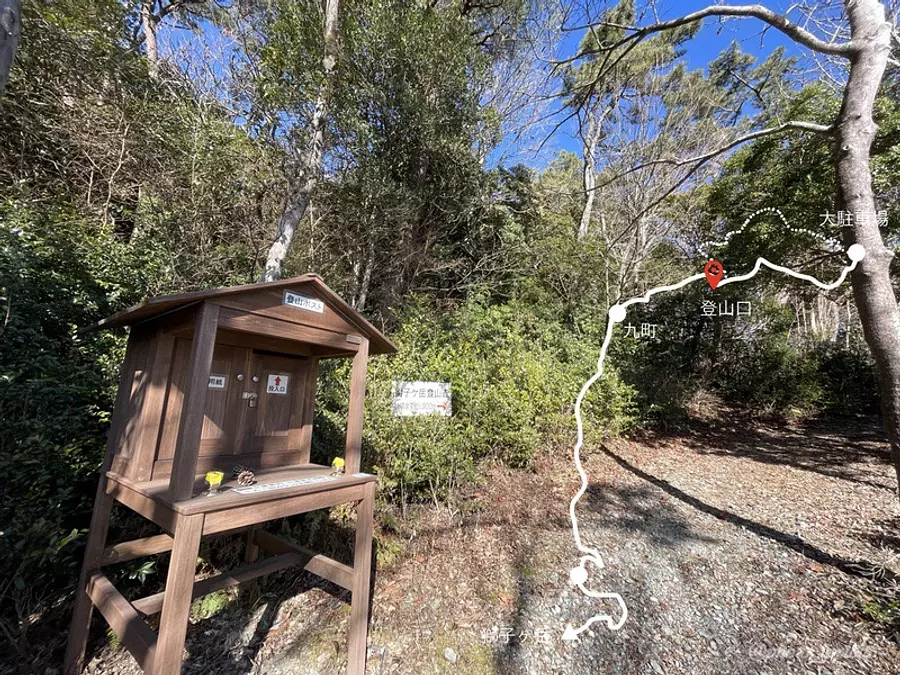
When going to the Hinode no Mori parking lot, you may not be able to search using the navigation system, so we will show you the directions to the parking lot.
[Directions to Hinode no Mori parking lot]
(1) Enter the forest road from the intersection where there is a traffic light in front of the former Nakagawa Elementary School in Makae WataraiTown.
(2) After going 2km along the forest road, you will see a sign saying "Shishigatake" and turn left.
(3) After walking along the slope of the forest road Makae Kohagi Line for about 20 minutes, you will arrive at the parking lot.
[Points to keep in mind when accessing the parking lot]
・Be careful of oncoming cars as you will have to walk through a narrow mountain road to the parking lot.
・During the winter, the road surface may freeze, so please drive carefully.
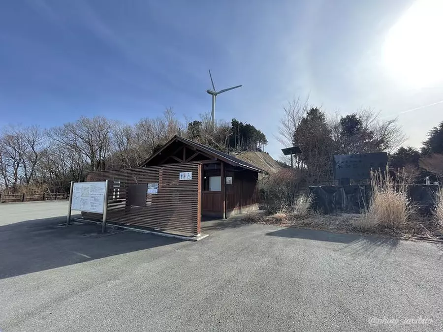
There is also a toilet in the large parking lot, which I am very grateful for ^ ^
This time, I would like to park my car at this large parking lot and aim for Mt. Shishigatake while walking along the Hinode Forest walking course.
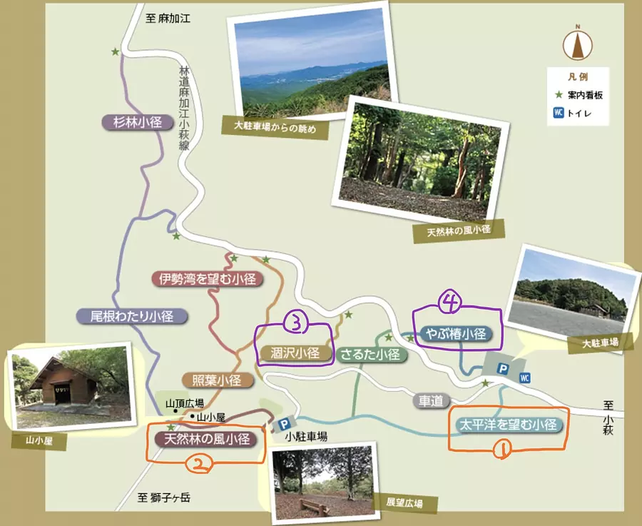
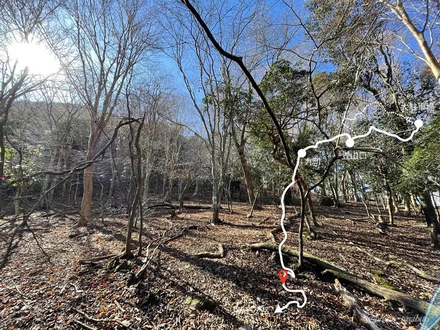
What is the Hinode Forest Walking Course?
*The course map was taken from WataraiTown Tourist Information website.
It has been introduced by WataraiTown Tourism Association as a walking path where you can fully enjoy the rich natural forest.
There are nine walking trails, starting from the summit plaza and leading to Mt. Shishigatake.
Please note that there are some places along theTAKA route that are difficult to walk.
To climb Mt. Shishigatake this time, we took the ``Pacific Ocean View Path (Photo ①) ~ Natural Forest Wind Path (Photo ②)'' on the way back, and on the way back we took the ``Karasawa Path (Photo ③) ~ Yabu Camellia. I passed through the small path (Photo ④).
- Points to note
- Please be careful as there are parts of Karasawa Komichi where the mountain path has collapsed and is difficult to pass.
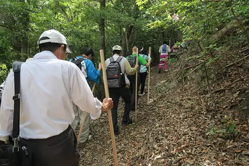
Explanation of Hinode Forest climbing route
Let's start by heading towards the summit plaza from the large parking lot!
We will proceed along the walking route that starts from the ``Pacific Ocean View Path'' and passes through the ``Natural Forest Wind Path''.
The course time is about 1 hour and 15 minutes.
It will take about an hour to get back, so I hope you find this helpful.
Now, let's explain with photos.
[1] Path overlooking the Pacific Ocean
This path is right next to the road that runs from the large parking lot to the small parking lot.
This is a path through the trees where you can hear the soothing sound of leaves swaying in the wind ^ ^
Please be careful as the path may be difficult to find due to some fallen trees.
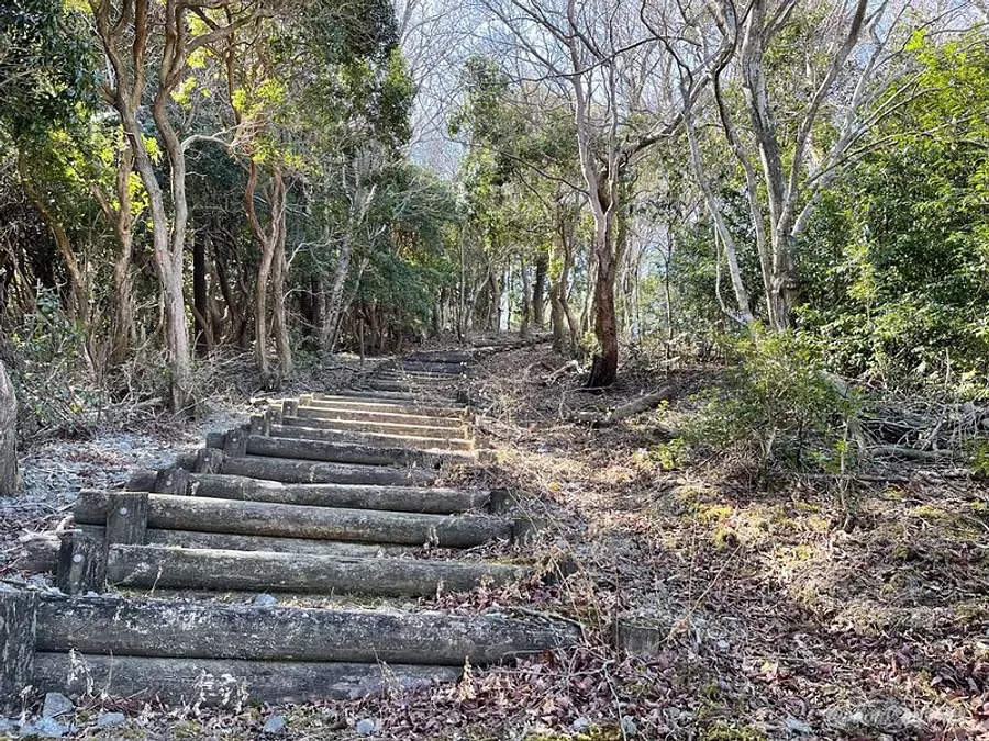
[2] Natural forest wind path
From the end of this path, the real mountain trail begins.
Part of the route will be paved, but don't worry, the route is correct ^ ^
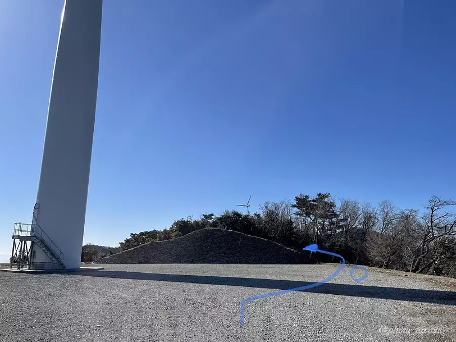
At the end of the paved road, the route continues like a blue arrow.
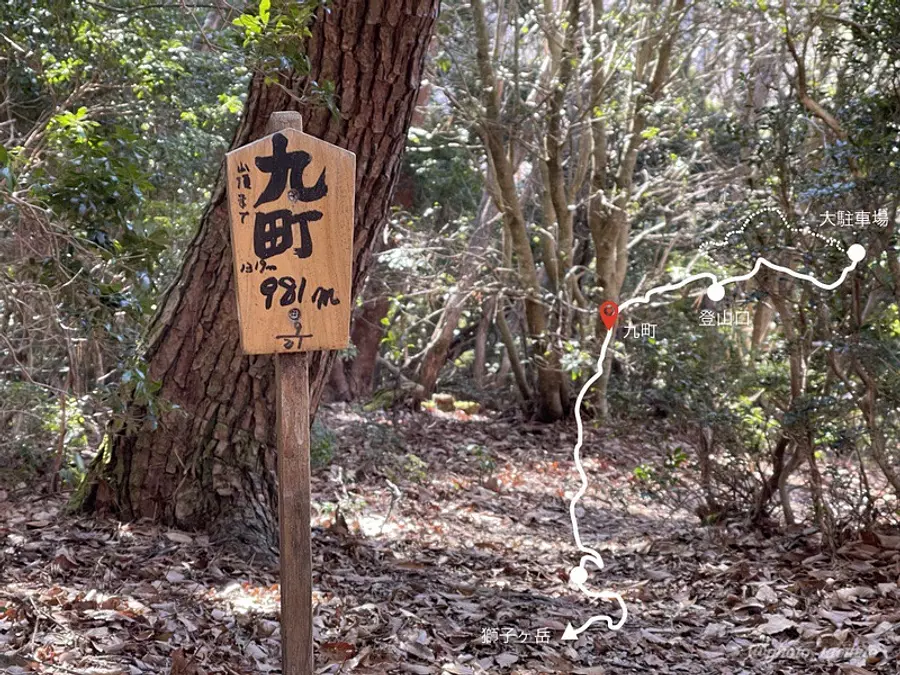
[3] Nine towns to fourteen towns
A sign for ``Nine Towns'' suddenly appears.
From here on out, you'll be going down to the point where you'll be like, ``This is it!'', so thinking about the return trip might make you a little depressed (lol), but let's do our best!
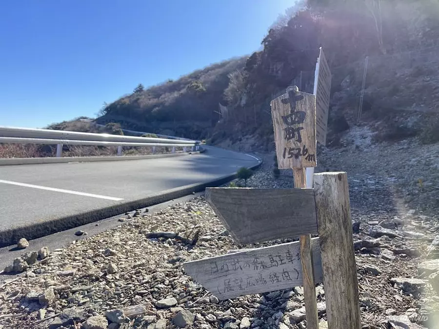
The paved road will appear again, so if you continue up the road a little, you will see a small sign that says ``Jyushimachi''.
TAKAIt's a small sign so be careful not to miss it.
As shown in the photo above, go back into the mountain from the sign.
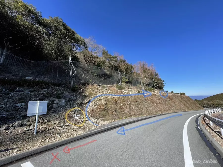
[4] Don't overlook the tape
It is important to walk carefully and be careful not to get lost in open areas.
Let's proceed relying on the pink tape.
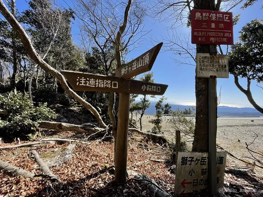
When you see a sign that says Shishigatake summit, you will be there in about 15 minutes ^ ^
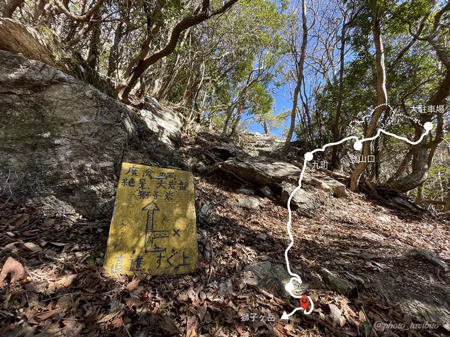
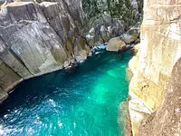
[5] Recommended Shishiiwa with a great view
At the end of the Shishigatake climb, you will be able to climb Shishiiwa (also known as Shishigahana), which is the origin of the mountain's name.
The rock slope is not that steep, but be careful not to slip.
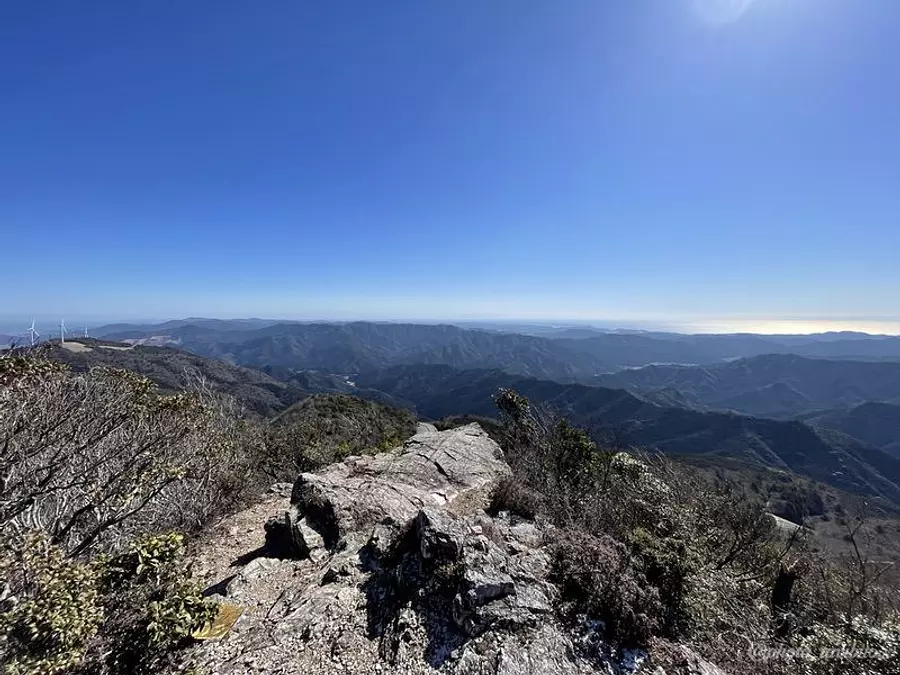
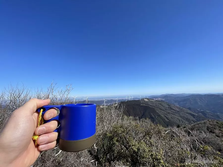
The panoramic view from the slightly protruding rock (perhaps this is Shishiiwa?) is spectacular!
The scenery is so pleasant that you can't help but wonder if this is the top of the mountain, and I'm sure many people will take a relaxing break here.
Of course I also took a break here ^ ^

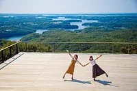
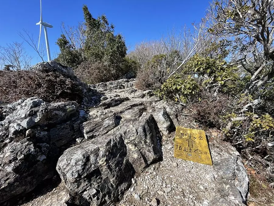
[6] To the mountaintop
A few minutes walk from Shishiiwa will take you to the top of Mt. Shishigatake.
The view from here is also open and recommended ♪
There is a small space around the top of the mountain, so it's a good place to take a break.
Introducing recommended spots after climbing
I think that one of the pleasures of mountain climbing is "delicious food" and "taking a bath" ^ ^
The place where you can enjoy all of this is VISON, one of Japan's largest commercial resort facilities located in TakiTown.
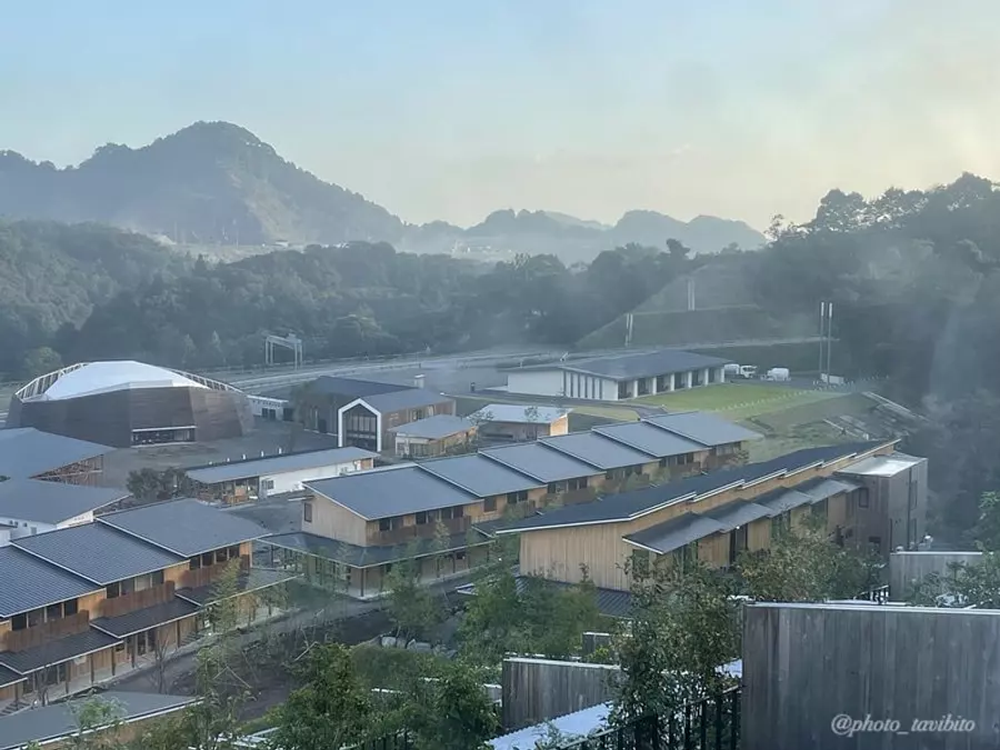
There are over 70 establishments here, ranging from authentic meals like sushi and tempura to restaurants where you can eat while walking, so it's not the kind of place that can be enjoyed by a wide range of people, from the young to the elderly. Is not it.
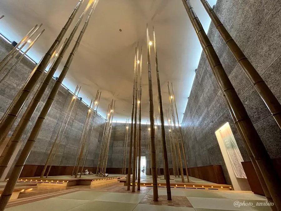
There is also a day trip bath facility, so let's soothe your tired body from climbing here ♪
Click here for an article that explains VISON in detail!
About access to VISON from Hinode no Mori parking lot
Return to the intersection with the traffic light in front of the former Nakagawa Elementary School in WataraiTown Watarai-cho, and take Prefectural Route 709 to the intersection of National Route 42.
If you drive for about 10 minutes on National Route 42 towards Seiwa Taki Interchange, you will arrive at VISON.
in conclusion
How was it.
This time we introduced a mountain with a cool name called Mt. Shishigatake in WataraiTown.
The great thing about this mountain is that you can choose what suits your style: you can aim for the summit, or you can use the parking lot as your base and walk along the walking course around it.
Why not try walking in your own favorite style ^ ^
Walking in the mountains is truly soothing.
Please come and visit us on your next vacation♪
This is a climbing video of Mt. Shishigatake that I shot. We have summarized the charm of Mt. Shishigatake in one minute, including the view from the top, so please take a look here♪
[Shishigatake] Mie Travel Camera Club TAKA approaches its charm!
Nearby spots
直線距離:632m
sunrise forest
直線距離:1.5km
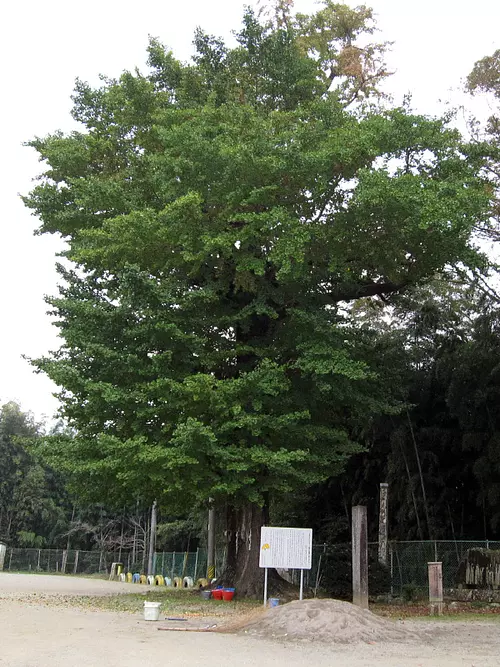
Shishigatake
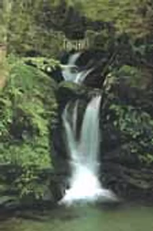
直線距離:2.4km
Onna Falls
直線距離:2.9km
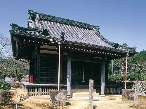
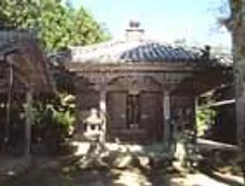
Shoboji Temple
直線距離:5.4km
Contact Plaza Kuriyama
直線距離:5.8km
Kokushokuji Temple
直線距離:6.0km
Kunitsukayama
直線距離:6.0km
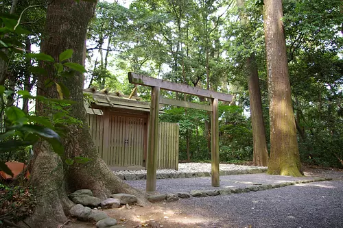
Kugutsuhime Shrine
直線距離:6.1km
Isemiya River Village Hinakaya
直線距離:6.1km
Shichiho no Ohatsukiitefu [Prefecturally designated natural monument]

直線距離:6.1km
Nohara Kobo Genki Village
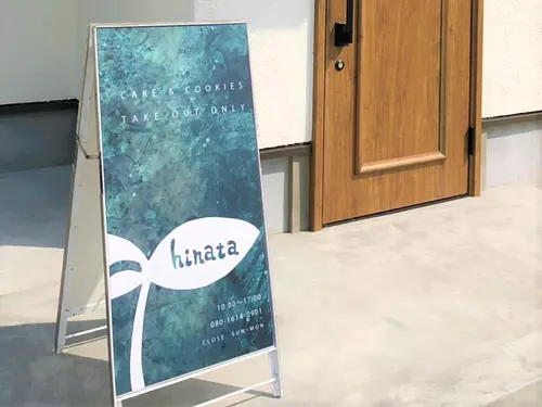
直線距離:6.2km
hinata
nearby events
Date: Thursday, August 15, 2024
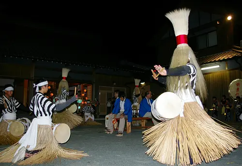
直線距離:4.7km
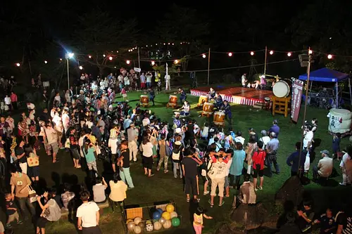
Makae Kanko Dance
![[Osugidani Nature School] Mountain☆River Kids! in Children's Kingdom](https://www.kankomie.or.jp/rails/active_storage/representations/proxy/eyJfcmFpbHMiOnsibWVzc2FnZSI6IkJBaHBBMUpnQkE9PSIsImV4cCI6bnVsbCwicHVyIjoiYmxvYl9pZCJ9fQ==--ae7119270b57049286db472c7cf9c8d04292776e/eyJfcmFpbHMiOnsibWVzc2FnZSI6IkJBaDdCem9MWm05eWJXRjBPZ2wzWldKd09oSnlaWE5wZW1WZmRHOWZabWwwV3dkcEF2UUJNQT09IiwiZXhwIjpudWxsLCJwdXIiOiJ2YXJpYXRpb24ifX0=--8d6bc4b517fae43c9e30c66a38f93836dd92b535/P5300781.jpg)
Dates: Saturday, July 13, 2024, Saturday, October 5, 2024...
直線距離:6.8km
[Osugidani Nature School] Mountain☆River Kids! in Children's Kingdom
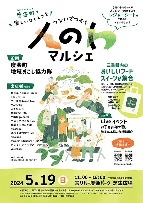
Date: Sunday, May 19, 2024
直線距離:7.3km
People's Marche Connecting and Weaving (MiyaRiverWataraiPark)
Date: July 15, 2024 (Monday)
直線距離:8.2km
ASPIATamaki Summer Concert
Event date: Now accepting reservations!
直線距離:8.2km
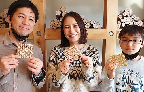
Let's make coasters using the traditional craft "Kumiko"!
Event date: Now accepting reservations!
直線距離:8.2km
Luxurious cypress handmade chopsticks experience
![[For 1 person] “Foot rowing” kayak experience in VISON forest](https://www.kankomie.or.jp/rails/active_storage/representations/proxy/eyJfcmFpbHMiOnsibWVzc2FnZSI6IkJBaHBBdzFMQXc9PSIsImV4cCI6bnVsbCwicHVyIjoiYmxvYl9pZCJ9fQ==--3ee6c4995976c6d42d6c2382d1f0330023161269/eyJfcmFpbHMiOnsibWVzc2FnZSI6IkJBaDdCem9MWm05eWJXRjBPZ2wzWldKd09oSnlaWE5wZW1WZmRHOWZabWwwV3dkcEF2UUJNQT09IiwiZXhwIjpudWxsLCJwdXIiOiJ2YXJpYXRpb24ifX0=--8d6bc4b517fae43c9e30c66a38f93836dd92b535/20230626-P6260172.jpg)
Date: March 9, 2024 (Sat) - October 31, 2024 (Thursday)
直線距離:8.2km
[For 1 person] “Foot rowing” kayak experience in VISON forest
![[For 2 people] “Foot rowing” kayak experience in VISON forest](https://www.kankomie.or.jp/rails/active_storage/representations/proxy/eyJfcmFpbHMiOnsibWVzc2FnZSI6IkJBaHBBeHBMQXc9PSIsImV4cCI6bnVsbCwicHVyIjoiYmxvYl9pZCJ9fQ==--798843999bb4852b0a791ddc868eae234353ba7d/eyJfcmFpbHMiOnsibWVzc2FnZSI6IkJBaDdCem9MWm05eWJXRjBPZ2wzWldKd09oSnlaWE5wZW1WZmRHOWZabWwwV3dkcEF2UUJNQT09IiwiZXhwIjpudWxsLCJwdXIiOiJ2YXJpYXRpb24ifX0=--8d6bc4b517fae43c9e30c66a38f93836dd92b535/20230626-P6260135.jpg)
Date: March 9, 2024 (Sat) - October 31, 2024 (Thursday)
直線距離:8.2km
[For 2 people] “Foot rowing” kayak experience in VISON forest
.jpg)
Event date: Now accepting reservations!
直線距離:8.2km
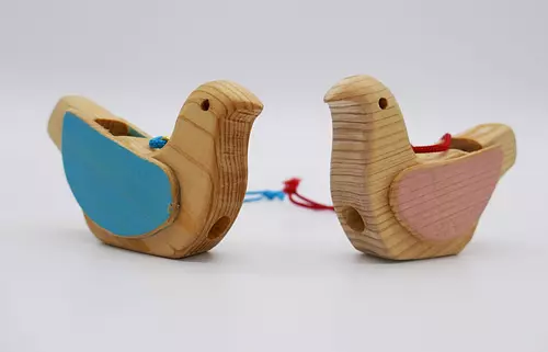
Let's make a bird whistle for a little bird!
![[Includes sweets] Easy cutlery making experience](https://www.kankomie.or.jp/rails/active_storage/representations/proxy/eyJfcmFpbHMiOnsibWVzc2FnZSI6IkJBaHBBMWRMQXc9PSIsImV4cCI6bnVsbCwicHVyIjoiYmxvYl9pZCJ9fQ==--135f0cce8797395db75eee7f763048fa06449d7b/eyJfcmFpbHMiOnsibWVzc2FnZSI6IkJBaDdCem9MWm05eWJXRjBPZ2wzWldKd09oSnlaWE5wZW1WZmRHOWZabWwwV3dkcEF2UUJNQT09IiwiZXhwIjpudWxsLCJwdXIiOiJ2YXJpYXRpb24ifX0=--8d6bc4b517fae43c9e30c66a38f93836dd92b535/P1110559.JPG)
Event date: Now accepting reservations!
直線距離:8.2km
[Includes sweets] Easy cutlery making experience

Event date: Now accepting reservations!
直線距離:8.2km
Moss terrarium using forest materials
Event date: Sunday, June 9, 2024 - June 9, 2024 (...
直線距離:10.8km
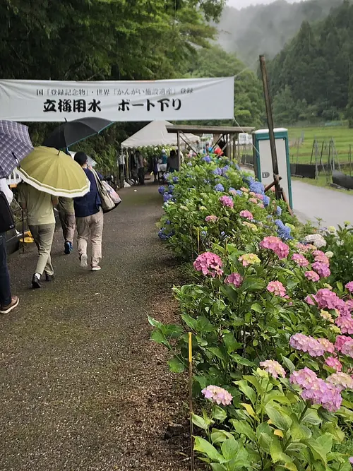
The 28th Daishi no Sato Hikozaemon Hydrangea Festival ~Grateful for the water and soil of our hometown~
Plays and experiences nearby
直線距離:7.7km
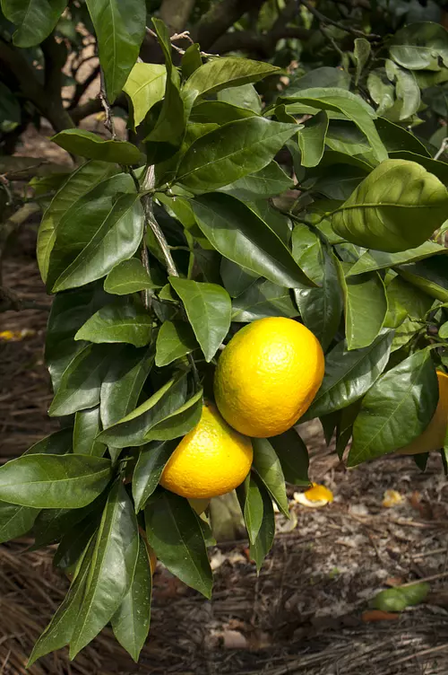
GokatsuraLake Pond Furusatomura Mikan Garden [Tourist Farm]

直線距離:7.8km
Gokatsuraike Furusato Village: Plate painting experience
直線距離:7.8km
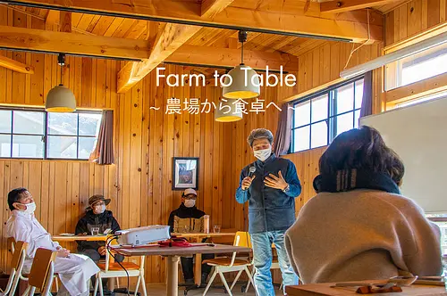
Farm to Table ~ From the farm to the table ~ Shinpei Murakami × Masayuki Okuda
直線距離:7.8km
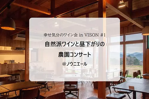
Happy wine party in VISON #1 “Natural wine and afternoon farm concert @Nouniere
![[Commemorating Chef Okuda's visit] Special lunch course (reservation required)](https://www.kankomie.or.jp/rails/active_storage/representations/proxy/eyJfcmFpbHMiOnsibWVzc2FnZSI6IkJBaHBBMXUyQXc9PSIsImV4cCI6bnVsbCwicHVyIjoiYmxvYl9pZCJ9fQ==--82466144956cfd4352db6a3c02d73bdbeb424adb/eyJfcmFpbHMiOnsibWVzc2FnZSI6IkJBaDdCem9MWm05eWJXRjBPZ2wzWldKd09oSnlaWE5wZW1WZmRHOWZabWwwV3dkcEF2UUJNQT09IiwiZXhwIjpudWxsLCJwdXIiOiJ2YXJpYXRpb24ifX0=--8d6bc4b517fae43c9e30c66a38f93836dd92b535/ev_nouniyell_1_1.jpg)
直線距離:7.8km
[December 9th (Saturday) Chef Okuda's visit commemoration] Special lunch course (reservation required)
![Farm restaurant [one of its kind in the world] Let's make your own pizza! ]](https://www.kankomie.or.jp/rails/active_storage/representations/proxy/eyJfcmFpbHMiOnsibWVzc2FnZSI6IkJBaHBBMlNlQWc9PSIsImV4cCI6bnVsbCwicHVyIjoiYmxvYl9pZCJ9fQ==--696b6e99b0665b15e662f7ac749468ab9dd1ccab/eyJfcmFpbHMiOnsibWVzc2FnZSI6IkJBaDdCem9MWm05eWJXRjBPZ2wzWldKd09oSnlaWE5wZW1WZmRHOWZabWwwV3dkcEF2UUJNQT09IiwiZXhwIjpudWxsLCJwdXIiOiJ2YXJpYXRpb24ifX0=--8d6bc4b517fae43c9e30c66a38f93836dd92b535/23no-pi_me01_1.jpg)
直線距離:7.8km
Farm restaurant [one of its kind in the world] Let's make your own pizza! ]

直線距離:7.8km
Professor Emeritus Manfred Krames Lecture in VISON

直線距離:7.8km
Special Italian lunch made with vegetables you harvested yourself
![[Animal Welfare Week] Talk session with Megumi Shika representative Chieko Watanabe](https://www.kankomie.or.jp/rails/active_storage/representations/proxy/eyJfcmFpbHMiOnsibWVzc2FnZSI6IkJBaHBBbVlyIiwiZXhwIjpudWxsLCJwdXIiOiJibG9iX2lkIn19--acbac8618e58d30f7760176a0016a290ad016265/eyJfcmFpbHMiOnsibWVzc2FnZSI6IkJBaDdCem9MWm05eWJXRjBPZ2wzWldKd09oSnlaWE5wZW1WZmRHOWZabWwwV3dkcEF2UUJNQT09IiwiZXhwIjpudWxsLCJwdXIiOiJ2YXJpYXRpb24ifX0=--8d6bc4b517fae43c9e30c66a38f93836dd92b535/2430_1_org.jpg)
直線距離:7.9km
[Animal Welfare Week] Talk session with Megumi Shika representative Chieko Watanabe

直線距離:7.9km
New Year's decoration making party by foret
![[January 25th (Thursday) limited lunch] Master Masahiro Kasahara's "Kasahara Gozen" lunch](https://www.kankomie.or.jp/rails/active_storage/representations/proxy/eyJfcmFpbHMiOnsibWVzc2FnZSI6IkJBaHBBMFdlQWc9PSIsImV4cCI6bnVsbCwicHVyIjoiYmxvYl9pZCJ9fQ==--7abf9bf0e63c31a2b40d37cb5bf14d5dcf44e62d/eyJfcmFpbHMiOnsibWVzc2FnZSI6IkJBaDdCem9MWm05eWJXRjBPZ2wzWldKd09oSnlaWE5wZW1WZmRHOWZabWwwV3dkcEF2UUJNQT09IiwiZXhwIjpudWxsLCJwdXIiOiJ2YXJpYXRpb24ifX0=--8d6bc4b517fae43c9e30c66a38f93836dd92b535/kasahara01_1.jpg)
直線距離:8.0km
[January 25th (Thursday) limited lunch] Master Masahiro Kasahara's "Kasahara Gozen" lunch
![[Aniteras] Animal Welfare Week Event](https://www.kankomie.or.jp/rails/active_storage/representations/proxy/eyJfcmFpbHMiOnsibWVzc2FnZSI6IkJBaHBBbVVyIiwiZXhwIjpudWxsLCJwdXIiOiJibG9iX2lkIn19--78863ff21a6eecd5e8dede488858023f0354e5eb/eyJfcmFpbHMiOnsibWVzc2FnZSI6IkJBaDdCem9MWm05eWJXRjBPZ2wzWldKd09oSnlaWE5wZW1WZmRHOWZabWwwV3dkcEF2UUJNQT09IiwiZXhwIjpudWxsLCJwdXIiOiJ2YXJpYXRpb24ifX0=--8d6bc4b517fae43c9e30c66a38f93836dd92b535/2429_1_org.jpg)
直線距離:7.9km
[Aniterasu] Animal welfare week event held!