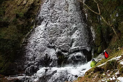
Miuneyama
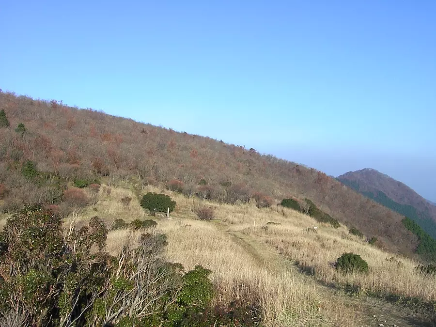
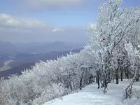
Altitude: 1235.2m.
Hatchodaira, which spreads out near the summit, is designated as Muro Akame Aoyama Quasi-National Park.
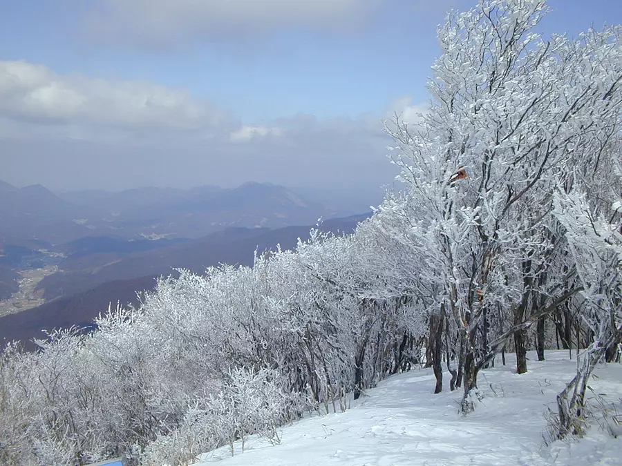
The hoarfrost that forms from early January to late February is popular and is called shrimp tail. You can see white palms from mid to late May.
Please see the mountain climbing course here↓↓
Matsusaka Kahada Chamber of Commerce Outdoor Map
For Matsusaka tourist information, visit the Matsusaka sightseeing information site Wakuwaku Matsusaka.
You can view and edit the sightseeing route (My Plan on My Page) that will take you around the selected spots.
現在選択中のスポット数:...件
Detailed information
From JR/Kintetsu Matsusaka Station, take the Sanko bus bound for Sumeru for 80 minutes and get off at Kawamata Bridge (Tsukide trailhead, Fukumoto trailhead, Yuriware trailhead)
Alternatively, take the Sanko bus bound for Sumeru and get off at Mori, then transfer to the community bus and get off at Kuwabara, 100 minutes (Tsukide trailhead).
100 minutes by car from Ise Expressway Matsusaka IC
About 10 cars at the trailhead
*Prices are subject to change, so please check with your contact information before going out.
Nearby spots
直線距離:1.9km
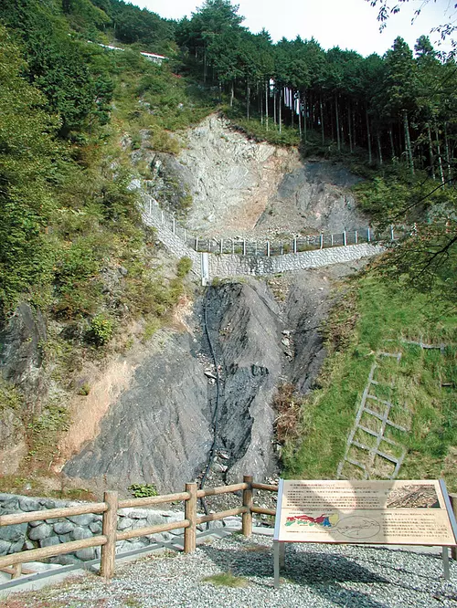
Median tectonic line of moonrise
直線距離:4.1km
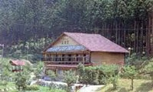
Sakamoto hut
直線距離:4.7km
MatsusakaCity Iidaka B&G Marine Center
直線距離:5.2km
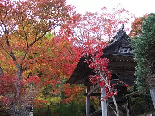
TenkaizanTaiunjiTemple
直線距離:5.7km
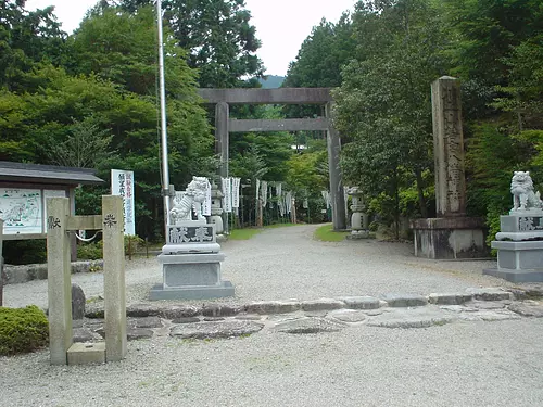
Kawakamiyama Wakamiya Hachiman Shrine

直線距離:5.7km
Misogi Falls
直線距離:6.2km
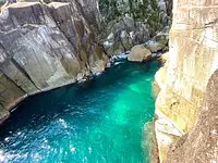
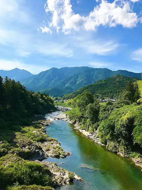
kahadavalley
直線距離:6.6km
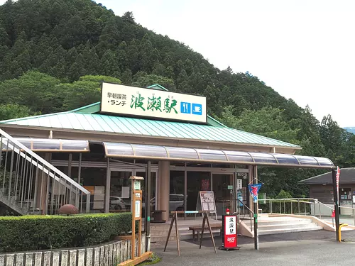
Hase Station

直線距離:6.6km
Green Life Yamarinsha
直線距離:6.6km
Green Life Yamarinsha
直線距離:6.6km
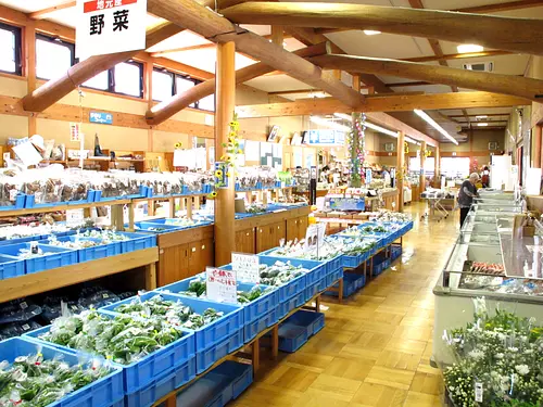
Michi-no-eki Iidaka Station sister store “Hase Station”
直線距離:7.2km
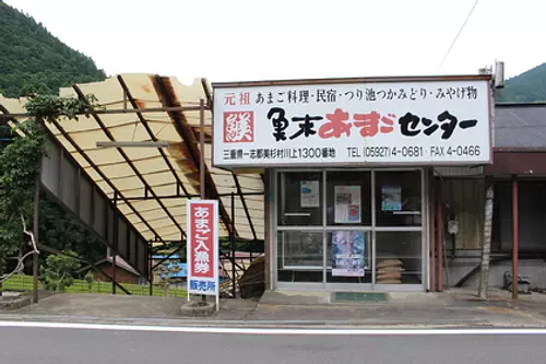
UomatsuAmagoCenter
nearby events
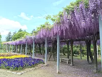
![[Flowers] Rhododendrons of TenkaizanTaiunjiTemple](https://www.kankomie.or.jp/rails/active_storage/representations/proxy/eyJfcmFpbHMiOnsibWVzc2FnZSI6IkJBaHBBaEF1IiwiZXhwIjpudWxsLCJwdXIiOiJibG9iX2lkIn19--844c7c5b279c6c8a791043e508a9bd6d5ccb9053/eyJfcmFpbHMiOnsibWVzc2FnZSI6IkJBaDdCem9MWm05eWJXRjBPZ2wzWldKd09oSnlaWE5wZW1WZmRHOWZabWwwV3dkcEF2UUJNQT09IiwiZXhwIjpudWxsLCJwdXIiOiJ2YXJpYXRpb24ifX0=--8d6bc4b517fae43c9e30c66a38f93836dd92b535/10111_1_org.jpg)
Date: Late April to early May
直線距離:5.2km
[Flowers] Rhododendrons of TenkaizanTaiunjiTemple
![[Flower] Yuri Hase](https://www.kankomie.or.jp/rails/active_storage/representations/proxy/eyJfcmFpbHMiOnsibWVzc2FnZSI6IkJBaHBBZzB1IiwiZXhwIjpudWxsLCJwdXIiOiJibG9iX2lkIn19--10a2f0d92dd0580521c0fd66dfd7bfb5a26715af/eyJfcmFpbHMiOnsibWVzc2FnZSI6IkJBaDdCem9MWm05eWJXRjBPZ2wzWldKd09oSnlaWE5wZW1WZmRHOWZabWwwV3dkcEF2UUJNQT09IiwiZXhwIjpudWxsLCJwdXIiOiJ2YXJpYXRpb24ifX0=--8d6bc4b517fae43c9e30c66a38f93836dd92b535/10106_1_org.jpg)
Date: Mid-July to late July
直線距離:6.1km
[Flower] Yuri Hase
![[Exhibition] (Hase Station) Photo exhibition of Tomomi Hase, Yoshito Tochigi, and Taro Chako](https://www.kankomie.or.jp/rails/active_storage/representations/proxy/eyJfcmFpbHMiOnsibWVzc2FnZSI6IkJBaHBBMnRLQkE9PSIsImV4cCI6bnVsbCwicHVyIjoiYmxvYl9pZCJ9fQ==--ca5515e4c6a6c6f6187c295f3e3fcce33bc8c3a3/eyJfcmFpbHMiOnsibWVzc2FnZSI6IkJBaDdCem9MWm05eWJXRjBPZ2wzWldKd09oSnlaWE5wZW1WZmRHOWZabWwwV3dkcEF2UUJNQT09IiwiZXhwIjpudWxsLCJwdXIiOiJ2YXJpYXRpb24ifX0=--8d6bc4b517fae43c9e30c66a38f93836dd92b535/s-240314hase-1.jpg)
Date: March 14, 2024 (Thursday) ~...
直線距離:6.6km
[Exhibition] (Hase Station) Photo exhibition of Tomomi Hase, Yoshito Tochigi, and Taro Chako
Date: April 1, 2024 (Monday) ~...
直線距離:10.6km
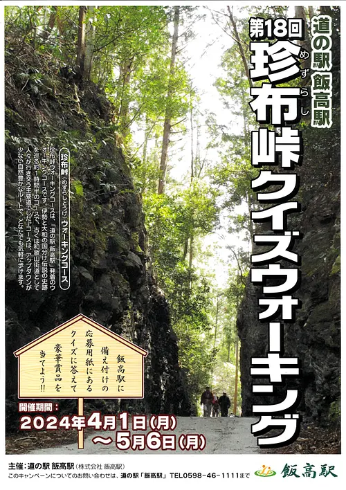
18th Mezurashi-togePass Quiz Walking

Date: April 1, 2024 (Monday) - March 01, 2025...
直線距離:11.6km
Green receipt campaign on the 1st of every month! !
Date: April 1, 2024 (Mon) - March 31, 2025...
直線距離:11.6km
Iitakano Store Every Wednesday is “Wednesday Thank You Day”!!
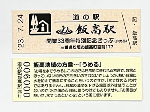
Date: July 24, 2023 (Monday) - July 2, 2024...
直線距離:11.6km
Iitakano Store Iidaka Station “Special Commemorative Ticket” now being distributed
![[Exhibition] The 13th Manyu Calligraphy Exhibition](https://www.kankomie.or.jp/rails/active_storage/representations/proxy/eyJfcmFpbHMiOnsibWVzc2FnZSI6IkJBaHBBNDFVQkE9PSIsImV4cCI6bnVsbCwicHVyIjoiYmxvYl9pZCJ9fQ==--56c649d0c6fdaa7a6569f14bab89fbc8d53aba3f/eyJfcmFpbHMiOnsibWVzc2FnZSI6IkJBaDdCem9MWm05eWJXRjBPZ2wzWldKd09oSnlaWE5wZW1WZmRHOWZabWwwV3dkcEF2UUJNQT09IiwiZXhwIjpudWxsLCJwdXIiOiJ2YXJpYXRpb24ifX0=--8d6bc4b517fae43c9e30c66a38f93836dd92b535/240328manyu-1.jpg)
Date: Thursday, March 28, 2024 - April 30, 2024...
直線距離:11.6km
[Exhibition] The 13th Manyu Calligraphy Exhibition
Date: April 1, 2024 (Monday) ~...
直線距離:11.6km
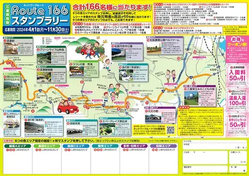
Network Route 166 Stamp Rally’24
Date: March 8, 2024 (Friday) ~...
直線距離:11.6km
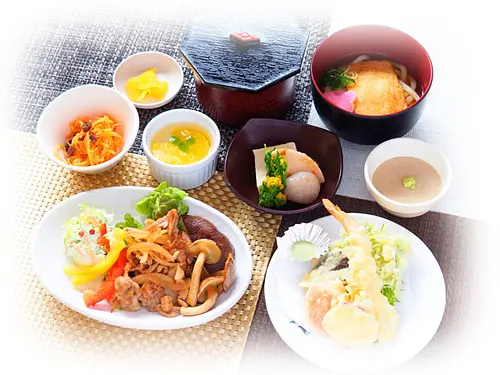
Restaurant Iitaka's spring limited menu "Hanagoromo"
Date: February 23, 2024 (Friday) ~...
直線距離:11.6km
Restaurant Iitaka Rendam Curry Spring Version
開催日:・2024年3月20日(水・祝)~ 11月30日(土)...
直線距離:16.3km
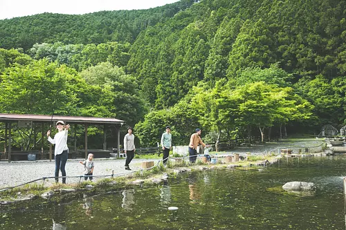
釣り堀で魚(ニジマス)釣りを楽しもう♪
Plays and experiences nearby
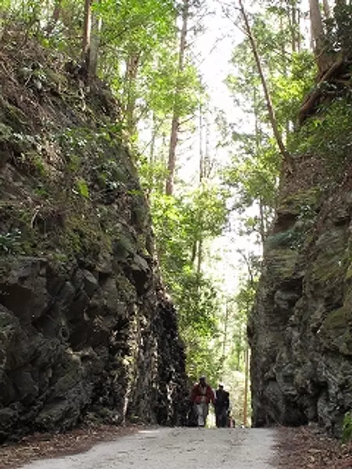
直線距離:10.6km
Historical road Mezurashi-togePass walking
.jpg)
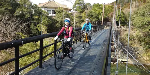
直線距離:16.3km
Rental bicycle (electrically assisted bicycle)
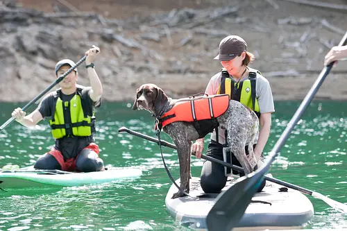
![[Verde project] Lunch SUP ~ French lunch included - Safe even in spring and autumn Enjoy a little SUP experience in shallow water with excellent transparency! A copy of ~](https://www.kankomie.or.jp/rails/active_storage/representations/proxy/eyJfcmFpbHMiOnsibWVzc2FnZSI6IkJBaHBBc2duIiwiZXhwIjpudWxsLCJwdXIiOiJibG9iX2lkIn19--a6d203ec6741edffc65bba1a1570ba74da3481e0/eyJfcmFpbHMiOnsibWVzc2FnZSI6IkJBaDdCem9MWm05eWJXRjBPZ2wzWldKd09oSnlaWE5wZW1WZmRHOWZabWwwV3dkcEF2UUJNQT09IiwiZXhwIjpudWxsLCJwdXIiOiJ2YXJpYXRpb24ifX0=--8d6bc4b517fae43c9e30c66a38f93836dd92b535/1742_1_org.jpg)
直線距離:16.3km
[Verde project] Lunch SUP ~ French lunch included - Safe even in spring and autumn Enjoy a little SUP experience in shallow water with excellent transparency! A copy of ~
![[Verde project] Lunch SUP ~ French lunch included - Safe even in spring and autumn Enjoy a little SUP experience in shallow water with excellent transparency! ~](https://www.kankomie.or.jp/rails/active_storage/representations/proxy/eyJfcmFpbHMiOnsibWVzc2FnZSI6IkJBaHBBc1luIiwiZXhwIjpudWxsLCJwdXIiOiJibG9iX2lkIn19--5d90fb83d23d297dbf2e156bade74e8b08c05dd3/eyJfcmFpbHMiOnsibWVzc2FnZSI6IkJBaDdCem9MWm05eWJXRjBPZ2wzWldKd09oSnlaWE5wZW1WZmRHOWZabWwwV3dkcEF2UUJNQT09IiwiZXhwIjpudWxsLCJwdXIiOiJ2YXJpYXRpb24ifX0=--8d6bc4b517fae43c9e30c66a38f93836dd92b535/1741_1_org.jpg)
直線距離:16.3km
[Verde project] Lunch SUP ~ French lunch included - Safe even in spring and autumn Enjoy a little SUP experience in shallow water with excellent transparency! ~
直線距離:17.1km
Children's exciting experience ECO tour
直線距離:17.1km
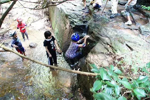
Genryu Adventure Tour
直線距離:17.1km
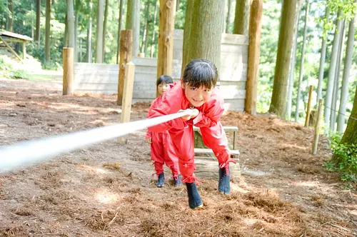
13th Ninja Training Championship Tournament
直線距離:17.1km
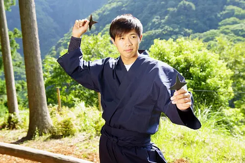
Experience training in NinjanoMori! Experience the secrets of Iga ninja at the foot of TheAkame48Falls ♪
直線距離:17.1km
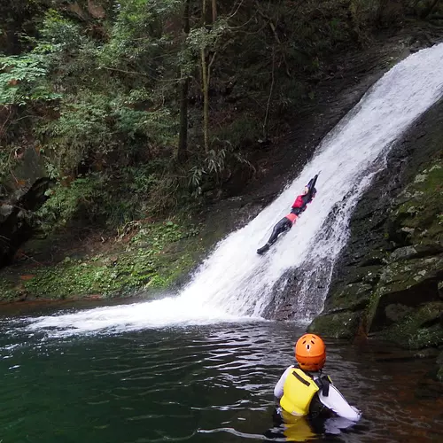
Dainichi Falls Icefall Tour
直線距離:17.0km
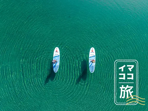
[Mie's current journey] Drone video present ♪ Miyagawa spectacular view SUP
直線距離:17.0km
Let's play with hermits in Osugidani project
直線距離:18.9km
RocaRocaActivities