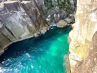
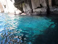
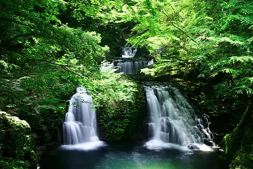
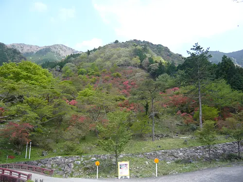
KaochidaniValley Kaochidani
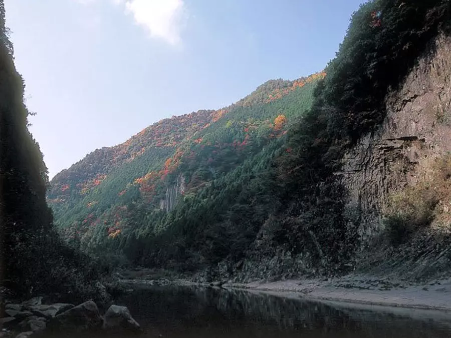
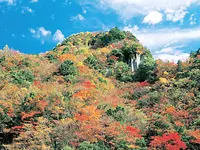
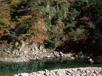
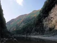
KaochidaniValley, which runs along the Shorenji River, a tributary of the Nabari River, is a valley called Yabakei in the Kansai region, and has approximately 8 km of columnar jointed rock that looks as if it has been cut with an axe.
Among them, the views of Tengubashira Rock and Byobu Rock are spectacular, and their majestic scenery allows you to enjoy the beauty of natural formations.
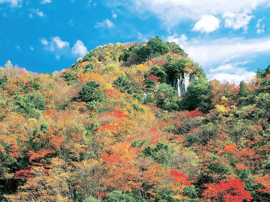
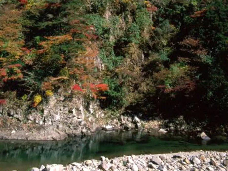
In the spring, the mountain bushes and azaleas are in full bloom, and in the fall, the entire mountain is covered in KaochidaniValley autumn leaves. It is kachiji perfect for hiking or driving while enjoying the scenery that stretches out in front of you.
〇There are many more! Click here for a special feature on Mie Prefecture's autumn leaves spots!
You can view and edit the sightseeing route (My Plan on My Page) that will take you around the selected spots.
現在選択中のスポット数:...件
Detailed information
30 minutes by bus from Kintetsu Nabari Station and get off at Ochiai
From the Osaka area, take the Meihan National Highway Needle IC and head towards Shorenji Dam via R165.
From the Nagoya area, take the Meihan National Highway Ueno IC and head towards Shorenji Dam via R368.
*Prices are subject to change, so please check with your contact information before going out.
Nearby spots
直線距離:2.7km
yuno CAMP SITE

直線距離:2.7km
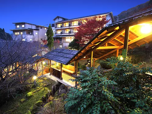
Takimotoya
直線距離:2.7km
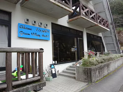
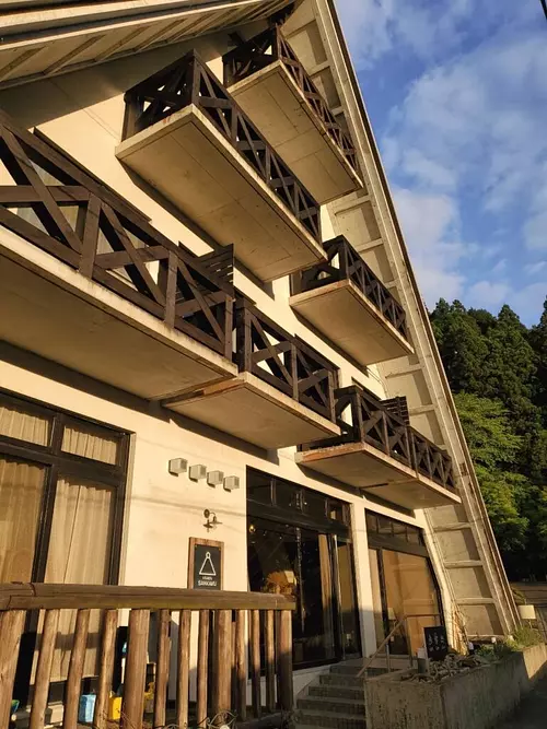
Akame Green Village Hotel
直線距離:2.7km
Tomaru Cafe SANKAKU
直線距離:2.7km
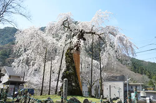
Bodhisattva cherry blossoms (weeping cherry blossoms)
直線距離:2.7km
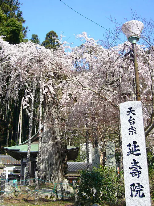
Enjuin Temple
![NinjanoMori [Ninja training experience]](https://www.kankomie.or.jp/rails/active_storage/representations/proxy/eyJfcmFpbHMiOnsibWVzc2FnZSI6IkJBaHBBcXdQIiwiZXhwIjpudWxsLCJwdXIiOiJibG9iX2lkIn19--a0a3427bc654b443767c9c924db3b353d75d2994/eyJfcmFpbHMiOnsibWVzc2FnZSI6IkJBaDdCem9MWm05eWJXRjBPZ2wzWldKd09oSnlaWE5wZW1WZmRHOWZabWwwV3dkcEF2UUJNQT09IiwiZXhwIjpudWxsLCJwdXIiOiJ2YXJpYXRpb24ifX0=--8d6bc4b517fae43c9e30c66a38f93836dd92b535/21217_1_org.jpg)
直線距離:2.8km
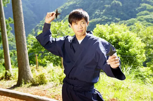
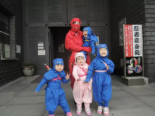
NinjanoMori [Ninja training experience]
直線距離:2.8km
Iga's Hidden Inn Akame Onsen Hidden Hot Spring Taisenkaku
直線距離:2.8km
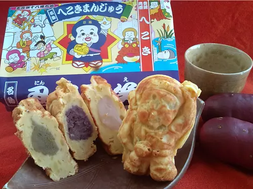
Tamakiya HekokiManju

直線距離:2.8km
Ninjutsu hot pot
直線距離:2.8km
Uedaya
直線距離:2.8km
TheAkame48Falls
nearby events
![[Flowers] Rhododendrons of TenkaizanTaiunjiTemple](https://www.kankomie.or.jp/rails/active_storage/representations/proxy/eyJfcmFpbHMiOnsibWVzc2FnZSI6IkJBaHBBaEF1IiwiZXhwIjpudWxsLCJwdXIiOiJibG9iX2lkIn19--844c7c5b279c6c8a791043e508a9bd6d5ccb9053/eyJfcmFpbHMiOnsibWVzc2FnZSI6IkJBaDdCem9MWm05eWJXRjBPZ2wzWldKd09oSnlaWE5wZW1WZmRHOWZabWwwV3dkcEF2UUJNQT09IiwiZXhwIjpudWxsLCJwdXIiOiJ2YXJpYXRpb24ifX0=--8d6bc4b517fae43c9e30c66a38f93836dd92b535/10111_1_org.jpg)
Date: Late April to early May
直線距離:15.4km
[Flowers] Rhododendrons of TenkaizanTaiunjiTemple
![[Flower] Yuri Hase](https://www.kankomie.or.jp/rails/active_storage/representations/proxy/eyJfcmFpbHMiOnsibWVzc2FnZSI6IkJBaHBBZzB1IiwiZXhwIjpudWxsLCJwdXIiOiJibG9iX2lkIn19--10a2f0d92dd0580521c0fd66dfd7bfb5a26715af/eyJfcmFpbHMiOnsibWVzc2FnZSI6IkJBaDdCem9MWm05eWJXRjBPZ2wzWldKd09oSnlaWE5wZW1WZmRHOWZabWwwV3dkcEF2UUJNQT09IiwiZXhwIjpudWxsLCJwdXIiOiJ2YXJpYXRpb24ifX0=--8d6bc4b517fae43c9e30c66a38f93836dd92b535/10106_1_org.jpg)
Date: Mid-July to late July
直線距離:16.2km
[Flower] Yuri Hase
![[Exhibition] (Hase Station) Photo exhibition of Tomomi Hase, Yoshito Tochigi, and Taro Chako](https://www.kankomie.or.jp/rails/active_storage/representations/proxy/eyJfcmFpbHMiOnsibWVzc2FnZSI6IkJBaHBBMnRLQkE9PSIsImV4cCI6bnVsbCwicHVyIjoiYmxvYl9pZCJ9fQ==--ca5515e4c6a6c6f6187c295f3e3fcce33bc8c3a3/eyJfcmFpbHMiOnsibWVzc2FnZSI6IkJBaDdCem9MWm05eWJXRjBPZ2wzWldKd09oSnlaWE5wZW1WZmRHOWZabWwwV3dkcEF2UUJNQT09IiwiZXhwIjpudWxsLCJwdXIiOiJ2YXJpYXRpb24ifX0=--8d6bc4b517fae43c9e30c66a38f93836dd92b535/s-240314hase-1.jpg)
Date: March 14, 2024 (Thursday) ~...
直線距離:16.5km
[Exhibition] (Hase Station) Photo exhibition of Tomomi Hase, Yoshito Tochigi, and Taro Chako
Date: Monday, April 29, 2024
直線距離:20.9km
Arataki Fudoson Azalea Festival
Date: Mid-April to early May
直線距離:22.1km
Anrakuin button [flower]

Date: May 3, 2024 (Friday/Holiday) - May 5, 2024 (Sunday/Holiday)
直線距離:22.2km
Iga Ueno NINJA Festa
Date: April 1, 2024 (Monday) ~...
直線距離:23.8km
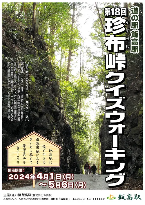
18th Mezurashi-togePass Quiz Walking
Event date: Mid-July to late July
直線距離:23.8km
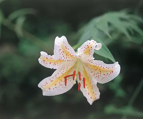
[Flowers] Mountain Lily Village

Date: April 1, 2024 (Monday) - March 01, 2025...
直線距離:25.0km
Green receipt campaign on the 1st of every month! !
Date: April 1, 2024 (Mon) - March 31, 2025...
直線距離:25.0km
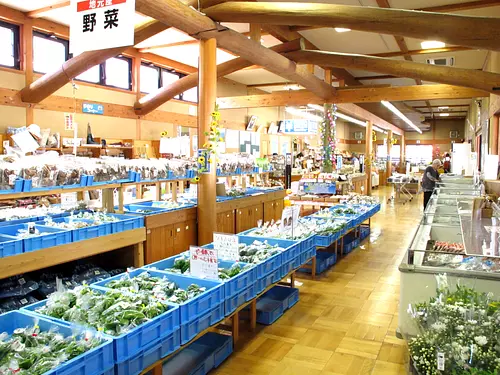
Iitakano Store Every Wednesday is “Wednesday Thank You Day”!!
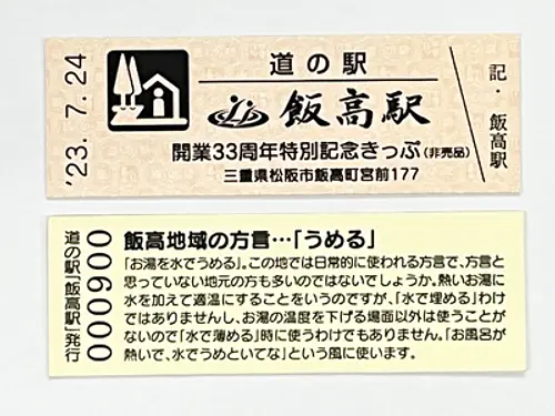
Date: July 24, 2023 (Monday) - July 2, 2024...
直線距離:25.0km
Iitakano Store Iidaka Station “Special Commemorative Ticket” now being distributed
![[Exhibition] The 13th Manyu Calligraphy Exhibition](https://www.kankomie.or.jp/rails/active_storage/representations/proxy/eyJfcmFpbHMiOnsibWVzc2FnZSI6IkJBaHBBNDFVQkE9PSIsImV4cCI6bnVsbCwicHVyIjoiYmxvYl9pZCJ9fQ==--56c649d0c6fdaa7a6569f14bab89fbc8d53aba3f/eyJfcmFpbHMiOnsibWVzc2FnZSI6IkJBaDdCem9MWm05eWJXRjBPZ2wzWldKd09oSnlaWE5wZW1WZmRHOWZabWwwV3dkcEF2UUJNQT09IiwiZXhwIjpudWxsLCJwdXIiOiJ2YXJpYXRpb24ifX0=--8d6bc4b517fae43c9e30c66a38f93836dd92b535/240328manyu-1.jpg)
Date: Thursday, March 28, 2024 - April 30, 2024...
直線距離:25.0km
[Exhibition] The 13th Manyu Calligraphy Exhibition
Plays and experiences nearby
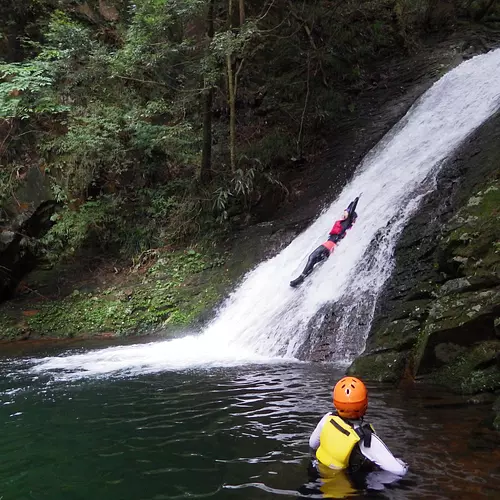
直線距離:2.8km
Genryu Adventure Tour
直線距離:2.8km
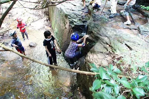
Children's exciting experience ECO tour
直線距離:2.8km
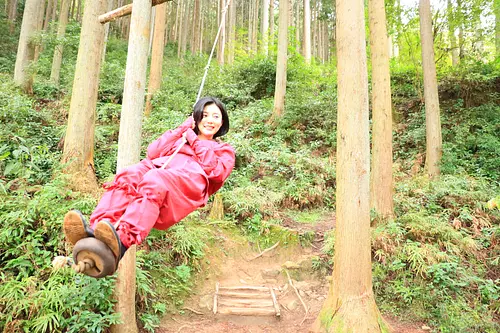
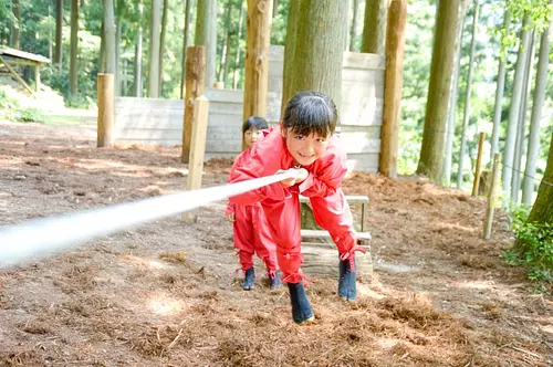
Experience training in NinjanoMori! Experience the secrets of Iga ninja at the foot of TheAkame48Falls ♪
直線距離:2.8km
13th Ninja Training Championship Tournament
直線距離:2.8km
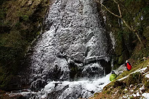
Dainichi Falls Icefall Tour

直線距離:3.8km
LakeShorenji Tourism Village Strawberry Picking
.jpg)
直線距離:4.8km
Digging sweet potatoes
直線距離:6.2km
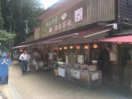
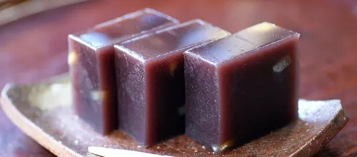
Visiting sweets shops in Nabari
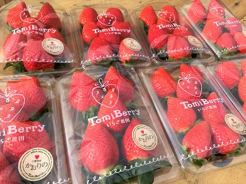
直線距離:17.6km
Tomi Berry Strawberry Farm

直線距離:22.4km
Mind Technique Body Iga Ninja Dojo
直線距離:22.4km
Danjiri Kaikan “Ninja Transformation Place”
直線距離:22.5km
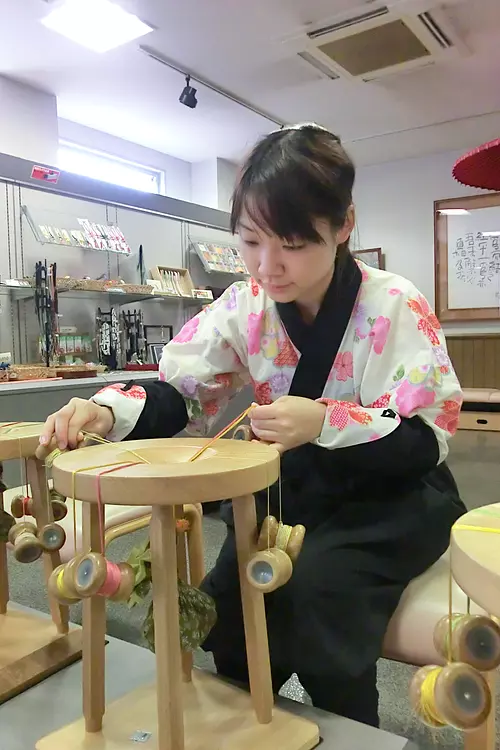
Iga Kumihimo Experience Iga Kumihimo Kumihimo Craftsman's Village
![Cycling to the Nabari/Soni area. A greedy course to enjoy autumn leaves, pampas grass, and hot springs [Beautiful Mie Bicycle Route Part 12]](https://www.kankomie.or.jp/rails/active_storage/representations/proxy/eyJfcmFpbHMiOnsibWVzc2FnZSI6IkJBaHBBa0NCIiwiZXhwIjpudWxsLCJwdXIiOiJibG9iX2lkIn19--4903e4d97a577d7ed1fbd57e1b4d64afa68f03b0/eyJfcmFpbHMiOnsibWVzc2FnZSI6IkJBaDdCem9MWm05eWJXRjBPZ2wzWldKd09oSnlaWE5wZW1WZmRHOWZabWwwV3dkcEF2UUJNQT09IiwiZXhwIjpudWxsLCJwdXIiOiJ2YXJpYXRpb24ifX0=--8d6bc4b517fae43c9e30c66a38f93836dd92b535/736_1_org.jpg)