
[The best viewing time is almost here!] A flock of white sheep on the mountain!? A popular sight at Suzuka Seven Mountain! We have published an article introducing hiking in Ryugatake in the spring when the white rhododendrons bloom!
掲載日:2024.05.17
There is a mysterious sight that can only be seen in spring at Mount Ryugatake, one of the Suzuka Seven Mountains. What is the true nature of this sight that makes you think, "A flock of white sheep?!"? We went to meet a flock of white sheep while climbing a popular course at Mount Ryugatake!
What are the seven mountains of Suzuka Seven Mountains?
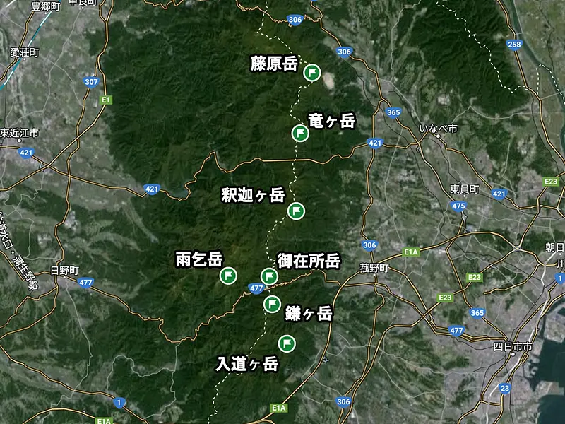
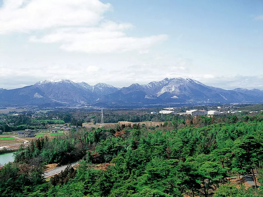
The Suzuka Mountains stretch from north to south on the border between Mie and Shiga prefectures. The seven main mountains in the Suzuka Mountains are known as the Suzuka Seven Mountains, and are visited by many climbers.
This time we will be reporting on Ryugataka, which is popular among many climbers!
column
Suzuka Seven Mountains
・ Mt.Gozaisho 1212m
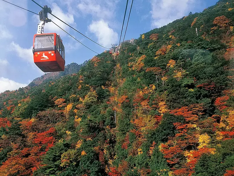
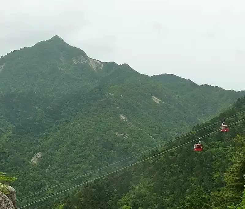
It is the main peak of the Suzuka Mountains, located on the border between KomonoTown Town, Mie County, Mie Prefecture and Higashiomi City, Shiga Prefecture. It has been selected as one of the 200 famous mountains in Japan and one of the 100 famous mountains in the Kansai region. A world-class ropeway leads to the summit, making it a popular mountain with tourists.
・Mt. Fujiwara 1140m
Located on the border between Inabe City InabeCity and Higashiomi City, Shiga Prefecture, it has been selected as one of the 300 famous mountains in Japan, one of the 100 famous mountains in the Kansai region, and one of the 100 famous flowers. Many climbers visit the mountain in spring when the flowers bloom.
・Kamagadake 1161m
This mountain straddles Komono KomonoTown Mie County, Mie Prefecture and Koka City, Shiga Prefecture. It has also been selected as one of the 100 famous mountains in the Kansai region. Its sharp, pointed shape makes it a famous mountain for rock climbing.
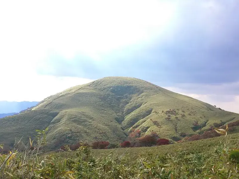
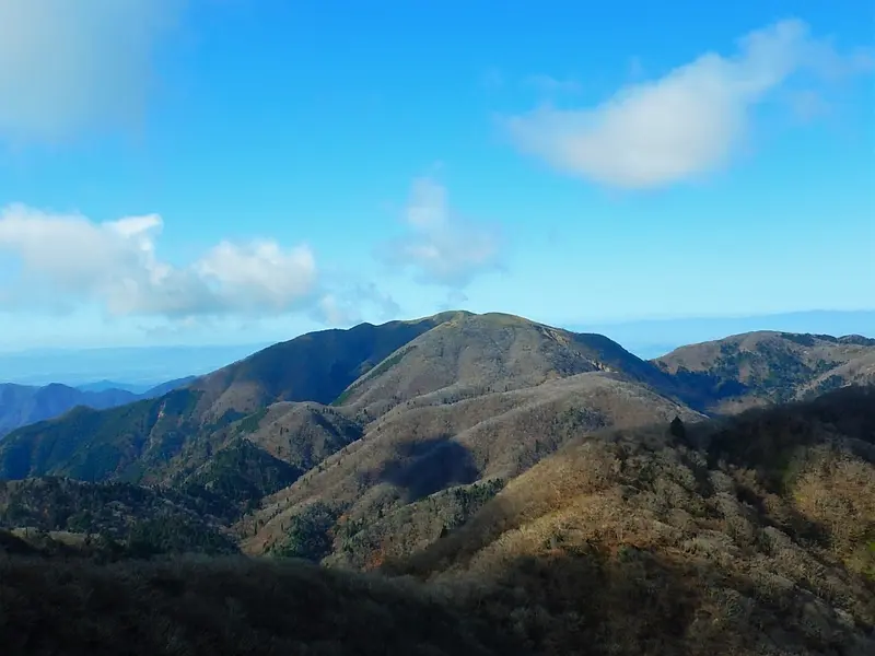
・Ryūgatake 1099m
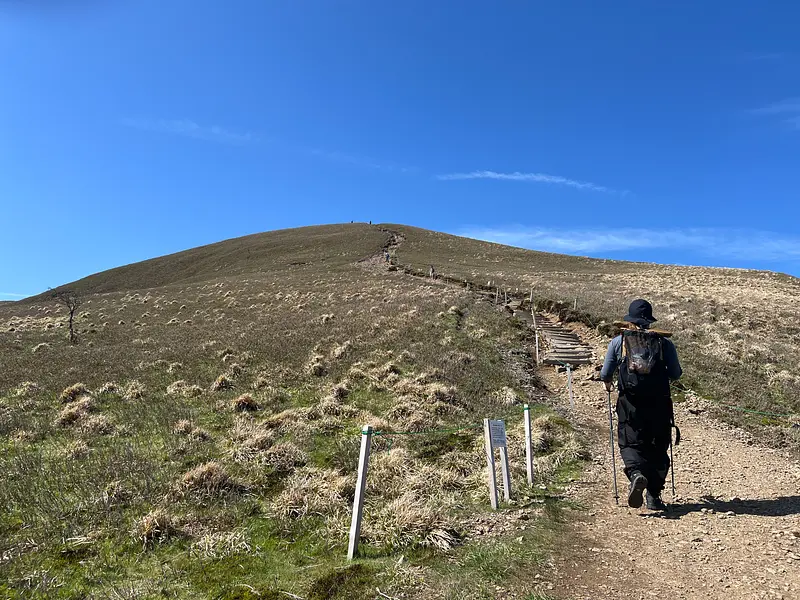
It is located in the center of the Suzuka Seven Mountains, on the border between Inabe City InabeCity and Higashiomi City, Shiga Prefecture. The summit area is characterized by a gentle ridgeline, and you can enjoy a 360° view while climbing.
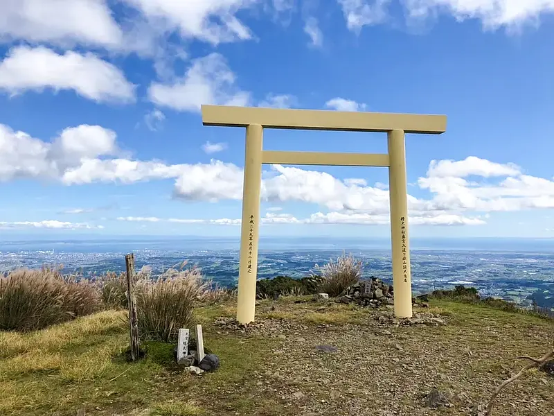
・ Nyudogatake 906.1m
Located in Suzuka SuzukaCity, Mie Prefecture, this mountain has been selected as one of the 100 famous mountains in the Kinki region. It is the object of worship for Tsubaki Okami TsubakiGrandShrine and has a large white torii gate enshrined on the summit.
・Shakagatake 1092.2m
It is located on the border between Komono Town, Mie County, KomonoTown Prefecture and Higashiomi City, Shiga Prefecture. The shape of the mountain, which does not protrude from the summit, resembles the sleeping posture of Shakyamuni, hence the name.
・Amagoi-dake 1238m
It is the second highest peak in the Suzuka Mountains, and lies on the border between Higashiomi City and Koka City in Shiga Prefecture. There is a small pond called "Otogenosawa" at the summit, and it has been worshipped as a rain-making faith since ancient times, which is the origin of the mountain's name.
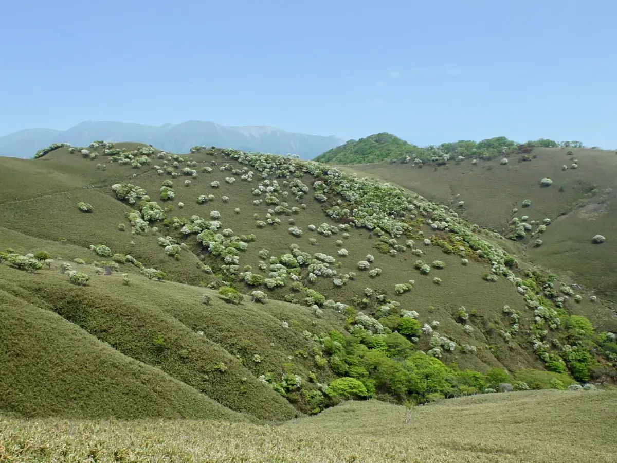
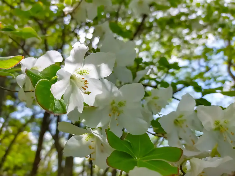
A flock of white sheep!? What on earth is a white yashio?
From May to June, many climbers visit Ryugatake Mountain to see a flock of white sheep. What does a flock of white sheep mean on the mountain's summit? Are there really sheep on top of a mountain?

The true identity of the flock of white sheep is a flower of the Ericaceae family called "Shiroyashio". They live on mountain slopes and rocky areas. From May to June, one or two white flowers bloom along with new leaves from the flower buds at the end of the branches.
It is also called "Five-leaf Azalea" because five leaves grow in whorls at the ends of the branches.
There are other mountains in Mie Prefecture, such as Mt.Gozaisho, where you can see the white rhododendrons, and even all over Japan, but Ryugataka is the only place where so many white rhododendrons grow naturally and they are also known as "white sheep"!
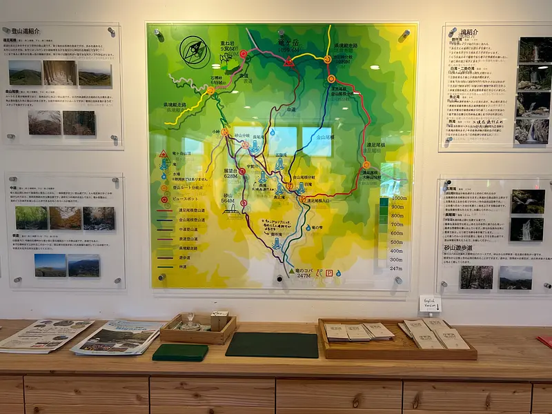
Introduction to the climbing course of Ryugatake
There are four main hiking trails on Mt. Ryugataka.
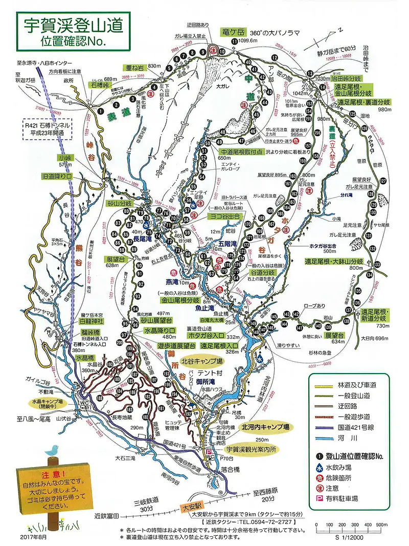
・Excursion Ridge Course (The view from the ridge is beautiful!)
Ascent: Approx. 3 hours Descent: Approx. 2 hours 30 minutes
・Kanayama Ridge Course (Lots of forests, so you can enjoy forest bathing!)
Ascent: Approx. 2.5 hours Descent: Approx. 2 hours
・Nakamichi (The steepest course, for advanced skiers)
Ascent: Approx. 3 hours 30 minutes Descent: Approx. 2 hours 30 minutes
・Main road (shortest route to the summit)
Ascent: about 1 hour 15 minutes Descent: about 50 minutes
For details on the Ugakei map, click here! (External link)
The difficulty level varies depending on the course, so please choose a course that suits your physical strength and climbing experience. In this report, we will introduce the Excursion Ridge Course, which is popular with climbers and is also a great place to view the white rhododendrons.


Introducing "Tatsunokoba," a must-visit spot for those climbing Mt. Ryugatake
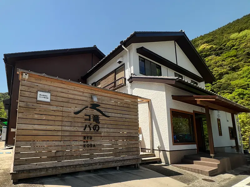
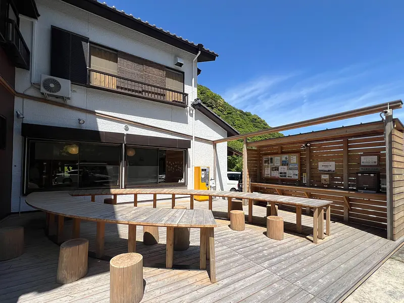
If you come to climb Mt. Ryugatake or visit Ugakei, please stop by "Tatsunokoba"! "Tatsunokoba" is an Ugakei Tourist Information Center operated by the Ugakei Tourist Association. Here, you can find toilets, rest areas, and a cafe.
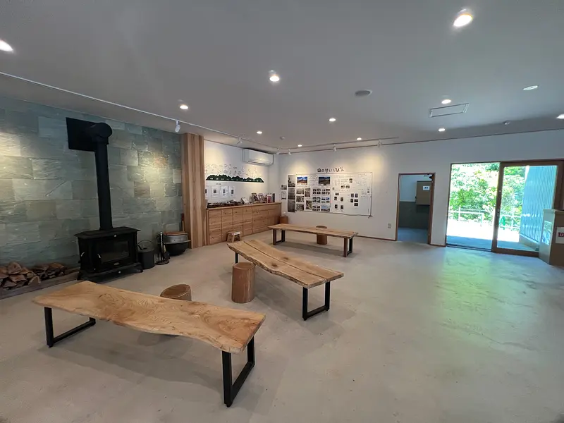
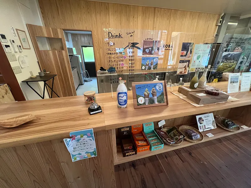


You can also find out about tourist information for Ugakei as well as various maintenance activities at Ryugataka!
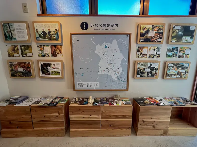
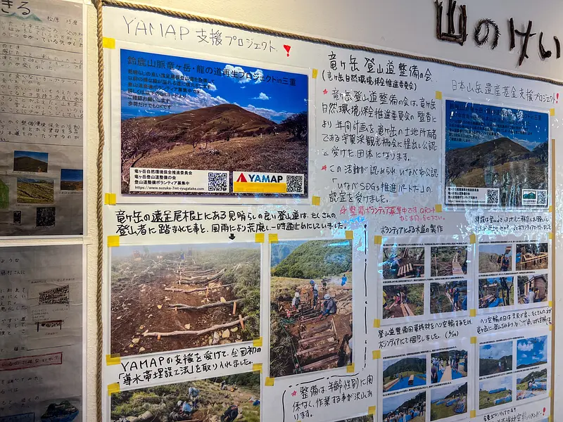
If you come to Ugakei, be sure to stop by Ryunokoba!
If you want to know more about Ryukoba, check out this article!
Recommended spots around Ugakei
Access information
Detailed information
20.2km (approx. 35 minutes) from Kuwana IC on the Tomei-Han Expressway
29.2km (approximately 40 minutes) from Meishin Expressway "Yokaichi IC"
Parking: 160 spaces
<Parking fee (per day)>
Large bus (reservation required): 4,000 yen Small bus: 2,000 yen Regular car: 500 yen Motorcycle: 200 yen