
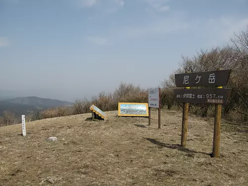
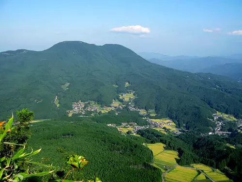
Amagatake (Igafuji) Amagadake (Igafuji)
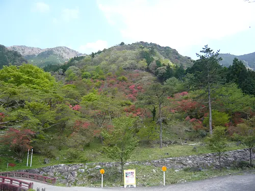
It is a 957.7m tall mountain that straddles the southern tip of Aoyama, IgaCity, known as Minami Aoyama, and straddles the border with Isemisugi Village. It is also called Mt. Kubugatake or Mt. Oyamagatake. Since the shape of the mountain resembles Mt. Fuji, it has been called "Iga Fuji" since ancient times. The Tokai Nature Trail crosses this mountaintop, and the view is spectacular.
You can view and edit the sightseeing route (My Plan on My Page) that will take you around the selected spots.
現在選択中のスポット数:...件
Detailed information
From Kintetsu Aoyamacho Station, take the Aoyama Administration Bus bound for Takao and get off at the last stop of the Takao/Hane Line.
45 minutes by car from Meihan National Highway “Ueno Higashi IC”
Mie's 100 selected trees
82. Kobushi of Mt. Amagatake
https://www.pref.mie.lg.jp/SHINRIN/HP/mori/13420015273.htm
*Prices are subject to change, so please check with your contact information before going out.
Nearby spots
直線距離:22m
Mt. Amagatake
直線距離:2.5km
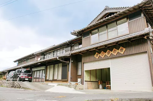
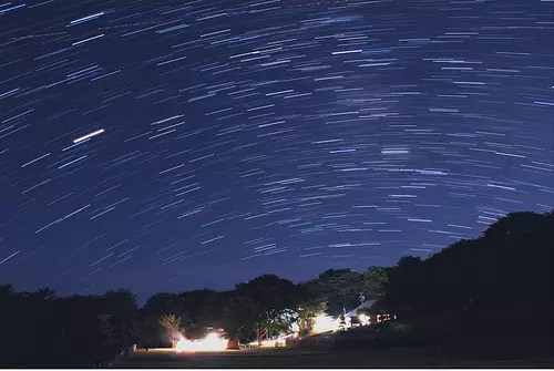
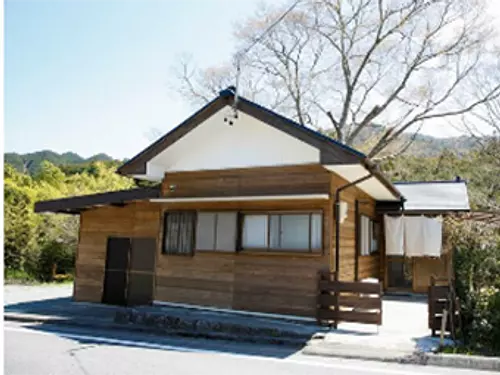
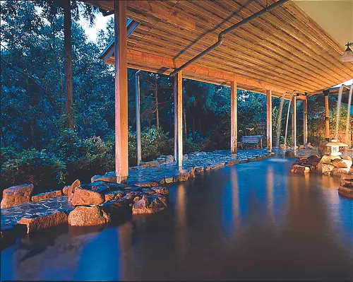
Starry sky inn
直線距離:2.6km
Mt. Otoro
直線距離:2.7km
Skyland Obora
直線距離:3.3km
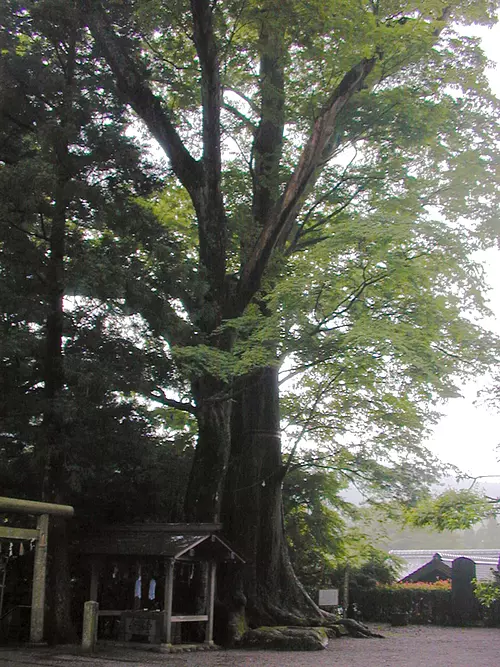
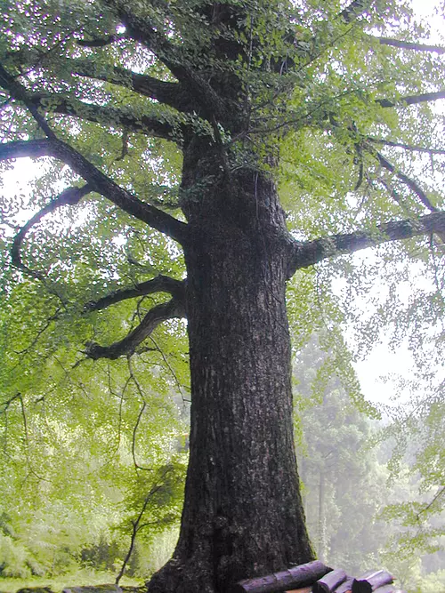
Keyaki at Kunizu Shrine [Prefecturally designated natural monument]
直線距離:3.3km
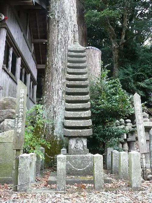
Kunitsu Shrine

直線距離:3.6km
CENTURIO POWER LAND
直線距離:3.6km
Kageyan no Ie
直線距離:3.9km
Higami Valley
直線距離:3.9km
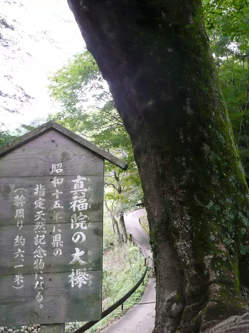
Zelkova at Shinpuku-in Temple [Prefecturally designated natural monument]
直線距離:4.0km
Ohatsuki Ginkgo at Higamifudo-in Temple [Prefecturally designated natural monument]
直線距離:4.1km
MisugiResort
nearby events
Date: Monday, April 29, 2024
直線距離:13.7km
Arataki Fudoson Azalea Festival
Event date: Mid-July to late July
直線距離:14.4km
[Flowers] Mountain Lily Village
![[Flowers] Rhododendrons of TenkaizanTaiunjiTemple](https://www.kankomie.or.jp/rails/active_storage/representations/proxy/eyJfcmFpbHMiOnsibWVzc2FnZSI6IkJBaHBBaEF1IiwiZXhwIjpudWxsLCJwdXIiOiJibG9iX2lkIn19--844c7c5b279c6c8a791043e508a9bd6d5ccb9053/eyJfcmFpbHMiOnsibWVzc2FnZSI6IkJBaDdCem9MWm05eWJXRjBPZ2wzWldKd09oSnlaWE5wZW1WZmRHOWZabWwwV3dkcEF2UUJNQT09IiwiZXhwIjpudWxsLCJwdXIiOiJ2YXJpYXRpb24ifX0=--8d6bc4b517fae43c9e30c66a38f93836dd92b535/10111_1_org.jpg)
Date: Late April to early May
直線距離:15.1km
[Flowers] Rhododendrons of TenkaizanTaiunjiTemple
![[Flower] Yuri Hase](https://www.kankomie.or.jp/rails/active_storage/representations/proxy/eyJfcmFpbHMiOnsibWVzc2FnZSI6IkJBaHBBZzB1IiwiZXhwIjpudWxsLCJwdXIiOiJibG9iX2lkIn19--10a2f0d92dd0580521c0fd66dfd7bfb5a26715af/eyJfcmFpbHMiOnsibWVzc2FnZSI6IkJBaDdCem9MWm05eWJXRjBPZ2wzWldKd09oSnlaWE5wZW1WZmRHOWZabWwwV3dkcEF2UUJNQT09IiwiZXhwIjpudWxsLCJwdXIiOiJ2YXJpYXRpb24ifX0=--8d6bc4b517fae43c9e30c66a38f93836dd92b535/10106_1_org.jpg)
Date: Mid-July to late July
直線距離:16.2km
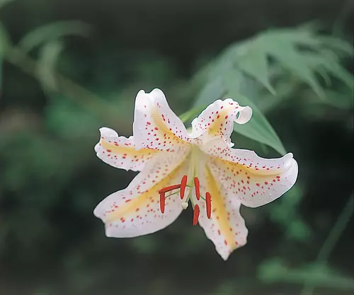
[Flower] Yuri Hase
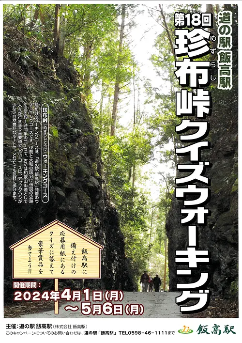
Date: April 1, 2024 (Monday) ~...
直線距離:16.4km
18th Mezurashi-togePass Quiz Walking
![[Exhibition] (Hase Station) Photo exhibition of Tomomi Hase, Yoshito Tochigi, and Taro Chako](https://www.kankomie.or.jp/rails/active_storage/representations/proxy/eyJfcmFpbHMiOnsibWVzc2FnZSI6IkJBaHBBMnRLQkE9PSIsImV4cCI6bnVsbCwicHVyIjoiYmxvYl9pZCJ9fQ==--ca5515e4c6a6c6f6187c295f3e3fcce33bc8c3a3/eyJfcmFpbHMiOnsibWVzc2FnZSI6IkJBaDdCem9MWm05eWJXRjBPZ2wzWldKd09oSnlaWE5wZW1WZmRHOWZabWwwV3dkcEF2UUJNQT09IiwiZXhwIjpudWxsLCJwdXIiOiJ2YXJpYXRpb24ifX0=--8d6bc4b517fae43c9e30c66a38f93836dd92b535/s-240314hase-1.jpg)
Date: March 14, 2024 (Thursday) ~...
直線距離:16.7km
[Exhibition] (Hase Station) Photo exhibition of Tomomi Hase, Yoshito Tochigi, and Taro Chako
![[Exhibition] The 13th Manyu Calligraphy Exhibition](https://www.kankomie.or.jp/rails/active_storage/representations/proxy/eyJfcmFpbHMiOnsibWVzc2FnZSI6IkJBaHBBNDFVQkE9PSIsImV4cCI6bnVsbCwicHVyIjoiYmxvYl9pZCJ9fQ==--56c649d0c6fdaa7a6569f14bab89fbc8d53aba3f/eyJfcmFpbHMiOnsibWVzc2FnZSI6IkJBaDdCem9MWm05eWJXRjBPZ2wzWldKd09oSnlaWE5wZW1WZmRHOWZabWwwV3dkcEF2UUJNQT09IiwiZXhwIjpudWxsLCJwdXIiOiJ2YXJpYXRpb24ifX0=--8d6bc4b517fae43c9e30c66a38f93836dd92b535/240328manyu-1.jpg)
Date: Thursday, March 28, 2024 - April 30, 2024...
直線距離:17.7km
[Exhibition] The 13th Manyu Calligraphy Exhibition
Date: April 1, 2024 (Monday) ~...
直線距離:17.7km
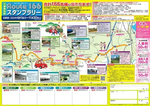
Network Route 166 Stamp Rally’24

Date: April 1, 2024 (Monday) - March 01, 2025...
直線距離:17.7km
Green receipt campaign on the 1st of every month! !
Date: April 1, 2024 (Mon) - March 31, 2025...
直線距離:17.7km
Iitakano Store Every Wednesday is “Wednesday Thank You Day”!!
Date: July 24, 2023 (Monday) - July 2, 2024...
直線距離:17.7km
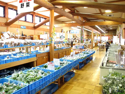
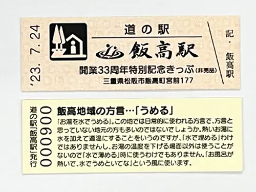
Iitakano Store Iidaka Station “Special Commemorative Ticket” now being distributed

Date: March 8, 2024 (Friday) ~...
直線距離:17.7km
Restaurant Iitaka's spring limited menu "Hanagoromo"
Plays and experiences nearby

直線距離:11.6km
LakeShorenji Tourism Village Strawberry Picking
直線距離:12.2km
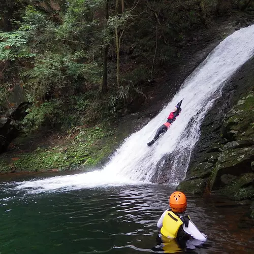
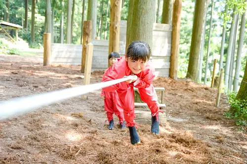
Genryu Adventure Tour
直線距離:12.2km
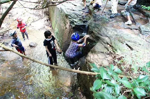
Children's exciting experience ECO tour
直線距離:12.2km
Experience training in NinjanoMori! Experience the secrets of Iga ninja at the foot of TheAkame48Falls ♪

直線距離:12.2km
13th Ninja Training Championship Tournament
直線距離:12.2km
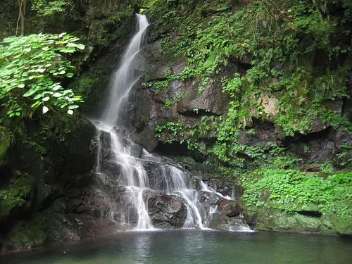
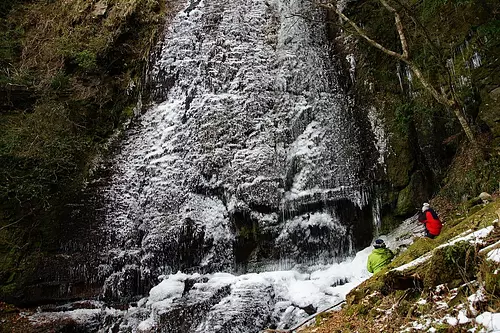
Dainichi Falls Icefall Tour

直線距離:13.3km
Visiting sweets shops in Nabari
.jpg)
直線距離:13.7km
Digging sweet potatoes
直線距離:16.4km
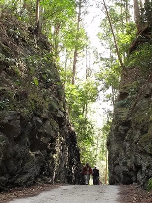
Historical road Mezurashi-togePass walking

直線距離:20.4km
Tomi Berry Strawberry Farm
![[Mie's Imma Coco Journey] Mountain Bike Beginner Tour](https://www.kankomie.or.jp/rails/active_storage/representations/proxy/eyJfcmFpbHMiOnsibWVzc2FnZSI6IkJBaHBBODVGQXc9PSIsImV4cCI6bnVsbCwicHVyIjoiYmxvYl9pZCJ9fQ==--16de877e4caab3320aa20a7fe1dffc1ca9ffee87/eyJfcmFpbHMiOnsibWVzc2FnZSI6IkJBaDdCem9MWm05eWJXRjBPZ2wzWldKd09oSnlaWE5wZW1WZmRHOWZabWwwV3dkcEF2UUJNQT09IiwiZXhwIjpudWxsLCJwdXIiOiJ2YXJpYXRpb24ifX0=--8d6bc4b517fae43c9e30c66a38f93836dd92b535/WARAK.png)
直線距離:21.5km
[Mie's Imma Coco Journey] Mountain Bike Beginner Tour
直線距離:23.6km
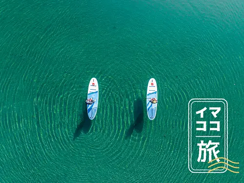
[Mie's current journey] Drone video present ♪ Miyagawa spectacular view SUP

.jpg)