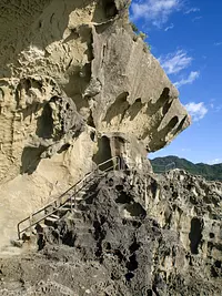
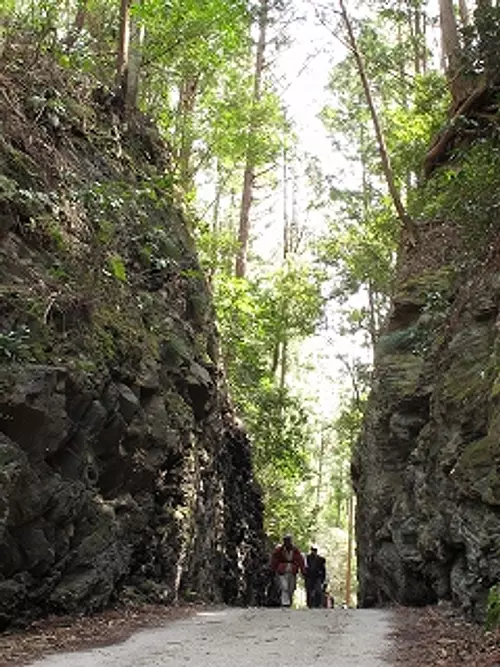
Tsubogatake Tsubonegatake

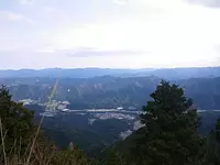
The altitude is approximately 1,028.7m. It is one of the three mountains of Ise, and from the top you can see Ise Bay and the city. There are two mountain trails from the north and one from the south.
Please see the mountain climbing course here↓↓
Matsusaka Kahada Chamber of Commerce Outdoor Map
For Matsusaka tourist information, visit the Matsusaka sightseeing information site Wakuwaku Matsusaka.
You can view and edit the sightseeing route (My Plan on My Page) that will take you around the selected spots.
現在選択中のスポット数:...件
Detailed information
From JR/Kintetsu Matsusaka Station, take the Iinan Hase Line (bound for Michi-no-eki Iidaka Station or Sumeru) bus for about 50 minutes, get off at Horide, walk 60 minutes to the new mountain trail, and walk 40 minutes to the old mountain trail.
Approximately 50 minutes from Ise Expressway "Matsusaka IC" via National Route 166
can be
*Prices are subject to change, so please check with your contact information before going out.
Nearby spots
直線距離:2.7km
Mezurashi-togePass
直線距離:2.9km
Arataki Fudoson
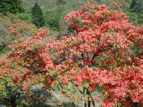
直線距離:2.9km
Azalea Village Arataki
![Large camphor tree at Mizuya Shrine [prefecturally designated natural monument]](https://www.kankomie.or.jp/rails/active_storage/representations/proxy/eyJfcmFpbHMiOnsibWVzc2FnZSI6IkJBaHBBck1FIiwiZXhwIjpudWxsLCJwdXIiOiJibG9iX2lkIn19--f3abceeb4594b28a50ee4a86e7433eea20a002bf/eyJfcmFpbHMiOnsibWVzc2FnZSI6IkJBaDdCem9MWm05eWJXRjBPZ2wzWldKd09oSnlaWE5wZW1WZmRHOWZabWwwV3dkcEF2UUJNQT09IiwiZXhwIjpudWxsLCJwdXIiOiJ2YXJpYXRpb24ifX0=--8d6bc4b517fae43c9e30c66a38f93836dd92b535/2265_1_org.jpg)
直線距離:3.0km
Large camphor tree at Mizuya Shrine [prefecturally designated natural monument]

直線距離:3.3km
Mokuichi Forest Art Museum
直線距離:3.6km
Tottoki Mochi
直線距離:3.6km
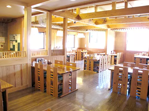
Michi-no-eki Iitaka Station ``Restaurant Iitaka''
直線距離:3.6km
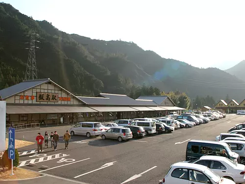
Michi-no-eki Iidaka station
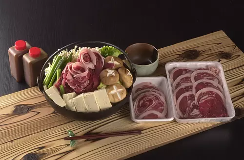
直線距離:3.6km
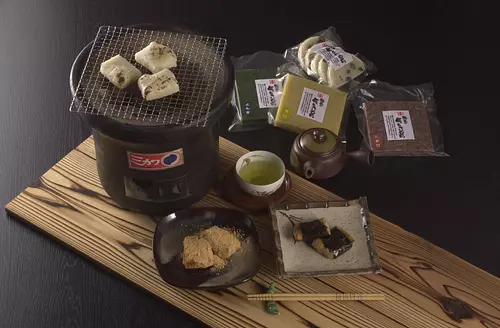
shish meat
直線距離:3.6km
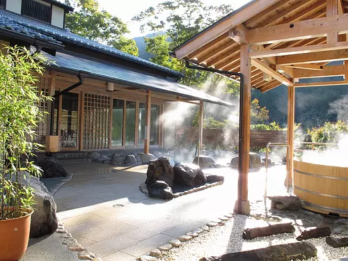
Michi-no-eki Iidaka Station "kahadavalley Iitaka no Yu"
直線距離:3.6km
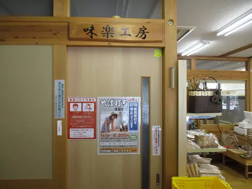
Soba making experience Miraku Kobo
直線距離:3.7km
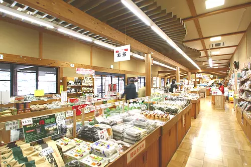
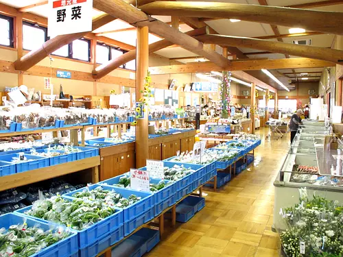
Michi-no-eki Iitaka Station "Iitakano Store"
nearby events
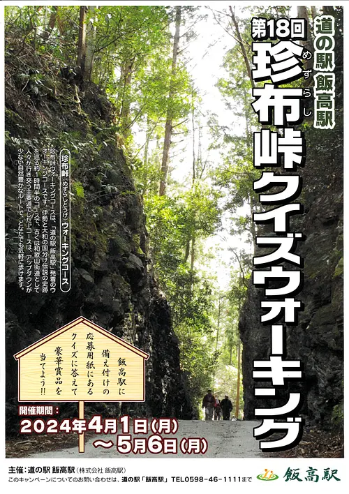
Date: April 1, 2024 (Monday) ~...
直線距離:2.7km
18th Mezurashi-togePass Quiz Walking
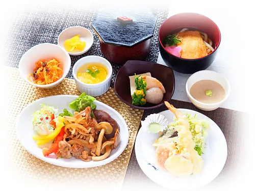
Date: March 8, 2024 (Friday) ~...
直線距離:3.6km
Restaurant Iitaka's spring limited menu "Hanagoromo"

Date: February 23, 2024 (Friday) ~...
直線距離:3.6km
Restaurant Iitaka Rendam Curry Spring Version
![[Exhibition] The 13th Manyu Calligraphy Exhibition](https://www.kankomie.or.jp/rails/active_storage/representations/proxy/eyJfcmFpbHMiOnsibWVzc2FnZSI6IkJBaHBBNDFVQkE9PSIsImV4cCI6bnVsbCwicHVyIjoiYmxvYl9pZCJ9fQ==--56c649d0c6fdaa7a6569f14bab89fbc8d53aba3f/eyJfcmFpbHMiOnsibWVzc2FnZSI6IkJBaDdCem9MWm05eWJXRjBPZ2wzWldKd09oSnlaWE5wZW1WZmRHOWZabWwwV3dkcEF2UUJNQT09IiwiZXhwIjpudWxsLCJwdXIiOiJ2YXJpYXRpb24ifX0=--8d6bc4b517fae43c9e30c66a38f93836dd92b535/240328manyu-1.jpg)
Date: Thursday, March 28, 2024 - April 30, 2024...
直線距離:3.6km
[Exhibition] The 13th Manyu Calligraphy Exhibition
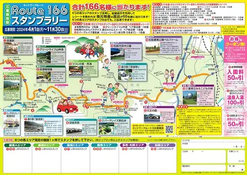
Date: April 1, 2024 (Monday) ~...
直線距離:3.6km
Network Route 166 Stamp Rally’24

Date: April 1, 2024 (Monday) - March 01, 2025...
直線距離:3.7km
Green receipt campaign on the 1st of every month! !
Date: April 1, 2024 (Mon) - March 31, 2025...
直線距離:3.7km
Iitakano Store Every Wednesday is “Wednesday Thank You Day”!!
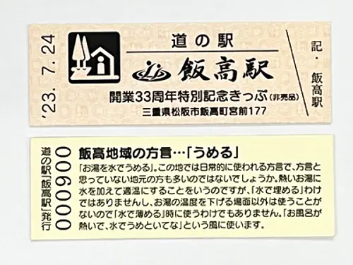
Date: July 24, 2023 (Monday) - July 2, 2024...
直線距離:3.7km
Iitakano Store Iidaka Station “Special Commemorative Ticket” now being distributed
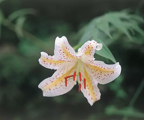
Event date: Mid-July to late July
直線距離:11.3km
[Flowers] Mountain Lily Village
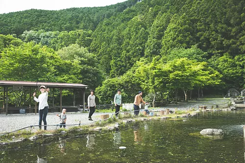
![[Reservation required] Experience catching fish at a fishing pond](https://www.kankomie.or.jp/rails/active_storage/representations/proxy/eyJfcmFpbHMiOnsibWVzc2FnZSI6IkJBaHBBMUNuQWc9PSIsImV4cCI6bnVsbCwicHVyIjoiYmxvYl9pZCJ9fQ==--a6bea6d0f3e733bc0bf3ce54fd910dbd40663802/eyJfcmFpbHMiOnsibWVzc2FnZSI6IkJBaDdCem9MWm05eWJXRjBPZ2wzWldKd09oSnlaWE5wZW1WZmRHOWZabWwwV3dkcEF2UUJNQT09IiwiZXhwIjpudWxsLCJwdXIiOiJ2YXJpYXRpb24ifX0=--8d6bc4b517fae43c9e30c66a38f93836dd92b535/catchingfish.jpg)
Date: July 1st (Mon) - September 30th (Mon), 2024
直線距離:11.6km
[Reservation required] Experience catching fish at a fishing pond
Date: Wednesday, March 20th, 2024 (National Holiday) - Saturday, November 30th, 2024...
直線距離:11.6km
Enjoy fishing for rainbow trout at the fishing pond♪
Event date: Sunday, July 8, 2023 - Saturday only, held all year round
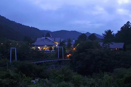
直線距離:11.6km
Night wildlife and night sky viewing drive
Plays and experiences nearby
直線距離:2.7km
Historical road Mezurashi-togePass walking
直線距離:9.2km
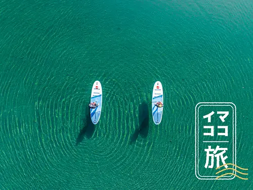
[Mie's current journey] Drone video present ♪ Miyagawa spectacular view SUP
直線距離:9.2km
Let's play with hermits in Osugidani project
直線距離:10.4km
First mountain climbing “Kumano Kodo Misesaka Pass edition” HIKE & BIKE

直線距離:10.4km
“Relaxing and luxurious” only in Osugidani ~Momokiyama House 2 days~
直線距離:10.4km
“Relaxing and luxurious” only in Osugidani ~Momokiyama House 2 days~
直線距離:10.4km
Osugidani Special Route 3 days ~ Go with the Osugidani Mountain Rescue Team Leader and Mori Guide ~
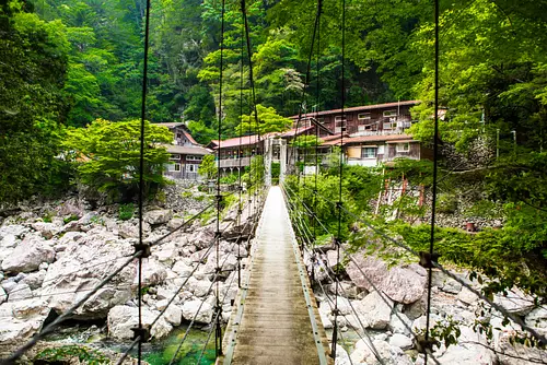
![[*Cancelled] “Tough” Osugidani traversal ~ 2 days of adventure crossing 7 waterfalls and 11 fishing bridges ~](https://www.kankomie.or.jp/rails/active_storage/representations/proxy/eyJfcmFpbHMiOnsibWVzc2FnZSI6IkJBaHBBbXNuIiwiZXhwIjpudWxsLCJwdXIiOiJibG9iX2lkIn19--d089e02d40e4aad7918db40258aa98b6cf8ecf3f/eyJfcmFpbHMiOnsibWVzc2FnZSI6IkJBaDdCem9MWm05eWJXRjBPZ2wzWldKd09oSnlaWE5wZW1WZmRHOWZabWwwV3dkcEF2UUJNQT09IiwiZXhwIjpudWxsLCJwdXIiOiJ2YXJpYXRpb24ifX0=--8d6bc4b517fae43c9e30c66a38f93836dd92b535/1666_1_org.jpg)
直線距離:10.4km
[*Cancelled] “Tough” Osugidani traversal ~ 2 days of adventure crossing 7 waterfalls and 11 fishing bridges ~
直線距離:10.4km
“Tough” Osugidani traversal ~ 2 days adventure crossing 7 waterfalls and 11 fishing bridges ~
.jpg)
直線距離:11.6km
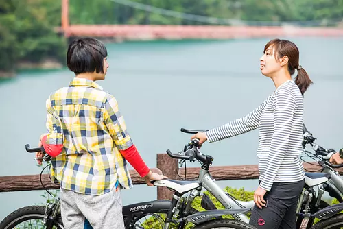
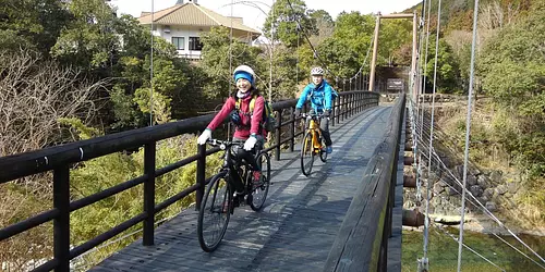
Rental bicycle (electrically assisted bicycle)
![[Verde project] Lunch SUP ~ French lunch included - Safe even in spring and autumn Enjoy a little SUP experience in shallow water with excellent transparency! A copy of ~](https://www.kankomie.or.jp/rails/active_storage/representations/proxy/eyJfcmFpbHMiOnsibWVzc2FnZSI6IkJBaHBBc2duIiwiZXhwIjpudWxsLCJwdXIiOiJibG9iX2lkIn19--a6d203ec6741edffc65bba1a1570ba74da3481e0/eyJfcmFpbHMiOnsibWVzc2FnZSI6IkJBaDdCem9MWm05eWJXRjBPZ2wzWldKd09oSnlaWE5wZW1WZmRHOWZabWwwV3dkcEF2UUJNQT09IiwiZXhwIjpudWxsLCJwdXIiOiJ2YXJpYXRpb24ifX0=--8d6bc4b517fae43c9e30c66a38f93836dd92b535/1742_1_org.jpg)
直線距離:11.6km
[Verde project] Lunch SUP ~ French lunch included - Safe even in spring and autumn Enjoy a little SUP experience in shallow water with excellent transparency! A copy of ~
![[Verde project] Lunch SUP ~ French lunch included - Safe even in spring and autumn Enjoy a little SUP experience in shallow water with excellent transparency! ~](https://www.kankomie.or.jp/rails/active_storage/representations/proxy/eyJfcmFpbHMiOnsibWVzc2FnZSI6IkJBaHBBc1luIiwiZXhwIjpudWxsLCJwdXIiOiJibG9iX2lkIn19--5d90fb83d23d297dbf2e156bade74e8b08c05dd3/eyJfcmFpbHMiOnsibWVzc2FnZSI6IkJBaDdCem9MWm05eWJXRjBPZ2wzWldKd09oSnlaWE5wZW1WZmRHOWZabWwwV3dkcEF2UUJNQT09IiwiZXhwIjpudWxsLCJwdXIiOiJ2YXJpYXRpb24ifX0=--8d6bc4b517fae43c9e30c66a38f93836dd92b535/1741_1_org.jpg)
直線距離:11.6km
[Verde project] Lunch SUP ~ French lunch included - Safe even in spring and autumn Enjoy a little SUP experience in shallow water with excellent transparency! ~