
Challenge yourself to climb the zodiac! Introducing Mt. Konodomari, recommended for the year of the rat.
掲載日:2020.01.25
Zodiac mountain climbing is a style of mountain climbing that is associated with good luck, climbing a mountain named after a zodiac sign once a year. In 2020, the Year of the Mouse, we recommend Mt. Nenotomari in Kiho-cho, Mie KihoTown for an easy walk! We will introduce the ``Hiyuki no Sato Campground'', which is convenient for overnight stays before and after, and where you can enjoy unique experiences such as ``Taki Ducky'' and ``Tent Sauna'', along with plenty of photos. Enjoy the waterfalls and mountains and make active and auspicious memories!
Once a year, they climb a mountain named after a zodiac sign (strictly speaking, there are twelve zodiac signs). This style of mountain climbing carries such auspicious origins.
2020 is the year of the rat! There are few mountains with the word ``ko'' or ``mouse'' attached to them, such as Konogongen in Saitama Prefecture, Mt. Nezumi in Fukui Prefecture, and Mt. O-Nezumi in Gifu Prefecture, but in Kansai there is Mt. Konodomari located in KihoTown, Mie Prefecture. (Nenotomariyama)” is recommended for an easy walking time.
On January 5, 2020, I would like to tell you about my first mountain climb of the new year, which was Mt. Konodomari!
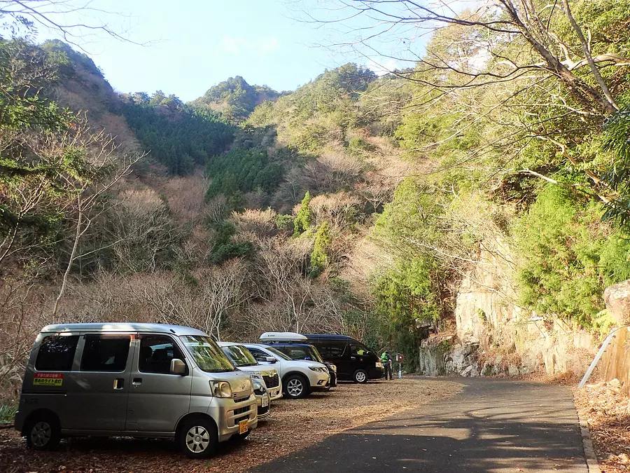
It is convenient to use your own car to get to the Kirihara trailhead, which is the starting point. From KihoTown, take the prefectural road Kiho Kawase Line to the Kirihara area. From there, it's about 6km along a forest road.
There may be falling rocks on the forest road, so drive carefully. There is parking space for about 6 cars at the trailhead.
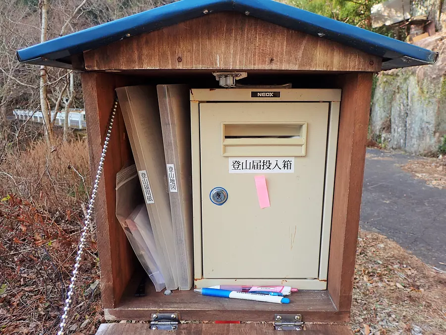
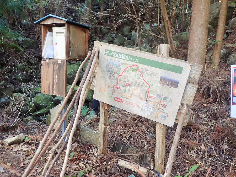
Climb registration forms and a submission box are available at the trailhead. You can also download the mountain climbing notification form from KihoTown website, so it's a good idea to prepare it in advance. It is recommended as it will save you time on the day.
A climbing map was also installed at the time of the interview. Like the mountain climbing notification, this can also be downloaded from KihoTown website.
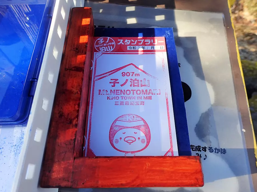
Stamps are placed at the trailhead and the summit. By getting a paper at the trailhead, stamping it, and stacking the stamps from the summit, a certain picture will emerge that is related to the zodiac signs.
What kind of picture it is is only for those who climbed it!
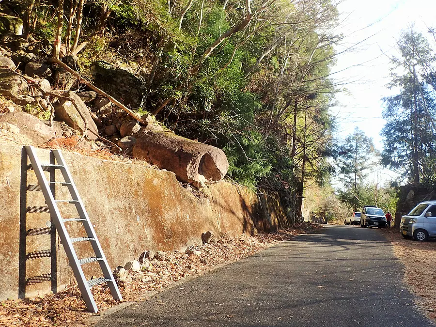
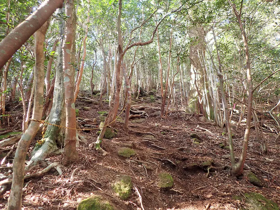
It takes about 1 hour and 30 minutes to 2 hours to reach the summit, depending on your pace. Immediately after climbing the ladder, you will start climbing a steep slope, but the slope becomes relatively gentle once you reach the ridge. Let's climb up while checking the tape etc. that serve as landmarks.
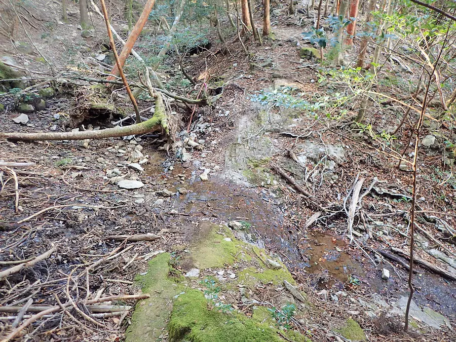
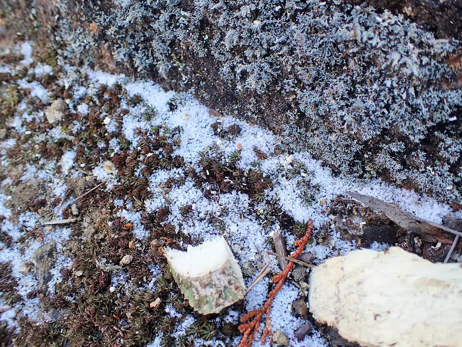
According to the sign at the trailhead, there is a ``Sukkasama River'' at about the 7th station from the trailhead, and it is said to be ``a valley that flows northwards, which is rare in the mountains around here.''
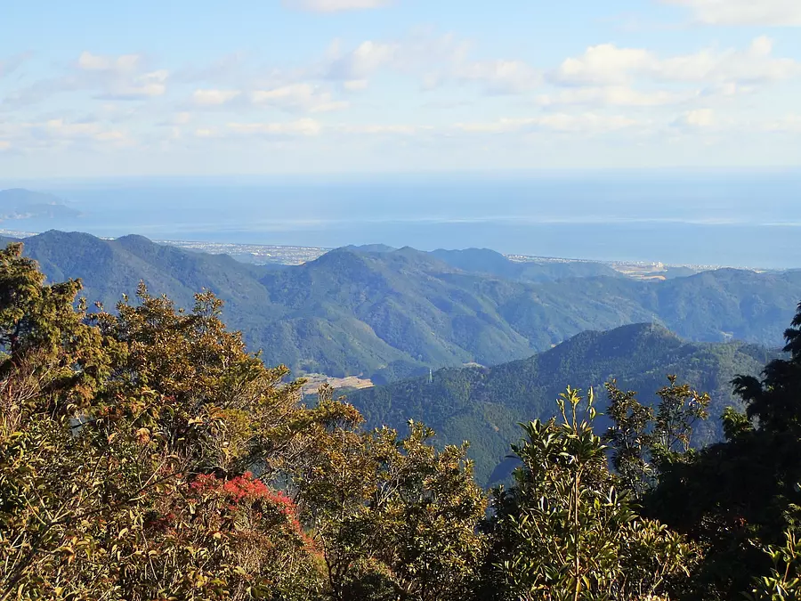
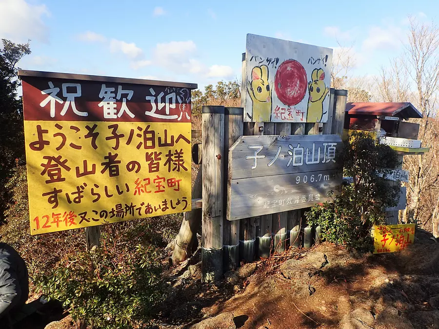
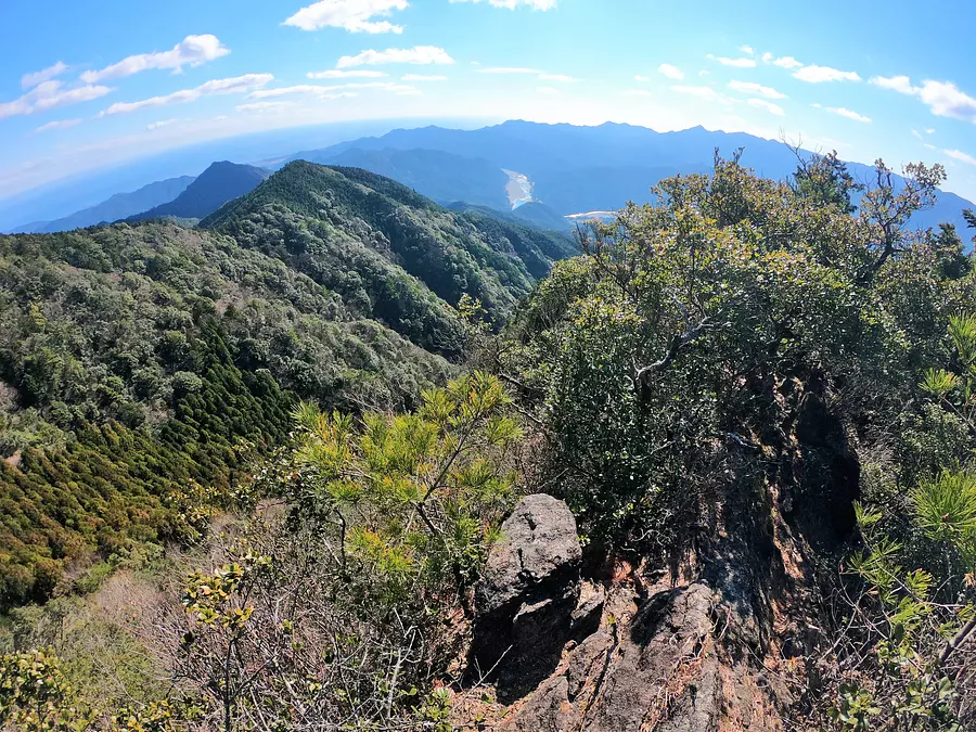
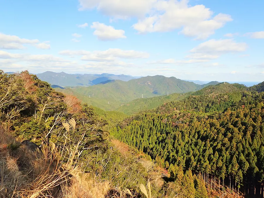
Eventually, the field of view opened up and we arrived at the summit of Mt. Konodomari with a great view!
From the top, you can see the Pacific Ocean to the east and the majestic mountain range to the north.
One of Mt. Nondomari's charms is that it can be climbed year-round due to its warm climate in the southern part of the Kii Peninsula. However, you need to be careful about heatstroke in the summer.
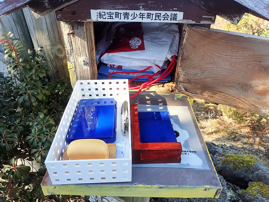
There is a stamp station just to the right of the summit sign. The completed stamp sheet will surely become a fond memory.
After descending steeply from the summit, you will come to a forest road littered with stones. Following the signposts, we re-enter the mountain path and gradually lower the altitude by making small ups and downs.
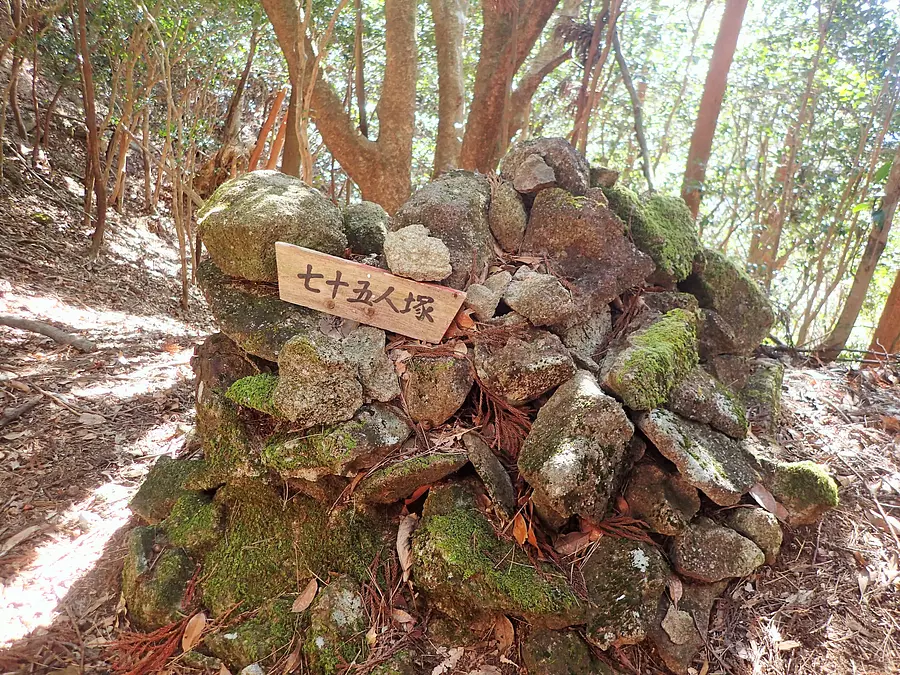
Then, I discovered a mound called "Seventy-five People's Mound"! It is said that this is where a vassal of Kuramitsu Akai, a fallen samurai of the Heike clan, was buried, who is said to have fled with his vassals to Mt. Konomari.
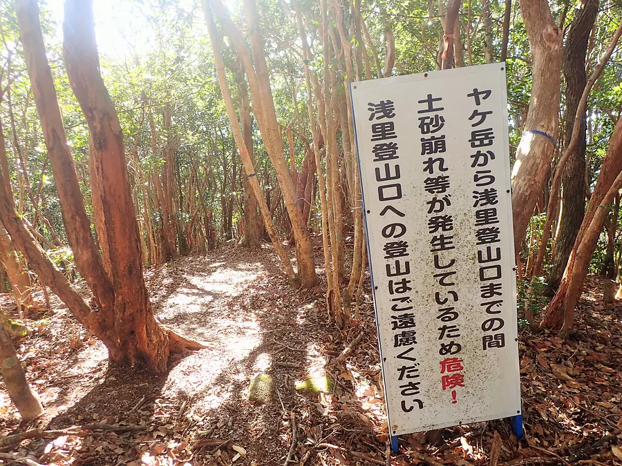
Although it is a new road, this road is already abandoned and cannot be used. However, about 5 minutes after entering this branch, there is a rocky area called Yakegata with a good view, and you can walk up to it, so if the weather is good, it might be a good idea to do the round trip.
There are no signboards erected at Yake-ga, so turn back at a suitable point.
Returning to the fork and descending the ridge, you will follow the signpost and turn right, descending steadily into the valley.
After crossing several valleys with flowing water, you will eventually emerge onto a paved forest road and arrive at the Kirihara Ridge trailhead. If you have two cars, it might be a good idea to have one car turn here first.
Eventually, the trailhead from which we started in the morning came into view, and the mountain climbing was successfully completed. Thank you for your hard work!
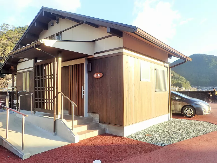
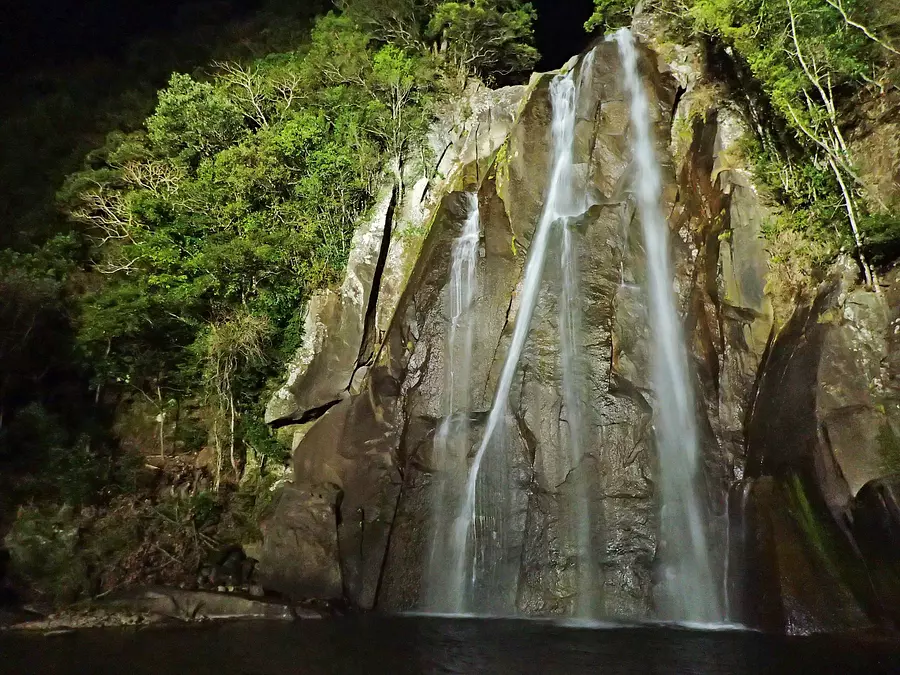
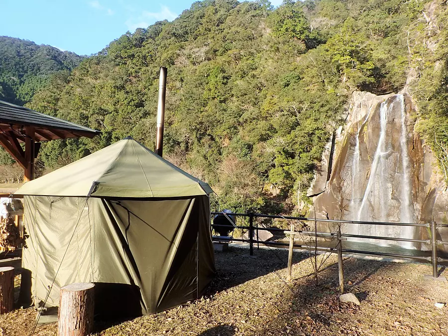
In addition to the campsite, the campsite overlooking the beautiful 30-meter-tall Hisetsu-no-takiFalls has become even more convenient with the addition of new cottages in April 2018.
〇Click here for detailed coverage report of Hisetsu-no-takiFalls Campsite
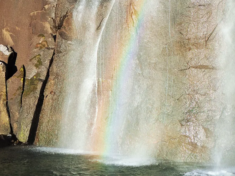
A photo contest is currently being held for a limited time until February 29, 2020. If you have some skill, please give it a try.

For a limited time, the campground offers programs such as riding a ducky (an inflatable canoe) at the base of Hisetsu-no-takiFalls and playing in the river. You can spend a fulfilling time together with Mt. Konomari trekking.
2020, the year of the rat, has just begun. Enjoy the waterfalls and mountains at Hisetsu-no-takiFalls Campsite and Mt. Konodomari and create active and auspicious memories!
[Writer profile]
Masayuki Takenaka
Climbing guide certified by the Japan Mountain Guide Association. Belongs to the Nara Mountain Nature Guide Association. Moved from Osaka to Kawakami Village, Yoshino District, Nara Prefecture, and currently works as a guide for mountain climbing and eco-tours mainly in the Kii Peninsula. He also contributes to mountaineering magazines.
Homepage: Chikuchu Climbing Guide Service
Hisetsu-no-takiFalls Campsite
0735-21-1333
Please check the official website for details.
Open all year round
Open all year round
*Telephone reception hours are 9:00-17:00
*Temporary closures may be required for facility management, maintenance, etc.
can be
2 minutes from JR Shingu Station by getting off at Asari Jinja-mae Town Bus
[From Nagoya]
From Kumano Owase Road Kumano Odomari IC, take National Route 42 towards Shingu for about 50 minutes (about 35 km)
[From Osaka]
From Kisei Expressway Susami Minami IC, take National Route 42 towards Shingu for approximately 1 hour and 40 minutes (approximately 80 km)
| Category | |
|---|---|
| season | |
| area |