
What is Mt. Shiroshi? We will explain the climbing route and parking lot of the Natsume course.
Mt. Shiranui is a mountain with an altitude of 819m, and the view from the top of the mountain that overlooks the surrounding mountains is attractive. In this article, we will explain the trailhead, route, and parking lot for the Natsumei Course, which allows you to climb as if you were hiking.

Article production / Mie Travel Camera Club Fugamaru-chan
▼Table of contents
What is Mt. Shiroshi?
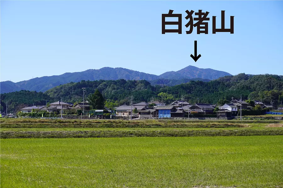
Shiraisan is a mountain with an altitude of 819m located in Iinan-cho, MatsusakaCity City, which is rich in nature.
The top of the mountain has a slightly pointed shape, and when you look at Mt. Shiroi from the base, you can see its impressive shape.
It was called the ``Miss of Ise'' by sailors who traveled to Ise Bay, and it was used as a landmark for navigation.
*The three stars of Ise: Mt. Horisaka, Mt. Tsubonegatake, and Mt. Shiranui. Both are mountains in MatsusakaCity.
A mountain with an outstanding view
The view near the top of the mountain is good, and you can see the surrounding mountains and the cityscape.
One of the charms of Mt. Shiranui is that you can enjoy climbing as if you were hiking, as there are many well-maintained mountain climbing courses.
Below are some typical mountain climbing courses.
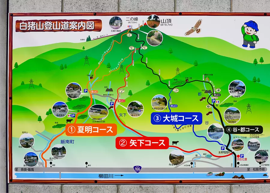
Representative mountain climbing courses
Mt. Shiranui has been selected as one of the 100 Famous Mountains of the Kinki region and is a popular climbing spot visited by many climbers.
There are four typical mountain climbing courses:
① Natsuake course
② Yaoroshi course
③ Ojo Course
④ Tani/Miyako course
These climbing courses can be accessed from National Route 166 to the trailhead, and there is a parking lot near the trailhead, making for an easy-to-climb environment.
In this article, we will explain the ``Natsumei Course'' climbing route, which is perfect for beginners.

Explanation of the climbing route of the Natsume course
The Natsuaki course is a route that passes through villages in the Fukano area of Iinan-cho MatsusakaCity and aims for the summit.
The course time is about 2 and a half hours, with a 30 minute break, making it a total climbing course of about 3 hours.

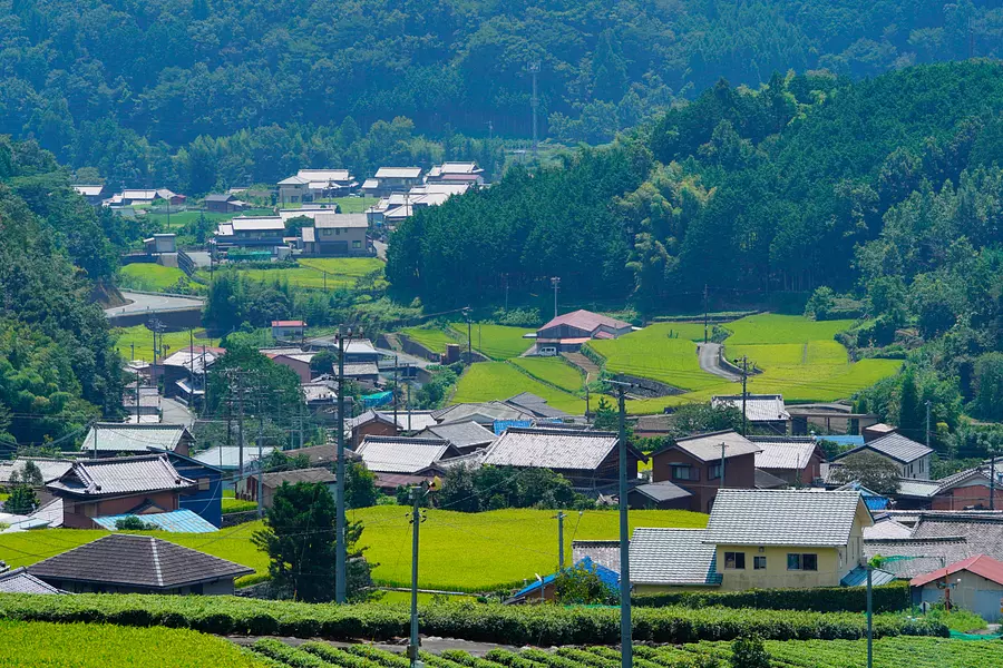
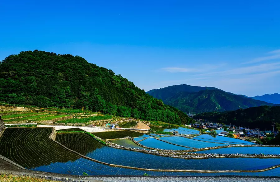
Along the way, you will find ``Fukano Dandan Rice Field'', which has been selected as a ``Tsunagara Rice Terrace Heritage'', and the sight of terraced rice fields with stone walls is worth seeing.
.JPG)
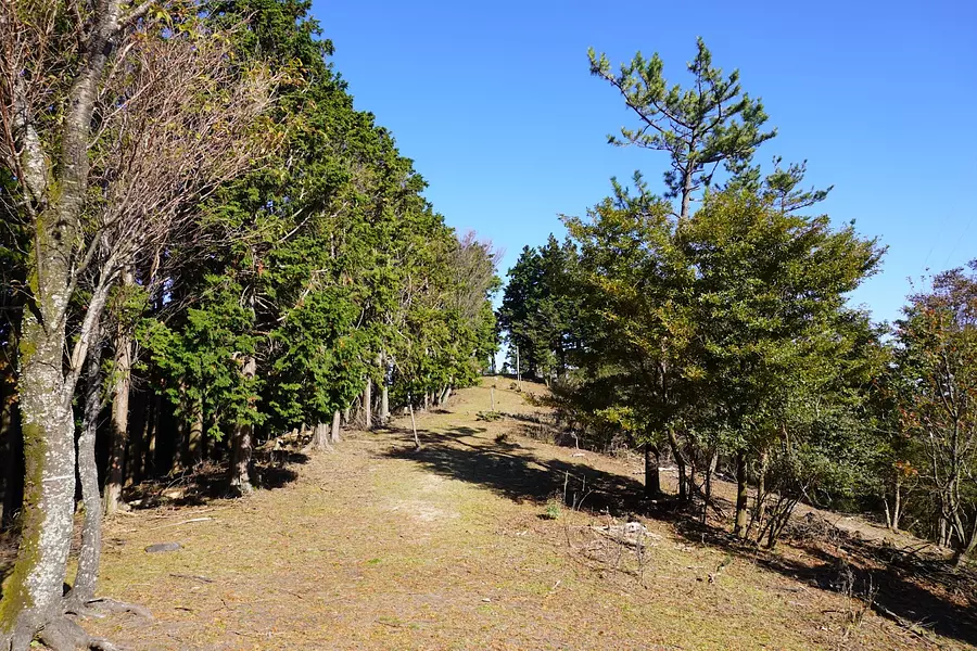
The mountain trail of the Natsumei course is well-maintained all the way to the summit, and there are several guide signs along the way, so even beginners can climb the mountain without getting lost.
Next, I will explain in detail the route from the parking lot to the summit.
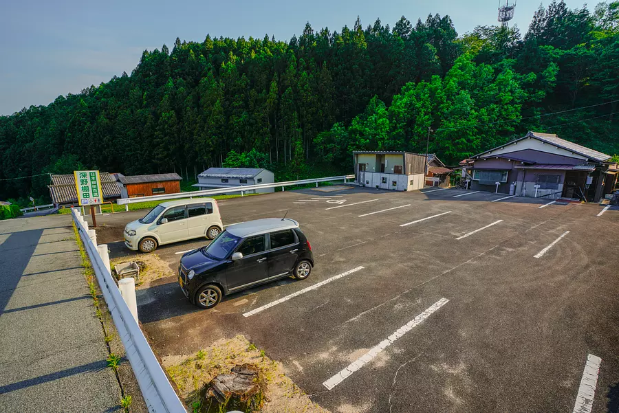
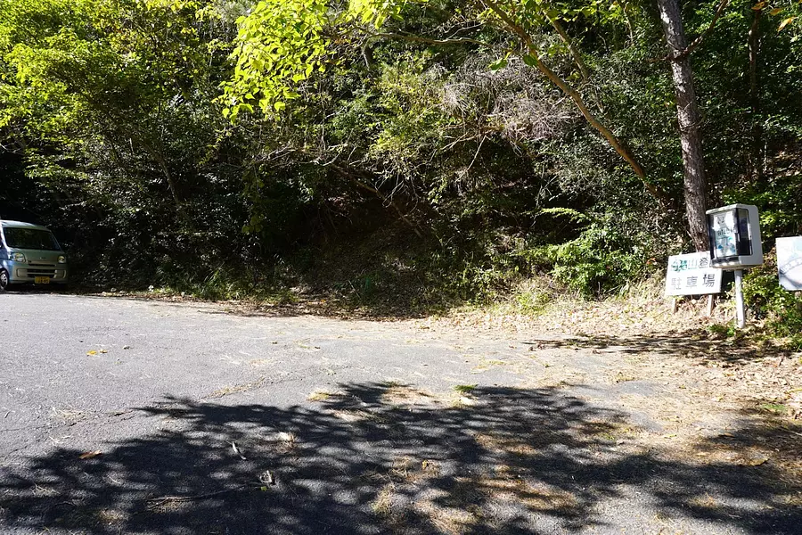
① Parking lot
If you drive up the slope that leads from National Route 166 to the Fukano area, you will arrive at the parking lot of Fukano's Dandan rice field.
There are 9 regular parking spaces and 1 thoughtful parking space for a total of 10 spaces, and there are separate toilets for men and women.
This parking lot is also used by tourists visiting the rice terraces, so it is expected that there will be a large number of users on holidays.
If the parking lot is full, please use the parking lot near the trailhead.
Dandanden parking lot in Fukano (Opens Google Maps)
Parking lot at the trailhead (opens Google Maps)
[Note] The area around the parking lot is a community road.
The path to the parking lot is a residential road used by local residents, so please be careful of pedestrians and bicycles.
There are some narrow spots where you might be worried about an oncoming car, so it's best to drive at low speeds.
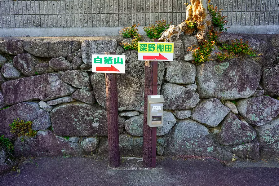
Marker to the trailhead
When you exit the parking lot of Fukano's Dandanda, you will see a signboard reading ``Shiraiyama'', so use this as a guide and proceed to the trailhead.
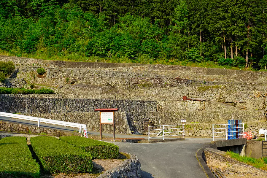
As I walked in the direction indicated on the signboard, I came into view of the stone walls of Fukano's Dandan rice field.
You'll be amazed at the many splendid stone walls that look as if there was a castle there.
The charm of Fukano's Dandan rice fields, known as "stone art," will be explained below.
② Dandan rice field in Fukano
If you walk for a few minutes from the parking lot, you will see a rice field with a stone wall extending over 120 steps.
Its history dates back to the Muromachi period, and it is said that the terraced rice fields were cultivated to provide food for the samurai who stood guard at the "Noroshiba" located west of Mt.
Due to its characteristics and scenery, it has been designated as a ``Tsunagara Rice Terrace Heritage Site'' selected by the Ministry of Agriculture, Forestry and Fisheries.
.jpg)
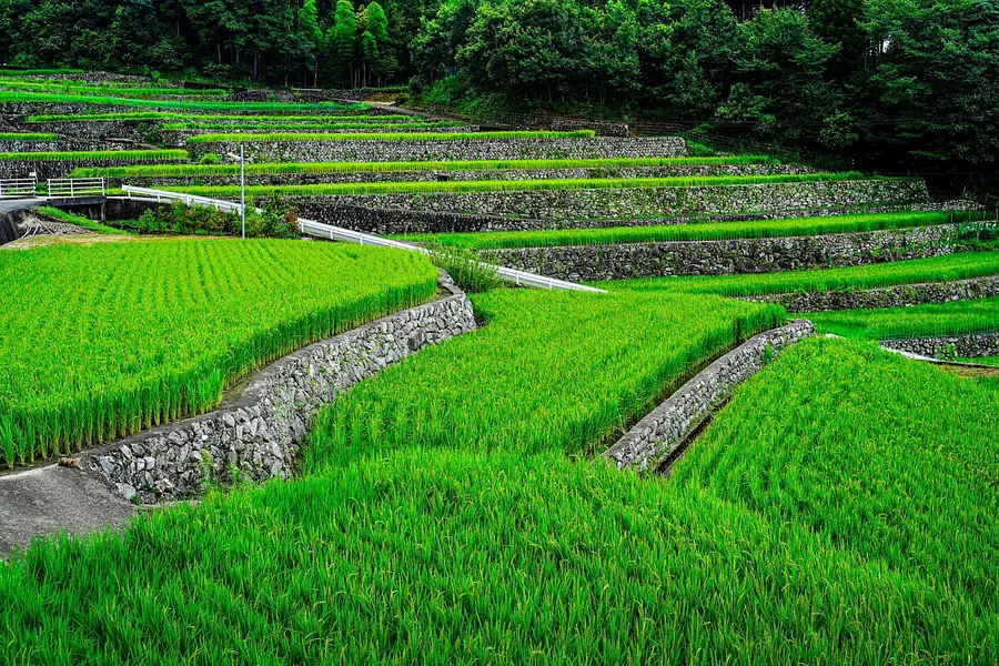
Fukano's Dandan rice fields change their appearance depending on the season, and the season from June to August is when the fresh greenery is beautiful.
.jpg)
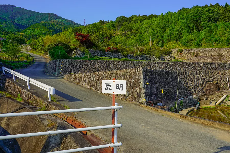
Climb up the slope next to the rice field and you will arrive at the trailhead. Along the way there is a signboard reading ``Natsumei'', so use this as your guide.
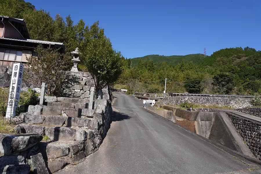
③ Climb entrance
As you climb up the slope while looking at the rice fields, you will see the signboard and stone lantern for "Mt. Shiranui Trailhead" on your left.
This is a fork in the road, but if you go straight up the slope without turning, you will arrive at the parking lot at the trailhead.
This is the trailhead parking lot for the Natsumei course, and there is space for about 5 to 6 cars. If the parking lot of Fukano's Dandanda is full, please use this parking lot.
If this place is also full,Parking lot near Oishi Disaster Prevention CenterYou can use the trailhead, but it takes about 40 minutes to walk to the trailhead.
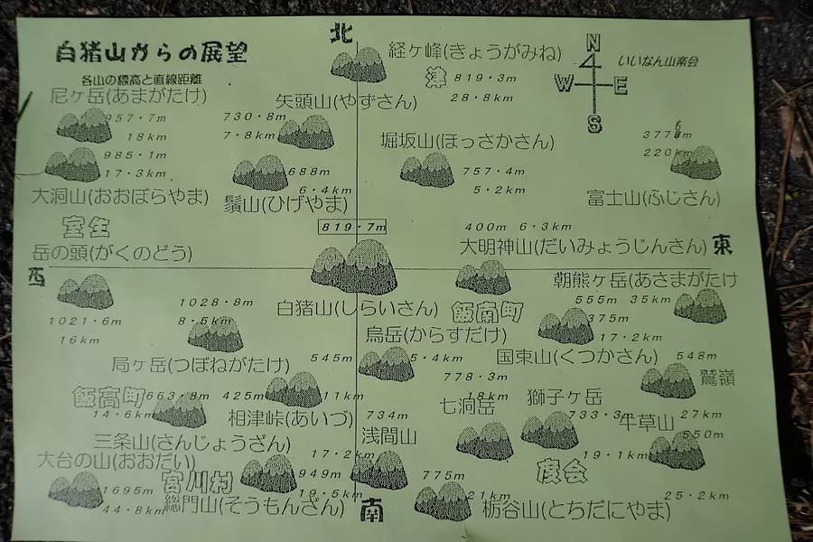
A climbing mailbox was set up in the parking lot at the trailhead, and there was a flyer about Mt.
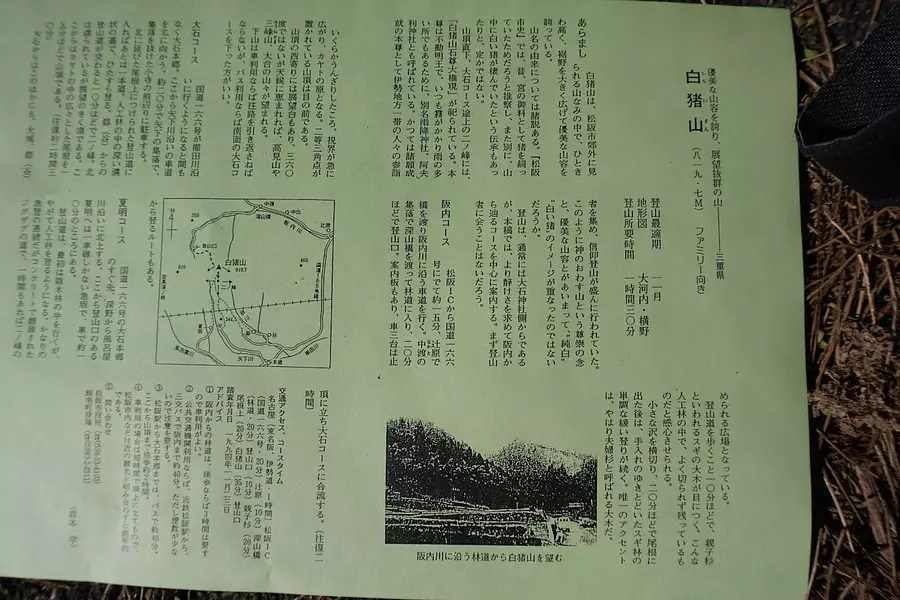
The front side has an illustrated map of the mountains visible from the summit, and the back side has an explanation of the history of Mt. Shiranui and each course, which was very helpful.

Once you enter the trailhead, a paved road with concrete underfoot will lead you to the top of the mountain.
This route has been maintained as an approach to the ``Shiraissan Sekison Daigongen'' located just before the summit, but the steep slope continues to drain your physical strength.
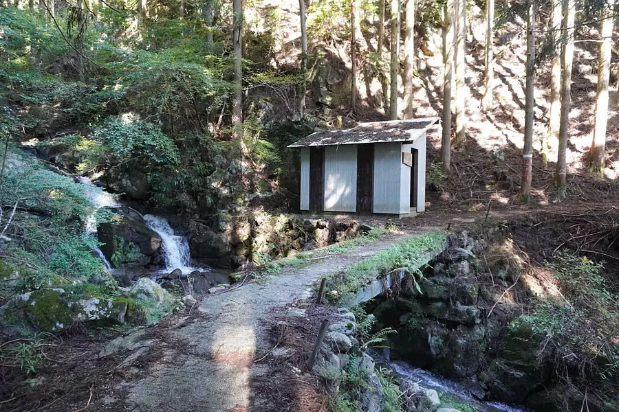
④ Fudogoya
After walking for about 30 minutes on a paved road from the trailhead, you will arrive at the roofed Fudo Hut.
This place is the halfway point of the Natsumei course, and it takes about 30 minutes to reach the top.
There is a bench inside the hut, so it's the perfect spot for a short break.
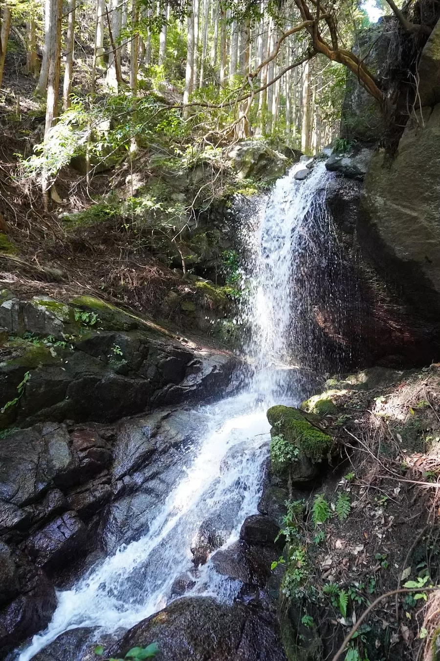
A short walk from the hut will lead you to Fudo Falls, so if you have the energy, why not stop by?
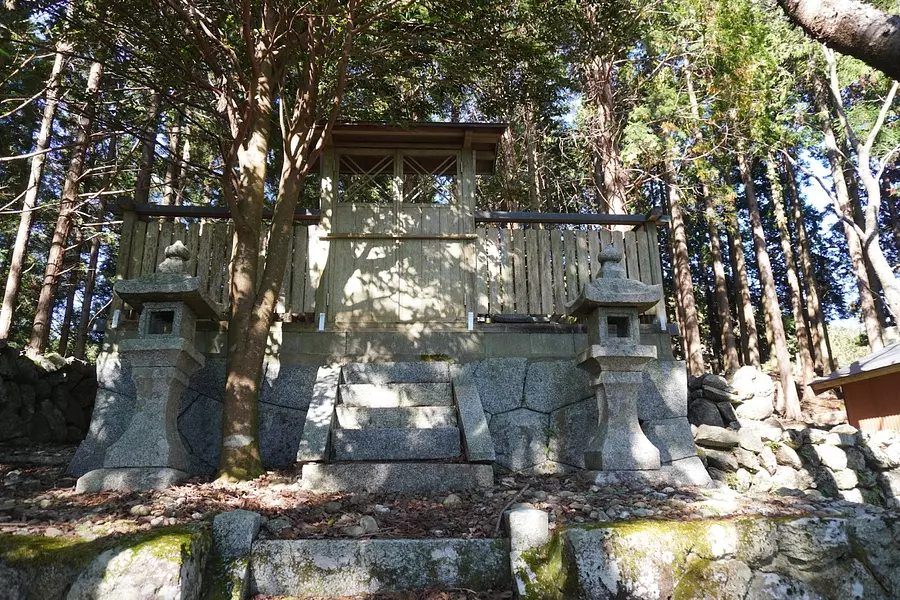
⑤ Sekison Daigongen
After about an hour's walk from the trailhead, we arrived at Mt. Shiraishi Sekison Daigongen.
Shiraizan Sekison Daigongen has a long history, and was enshrined at Daisenji Temple in Kanagawa Prefecture in 1759 by Hosenji Temple's 10th generation, Hoyo Shonin, and his 11th disciple, Katayo Shonin. .
It is said that during the end of the Edo period and the Meiji period, there were many worshipers from the Matsusaka, Tsu, and Ise areas.
.JPG)
⑥Fork near the mountaintop
If you walk a little from Shiranuiyama Sekison Daigongen, you will see a fork in the road.
From here on, the trail becomes a ground trail, so it's less stressful on your legs than the steep paved trail.
It's about 10 minutes away from the top of the mountain, so it's time to push harder.
⑦ Ninomine
After a few minutes walk from the previous junction, you will arrive at Ninomine, which has a nice view.
You can see the surrounding mountains, so yahoo! It was a good prospect that made me want to scream.
I think it's perfect for a rest spot as the foothold is wide.
There's only a little more to go from here to the top of the mountain! Walk for about 10 minutes on a ridge-like slope.
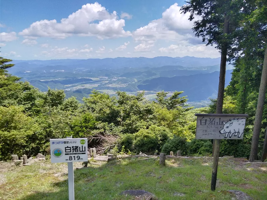
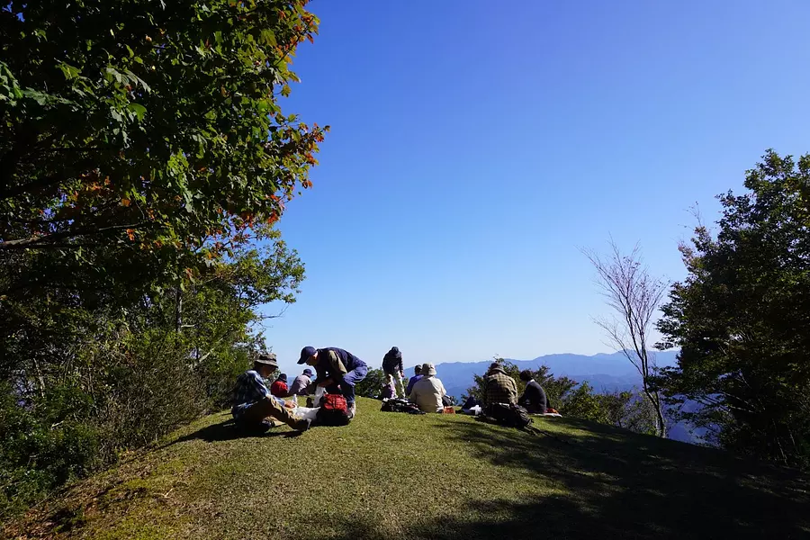
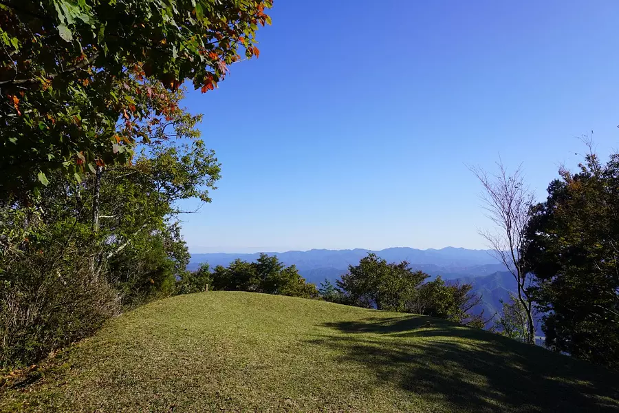
⑧ Mountaintop
We arrived at the summit after walking for about 70 minutes from the trailhead.
The weather was nice that day, and we were blessed with a great view of the surrounding mountains.
There is also a handmade summit sign, depicting a ``white boar'' from which the mountain takes its name. *There are various theories
We took a 30 minute lunch break here and headed back down the mountain the way we had come.
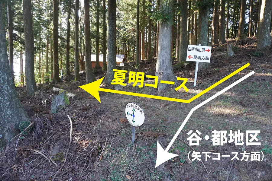
If you would like to take a different course on your way back, we recommend the ``Yashita Course''. You will be walking on a mountain trail instead of a concrete paved road, which will reduce the strain on your feet.
To get there from the summit, take the ``Tani/Miyako District'' course at the junction near Sekison Daigongen, and after walking for a while, you will reach the juncture of the ``Yashita Course'' and the ``Tani/Miyako Course.''
If you proceed from there to the Yashita course, it will take you to the Dandanden parking lot in Fukano, and you can descend the mountain in about an hour.
Recommended hot springs after descending the mountain
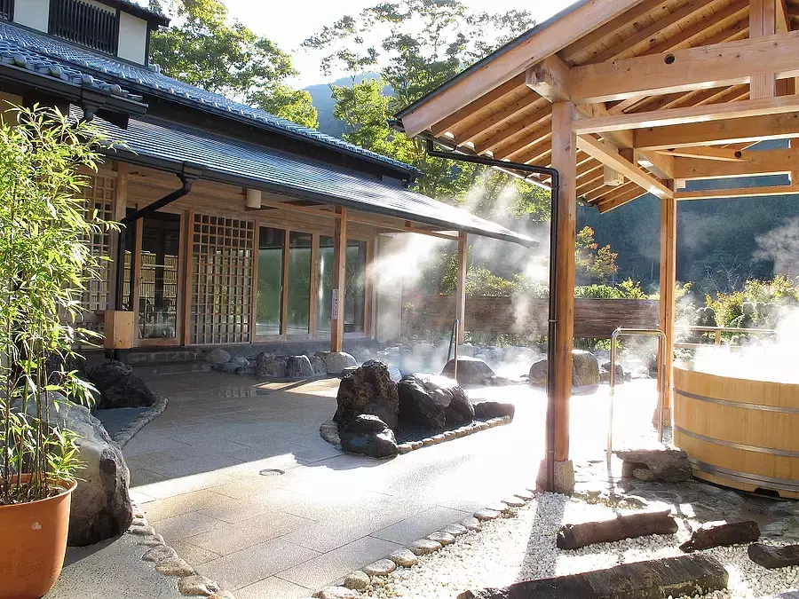
After enjoying mountain climbing, why not wash off your sweat in a hot spring?
Kahadakyo Onsen Iitaka-no-Yu is located about 20 minutes by car from kahadavalley parking lot in Fukano.
This is a natural hot spring located at Michi-no-eki "Iidaka Station", where you can relax in the spacious large public bath and open-air bath.
You can see kahadavalley from the open-air bath, and enjoy the seasonal scenery.
.png)
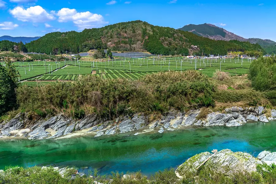
kahadavalley is an area located in the upper and middle reaches of the Kushida River that flows through the western part MatsusakaCity (Oishi Town, Iinan Town, and Iidaka Town), and is kachiji that stretches for approximately 40 km with beautiful natural formations.
A unique charm of this hot spring is that you can view the beauty of the valley from the open-air bath.
*The photo above is not the view from the open-air bath, but the view of kahadavalley along the tea plantations in the Ayumi district.
.png)
After relaxing in the hot springs, why not enjoy shopping for souvenirs at Michi-no-eki "Iidaka Station"?
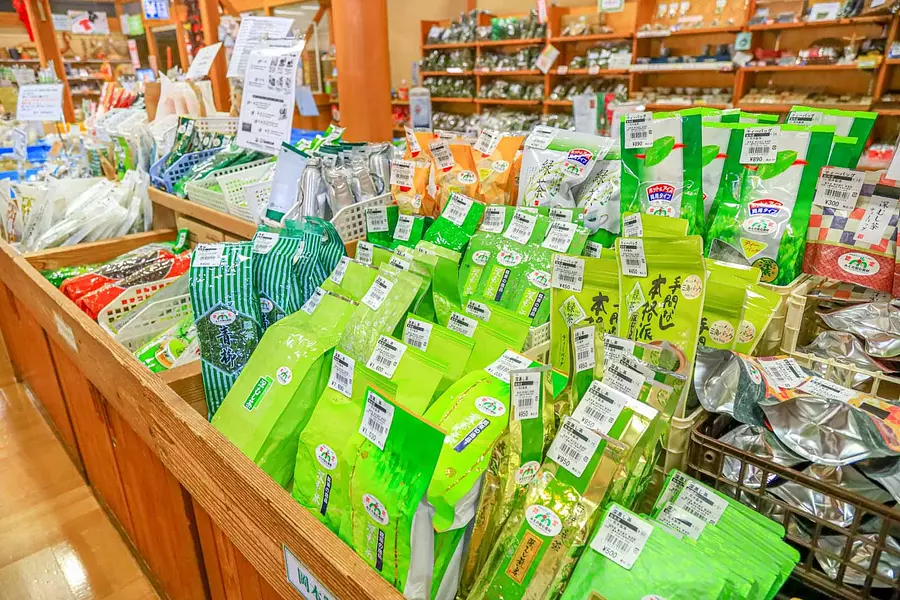
The area between Iinan-cho and Iidaka-cho in MatsusakaCity where Mt. Shiraishi is located, is an area where tea is actively produced, and one of the specialty products is deep-steamed sencha.
The shop ``Iitakanoten'' at Michi-no-eki ``Iitaka Station'' sells deep-steamed sencha tea leaves, so why not buy them as souvenirs from your trip?
We also sell ``Matsusaka tea'' made with these tea leaves, which is also recommended for hydration.
Michi-no-eki Iidaka Station "kahadavalley Iitaka no Yu"
0598-46-1114
10:00-20:00 (bathing reception)
Every Wednesday (the next day if it is a holiday), 12/31-1/1
116 spaces free of charge (8 other large spaces available)
From Matsusaka Station on the JR or Kintetsu Lines, take the Mie Kotsu Bus bound for Michi-no-eki Iidaka Station and get off at the last stop.
From Ise Expressway "Matsusaka IC", take Prefectural Route 59, then National Route 166 towards Iinan/Sakurai for 40 minutes.
What did you think
The Natsumei course has a well-maintained mountain trail, so you can climb it as if you were hiking, but the concrete paved road was more physically demanding than I expected.
Don't forget to stay hydrated and bring standard mountaineering gear to enjoy a comfortable climb.
Let's visit Matsusaka Kahada Eleven
Matsusaka Kahada Eleven is a selection of 11 mountains that surround kahadavalley, and Mt. Shiranui is one of them.
We have a full lineup of courses ranging from beginner courses with an altitude of less than 1000m to advanced courses with an altitude of over 1000m, so if you are interested, please visit the official website of Matsusaka Kahada Eleven.

Fugamaru-chan (photography/article production)
He is a member of Mie Tourism's Mie Travel Camera Club and is active mainly on Twitter and Instagram as a photographer who takes pictures of Mie. We operate the Mie Photo Gallery, which distributes Mie's scenery for free, and the Mie Eetoko Tour, which disseminates Mie's latest information.
| Category | |
|---|---|
| season | |
| area |
.jpg)