
Walking up the world heritage site Kumano Kodo to Mt. Yaki. We will explain the historic route and introduce recommended spots in the surrounding area.
掲載日:2022.11.17
Have you ever heard of a mountain in the southern part of Mie Prefecture called Yakiyama, which has a scary-sounding name?
This time we will introduce ``a mountain hike that lets you experience a piece of history'' while following this path, which is now easier to walk.
We will also introduce recommended spots around Mt. Yakiyama, so please refer to them!
- Climbing involves dealing with nature, so there is a good chance that uncertainties and unexpected situations may occur. Be sure to prepare well, plan well, and have fun.
[Things to keep in mind when climbing]
~table of contents~
- What is Yakiyama?
- About access to Mt. Yaki and the trailhead
- Climb Mt. Yaki
- Introducing recommended spots in the surrounding area
- in conclusion
What is Yakiyama?
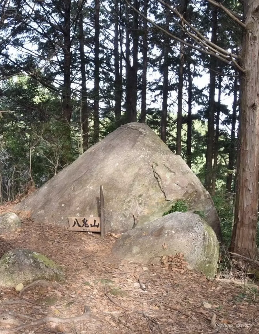
Mt. Yaki, which I will be introducing today, is a mountain located in OwaseCity with an altitude of 647 meters, and is of course one of the `` HigashiKishu Ten Mountains'' that often appear when I write about mountains (emphasis added).
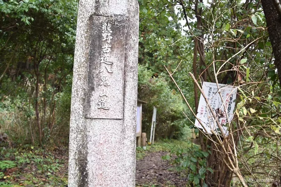
The road up Mt. Yaki is included in the "Kumano Kodo Iseji Route", one of the Kumano Kodo routes that was registered as a World Cultural Heritage Site in 2004. It was a very tough road.
The path to the top of Mt. Yaki that we will be introducing this time is called ``Yaki-yama Goe'' and is said to be one of the most difficult parts of the Kumano Kodo Iseji Route.
About access to Mt. Yaki and the trailhead
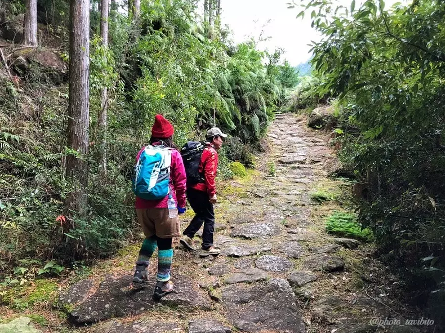
The most popular mountain climbing route is a 10km long trail that starts from the trailhead in Mukai, OwaseCity (marker at the top of the map) and goes beyond Mt. Yaki to Mikisato Town. This is probably the ``Yakiyama Crossing'' route, which has a long cobblestone road.
However, if you are going to drive to the trailhead, please be aware that if you walk to Mikisato-cho beyond Mt. Yaki, you will need to retrieve your car. .
For your reference
takaIwent to Mt. Yaki that way.
In addition, if you climb Mt. Yaki by turning around, I think it will take about 4 hours for the round trip to get back to the parking lot.
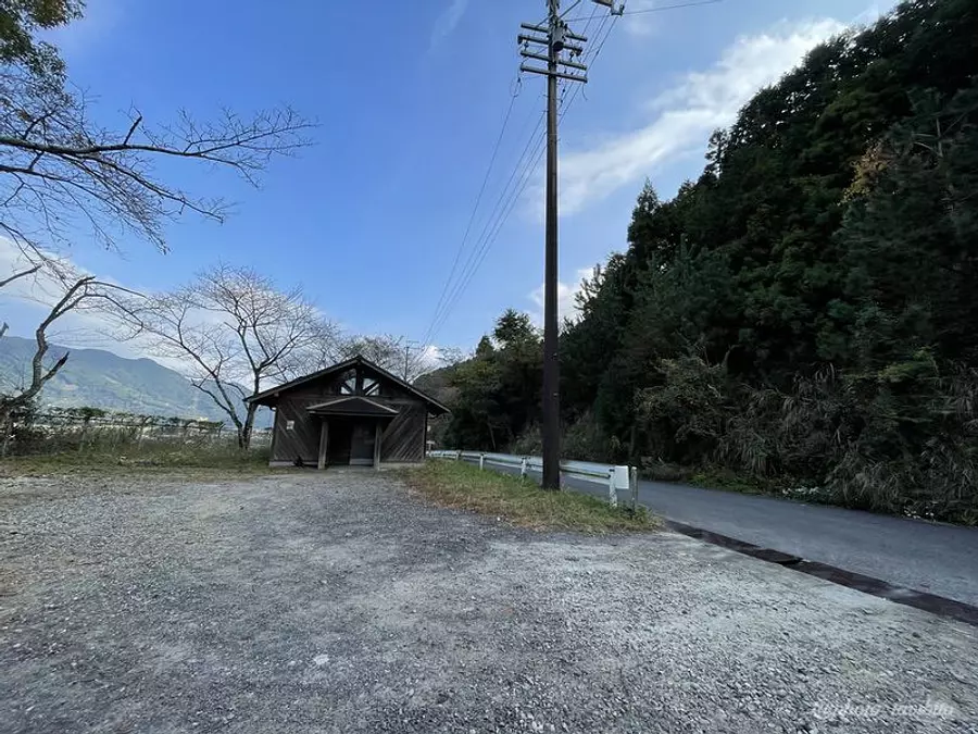
About the trailhead
There are a few parking spaces near the trailhead.
There are also toilets here, so be sure to use them before climbing.
About access
Please refer to this link for access to the Mt. Yaki trailhead.
The road is somewhat narrow, and residents often walk in this area, so be careful of pedestrians.
Climb Mt. Yaki
The most notable feature of Mt. Yakiyama is the harsh road that has been called ``the most difficult part of the western country.''
The reason why it was so tough was that you had to walk along a mountain path that was about 10 kilometers long to cross Mt. It seems that there was a time when they stood in the way and caused trouble for pilgrims.
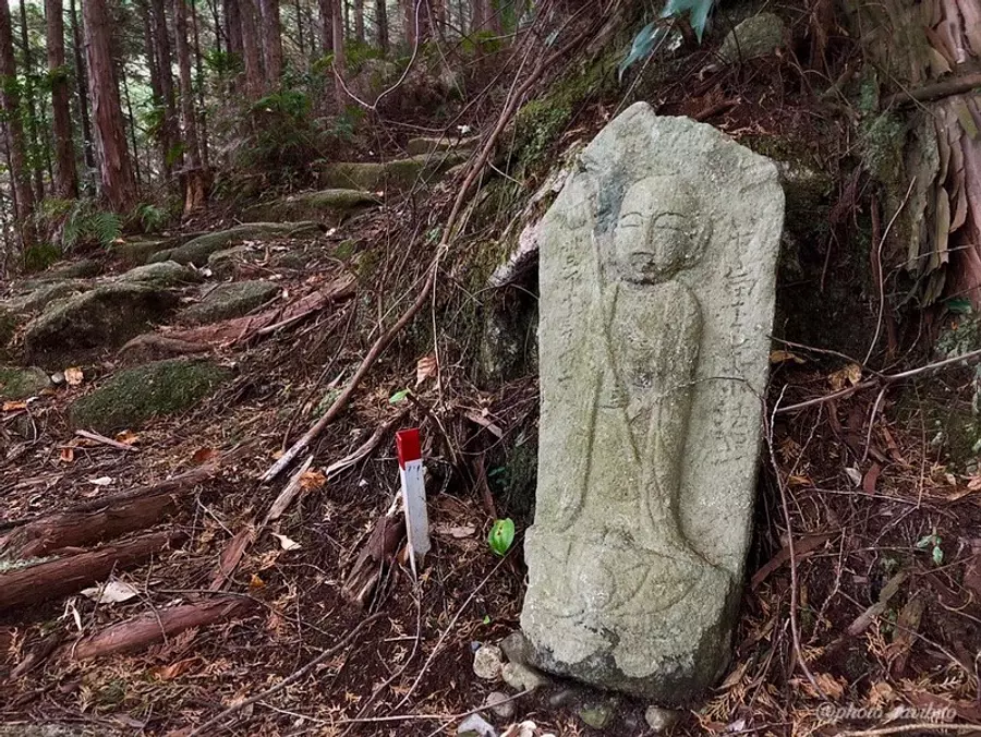
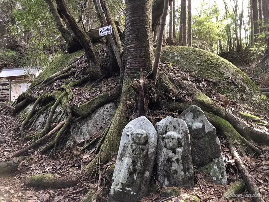
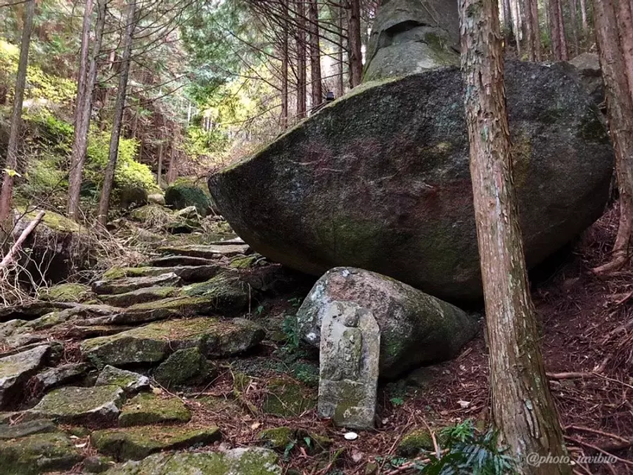
Local people left stone Buddha statues and memorial monuments to commemorate those who visited here at that time and died at Shinakaba, and their remains can still be seen on the mountain trail today.
Now, wolves and bandits no longer appear, and the mountain trail is better maintained than it was back then, but there are some steep slopes, such as the ``seven bends,'' so you can't let your guard down.
I don't know the details of the origin of the name ``Nanamagari'', but I personally think that the name came from ``Due to the steep uphill slope, you had to make 7 zigzag turns to climb up.'' I think so.
You need to have enough stamina to walktaka.
There are two points to conquer Mt. Yaki.
“I want to climb Mt. Yaki!”
For those of you, I would like to introduce two points for conquering the difficult mountain, Mt. Yakiyama.
The first point is to ``proceed at a steady, comfortable pace in order to walk long distances.''
The mountain trail is a continuous climb from beginning to end, so you don't want to climb too hard and get exhausted along the way.
As a guide, there are wooden guideposts placed about every 100m along the trail.
“When you reach this signpost, you can take a breather.”
It might be best to climb at that pace.
Another point is the steep slope of the climb called ``Nanamagari,'' which I introduced earlier as a difficult point.
Seven bends begin from the wooden signpost 20/63.
Nanamagari is a 280m long climb that takes about 15 minutes, so as long as you don't rush and try to climb slowly, you'll be fine!
Let's look for the Gotton stone!
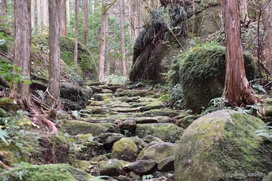
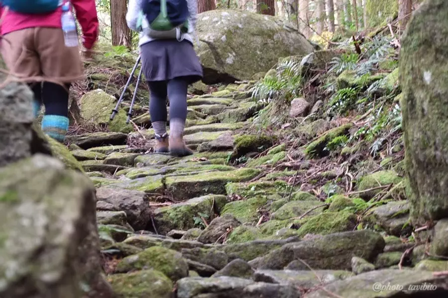
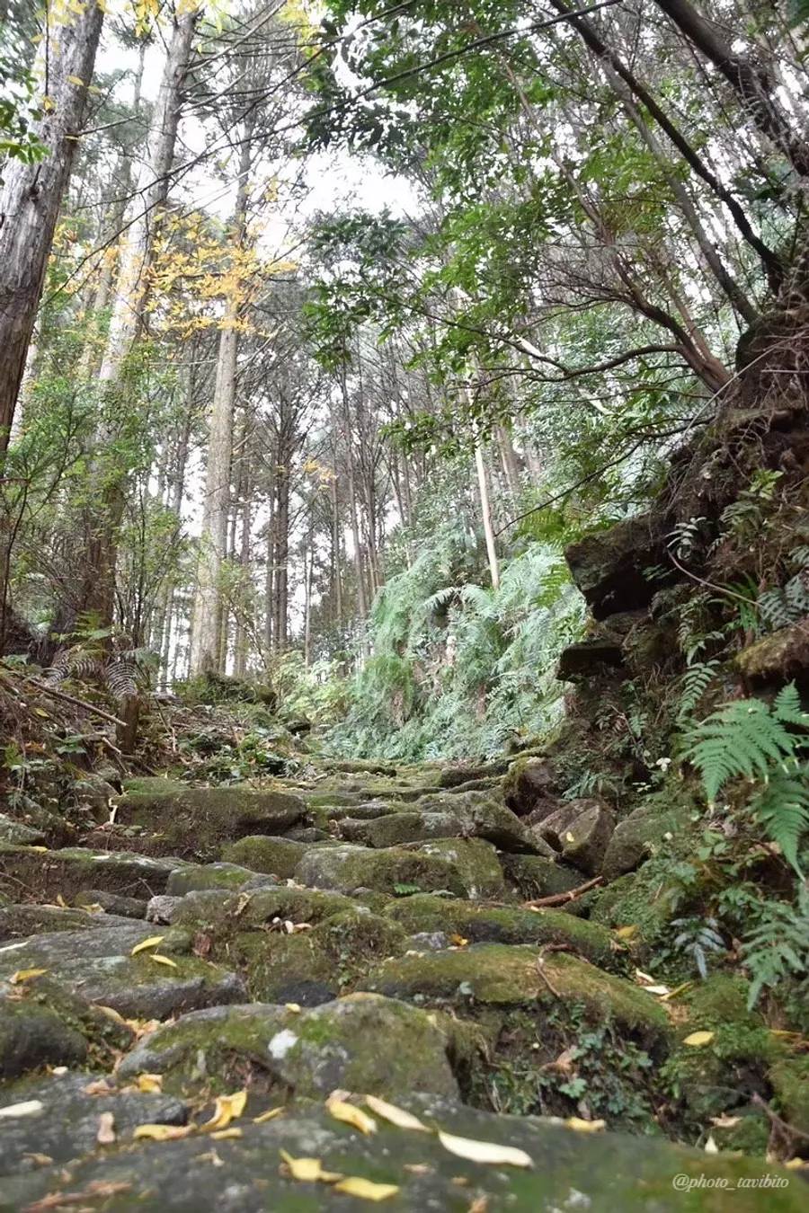
Like the mountain trail up Mt. Yaki, Kumano Kodo still has many cobblestone paths.
Why are the cobblestones laid out like this?
It is believed that this is due to the climate of this region.
Higashi Kishu, the southern part of the Kii HigashiKishu, is a region with a lot of rain, and it is said that these stone pavements were placed to prevent mountain trails from disappearing due to soil being washed away by rain.
Somewhere along this cobblestone road there is a large paving stone called "Gotton Stone".
This stone is placed so that it is slightly floating, and when you put your foot on it, it moves with a ``Gotton'' sound, which is why it got its name.
When you go to Mt. Yaki, please try to find "Gotton Stone".
takaAsa hint, it appears relatively early on.
For your reference
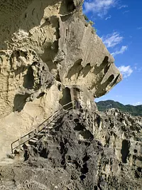
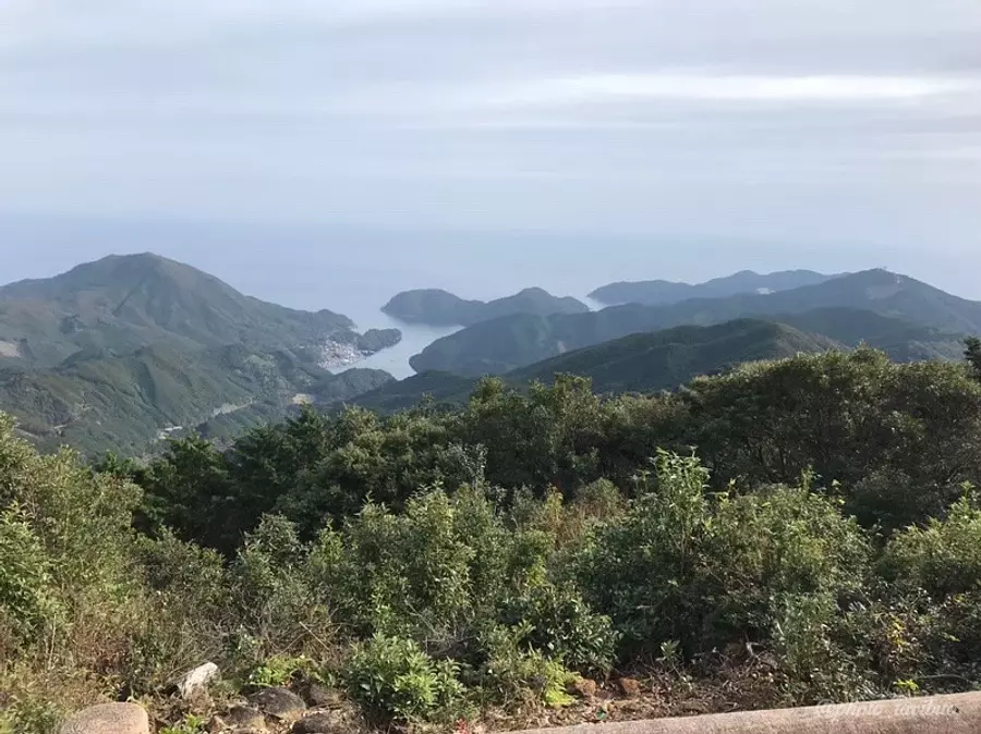
What is the view from the top of Mt. Yakiyama?
Unfortunately, there is no view at the summit of Mt. Yakiyama, just a large rock and a summit marker as shown in the photo, but a place called "Sakura no Mori Hiroba" located right near the summit is recommended as it has a nice view. ^ ^
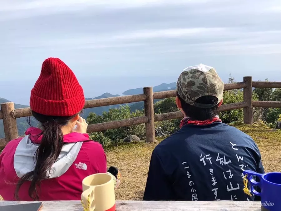
The view here is the most recommended in Mt. Yakiyama, and there is a gazebo where you can sit down in the square, so it's perfect for a relaxing coffee time ♪
For reference, the walking time and distance it takes to climb Mt. Yaki are as follows.
- Round trip from trailhead P to the summit
- Approximately 4 hours
- Round trip distance
- about 8 km
- Traverse to Mikisato Station
- Approximately 5 hours
- traverse distance
- about 10km
- (For your reference)
- In my case, it takes about 3 hours to go round trip from the trailhead parking lot to the summit of Mt. Yakiyama.
Introducing recommended spots in the surrounding area
Here I would like to introduce two recommended spots around Mt. Yakiyama.
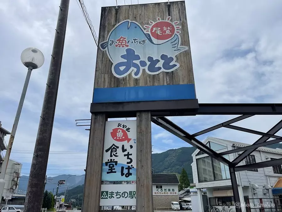
Fish Ichiba Ototo
A direct sales shop where you can buy fresh fish landed at Owase Port and local specialties at great prices.
This is a shop that I previously featured when introducing Tengukurayama, but I personally recommend this shop as ``If you want to buy fish in OwaseCity this is the place to go.''
- business hours
- [Store] 10:00-18:00 [Dining room] 11:00-14:00
- holiday
- Open all year round (confirmation required)
- address
- 2-10 Furutonomachi OwaseCity
- TEL
- 0597-23-2100
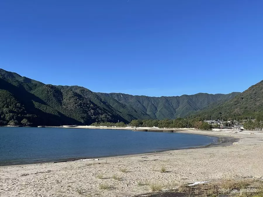
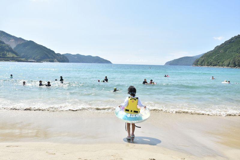
MikisatoBeach
Mikisato Town is located on the exit side of Mt. Yakiyama.
This town is home to MikisatoBeach, a beach that is crowded in the summer.
It is a very pleasant beach with beautiful white sand♪
It is also introduced in Sightseeing in Mie, so if you are interested, please refer to it.
in conclusion
How was it.
Wouldn't you like to experience the emotional experience of walking the same path that so many people once walked, hundreds of years later?
Please come and visit the mountains in southern Mie Prefecture!
☆☆ Article creation: TAKA ☆☆
A traveler who lives in HigashiKishu region of Mie Prefecture and has some experience in mountain climbing. Rather than aiming for the peak of a mountain, I prefer a relaxing walk in nature. We will not only show you the charm of Mie Prefecture's mountains, but also introduce Mie Prefecture, which has many attractive tourist spots, from various angles!
| Category | |
|---|---|
| area |