A panoramic view of Kumano Sea! Introducing Mt. Oeboshi in HigashiKishu, where you can enjoy views of both the sea and mountains.
掲載日:2022.07.26
Climb the mountain and look at the sea! ?
You can do that in the mountains of HigashiKishu!
Would you like to experience a way to enjoy the mountains that is different from your usual mountain climbing?
- [Things to keep in mind when climbing]
- Climbing involves dealing with nature, so there is a good chance that uncertainties and unexpected situations may occur. Be sure to prepare well, plan well, and have fun.
▼Table of contents
What kind of mountain is Oeboshiyama?
Oeboshiyama is a mountain with an altitude of 362 meters located in Kiho Town, the southernmost KihoTown of Mie Prefecture.
The origin of the name "Oeboshi" is not known, but it is thought that the mountain was named because its shape resembles an eboshi (Japanese hat introduced in the Heian period).
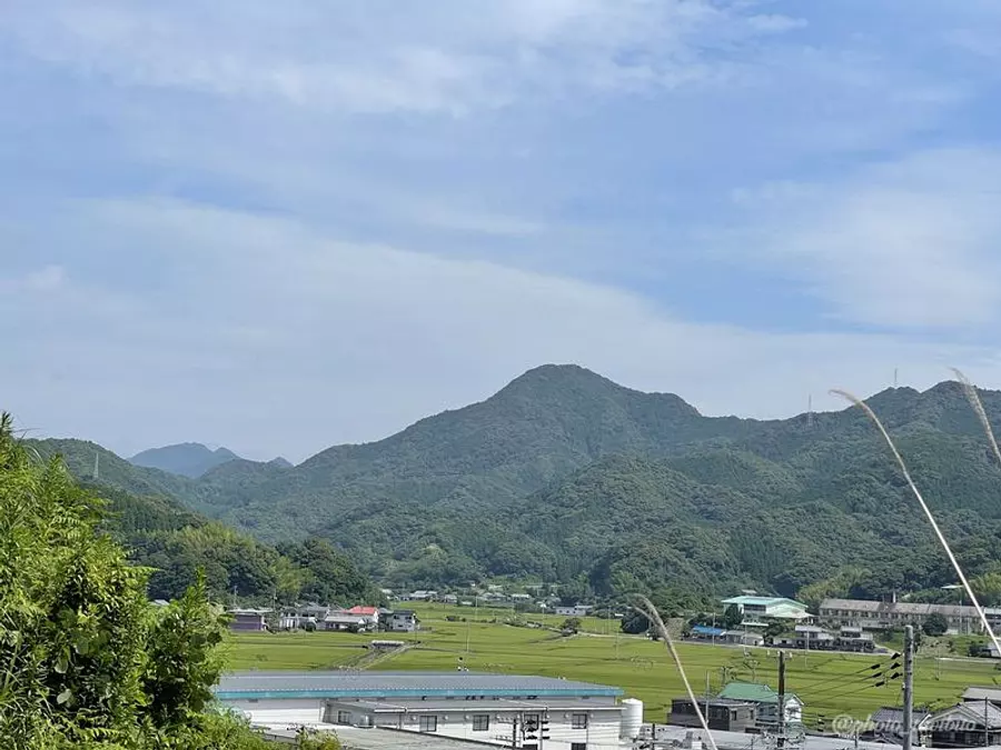
Mt. Oeboshi, also known as `` konochi Fuji'' in this area, is counted as one of the 10 mountains that represent HigashiKishu region, called the `` HigashiKishu Kishu Juza.''
So, why is Mt. Oeboshi chosen as the mountain that represents HigashiKishu?
Here's my personal opinion...
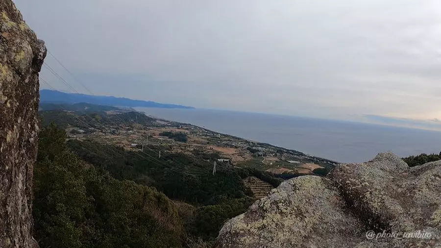
I think this is probably the best view of the Kumano Sea from the top.
It's rare to be able to see the ocean from the top of Mt.TAKA, and from such a close distance.
Next, we will introduce the route to climb Mt. Oeboshi, which has such a good view.
Climb entrance and climbing route explained
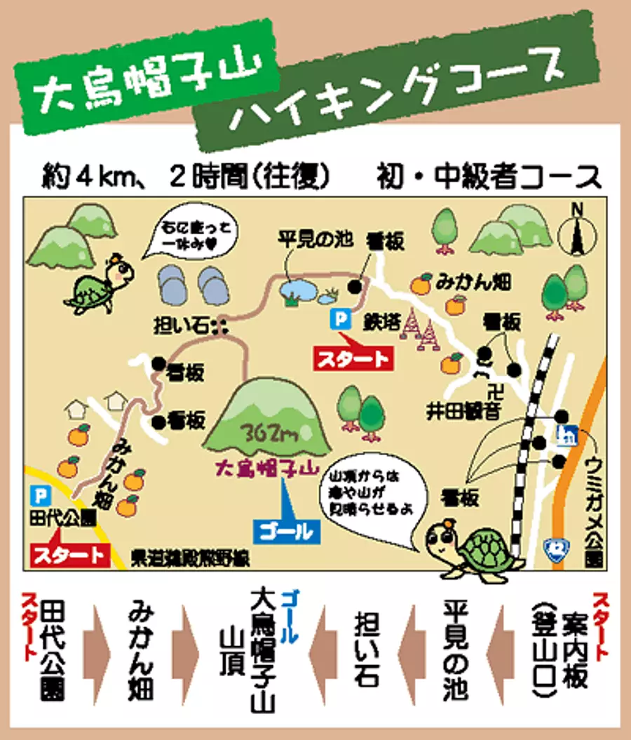
This is a climbing map created by KihoTown for first-time climbers of Mt. Oeboshi.
This map can be viewed on KihoTown website, so please check it out from the link below.
There are two trailheads: Tashiro Park trailhead and Hirami trailhead, and it takes about the same amount of time (about 1 hour) to reach the summit no matter which way you climb.
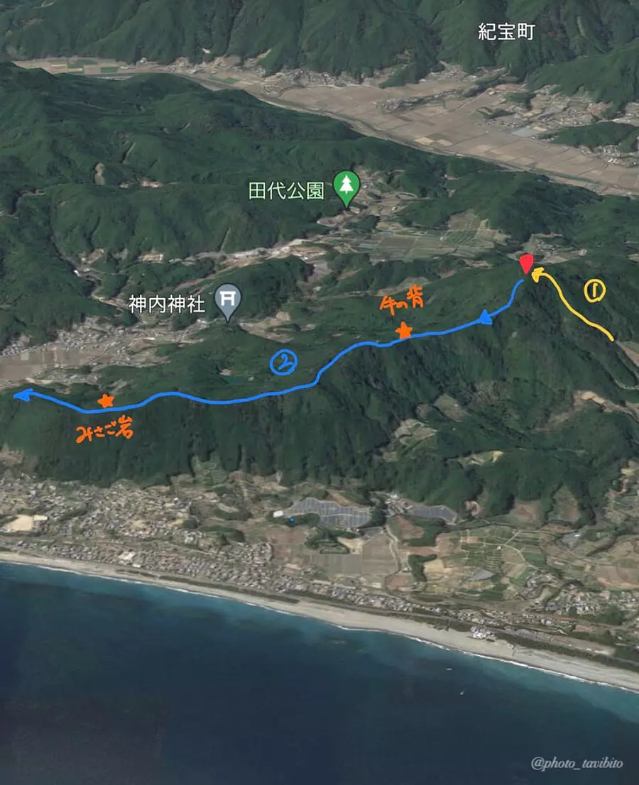
This time, we will climb from the Hirami trailhead to reach Mt. Oeboshi (Route 1), and from Mt. Oeboshi, we will traverse the ridgeline (ridge) to the hidden observation spots such as Ushi no Se and Misago Rock. I will introduce two routes, route ②, where you go to Ueno and get off at the Ueno trailhead.
Let's remember
[Climbing route 1] From Hirami trailhead to Mt. Oeboshi
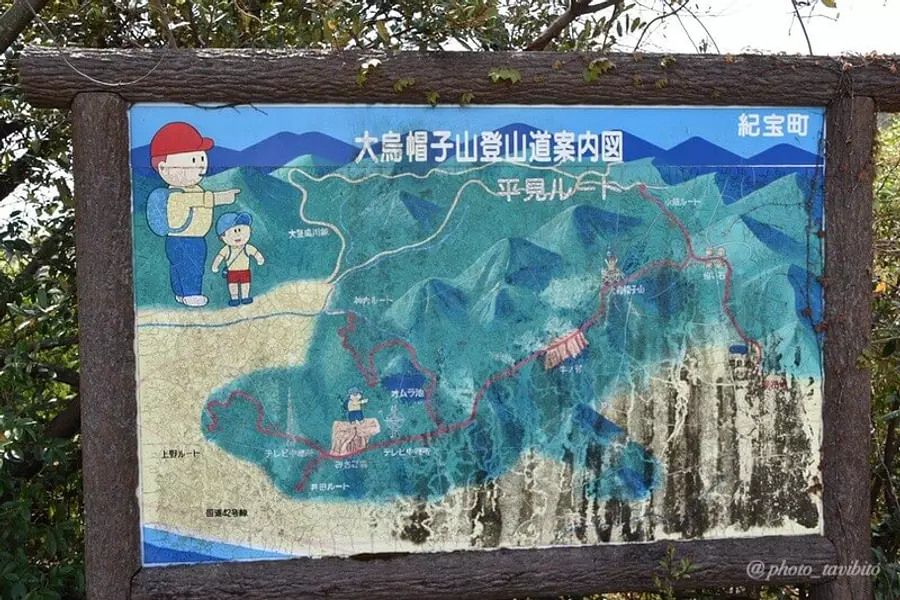
At the trailhead entrance, there is a signboard with the route of Mt. Oeboshi.
The climb starts from beyond this signboard.
- Points to note
- Please note that public transportation such as buses is not available at the Hirami trailhead. Also, please refer to the parking lot listed on the mountain climbing map on KihoTown website.
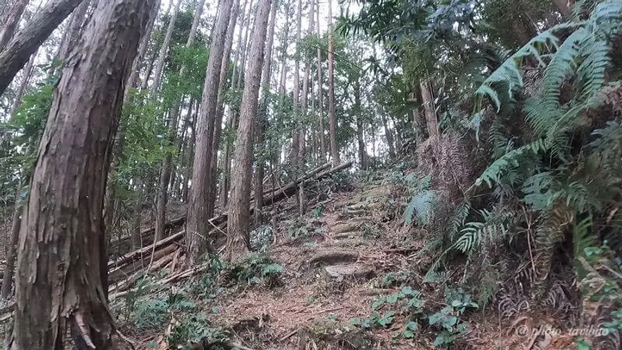
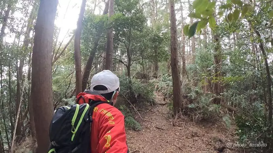
Although some parts of the mountain trail are rough, there are well-marked trails and markings, so even beginners should be able to walk without getting lost.
It took about an hour to start walking. The summit of the mountain is right in front of you!
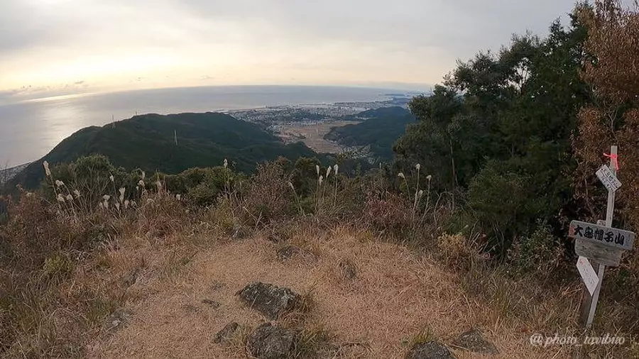
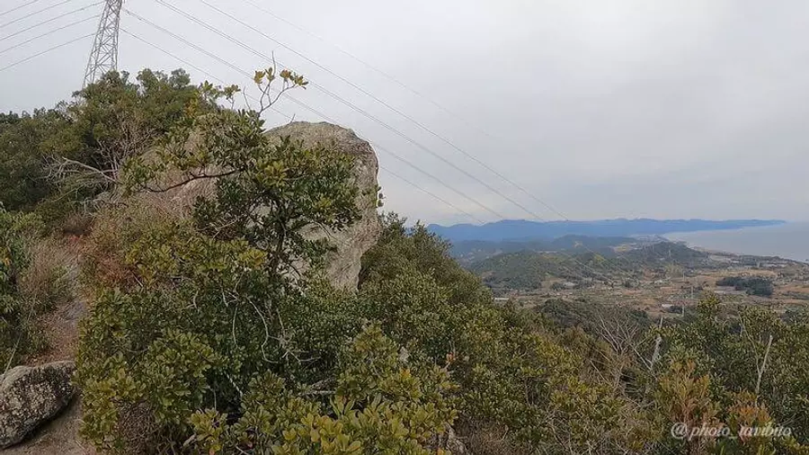
Arrived at Mt. Oeboshi!
From the top of the mountain, you can also see the Kumano Sea and the cityscape of Wakayama Prefecture, and the view is said to be one of the best in HigashiKishu Kishu Juza.
I think you'll be satisfied just by going back and forth to Mt. Oeboshi, but here I'd like to introduce another recommended route that will allow you to enjoy the sea and mountains even more.
[Climbing route 2] From Mt. Oeboshi to Misagoiwa
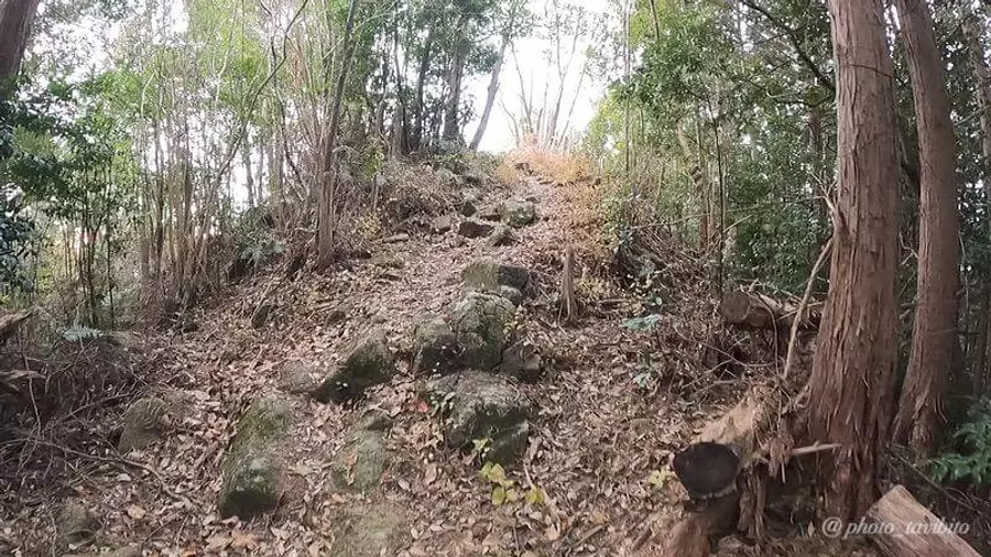
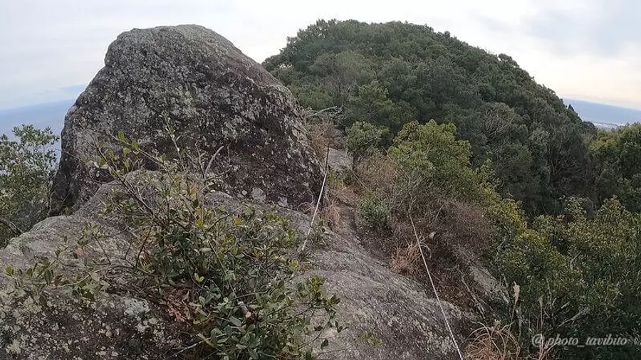
From Mt. Oeboshi, you can walk along the mountain ridge as shown in the photo.
The mountain trail is marked, but there are some spots where the footing is poor, so be careful and walk carefully.
In addition, the trees on this ridge are densely packed, and although direct sunlight can be avoided, it tends to be difficult for the wind to escape, making it difficult for the heat accumulated in the body to escape.
You should be especially careful during hot seasons such as summer.
There are two main viewing spots on this ridge.
About a 40-minute walk from the summit of Mt. Oeboshi, this place with exposed rocks called `` Ushi no Se'' is the first ``point where you'll want to take a picture''.
The area reflected in the back of the photo is towards KumanoCity.
I don't know why this place is called Ushi-no-saka, but maybe it's because the rocks around here look like a cow's back? What is it?
Is it because the pattern of the TAKArock is a cow pattern? I thought so, but maybe not (lol)
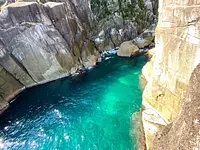
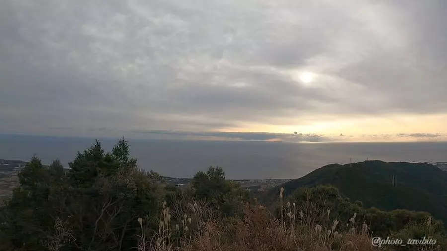
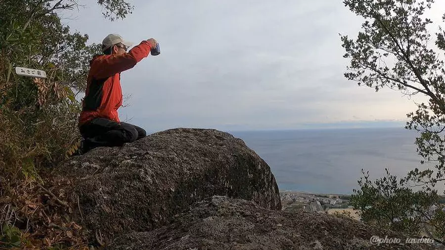
After about 40 minutes of walking through the forest from Ushi-no-saka, we arrived at Misago Rock, another viewing spot.
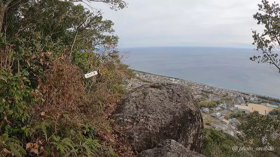
Close to the sea! !
The scenery seen from here is so amazing that many people post it on SNS, and it is truly a place that deserves to be considered a ``point where you will want to take photos'' ^ ^
Check☆
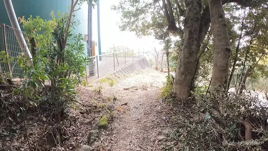
After passing Misagoiwa, the mountain trail goes all the way down, and after 20 minutes of walking, you will arrive at the Ueno trailhead.
Points to note when traversing
When traveling vertically, the problem is ``How do I get back to the trailhead where I left my car?''
As I walked this time, I thought about how to solve this problem.
The solution I came up with at this time was to leave my bicycle at the trailhead where I was going down the mountain and ride it back to the trailhead where I left my car.
It is possible to return to the parking lot where your car is parked after driving for about 30 to 40 minutes, so I hope you will use this as a reference when traversing this mountain range.
About access
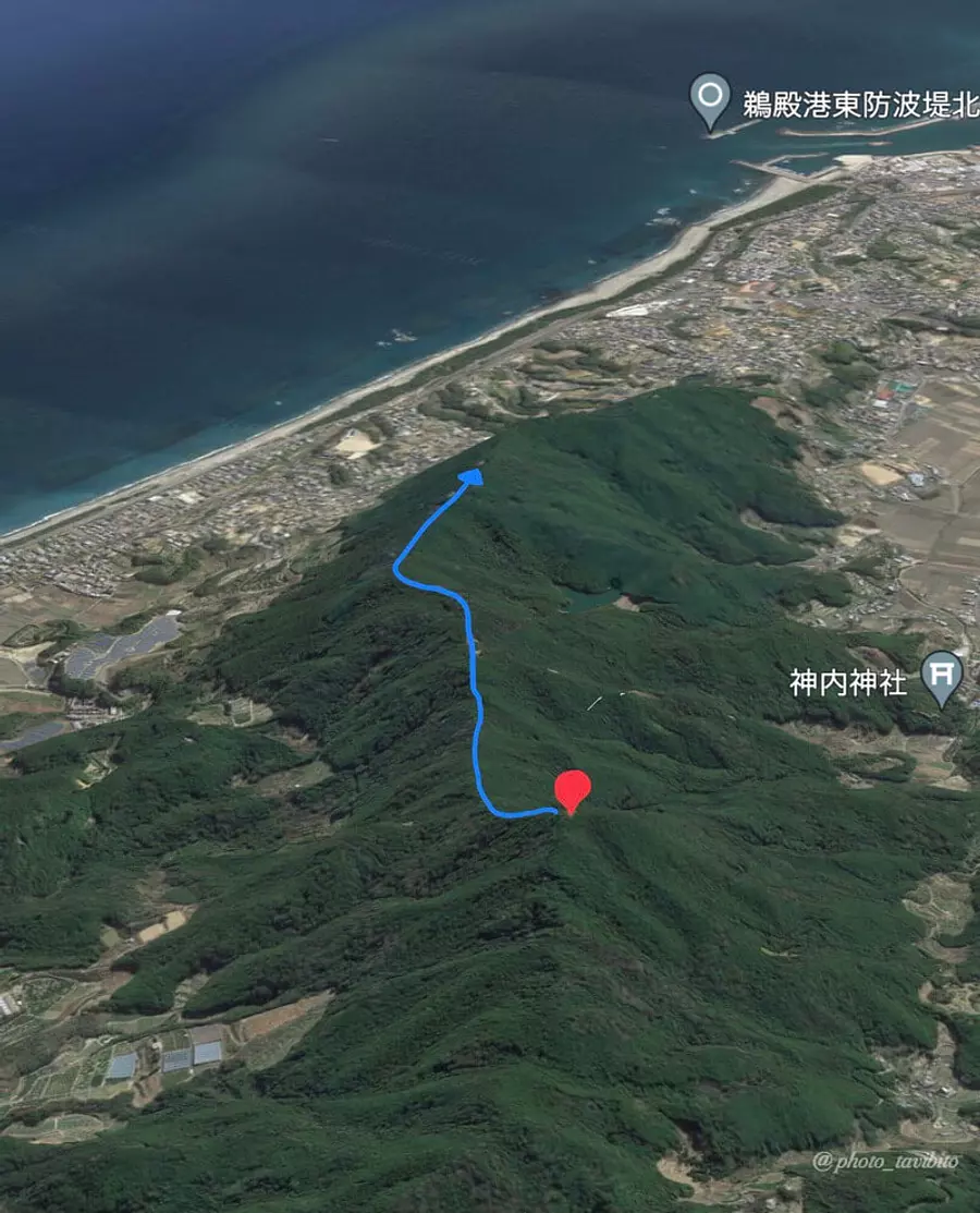
Take National Route 42 along the coast towards Shingu City, Wakayama Prefecture. After about 2 kilometers past Michi-no-eki Station Park Shichirimihama, turn right and drive toward the mountain for about 10 minutes to arrive at the Hirami trailhead.
The trail that deviates from the national highway and heads towards the trailhead is difficult to find, so use your navigation system to navigate (the trailhead is near the pond in the center of the map).
- Let's watch out
- The road to the trailhead is a road used by KihoTown, so please be considerate of the residents when driving.
Introducing recommended spots in the surrounding area
Here we will introduce three recommended spots around KihoTown, where Mt. Oeboshi is located.
These three recommended spots are within a 3km radius from the trailhead introduced this time, so you can easily stop by after descending the mountain.
konochi Shrine
“konochi Fuji” which is also another name for Mt. Oeboshi
konochi is the name of a place in this area, and the konochi Shrine, named after that place, has been a familiar place for local residents since ancient times.
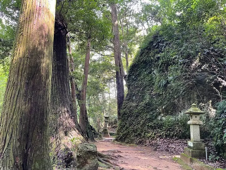
One of the characteristics of konochi Shrine is that ``there is no shrine building, and the rock wall is enshrined as the object of worship.''
Another feature of this shrine is that it is also dedicated to the ``god of safe childbirth.''
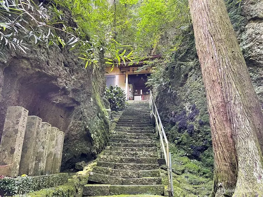
After doing some research, I learned that there is a legend that this area has been a power spot for a long time.
It might be interesting to unravel such history ^ ^
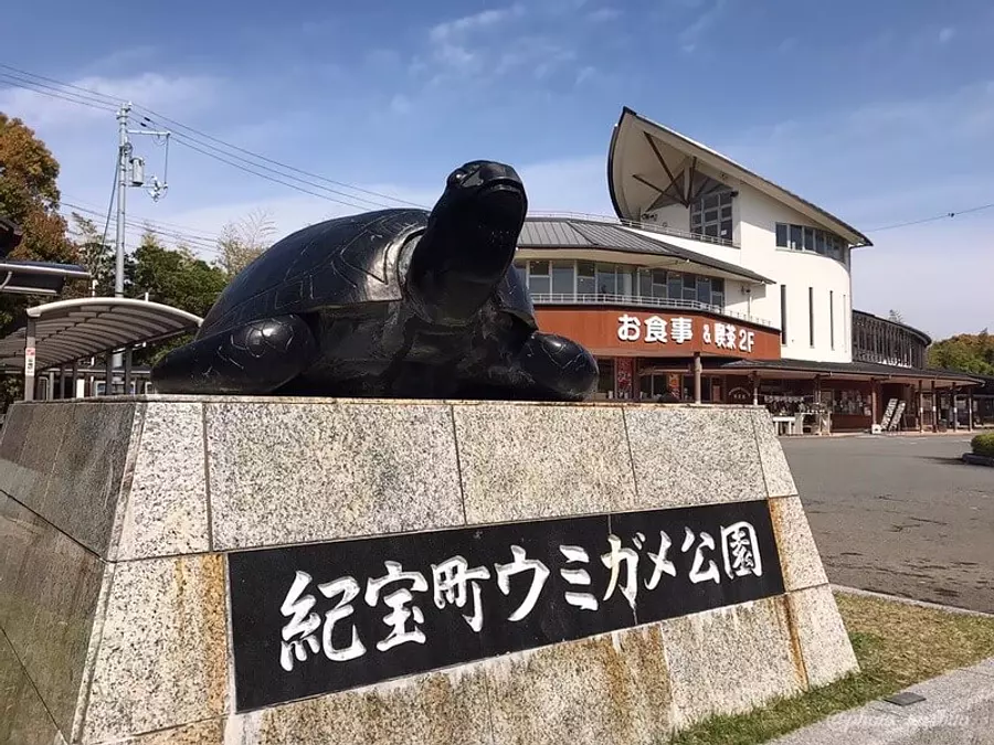
Michi-no-eki / KihochoUmigamePark
As you can tell from the name (lol), it is a famous place for turtle lovers as Michi-no-eki where you can see sea turtles.

It's easy to focus only on the sea turtles, but it's a fully-equipped facility that sells local specialties and has a cafe space.
Even within Mie Prefecture, there are different specialties depending on the region, so I hope people will enjoy shopping and think, ``I have something like this!''
You can also enjoy light snacks at the restaurant on the second floor, so you can recharge your energy before climbing!
- Product store
- 8:30-18:00 (November-February) 8:30-19:00 (March-October)
- Restaurant (snacks)
- 8:30〜15:00
- sea turtle house
- 9:00〜18:00
Patisserie Afrail (Western confectionery shop)
The owner of this shop opened this shop in its current location in 2015 after training at a Western confectionery shop in kambe for over 10 years.

The things we recommend are pudding and Mont Blanc, and we always buy them when we visit them (lol).
They also make sweets that make use of local specialties, so be sure to check them out when you're there.

By the way, the dessert in the photo is "Peach Verrine"
This was also very delicious ♪
- address
- 1415-13 Ida, Kiho-cho, KihoTown
- business hours
- 10:00-18:00 (17:00 on Sundays)
- Regular holiday
- Wednesday
- TEL
- 0735-29-7395
in conclusion
How was it?
I myself have climbed many mountains that Mie Prefecture is proud of, but there are few mountains where you can feel the sea as close as this one, and the compactness of this mountain area is attractive, as you can walk it in just 2 to 3 hours. I think.
Please make sure to visit Mie Prefecture at least once (although it is quite far to the south) and enjoy a luxurious mountain climbing experience where you can enjoy both the sea and the mountains ^ ^
☆☆ Article creation: TAKA ☆☆
A traveler who lives in HigashiKishu region of Mie Prefecture and has some experience in mountain climbing. Rather than aiming for the peak of a mountain, I prefer a relaxing walk in nature. We will not only show you the charm of Mie Prefecture's mountains, but also introduce Mie Prefecture, which has many attractive tourist spots, from various angles!
| Category | |
|---|---|
| season | |
| area |
.jpg)