How about a ``power spot mountain hike'' that includes climbing Otankura, a Onigura nestled deep in the mountains of Kumano, and Omotankura, which has a great view?
掲載日:2022.06.23
If you visit the city of KumanoCity, you'll notice that there are strangely shaped rocks and rocks that look like certain animals all over the city.
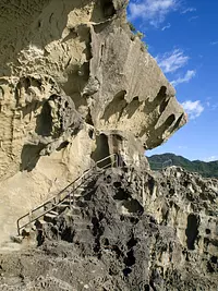
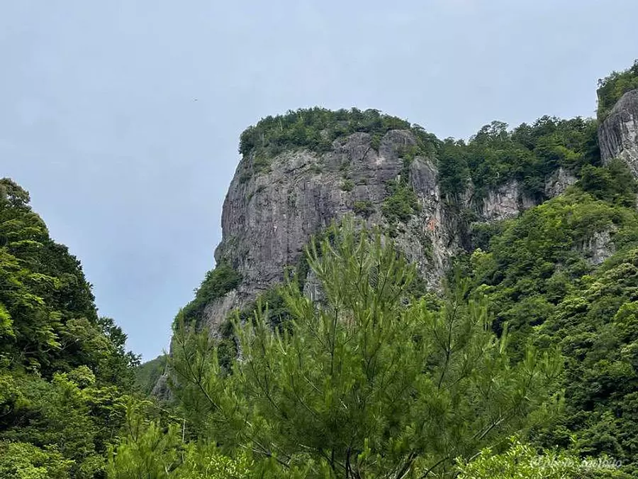
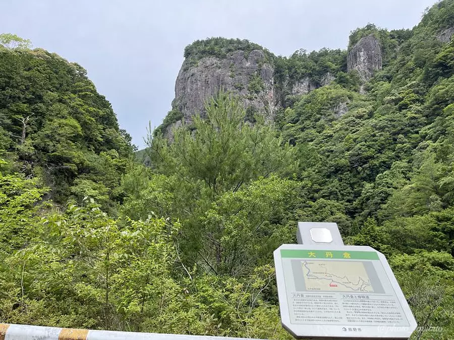
Deep in the mountains of Kumano, the city of rocks (?), there is a place where a gigantic rock about 300m high and 500m wide sits majestically!
That rock is called `` Onigura'' located in Ikusei-cho, KumanoCity City.
In this article, we will introduce the giant rock `` Onigura'' and ``Omotenigura'', a mountain with a good view in the Kumano Mountains, which is about a 40-minute walk from there. Masu.
In addition to the mountains, we will also introduce recommended spots in the area, so please use them as a reference!
☆☆ Article creation: TAKA ☆☆
A traveler who lives in HigashiKishu region of Mie Prefecture and has some experience in mountain climbing. Rather than aiming for the peak of a mountain, I prefer a relaxing walk in nature. We will not only show you the charm of Mie Prefecture's mountains, but also introduce Mie Prefecture, which has many attractive tourist spots, from various angles!
- [Things to keep in mind when climbing]
- Climbing involves dealing with nature, so there is a good chance that uncertainties and unexpected situations will occur. Make sure to prepare well, plan well and have fun.
▼Table of contents
About Onigura /Omotankura
[Onigura] is a gigantic rock wall approximately 300m high, and in the past it was a place for rigorous training in the mountainous area, called a place of training.
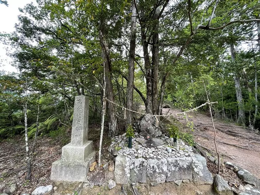
``Takakura Tsurugi oaki'' is enshrined at the top.
[Omotankura] is located about 40 minutes up the mountain path from Onigura, and the view of the Kumano Mountains from the top is worth seeing!
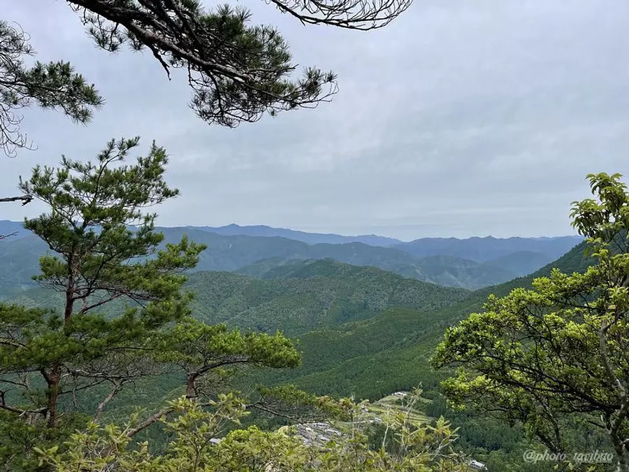
If the weather is good, you can also see the mountain range of the Omine mountain range.
Also, it is common to Onigura and Omotankura. The character ``Tan'' means ``red color,'' and the character ``Kura'' means ``a mountain with a steep cliff.''
``So, Onigura and Omotankura are mountains (rocks) with red cliffs! ”, right?
Actually, there are some rocks that look reddish, but there are rocks and soil that look exactly like the Japanese character ``tan'' here in Onigura and Omotankura. To be honest, there aren't many...(^^;)
However, if you look at this area as a whole, there are many rocks that are red in color, so you are likely to see red-colored rocks while driving along the prefectural highway.
How about paying attention to the rock quality in this area as long as it doesn't affect your driving?
First, go to Onigura
If you drive from KumanoCity toward the mountain on a road called the “Akakura Forest Road” to the end, you will arrive at the Onigura /Omotankura trailhead.
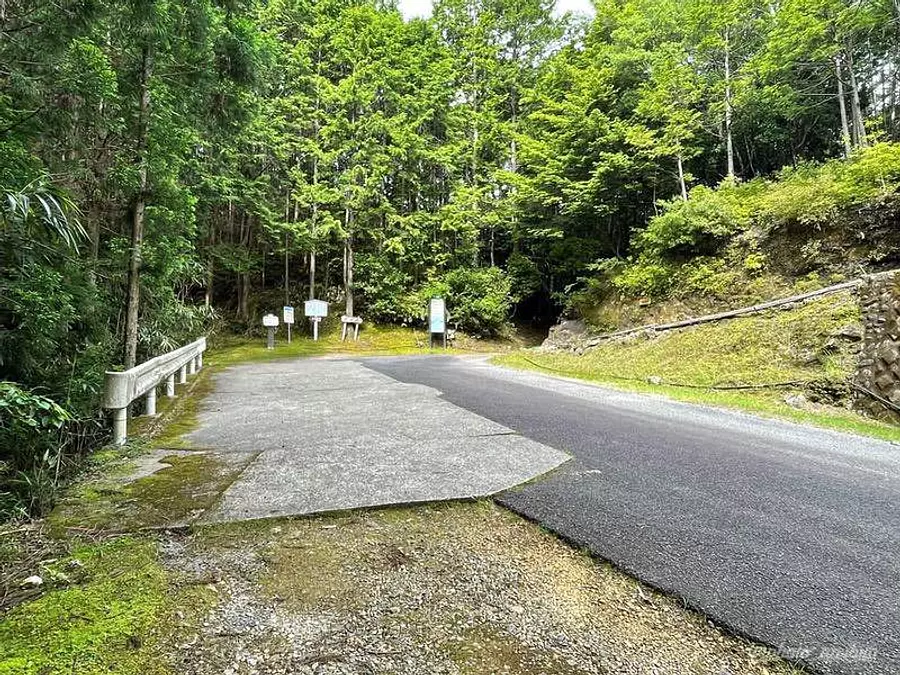
There is space to park about 5 cars at the end of the forest road.
From here to Onigura...
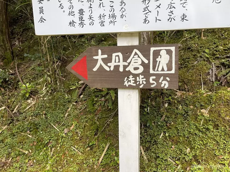
picture? 5 minutes! ?
Yes, you will arrive in no time lol
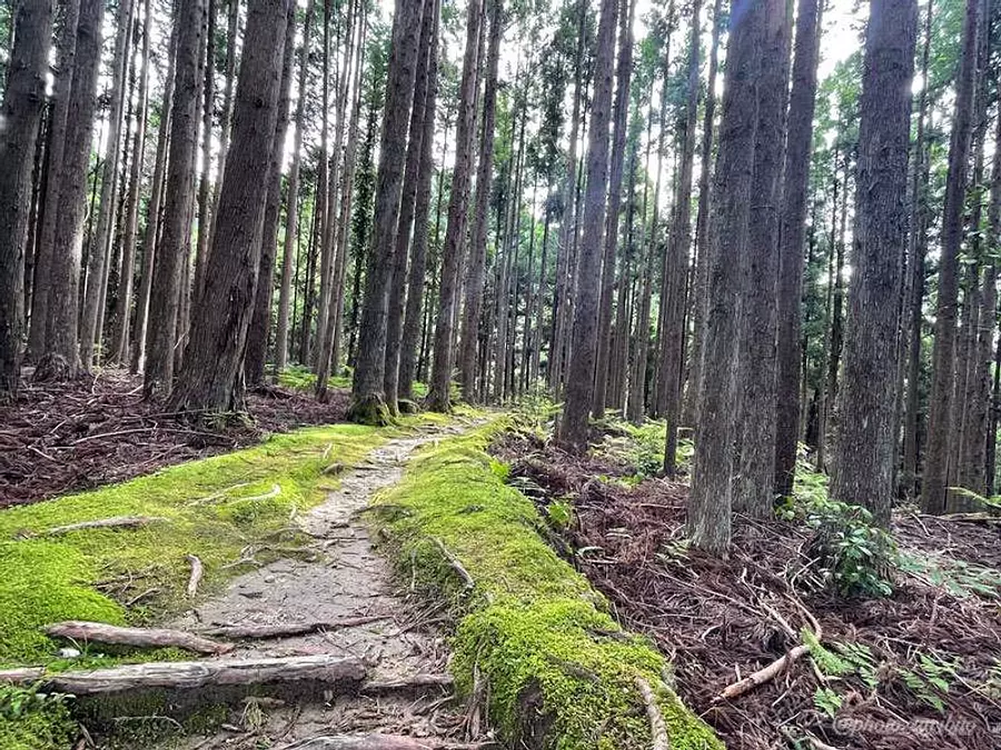
As you walk along the path with beautiful moss and a nice atmosphere...
Part of the huge rock of Onigura will appear.
Opposite this huge rock is a monument carved with the words ``Kashihara Shrine Yohaisho''.
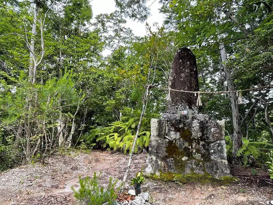
``Yohaisho'' means ``a place to worship gods and Buddha from a faraway place,'' and it is said that the end of this monument leads to the tomb of Emperor Jimmu in Kashihara City, Nara Prefecture, so people in the past used to visit this place. Perhaps they were worshiping Emperor Jimmu from this location.
What is that distance? ?
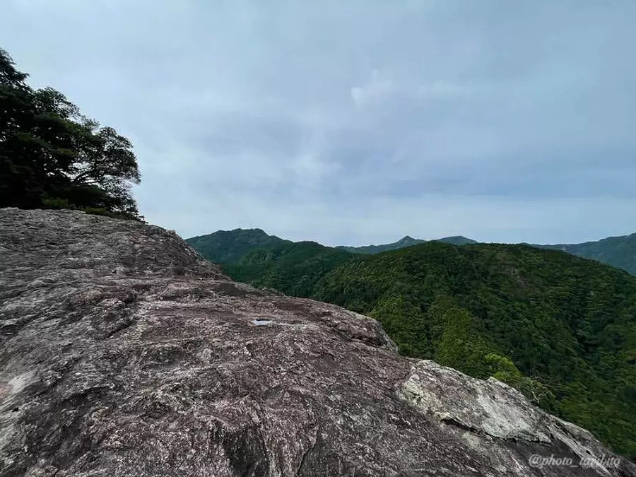
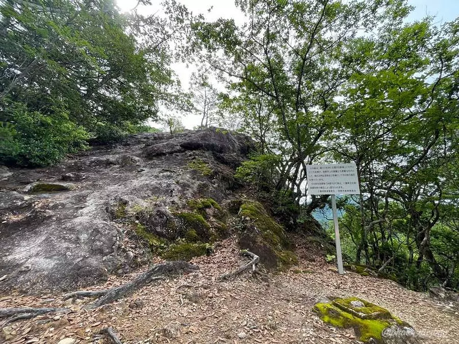
You can climb up to the top of the giant rock at Onigura, but the edge of the rock is a sheer cliff, so be careful not to fall!
TAKA:For people like me who are afraid of heights, it's hard to go near cliffs... (sweat)
However, the view from here is worth seeing! I think.
By the way, there is a point on Prefectural Route 52 heading towards the Tankura Forest Road where you can see the entire view of Onigura.
When I think about going to a place like that... it makes me cringe (bitter smile)
Continue to Omotankura
``Omotankura'' is about a 40-minute walk from Onigura along a mountain trail with a gentle uphill slope.
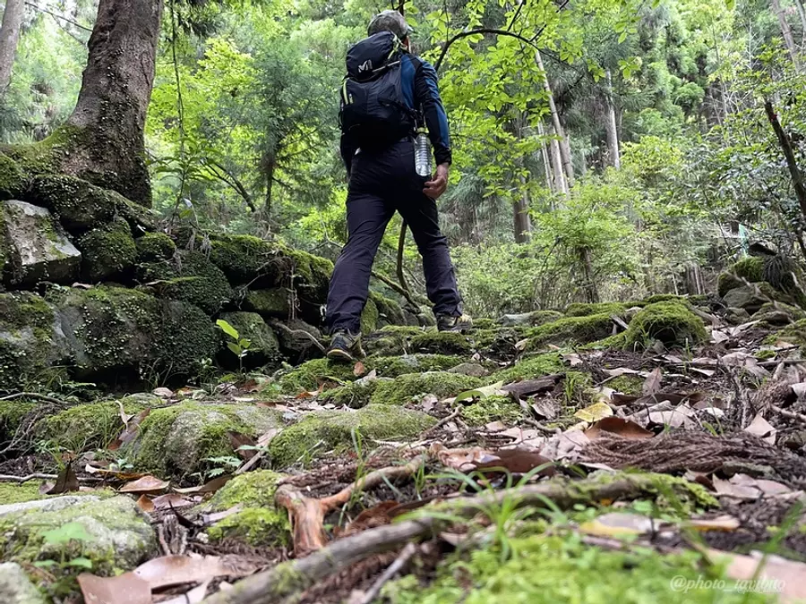
The mountain trail is a little rough, so be careful.
However, as I walked this time, I felt that there are trails and landmarks, so it's less likely to get lost.
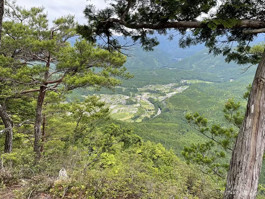
This is the view from the top of Omotankura.
The village of Ikuo-cho, KumanoCity spreads out below, and when you turn your eyes toward the mountains, you can see a pleasant view of the mountain range of the Omine Mountain Range, which can be said to be the backbone of the Kii Peninsula.
Onigura and Omotankura, which we introduced this time, are recognized as one of the 10 mountains that represent the area, `` HigashiKishu Kishu Juza'', which is also called ` HigashiKishu Kishu''.
Originally, the troupe was limited to Omotankura, but Iwamine from Onigura is also often introduced as part of the troupe.
What kind of mountains are HigashiKishu Kishu Juza and the other nine mountains...? ?
I hope to introduce them in the future!
About access
Proceed along National Route 169 from KumanoCity-cho, Kumano City towards Shingu City, Wakayama Prefecture, and turn at the fork to Prefectural Route 52 along the way (on the map, it is towards the top left of what is shown).
There will be signs, so if you follow the directions, you will find the Tankura Forest Road that leads to Akakura Shrine.
Follow the narrow forest road until you reach the end.
The distance from the junction with Prefectural Route 52 to the end of the Tankura Forest Road is approximately 4 km, and the journey takes approximately 15 minutes.
Also, please note that there is no other means of transportation other than your own car to get to the end of the Tankura Forest Road, where the trailhead is located.
- [Points to note when heading to the Tankura Forest Road]
- Prefectural Route 52 leads to MihamaTown, so you can also go to Tankura Forest Road from here (toward MihamaTown), but we do not recommend it because the road is narrow.
Introducing recommended spots in the surrounding area
After coming down from the mountain, don't you want to look for recommended sightseeing spots and food shops in the surrounding area? ?
From here, my assistant wife (Mr. M) and I (TAKA), who are somewhat knowledgeable about the area, will introduce three places that we recommend if you come to this area.
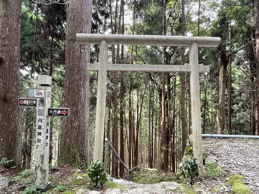
“Akakura Shrine” where you can feel the power
The Onigura and torii gate of Akakura-JinjaShrine suddenly appear along the “Tankura Forest Road” heading towards Otankura and Omotetankura.
It's a place that you almost pass by, but it's such a power spot that you feel like it's too good to pass by.
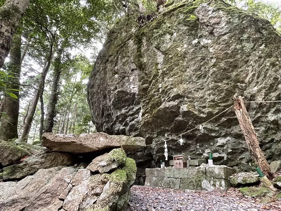
A majestic large rock that appears when you pass through the torii gate and go down the stairs.
Apparently, this place is said to have been the site of a nature worship called ``Iwakura Faith,'' which is said to have taken root even before worshipers came to Kumano Sanzan, where giant rocks were worshiped as sacred objects.
The mystery of the huge rocks here gives you an indescribable feeling.
Please note that there are a few parking spaces available.
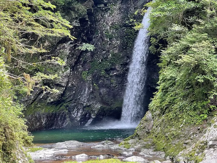
``Ame Falls'' where the legend of Amenouo remains
This area is surrounded by mountains, so it receives a lot of rainfall, and there are many waterfalls scattered throughout the area, including well-known waterfalls like Ametaki, as well as unknown waterfalls.
You can get to Ametaki in about 5 minutes by going down the mountain road from the prefectural highway.
The water is so clean that the purity of the waterfall stands out!
In addition, the rain waterfall here is also a place where people pray for rain, and there is a legend that says that when the sun is out, people would dip the temple bell into the basin of the waterfall to pray.
What is the legend of Amenouo?
There is a parking lot near the entrance of Ametaki where you can park about 2 cars.
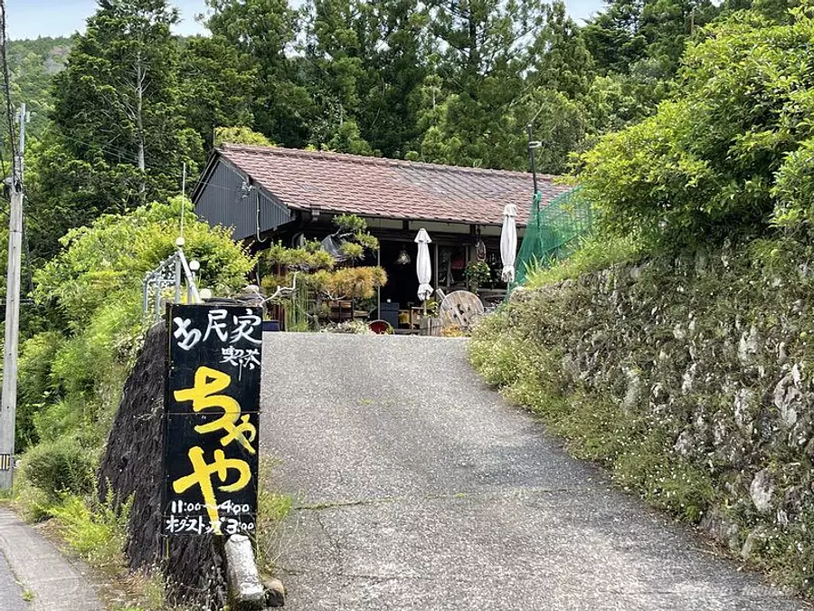
"Old folk house cafe Chaya" where you can enjoy gibier
We have renovated an old private house into an antique-style restaurant, and serve handmade dishes using carefully selected tableware.
The curry made with game meat is said to be famous, so if you're in the area, you'll definitely want to try it!
I wasn't able to go this time due to the timing, but my wife, M, said, ``The interior of the store is lovely!'', so it's a store I'd like to visit someday.
- address
- 445 Nagai, Ikuo-cho KumanoCity Mie Prefecture
- business hours
- 11:00〜16:00
- Regular holiday
- Tuesday/Wednesday
- TEL
- 0597-82-1505
in conclusion
How was it?
These days, I often get asked, "What kind of mountains are there in the south of Mie Prefecture?"
In fact, I feel that the current situation is that not much is known about the mountains in the central and southern regions.
I decided to write this article because I thought it would be a good idea to spread the word about the mountains in central and southern Mie Prefecture, even if just a little.
We will continue to provide information about mountains and recommended areas in the surrounding area that will be helpful to many people!
A trip around the sacred place Kumano
Kanko Mie introduces travel plans that explore the charms of Kumano, including scenic spots and power spots.
Onigura and old folk house cafes that we introduced this time are also introduced, so please check them out!
↓