Let's explore the charm of "Suzuka 10-za" where you can deeply enjoy the Suzuka Mountains! !
掲載日:2022.04.30
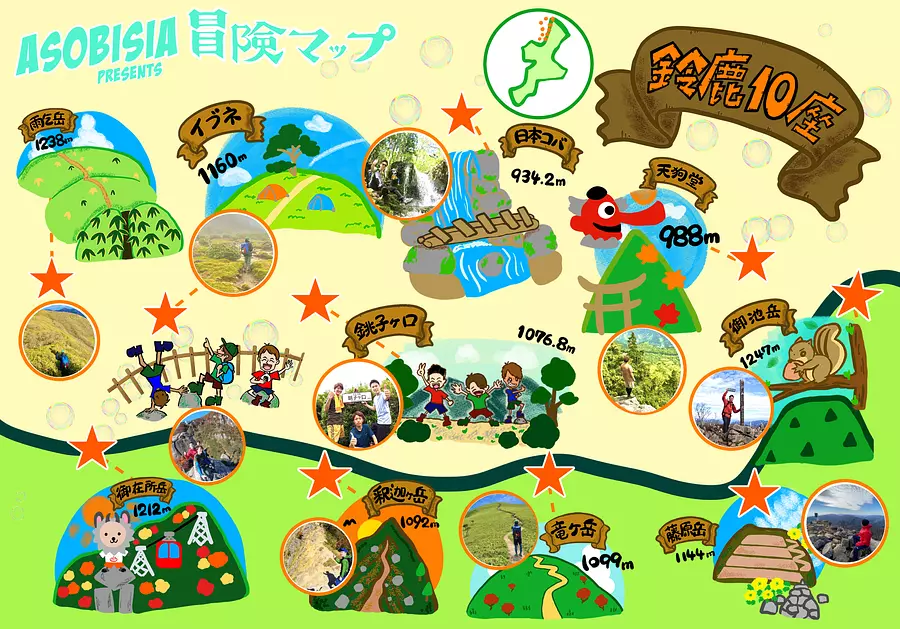
The 10 mountains selected from among the mountains in the Suzuka Mountains are also known as the ``Suzuka 10 Mountains''.
In addition to Mt. Fujiwara, Mt. Ryugadake, Mt. Shakagadake, Mt.Gozaisho, and Mt. Amagodake, which have been selected as one of the Suzuka Seven Mountains, Mt. Oike, the highest peak in Mie Prefecture, and Mt. Tengudo. The 10 mountains called "Choshigaguchi", "Nippon Koba", and "Ibune" are called "Suzuka 10 Mountains".
This time, we will introduce the remaining five mountains that we were not able to introduce in "Suzuka Seven Mountains"!
◆ Article creation: ASOBISIA #Mie Travel Camera Club
A trio of close friends who love the outdoors. Normally, he struggles as a Japanese office worker and faces the turbulent waves of society. In October 2020, he formed ASOBISIA after climbing a mountain one day, and opened Instagram and YouTube. On Instagram, his SUP photo in Miyagawa ranked first in the 2020 "Likes" ranking for Mie Tourism. This is a fledgling and active group.
Thoroughly explore the mountains of Mie! ``Suzuka 10za'' where you can deeply enjoy the Suzuka MountainsWe suggest ways to enjoy ASOBISIA style☆Use the adventure map to leave proof of your summit!You can add the date or make a collage of photos! Let's enjoy the sense of accomplishment together!!
Share your adventures on Instagram with the hashtag #Suzuka10za #ASOBISIAAdventureMAP!
Download the adventure map from the last page! ! (Long press on image → save image)
Are you ready?
This time, we will attack the remaining 5 mountains that are not introduced in "Suzuka Seven Mountains"! ! Now the adventure begins!
Related article: Mountain adventure “Suzuka Seven Mountains” that everyone from beginners to veterans can enjoy
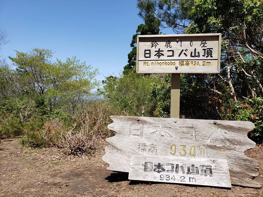
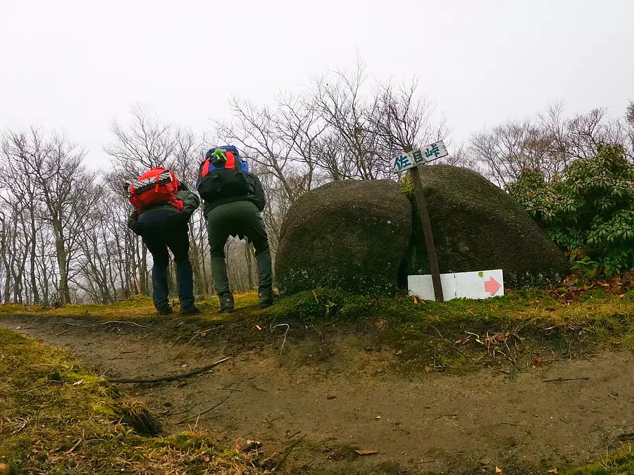
Nihon Koba (altitude 934m)
Climbing level ★★ ★ ☆☆
It stands tall in Higashiomi City, Shiga Prefecture.
There is a theory that it came to be called ``Japanese Koba'' because it takes two rest stops (koba) on the way to reach the summit.
■ASOBISIA's choice climbing course
Trailhead in front of Mandokoro Post Office (about 3 hours to the summit)
◆Access
There are parking spaces for about 3 cars at the trailhead.
You can also park at the parking lot for mountain climbing vehicles at the nearby Michi-no-eki ``Okueigenji Keiryu no Sato.''
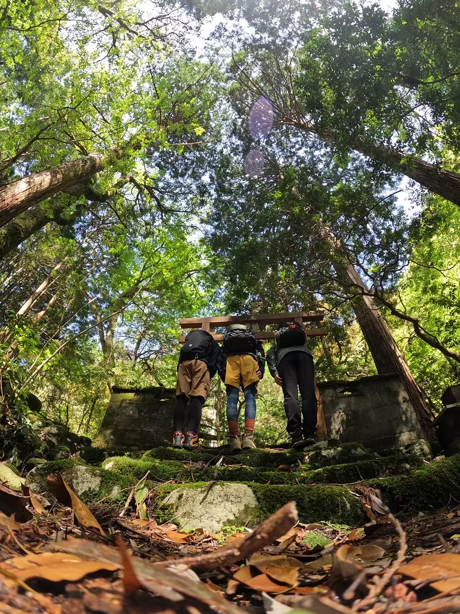
#Torii in the forest
A torii gate will appear soon after you start climbing.After bowing, let's step into the forest. The mountain gods will be watching over you.
From here, we will continue through the beautiful forest for a while!
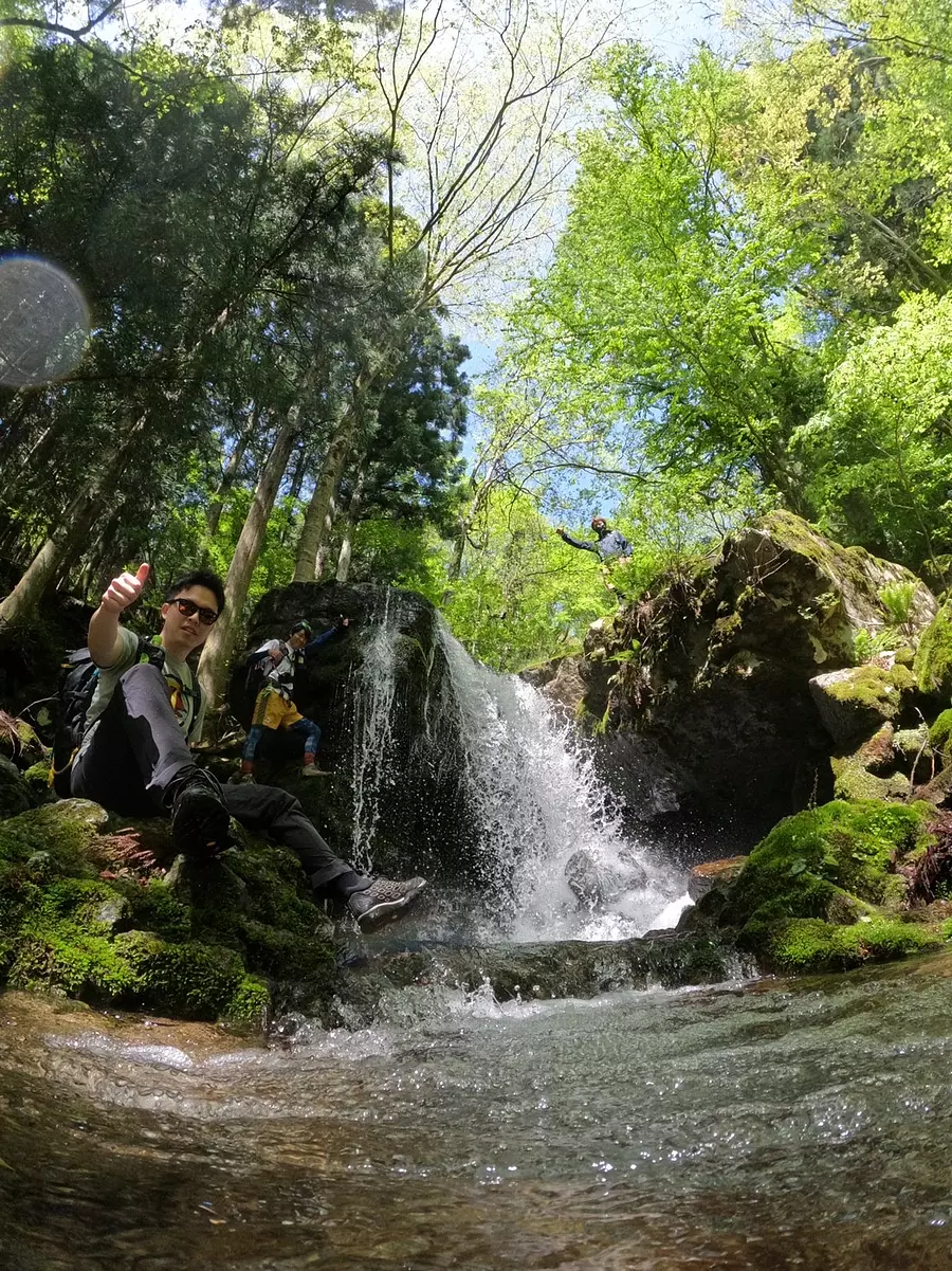
#Treasure trove of waterfalls
Nihon Koba has many beautiful waterfalls. When I went there, I was really impressed by how beautiful it was.I think this is the mountain with the most waterfalls in Suzuka.It's great to take a break at the waterfall when climbing on a hot day!
Take lots of great photos while being careful not to slip!
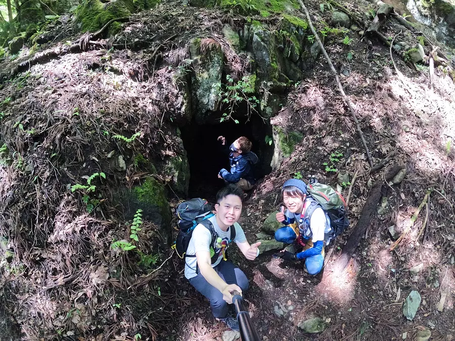
#Leopard's Hole
This is a spot called Leopard Hole!
It really looks like a hole where a leopard lives. I went in with trepidation, but it was pretty exciting (lol)
It's a little spooky, but since you're here, you'll want to take a photo as a souvenir!(lol)
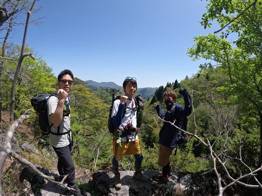
# Decided pose near the mountaintop
Most of Nihonkoba's mountain trails are through the forest, butthere are spots near the summit where you can view the surrounding mountains. This is also a must-take spot for commemorative photos! We also got it right!
Ibne (altitude 1,160m)
Climbing level ★★☆☆☆
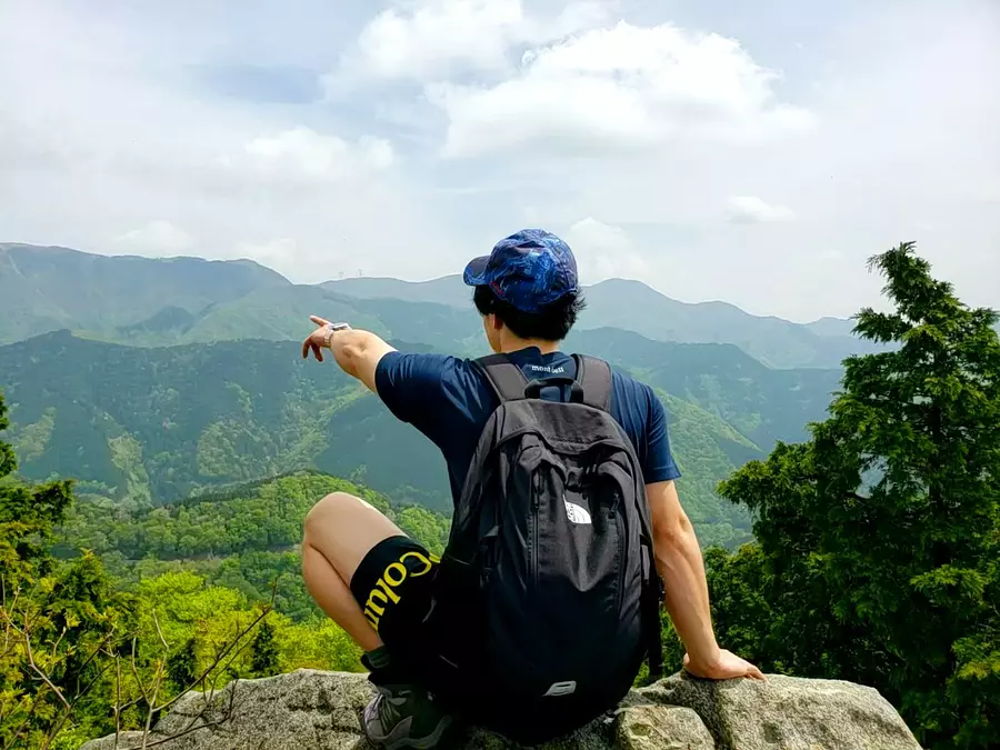
Ibune, which is selected as one of the 10 Suzuka theaters, is called ``Suzuka's inner parlor'' and its highlight is the moss that spreads all over the area. The view from the summit of Mt. Ibune is good, and you can see the mountains of the Suzuka Mountains such as Mt.Gozaisho and Mt. Kamagadake. Additionally, the summit is flat and has a carpet of moss, making it a popular place to stay in a tent.
■ASOBISIA's choice climbing course
Buhira Pass - Amagodake - Ibune (about 3 and a half hours to the summit)
◆ Access
Get off at Shin-Meishin Expressway Komono IC and follow National Route 577 for about 40 minutes, and you will see a parking lot on your left just before Takehira Pass Tunnel. It's just up SuzukaSkyline from the Naka trailhead of Mt.Gozaisho. From here you can access Mt. Amagodake, Mt. Kamagadake, and Mt.Gozaisho.
#Puri at Same Pass!
On the way from Amagodake to Ibne,a point called ``Same Pass'' will appear. A large rock was split in two, and it looked like a butt (lol). Point your butt towards the camera and pose high!
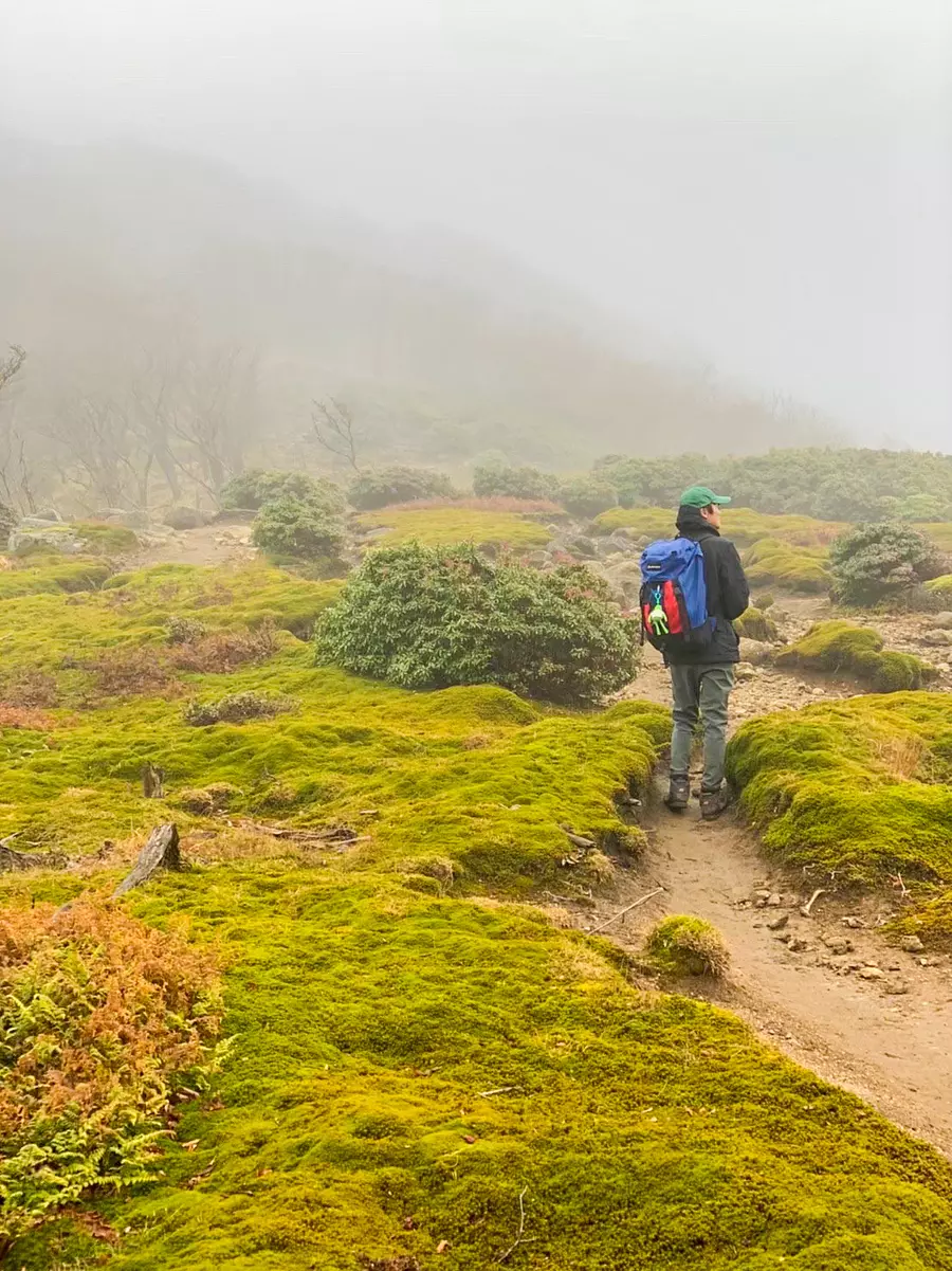
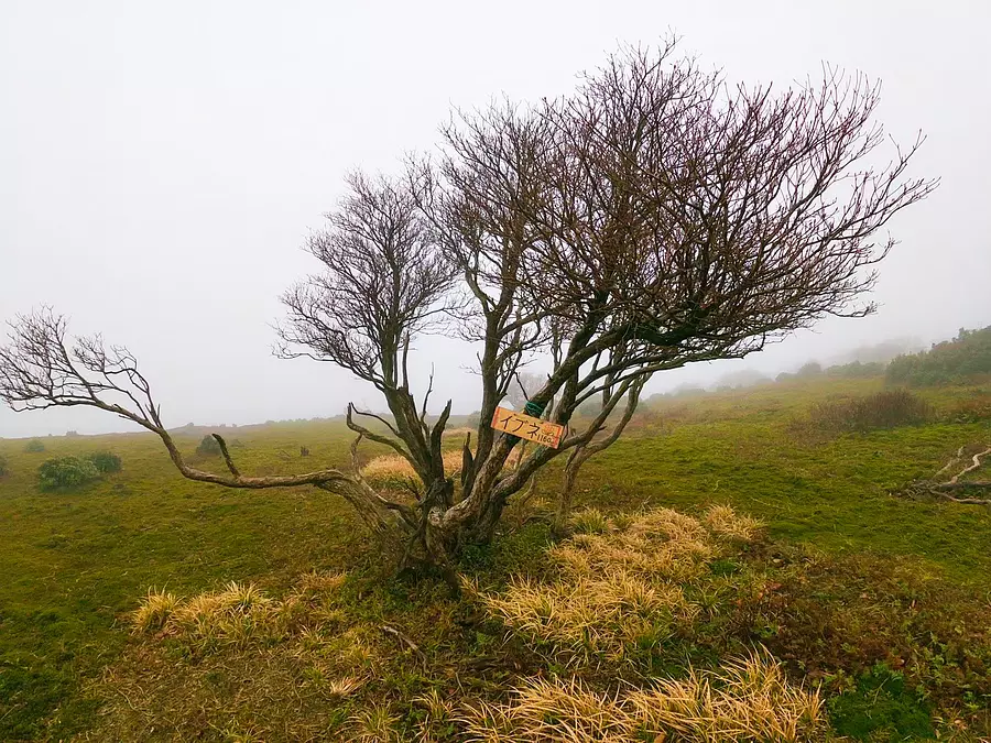
As you approach the summit of Mt. Ibne, moss grows thick and a fantastical space spreads out. On the day the photo was taken, the sky was cloudy and the area near the mountaintop was shrouded in fog. I felt like I had wandered into a fantasy world!
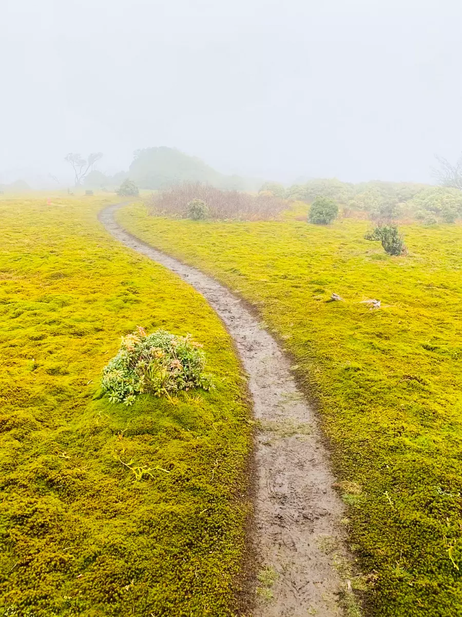
The path to the summit is easy to understand and follows a well-maintained mountain trail. Moss does not grow on roads where many people walk. It was difficult to see what was ahead due to the fog, but we were able to proceed without getting lost.
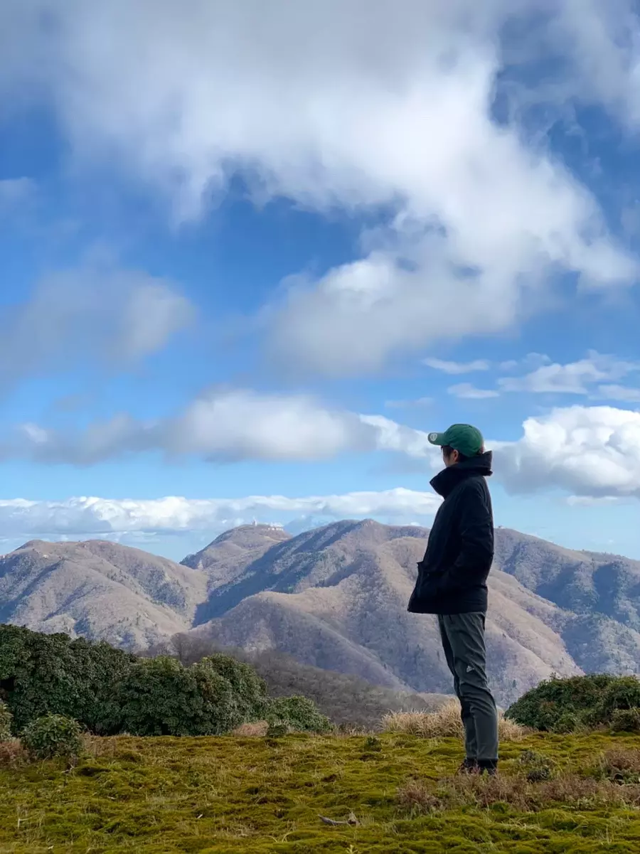
When we arrived at the summit of Mt. Ibne, it was sunny •••! !
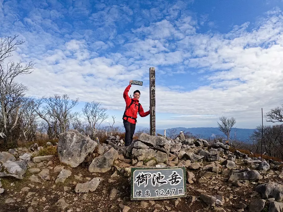
Mt. Oike (altitude 1,247m)
Climbing level ★★★☆☆
It stands on the border between Fujiwara-InabeCity, Mie Prefecture and Eigenji-cho, Higashiomi City, Shiga Prefecture. It is one of the most popular mountains among the 10 Suzuka mountain peaks, where mountain boys and mountain girls come to climb all year round! Near the top of the mountain, there is a wide and flat space called "table land", which is a great place to walk!
■ASOBISIA's choice climbing course
Kogurumi Valley Route (about 3 hours to the summit)
◆Access
You can park at the "Kurakake Tozan East Exit".
You can arrive by searching for "Kurakake Tozan East Exit" on Google Maps. Parking is available for approximately 20 cars.
Although the distance to the trailhead is longer, you can also park at the Kurakake Tozan West Exit after passing through the tunnel.
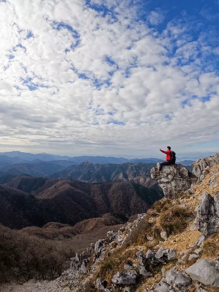
Tengu Rock, a photo spot on Mt. Oike! I took one more breath to the top and took a rest on Tengu's nose. The view is also spectacular! Be careful of gusts! Enjoy Mie Prefecture's highest mountain from the tip of a tengu's nose ^^
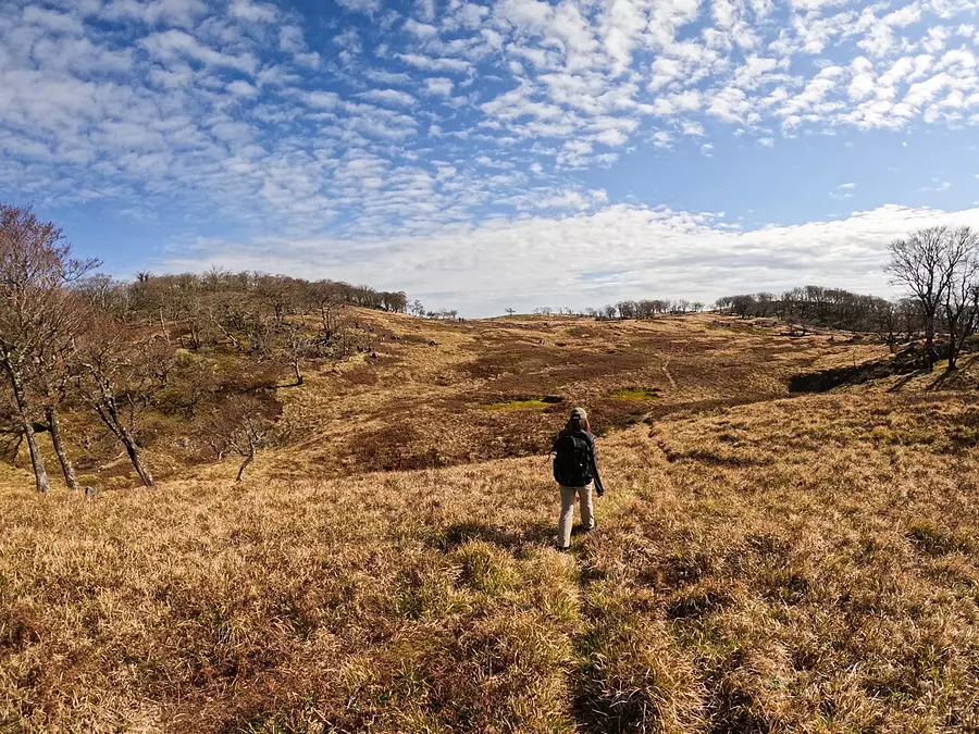
The area near the top of the mountain is a grassy plain with few plants, and people walking there look as if they have landed on a planet. All your worries will be blown away when you stand in front of the open landscape called Tableland.
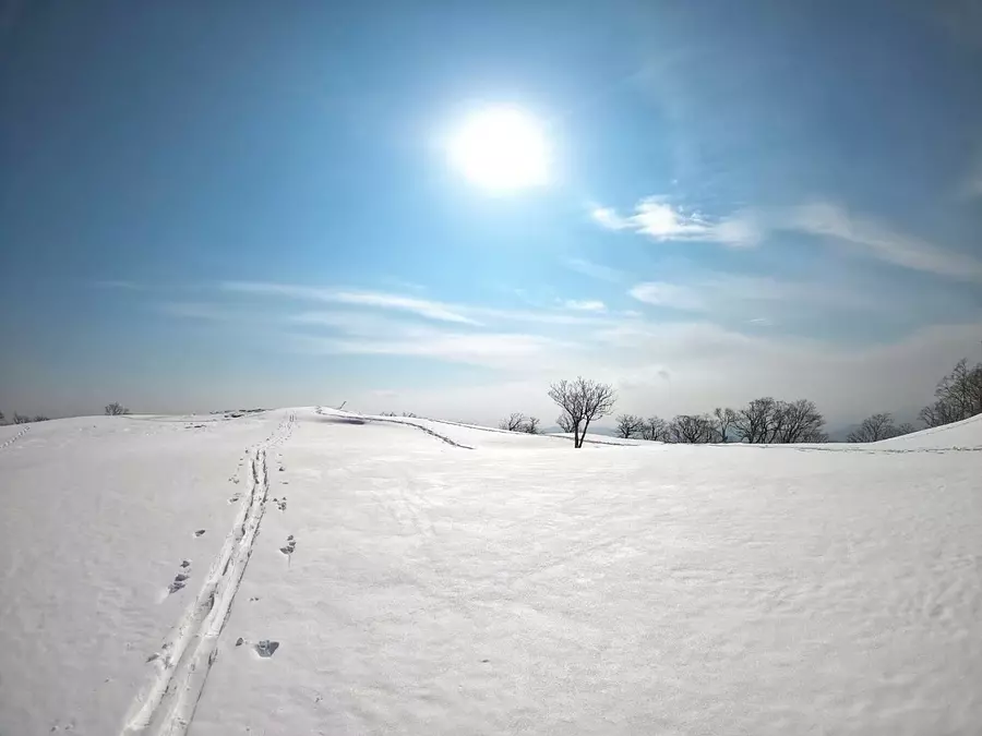
As winter approaches, the Tableland is transformed into a world-class wonderland with snow everywhere!
Mt. Oike in winter is also highly recommended!
*When climbing a snowy mountain, make sure you have the proper equipment.
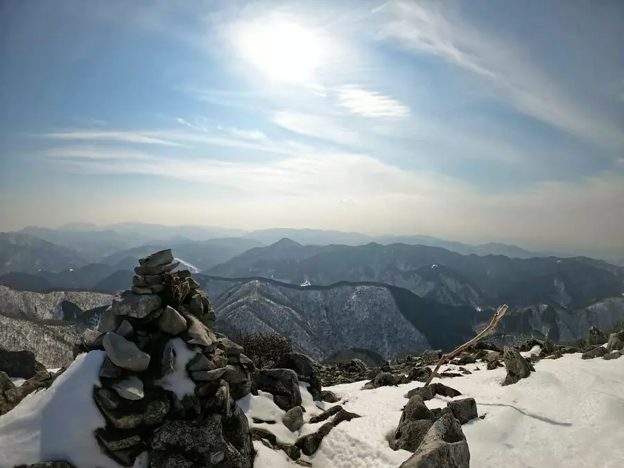
#Big Ice Cologne
The area near the top of Mt. Oike is open and has a good view, allowing you to enjoy a variety of scenery in spring, summer, fall, and winter! Oh, I found a big cairn! Snow-covered cairns are also very tasty.
We also have an article about climbing the snowy mountain of Mt. Oike, so please take a look!
Related article: Recommended for winter mountain climbing! Introducing the “snowy mountains” that Mie is proud of! ~To the world of silver~
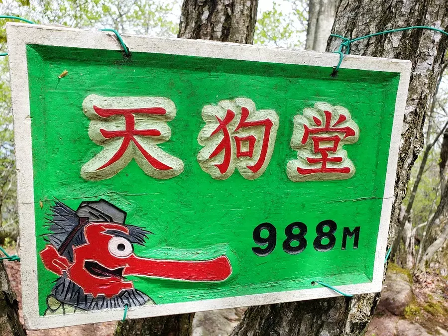
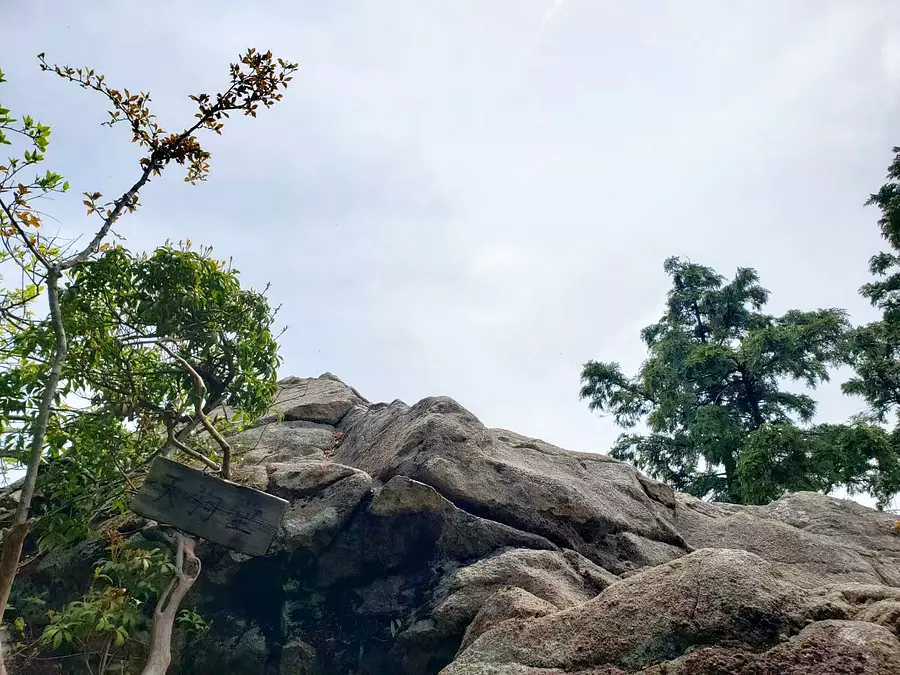
Tengudo (altitude 988m)
Climbing level ★★☆☆☆
It is located almost in the center of the Suzuka Mountains, and there is a viewing spot near the summit where you can see the mountains of northern Suzuka! There are rumors that this is a tengu meeting place, and if it really exists, you might be able to take some amazing photos. ?
■ASOBISIA's choice climbing course
Iwaodani trailhead (approximately 2 hours to the summit)
◆ Access
It is recommended to park at the Suzuka 10-za Tengudo climbing sightseeing parking lot, which is located just in front of Kimigahata village. *More than ten parking spaces available
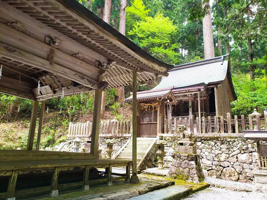
Right next to the trailhead, there is a shrine with a magnificent cedar tree called Daikokijisojinja Shrine. Before climbing the mountain, I pray for safety and the best experience before attempting Tengudo.
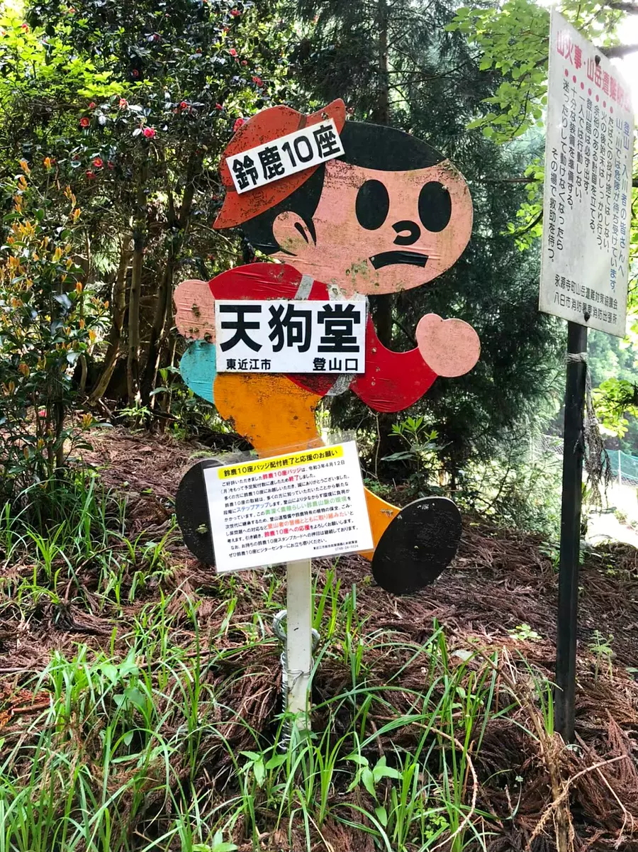
A young boy who has discovered the appeal of mountain climbing, has left his natural habitat facing the road and is spending his time alone in Tengudo. He's wearing a nice hat. We waved to the pop-up boy and started climbing!
After walking along a fairly steep mountain path, there is an observation spot just a little further from the top of Tengudo! Its name is "Observation Rock". This is a spot you should definitely take a detour to after taking a photo with Tengu at the top!
Is that Mt. Fujiwara over there? This is Ryugatake! You can look out over the mountains of the Suzuka Mountains while having a lively conversation.
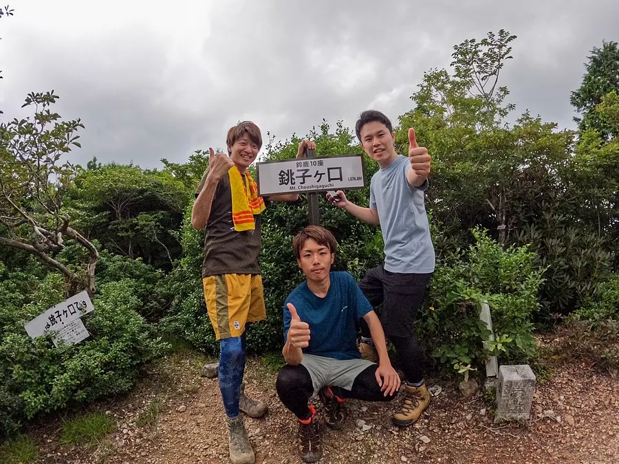
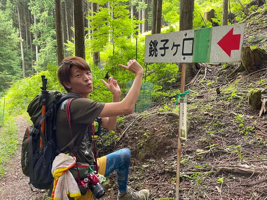
Choshigaguchi(altitude 1,076m)
Climbing level★★☆☆☆
It stands tall in Higashiomi City, Shiga Prefecture.
Although it is a little-known mountain, you can enjoy the beautiful forest that is unique to Choshigaguchi!
Climb even minor mountains and step up to becoming an advanced mountaineer!
■ASOBISIA's choice climbing course
Kubohao trailhead ~(about 2and a half hoursto the summit)
◆Access
Approximately 3cars can be parkedin front of the trailhead
You can also park at the climber parking lot at Michi-no-eki ``Okueigenji Keiryu no Sato'', which is about a 30-minute walk from thetrailhead.
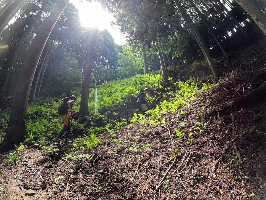
# Rugged Forest
Climbing at Choshigaguchi is all about walking through the forest! Depending on the time of year, there may be a lot of leeches, so be careful. It may be a good idea to keep leech spray and salt in your backpack. Make sure it doesn't stick to your legs, back, or arms along the way (><)
Let's goto Choshigaguchi#
There are signboards placed here and there, making it relatively easy to navigate the mountain, but be sure to check the climbing route and weather carefully before climbing! Now, let's move on!
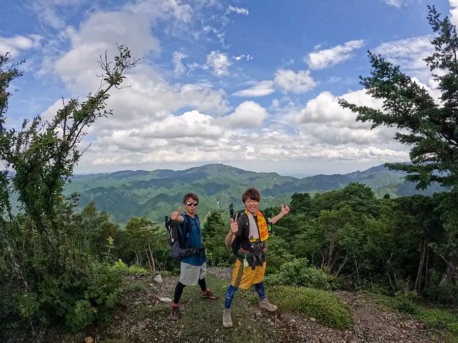
# A wide-open view from near the summit
The mountain path continued through the forest, but there was a viewing spot near the top where you could see the surrounding mountains. When you come to Choshigaguchi, take a commemorative photo here! !
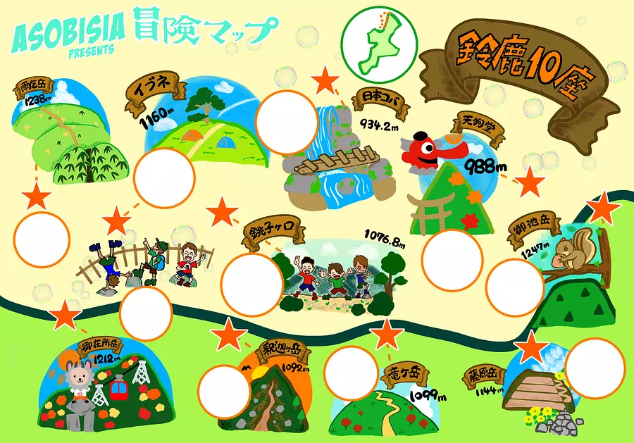
#Download the MAP now! !
>> How to save: Long press on image → Save image
If you have obtained this adventure map, you are now a worthy adventurer! A wonderful story that only you can experience is waiting for you. . . ! Would you like to try climbing Mie and Suzuka 10th mountain with the three of us ^^!? We will support your every step!
Share your adventures on Instagram with the hashtag #Suzuka10za #ASOBISIAAdventureMAP!
Let's GO!!!
◆◆◆
There are many other trailheads and mountain trails in Suzuka 10th Mountain than the one we chose this time, and it is really deep and there is no end to the adventure!
ASOBISIA is still in its infancy when it comes to things like mountains, photography, and vocabulary, but I would like to adventure with you and grow more and more! !
We will focus on outdoor activities and introduce the charming nature of Mie in our own way! ! We will introduce various aspects of Mie and deliver articles that will make you want to go!
I'll play with all my might! ! Oh! ! !
◆◆◆
↓Check out the article here☆
You'll love Mie's mountains even more! “Kameyama 7-za Trail”! !
Link ⇒ https://www.kankomie.or.jp/report/1012.html
↓ Follow Us! Please subscribe to the channel ☆
■Instagram: @ASOBISIA
Link ⇒ https://instagram.com/asobisia?r=nametag
■YouTube: ASOBISIA Channel
Link ⇒ www.youtube.com/channel/UCKrgfv5STSHezyOWmVwiUOQ
■TikTok:@asobisia
Link ⇒ https://www.tiktok.com/@asobisia