
What is Kameyama 7th place “Mt. Takahata”? Introducing attractions, parking lots, and climbing courses
掲載日:2022.02.17
Mt. Takahata is a mountain with an altitude of 773 meters and is full of attractions such as the thrilling knife edge and the huge rock called Kagamiishi on the mountain trail. In this article, we will introduce a climbing course that starts from the parking lot of Manninko Yoyato.
Fugamaru-chan from the Mie Travel Camera Club delivers information that will make you love Mie even more! This time, the theme is Mt. Takahata, one of Kameyama's 7 temples.
table of contents
What is Mt. Takahata?
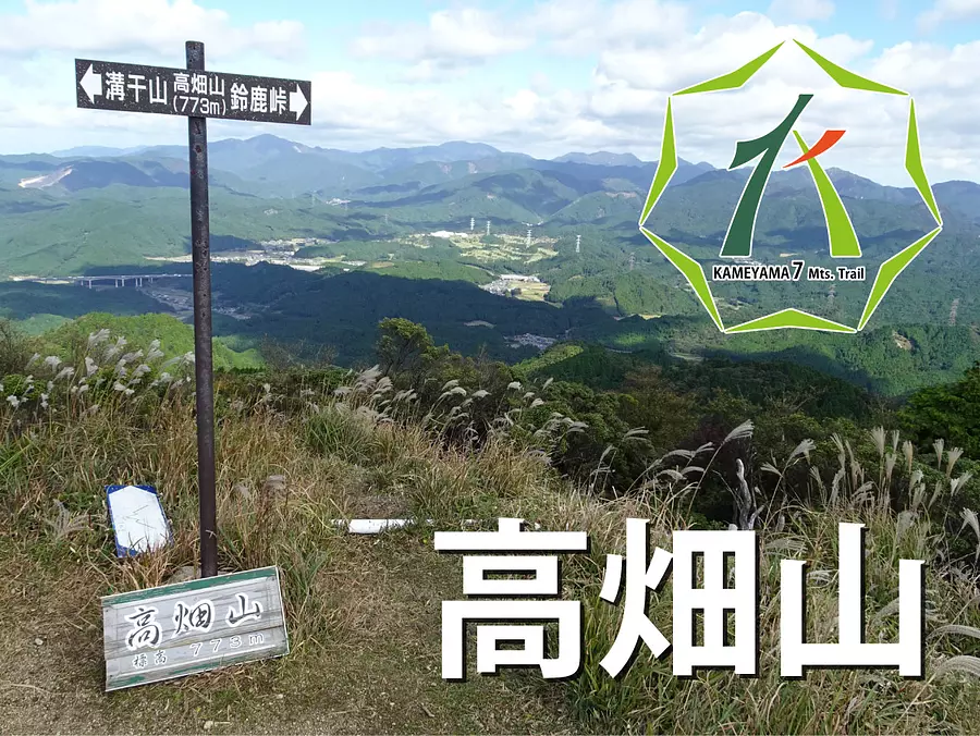
Takahatayama is a mountain located on the border of Kameyama City KameyamaCity Prefecture and Koka City, Shiga Prefecture, and has an altitude of 773 meters. It is the third highest mountain among the 7 Kameyama Mountains, and you can enjoy a 360-degree panoramic view from the top.
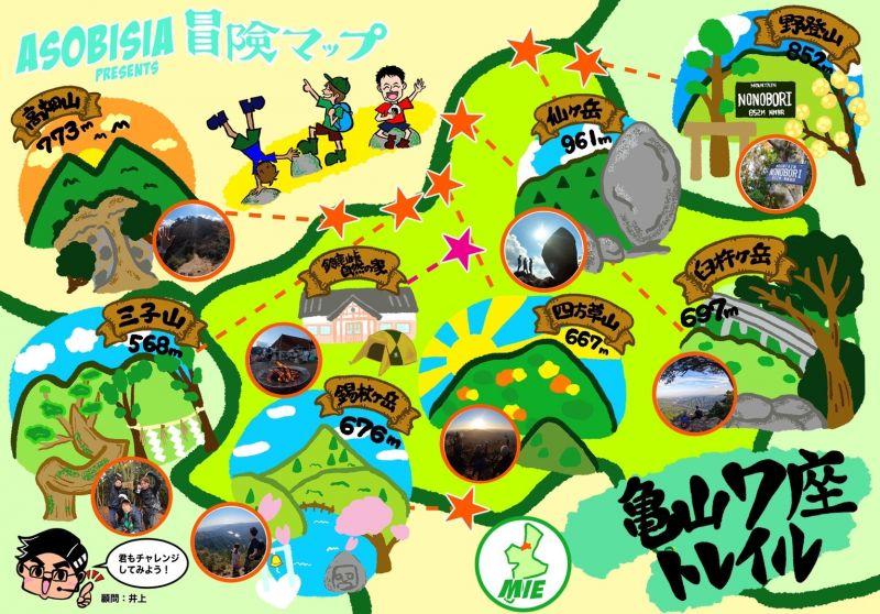
*Kameyama 7-za is a mountain that is approximately 700 meters high and is located within KameyamaCity.
Highlights and characteristics of Mt. Takahata
Panoramic view from the mountaintop
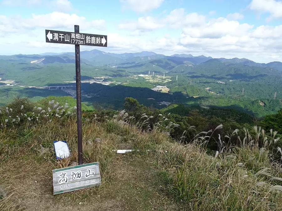
From the top of Mt. Takahata, you can enjoy a 360-degree panoramic view of Ise Bay, Lake Biwa, and the mountains of Suzuka. The summit is large enough for about 10 to 20 people to take a break, so it's also a recommended place to take a meal break.
knife edge
A ridgeline that is sharp like a knife blade is called a knife edge, and the mountain trail on Mt. Takahata has a knife edge of rocks and gravel. The route is full of thrills as there are places where your feet are narrow and places where you have to climb up rocky areas using the provided rope.
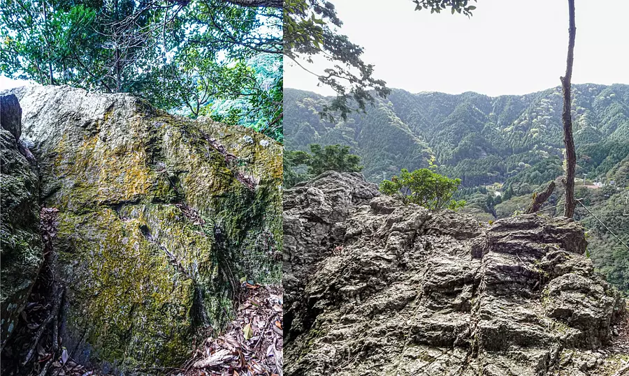
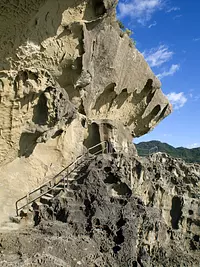
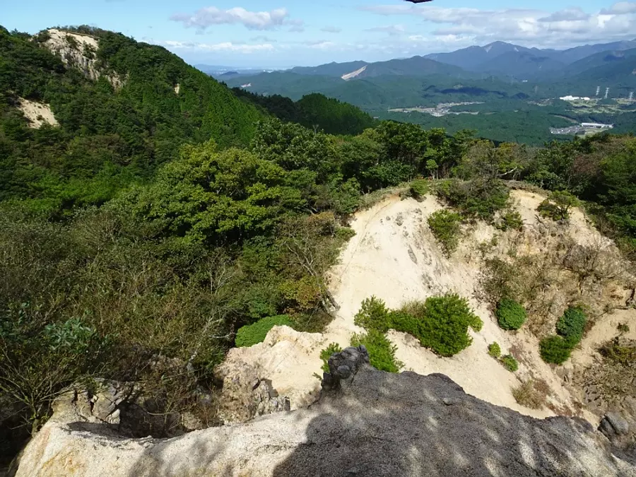
Kagami-iwa of Mt. Suzuka
The mountain climbing course introduced in this article passes through the summit of Suzuka Pass, where a gigantic rock called ``Kagami-iwa'' rises.
This gigantic rock is called "Kagami-iwa of Mt. Suzuka" and is designated as a natural monument of Mie Prefecture, and is also a viewing spot overlooking the village below the slope.
It is also known as the ``devil's full-length mirror'' because of the legend that bandits polished this rock and attacked travelers who appeared in the image at the bottom.
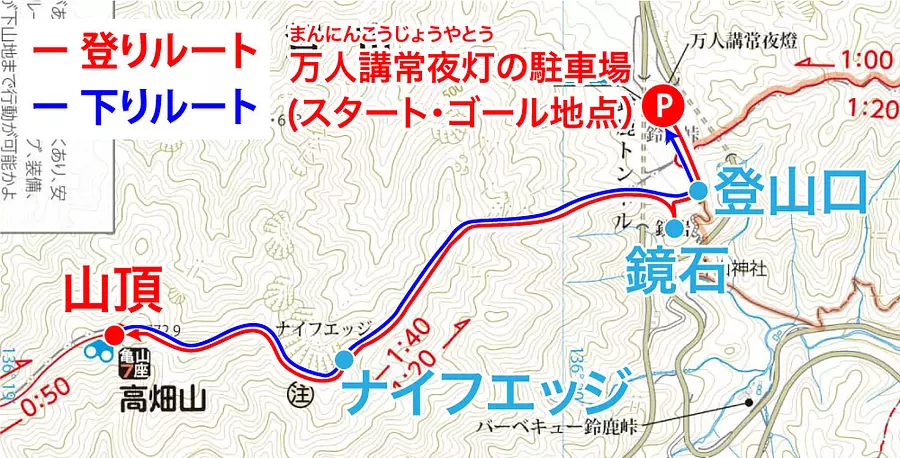
Climbing course overview
In this article, we will introduce a climbing course that follows the route of the Kameyama 7-za trail map! The course time is approximately 3 hours, with a 1 hour break time, making the climbing course approximately 5 hours in total.
Climbing course plan
We will start from the parking lot of Manninkojoyato and head to the Mt. Takahata trailhead at Suzuka Pass and aim for the summit. On the way there, we stop at Kagami-iwa to enjoy the view from the rock, and take a meal break at the top of the mountain with a wide foothold.
[Climbing route] Manninko Joyato Parking Lot (7:56) ➞ Trailhead (8:02) ➞ Kagami Rock (8:05) ➞ Knife Edge (8:58) ➞ Summit (9:25)
Downhill course plan
After taking a lunch break at the summit, descend the mountain the way you came and return to the Manninko Joyato parking lot to reach the finish line.
[Down route] Summit (10:25) ➞ Manninko Joyato parking lot (11:45)
Course difficulty: Beginner class
It's a short 6-minute walk from the parking lot to the trailhead, and the trail is well-maintained, making it easy for even beginners to climb. Knife Edge has narrow footing, so be especially careful when walking in strong winds.
- Precautions and tips for mountain climbing
- ① When climbing, give yourself plenty of time and choose a mountain that suits your experience and physical strength.
- ② Make a climbing plan in advance and submit a climbing report to the nearest police station or mountain climbing post by the day of the climb.
- ③ Make sure to check the weather information beforehand.
- ④ Prepare clothing that can handle sudden changes in temperature, including rain gear.
- ⑤ Bring water and portable food, take precautions against heat stroke, and take adequate breaks.
- ⑥ When climbing the mountain in winter, be sure to bring snowy mountain climbing equipment such as crampons. Even if there is no snow at the foot of the mountain, there may still be snow and ice near the top of the mountain.
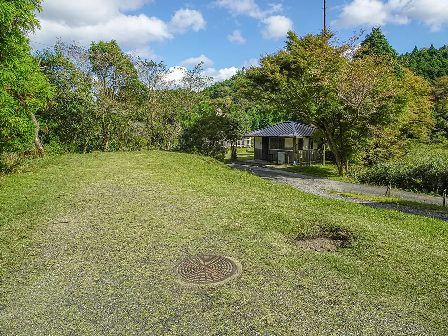
Parking location
For this climbing course, we will use the parking lot at Manninko Joyato. The photo only shows part of the parking lot, but there is space for about 10 cars.
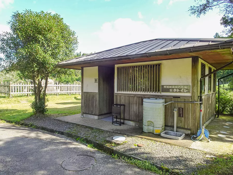
It takes about 1 hour and 40 minutes to walk one way from here to the summit, so it's best to relieve yourself at the public restroom near the parking lot.
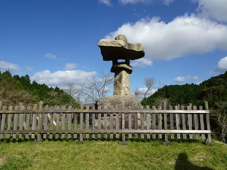
Manninko Joyato is a Joyato that was built at Suzuka Pass about 270 years ago. It has now been relocated above the Suzuka Tunnel entrance and can be seen right near the parking lot.
How to get to the parking lot
By entering the Tokaido from the Suzuka Pass bypass on the Shiga Prefecture side, you can reach Manninko Joyato and the parking lot.
Climbing course explanation
This climbing course is explained using photos taken on October 20, 2021. Please use the course times as a guide only.

Manninko Joyato Parking Lot (7:56)
Park at the parking lot of Manninko Joyato and start climbing! From here, we will walk along Tokaido to the trailhead.
Walk: about 4 minutes
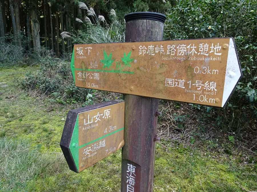
Suzuka Pass junction (8:00)
We arrived at the Suzuka Pass junction. There are various signs posted here, but keep going straight without turning. *Go towards the slope of the sign.
Walk: about 2 minutes
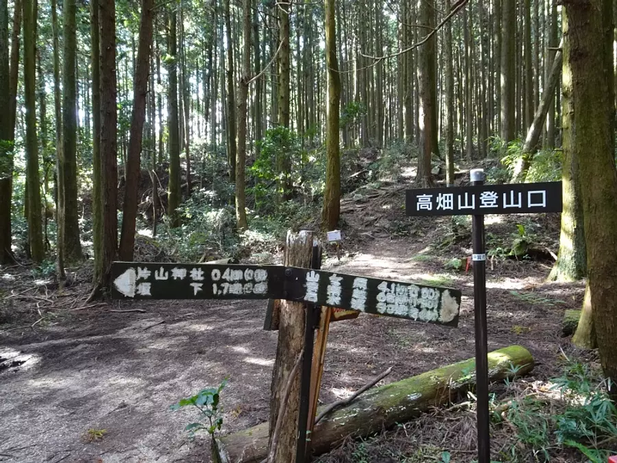
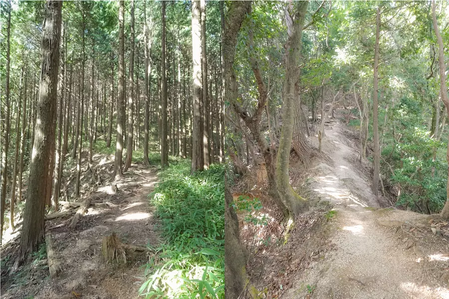
Mt. Takahata trailhead (8:02)
Arrived at the Mt. Takahata trailhead at Suzuka Pass. It's a well-maintained mountain trail, so it's easy to walk.
Walk: about 2 minutes
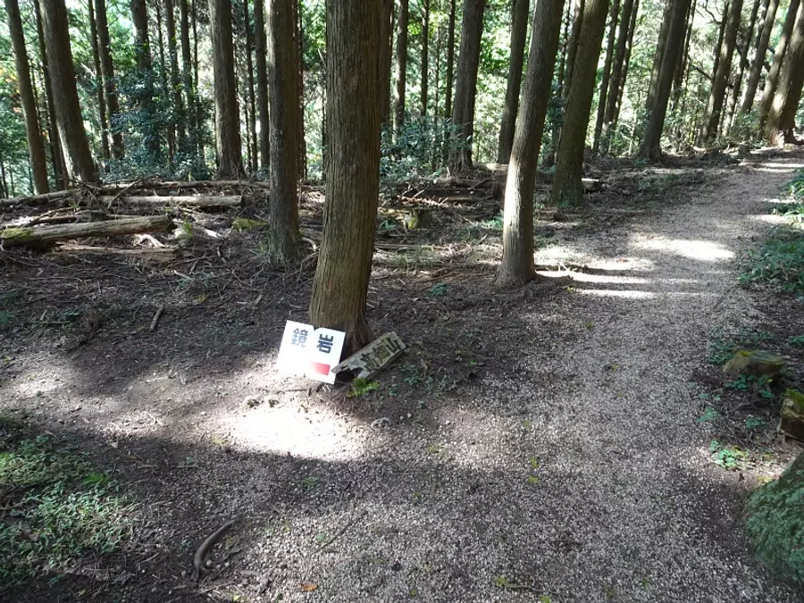
Kagamiiwa Junction (8:04)
Arrived at the junction of Kagami-iwa and Mt. Takahata. It's about a 1 minute walk from here to Kagami Rock, so I decided to stop by.
Walk: about 1 minute
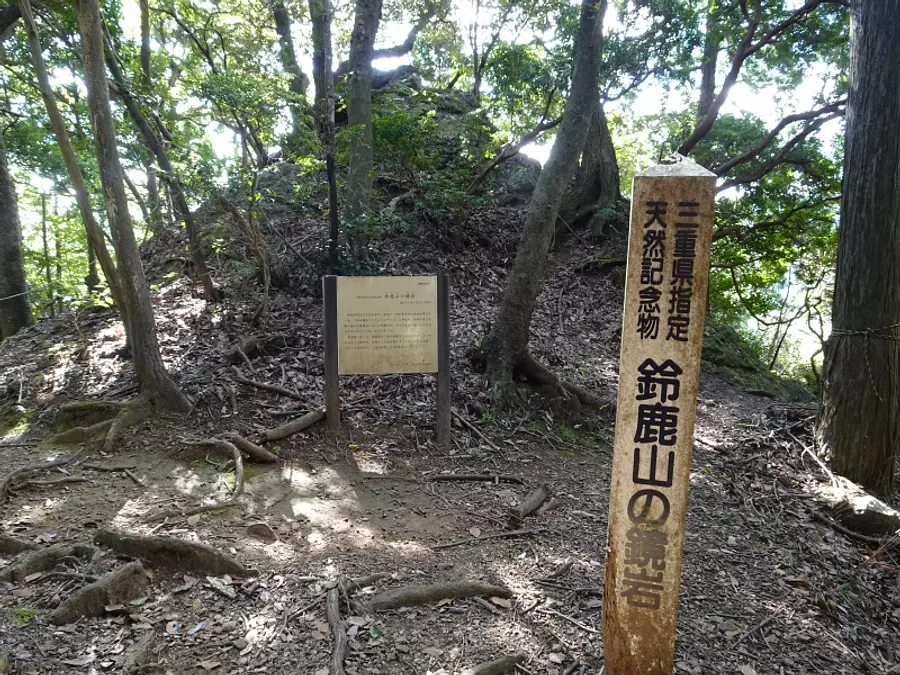
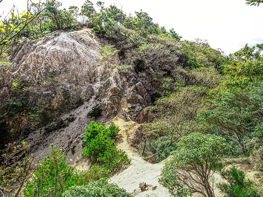
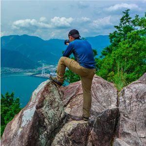
Kagami Rock (8:05)
There is a sign and a sign saying "Kagami Rock of Mt. Suzuka". The mirror rock is behind the signboard, and you can climb up to the top of the rock using the provided rope.
climb a rock with a rope
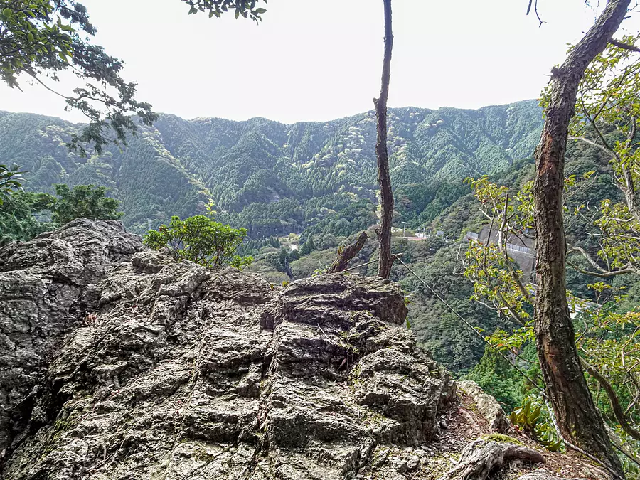
View from Kagami-iwa (8:06) *4 minute break
This is a viewing point that overlooks the surrounding mountains. You can see National Route 1 and the village of Sakashita below.
Walk: about 2 minutes
Kagamiiwa Junction (8:12)
Return to the Kagami-iwa junction and aim for the summit of Mt. Takahata. From here, you'll be walking along a road surrounded by trees and a ridgeline for a while, but it's easy to walk as there are well-maintained mountain trails.
Walk: Approximately 42 minutes
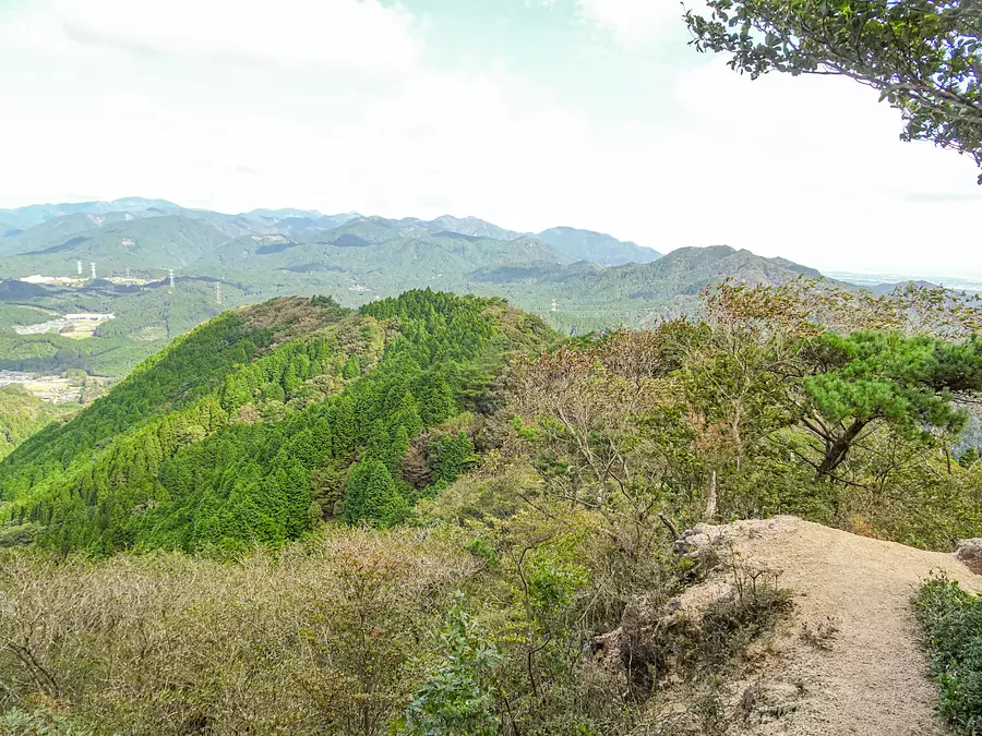
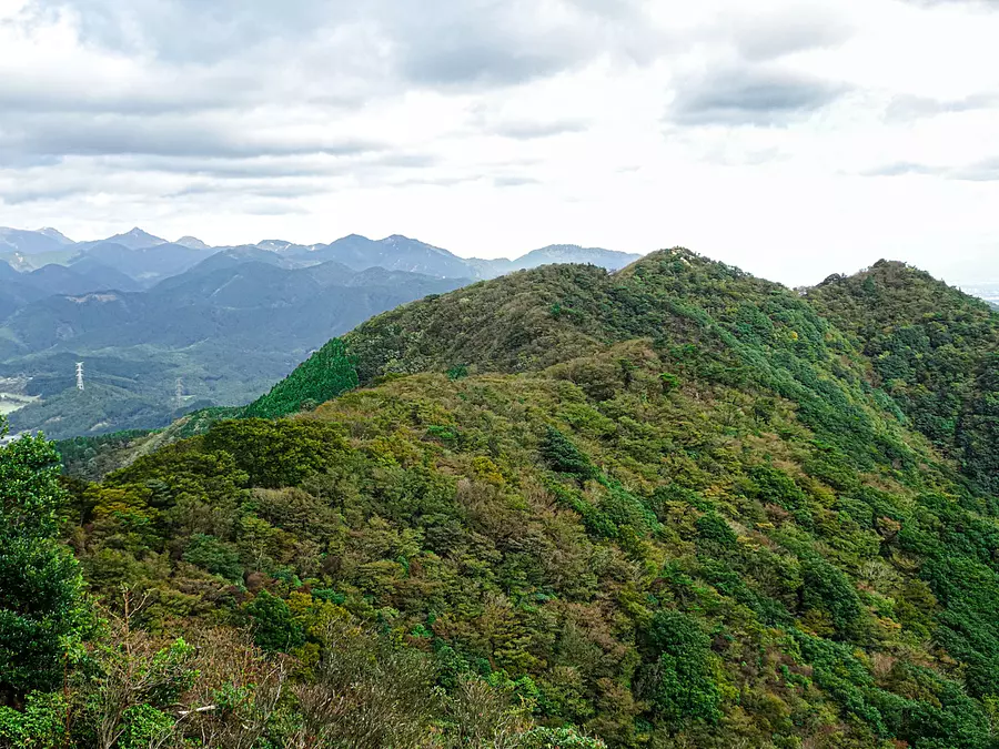
View from the ridge path (8:54)
After walking for about 40 minutes from the Kagami-iwa junction, I reached a road with a clear view. The weather was nice on this day, so we could see mountains such as Mt. Kamagatake, Mt. Sengadake, Notoyama, and Mt. Usuki.
Walk: about 4 minutes

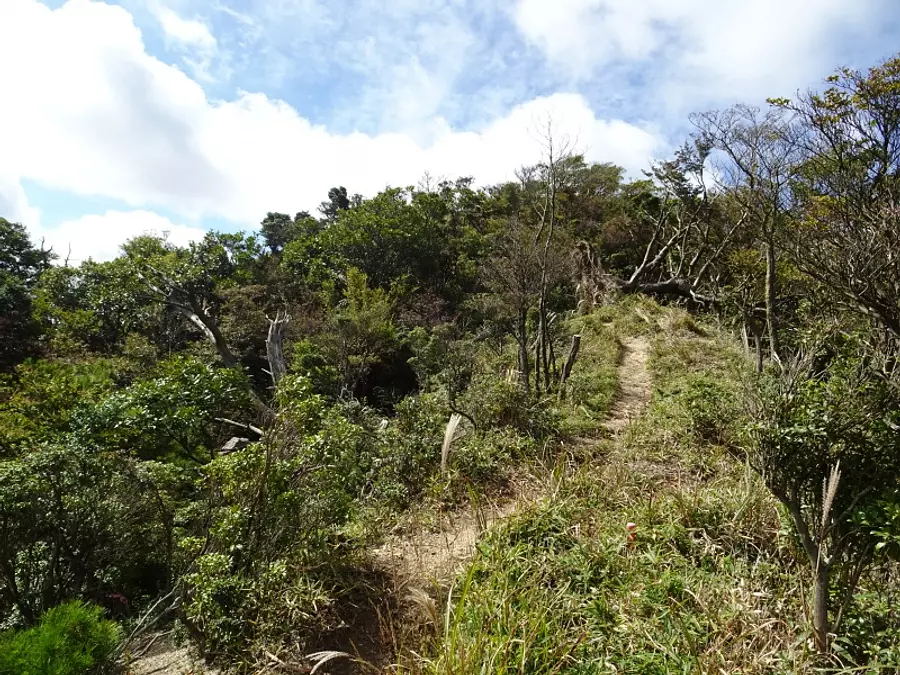
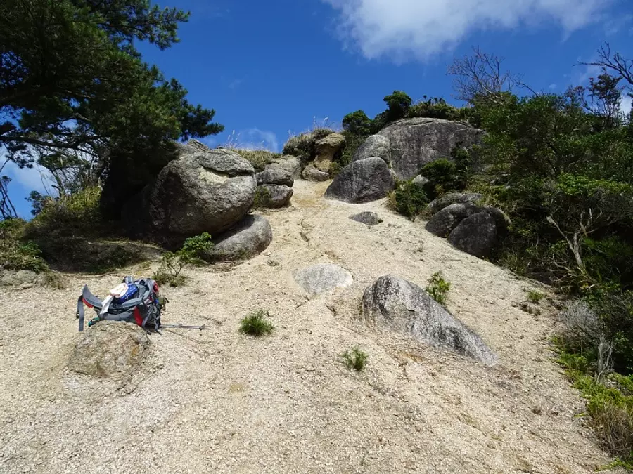
Knife Edge (8:58)
We arrived at the famous "knife edge" of Mt. Takahata. There are parts of the trail that involve climbing up narrow ridges and rocky areas, so be careful as you proceed.
Walk: about 4 minutes
Top of Knife Edge (9:02)
We came to the top of a knife-edge rocky area. When I look back at the way I came, I can see that it's quite undulating.
Walk: about 15 minutes
Ridge road with good views (9:17)
After climbing the knife edge, a ridge trail with a clear view continues. The view is so good that it feels like walking in the air ♫
Walk: about 8 minutes
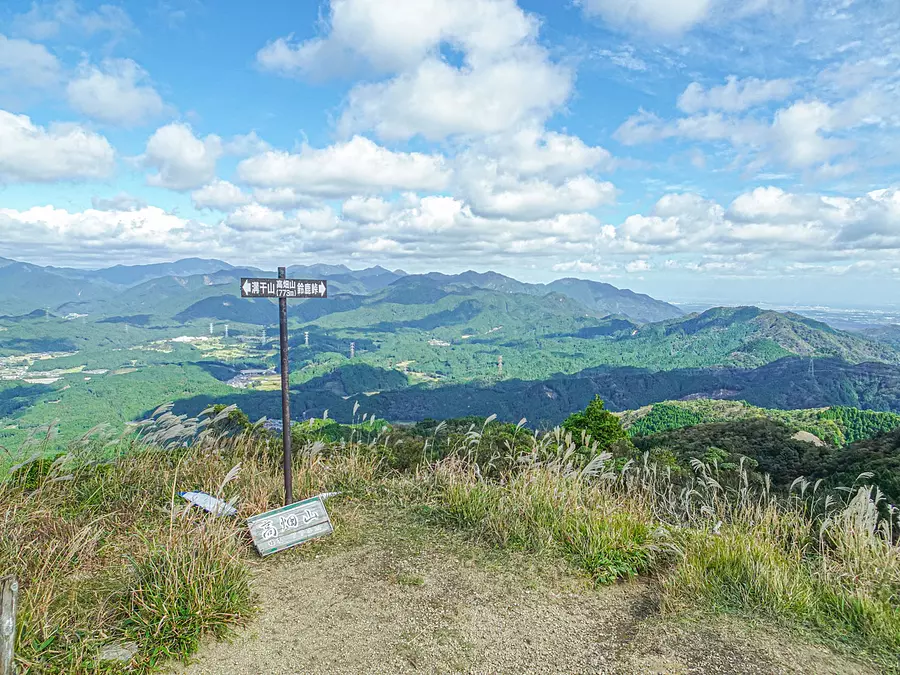
The summit of Mt. Takahata (9:25)
We arrived at the summit of Mt. Takahata. It is a place where you can be impressed by the 360 degree panoramic view. The sky was clear and blue that day, so I was able to see Ise Bay and Lake Biwa.
Walk: about 1 minute
Meal break (9:26) *1 hour break
The wind was strong that day, so we took a meal break on the slope on the southeast side of the summit. There is ample foothold at the top of the mountain, so it is a perfect spot to take a break. After you finish your break, head back down the mountain the way you came and return to the parking lot to reach the finish line.
Walk: Descend in about 1 hour and 20 minutes
What did you think
We introduced the charm of Mt. Takahata along with an introduction to the mountain climbing course. The charm of Mt. Takahata is that you can enjoy the beautiful view and the thrilling knife edge.
The mountain climbing courses introduced in this article are perfect for beginner mountain climbers as they go up and down the same route and there are many well-maintained trails. Please give it a try!
Enjoy Kameyama 7-za Trail
Mie Kanko has released a special website for the Kameyama 7-za Trail that introduces the charms of Kameyama 7-za and the climbing courses for each mountain.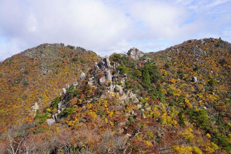
In addition, ASOBISIA from the Mie Travel Camera Club has written an article about the charms of the Kameyama 7-za Trail. You can see all the attractions of each mountain on one page, so please take a look.
Latest information on Kameyama 7-za Trail
KameyamaCity 's official homepage provides the latest information on initiatives and events for the Kameyama Seven Trails.
It clearly states where to download the mountain climbing registration form and where to submit the mountain climbing notification, so if you are going to Kameyama 7-za, please take a look. You can also download the Kameyama 7-za trail map.
About the author of the article
Fugamaru-chan (article production)
He is a member of Mie Tourism's Mie Travel Camera Club and is active mainly on Twitter and Instagram as a photographer who takes pictures of Mie. We operate the Mie Photo Gallery, which distributes Mie's scenery for free, and the Mie Eetoko Tour, which disseminates Mie's latest information.
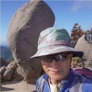
kazenami (photography)
Fugamaru-chan's father. A mountain man who has climbed all the mountains in Mie Prefecture and not only does trekking, but also rock climbing, ice climbing, and shower climbing. My hiking records so far are now available on YamaReco.
| Category | |
|---|---|
| season | |
| area |