What is Kameyama 7za “Noclimbing”? Introducing attractions, parking lots, and climbing courses
掲載日:2022.02.10
Notoyama is a mountain with an altitude of 851.4m, and along the trail there is a mitsumata colony and Notoji Temple, which was built in the Heian period, making it a mountain where you can feel the seasons and history. In this article, we will introduce in detail the appeal of field mountain climbing, parking lots, and mountain climbing courses.
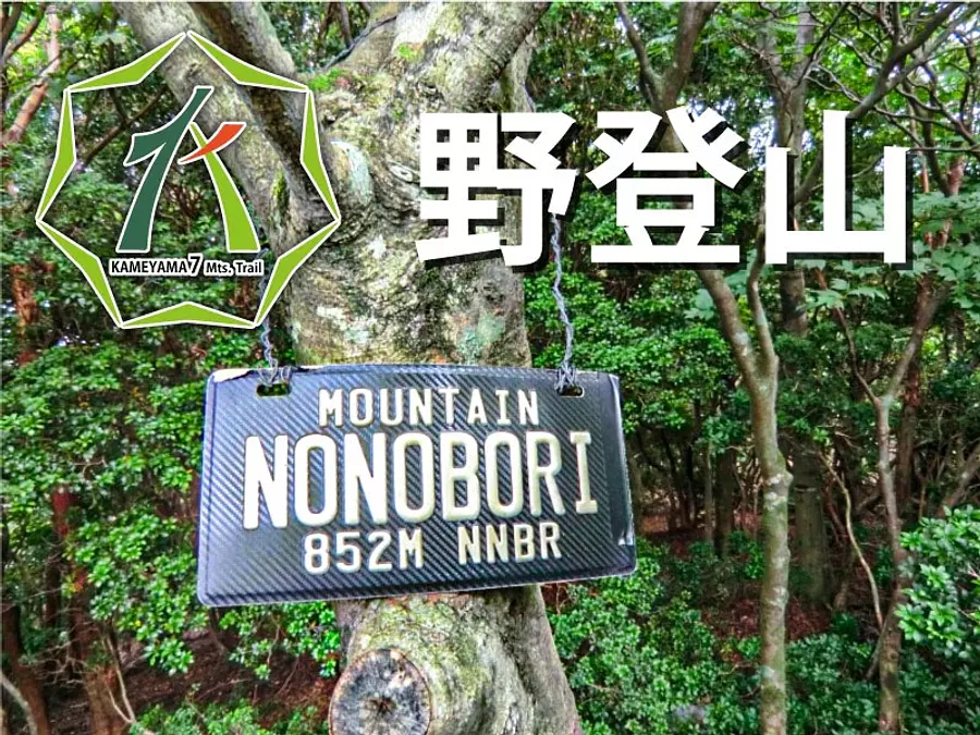
Fugamaru-chan from the Mie Travel Camera Club delivers information that will make you love Mie even more! This time, the theme is ``wild mountain climbing'', one of Kameyama's 7 temples.
table of contents
What is field climbing?
Nonoboriyama is a mountain located in KameyamaCity Mie Prefecture, with an altitude of 851.4m. It is the second highest mountain among the 7 Kameyama mountains after Mt. Sengatake.
The mountain was originally called Keisokuzan, but now it is popularly known as ``Nonoboriyama'' because there is a temple called Yatoji on the mountain.
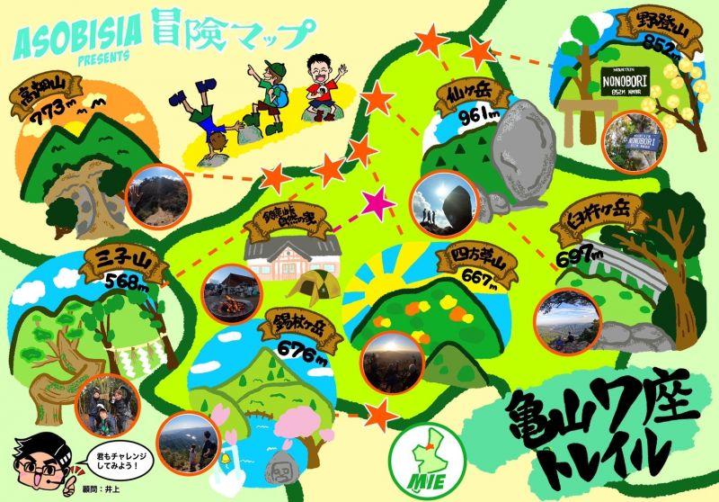
*Kameyama 7-za is a mountain that is around 700m in KameyamaCity and has been certified as Kameyama 7-za.
Highlights and characteristics of field climbing
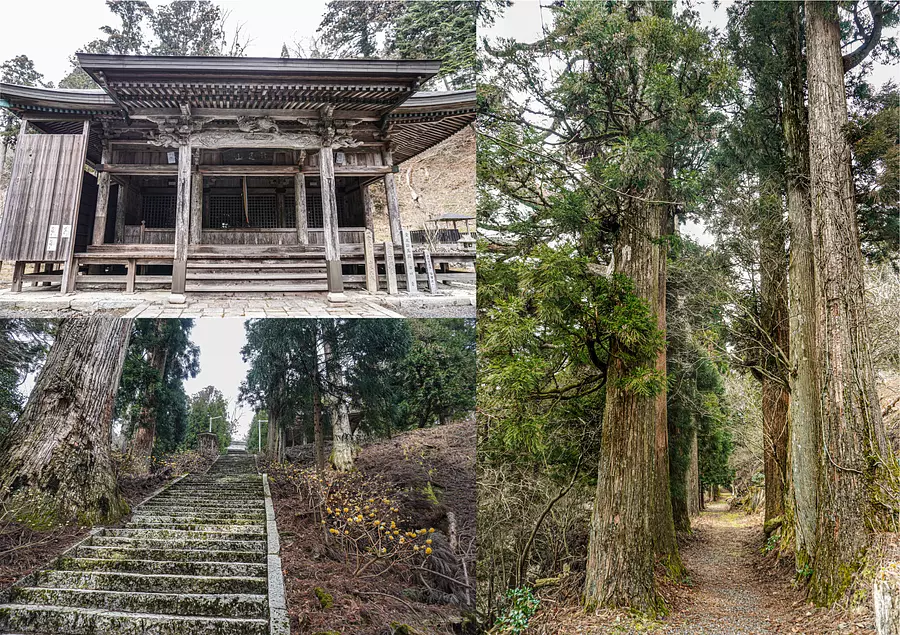
Notoji temple approach and giant tree
Near the summit, there is a Buddhist temple called Notoji, belonging to the Omuro sect of the Shingon sect, and you will be overwhelmed by the large number of large cedar trees that line the approach. This temple is said to have been built between 907 and 910 by Sencho Shonin, who received an imperial order from Emperor Daigo.
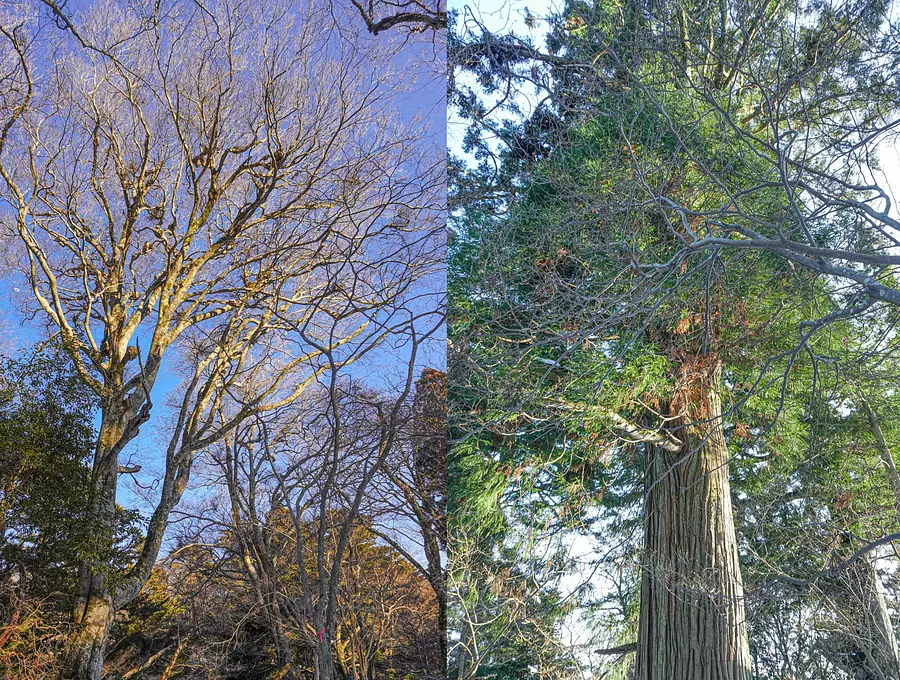
Beech forest for field climbing
Near the summit, there is a virgin forest of deciduous broad-leaved trees, mainly beech trees, and it has been designated as a Mie Prefectural Natural Monument as a ``wild climbing beech forest.'' The original vegetation has been preserved well, and the only place in the Suzuka Mountains where you can see this kind of scenery is near the summit of the mountain.
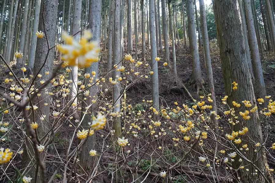
Mitsumata Forest
There is a spot on the mountain trail called Mitsumata Ridge, which is a forest where you can see beautiful Mitsumata from March to early April. When the Mitsumata are in full bloom, the slopes of the mountain turn yellow and you can see a scene that looks like a fairy has descended on you ♫
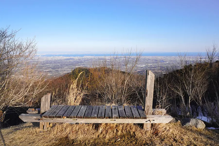
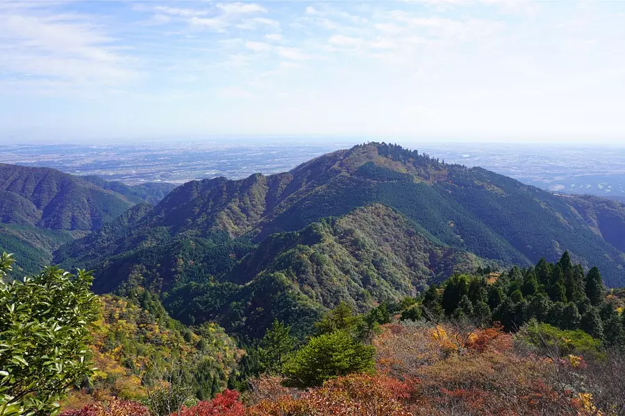
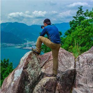
View from Kunimi Square
Near the top of the mountain, there is a plaza with a good view called Kunimi Hiroba, where you can see the townscape of Mie Prefecture's Hokusei-Nakasei area and Ise Bay. How about having lunch here while admiring the spectacular view?
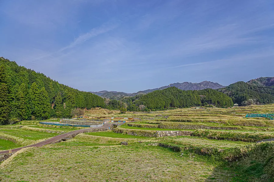
Top 100 rice terraces in Japan “Sakamoto Rice Terraces”
Near the parking lot we will use for this mountain climbing course, there is "Sakamoto Rice Terrace", which has been certified as one of Japan's top 100 rice terraces. You can start your climb while admiring the beautiful rice terrace scenery, which can be said to be the original scenery of Japan ♫
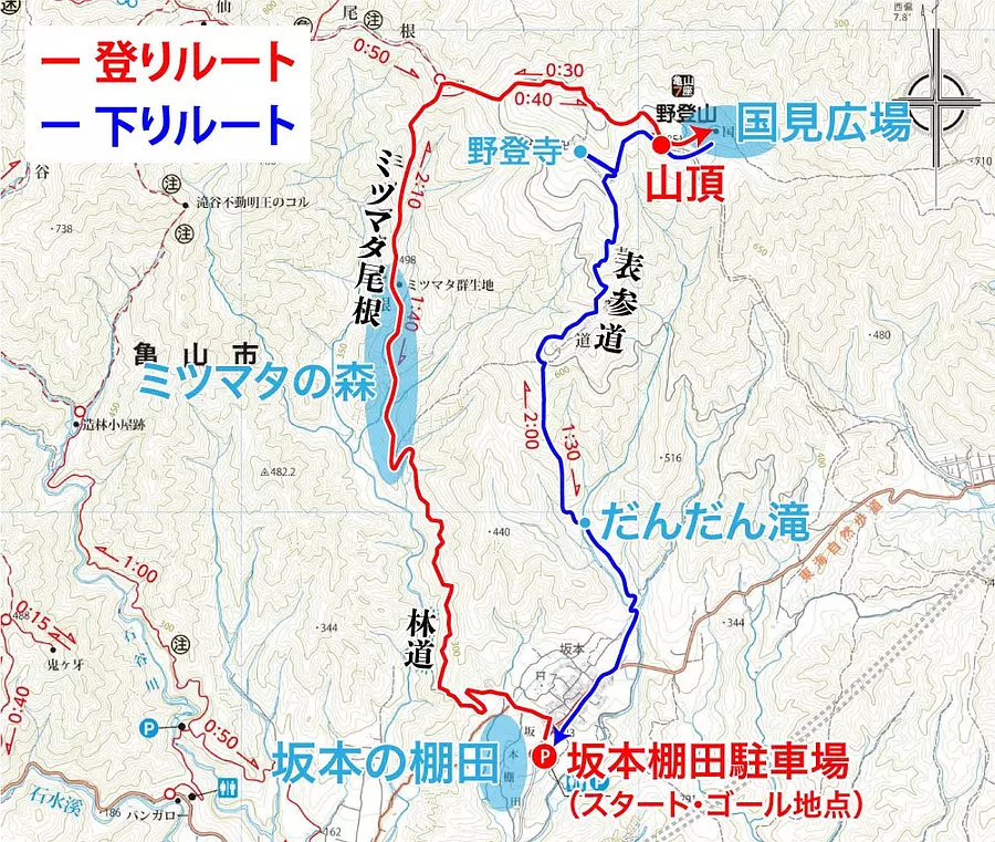
Climbing course overview
In this article, we will introduce a climbing course that follows the route of the Kameyama 7-za trail map! The course time is approximately 4 and a half hours, with a 1 hour break time, making the climbing course approximately 5 and a half hours in total.
Climbing course plan
Start from the Sakamoto Rice Terrace parking lot, enter the forest road that leads to Mitsumata Forest, and head for the summit via Mitsumata Ridge. After reaching the summit, enjoy the view while taking a lunch break at Kunimi Square.
[Climbing route] Sakamoto rice terrace parking lot (7:24) → Mitsumata Forest (8:03) → Summit (9:41) → Kunimi Hiroba (9:54)
Downhill course plan
After a lunch break, we took a walk through the beech forest near the mountaintop, and then went to visit Notoji Temple, which is lined with large cedar trees. After that, descend the mountain via Mt. Keisoku Omotesando and return to the Sakamoto Rice Terrace parking lot for the finish line.
[Down route] Beech forest (11:15) → Notoji Temple (11:48) → Keisokuyama Omotesando (12:15) → Sakamoto rice terrace parking lot (12:55)
Course difficulty: Beginner class
There is a steep ridgeline from Mitsumata ridge to the confluence of Sengei ridge, but other than that it is a relatively gentle mountain trail, so the difficulty level is beginner level.
I think this is a course that can be easily completed if accompanied by someone with experience in field mountain climbing.
- Precautions and tips for mountain climbing
- ① When climbing, give yourself plenty of time and choose a mountain that suits your experience and physical strength.
- ② Make a climbing plan in advance and submit a climbing report to the nearest police station or mountain climbing post by the day of the climb.
- ③ Make sure to check the weather information beforehand.
- ④ Prepare clothing that can handle sudden changes in temperature, including rain gear.
- ⑤ Bring water and portable food, take precautions against heat stroke, and take adequate breaks.
- ⑥ When climbing the mountain in winter, be sure to bring snowy mountain climbing equipment such as crampons. Even if there is no snow at the foot of the mountain, there may still be snow and ice near the top of the mountain.
Parking location
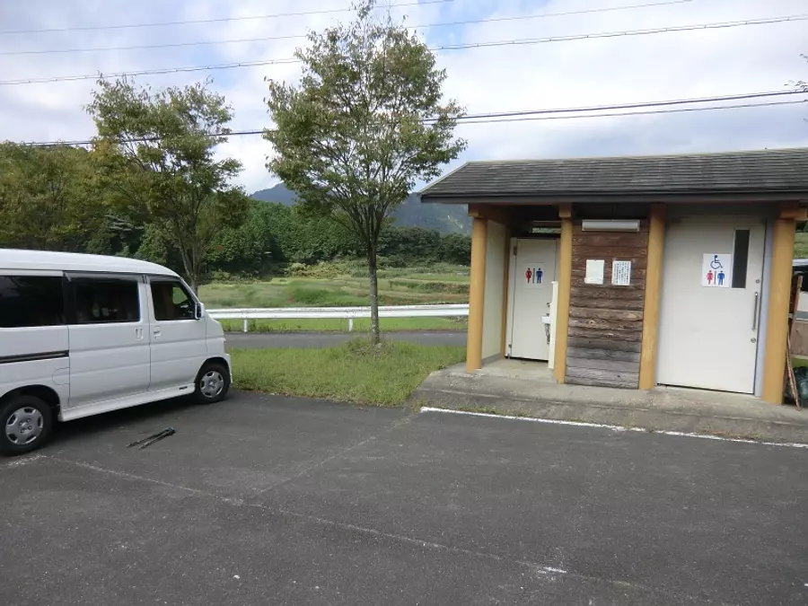
On this mountain climbing course, we will park the car at the Sakamoto Rice Terrace parking lot. It's about a two-hour walk from here to the summit, so it's a good idea to use the attached public restroom. There is also a restroom at Notoji Temple, where you will stop after climbing the summit.
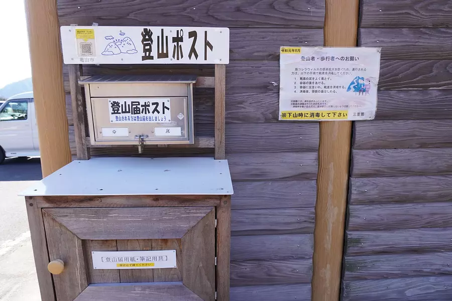
There is a climbing post next to the toilet, and those who will be climbing from here should be sure to submit their climbing notification. There is also a box with climbing registration forms and writing utensils.
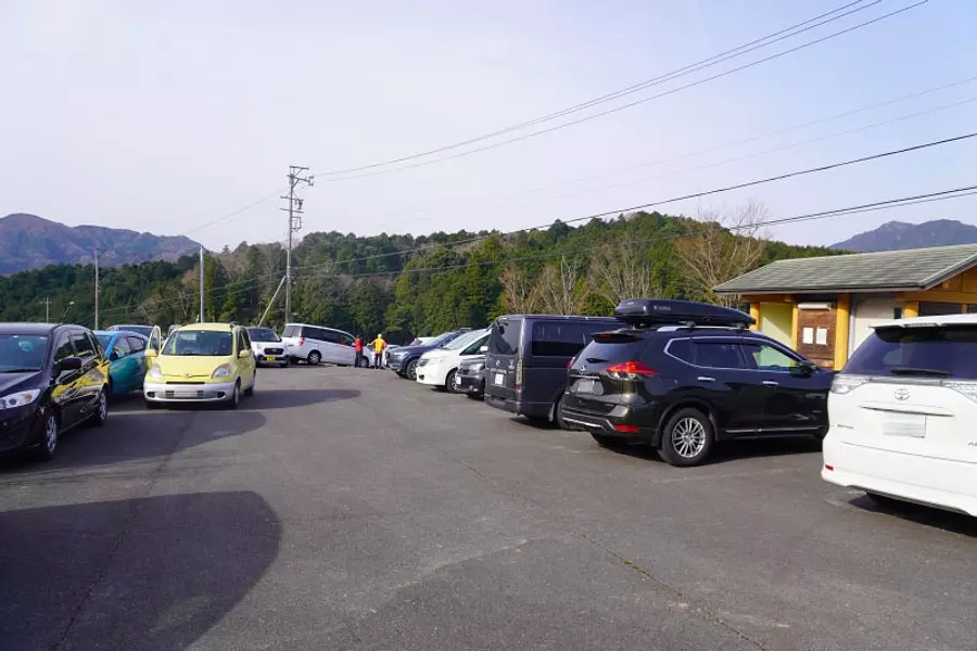
The parking lot tends to be full during the fall foliage season and the best time to see Mitsumata from March to April, so we recommend arriving early. *The photo was taken at 8:30 a.m. on a Sunday at the end of March.
Climbing course explanation
The photos introduced here are a combination of those taken on March 22, 2020 and those taken on February 11, 2022. Please use the course times as a guide only. *There are some areas where there is snow.
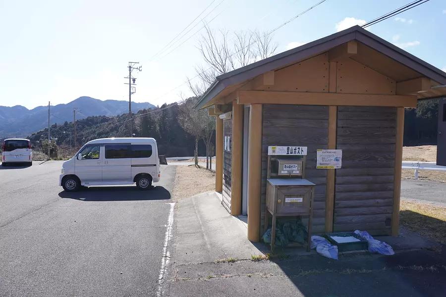
Sakamoto rice terrace parking lot (7:24)
Park your car at the Sakamoto Rice Terrace parking lot and start climbing! Be sure to submit your climbing notification at the climbing post next to the toilet.
Walk: about 3 minutes
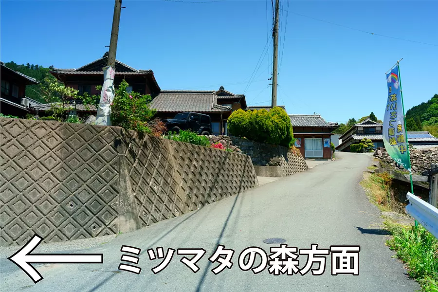
Sakamoto village (7:27)
After leaving the parking lot, walk towards Sakamoto Village and turn left at the first fork. The road in front of the building connects to Mt. Keisoku Omotesando, so you will have to pass through here to return to the parking lot on your way back.
Walk: about 3 minutes
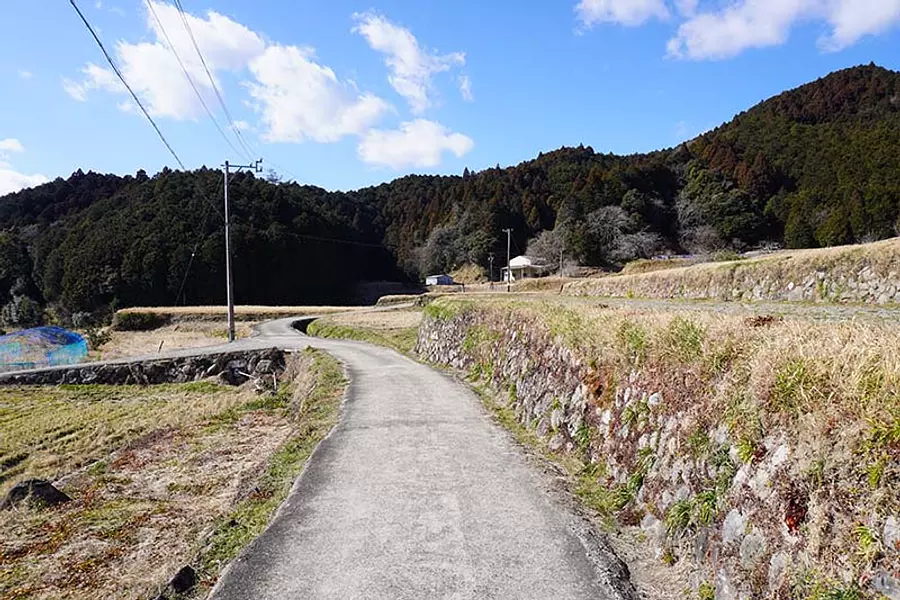
Sakamoto rice terraces (7:30)
When you leave the village, you will enter the farm road of Sakamoto's rice terraces, so continue straight ahead. There is a branch of the Tokai Nature Trail along the way, but don't turn there, just go straight.
Walk: about 2 minutes
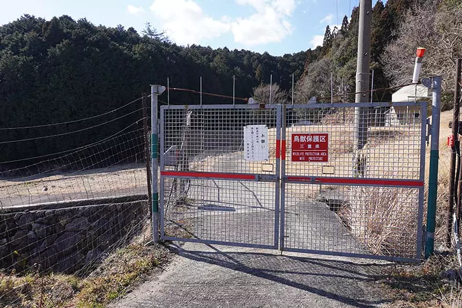
Animal damage prevention fence (7:32)
There is a fence to prevent animal damage, so open the gate and proceed. Be sure to close any gates you open.
Walk: about 5 minutes
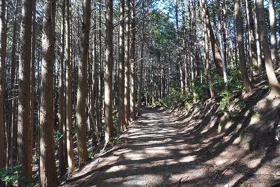
Forest road (7:37)
After passing through the animal damage prevention fence, enter the forest road that leads to Mitsumata Forest and continue until you see the river.
Walk: Approximately 24 minutes
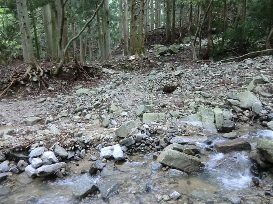
Entrance to the mountain trail (8:01)
After passing through the forest road, you will come to a place where you will cross a river, and the trailhead will be at the end of this point. It's a shallow river, so cross it by walking on stones. *River crossing (or something)...to cross a river
Walk: about 2 minutes
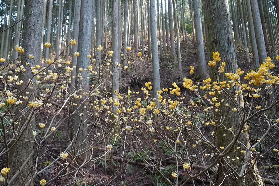
Mitsumata Forest (8:03)
A few minutes' walk from the trailhead leads to the Mitsumata Forest, where the colony continues along the trail. The best time to see them is from March to April, and it's a good idea to take a short break while admiring the Mitsumata.
Walk: Approximately 13 minutes
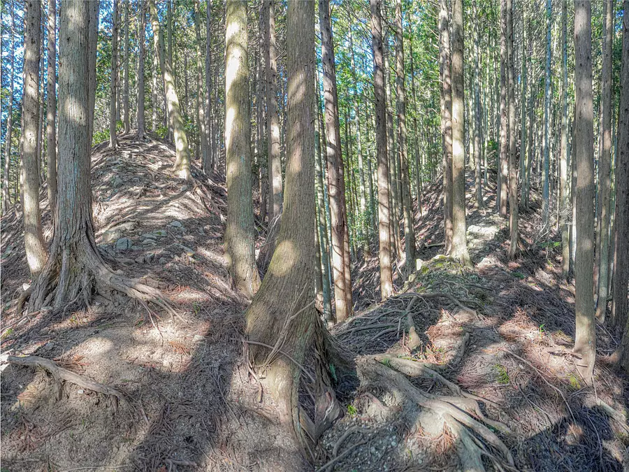
Mitsumata Ridge (8:16) After walking through Mitsumata Forest for about 10 minutes, you will enter Mitsumata Ridge and walk along the ridge path to the confluence with Sengei Ridge. Although it is a steep and narrow ridgeline, there are no dangerous spots where the footing has collapsed, so don't worry.
Walk: about 50 minutes
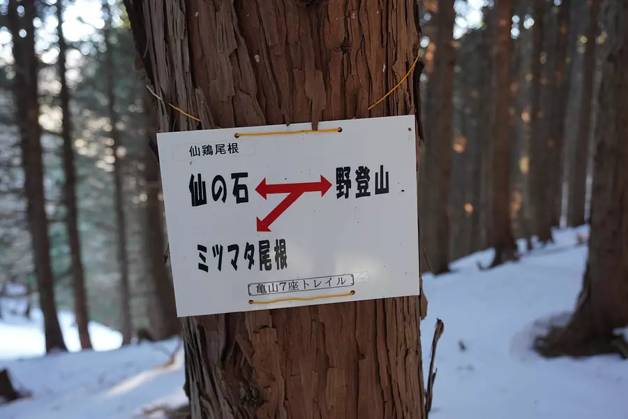
Confluence point of Sengei ridge (9:06)
After walking along the ridge path for about 50 minutes, we arrived at the confluence of Sengei ridge! From here we will walk towards the field mountain climbing, but the steep climb will continue for a while.
Walk: about 9 minutes
Junction point to the road (9:15)
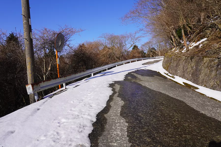
At the end of the steep climb, you will come to a road with a card rail. In fact, you can drive here from the foot of Notoyama, and there is a parking lot at the main gate of Notoji Temple.
Walk: about 10 minutes
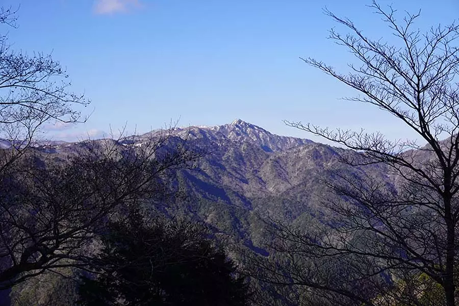
View from the road (9:25)
On our way to the summit, we could see a panoramic view of Mt. Sengatake from the road. It's a road with a nice view ♫
Walk: about 5 minutes
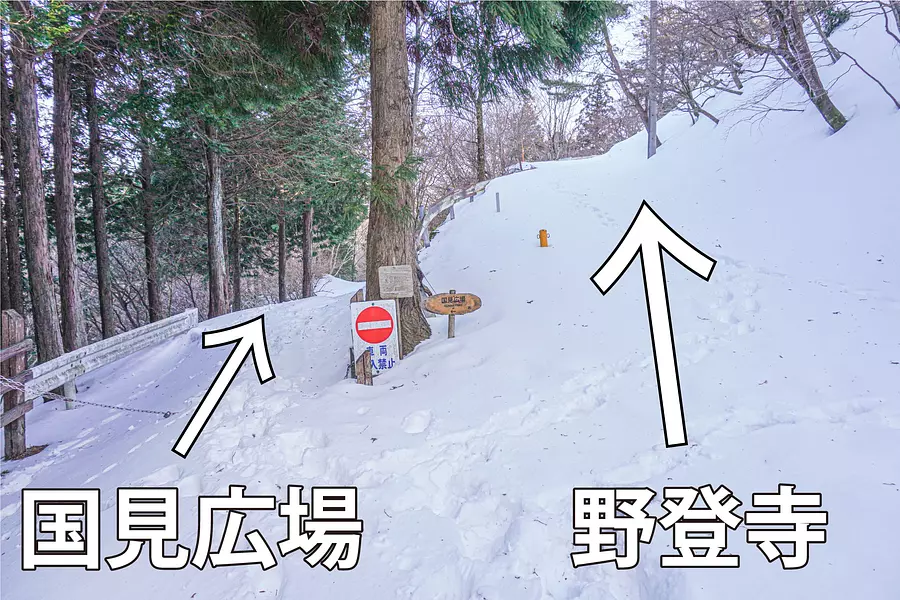
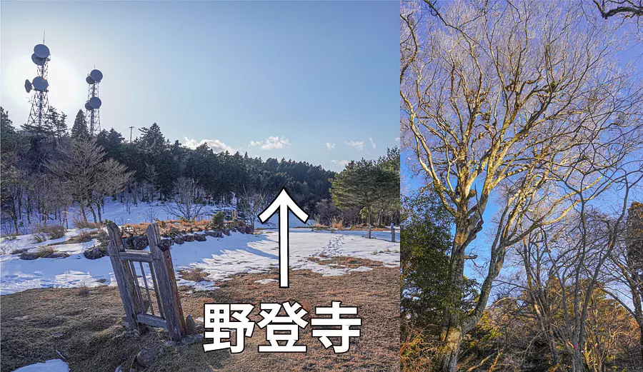
Junction of Kunimi Square and Notoji Temple (9:30)
We arrived at the junction between Kunimi Hiroba and Notoji Temple. The summit is near Kunimi Hiroba, so turn left here. *On this day, there was enough snow to cover our feet *Photo taken on February 11, 2022
Walking: Approximately 11 minutes
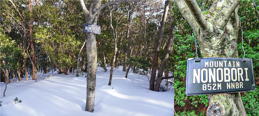
Mountain climbing summit (9:41)
As you proceed along the path leading to Kunimi Hiroba, you will see a side road on the right, which will take you to the top of the mountain. There is no view because the summit is surrounded by trees, but there is a cool mountain name sign.
Walk: Approximately 13 minutes
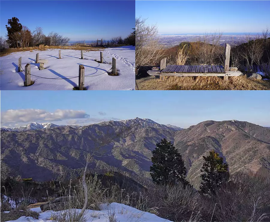
Kunimi Square (9:54) *1 hour break
Arrived at Kunimi Hiroba, which overlooks the townscape of the Hokusei area of Mie Prefecture and Ise Bay! Since there is nothing blocking the view in front of you, you will be impressed by the spectacular panoramic view♫ The foothold is wide, so we took a lunch break here. There are also places where you can see the Suzuka Mountains.
Walk: about 15 minutes
Beech forest near the summit (11:15)
After the lunch break, we will head to Notoji Temple. As you walk towards the radio tower, you will enter the road that leads to Notoji Temple. Along the way, there is also a beech forest designated as a natural monument of Mie Prefecture.
Walk: about 18 minutes
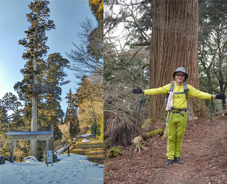
Notoji temple gate and large cedar (11:33)
After walking for about 30 minutes from Kunimi Square, we arrived at the main gate of Notoji Temple. The approach to the shrine is lined with large cedar trees, and you will be overwhelmed by the thickness of the trunks and the height of the trees.
Walk: about 15 minutes
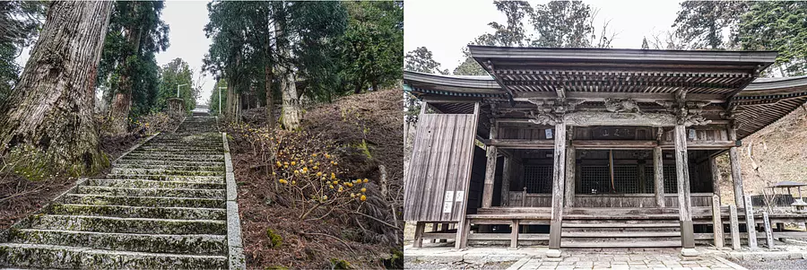
Worshiping at Notoji Temple (11:48) *10 minute break
After walking for about 15 minutes from the Sanmon gate of Notoji Temple, we arrived at the shrine building. The shrine building on top of the mountain is surrounded by nature, giving it a mysterious atmosphere. From March to April, Mitsumata flowers bloom on both sides of the stone steps leading to the shrine building. *Photo taken on March 22, 2020.
Walk: about 20 minutes
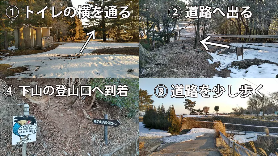
Keisokuyama Omotesando trailhead (12:15)
After visiting Notoji Temple, start descending! It is about a 15 minute walk to the trailhead of Mt. Keisoku Omotesando on the descent course. Please refer to the photo above for directions. The mountain trail continues downhill, so you can descend the mountain in about 40 minutes on foot.
Walk: about 20 minutes
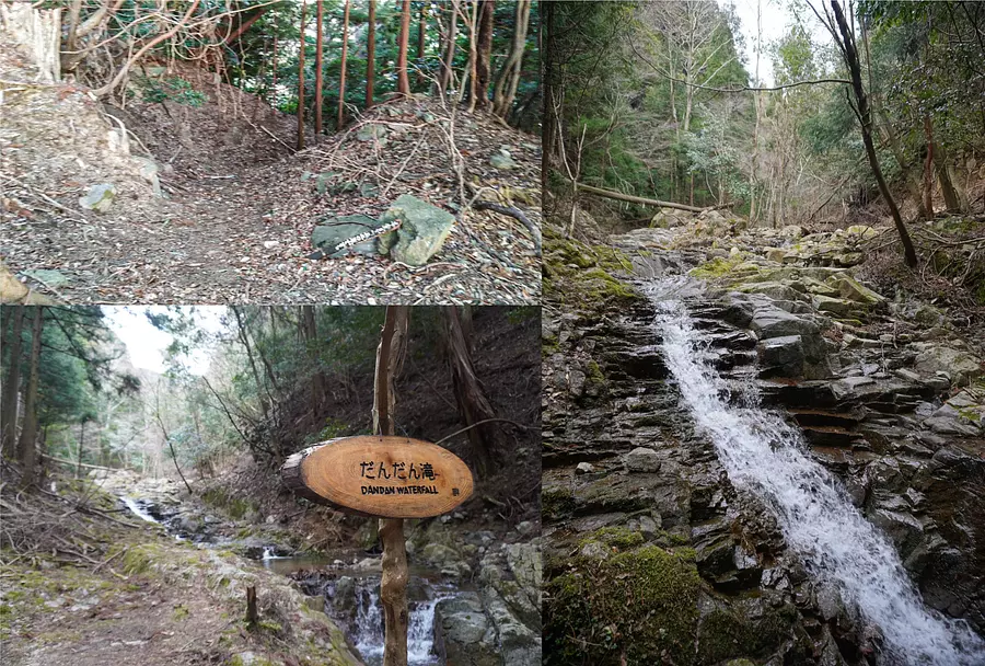
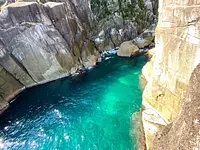
Dandan Falls (12:35)
Keisokuyama Omotesando is a mountain trail that descends through the forest, but the path is well-maintained and easy to walk. There is also a waterfall called ``Dandan Falls'' along the way.
Walk: Arrive at the parking lot in about 20 minutes
What did you think
We have delivered plenty of the charm of field mountain climbing along with an introduction to mountain climbing courses! The field climbing route is one of the easiest to climb among the 7 Kameyama Mountains, so it is also recommended for beginner mountain climbers. Please give it a try!
Enjoy Kameyama 7-za Trail
Mie Kanko has released a special website for the Kameyama 7-za Trail that introduces the charms of Kameyama 7-za and the climbing courses for each mountain.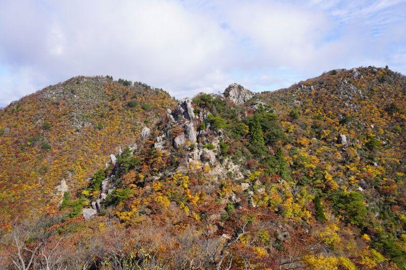
In addition, ASOBISIA from the Mie Travel Camera Club has written an article about the charms of the Kameyama 7-za Trail. You can see all the attractions of each mountain on one page, so please take a look.
Latest information on Kameyama 7-za Trail
KameyamaCity 's official homepage provides the latest information on initiatives and events for the Kameyama Seven Trails.
It clearly states where to download the mountain climbing registration form and where to submit the mountain climbing notification, so if you are going to Kameyama 7-za, please take a look. You can also download the Kameyama 7-za trail map.
About the author of the article
Fugamaru-chan (article production)
He is a member of Mie Tourism's Mie Travel Camera Club and is active mainly on Twitter and Instagram as a photographer who takes pictures of Mie. We operate the Mie Photo Gallery, which distributes Mie's scenery for free, and the Mie Eetoko Tour, which disseminates Mie's latest information.
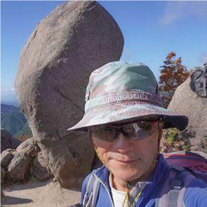
kazenami (photography)
Fugamaru-chan's father. A mountain man who has climbed all the mountains in Mie Prefecture and not only does trekking, but also rock climbing, ice climbing, and shower climbing. My hiking records so far are now available on YamaReco.
| Category | |
|---|---|
| season | |
| area |